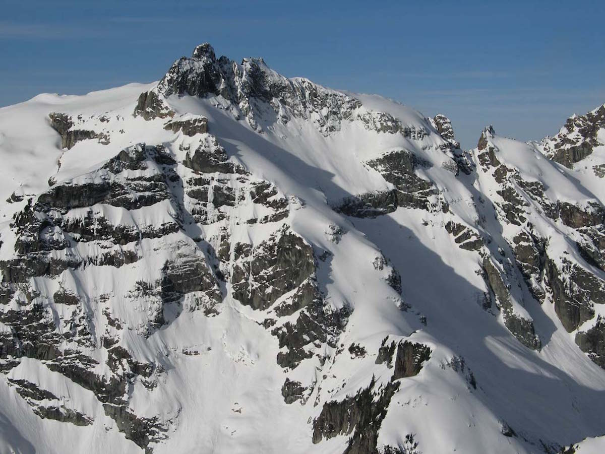
Kyes Peak is a prominent and picturesque mountain near the abandoned mining town of Monte Cristo. In the late 1800s, the Rockafeller family helped to develop the area by funding the exploration of the area’s mining deposits. Situated in the Mountain Loop Highway Area of the North Cascades, the town of Monte Cristo was at the turn of the century the terminus for an Everett railroad built to ferry ores from the surrounding mountains to the then-bustling town.
Along with Monte Cristo and Columbia Peaks, Kyes and its surrounding ridges contain the Columbia Glacier basin. Kyes Peak is geologically significant in that it is the highest summit in the Monte Cristo group of peaks. Knowing that Scott McAlister and I decided to check out the area with a snowboard descent of the Pride Glacier Headwall.
The remote location, colorful proximate history, and aggressive terrain of this relatively unexplored objective left Scott and I wondering about the area. With a topographical map we were off to check out the terrain around Kyes Peak and the Monte Cristo.
Climbing Quartz Creek to Access Kyes Peak
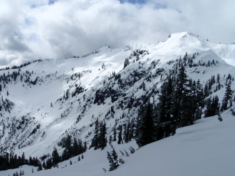
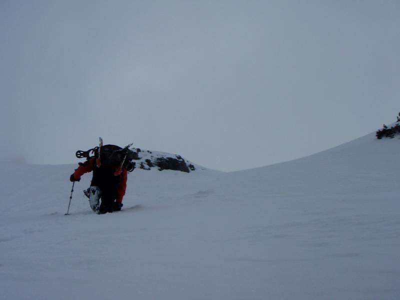
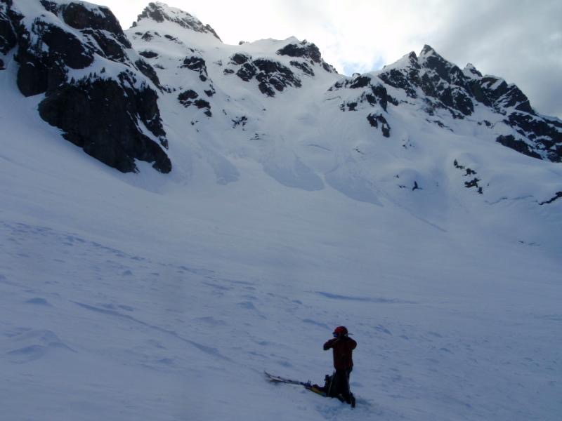
Our approach started with an early morning skin up Quartz Creek. Both below and above us the Monte Cristo area was buried under almost 10 feet of snow. As we climbed the clouds would move through the area and occasionally we would get a view of the massive alpine slopes.
Once we gained our first ridge, we were forced to traverse under and around a massive cliff band before reaching Quartz Basin. We were surprised to find that the basin was composed of numerous cliffs, waterfalls, and generally unskiable lines everywhere. If we chose to descend through the area we would have to be careful with our escape route.
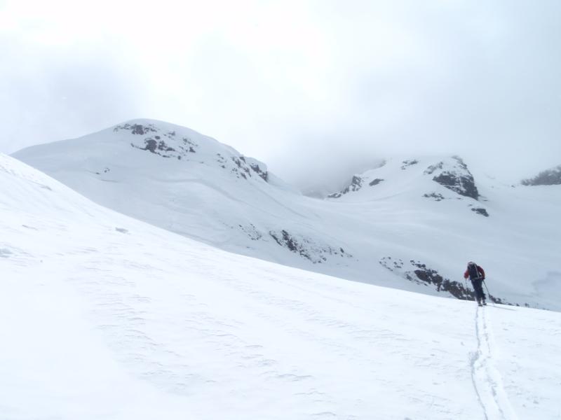
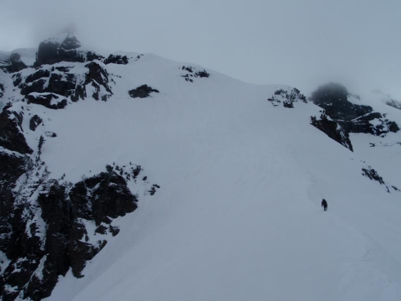
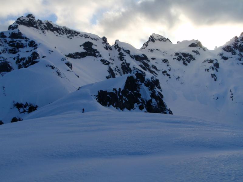
From up high in the basin the terrain changed dramatically from steep to mellow. We skinned up mellow, glacier-carved rollers until arriving at the Quartz col. According to the map it was connected to Kyes Peak via a long ridge. If the route went we would get endless views of the Monte Cristo, still covered in clouds.
We were eight hours deep into the tour and visibility was bad so we pondered our next move. Either we’d turn back to the car or push forward for a potential summit attempt.
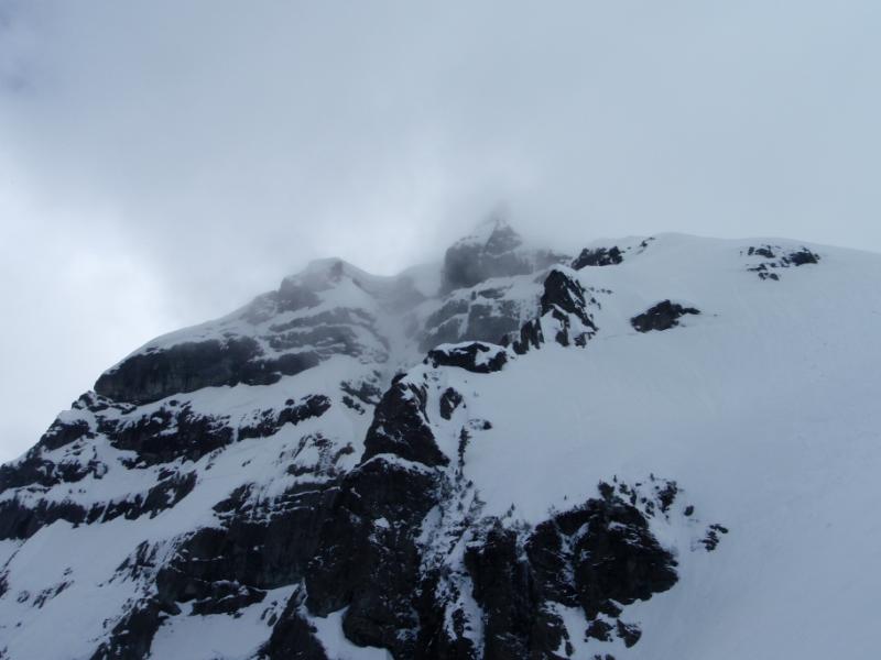
Finally, we decided we’d wait to see if the weather changed. A few moments later the clouds began lifting and we got a view of the summit and our initially intended route. We could see enough to tell that our intended approach ridge was impassible at spots. Instead we would climb the edge of the Pride Glacier and as it would be a much easier route.
Climbing up the Pride Basin in the Monte Cristo
Making our way up the Pride Glacier the route was straight forward and it was easy to skin. As we broke trail we started cutting towards the ridge as it would be the best climbing route. After a while we were back of the glacier and following the ridge to the base of Kyes Peak.
Once on the ridge it was time to take out the crampons and ice axes. We kick stepped carefully and intentionally up the steep ridge being exposed on both sides. Navigating carefully we worked with the rolls of the terrain hoping that the sketchiest section was over with.
Making Our Way up the Pride Glacier Ridge of Kyes Peak
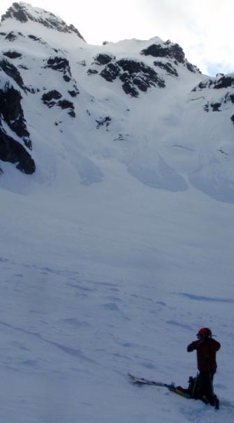
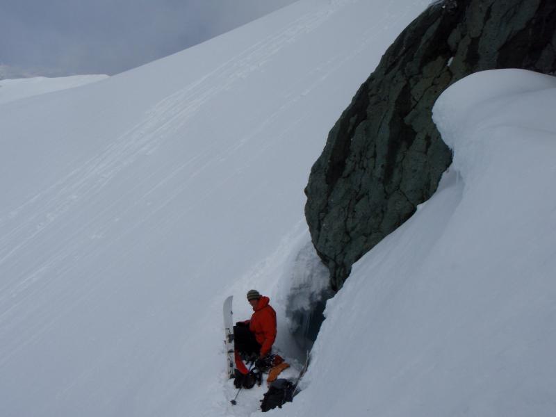
Before long we were at the base of Kyes Peak and about ready to climb up the final ridge. From what we could see the clouds had moved in again to block in the view. Not to be discouraged we kept going knowing that the clouds would blow out again.
Climbing conditions were great as we punched our way up the ridge of the Pride Glacier. It seemed the winds had died down and hopefully we would be getting some great turns soon. We had worked hard to get to where we were and finally we were pushing up the final slopes of Kyes Peak.
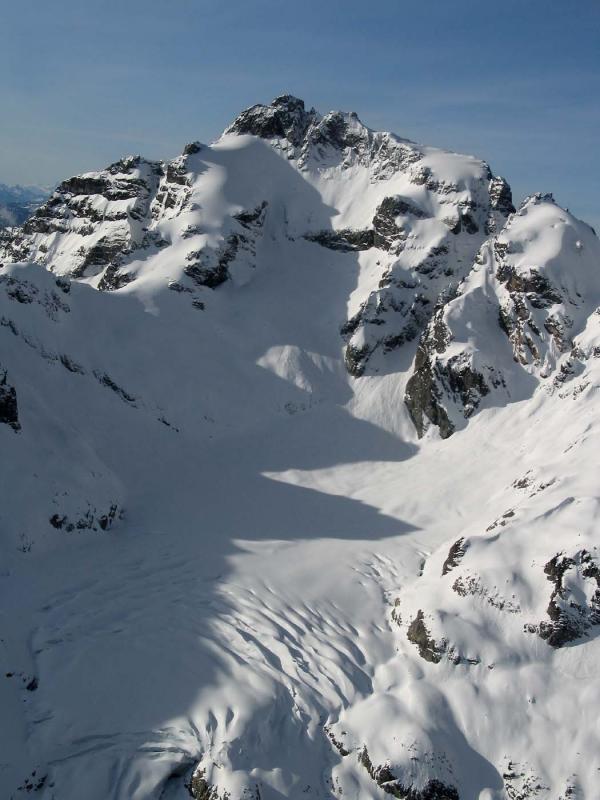
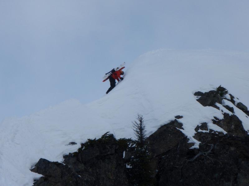
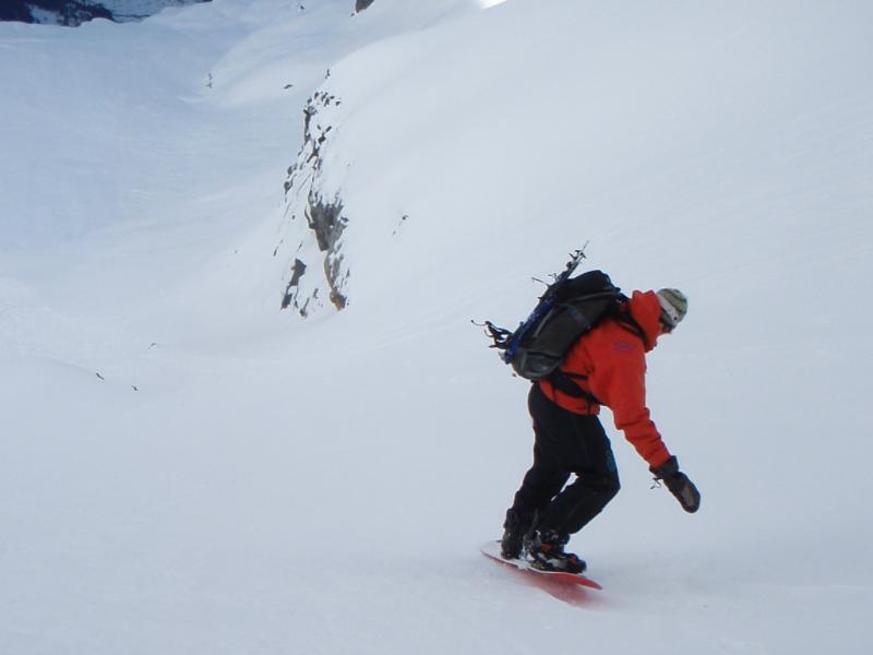
As we ascended, the cloud layers burned off and to our east was Glacier Peak. Before long we were on top of the Pride Glacier Headwall with only 300 feet to go to the summit. The remaining vert of which was a solid rock and we were there to snowboard. With only a few hours of sunlight remaining we chose to ride down the headwall. Below us was over 2000 vert of fall line turns heading down Kyes Peak.
Snowboarding Down the Pride Glacier Headwall on Kyes Peak
We rode the line cautiously as underneath us was a few inches of snow on top of ice. Soon things mellowed out and we were able to open up on the lower apron. We had worked so hard to get where we were and finally we were riding the east face of Kyes Peak. It felt great as we made our final turns down the Pride Glacier Headwall.
Before long we were at the bottom of our run and it was time to get out. While there was still a bit of light left it would be an exit via headlamps. We quickly changed our layers and got on our crampons and ice axes and soon we were retracing our steps from earlier.
It had been a long day and we were still only halfway done, since we still had to skin out. Retreating towards the Quartz col, we occasionally glanced back at Kyes and Monte Cristo now to our backs.
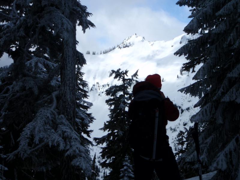
Another Cascadian Bushwhack Exit
Being rushed for time, we opted to drop into the Quartz bowl and navigate through cliff bands until arriving at a 30 foot cliff. We had two choices, either to climb back up or to down climb, which we felt comfortable with because of the “veggie belay” opportunities surrounding us. With the help of endemic plants, we climbed down the nearly vertical face until once again arriving onto the snowpack. Soon we were snowboarding down the final few hundred feet of steep terrain before putting on our headlamps for hours of skinning through low angled forests.
Thank you for reading this trip on our trip to Kyes Peak in the Monte Cristo. If you want to see more ski tours within the Stevens Pass Backcountry check out this link.