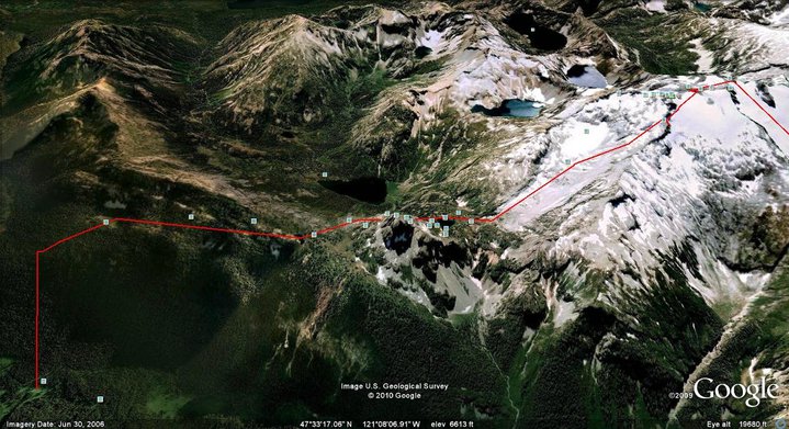
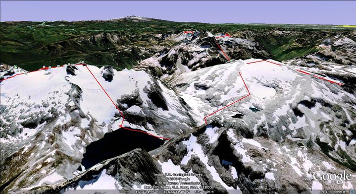
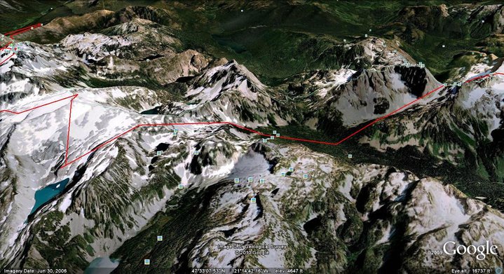
The Alpine Lake Ski Traverse was a 70 mile high route through Alpine Lakes Wilderness. Starting at Hyas Lake trailhead we would slowly make our way Southwest until arriving at Interstate 90 through Gold Creek. This trip would connect some of the bigger peaks starting off with Mount Daniel and Hinman. Then after crossing the Middle Fork of the Snoqualmie we would make our way past Overcoat Peak and Chikamin Peak. This route would take a week of climbing and descending but in the end it was one of my favorite in the Cascades. Heading North From Mount Rainier this is After the Patrol Race and Before the 14 Lakes Traverse
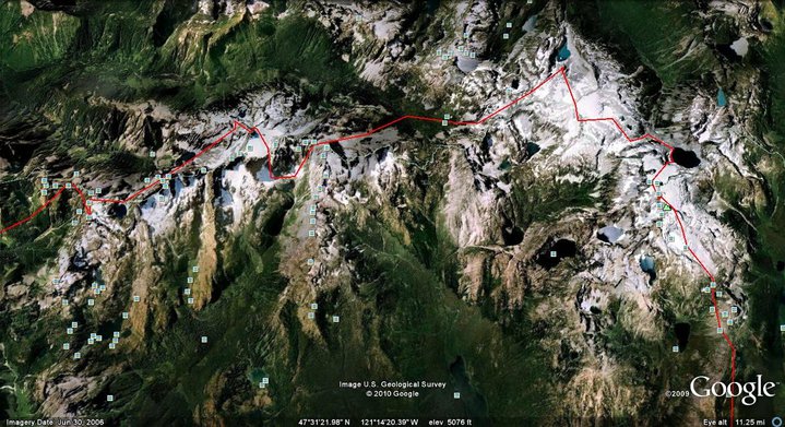
The Alpine Lake Ski Traverse Route From Hyas Lake to Gold Creek
Entering Alpine Lakes Wilderness From the Hyas Lake Valley to Mount Daniel
We parked our car at the Hyas Lake trailhead near Salmon La Sac. Above us the skies were dark gray with a thick layer of clouds that seemed to promise rain at any second. Carefully we packed our bags to utilize every spare inch of space. Meticulously going through our gear we tried to find the balance between too much stuff and not enough. The question kept coming up whether to bring hiking shoes or just do the trip in Snowboard boots. For 30 minutes I went back and forth on what to do until it was time to get moving. I was walking from the Hyas Lake summer trail towards Mount Daniels in Snowboard Boots.
We slowly made our way up the dirt covered trail in high spirit. We were finally making our way on a journey that I had wanted to do for years. I had hiked this section of the Pacific Crest Trail when I was younger but was on the trail the entire time. This time we would be traversing over the high mountainous peaks and seeing the area from a whole new perspective. We had read over the topographical maps for weeks and finally it felt great to finally be experiencing it.
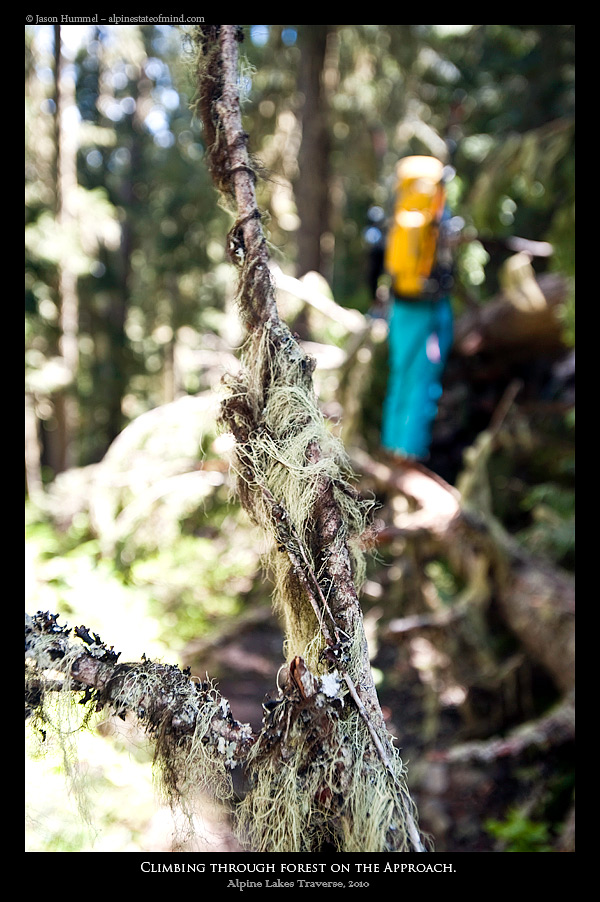
It wasn’t long before we left the standard path and joined a faint climbing trail. After traversing above a sheer vertical cliff we were passing Cathedral Rock. Finally we were making our way towards the lower flanks of Mount Daniel and the beginning of the Alpine Lakes Traverse.
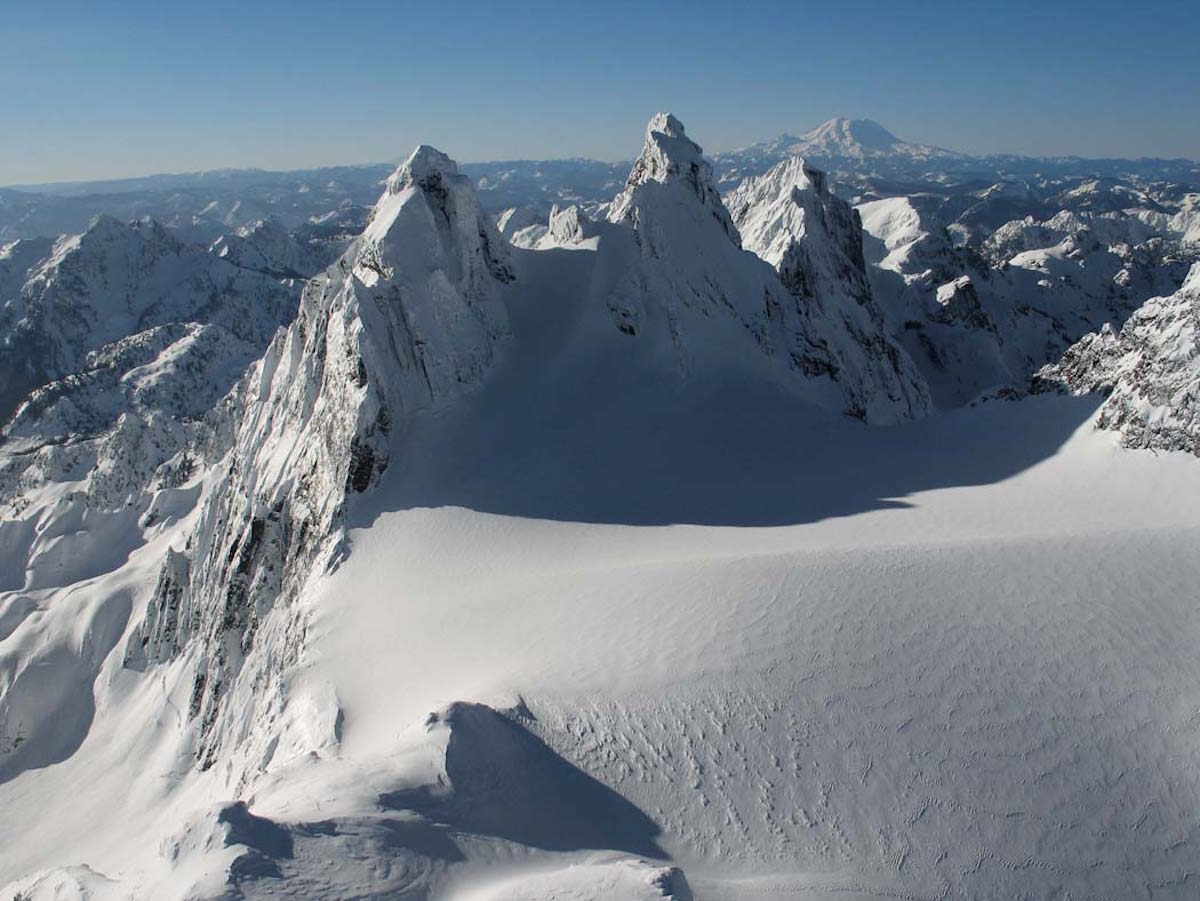
Arriving at the East Face of Mount Daniel
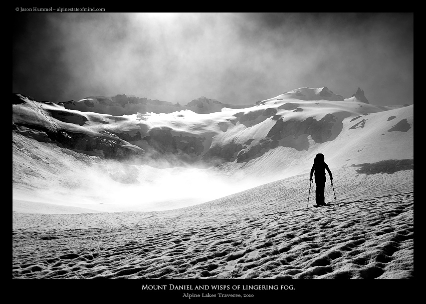
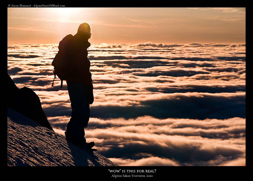
Before long the landscape had turned from green to white. We had become engulfed in a sea of clouds, taking a break on the shores of Peggy’s Pond. We rested on a melted out rock and glanced over our topographical map before looking at the route in front of us. Jason had previously ski toured in the area but it was hard to reference in the clouds. The moment we started moving the clouds seemed to part and we finally had a view of our first summit, Mount Daniel.
A Race Against the Storm on Mount Daniel
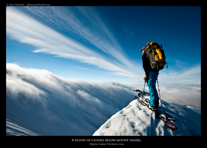
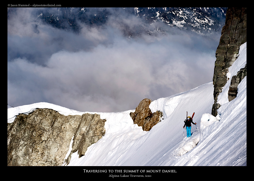
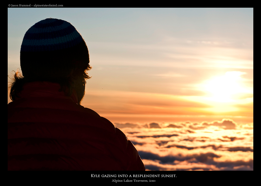
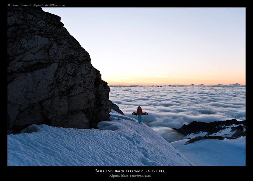
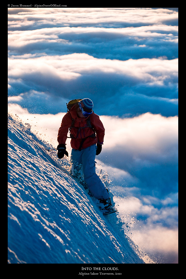
Pushing on we climbed up the mellow glaciated slopes of the eastern side of Mount Daniel. The clouds had come and gone but finally we were above the ceiling and in blue skies. We felt reinvigorated as we climbed on the three inches of new snow. Finally we could see the surrounding environs and with a few carefully placed switchbacks we would gain the summit ridge. From our vista we could see a sea of clouds crashing among the opposing ridge, devouring it in whole. It quickly became apparent, we were going to get swallowed by the incoming front.
We picked up our pace fearing getting pinned on the glacier during a white out. Carefully we made our way on the steep traverse towards the summit headwall. Each step would get us closer to our destination for the night and a place to get the weight off our packs. By now everywhere we looked the clouds were heading for us. There wasn’t much time to look around as all I could think of was getting to the summit of Mount Daniel.
Summiting Mount Daniel in Alpine Lakes Wilderness
Finally we arrived on the summit as the sun was dropping to the west. After a few seconds of searching we had found a camping spot and the packs were on the ground. As we set up our tent and made dinner we smiled and chatted about the beauty of our spot. The first day of the Alpine Lakes Ski Traverse had gone well considering. Little did we know what mother nature had in store for us as we fell asleep under clear skies above.
The Second Day of the Alpine Lakes Ski Traverse: 24 Hours of Misery
We woke up to the sounds of rain pelting the tent. A few minutes later it had switched to snow, then back to rain. It was July 4th and we were in the middle of a storm on the summit of Mt. Daniel. The storm raged all day as we sat in a tent too small to stretch and not wide enough for us to move around. We looked through our food and overlooked the maps for hours hoping it would keep us entertained. Looking outside we couldn’t see anything and we were quickly becoming stir-crazy.
There was no choice, we would have to wait out the storm and that’s what happened for the next 36 hours. By now we were starting to wondering if we should turn back from the Alpine Lakes Ski Traverse. It was the end of day 2 and we were still on the summit of Mount Daniel.
The Third Day of the Alpine Lakes Ski Traverse: Mount Daniel to Mount Hinman
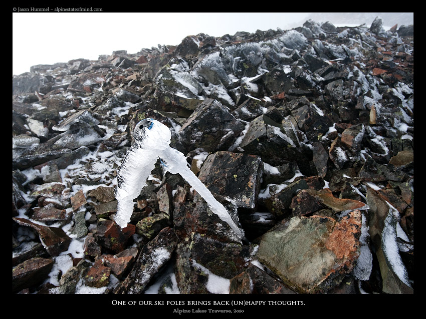
We listened to the rain pelt the side of our tent for hours on end. Being both half awake and half asleep we hung out inside the tent watching our plans slowly melt away. We were loosing patients and considering turning back when all of a sudden the rain stopped. It was time to check the situation outside. Making our way out of the tent we found that all our gear was caked thick in rhime ice on one side. But more importantly the cloud deck had lowered a few hundred feet and although we couldn’t see much it was improving.
We sat around for a hour drying out our gear in the sun wondering what to do next. We could turn back and return to the car or continue on. Although we would have to ration our food a bit more we decided it was well worth continuing the Alpine Lakes Ski Traverse.
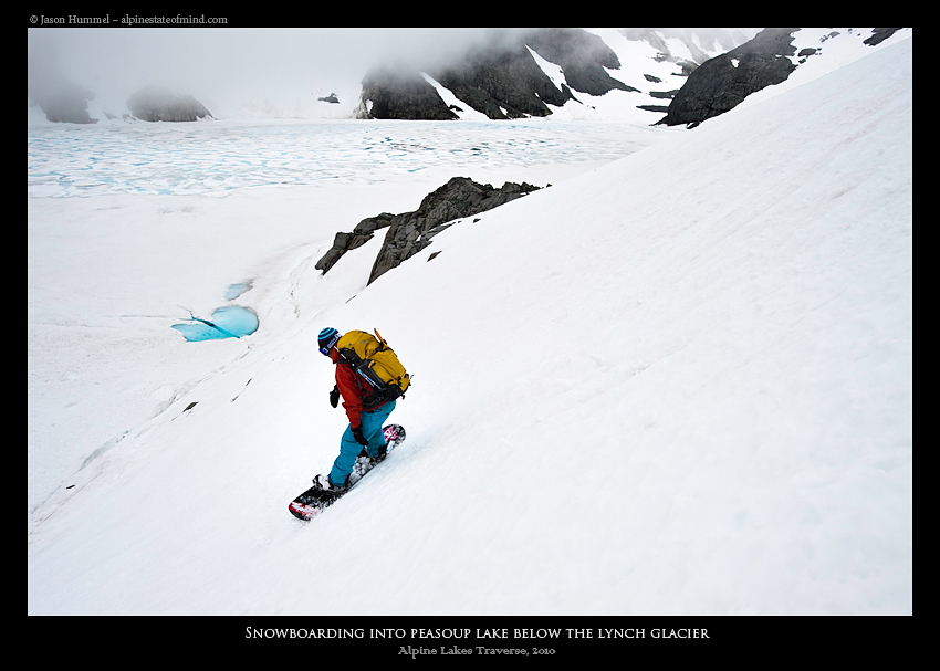
Skiing down the Lynch Glacier to Pea Soup Lake
On the summit of Mount Daniel we looked down onto the Lynch Glacier. From our perspective it was a featureless landscape of white in the sea of clouds. We waited for a hour before getting impatient. It was time to push on and head down towards Pea Soup lake and hopefully below the clouds.
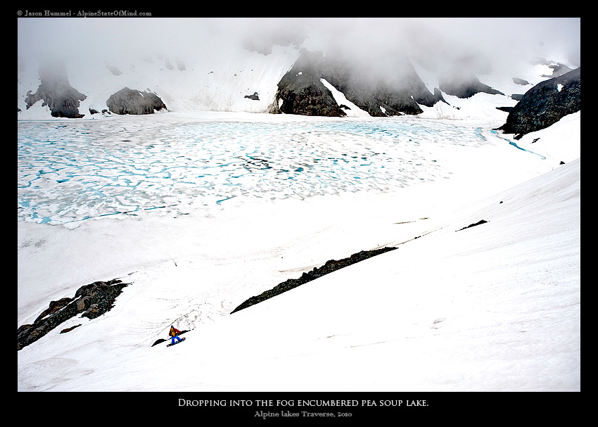
We rode essential blind until we could barely see the faint color of the lake 1000 feet below. The plan was to ride onto the shoreline but once we were almost there it dropped off dramatically. We would have to ride onto the lake itself as it was the only good option to head west. One at a time we quickly skirted across the surface to the opposing shoreline.
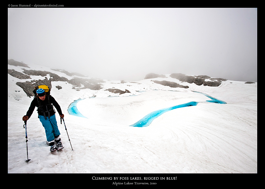
Climbing Mount Hinman
From Pea Soup Lake we snowboarded down into the East Fork of the Foss River tributary. In every direction we were surrounded in an amphitheater of rock hiding within the clouds. Soon we were skinning up the lower flanks of Mount Hinman in a Northwesterly direction. Occasionally the bright blue of the numerous lakes would stand out in stark contrast to all the white both above and below.
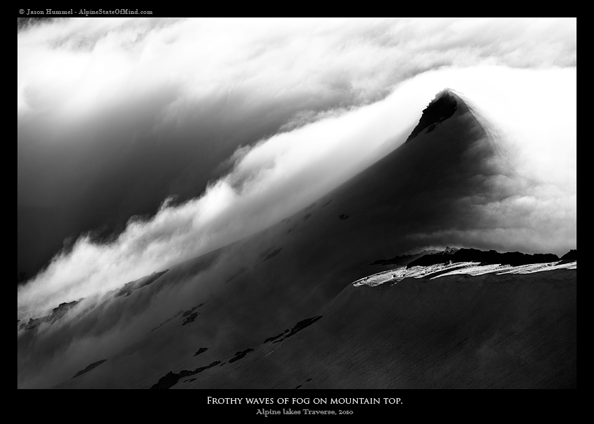
Before long we were once again above the cloud deck. Below us the seas of clouds were devouring everything in site including Mount Daniel to the East. It was as if we had crossed a line with our heads in the sky and our feet in the clouds. Hopefully the worst of the weather on the Alpine Lakes Ski Traverse was behind us.
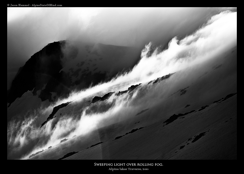
Once on the ridge we watched the clouds slowly burning off as they barely clinged to the ridges. As each moment went on they seemed to be in a battle with the sun and quickly loosing. The weather was about to change for the better and we could tell.
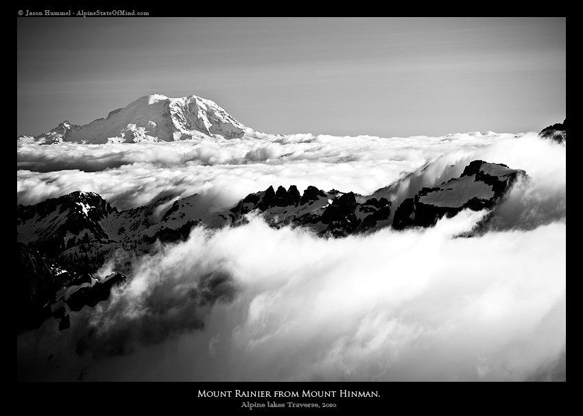
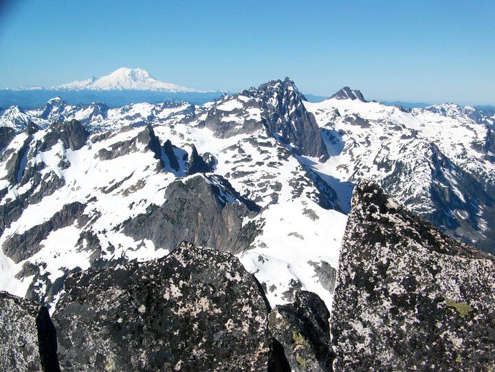
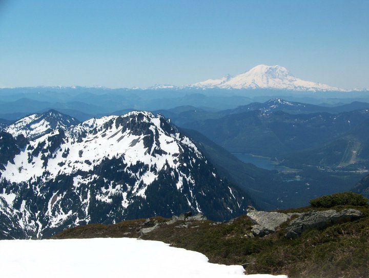
Once on the summit of Mount Hinman it was time to think about making a camping spot. By now the weather had really cleared out and we could see Mount Rainier. The whole area seemed to be so close but we knew it was over 60 miles away. To get there we would have to go up and over Stampede Pass to Crystal Mountain. From Crystal Mountain it would be an additional 3 day trip to Paradise.
Camping on the Summit of Mount Hinman in Alpine Lakes Wilderness
We were stoked with how the conditions had turned out. In the beginning of the day we were discouraged on the summit of Mount Daniel but we pushed on. Now we were on the summit of Mount Himman with a stunning view of the surrounding area. The rest of the afternoon we took the opportunity to take a few laps with the setting sun lighting up the late afternoon sky.
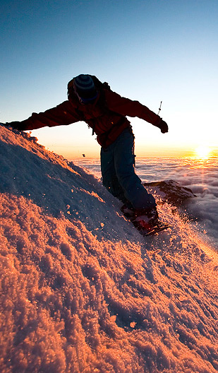
We lapped up the northern face of Hinman as the snow glowed in the afternoon sun. It had been such a stark contrast to only 4 hours earlier when we were stuck in a white out.
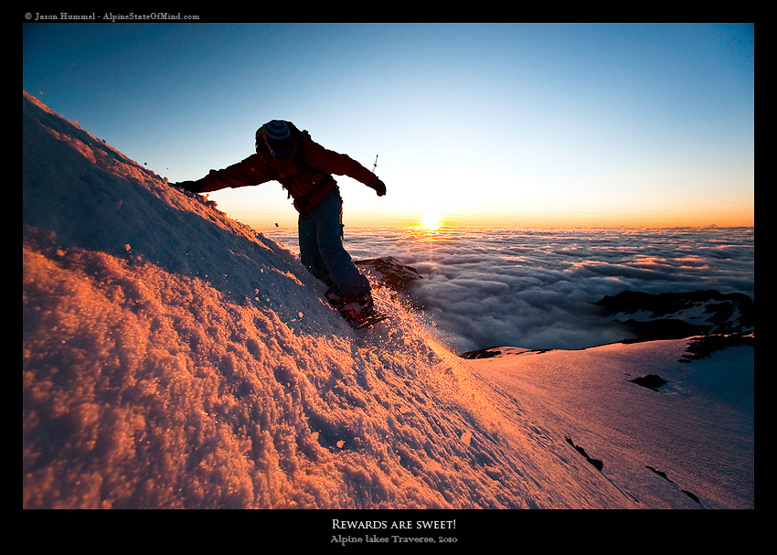
With the camp being within a reasonable distance we decided to get some turns on the Himan Glacier. By now it was glowing from the last light of the sun on the horizon.
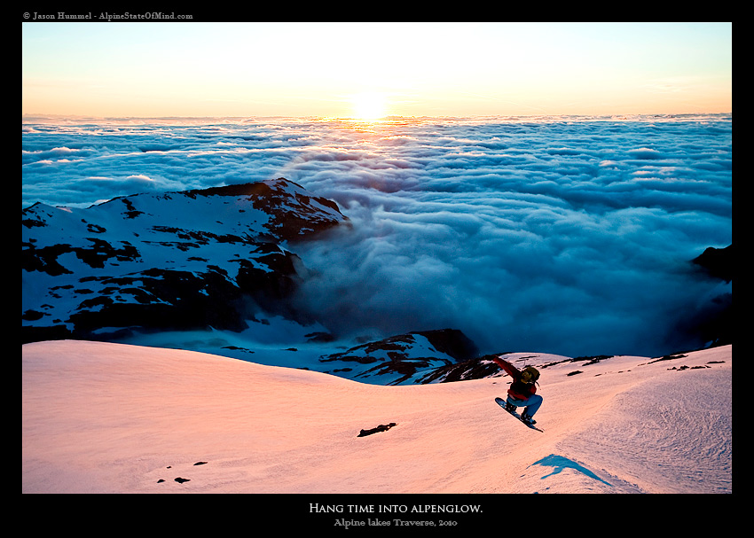
It was the perfect way to end our 3rd day on the Alpine Lakes Ski Traverse. The mountains around us seemed to rise dramatically from a sea landscape. Before long it would be dark but at the moment it was by far the best view of the day.
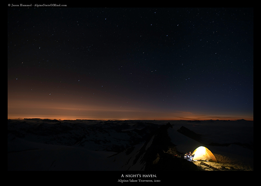
Camping under the stars
Our legs were worked as we made our last steps back to the summit of Mount Hinman. We had hiked and skinned non stop for the past 10 hours and our feet were starting to feel it. As the sun dropped over the western horizon we were arriving at our camping spot. Since we had lost a day to the storm we would have to make it up the next few days.
The transition from daylight to darkness was fast as the stars came out one at a time. We sat at our perfect vantage point watching fireworks exploding in valley below us. The day before it had been the 4th of July and we could see people now celebrating in the distance.
The Fourth Day of the Alpine Lakes Ski Traverse: Mount Hinman to the Summit Chief Col
We woke up to clear sky as we quickly realized how scenic our camp was.. Slowly we got out of the tent and put our wet gear in the early morning sun. Within a few seconds the tent was draped in socks and the warm rocks were covered in base layers. We had waited for this forecast for months so we could pull off the Alpine Lakes Ski Traverse. Finally we could see the route we would be taking the next few days.
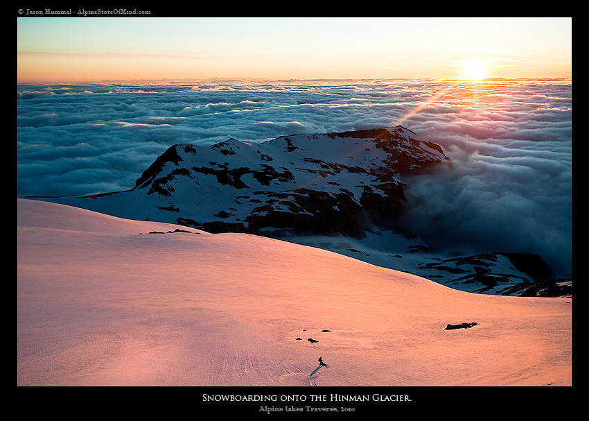
With a renewed sense of faith we went over the two options. We could traverse to a low col or get a run down the Hinman Glacier. Being that this was our one time in the area we decided to make the most of it and snowboard down the Hinman Glacier.
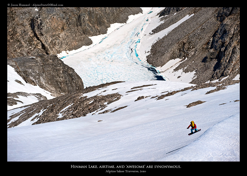
We could see every hump, bump and feature ripping down the Hinman Glacier. We acted like kids hooting and hollering at each other making turns on the open slope. Before long we stopped at a massive glacier carved rock. From there we sat on the warm surface looking down upon Hinman Lake and ate a quick snack. According to the topographical map it has doubled in size within the past ten years.
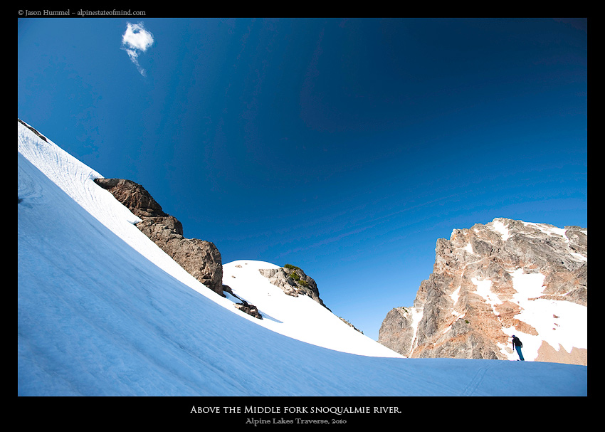
Heading Towards the Middle Fork of the Snoqualmie River
With our water bottles full of fresh water it was time to start skinning once again. Our endorphin levels were high as we skinned back to the low col. From our vantage point we could see well over 50 little lakes scattered among the high alpine terrain. We had officially past the Eastern crest of the Cascades and were making our way through Alpine Lakes Wilderness.
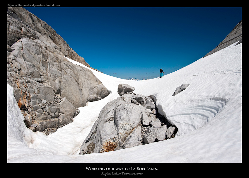
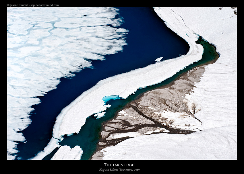
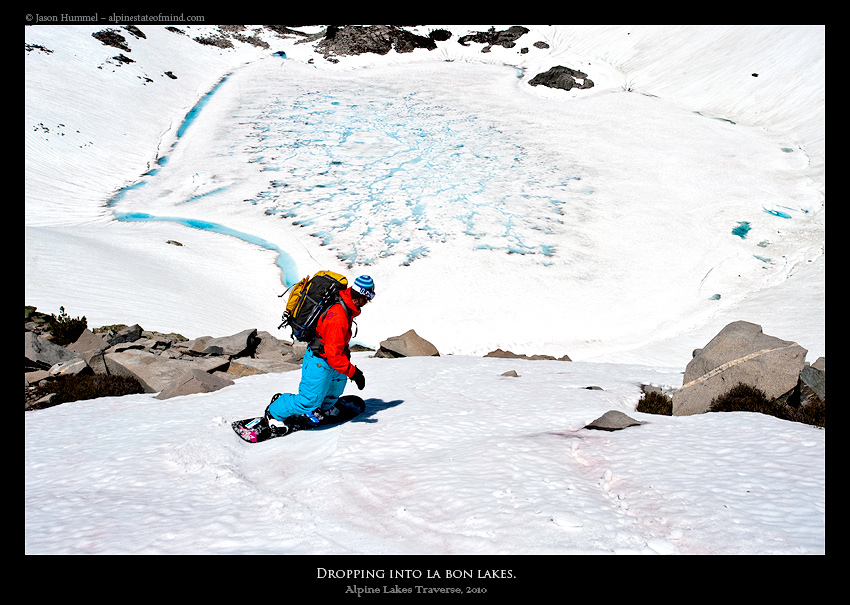
From what the topographical maps showed us the terrain below was riddled in cliffs. We could see the shores of La Bon Lakes as the turquoise color glistened brightly. With a little bit of scouting we found a small ramp and dropped in finding the slopes below open. Now we were on our way to the next destination making our way into the Middle Fork of the Snoqualmie river.
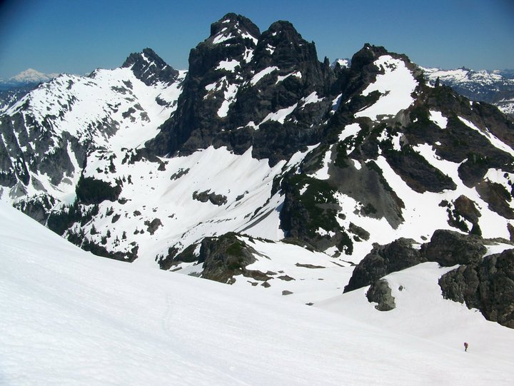
Making Our Way Towards Overcoat Peak
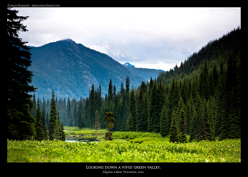
We passed by La Bon Lakes, Chain Lakes and Lake Williams before making it to the Middle Fork of the Snoqualmie River. This would be the low point of the Alpine Lakes Ski Traverse and to no surprise we were on dirt. Carefully we followed the river taking into account both our elevation and how many streams we crossed. We would be climbing again and we couldn’t afford heading up the wrong valley.
Once we found the stream we needed to go up it was time to gain elevation. We clawed up the thickly vegetated slopes before reaching the snow line once again. After putting on our skis we pushed forward looking occasionally back at our route earlier in the day. We were amazed that we found a way through all the cliffs to get down to the Snoqualmie River.
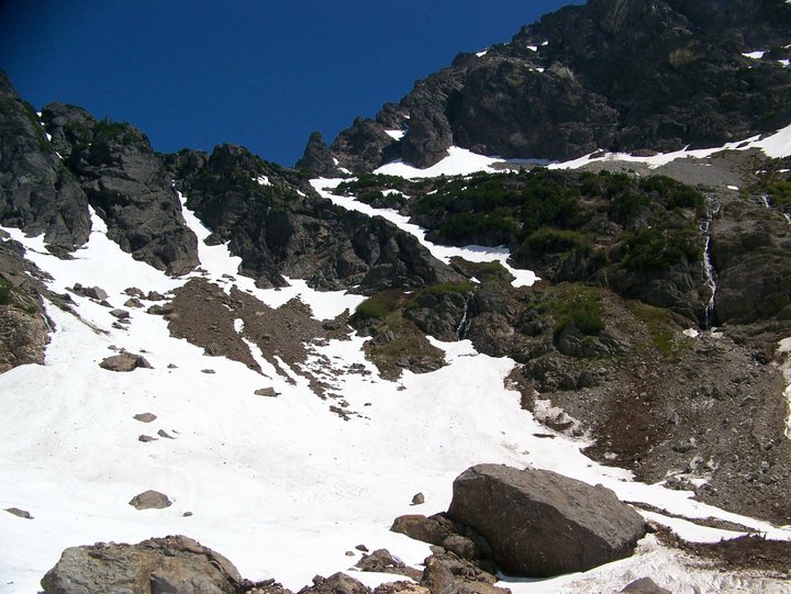
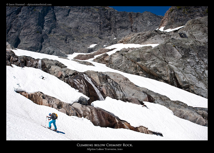
Once we made it to the high col of Chimney Rock we were once again at another crux. Either we would go up and over or down and around to make it to the Overcoat Peak area. We searched for hours on the upper ridge unable to descend onto the Overcoat glacier because of a cliff band. It became apparent that we would have to go down through the valley below instead. Under us we could see that it was steep and melted out. If we chose to exit that way it would be a epic bushwhack. Hopefully we could go around as from what we saw there was no way up and over.
That night we camped on the col wondering about what was in store for us the next day. Although it had been a stressful afternoon we were more than halfway through the Alpine Lakes ski traverse.
The Fifth Day of the Alpine Lakes Ski Traverse: Summit Chief Col to Iceberg Lake
The options were limited as we woke up and got out of our tent. Either we would return to the cliff band and hope for the best or ride down a potentially melted out gully. We chose to descent as we strapped in and rode down. It seemed to be fine as we descended around 1500 feet until to our dismay it abruptly melted out.
By now we were on vegetation and I tediously put my board on my back. It was a free for all as we down climbed, grabbing anything we could. Once we made it back towards the snow a 10 foot deep trench blocked our progress. I jumped across slamming hard on the firm snow and torqued my shoulder. With my ice axe out I immediate used it to self arrest. Finally we were back on snow and searching for another route to the Overcoat Glacier.
A Second Attempt at Overcoat Peak
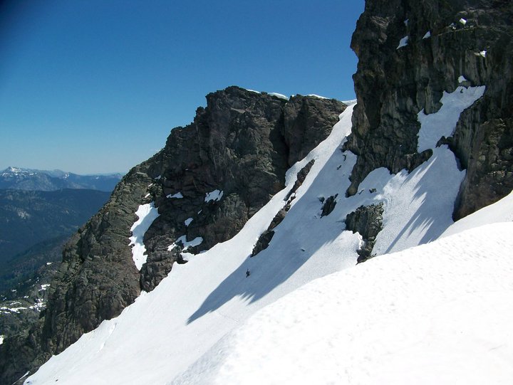
The Summit Chief valley is truly a spectacular place immersed in massive cliff bands. There was no place in the entire trip that I felt more isolated. As we skinned up the Chimney Rock glacier all we could see was rock formations passing by numerous waterfalls along the way.
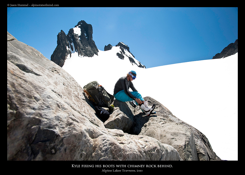
Once on the upper slopes we switched to bootpacking as the terrain had ramped up. The afternoon sun blazed as sweat dripped into our eyes hoping we had found a route through. Finally we had made it through a low col and had arrived on the open slopes of the Overcoat Glacier. We had passed the crux and all things considered the route had gone smooth. Finding a nice rock to sit on, it was time to take a much needed break.
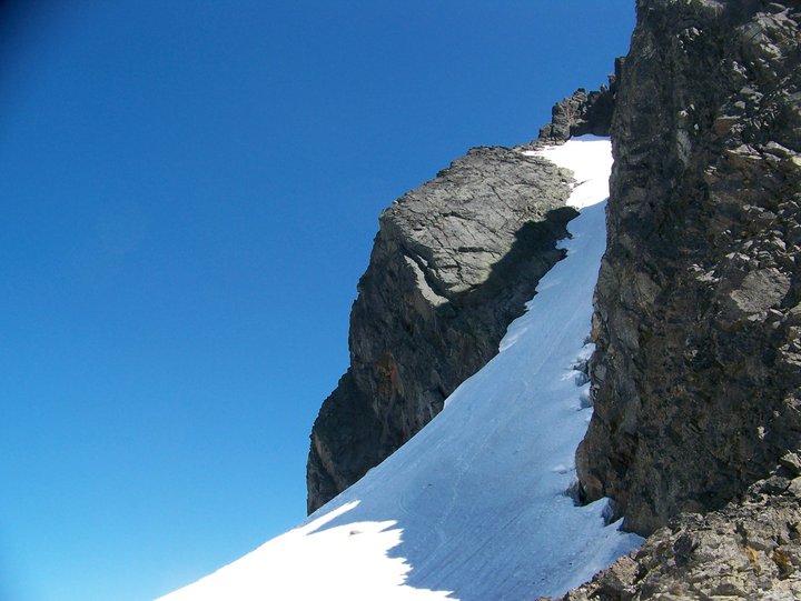
For years I had wanted to ride the aesthetic couloir off Overcoat Peak seeing it from a distance. It was finally within reach and there was no question that we were going over there. After our break we skinned over to the base of Overcoat Peak and dropped off all of our unneeded gear. With two ice axes in hand we pushed up the gut and soon enough we were looking down our line.
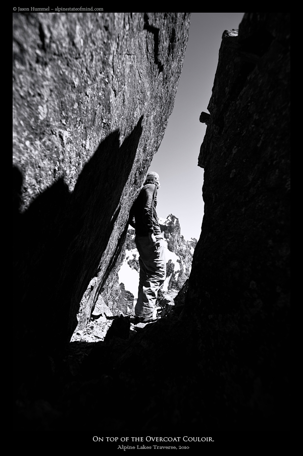
Snowboarding Down Overcoat Peak
We were both stoked finally standing on the top of the line after seeing it on Mount Hinman. Looking upon the Alpine Lakes Wilderness landscape we could see that our intended route to the west for later in the day was cliffed out. It seemed we had yet another crux but it didn’t matter. We were about to ride the 1000 foot couloir on Overcoat Peak in perfect corn conditions.
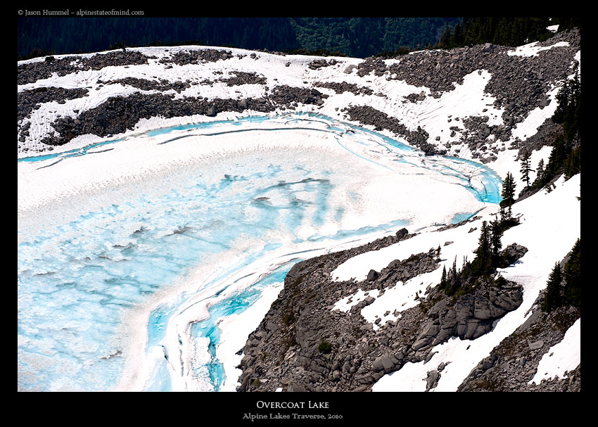
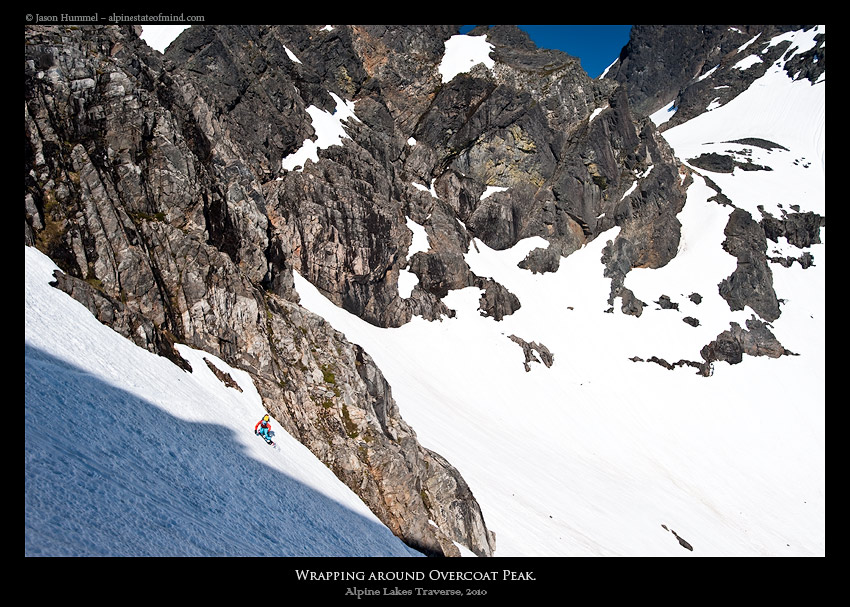
With our intended route blocked we had to do a counter clockwise traverse around Overcoat Peak. After dropping in the couloir we made our way to a low ridge that was steep with most areas melted out. Below us stood the magnificent Overcoat lake still frozen from a endless winter if only we could make it around the lakes shores.
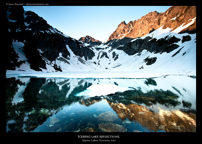
Making Our Way to Iceberg Lake
According to our map we would not only be able to pass Overcoat Lake but we would be able to make it all the way to Iceberg lake. Fortunately we wouldn’t have to deal with the melted out slopes below.
In front of us was 2 miles of mellow slopes that were half in the shade and half in the sun. Making our way down the surrounding scenery made us feel small and we were happy to be making ground.
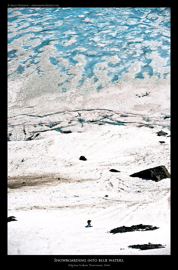
Wrapping through the mellow terrain all of a sudden we were making our way down to a sheet of blue. Early in the Alpine Lakes ski traverse it seemed as if we could skin across lakes but not here. It was far to melted out even to get near the water.
Another Perfect Camp on the Shores
Once on the shorelines we were able to do a high traverse to the western edge. With a final hike up to camp I chose to bootpack instead of transitioning. Arriving at camp I realized that my Splitboard pin had fallen out of the board somewhere. To make matters worse it was my only pin and if I couldn’t find it I wouldn’t be able to skin. I retraced my steps over and over to no avail. What was once anger became fear knowing we had a long trek in front of us. I contemplated what to do while returning to camp. Fortunately while I was gone Jason had located the touring pin. I wasn’t going to have to bootpack for kilometers in knee deep spring slush.
That night we watched the sunset alpenglow over Chimney Rock before calling it a night. If all went according to plans this would be our last night in a tent. We had already covered a lot of ground during the Alpine Lakes ski traverse and yet again we were staying at a scenic and isolated spot.
The Last Day of the Alpine Lakes Ski Traverse: Iceberg Lake to Gold Creek Valley
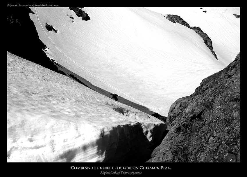
We started early in the day not knowing how long the final leg of the Alpine Lakes ski Traverse would be. With the snow still firm we put our skis on the packs and put on crampons. Making our way under Lemah mountain finally the last mountain on our trip came into view. We were both excited and nervous seeing Chikamin Peak as we didn’t know how the west face would be..
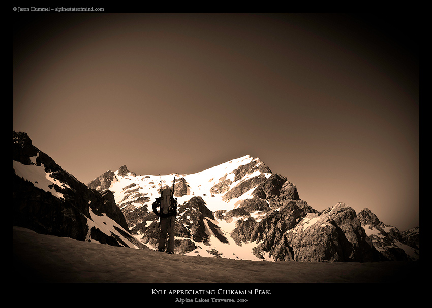
Our Final Mountain Chikamin Peak
We skinned up the slopes as the afternoon sun drained our energy. Later we would find that it was the hottest day of the season. Occasionally we would look back at Lemah Mountain and Overcoat Peak. We had covered quite a bit of terrain the previous day.
Our final objective was to ride off the summit pyramid of Chikamin. Jason led the way up the steep eastern face as we were excited to see what was on the other side. If what the map showed us was correct we would be back at the car in a few hours.
It was much steeper then anticipated as I made my way up with two ice axes. With each step I meticulously kick into the frozen surface, clawing to the top. After a big step over the top shrund we were standing merely feet below the true summit. The last few feet would be a mixture of excitement and impatience for what was below.
Standing near the summit we could see that our line had melted out. My heart sunk as we pondered what to do next. Looking to the west we knew our car was parked 4000 feet below and 10 miles away. Knowing the Cascades we would have to find a trail or get lost in the jungles of the valley.
Finding A Summer Trail to the Car in Gold Creek Valley
We retreated and descended down the couloir we had just climbed. We had to come up with a new plan as we looked again at the topo map. It seemed that everything on the west face was melted out and it was the direction we needed to go. A decision had to be made quickly as no matter what we had a long day ahead of us. In the end we decided to attempt riding a NW facing chute that should connect with the Pacific Crest trail.
Once arriving at the top of the chute we prepared for a epic bushwack before dropping in. It was unnerving but at that time we had no other choice. Soon enough Jason led the way dropping in. It seemed luck was on our side as we made our way down and the route had melted out only feet from the trail. We had made it through yet again another crux. From then on everything would be easy, or that is what we thought.
Following an Overgrown Trail towards Gold Creek
Throwing our gear on our backpacks we made a fast pace following the summer trail. It was easy traveling but we had an issue as Jason’s car was parked in the valley below. According to his map there was a trail that led directly into the valley so we made our way down to find it.
We quickly found the trail which was easy at first but quickly deteriorated. It had become overgrown as we forged through the dense vegetation going less then a mile a hour. The sun was blazing and our bodies exhausted from the past 6 days as we pushed forward.
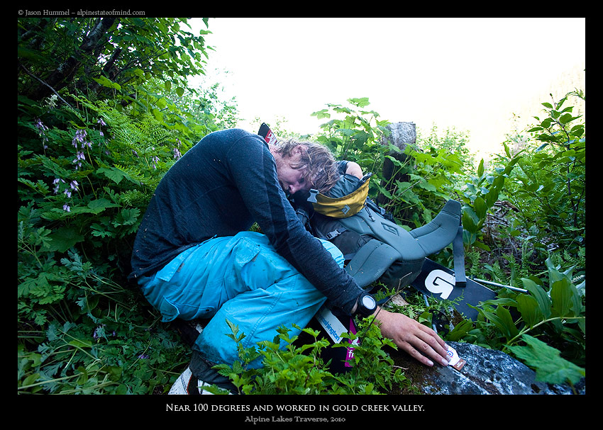
The Final Crux of the Alpine Lakes Ski Traverse
The trail slowly improved and before long we were back on a maintained path. By now all we could think of was making it back to the car before sunset. I didn’t care about wet gear anymore, passing stream after stream of knee deep water. The creeks were deeper then normal because of the heat but totally manageable.
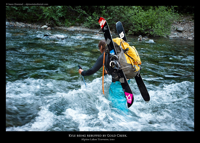
When we reached the Gold Creek we saw that the bridge was out. It was the hottest day of the season and in front of us was waist deep water that was raging. Thinking nothing of it I started crossing but the current almost ripped me off my feet, I grabbed onto a tree and pulled myself back to shore. I had almost been swept away by the current.
If I wanted to get out of there I would have to cross the river but falling was dangerous. It was one of the scariest experiences of my life knowing I would have to try again. Jason had experience crossing rivers so he slowly made his way a step at a time. One foot at a time I stepped into the current and made my way across. Finally we were on the final stretch to the car and the end to the Alpine Lakes ski Traverse.
9 Miles Between Us and the Car and Finishing the Alpine Lakes Ski Traverse
All of my gear was soaked but I didn’t care. It was a race against sunlight and I was determined to get to the car before dark. My boots squished with every step for the final 9 miles as we kept moving thinking of the car. The nonstop hiking in wet boots had taken its toll on my feet but I didn’t care as we were so close. We made it to the car just as darkness arrived, completely exhausted we dropped to the ground and celebrated. We had completed our goal in traversing most of the Alpine Lakes Wilderness.
Hyas Lake Trail to Mount Daniel
Mount Daniel to Mount Hinman
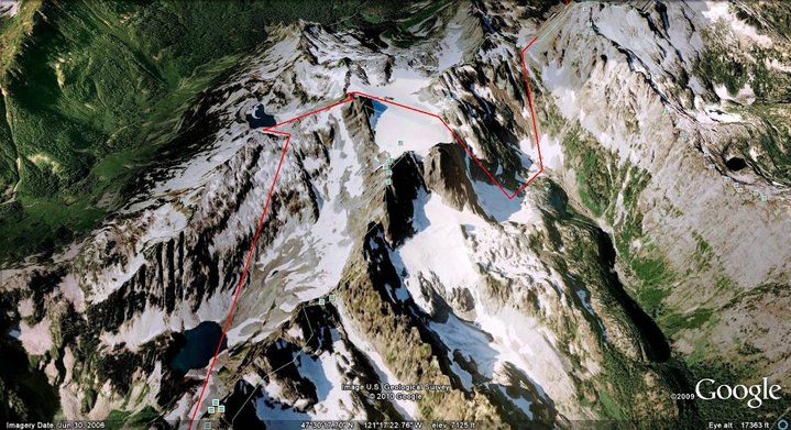
Mount Hinman to Summit Chief Col
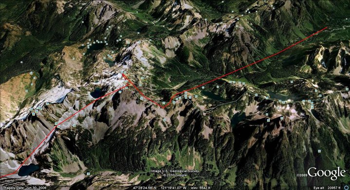
Summit Chief Col to Iceberg Lake
Iceberg Lake to Gold Creek
I highly recommend this tour if you have the opportunity to do so.
Out of all the traverses I have done I easily found this to be the most
enjoyable.
To hear Jason Hummels version click here