Any mountaineer who has intimate knowledge of the Cascades knows of at least one mountain that invokes fear. A mountain full of near-vertical faces, glaciers covered in seracs, crevasses and schrunds and an abundance of cliffs everywhere. For every dream of majestic open slopes, there is a nightmare hiding in the shadows. To me Goode Mountain was that nightmare.
Heading Out for Goode Mountain
For once, it was blue skies when Jason Hummel, Scott McAllister and I got on Lady of the Lake. Loading our gear soon we were on a small ferry that grants access 60 miles up Lake Chelan. Our destination was Stehekin, a small village engulfed in the North Cascades and locked away from civilization. This place is as unique as it comes in the lower 48. No grocery stores and fewer than 100 permanent residents. It’s a nature lover’s oasis.
We arrived to the warm greeting of Bob, a Stehekin local for the past 30 years who literally keeps the town running. It was our first time meeting him in person and immediately we hit it off. He was kind enough to let us borrow one of his trucks to drive up the valley towards Goode Mountain. This would take away the burden of hiking 12 miles up the dirt-covered Stehekin River Road. At one time the road was thought to be the passage through the North Cascades. Following the banks of the Stehekin River up 26 miles to Cascade Pass during the summer. But winters in this neck of the woods are inhospitibal, untame and downright cruel. A once-busy road now laid abandoned, covered in downed trees and new creeks and taken over by the river itself for the final 14 miles.
Day 1 Stehekin to Bridge Creek Campground
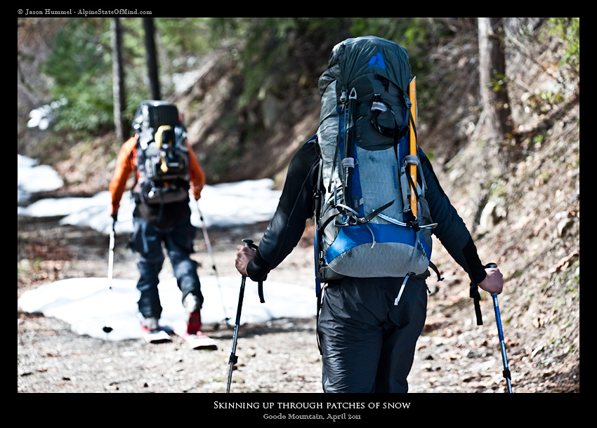
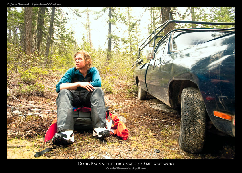
The truck drove towards High Bridge before being stopped by snow. We took our time shuffling through gear, packing necessities and trying to maintain the perfect balance between too much gear and not enough before finally hitting the trail.
It was well into the afternoon by the time we got moving on the patchy road toward our objective. The afternoon sun had taken its toll on the snowpack as we attempted to bootpack, sinking to our knees with every step. The road was buried in an unusually deep snowpack for this time of year, but we were able to follow it and finally arrive to our camp, five miles up road. Bridge Creek Campground was once a bustling vehicle-accessed area, vital to the local mining operations, but now it is abandoned, leaving behind cabins and horse corrals, perfect shelter for the first night.
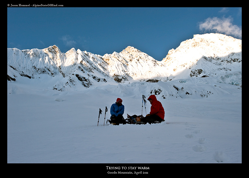
That night, we sat around and talked. If all turned out as planned, we would be sitting at the base of Goode in 24 hours.
Day 2 Bridge Creek Camp to the Base of Goode Mountain
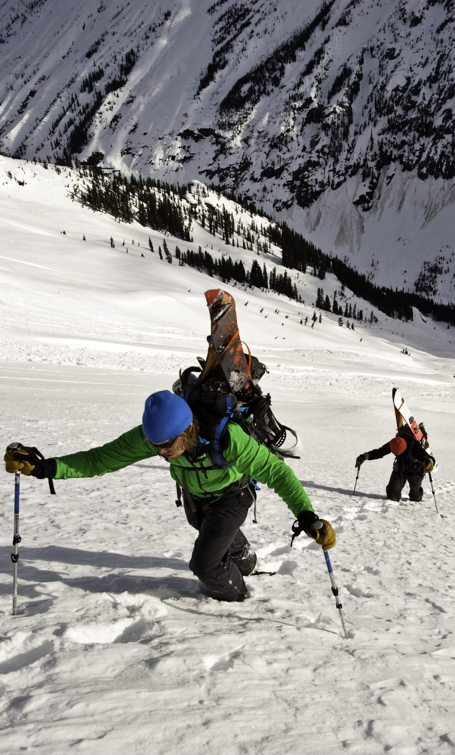
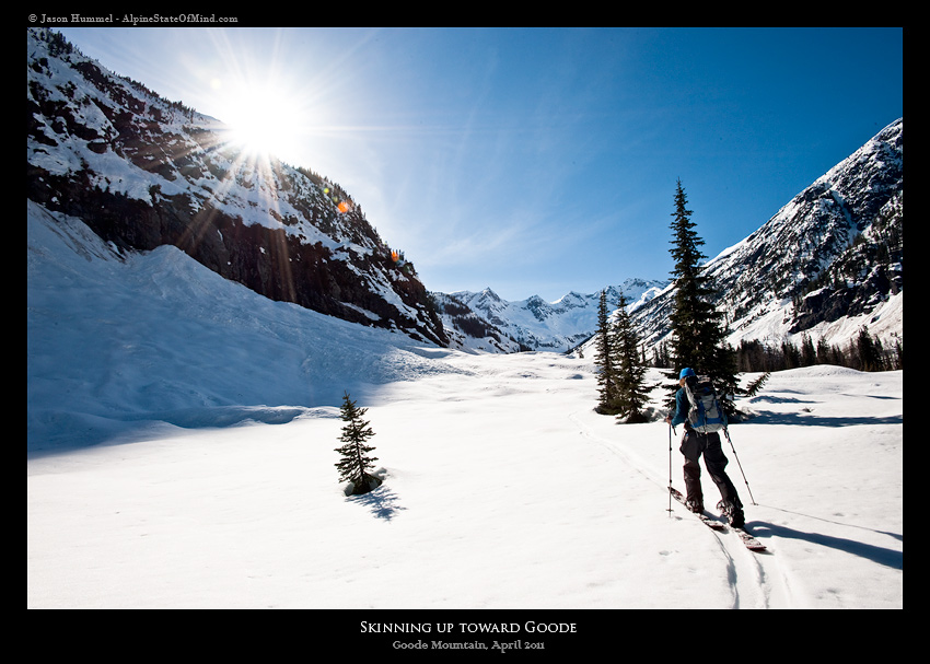
The next morning, we were awakened by the first rays of the sun. It was cold and calm outside, a welcome change to the constant storms the Pacific Northwest has been ravaged by. We packed our bags and loosely followed the Pacific Crest Trail, which was buried under three feet of snow. The crux of the approach was one mile of sidehilling on the steep slopes above Bridge Creek where falling wasn’t a option. Before long, we were standing at the junction of the North Fork of Bridge Creek and walking on a bridge covered with five feet of snow.
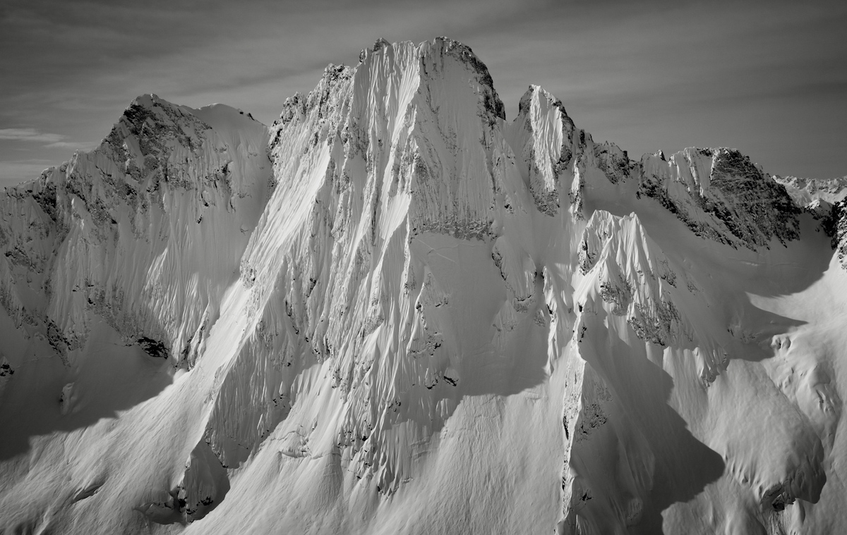
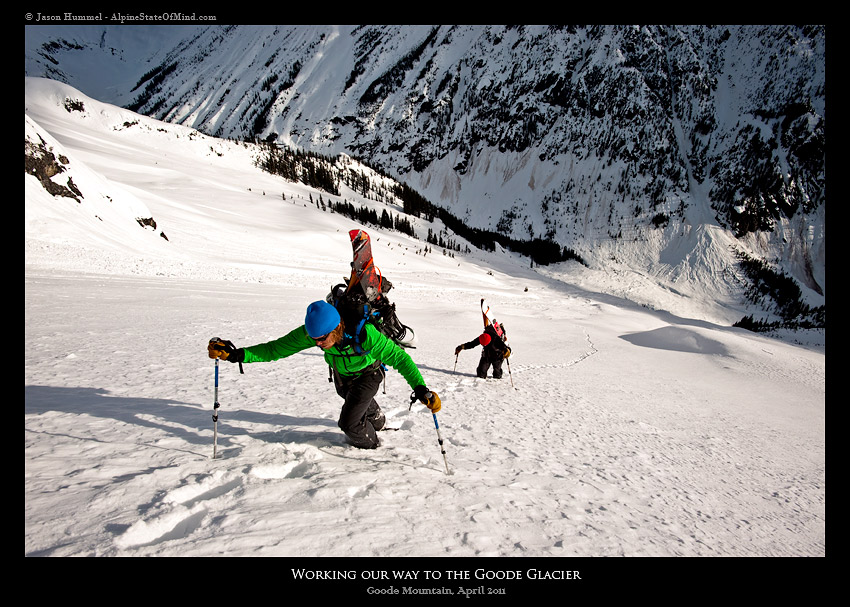
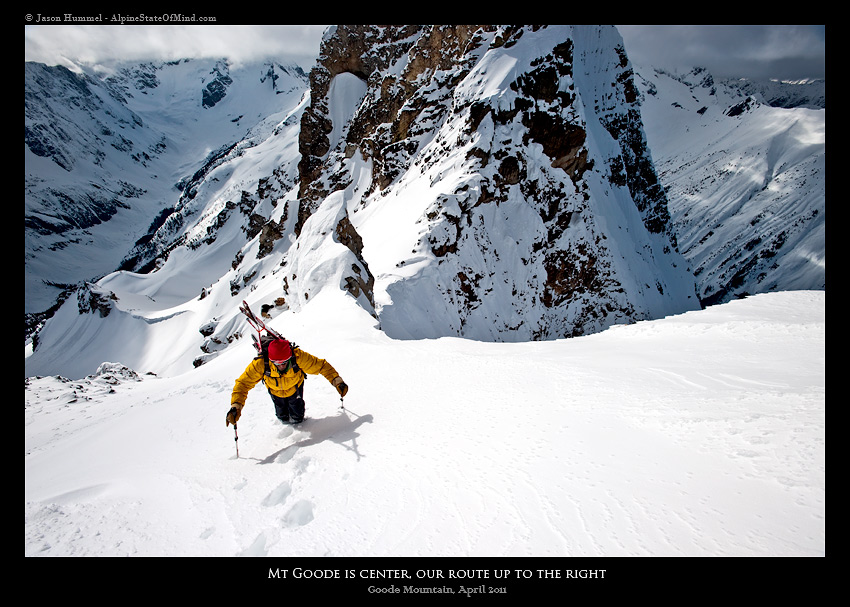
We skinned up the North Fork of Bridge Creek, making quick progress on the shoreline. Once out of the dense forest, we had our first view of the mountains surrounding us and were blown away by how tall they were, with almost a vertical mile between the summits and the low point of the valley. It wasn’t until we were at the base of Goode that we finally got our first view of the upper slopes. Pictures don’t do justice to the North Face of Goode Mountain. We were dumbfounded that there was 5,500 feet of climbing above us, and we would soon find out it would be one of the harder climbs we would ever undertake.
Day 3 Up and over Goode Mountain
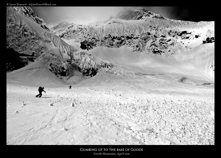
The alarm went off at 3:30 a.m., and I quickly arose from my sleeping bag, making coffee and breakfast under the light of a headlamp. The snow was firm from a overnight freeze. We found conditions favorable to cramponing, climbing a small ramp between cliff bands.
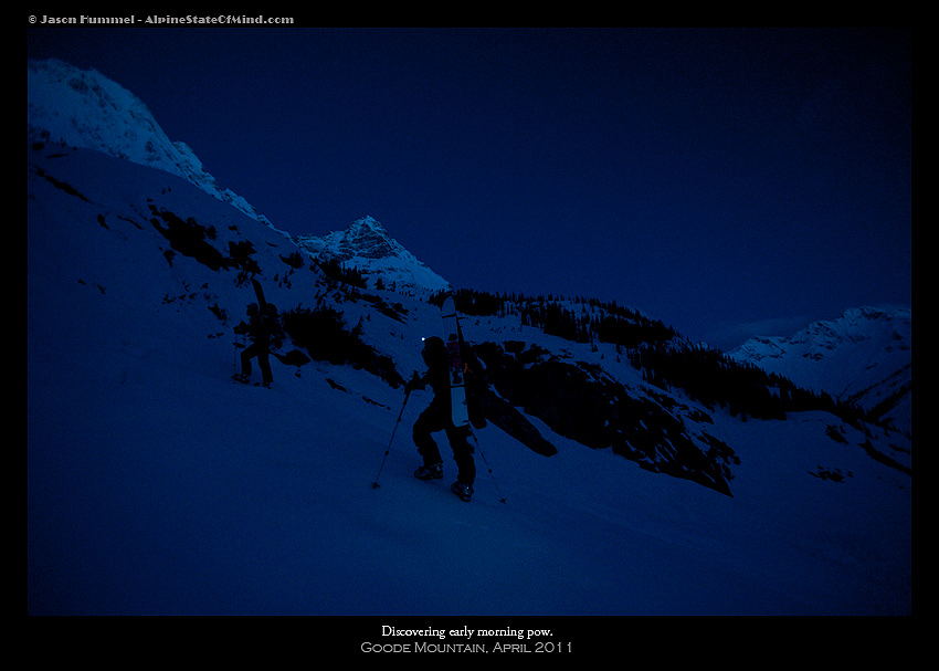
We made fast progress up the lower slopes, mesmerized by the early morning alpenglow taking place above us on Goode Mountain.
What originally was ice quickly transitioned to snow and what was a few inches became a few feet of cold smoke. We all made turns breaking trail, making our way onto the Goode Glacier, and navigated around the seracs and bulging ice cliffs before making it to the main headwall and the base of the final 2,000-foot chute at around 9 a.m.
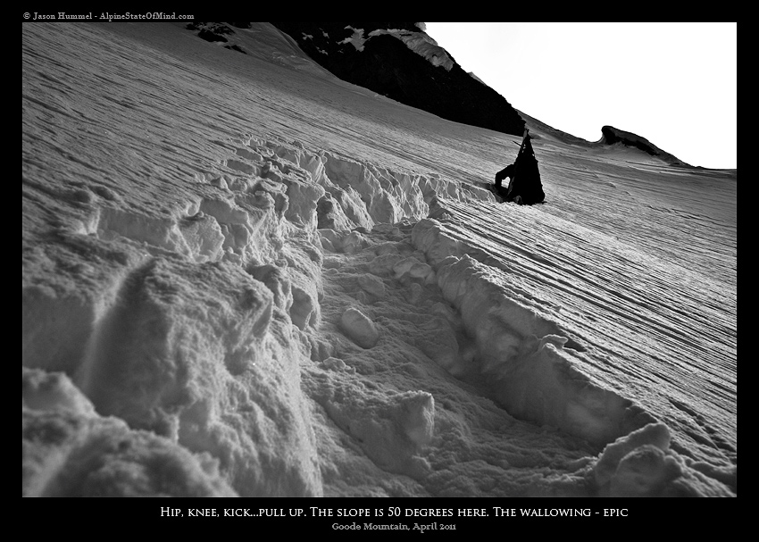
The chute was just as steep if not steeper than imagined, with 2,000 feet of consistent, 55-degree slopes made worse by the fact that an avalanche had run the entirety of it, leaving behind firm conditions.
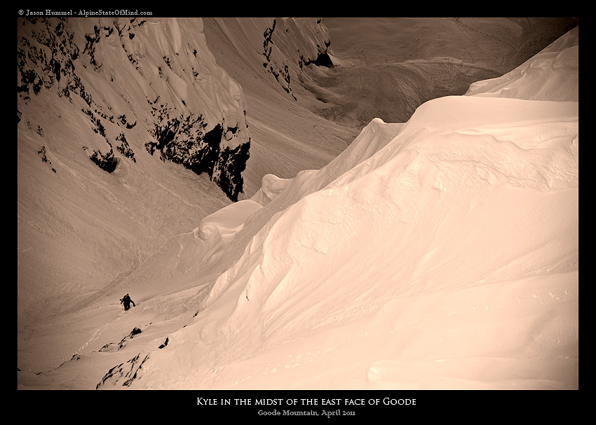
One-by-one, we carefully crossed the small shrund at the base of the chute and started climbing. Jason and Scott blazed a trail in hardboots, frontpointing on the steep face while I carefully dug out footholds for my softboots with both my ice axes. I kept focused on small tasks and creating a rhythm digging out a platform for both my left and right foot, placing my tools in the solid snow then pulling myself up. Those final 2,000 feet took me 8 hours.
Change in plans on Goode Mountain
By the time I reached the top of the east face, I was exhausted. Scott and Jason had been hunkered down and waiting for around an hour. From the vantage point could see a small front coming in. We had hoped the snow would warm up in the afternoon sun, but clouds kept the lower slopes ice-hard, and the upper slopes had unstable slabs that would break with the slightest of pressure. With the conditions at hand, we made a group decision that the line just wasn’t safe, knowing that any fall could potentially be fatal.
We looked at our other options and decided the safest option was to ski the entirety of the south face down to Park Creek, 4,500 feet below us, and do an emergency bivy. It was a hard decision knowing all our food and shelter was the opposite direction and that we would have an additional 14 miles of skinning to reach it again, but we said a quick goodbye and dropped off the southern slopes of Goode.
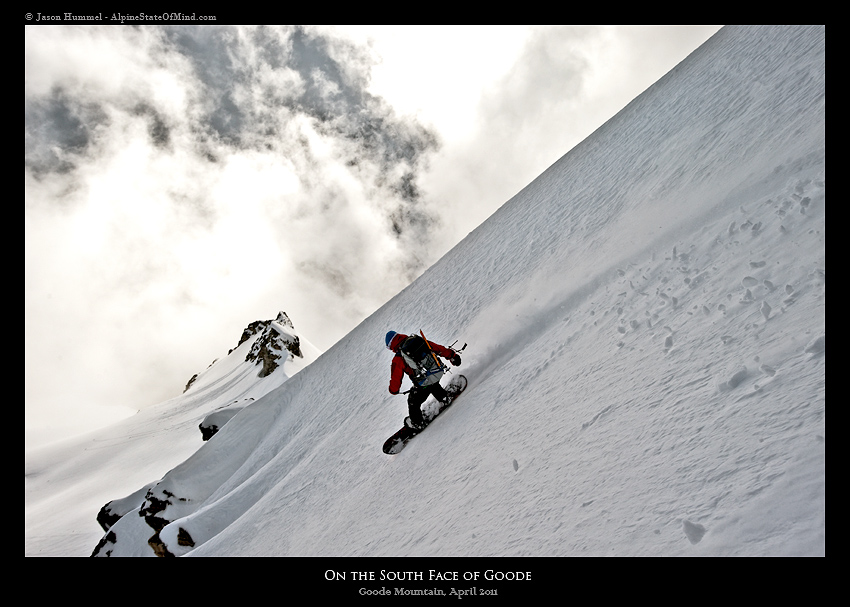
The snow was anywhere from powder to slush and all in-between as the clouds danced on the summits. We made our way down to Park Creek just before sunset and looked for potential bivy spots while skinning downstream. We made camp next to an avalanche path which had an abundance of dead trees. It was a good enough spot with flowing water and multiple potential spots for shelter. That night, we focused on keeping the fire going and attempting to get whatever sleep we could. In the end it wasn’t much at all.

Day 4 Back to the base of Goode Mountain
The moment that the sky lightened it was time to get moving. We had no sleep, no food and a 14-mile trek in front of us, a long day by any standard. The Park Creek Trail was nowhere to be found loosely following the general route. Soon we had wrapped around a massive canyon and back down to Stehekin River Road still five miles upstream from Bridge Creek Campground. Little was said as we skinned on the abandoned road, tired from the lack of sleep and lack of calories. Once we arrived at Bridge Creek, we took our boots off and took a nap in the early morning sun.

Three hours had passed before we woke up once again. We were ready to skin the final nine miles back to camp and, more importantly, food. Since we had to pass Bridge Creek one more time on our way out, we decided to ditch our climbing gear and travel light. We made fast progress on the now familiar trail, shaving off hours by the time we reached the North Fork of Bridge Creek. While we didn’t have food, there was no shortage of water.
By the time we reached camp, it was 5 p.m. That afternoon, I put my sleeping pad out in the sun, took off my boots and ate everything in sight. That night I slept easily, having a warm sleeping bag and sleeping pad. It was a stark contrast compared to the relentless shivering of the previous 24 hours.
Day 5 Back to Stehekin
I woke up the final morning well rested and ready to take on the 14-mile deproach back to the car. The weather had turned for the worse, and it was drizzling by the time we had packed up camp. By now, we were quite familiar with the terrain and made quick travels down to the North Fork Bridge. The night before, we had decided that bootpacking would be more efficient for the mile of the steep sidehilling on the PCT, and before long we were past the crux. The last nine miles were somewhat of a blur, our minds occupied with thoughts of food, shelter and resting on the river shores. We made our way past Bridge Creek Campground and onto the final stretch back to the car.
One foot in front of the other, I pushed myself forward. Finally I was back at the truck where Jason was waiting. By now, my feet were swollen and my body exhausted, but it didn’t matter. Nothing could take the smile off my face. Finally, we rode on the slopes of Goode Mountain.
In Conclusion
Thank you for reading this trip out to Goode Mountain. If you want to see more ski tours within the Stevens Pass Backcountry check out this link.