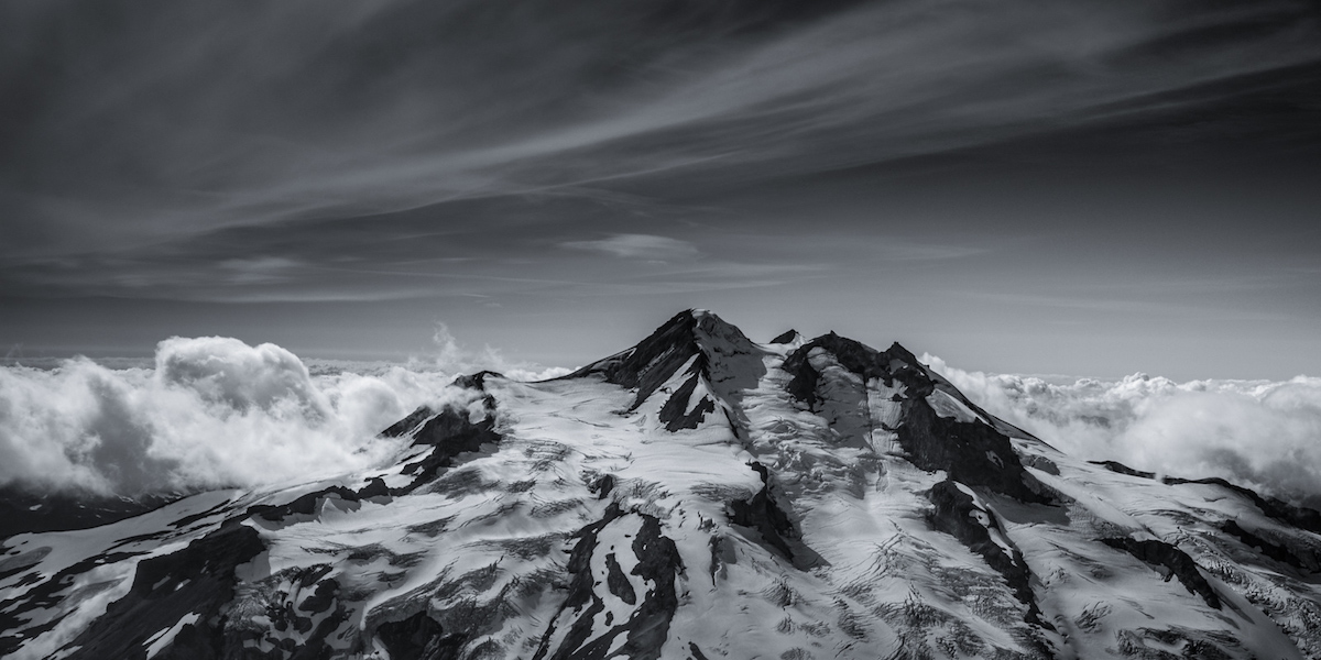
It all started with a forecast. If predicted correctly we would finally get three days of sunshine and a shot at getting in the alpine. The plan came together quickly to ride Glacier Peak via the Chocolate Glacier Headwall. Unlike other Cascade volcanoes Glacier Peak is surrounded by some of the most rugged and remote peaks in the lower 48. It has become by far my favorite peak. I had been to this area two times before. Once three years ago on a quest to climb the five Washington volcanoes. The next time it would be via the Dakobeds which was a 60-mile seven day traverse. This time, we would go in via Thunder Basin, a route pioneered by Ryan and Monica years earlier.
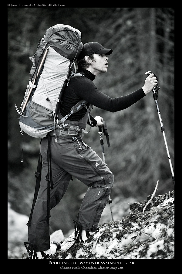
We heard the snow level was low, but we weren’t expecting snow at 2,000 feet. It quickly stopped our car miles from the White River trail head. It was late afternoon, and we decided to shave off a few miles for the upcoming days. We crawled over blown-down trees and across numerous avalanche paths before making camp. We were at the trailhead three miles in that we were able to drive two years ago.
Day 2 Approach via the White River
The next morning dawned with partly cloudy skies as we packed our bags. It was going to be a 14 mile push and 4,000 feet to access the Honeycomb Glacier. From there we would be perfectly situated at the base of Glacier Peak.
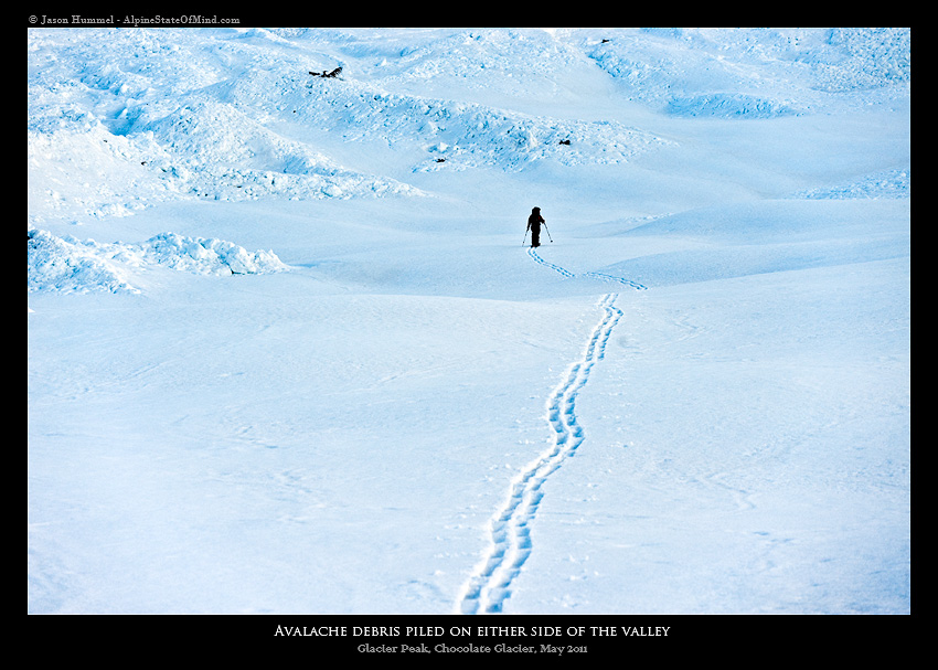
It took minutes before we lost the trail under multiple feet of snow following the White River Valley. There were no bridges on the numerous creeks, requiring downed trees for us to climb above the torrents of water. Six miles into the trek, we crossed the southern base of Clark Peak which was recovering from a mid-winter battle. Below it was huge avalanche scars half a mile wide and more than 30 feet tall. “Impressive” was an understatement.
Heading Up Thunder Basin to Climb Glacier Peak
By the early afternoon, we made it to Thunder Creek, raging water where a trail-hiking bridge lay broken with only with half of it remaining. We used rocks, careful not to fall into the waist deep current, before climbing onto the bridge and crawling delicately across it. That afternoon, we climbed up Lightning Creek, an area littered in massive rock bands and waterfalls and the end of the Dakobeds. Normally, there was a hiking trail, but at this time it was buried under at least six feet of snow.
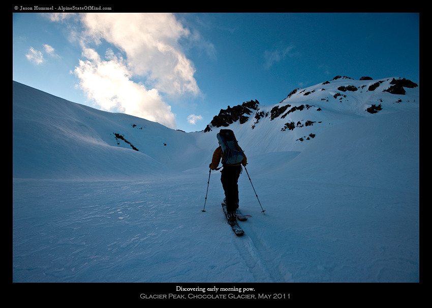
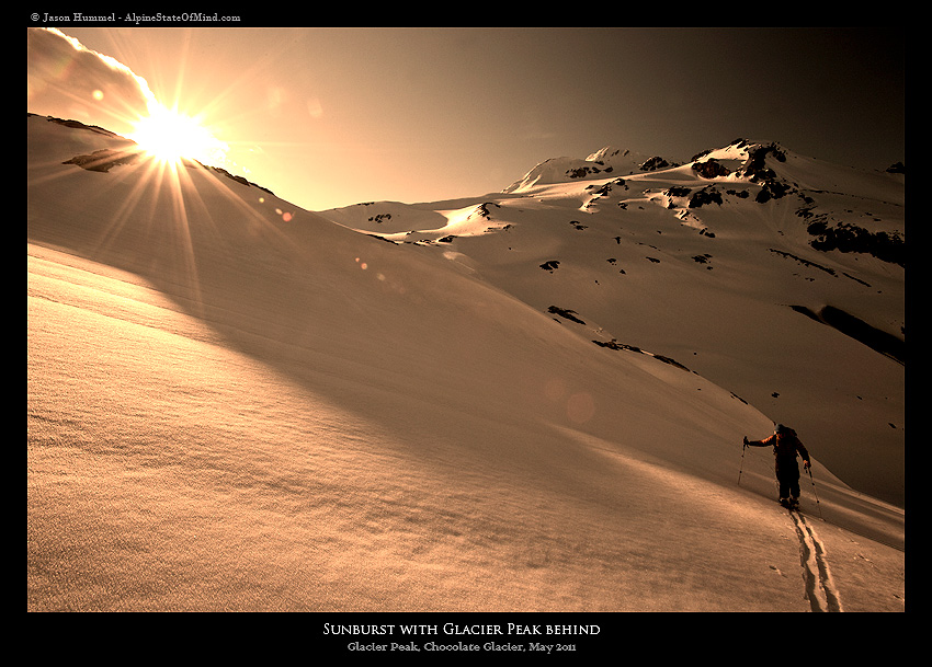
We skinned up the upper slopes of Lightning Basin as the sun set around us. The alpenglow illuminating peaks like Indian Head Peak and Mount Rainier to the south. We wondered if we would make it to camp before dark as we pushed up the open slopes. Finally we arrived at our low pass literally minutes before dark.
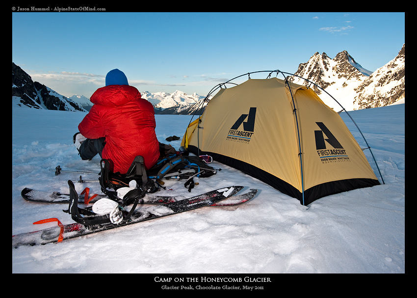
That night, we spent hours eating food and melting water in preparation for a long summit day. To the North was Glacier Peak four miles directly in front of us.
Day 3 Heading up the Cool Glacier Route
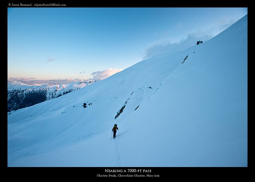
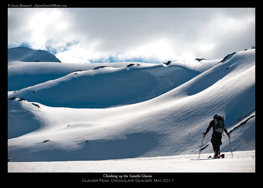
We woke up to the sunrise gleaming on the Honeycomb Glacier. After an hour of packing and hydrating, we were off for the summit of Glacier Peak. A long sidehill of the Suiattle Glacier took us up to the Cool Glacier. It had been years since I climbed this route. As the surrounded peaks came out I was blown away at how familiar I had become with the Cascades. Looking every direction, I would notice peaks that I had skied in the past two years. The puzzle of our mountains was coming together.
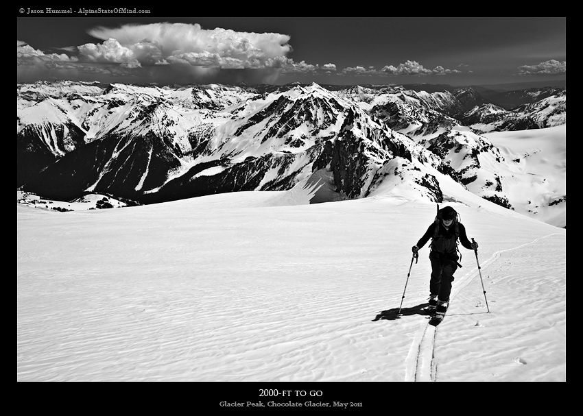
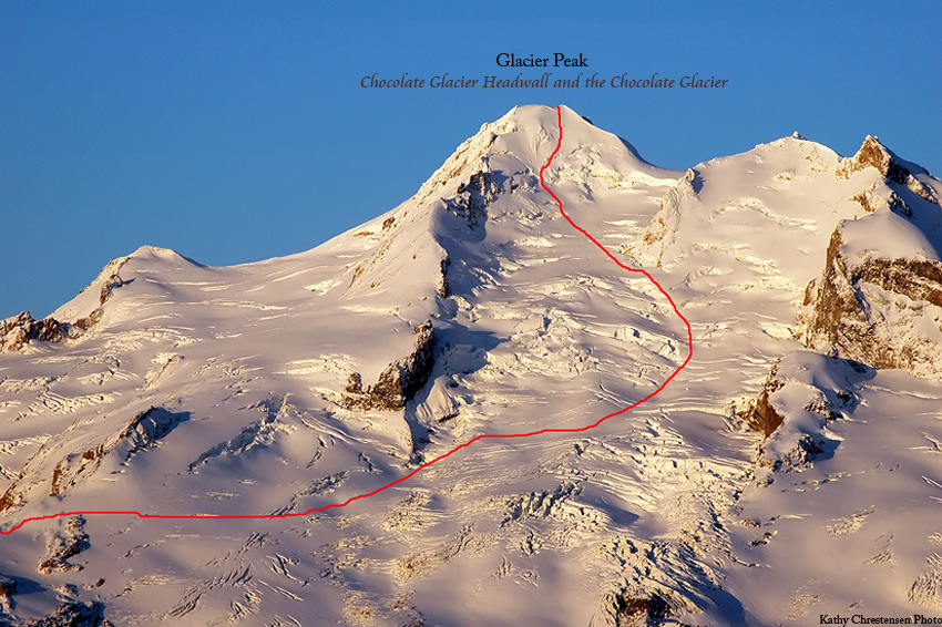
It’s amazing how your perspective changes over the years. What you found to be technical years prior is now just an easy walk up. That was the case as we summited Glacier Peak and quickly celebrated our achievement. All the while we were keeping an eye on some incoming clouds from the east. Our plan/goal for the trip was to ride the Chocolate Glacier via a steep headwall. This slope is incredibly aesthetic and as isolated as it comes in the Cascades.
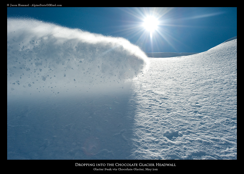
Snowboarding Glacier Peak via the Chocolate Glacier Headwall
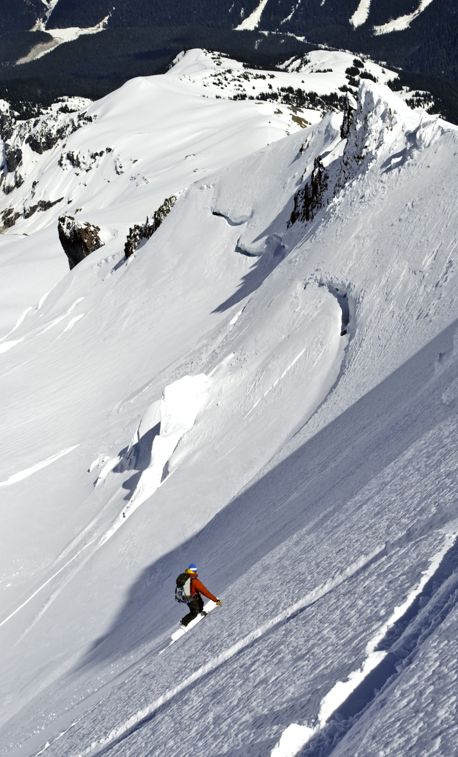
Standing above the headwall, we found a few inches of powder on top of breakable crust dropping onto the 50-degree slopes. From our view, all we could see was a blind rollover and a bergshrund over a thousand feet below. Before long we were dropping and and happy to find powder snow up top.
Our hearts pumped with adrenaline as we descended the upper slopes, losing 15 feet with every turn. The terrain was steep and we couldn’t really tell where the gaps were below us. Fortunately the snow was edgeable as we descended down the Chocolate Glacier Headwall.
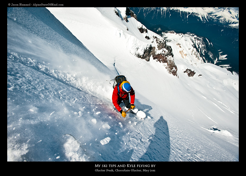
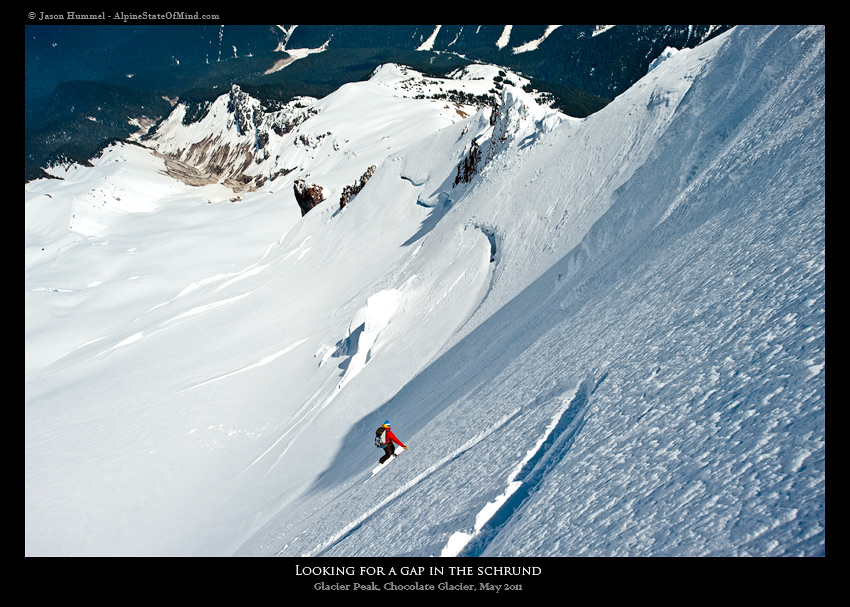
After a handful of steep turns up top we started to see our route roll out under neath us. There was a ramp on the south side and with a bit of maneuvering soon we would avoid the biggest section of the shrund.
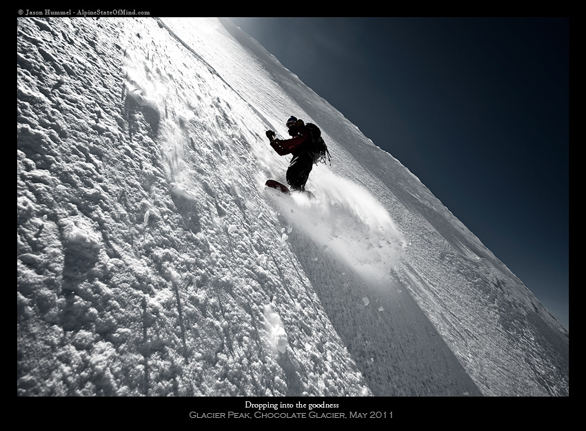
With a bit of maneuvering we had made our way past the main shrund. Soon we were on the low angled terminus of the Chocolate Glacier. Finally we could let go and ride down to the Suiattle River, 6,000 feet below.
Climbing Back to Camp via the Suiattle River After Riding the Chocolate Glacier
That afternoon, we followed the Suiattle River back up to its source. We had an amazing run of the Chocolate Glacier Headwall and weren’t that far from camp. It would be around 2 hours to get back to the Honeycomb Glacier but it was worth it.
For the next few hours we skinned around the mellow contours and up the Suiattle Glacier. Before long we had made our way back to camp just before sunset. The day had gone as smooth as we could imagine and it felt great being back in the area.
That night we hung out for a few hours before heading to bed. The next day was going to be a long one and we needed to get some rest.
Day 4 and the Exit of Glacier Peak via Thunder Basin
We had pulled off the summit but the journey was nowhere near being over with. Our deproach would be 14 miles during the hottest day of the season so far. Other than a 4,000-foot descent, it was all flat. We carefully followed our faint track from a few days earlier.
The sun blazed, and our feet ached skinning with only two breaks along the way — one at Thunder Creek and one at Boulder Creek. Both were more rivers than creeks. What took 12 hours to climb, took 9 hours to get out of just as clouds finally came in. We made it back to the car just as the weather deteriorated– a close call furthermore a perfect trip of three days and almost 50 miles. We had taken advantage of the weather window, were stoked at our achievement and finally we were ready to get home.
One broken-down car and a 4-hour car tow got us back to Jason’s house at the late hour of 1 a.m., but we didn’t care. We had pulled of what we generally thought was impossible. What a way to spend my birthday.
Thank you for reading this trip snowboarding the Chocolate Glacier Headwall on Glacier Peak. If you want to see more ski tours within the Stevens Pass Backcountry check out this link.