The North Fork of Bridge Creek is one of those valleys in the North Cascades rarely visited. With both Goode Mountain and Mount Logan in close proximity the area offers great terrain. Both Scott and I had been in the area via a previous trip and had wanted to go back. With 5 days of good weather our plan was to camp. With the opening of Highway 20 we decided on heading there via Black Peak Col. We weren’t sure how the route would go but we knew it was going be a wild journey non the less. It was time to get some redemption in the North Fork of Bridge Creek.
The Backstory of Goode Mountain
Two seasons ago while attempting to ride the Ten highest Peaks in Washington we toured up North Fork Bridge Creek from Stehekin. The approach was somewhere around 16 miles of the sketchiest skinning in my life. Skinning along the river my edges barely held on the ice above a 100 foot fall into a raging torrent of water. This lasted for hours on end before arriving in the North Fork of Bridge Creek.
Once we made our way to Goode Mountain we found stellar pow conditions until the NE couloir. It had slid and there was nothing but bulletproof snow. Hoping the snow would soften in the sun we made our way up. The 2000 northeast couloir was a consistent pitch with fluting near the top which signifies terrain above 55 degrees. I usually average 1000 feet per hour but those 2000 feet took me 6 hours. Each step had to be dug in with my ice axes and each move had to be solid. Soon enough we arrived at the col.
Weather had come in and the face didn’t soften like we had hoped. It was a group decision that the NE Couloir of Goode Mountain was not safe. Instead we dropped the south face descending into Park Creek for a surprise bivy in the snow. The next day we made our way back 14 miles to our food and shelter. It was a brutal learning experience and we didn’t ride our planned descent.
The plan simply was there was no plan.
The weather was looking great for the next 4 days as we looked at the forecast. Scott had mentioned interest in heading back to Goode Mountain via highway 20. We would drive up to Rainy Pass then go up and over the southern slopes of Black Peak. From there our plan was to bushwhack through numerous creeks all the way down to North Fork Bridge Creek. With enough food for 4 days we would explore more of the valley. Condition depending we would also check out the northeast couloir on Goode Mountain
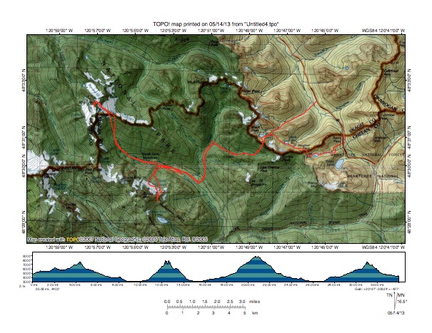
Day 1 Highway 20 to North Fork of Bridge Creek via Black Peak
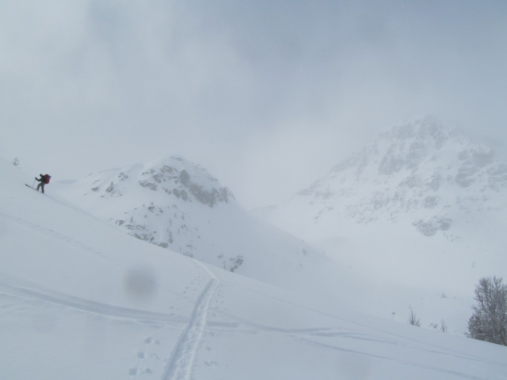
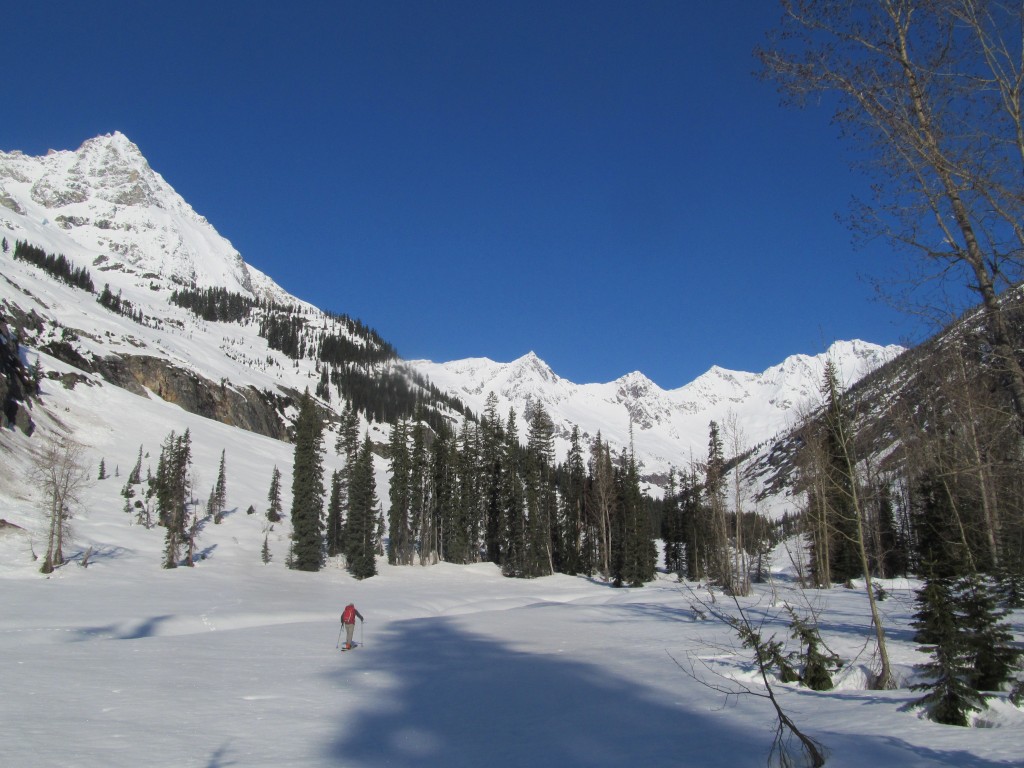
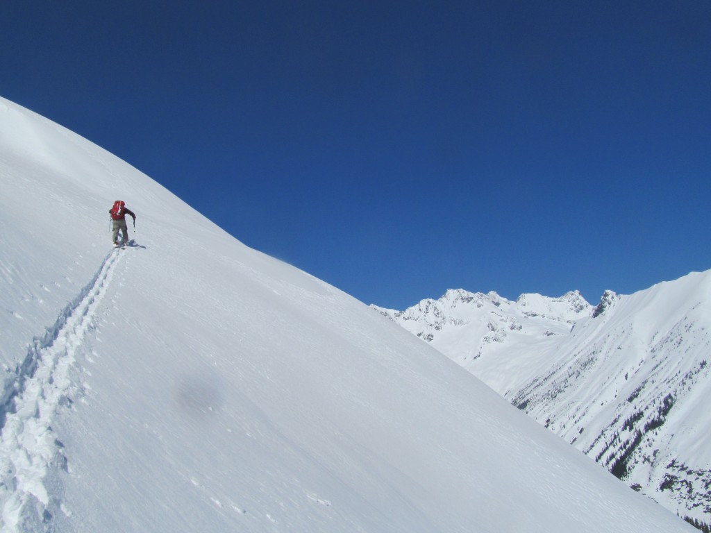
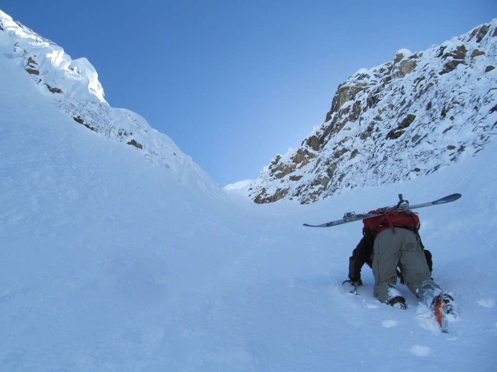
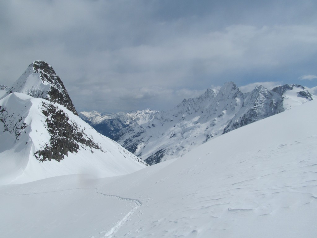
We left Rainy Pass trailhead in a small snowstorm. According to the forecast the clouds were going to break in the afternoon. Leaving from the car we wanted to be in a good zone when they did. We were fortunate that there were a few groups ahead of us, following there tracks in the whiteout. One by one we ran into each group heading back because of poor visibility and soon were on our own. We have a superstition about weather improving when people turn back and this was the case. Within minutes of the lat groups departure Black Peak started coming into visibility. Before long we were ascended towards a low point in the ridge.
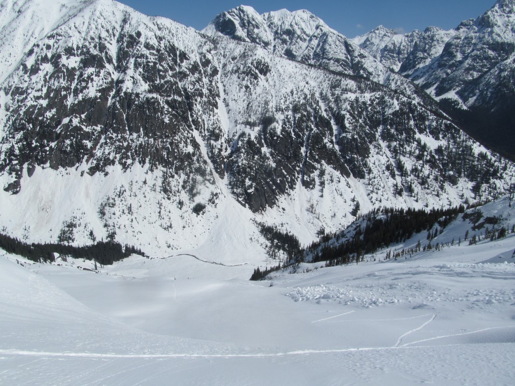
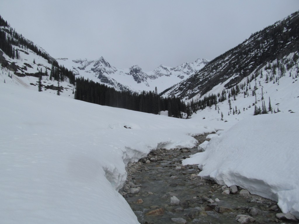
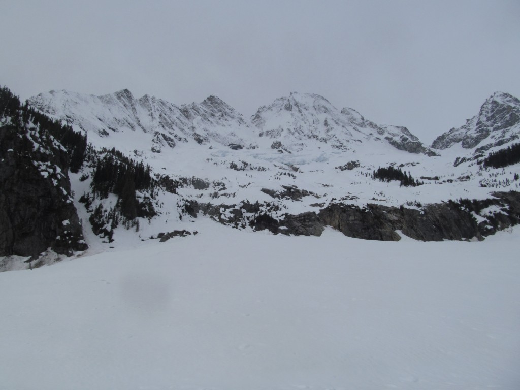
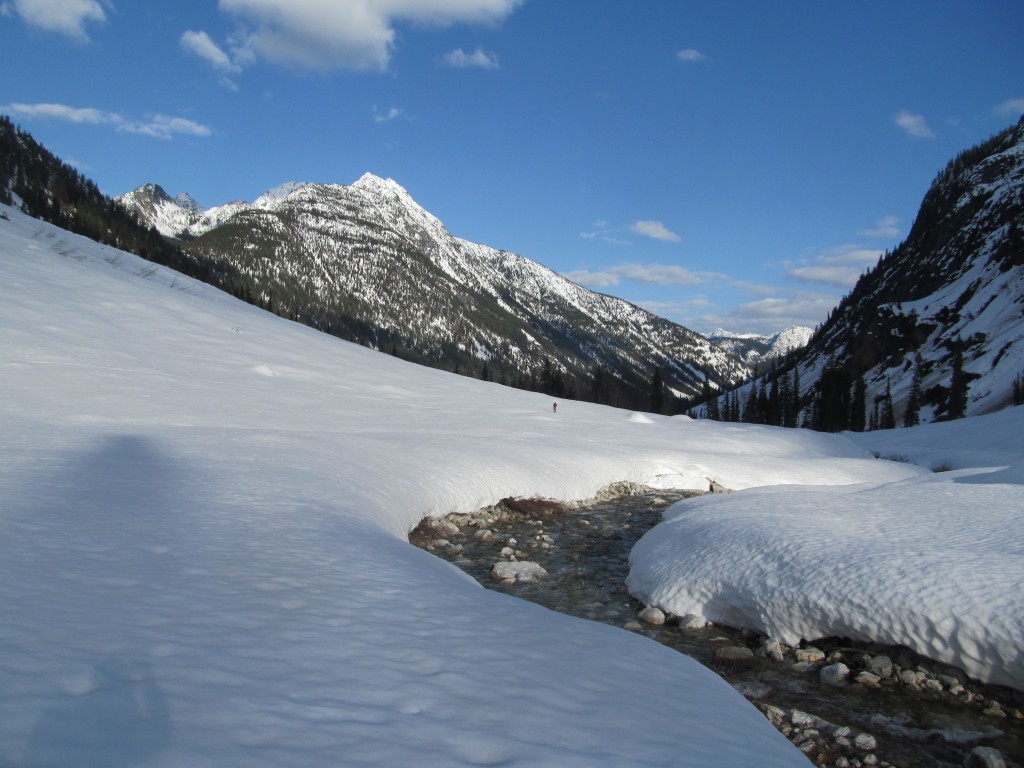
The next few hours were an adventure of skin skiing down valley. We decided to stay on the skiers right down Woody creek before heading to the left side once getting into Grizzly Creek. The vegetation was thick and crossing Falls creek was a pain but the route went. It wasn’t until late afternoon that I got a good view of Goode Mountain. I was both excited and terrified as we pushed way to camp. Soon enough we were in the North Fork of Bridge Creek setting up camp less then a mile from Goode Mountain.
Day 2 Ski descent of the NE Couloir of Goode Mountain
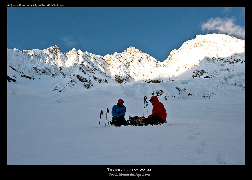
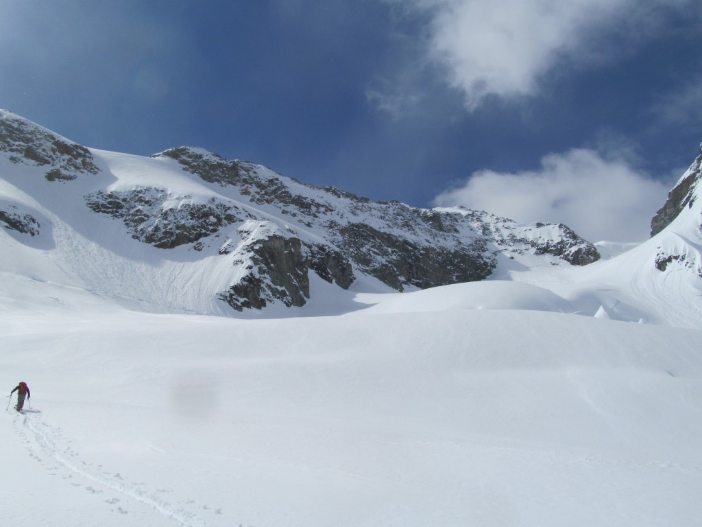
The next morning we woke up with the sunrise and took our time before started the day. Our intentions were to look at the NE Couloir and see how conditions were. The valley was cold so I hastily made my way into the sunshine as we started skinning towards the base of Goode Mountain. Around 5,000 feet above us was the col we were interested in potentially riding.
The previous trip when we climbed Goode Mountain there was a mellow ramp up the cliffbands but it was already melted out. We found a another spot on the far right hand side and skinned in steep trees. Soon enough we were on the open slopes above.
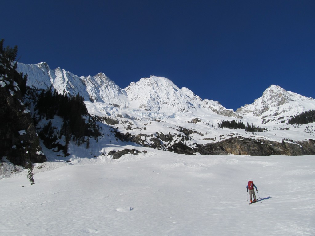
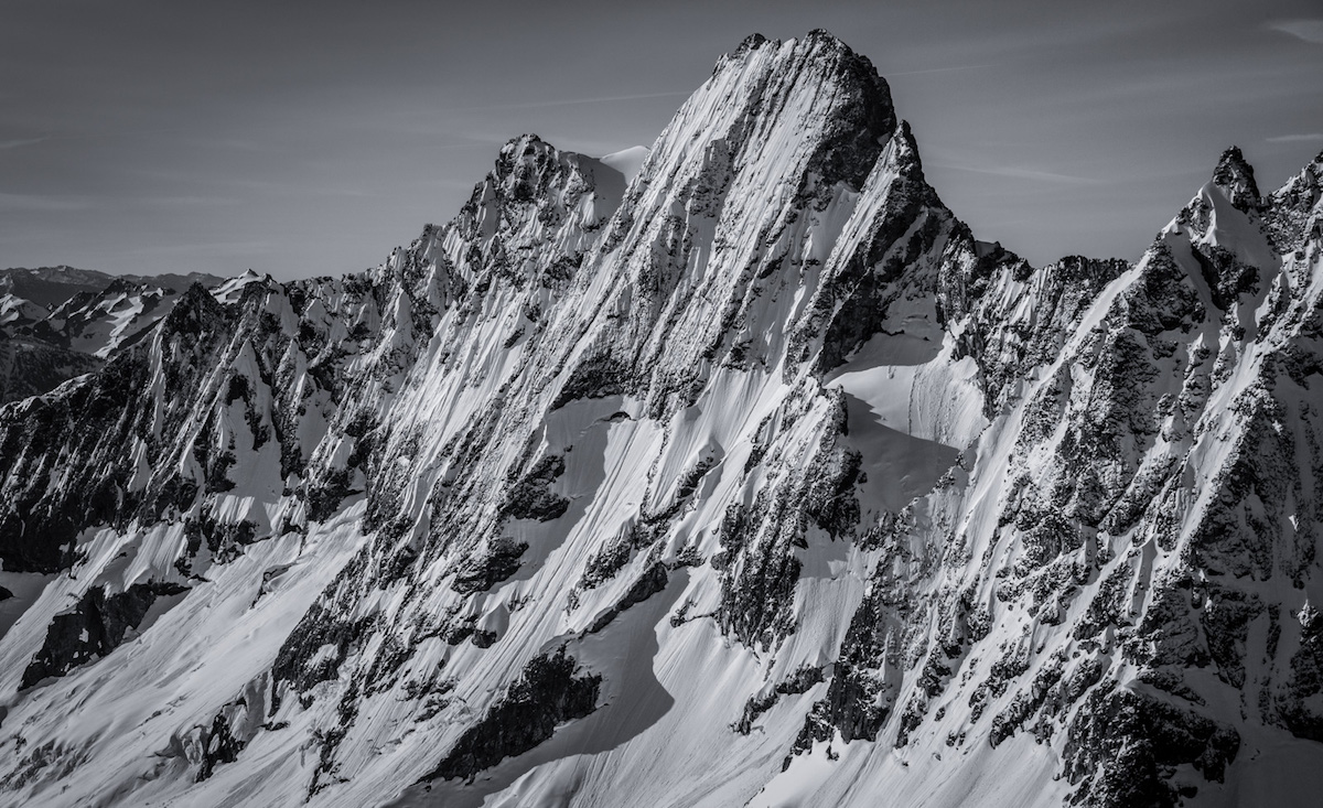
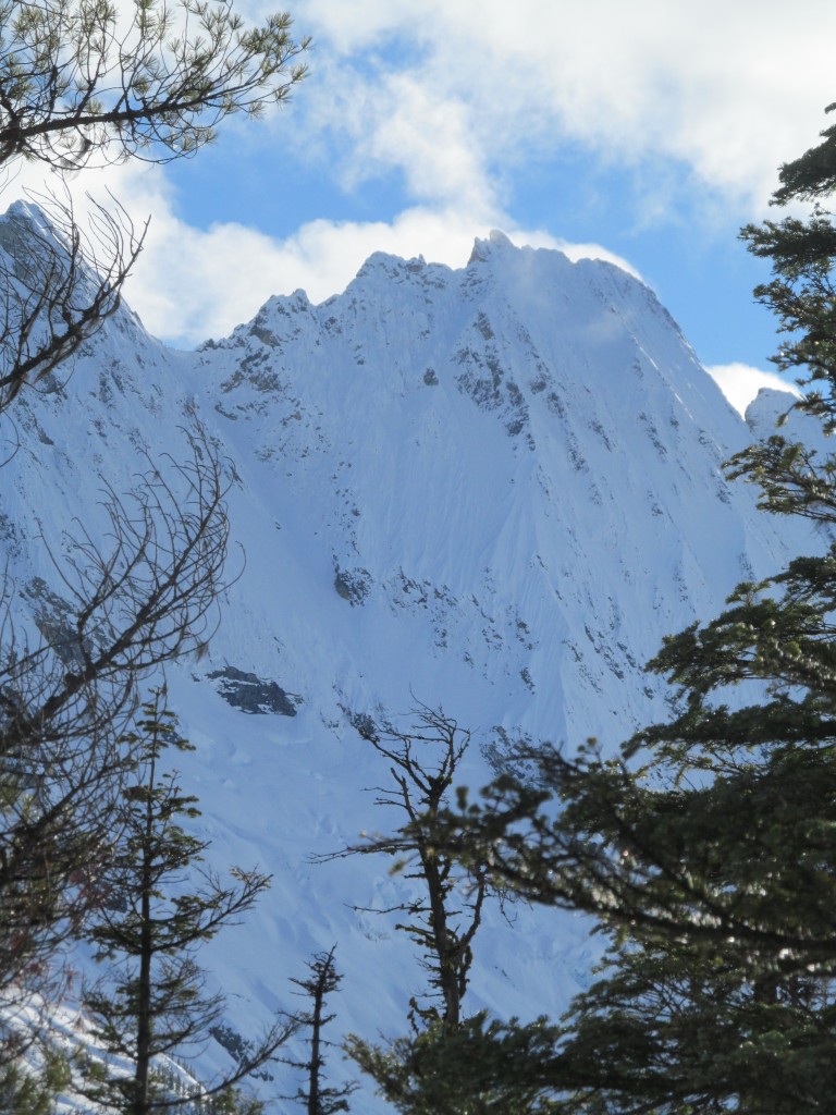
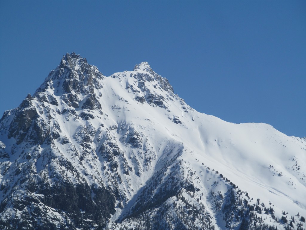
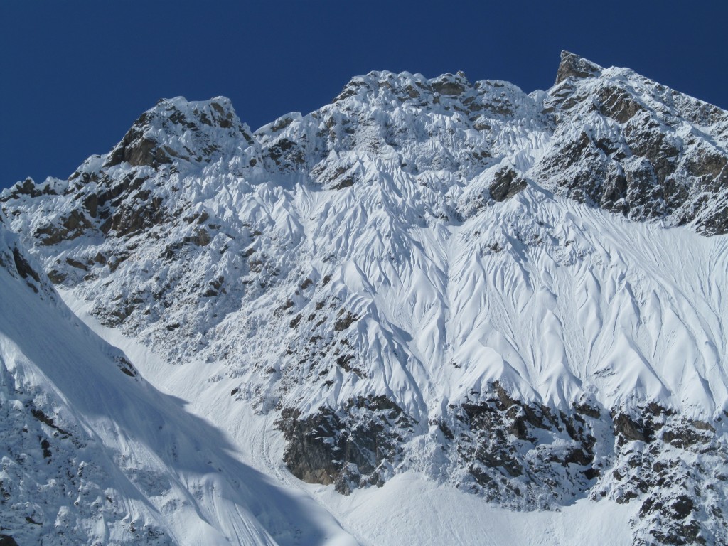
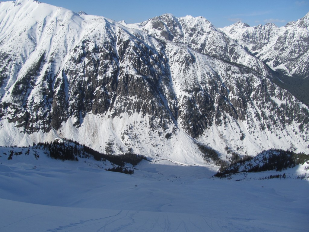
Goode Mountain is all fall line and we found ourselves below the Goode Glacier. Beyond us was fluted all the way from the main summit. Between the rocks was northeast couloir which was the focus of our attention.
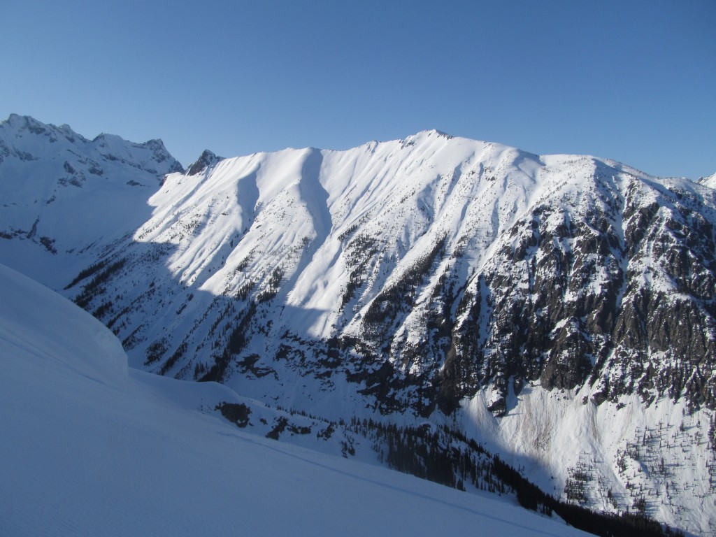
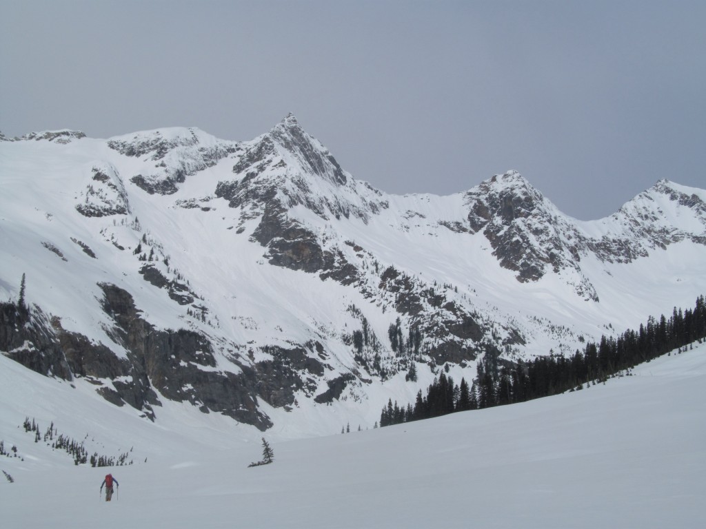
By now we had a clear view of the South Face of Black Peak. This was the route we had come from the previous day. A few year earlier I had skied the face and was looking at Goode Mountain. It felt like completing a circle as now we were looking back at it.
Making our Way up the Northeast Face of Goode Mountain
Laying in mellow switchbacks we were happy to be breaking trail in new snow. Though we knew not to get too excited it made for great skinning. The previous trip we experienced similar conditions only to find an ice filled couloir.
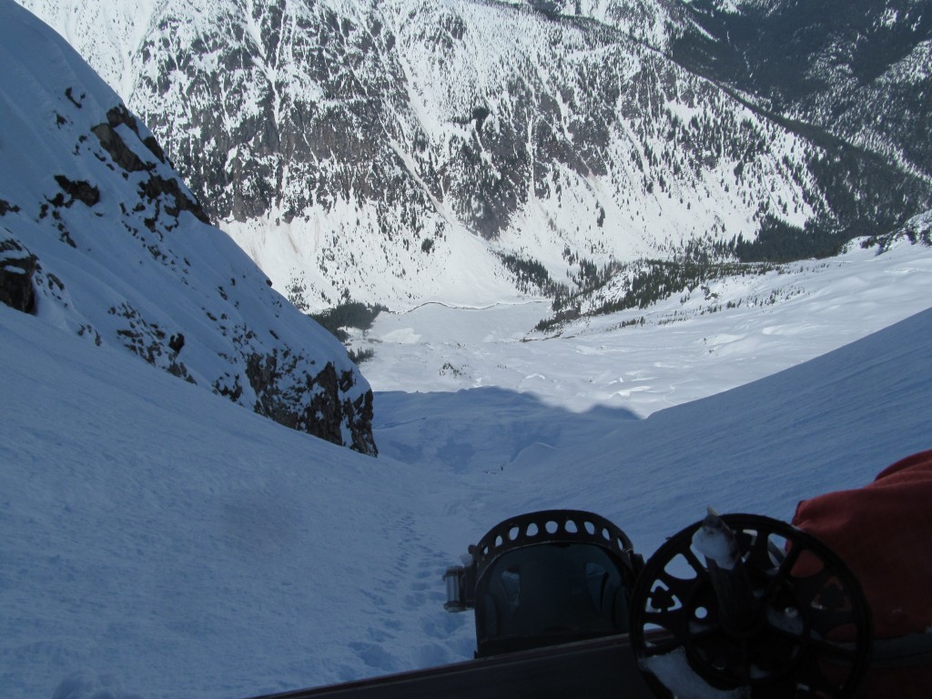
Looking down we had covered over 4,000 feet within a few hours. Between us and the valley looked was open slopes before the cliff band. Our camp was still in the shadows but we were in the sun. A switchback at a time we had gained quite a bit of elevation. Before long we would be riding down happy to know there was powder below us.
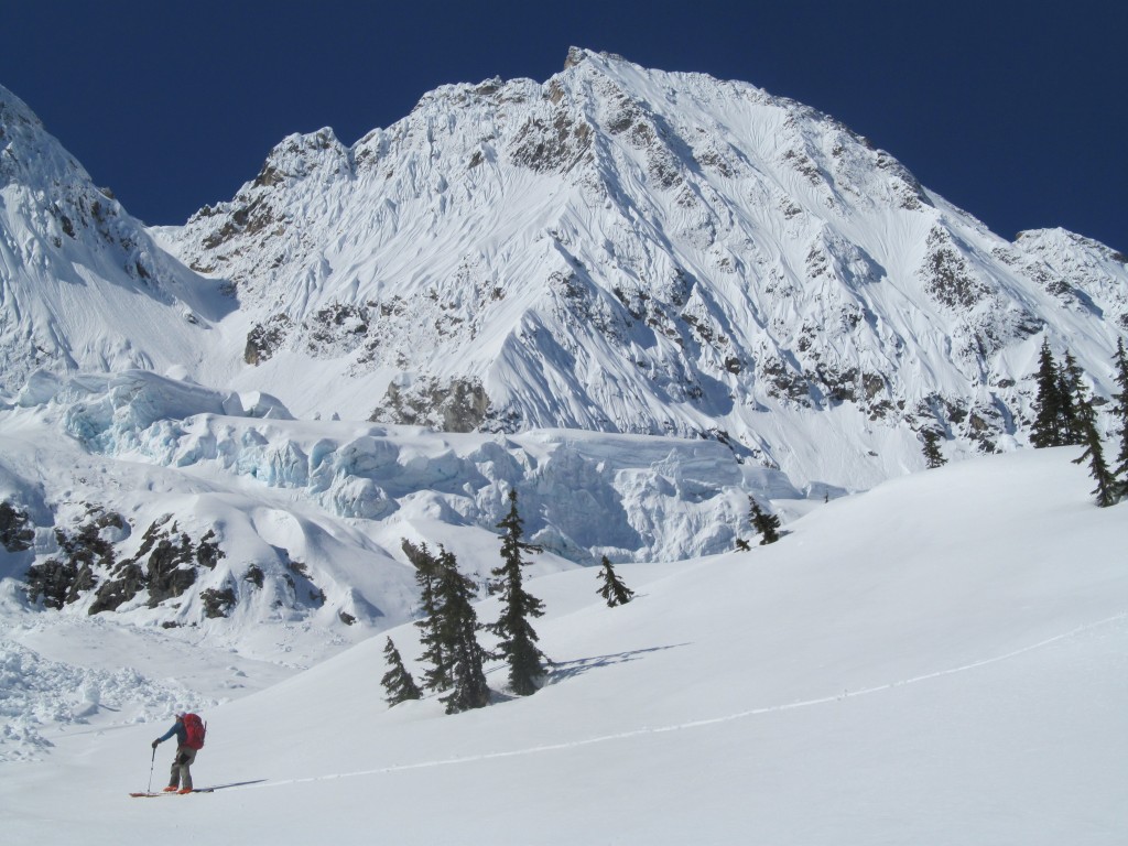
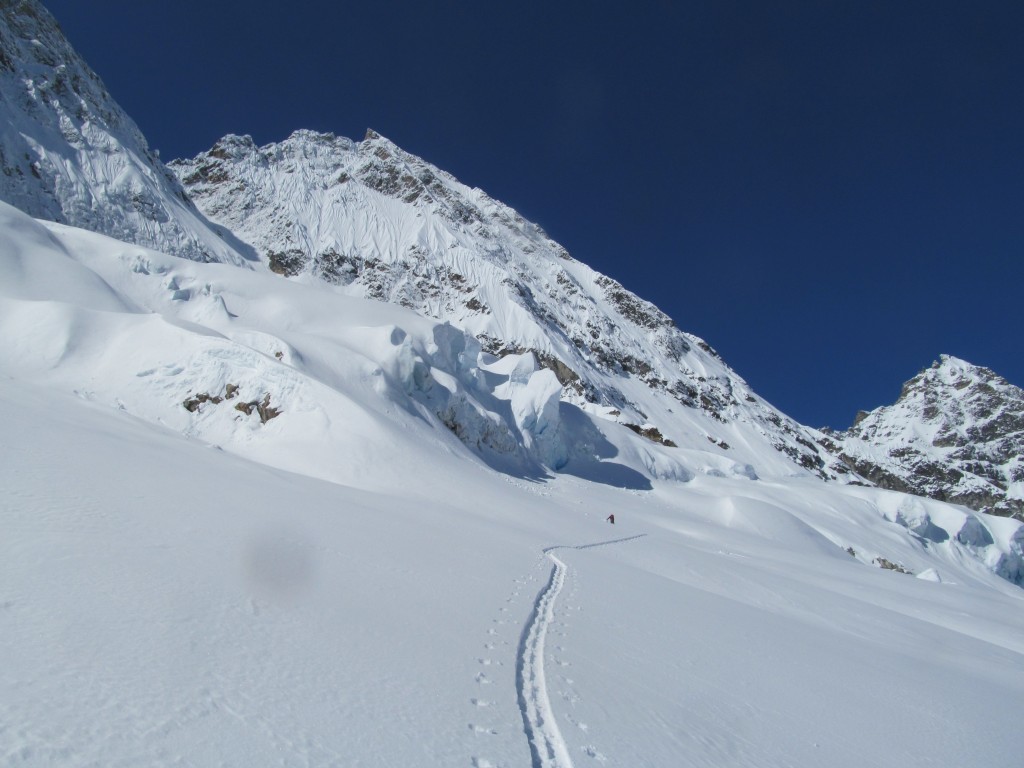
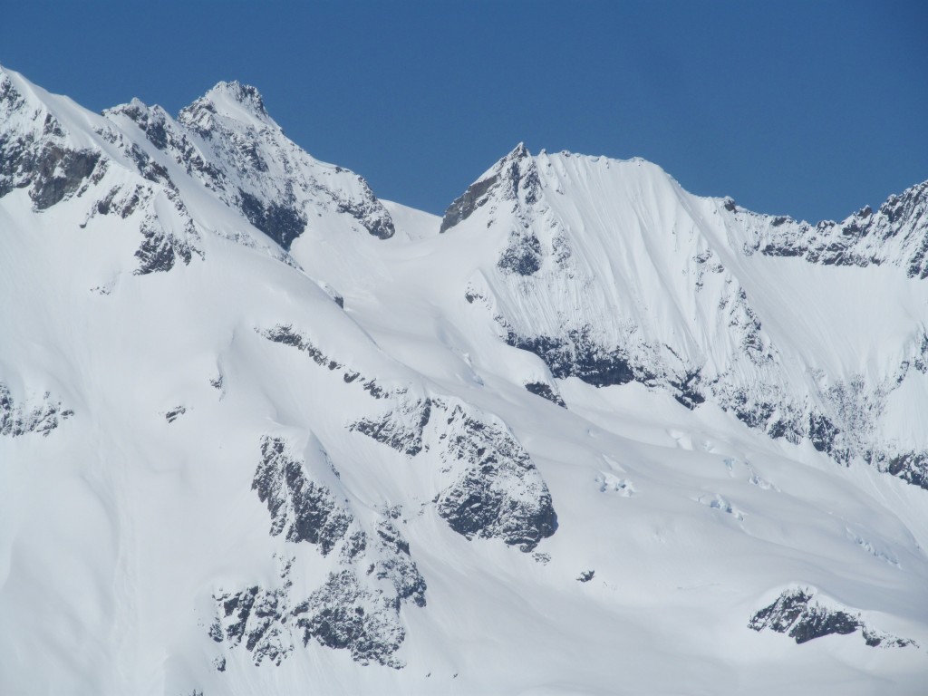
Once we got onto the glacier the snow quickly got deeper. Looking to the east we were starting to get close to the northeast couloir. Working our way past the crevasses and ice cliffs we were able to find an easy route. Soon we would be at the base of Goode Mountain and its upper slopes.
Getting closer the shapes of the snow really stood out. The upper headwall of Goode Mountain was a near vertical face and holding snow. While there are a lot of steep mountains in the Cascades fluting like this is pretty rare.
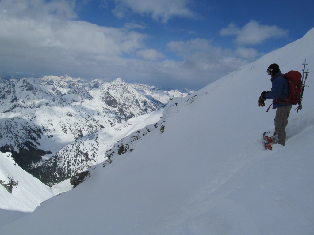
Arriving at the Base of the Northeast Couloir
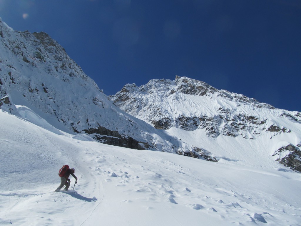
Before long we were wrapping around towards the lower apron. Within a few minutes we would be at the base of the northeast couloir. There was a bit of excitement as conditions down low were better then expected. With one long switchback we would be at our destination.
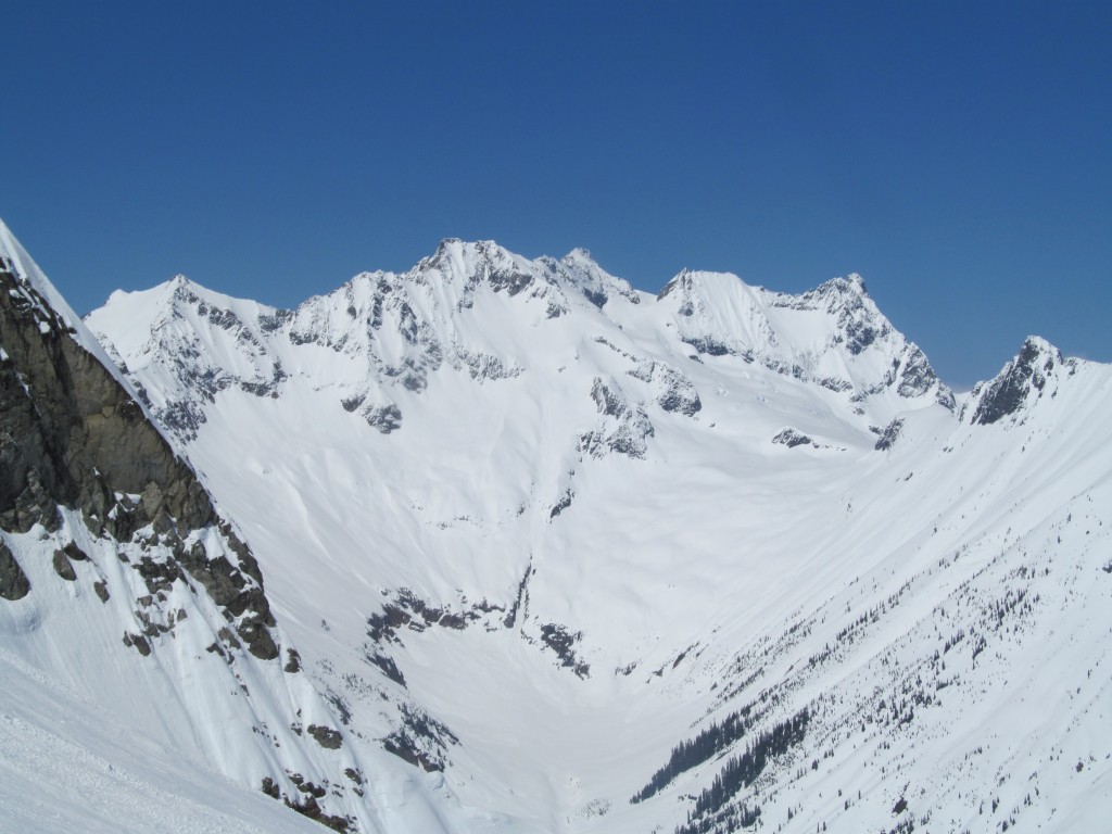
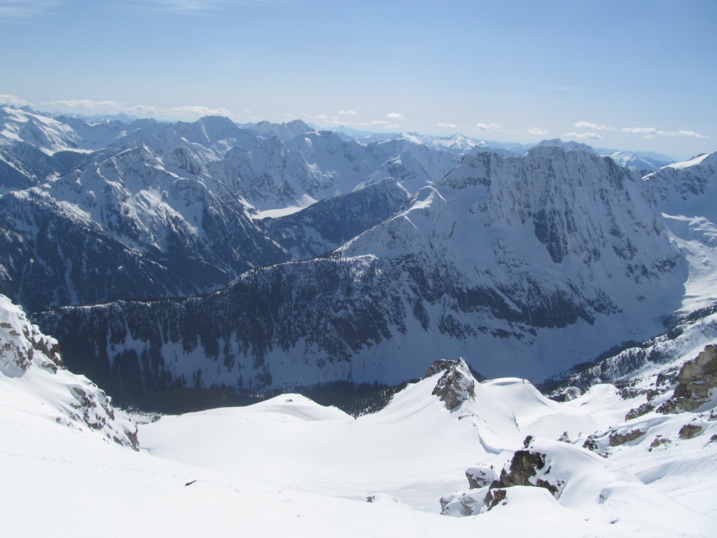
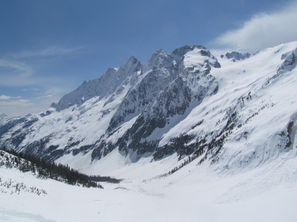
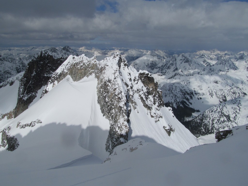
Looking to the west we had a clear view of Mount Logan. We could now see the head of the North Fork of Bridge Creek. Beyond the col was the Douglas Glacier before ramping up to the summit. We made sure to put it on our mental to do list for another day. If we couldn’t find another thing to do in the North Fork of Bridge Creek at least we had that.
Part of me didn’t even want to go over there to check out conditions. I was sure it was going to be ice but instead it was holding a foot of powder. Not only would it be easy to climb but it would be perfect conditions for snowboarding. We made an agreement that we would turn around once and if we got sketched and started ascending.
Finding Powder Conditions in the Northeast Couloir of Goode Mountain
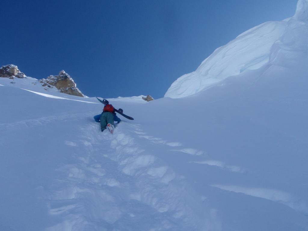
Unlike the previous trip we were making our way up in powder conditions. A step at a time we worked our way up the lower slopes waiting to hit ice. The previous trip I remembered the area to be really steep but this time around it wasn’t nearly as bad. Playing it safe we had on crampons and took turns kicking in the bootpack.
Looking down we were gaining elevation fast. Though it had taken us 4 hours the time before we were already half way up in a quarter of the time. Being in the shade the snow was even better then the apron below. While it had been a bit heavy in the sun under our feet it felt dry and stable.
Near the col the terrain steepened like a I had remembered. Each step was a task as we dug out the snow before putting in our steps. Seeing a big cornice above we made sure to stick to the side of the gully. While it was physically draining the climb was mentally easy. For two hours it was dig then step then dig more then a thousand times.
Before long I had made my way up on the col and ready to transition. Our plan of turning around when it got sketchy didn’t happen. From top to bottom we knew it was powder conditions which would be great for riding. Finally I was on the flat ridge and ready to take a long break.
Arriving at the Col and Looking into the North Cascades
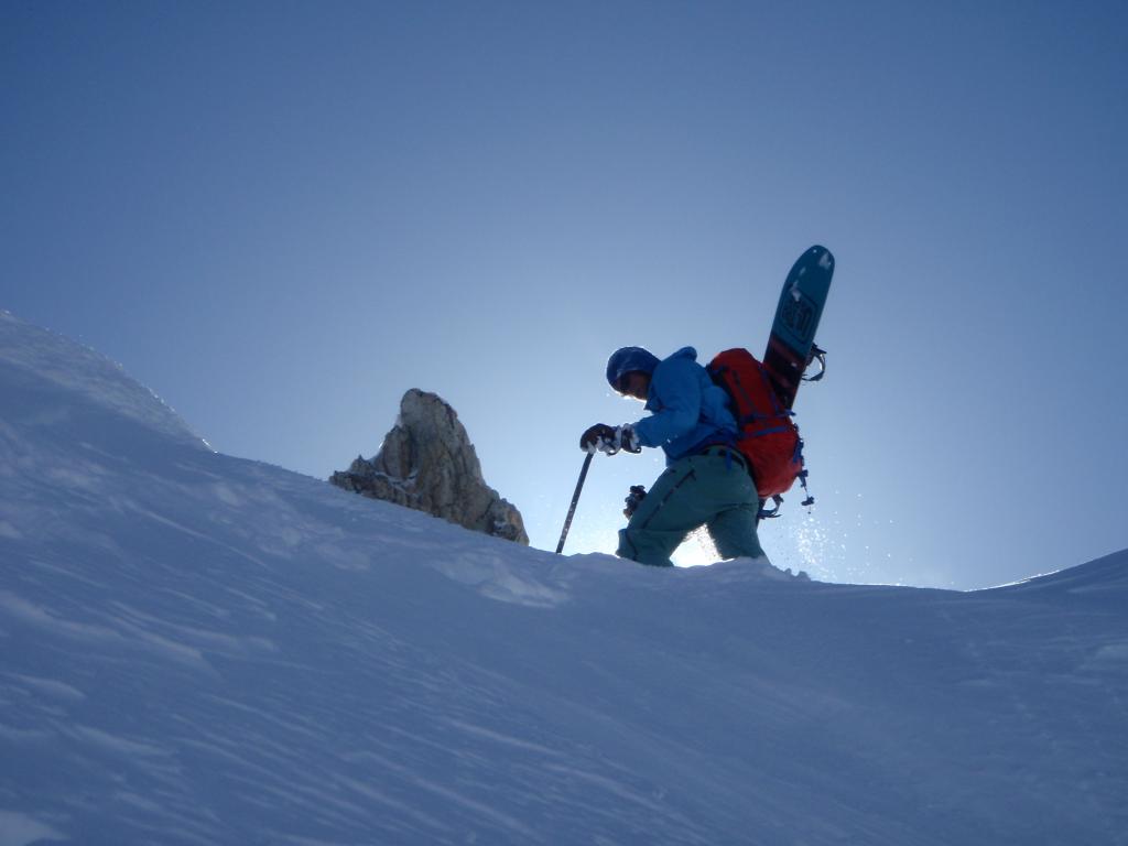
Standing on the col I watched Scott take his final steps up the northeast couloir. From my vantage point I could see our route down Grizzly Creek. A step at a time Scott was making his way out of the shade. Withing two minutes he would be in the sun as well. The plan for no plans was coming together perfectly.
Standing on the col brought back old memories. The last time we were here we decided to ride the south face into the Park Creek Valley. What we had climbed was solid ice and we had chose not to ride it back down. Now we were in the same situation but prepared to ride the northeast couloir of Goode Mountain.
Hanging out in the sun we took in views for the next 30 minutes. There was no race against the sun and warming of the couloir below. Sitting around we chatted for a while as we slowly transitioned. Not only was it clear skies but there was also no wind.
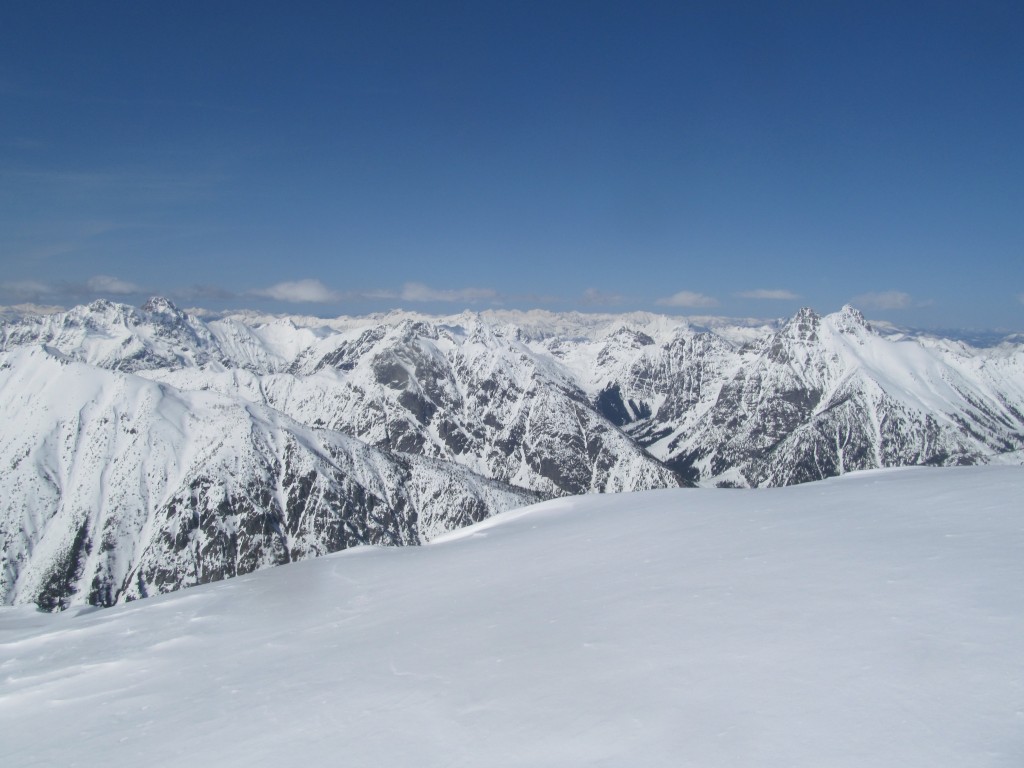
To the north we could see Jack Mountain rising above the surrounding peaks. I had rode the opposite side the year before and while summit ridge noticed the south face was steep. Looking that way from Goode Mountain confirmed my beliefs.
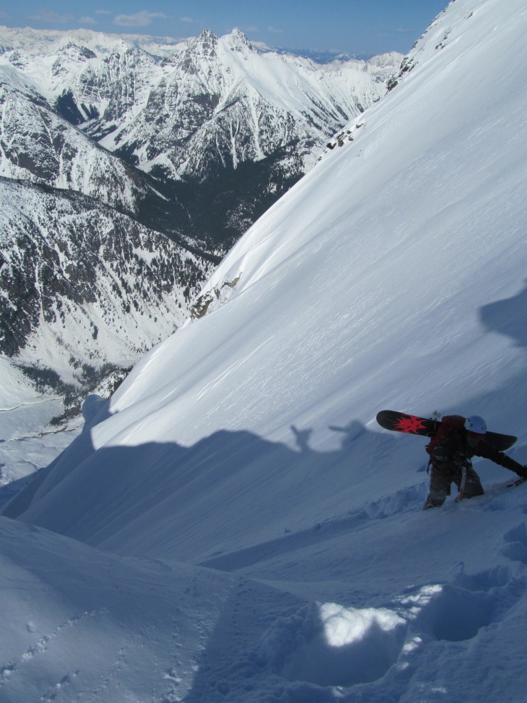
Snowboarding down the Northeast Couloir of Goode Mountain
Scott charged into it and made his way to the bottom while I patiently waited for 5 minutes. There wasn’t any safe spots in the line so we would meet again at the apron. Before long it was my clock confirmed it had been long enough and I traversed in. The top few hundred feet was numerous feet of fluted pow as I hop turned down the spines. Being both steep and bottomless it was perfect conditions and an amazing experience. As long as I stayed out of the runnel there was a foot of new snow with soft underneath.
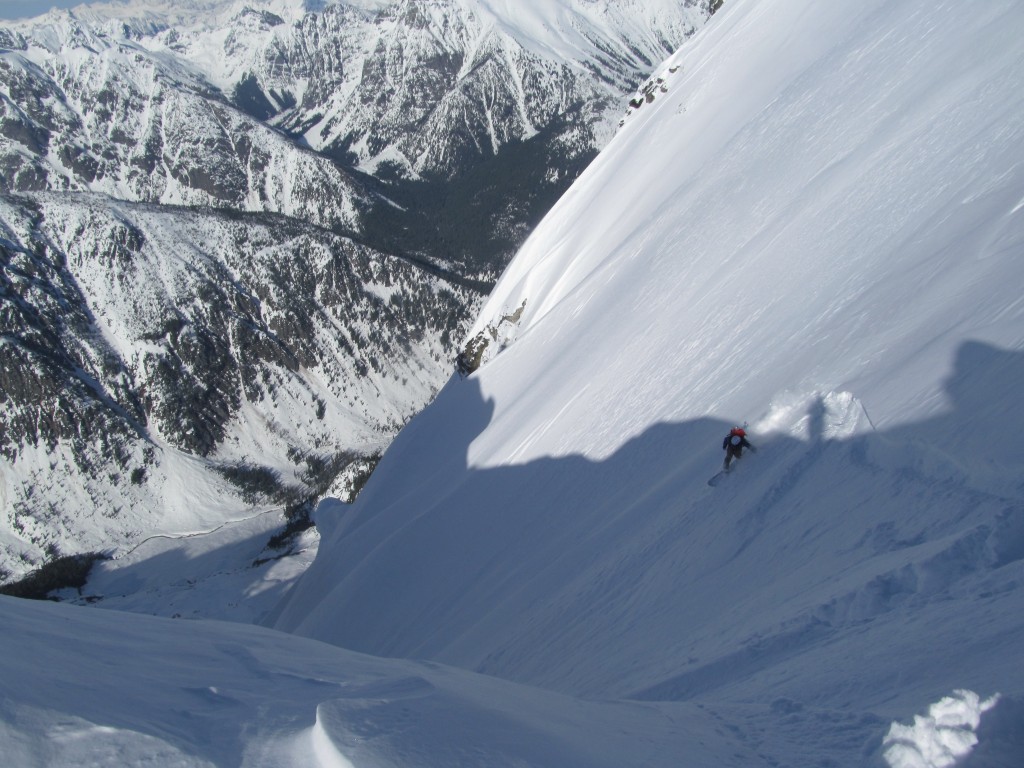
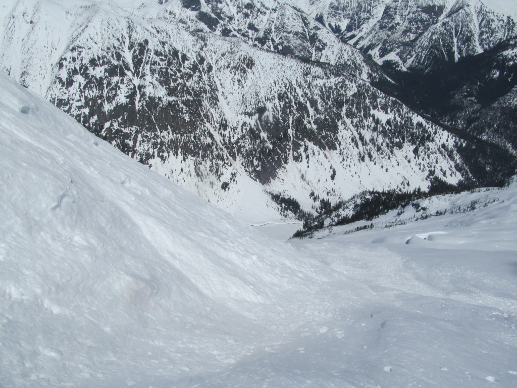
Once we regrouped at the apron we were stoked. This line meant a lot to both of us and we rode it in prime conditions. Being 3,500 feet above the valley we decided to ride fall line and work our way down the mountain. It wasn’t long before the Goode glaciers terminated into huge ice cliff and stopped us in our tracks.
We transitioned back to skinning and made our way onto the Northwest slopes along the toe of the Ice cliff. It was one of the coolest experiences going up and down working with the contour between crevasses and cliffs. Soon enough we were back on the open slopes and switching back to snowboarding. From there we enjoyed 3,000 feet of breakable crust before making our way back to camp for the night.
Day 3 Mount Logan from North Fork of Bridge Creek
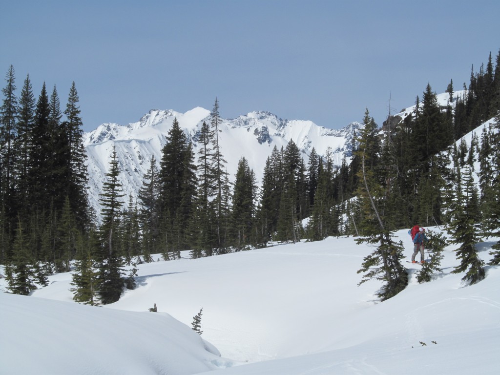
Once again we didn’t really have a plan but wanted to check further up valley. Leaving our overnight gear at camp we started skinning along the creek. The weather started off cloudy but as the day went along the clouds were slowly burning off.
Skinning by Goode Mountain we couldn’t help but look at our route from the previous day. It had been such a great run and now it was time for something different. Staring up at the cliffs we were happy to have found an easy way around. It had been as smooth as I could have hoped for.
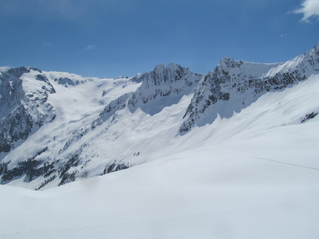
Working our way up the North Fork of Bridge Creek we looked at the endless options. While there was some great and open terrain above it seemed most of it terminated in cliffs. Though climbing through the lower section would be easy we were somewhat afraid of avalanches. The last thing we wanted was to be swept off one of them.
Though we had passed numerous nice looking lines we became interested in Mount Logan. Knowing it was a smooth ramp from top to bottom we followed the valley floor.
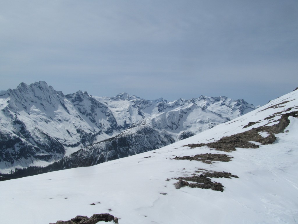
Working with the contours we were quickly gaining elevation. Soon we had a clear view of the terrain west of Goode Mountain. While riddled in cliffs below it was open alpine above. It would be the perfect area if you were sure that the snow was stable.
Climbing up the Douglas Glacier on Mount Logan
Soon enough we were at the high col and the east slopes of Mount Logan. We were climbing up the Douglas Glacier which which Jason and I climbed the previous year. Though the snow wasn’t as deep as the previous day the terrain was mellow. It made for mellow skinning and a fast route to the summit.
Before long we were at the final ramp of Mount Logan. We were now less then 1,000 feet below the summit and gaining elevation fast. Though the clouds had burned off earlier we could see that they were coming back. The last thing we wanted to do was ride a glacier in a white out.
We were able to skin all the way to the sub summit of Mount Logan. As we transitioned we watched the clouds had changed for the worse. Putting our skins away we could see the North Cascades in all there glory. It was going to be a long ways all the way back to camp. After summiting Goode Mountain this was the perfect bonus to the trip.
Snowboarding Down Mount Logan to the North Fork of Bridge Creek
With our boards on our feet we started making turns down the Douglas Glacier. The route down was straight forward making our way past crevasses and slide debris. Before long we were back at the col and dropping into southern slopes. Within a few a thousand feet we would be back in the North Fork of Bridge Creek.
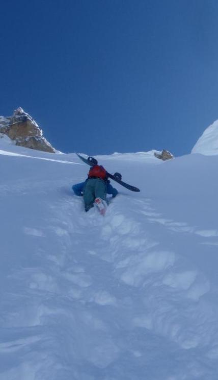
Conditions changed from recycled pow to corn conditions and it was only getting deeper. The bottom section was the steepest and slushiest and we both knew there was a good chance for wetslides. Scott rode down with minimal turns and was in the flats a few seconds later. Once he was in a safe spot it was time for me to drop in. I cut a few turns and moved off to the side but above me the slope released. While I had traversed it wasn’t enough. All of a sudden I was slammed by a freight train of energy and I was heading fall line for a small cliff band.
Having been in avalanches before I knew to angle my board so I would traverse away from the main deposit zone. In the end I was taken over a small drop and got a knee to my nose but I was a few feet from the main debris pile. I was sure my nose was broken and in my mind the blood was confirming it. I got up, shook it off and rode down to Scott who was transitioning to dig me out. We made our way down valley and while a tad bit lightheaded I felt fine.
Back at Camping and Resting After to Great Days of Snowboarding
We made our way back down into the forest and back to camp. Happy with our day we built a small fire to dry out our gear. As the sun set I dug out a nice area to lay my inner liners and gloves semi close to the fire then quickly fell asleep.
Day 4 North Fork of Bride Creek to Highway 20 via Black Peak Col
I woke up to Scott asking where my liners were. Sitting up I and looked to where they had been and the snow was all melted out. I had them on my ice axe and my ice axe was now in the fire. There was nothing left and we still had a long day ahead of us
My boot liners were gone!!!
I had to climb almost 4000 feet over a high pass and ski out almost almost 5000 vert over ten miles. This was a huge huge dilemma. I thought to myself “How do you fix this problem” and looked through all the gear I had.
The solution was this.
I had brought some minimal Teva sandals and put them in the boots to fill in the space and hold down my feet. Then I put on two pairs of sock and covered my feet with ziplock bags to keep the moisture out. It worked well unless there was any steep sidehilling. Over the next few hours I cramponed using the French Technique and skinned straight up steep pitches. Soon enough we were at Black Peak col. It felt like I was skinning in sandals and had no ankle support while difficult it was doable.
The Final Descent From Black Peak Col to Highway 20
For the downhill section my solution was to put down coats in each of the boots to fill the mass then use Voile Straps to tighten it down. Once again it worked and we made our way down to Highway 20. Finally we were back on the main road and after a few minutes hitched a ride to our car. It had been a great 4 day trip full of surprises as only the North Fork of Bridge Creek can give.
I made it home at 11:00p.m. then was back out the door at 6:00 A.M. for the next adventure. While swollen I am happy to say my nose was not broken.
In total the trip was 33 miles and 20,000 vert
Thank you Scott for a rad EPIC!!
Thanks for reading this trip report on Goode Mountain and Mount Logan
If you want to see more ski tours within the the Highway 20 corridor check out this link.