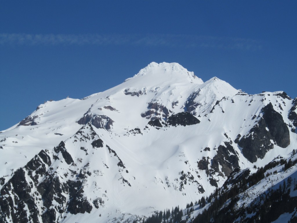
Glacier Peak is one of my favorite mountains in Washington State and it is easy to see why. Unlike other volcanoes it is situated wihtin the North Cascades landscape . The natives of the area cherished the mountain calling it Dakobed which translates to “The Great Father”. During the winter months there is little actively within Glacier Peak Wilderness when the area has its deepest snowpack. For years I had been interested in doing a north to south traverse as well as ride the Scimitar Glacier. With a week of good weather I decided it was time to do both and finally tick the trip off the “to do list”.
The Plan to Ride Glacier Peak and the Scimitar Glacier
When I arrived in Washington it was the tail end of a perfect weather window. There had been 4 days of uninterrupted sunshine with similar days in the forecast. By now the freezing level had lowering I realized I had missed the Mount Rainier summiting weather window. If I wanted to find good conditions I would have to look for something lower. After running through routes and ideas I decided I would head into Glacier Peak Wilderness. The plan was to do a base camping mission on Glacier Peak and finally ride the Scimitar Glacier.
Less then 12 hours after getting home my alarm was already going off. It was 5 A.M. as I threw my gear into the car and started driving in the darkness. I wanted to make my way up north before the morning traffic hit Seattle. While driving through Everett I got my first view of Glacier Peak in the distance. I was both excited and nervous as I started heading east knowing before long I would be breaking trail and alone in the wilderness.

Starting the Trip up Glacier Peak from the White Chuck Road
Before long I was passing Darrington with White Horse Mountain behind me. Turning off on the White Chuck River Road I knew that I would be leaving the comfort of my car any minute. Within a mile and a half I had hit snow and my car wouldn’t be able to go any further. Looking at my map I was at 1500 ft and on skinnable snow. Early in the Season I had done the Osceola Traverse starting at 1,700 feet and was walking on pavement. This was one of the lowest starting point I could think of in the Cascades.

I think I became too comfortable on the first 5 miles of road skinning. Passing around numerous old growth trees and washouts things were going better than expected. I finally reached a sign announcing I was in Glacier Peak Wilderness though it felt like I was on the White Chuck trail the previous few miles.

Skinning quickly became a nightmare once I passed the sign and arrived in the forest. Fighting for every step I would come across hundreds of fallen old growth trees one after another. I would have to crawl, flipped and rotate well over 100 times over the next 60 minutes. Looking at my GPS I realized I had only traveled a mile and decided to ditch the trail all together.

Ditching the Kennedy Hot Springs Trail and Making my Own Way
Immediately I started heading west towards a steep bump in terrain which according to the maps would mellow out. It started as a typical North Cascade bushwhack getting covered in mud while I held onto branches and roots. What was at first a near vertical face soon mellowed out arriving at pumice flats but best of all it was wide open forests.
From Pumice Flats I made quick progress SE towards Glacier Creek following Pumice creek then cutting a hard right. I was now at the south end of the plateau and looking down upon Glacier creek. Strapping into my board I started descending 600 feet when all of a sudden I heard a loud crack. In front of my eyes I saw a massive old growth break in half and smash down the mountain. It was wild seeing something that had been there for hundreds of years fall in front of my own eyes.

The route up Glacier creek was straight and steep as I climbed through the forest. Soon I was able to make my way onto Kennedy Ridge where I had to make a decision. Either I could follow the ridge or drop into the creek to the south. In the end I dropped down to Kennedy Creek and switched over to skinning. I was thinking it would be the fastest and most straight forward way to get up to the Glaciers. The plan was that once I was higher in the valley I would set up camp for the night.
Skinning up Kennedy Creek to the Base of the Scimitar Glacier
There was only a single crux section up Kennedy Creek where I had to traverse over a waterfall being held up by a tree branch. The situation only lasted for a few seconds and afterwords the terrain opened up again. I had passed the worst that Glacier Peak had to offer so far and soon I would be in the alpine.

I arrived at a spot that was perfect for camping just as the sun was setting. From my spot I was situated just northwest of the summit of Glacier Peak and easily within a few hours climb. From camp I could see both the Kennedy and Scimitar Glaciers but best of all there was running water available. Upon arriving I dug out a trench and laid down under a starry sky.

As the light drained from the sky I started making plans for the next day. Looking towards the Scimitar Glacier I was curious how the snow would be. Although I had be skinning on firm conditions the glacier was north facing. Potentially I would have all the north slopes in powder conditions.

Day two Riding the Ermine Glacier and Scimitar Glacier
I woke up and watched the sunrise in the warmth of my sleeping bag. Before long it was 8 a.m. and time to start heading up the Kennedy Glacier. At camp I left behind most of my overnight gear as I was aiming to ride the Scimitar Glacier. This meant I would be returning to camp so there was no need to carry a sleeping bag, This left me with a super light backpack and some calories as I made my way up the mountain not having a real plan.

Soon I was on the Kennedy Glacier as the early morning sun made its way over the horizon. It was amazing being in the area but I was surprised by how broken up it was. Looking at topographical maps I thought I could just skin up with no problem but this was not the case. From what I could see there was no safe route to go solo so instead I would have to make my way towards the north col.

Once arriving at the col I got my first view of the North Cascades. From the west to the east it was a solid mass of mountains as far as the eyes could see. This was the area of the Extended Ptarmagin Traverse and seemed like a world I had no clue about. I had spent numerous years in the area but looking into the center of the North Cascades I knew I had only just scratched the surface.

Snowboarding the Ermine Glacier
In front of me to the north was the Ermine Glacier and it looked to be in amazing condition. While there were crevasses in the area it was easy to see where the bridges were. This was a once in a lifetime chance to ride the area in powder and I wanted to make the most out of it. I still had more then enough time to ride the Scimitar Glacier so I strapped into my board and made the first run of the trip.

I could see my rooster tails off the silhouette of the sun as I made my way down the glacier. It was a surreal situation to have such good conditions in mind blowing scenery. Sitting at the base of my line I stared transitioning looking up at 2000 feet of powder turns.

I carefully skinned back up my snowboard tracks arriving at to the north col. It was time to focus my attention south and start climbing towards the summit of Glacier Peak and the Scimitar Glacier. As I switched over to crampons I would occasionally glance back down the Erimine Glacier. It was so good I could have almost stayed there for the rest of the day.

Heading to the Summit of Glacier Peak and the Scimitar Glacier
Making my way up the north ridge I battled with over a foot of wind blown snow. It was exactly what I wanted for riding but it had dramatically slowed down my speed while climbing. Looking towards the west I had a clear view of the Kennedy Glacier and the numerous buried crevasses. If conditions were similar on the Scimitar Glacier I would be riding in some epic powder conditions.

The upper Kennedy Glacier seemed like a maze wrapping around the crevasses but I could see a clean route. I’m sure it would have been a fun line heading both up and down. Since I was going solo with a bunch of new snow it wasn’t an option but worth returning for.

Before long I was standing on the summit of Glacier Peak and looking at the views. to the southwest was the Chocolate Glacier, Tenpeak Mountain and the Dakobed Range.

Standing on the summit solo in mid March I felt so isolated. Beyond me in every direction there was no sign of life. Looking down the Chocolate Glacier and the wide open slopes I could barely make out Bonanza Peak and Mount Fernow at the head of Holden Village. There were more then enough lines to keep one busy for the rest of there life.

To the South was the White Chuck area and the terrain between White Pass and Stevens Pass. In the far distance I could barely make out both Mount Stuart and Mount Rainier. It was amazing to be able to see everything in such a deep snowpack as I had usually been out here in May on previous trips.

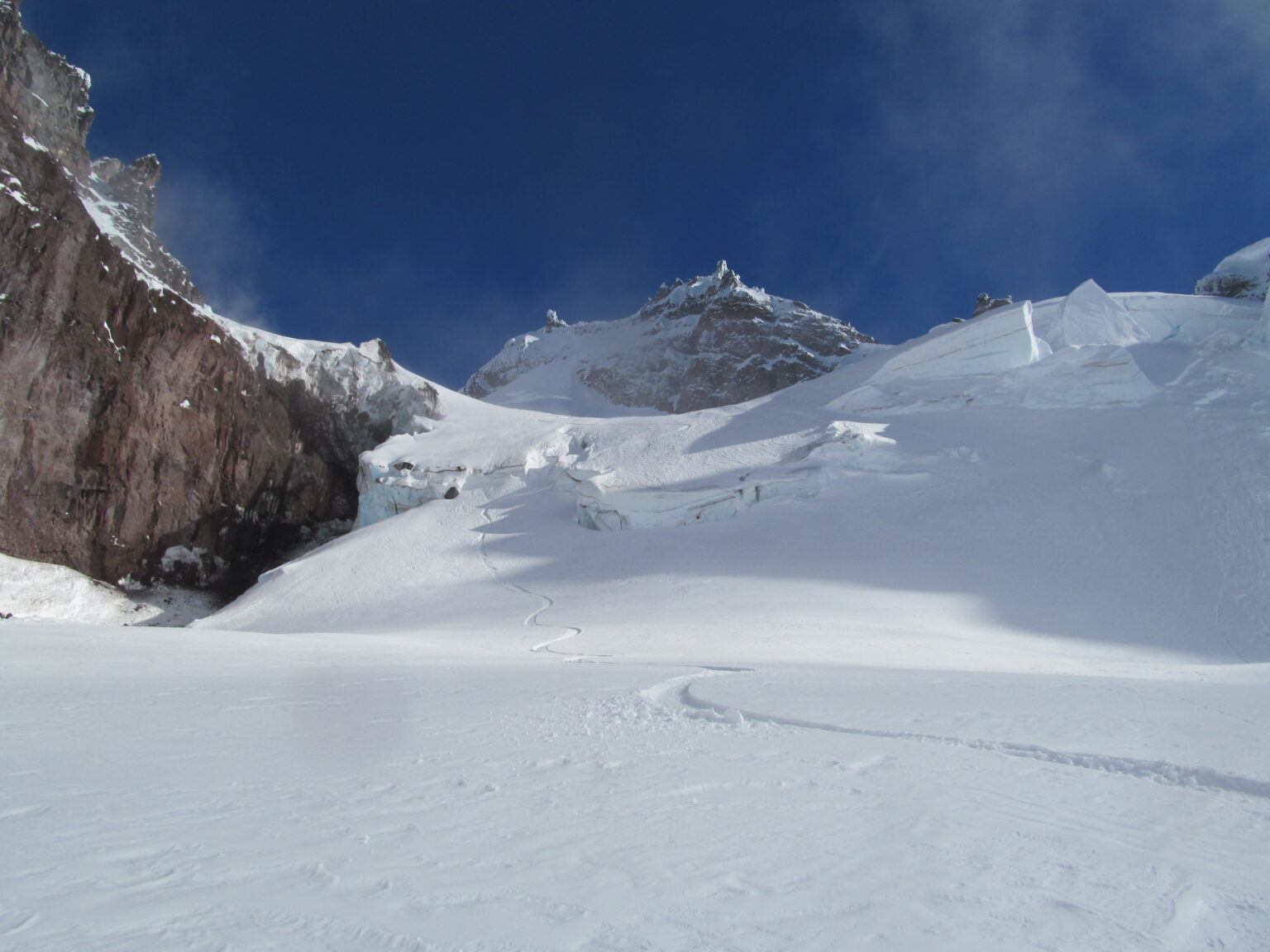
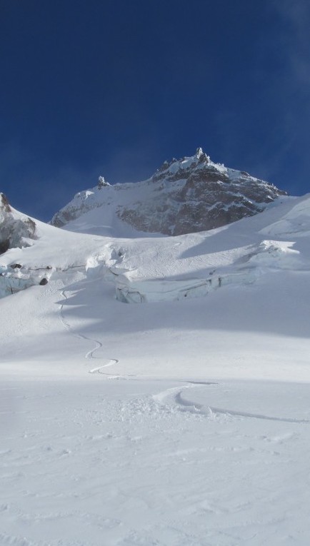
Snowboarding Down the Scimitar Glacier
Standing on top of Glacier Peak it was time for me to snowboard down. I knew that my line of choice was the Scimitar Glacier but I couldn’t see much as I strapped in. A turn at a time the route opened up below me and I was fortunate it was straight foreword. In the end I rode the Scimitar glacier in pow conditions for almost 5000 vert fall line directly to camp. The one crux was jumping off a small ice serac to powder. Both above and below the crevasse were wide open slopes and I was able to ride top to bottom. That one run was worth all the effort of the past 24 hours.

My plans were to skin back up to Ermine Glacier and put up an alpine camp. Being further to the east it would get hit by the sun first thing in the morning and give me more terrain to tour around. Quickly I threw my gear into my pack and made my way back towards the col. It was hard to say goodbye to the Scimitar Glacier with one lonely track but it would be worth it. Soon I was racing the dark and skinning up the edge of the Kennedy Glacier in the last of the light.

The weather was changing and dark clouds were pushing up the mountain as I climbed east. I raced up using my old skin track and soon made it up to the col minutes before the clouds absorbed the area. I was happy to be on the Ermine Glacier as it was the perfect shelter with a great view and would get first light. Within a few minutes I had dug my pit and started falling asleep under the perfect night.

Day 3 on Glacier Peak and an Epic Failure
In the middle of the night the winds picked up and it was throwing up the loose granular of snow. It wasn’t long before I was getting buried in my pit under the wind drifts. I woke up at 2 A.M. to find that my sleeping bag was buried all the way up to my face. Jumping up I cleared out the entrance of my shelter and put the top of my sleeping bag in the only spot without new snow. It wasn’t long before my body was buried again but fortunately my head was out of the snow. I still had 4 hours of darkness and it was going to be a long night.
I was concerned since I was using a down sleeping bag and decided not to brush off the snow. It would be a never ending battle and the snow would be insulating the heat. I had chose to bring primaloft layers with a lightweight shell in case I had gotten wet and happy with my choice. With my bodies core dry I sat awake for the last few hours waiting for the sun to rise and to get moving. It was an exhaustively slow night that was a blur between being awake and asleep but soon enough the sun was rising to the east.

I watched the sunrise being eye level with the surround mountains. Each individual flake of snow was on fire as the alpenglow slowly made its way over Glacier Peak. Morning brought another problem as I dug myself out of my snow filled pit. It was now filled with over 4 feet of blown in snow and everything inside was buried. I started shoveling while inside of my sleeping bag as the winds howled searching for anything and everything. The first thing I found was my gloves which allowed for some protection from the winds.
Losing my GPS and Changing Plans for the Exit
Digging for well over an hour I found everything but my GPS as I checked out every corner of the area. This changed the dynamic of the trip a bit as my ascent route in was a navigational nightmare. I wasn’t sure if my tracks would still be in the valley so I had to come up with a plan. The winds and clouds were coming in from the west strong so I made the decision to go onto the sheltered eastern side. As fast as I decided a new plan I was strapped in and started riding. Within a 4000 vert run I rode the Dusty, North Guardian and Chocolate Glaciers riding a fall line traverse for miles within 10 minutes. I ended up right above the Chocolate canyon and with no winds I boiled water and had breakfast.

I had originally planned to skin the Chocolate Glacier to the summit but felt that the Cool col would be better situated for camp. I could see that the clouds were coming and going so I needed to move fast while I had visibility. Soon I was heading around South Guardian rock and onto the Cool Glacier. Before long I was at the main southern col just 500 feet below the summit. The clouds moved in and out as I started digging out a camp and some shelter. The wind was just as bad as it was early in the morning.

I had minimal sleep from the night before and I knew the exit day was going to be long. The time needed to be focused on make a bomber shelter. I dug down 6 feet and put up some additional blocks up to provided shelter. After hours of work I had a home for the night and protection from the consistent 30 mile per hour winds above me. Other then the noisy I wouldn’t have know it was such a brutal afternoon.
Camping on Disappointment and Glacier Peak Col
Within those last few hours of daylight the cloud deck had risen and the occasional cloud made it up to camp. There was no time for the Chocolate Glacier and riding anywhere under the loud deck was out of question. I went to bed before sunset and prepped for a long day ahead.

Day 4 and a Long Exit Down the North Fork Sauk River
I woke up at sunrise and did a quick gear check to make sure everything was good. Fortunately I had taken the time the day before to rest and now was in a much better position. It was time to think about my exit as I pondered different ideas and aspects. My options were head north to the White Chuck Sufferfest or head south to the North Fork of the Sauk. I had previous experience with the Sauk but it would add a 21 miles hike back to my car.

Looking to the south from camp I had a clear view of Mount Rainier. I had originally thought of going there with the weather window but instead came out to Glacier Peak. Though I was sure it was windy down there I wondered if people were riding in the alpine. I needed to come up with an exit plan and anyway I looked at it there was going to be pain involved.

The Sitkum Glacier was rideable all the way to the White Chuck Valley as I looked towards its slopes. This was one of the lines I really wanted to descend but there was a problem. It was west facing and getting the blunt of the wind. It wouldn’t be soft until late in the afternoon if it softened at all. Time was just too valuable sit around so I strapped into my board and rode the still frozen but edgeable Cool and Suiattle Glaciers. Before long I arrivied at Dakobed rock and skinned to the peak above Glacier gap.
From my vantage point I could see into the Baekos drainage to the northwest and the White Chuck basin to the SW. I really wanted to ride the Baekos but the snow wasn’t ready either. In the end I made the decision to travel on the mellow but scenic White Chuck.

Heading Down the White Chuck Basin to Red Pass
Without the GPS I felt confident heading out via the North Fork of the Sauk as I had been there before. Dropping into the White Chuck Basin I was able to take advantage of the deep snowpack riding towards White Peak.

Finally I was stuck on flats and making my way towards the lower basin. In the distance I could see the summit of White Mountain barely poking out above. I knew I was getting close to the end of the route and picked up the pace towards Red Pass.

After riding down to the base of White Mountain I started skinning up towards Red Pass. The thought was I would be able to ride down to the North Fork of the Sauk and save a mile or two. I had been breaking trail for days on end and here I was putting in the last alpine skin track of the trip. I was both excited and terrified over what was next.

On the Top of Red Pass
Soon enough I was taking my last view of Glacier Peak. It had been a wild trip riding the Scimitar Glacier and know I had a clean view of the southwest face. Only two hours earlier I had been on the col between the summit and Disappointment Peak and I had traveled miles since then.
To the southwest I could see the Monte Cristo Mountains and Kyes Peak. While I had spent a bit of time in the area I had always wanted to be out there longer. It was surrounded by tree covered mountains while in the range there trees were few and far between.

To the South was Mount Daniel and Himan where I had climbed on the Alpine Lakes Ski Traverse. It was cool to see the north faces of both lines as they we the areas we had snowboarded. If there was powder on the Scimitar Glacier those mountains would definitely be the same.

Snowboarding Down the North Fork of the Sauk River
Finally it was time to get going as I took the last few steps up to Red Peak. My plan was to ride the same avi swath that you switchback up on the North Fork Sauk Summer Trail. Before long I was riding down a steep couloir followed by ripped out avi paths arriving on the shores of the Sauk River.

The river turned into a canyon immediately so the shores weren’t a option. Knowing I had to go west I started skinning and trying to find the trail. I would climb west 400 feet before dropping down each avi swath hoping to spot the trail. After two failed attempts I sat on top of the third and looked at the terrain surrounding me. Across the valley was a huge canyon and according to my map the Mackinaw Shelter was directly below it. Using the canyon as a reference I rode down to the river and found myself in front of the building.

Within a few hundred feet I stumbled upon some old snowshoe tracks confirming the route back to the road. I followed the trail most the time but found myself skinning by the river occasionally to take in the scenery. The long exit down the valley consumed many more hours then I had originally planned but it was smooth.
I reached the trailhead around 6:30 and skinned until I got to the first patch of dry soil. My feet were worked by now and using my MSR Reactor I attempted to dry my soaked boots to no avail. Soon I was passing out knowing I had a long day walking on the roads ahead of me.
Being Chased by the Storm and a Long Exit on the Mountain Loop Highway
I woke up at 3 A.M. and looked at the sky noticing that the stars were gone. Weather was coming in and it was only a matter of time before it would start raining. Quickly I packed my gear and took off skinning down the road hoping the snow was frozen. For the next 7 miles I was making my way down slush before making it to snowline. I ditched my gear at the junction for the Mountain Loop highway and started walking north up the road. In my backpack was a bottle of water some food and a rain shell as I started moving towards my car. I ended up walking 7 miles before reaching the White Chuck road then 5 miles before getting picked up for the last 2. In all I did a circumnavigation of Mount Pugh and Glacier Peak.
Everything was perfect other then my car battery was dead. With some luck and some really nice people I was soon able to get it working again before driving up the Mountain Loop Highway. Soon I was picking up my stashed gear and heading back home before noon and right when it started raining. That day I walked 21 miles and my feet were already worked the day before.
In Conclusion on the trip to Glacier Peak and the Scimitar Glacier
The traverse was a challenge the entire way. Being solo in such isolated and rugged terrain I made sure to always be on the side of caution. I made a few mistakes with the snow pit but in the end everything worked out and I was able to ride the Scimitar Glacier in powder conditions. It was an amazing and unique trip.
Thank you for reading this trip on the Scimitar Glacier and Glacier Peak. If you want to see more ski tours within the Stevens Pass Backcountry check out this link.