The Magic S Loop has been on my radar for a long time as it always seemed like a great ski tour. With both its proximity to Cascade Pass and the quality of lines it was only a matter of time. Being on the edge of North Cascades National park it offers steep and scenic runs. With a nice weather window and some time on our hands Jason Hummel and I made our way north. The plan originally was to have no plans but before long we were at the end of the road. Looking at options we had already skied numerous peaks in the area. One thing that we hadn’t done as a crew was the Magic S Loop. Things kind of fell together as it was a late start and before long it became our mission.
I Think Were on the Wrong Road
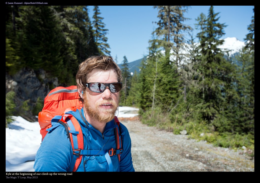
Driving up Cascade River Road our original plan was to check out Snow King. Looking at the maps we made our way up a road until we were stopped by a fallen tree. Packing our bags we checked out the map and started moving. After around 3 miles we realized something was wrong. The road we thought we were on definitely didn’t make sense as we should have been in forests. Instead we were in clear cuts and on a long traverse. We had taken the wrong road and immediately our plans fell apart.
Making our way back to the car we needed to come up with a plan B. It was already after noon and we had a few hours of light left. Chatting back and forth we decided to go up to Cascade Pass. We would set up camp on the southern end and decided from there what to do.
Time For Plan B and the Magic S Loop
Fortunately our bags were already packed as we drove past Eldorado Trailhead to the locked gate. Quickly we through on our packs and started walking up dry pavement. Before long we were passing Johannesburg Mountain and the CJ Couloir. We were happy to be back in the mountains and able to salvage our day.
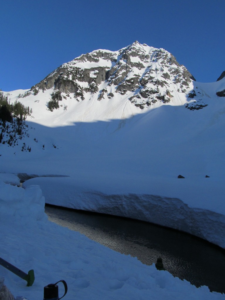
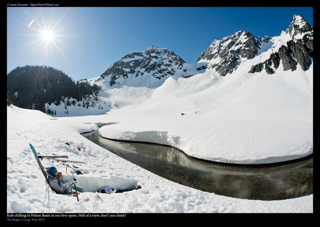
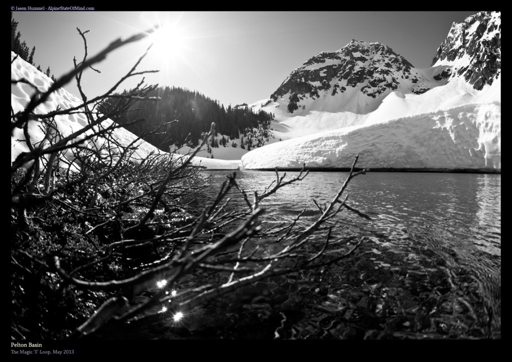
Before long we were over Cascade Pass and skinning along the shores of Pelton Basin. Looking around we searched for the perfect camping spot. It was already late in the day so we would have to settle for something along the creek. Before long we were digging out camp on the shores as then we would have an endless supply of water. This would take out the melting process allowing us more time to ski the following day. Best of all it was a direct descent from the final run of the Magic S Loop.
Day 2 and Our Start to the Magic S Loop
It was a windy night as I slept under the stars but fortunately the weather was clear. The next morning we enjoyed a leisurely start to the day. Our approach was already done and all we had to do was start climbing. Slowly we got our gear together and I enjoyed a few cups of coffee before it was time to get moving.
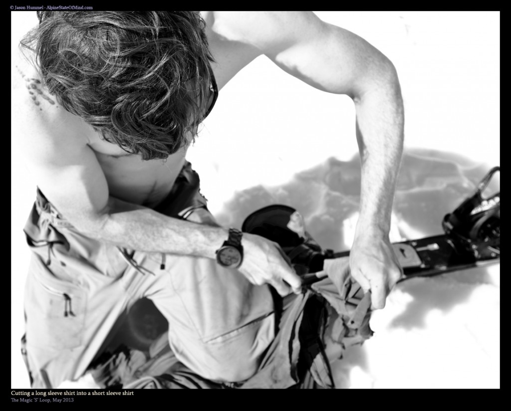
It was much warmer then we had expected as we got ready to get moving. My only layer was a Ibex Indie Hoodie that I had been using for the past four years. While I loved the shirt it had been through a lot and the sleeves were worn out. Knowing it was near the end of its life I cut off the sleeves hoping it would make my day a bit more peasant.
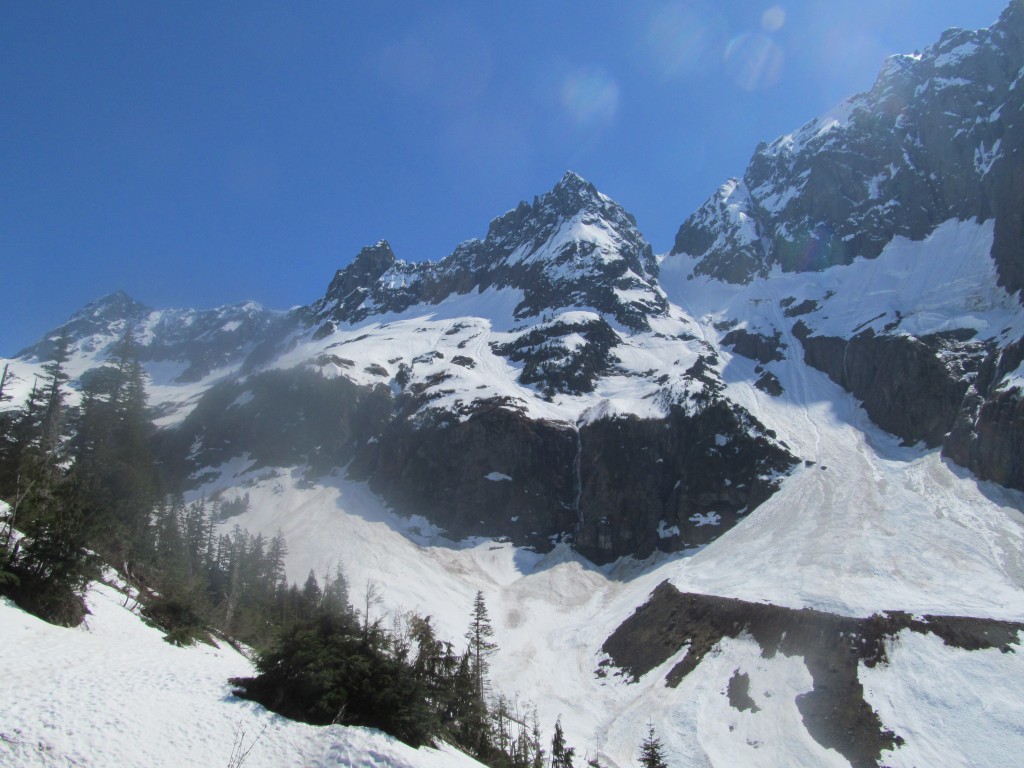
It was time to get moving and before long we were at the base of Cahce Col. The valley was flat which made for easy skinning until the terrain ramped up. Knowing that putting in a skin track was more effort then it was worth we started boot packing. Following the shade line we put steps straight up the face before it mellowed out again. Within an hour we had made it to our first col of the trip and happy to be in the alpine.
Our First High Point of the Trip on Cache Col
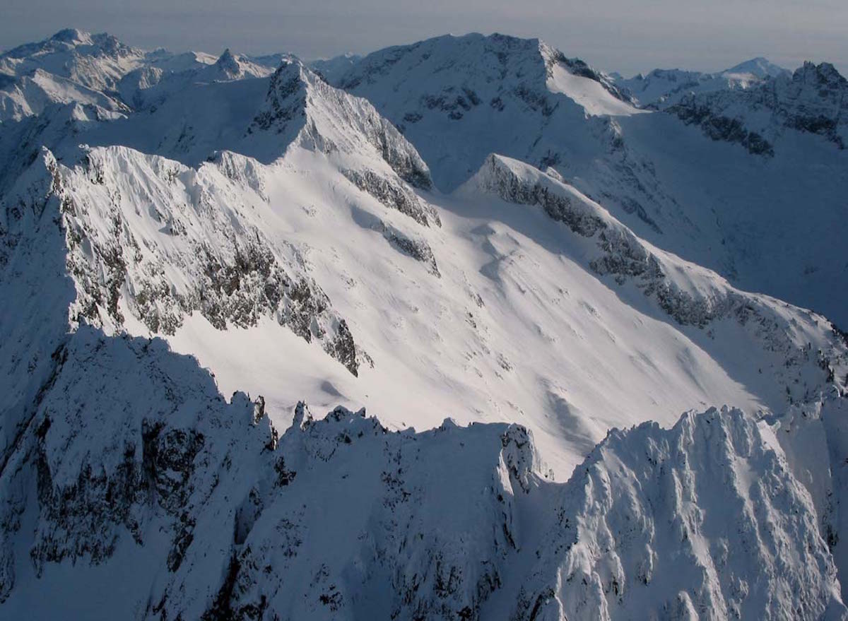
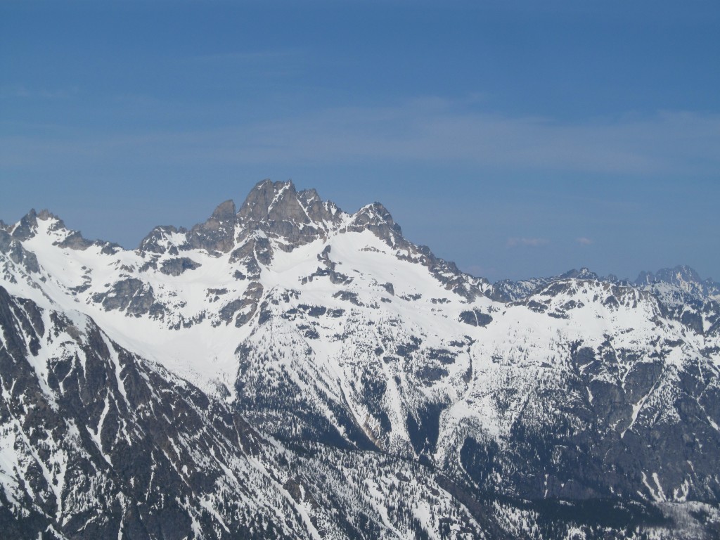
From Cache Col we had a great view of the mountains in North Cascade National Park. Directly north of us we could see Sahale Peak and its gullies down to Doubtful Lake. To the east was Buckner Mountain that rose well over 5,000 feet above the valley below. This area held some of the biggest descents in Washington all the way to the Stehekin River.
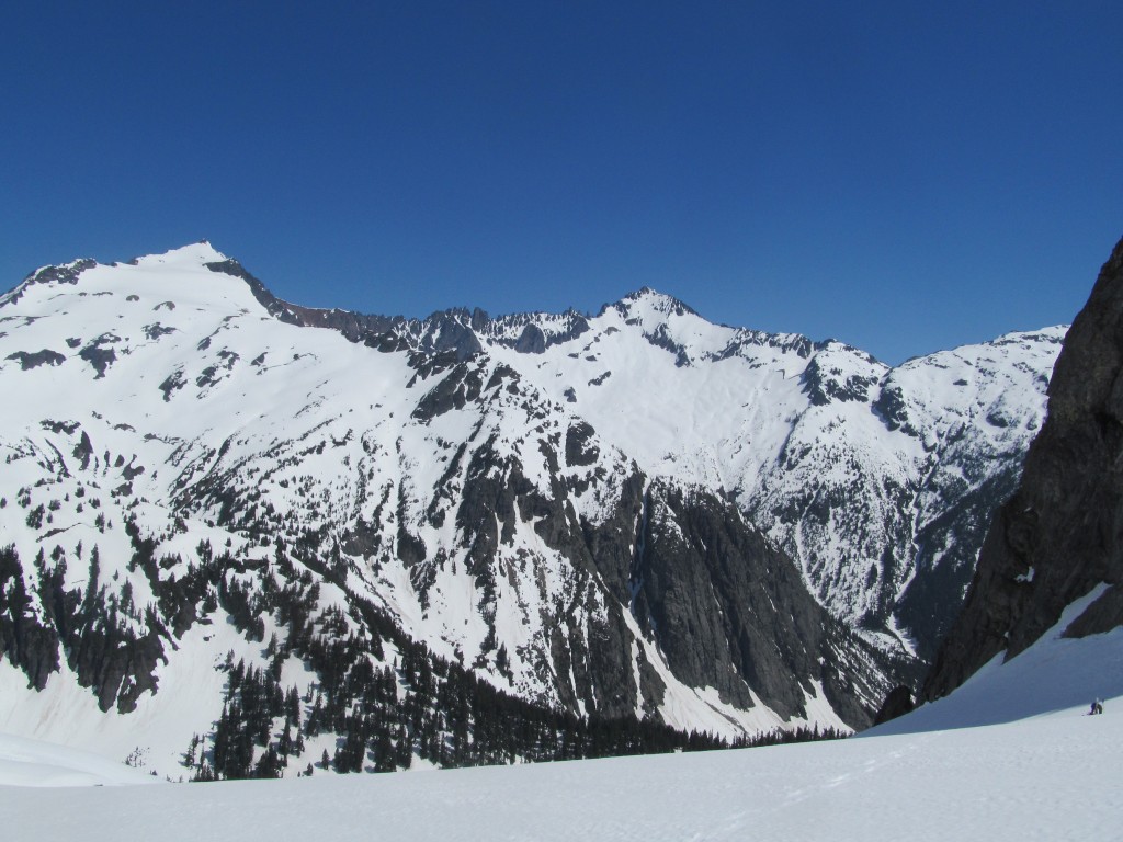
Looking to the northwest we were right above the Middle Fork of the Cascade River. We had a clear view of the original area we had planned on touring to. Looking towards the Snow King area we knew it would have been a fun area to explore. Though all didn’t go according to plans we were happy that we had salvaged the trip.
Once arriving at Cache Col we made a high traverse over to Kool-Aid lakes before dawning skins and making it up to Arts Knoll. We were in the heart of the Middle Cascade River an area that sees a handful of people during the winter months.
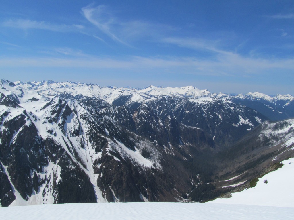
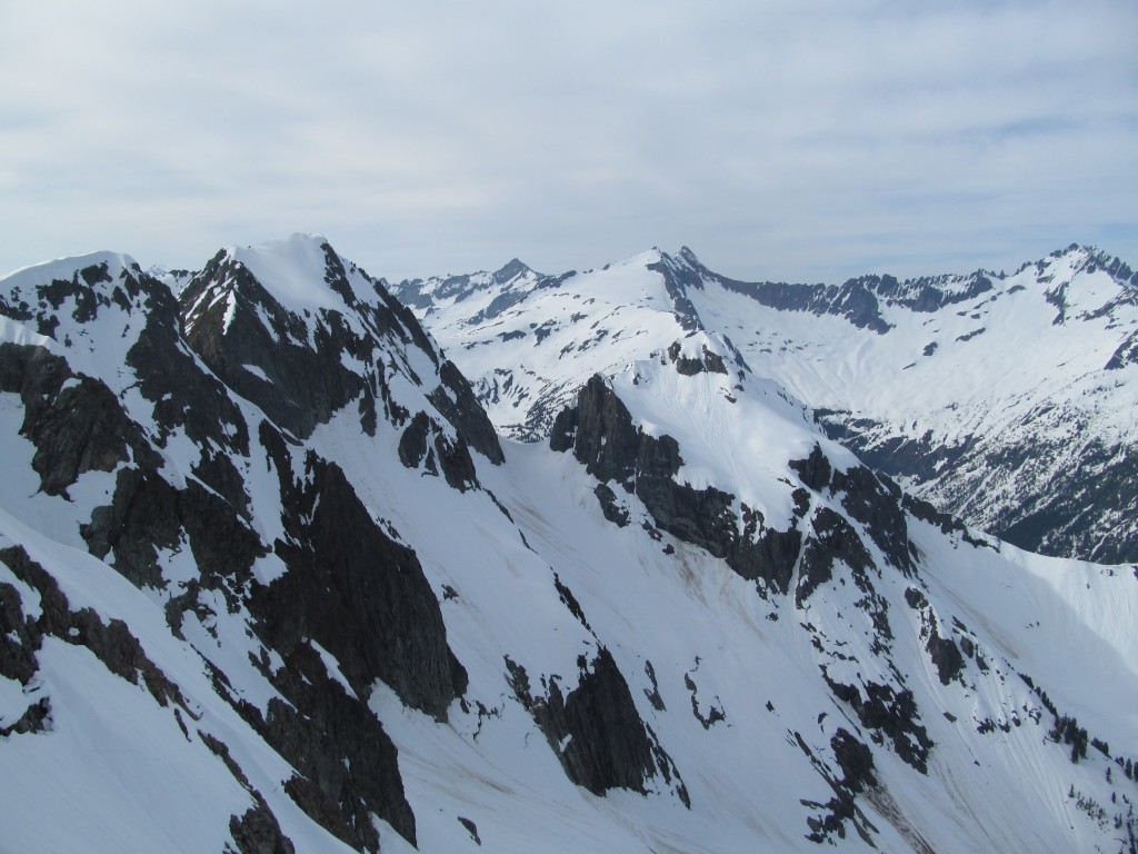
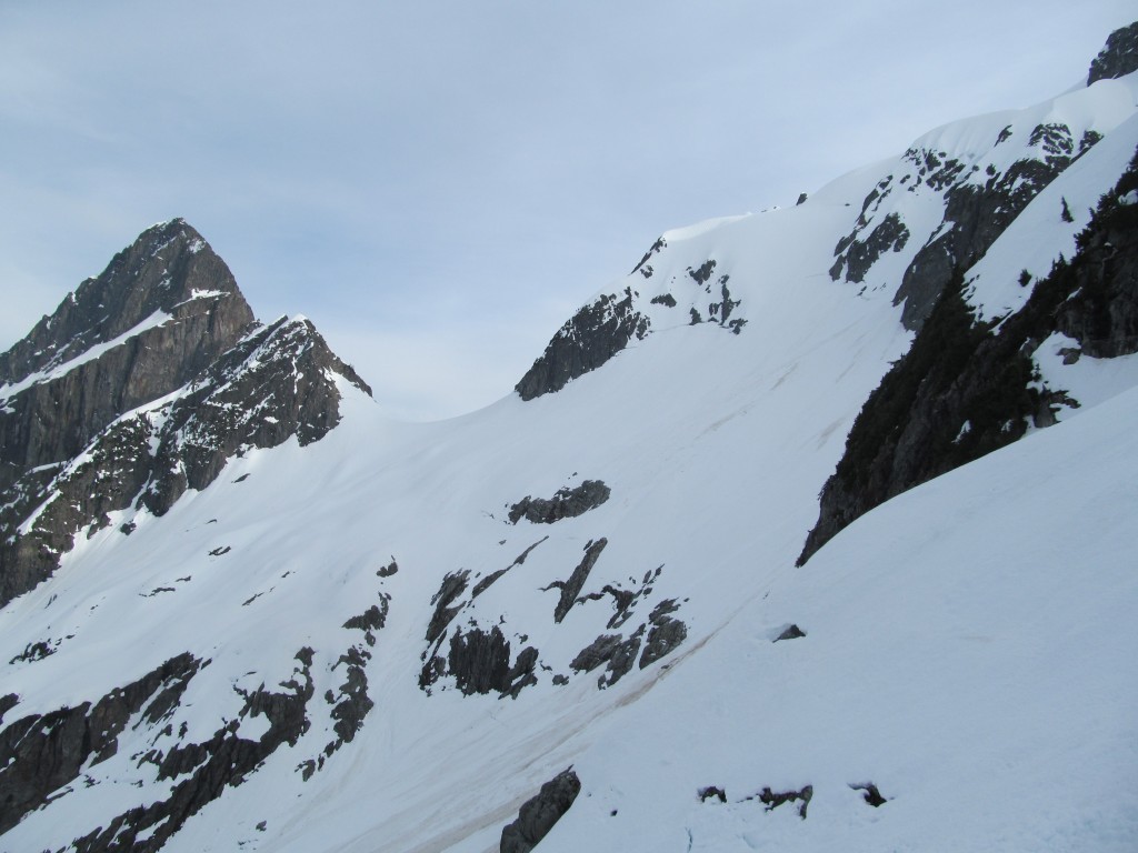
Soon we were traversing under the west face of Magic Mountain. To the south we had a clear view of the Middle Cascade Glacier. This was the route through the Ptarmagin Traverse and a col climbed over during the American Alps Traverse. Being bordered between Mount Formidable and Spider Mountain the terrain was dramatic. We had now made our way into Glacier Peak Wilderness.
Heading Towards Arts Knoll
After a long ski traverse from Cache Col we were on the shores of Kool-Aid Lake. We were able to do a snowboard traverse before it was time to put the skins back on. Making our way towards Arts Knoll we had a clear view to the North. In the foreground was the rugged summit of Johannesburg Mountain. In the far distance we could see the glacier covered slopes of Mount Baker.
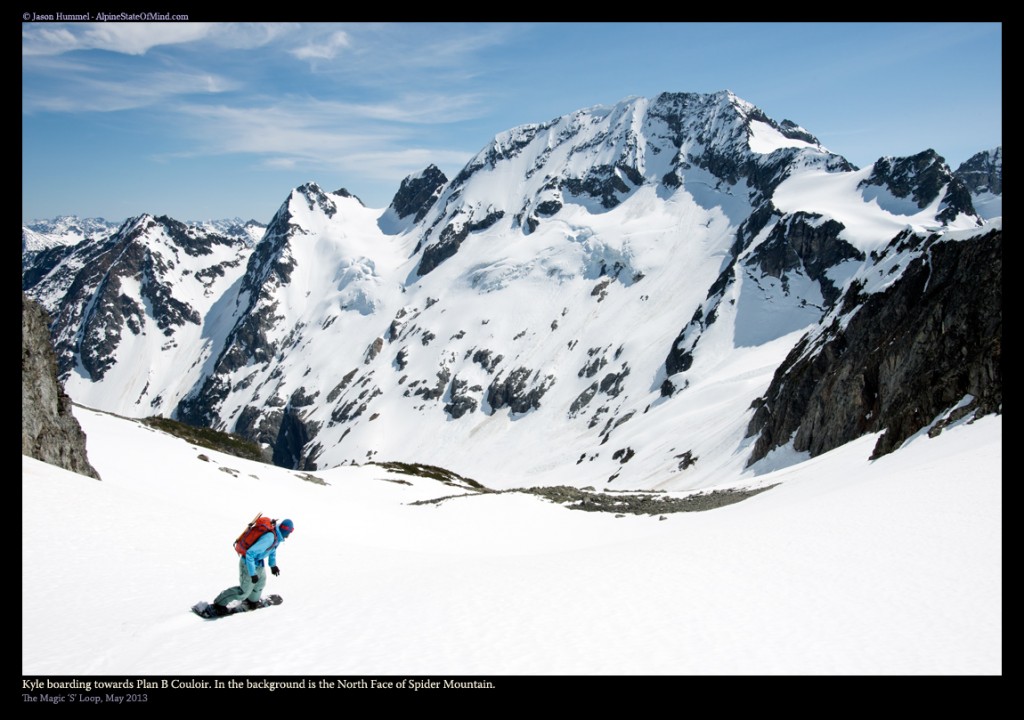
Once on Arts Knoll we took a quick break soaking in view of the North face of Spider Mountain. Now we had diverted from the Ptarmigan traverse and were on the Magic S Loop. Soaking in the warm sun we took the time for a quick rest. Our next climb would be the most challenging of the trip.
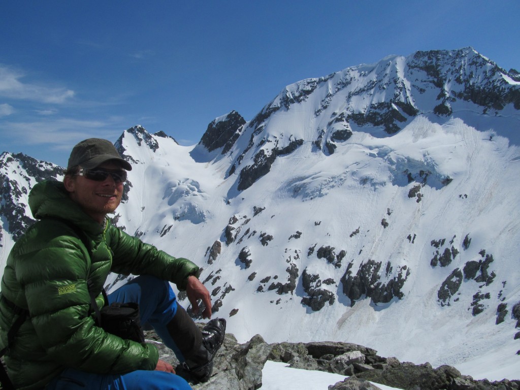
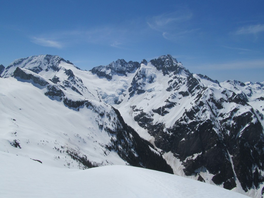
After transitioning it was time to snowboard towards the south face of Hurry Up Peak. After a 1000 feet we arrived at a flat spot and started transitioning. We were in the middle of nowhere. 2,000 feet below us we could hear the waterfalls of Flat Creek. Every direction was wilderness seldom touched by people and a world known by few.
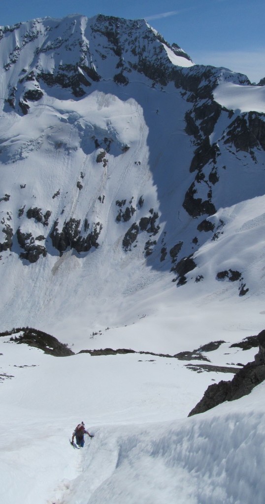
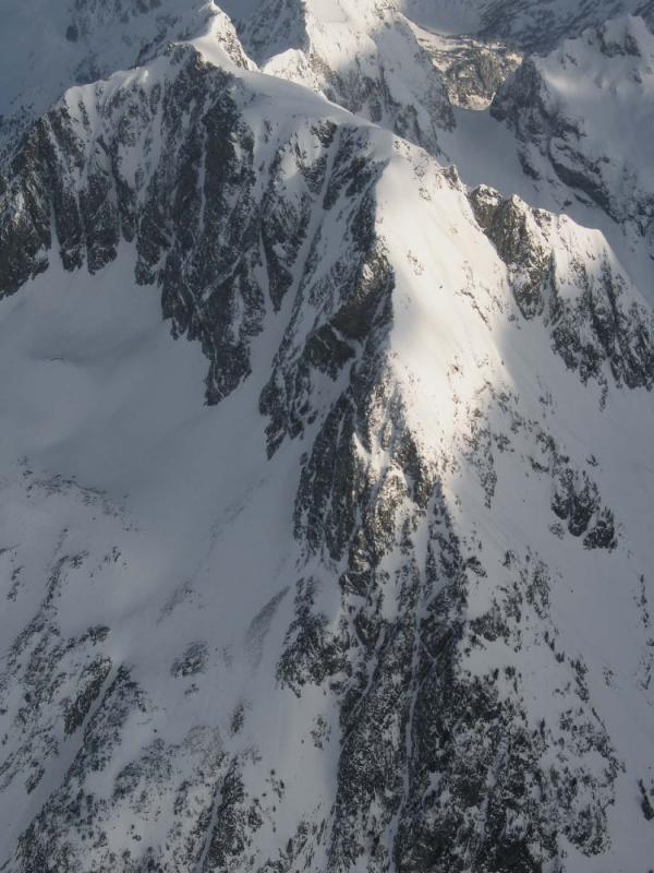
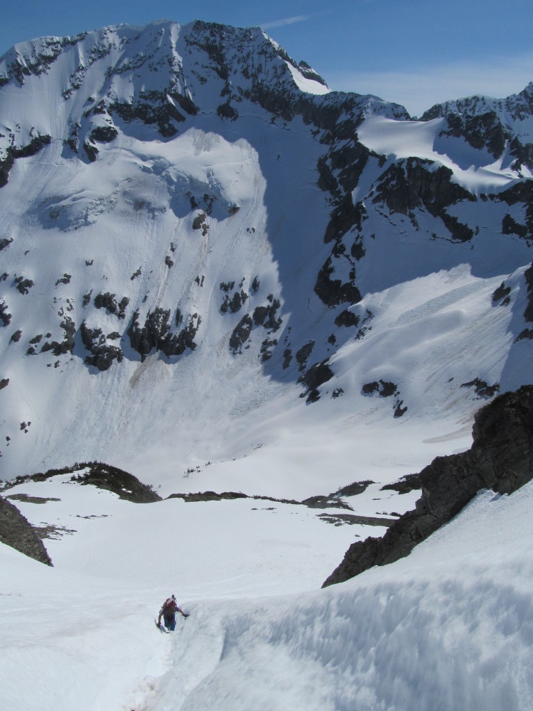
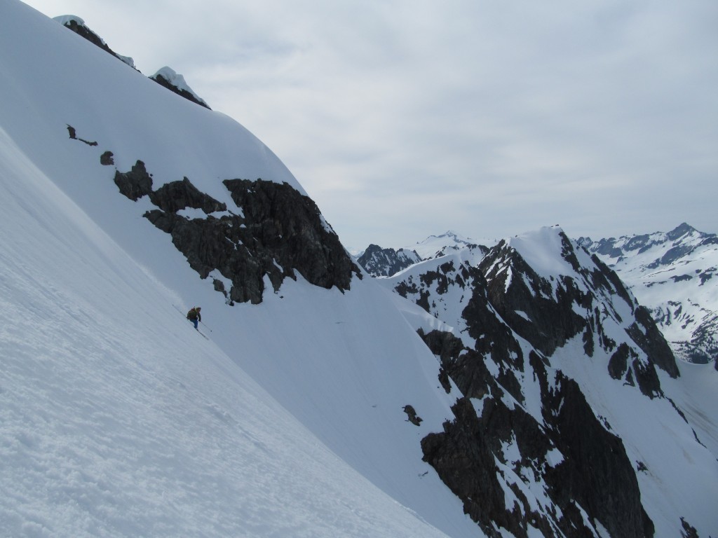
The Crux of the Magic X Loop Climbing the Plan B Couloir
The south face of Hurry Up Peak is mainly solid rock. There was only one way through the solid mass know as the Plan B Couloir. We found it fitting as the Magic S Loop was our Plan B. We would have to climb both the lower and upper couloir before arriving on the ridge.
With crampons on we were happy to find that the now was still firm. Putting on crampons we pushed our way up through the runnel a foot at a time. I had two ice axes with me so I always felt like I had secure holds. Though the terrain was steep it was as direct as you could ask for. Looking back we would reference how much longer we had by the elevation of Spider Mountain.
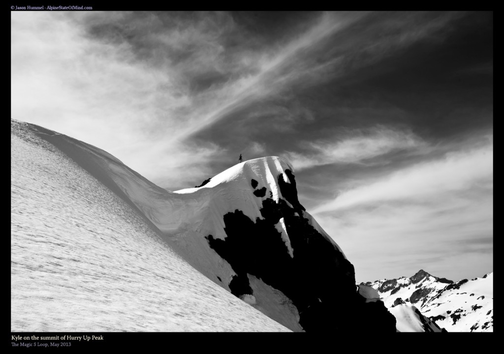
Arriving on the Summit of Hurry Up Peak
Within an hour of starting our climb we had made our way up to the ridge. Being so close to the summit of Hurry Up Peak we decided to push the final bit. Though there were dramatic drops to both the west and east it wasn’t technical. Soon enough I was standing on our one and only peak of the trip.
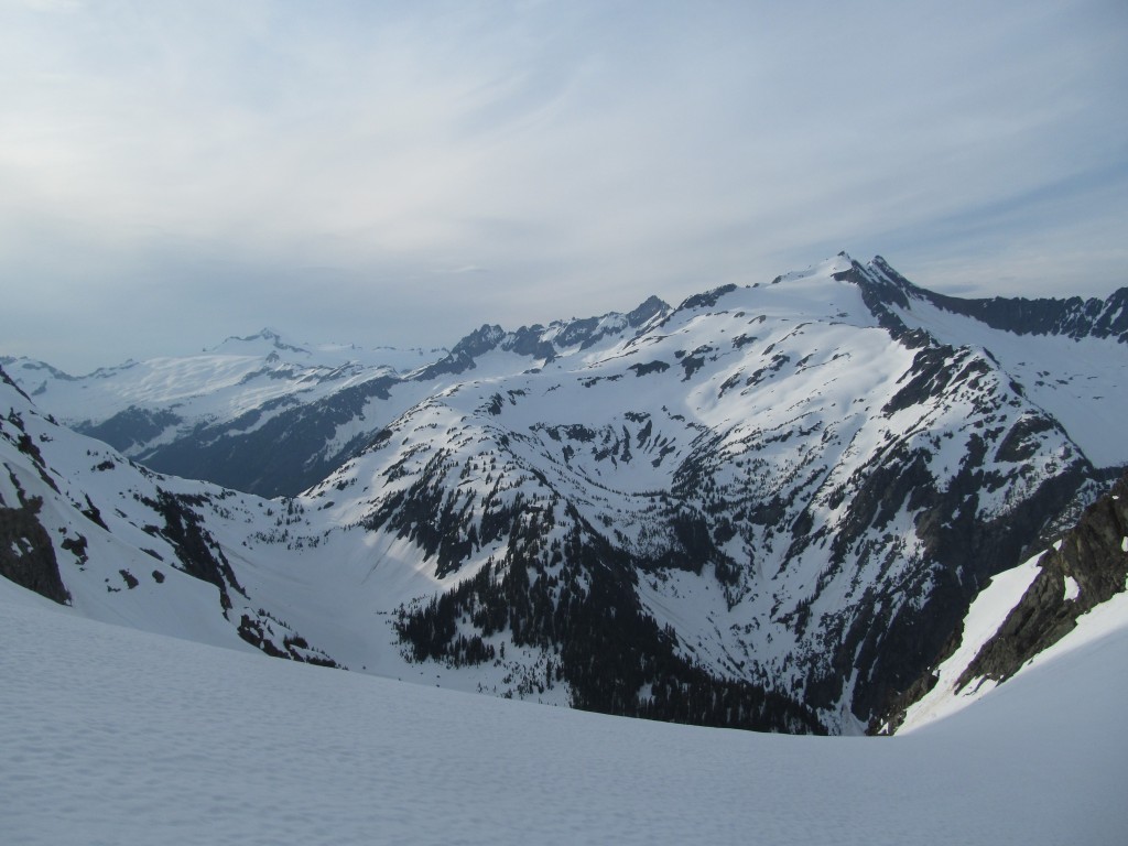
From here we had a clear view to the south towards the Holden Village area. Standing high above the surrounding peaks we could make out the north side on Bonanza Peak. This was an area we had made our way out to the previous year.
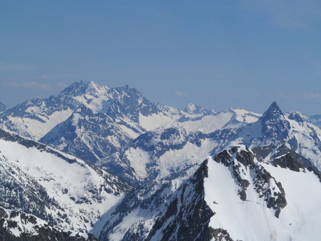
To the northeast we had a clear view of Goode Mountain. Two years before we found ourselves on another plan B trip riding down this face. It was a brutal yet rewarding experience having an unplanned bivy at the base of the valley.
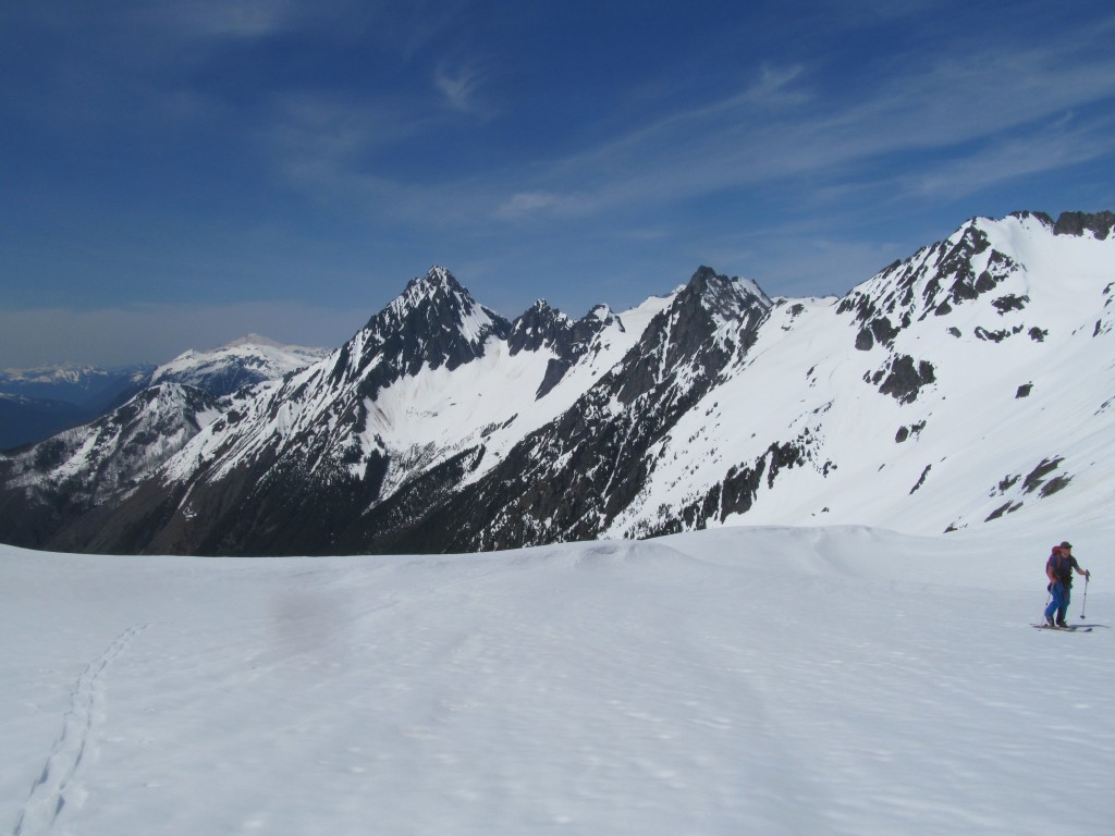
In the distance we could see our final col of the trip to the north. We were happy to see that it wasn’t a technical climb and much more mellow then our last ascent. Before long it was time to get moving and take our biggest descent of the trip.
The Biggest Descent of the Magic S Loop Riding Down the S Glacier
Dropping off the ridge of Hurry Up Peak we were immediately on steep slopes. By now we had perfectly softened corn dropping numerous feet with every turn. Fortunately the Hurry Up Glacier would be fall line for over 2,000 feet. There was no need to traverse as it would bring us to the base of our last line anyways.
From a few hundred feet above Trapper Lake we started bootpacking towards our final col. Looking back we had a great view of our previous line. There were now 2 tracks running down the S Glacier. Soon we would be back at camp as there was one more run is the Magic S Loop.
Our Final Descent of the Magic S Loop Via the Yawning Glacier
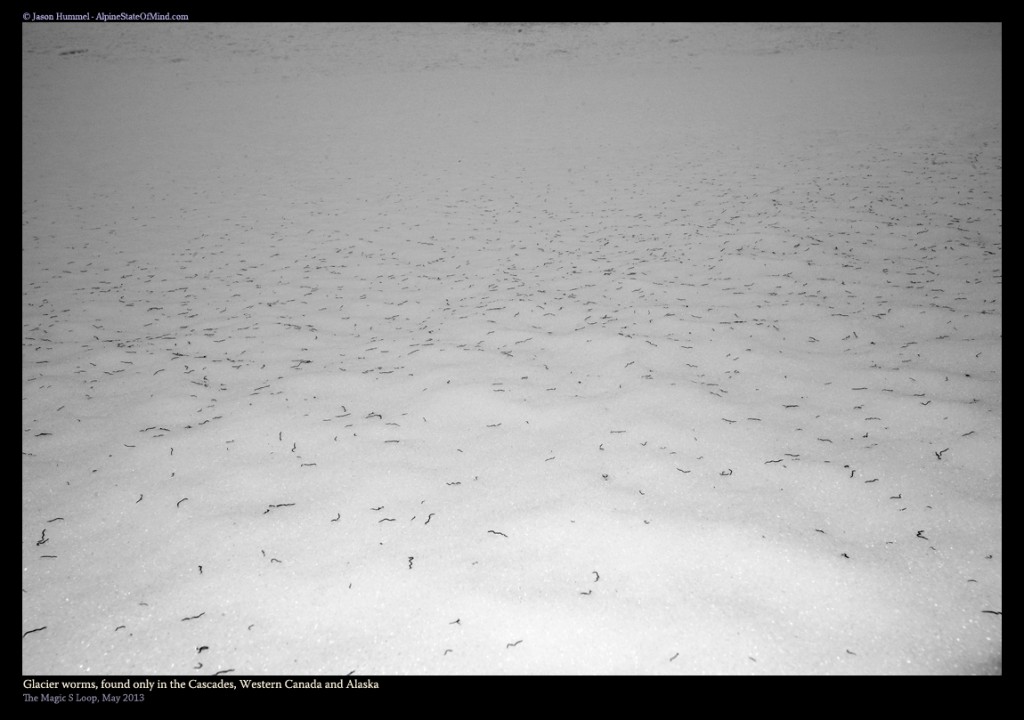
Making our way up the final steps to the ridge we encountered millions of Glacier worms. Being near sunset they had come to the surface and were in every direction. From what I’ve read this is something that only happens on the Coastal and Cascade Mountains. It had been a while since we had seen them during a trip. The last time we experienced this was on the Blue Glacier of Mount Olympus.
Below us was a 2000 feet directly back to camp. By now it was going to be dark in minutes as the sun cast shade on Sahale Mountain and Eldorado. Fortunately we had all of our overnight gear waiting below. Taking in the view for a few minutes we chatted about our turns of the day. Before long we finished the Magic S Loop with one final descent and rode all the way back to camp.
Exiting via Cascade Pass
Within an hour we were in our sleeping bags and cooking meals. The night went fast and before long the sun had rose once again. It was time to get going back to the car for the long drive home. With one final look at our last run we were off towards Cascade Pass.
With a quick ski run we made our way from Cascade Pass to the dry pavement of Cascade River Road. After around an hour of walking we were back at the car with our car waiting. After a quick moment of celebration we were driving back towards the Puget Sound. Though the trip didn’t go according to plans at all it was still an amazing time.
Thank you for reading this trip to the Magic S Loop. If you want to see more ski tours within the the Highway 20 corridor check out this link.