
Whitman Crest is one of those peaks that is perfect for spring skiing in Mount Rainier National Park. With ski touring options of every side and glaciers off 3 sides of the mountain you can find turns any month of the year. With the White River road plowed out we decided to set up camp in Ohanapecosh and explore the surround area over two nights. Being a relatively quite area for ski descents off the South side it would be the perfect area to explore.
A Little Bit of Info About Whitman Crest
Whitman Crest is a high point on the eastern side of Mount Rainier National Park separating the Fryingpan and Whitman Glaciers. At a summit elevation of 9,323 ft it is just east of Little Tahoma and can be accessed via Summerland trail and Paradise Visitor Center. It was named after Marcus Whitman who was an early missionary to the Pacific Northwest.
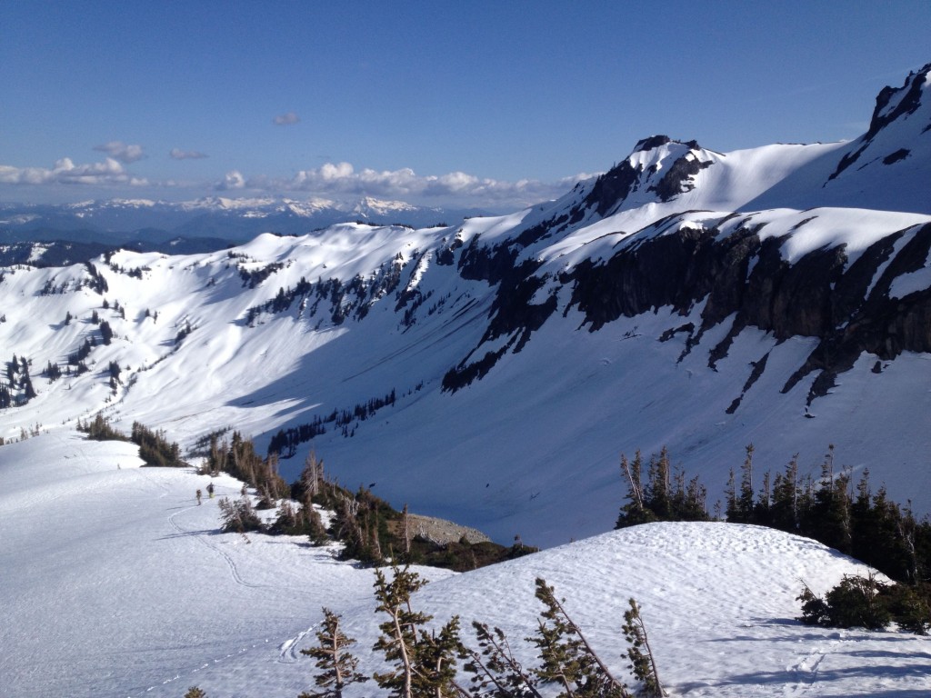
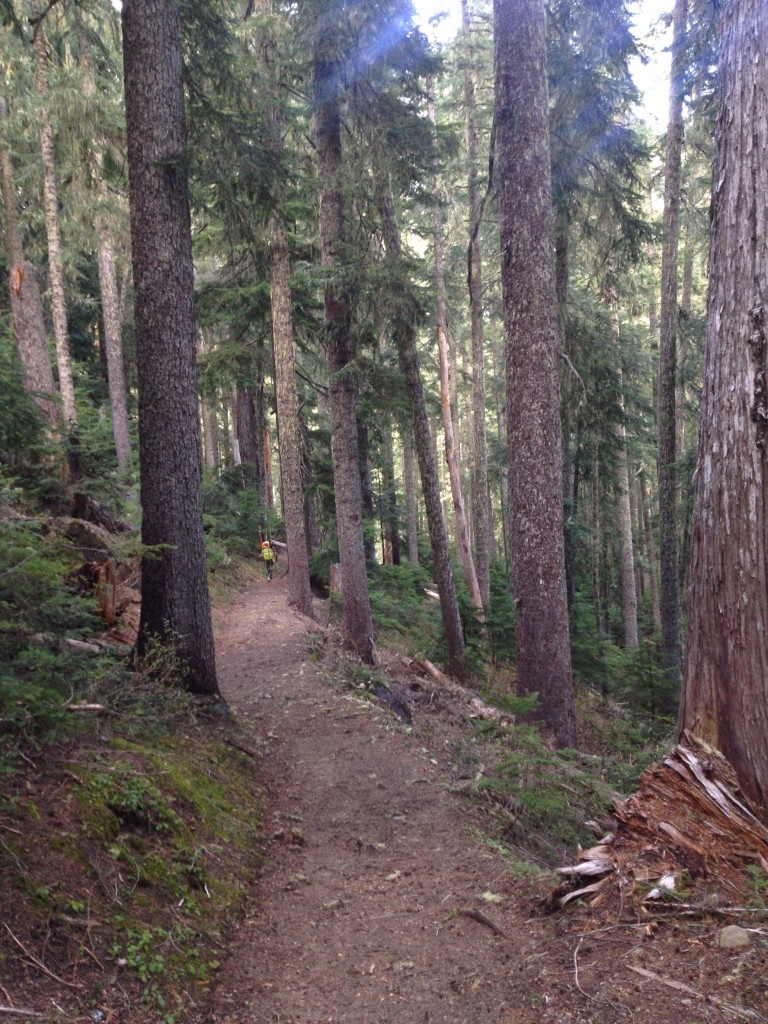
Heading up Fryingpan Creek Summer Trail Through Summerland
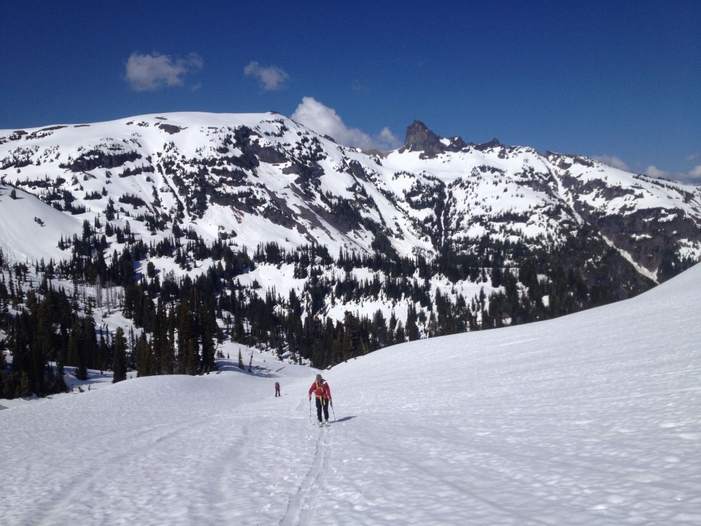
Arriving at the Ranger Station we signed our camping permits and set off for the Summerland Trail. Though I had been in the Ohanapecosh area once before it had been a quick and cloudy day. Hiking on the summer trail we finally reached snowline at the base of the alpine. Following the easy contours of the terrain we did a low angle traverse over Fryingpan Gap.
Once on the Gap we scoped around for a camping spot. A few hundred feet below the pass we found the perfect spot to set up tent that would link up with our skin track after riding Whitman Peak. The area offered great views and numerous options for places to ski tour so we dropped off all our overnight gear before heading for the summit.
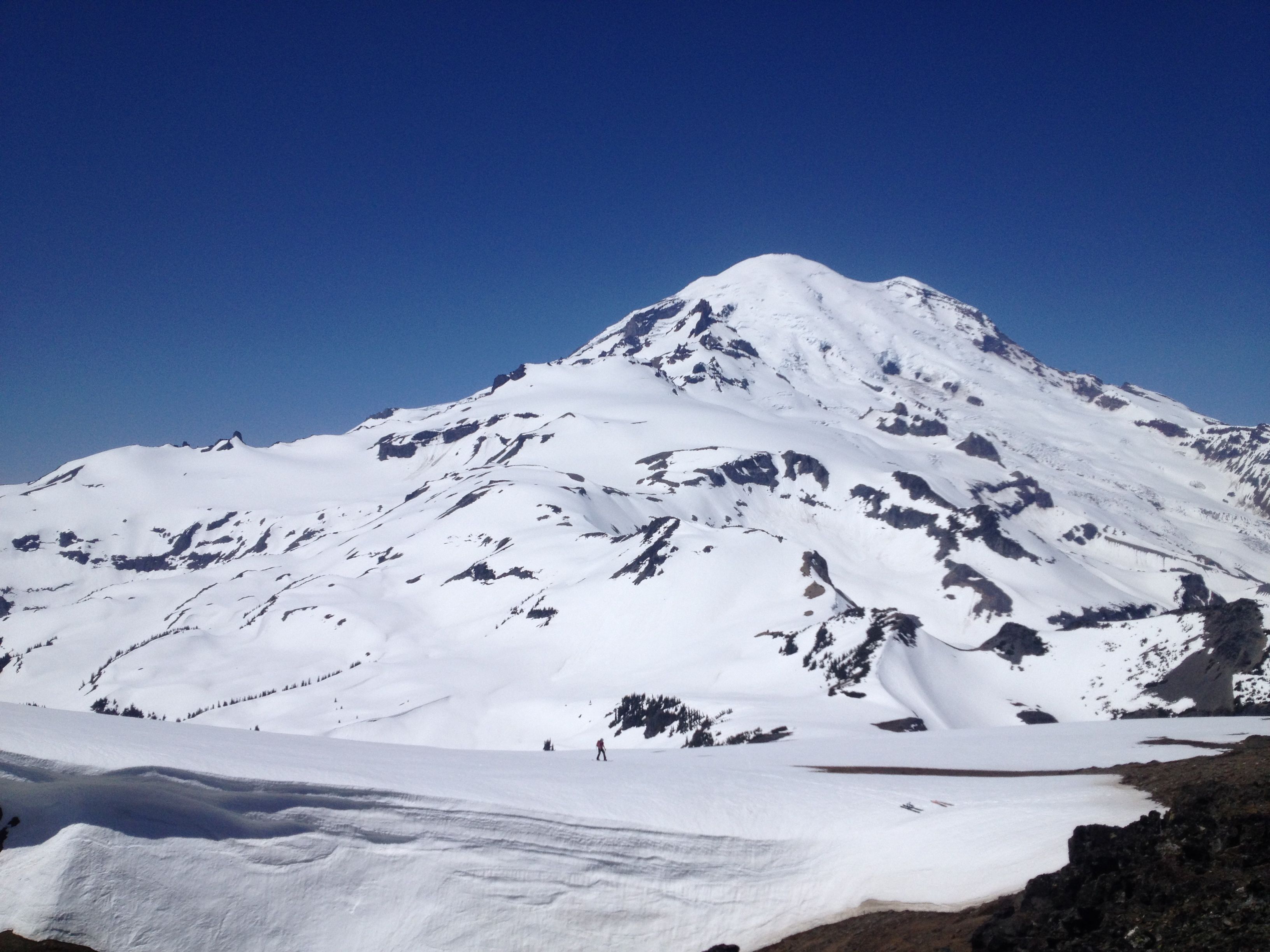
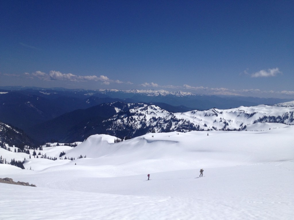
Making our way up the Fryingpan Glacier the peak quickly came into view. Looking on the Southside we could tell that our line went all the way to Indian Bar. It was a stunning day with clear skies and no wind heading onto the upper slopes of Whitman Crest.
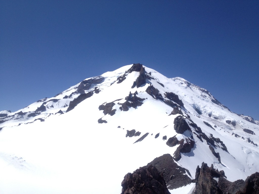
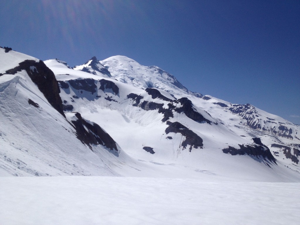
From the summit we had a stunning view of Little Tahoma and the Ingraham Glacier on Mount Rainier to the West. To the Northwest we were looking out among the Emmons Glacier and Steamboat Prow which is the high point of the Interglacier. To the Southeast was the Sunrise Vistor Center and Mount Aix in the far distance. After soaking in the views it was time to ride the Southeast face of Whitman Peak down onto the Ohanapecosh Glacier.
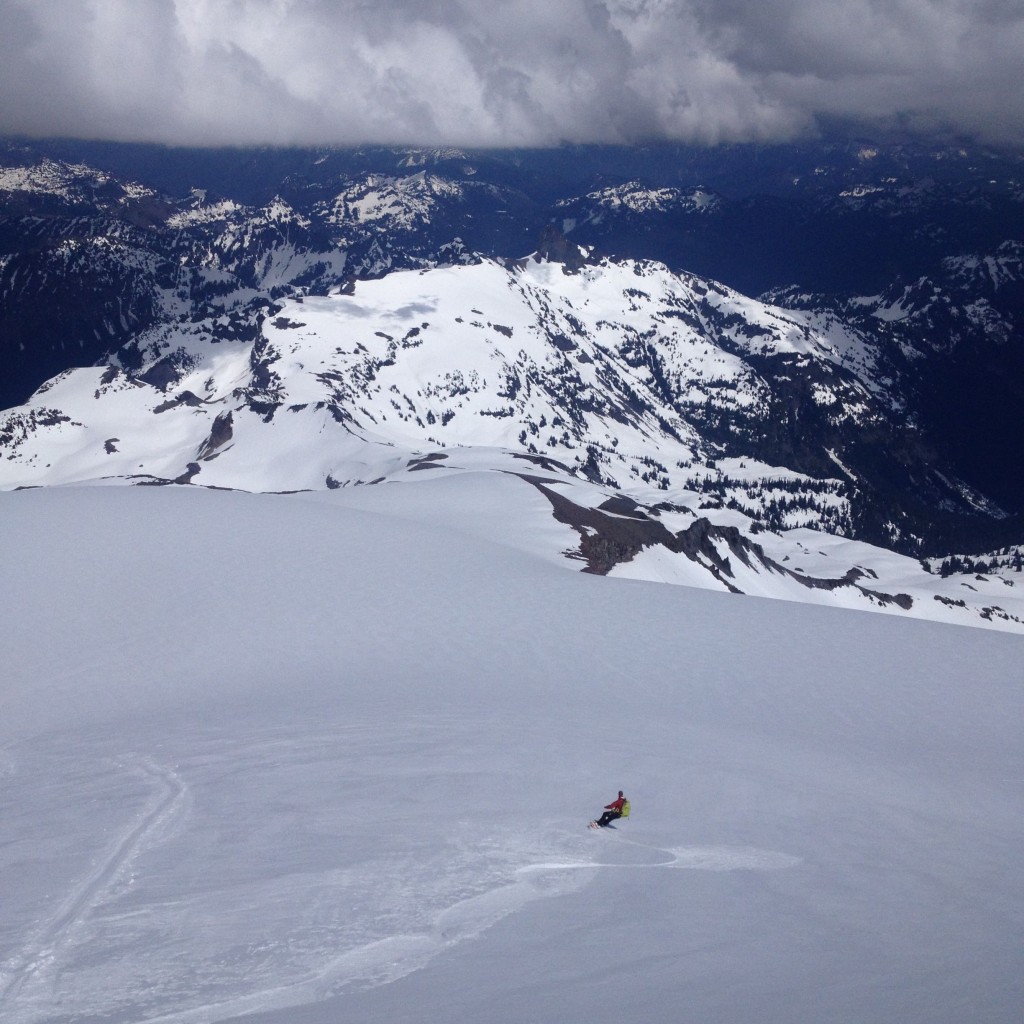
Snowboarding Down Whitman Crest to the Ohanapecosh Glacier
The upper face was low angle, dropping in to find amazing corn conditions. Soon enough we made it over to the upper steep face of the Ohanapecosh Glacier. Once we were sure the lower route went we rode all the way down to Indian Bar with all of it in great conditions.
Once down at Indian Bar it was time to transition and start skinning back to camp. We had already spotted our ascent route from camp and made our way over to the area following a mellow ridge.
Once back at camp we rested for a while melting down snow and eating food. After an hour we made our way to one of the lower peaks and took an afternoon lap. After the run it was time to head back to camp. As the sun set we took in an amazing light show before heading to bed.
Heading Over to Banshee Peak
The next morning we woke up and made a plan to head over to Banshee Peak. We knew there was a great couloir off the East side and wanted to see if it was still filled in. We would leave our camping gear where it was a retrieve it later in the day for our descent back to the car.
Once on top of Banshee Peak we looked at the line we were going for and it was melted out. With it being a beautiful day we hung out in the sun and took in the view of Mount Rainier. From our vantage point we had a clear view of the terrain I had covered on the 2nd day of the Paradise to Crystal Mountain. After a while it was time to heading back to camp and breaking it down.

Our Exit via Fryingpan Gap
After packing up camp it was time to head back to the the Summerland Trail. We made up to Fryingpan Gap and transitioned for our final descent. Looking to the west we had a great view of the bowl Hummel and I rode during the Paradise to Crystal Traverse, the Emmons Glacier and Mount Ruth on the right side of the photo below.
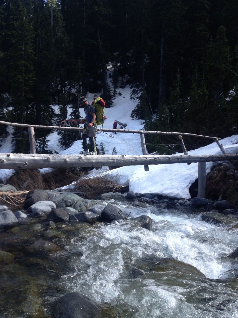
Riding down was brutal with our heavy packs. By now the snow had turned to slush which was adding to the difficulty. After 30 minute we had rode down to the bridge below Summerland. After crossing we were back on the summer trail.
Descending down the trail we finally got made it out off snow and on a well maintained trail. The last 3 miles were a breeze as we covered the ground fast. Finally we were back at the car and celebrating. It was a great trip out to Whitman Crest and ski touring around Ohanapecosh.
In Conclusion
The whole area around Whitman Crest is a great spring ski tour. It can be accessed from both Paradise Visitor Center and White River Road. In my opinion the latter is the better option as the ski line is much better but it is a longer approach. Which ever approach you decide, as long as the weather is good it has stunning views of Mount Rainier National Park. I highly recommend this ski tour especially if you are looking for an alternative to the Interglacier.
Thank you for reading our camping trip and want to see more ski tours within Mount Rainier Backcountry check out this link
and for a full and text only list of all Trip Reports Click Here