
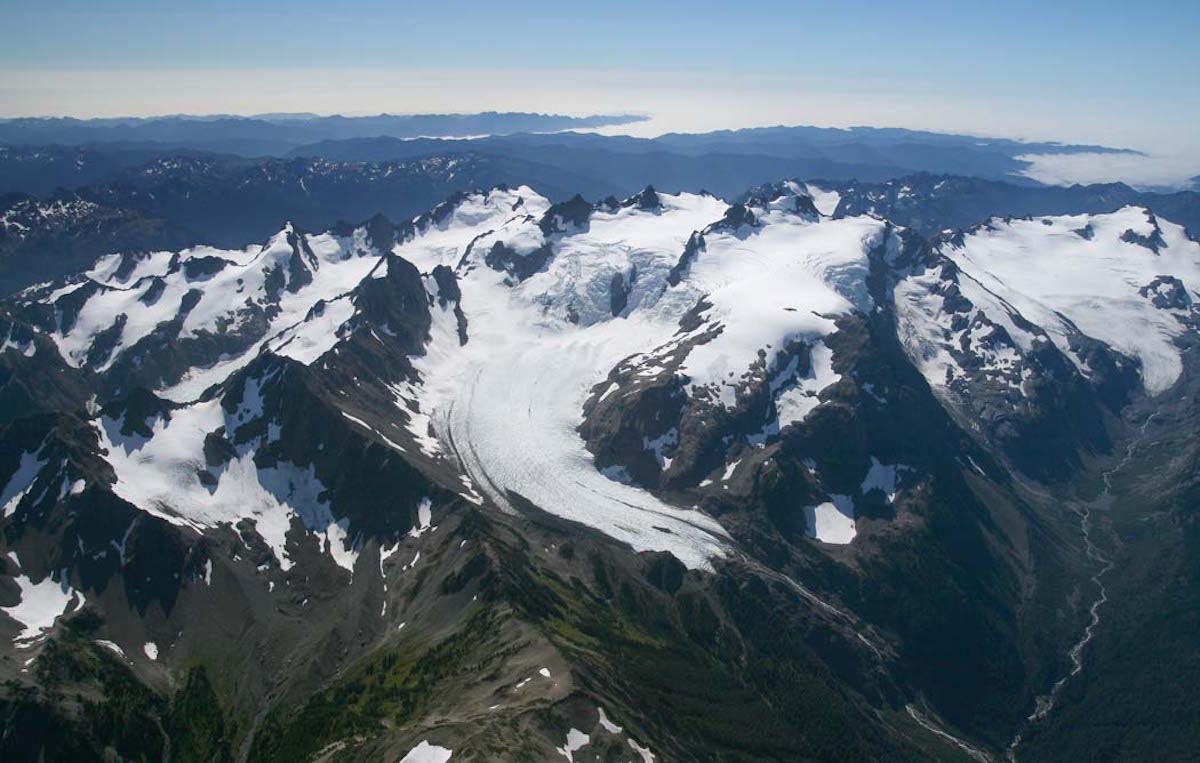

When I started the 09/10 Season I decided I would have a unified theme of exploring all the sub ranges of the Pacific Northwest and more specifically Washington State, with the Bailey Range Traverse being my big project. These mountains are quite literally the heart of the Olympic Mountains with well over 20 miles of unscathed alpine, rainforest, and enough terrain to stoke any climber. Once at the end of the Baileys and dead center in the Olympics our plan was to exit via Mt. Olympus an area we became familiar with over a year earlier, pulling off a 7 day expedition to the Valhallas (Click Here for the trip report). To pull off the traverse we expected it would take 7 days so we patiently waited for the perfect weather window throughout the season. By the end of June we had all but given up with questionable forecasts, but our window finally came in July with the promise of weeks of uninterrupted sunshine.
The first of our endeavors was the Alpine Lake Traverse which crossed through the high points of the Snoqualmie Pass area for a total of 7 days and 70 miles.
Four days later were off to the Olympics, our feet still rubbed raw from the previous expedition.

Day 1 of the Bailey Range Traverse
Anxiety always comes when you are at a trailhead packing gear for a multi-day trip. First comes excitement knowing that you are going to go somewhere seldom ventured, then fear knowing that you will have to be self sufficient . It was hard to believe that we would soon be alone as both Jason and myself passed group after group of spectators heading to a waterfall a mile into the trail. Once passing the falls it quickly became obvious that we were alone, it was mid July and rumor had it that the high peaks were still covered in a healthy snowpack.
It took 9 miles before we had our first glimpse of snow not more then a foot deep, it had been much less then I expected but travel was fast on well maintained trails. Things slowed down considerably as we hiked on patches of snow not big enough to skin on and not strong enough to support our weight. Here we were trying to pull of a ski traverse with insufficient snow.
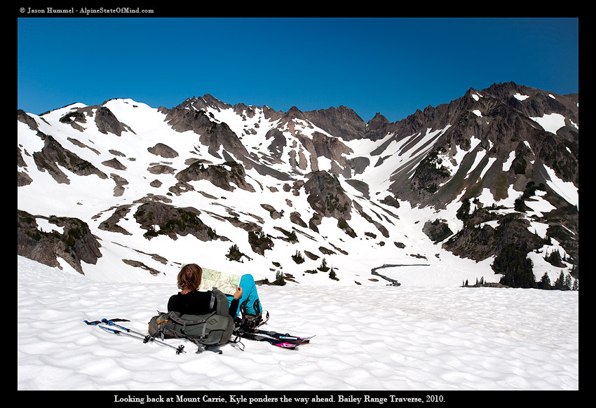
It was late afternoon before Jason and I reached High Divide which allowed us our first views of the Bailey and Mt Olympus which was right across the valley. My heart sunk realizing this would not be a easy task and that we had 6 days of hard work ahead of us. While I couldn’t see a smooth path through the Bailey Range Traverse I hoped it would become obvious as we got deeper into the range.
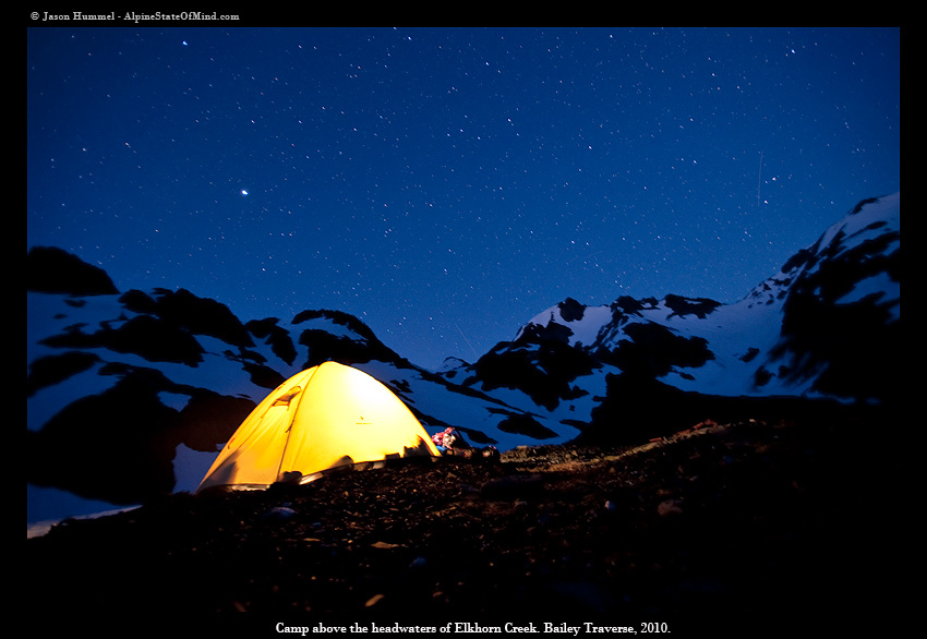
That night we watched the sunset over Mt. Olympus and studied our topographical maps before going to sleep.

Day 2: Making Our Way to the Snow
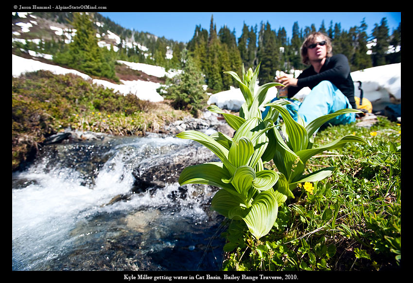
We woke up to the sound of rustling outside the tent. It was just after sunrise and to our astonishment there were elk eating flowers not five feet from our tent. I carefully and meticulously spread out my wet gear in the early morning sun taking advantage of a opportunity to dry all of my wet gear before hiking. In front of us was a small basin covered with snow but beyond that it was dry with no snow in sight. We carefully followed the faint reminisce of the high Divide trail still buried under a foot of well compacted snow fearing that losing the trail would lead us to a legendary bushwhack, little did we realize what was in store for us.

I had heard of a section on the trail known only as the Catwalk which traverses through steep cliffs and is considered one of the sketchiest places around. What I originally thought was the Catwalk turned out only to be the approach finally turning into a climb up class 4 rock on a exposed knife ridge with dense forest. Each move was calculated, slowly moving through the brush so the skis on our packs wouldn’t snag branches. While the Catwalk was only 3 miles it had taken us hours to push through the steep slopes and vegetation, before long we had reached the open alpine of Mt. Carrie.
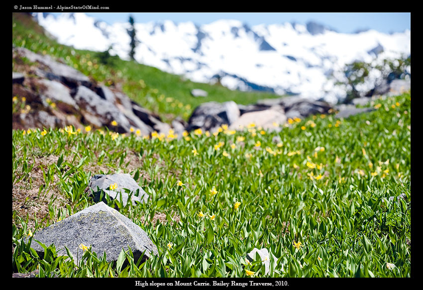
Mt. Carrie is the high point of the Bailey Range with a summit elevation of 6995 feet. The southern slopes were absent of snow but northern slopes hold Remnant snowfields that would allow us to skin, hopefully for the rest of the trip.
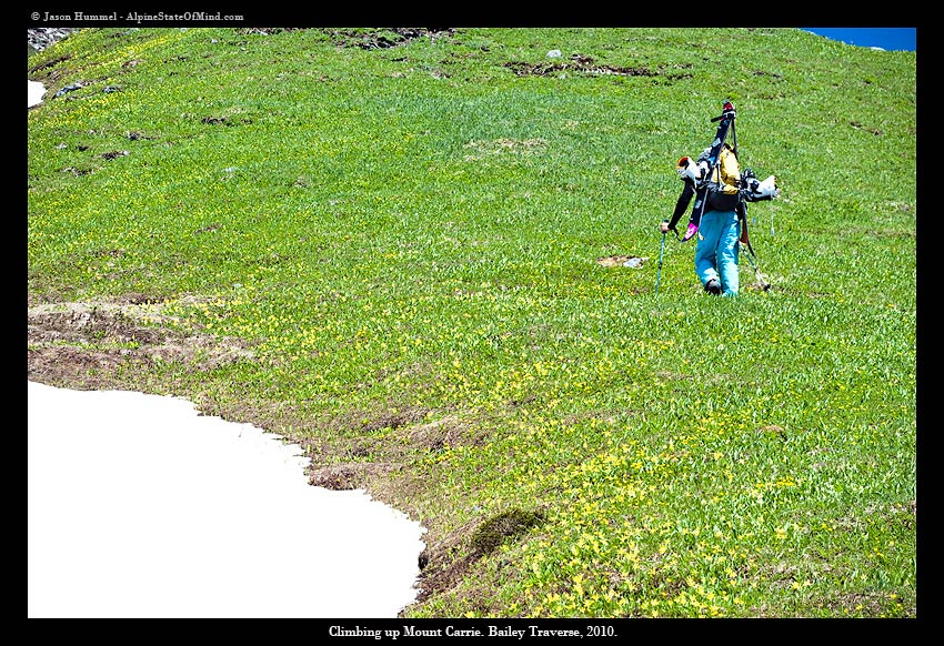
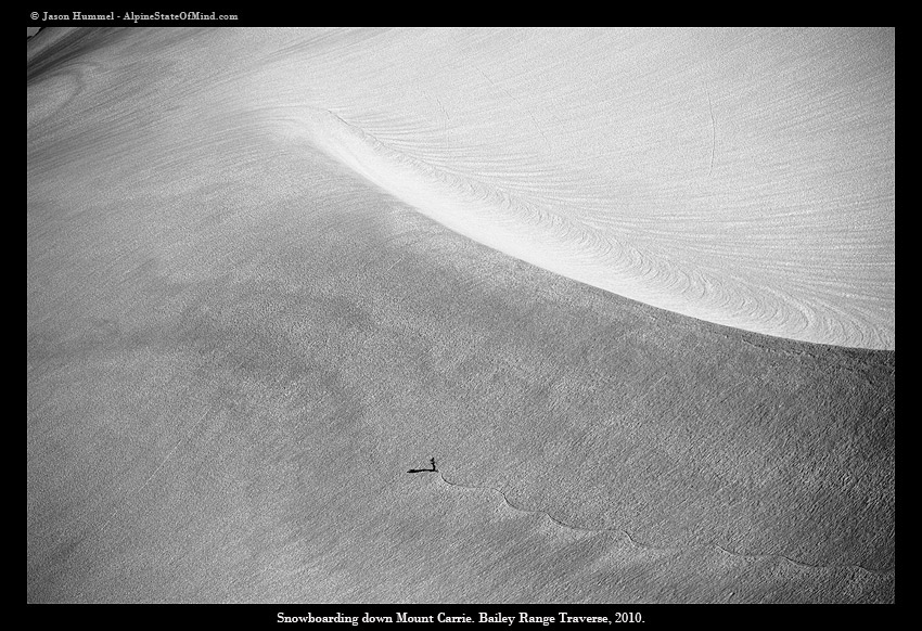
Snowboarding Mount Carrie
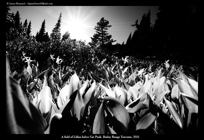
We hiked through Avalanche lilies straight up Mt. Carrie with not a patch of snow anywhere to be seen. It wasn’t until we were a few hundred feet below the summit that we would step foot on snow again. From the summit of Mt. Carrie we could see Hurricane Ridge to the north and Mt. Olympus to the south. Finally we were able to make some ground on the Bailey Range Traverse riding a NE facing glacier to the base of our next project, Mt. Ruth.
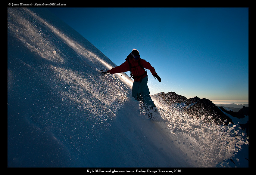
Snowboarding Mount Ruth
From the moment we set site on Mt. Ruth we knew that we just had to ski it. It was late in the day and we watched the shade take over the mountain as we quickly climbed up the steep NE face. We had gained more ground then anticipated as we rode perfect corn for 2000 feet to Stephens lake, our camp for the night.
Day 3: Halfway Through the Bailey Range Traverse
After a little bit of route finding around Shephen lake we made our way up a low col directly underneath Stephens Peak and took a much needed break.
We had hoped to ride all the way to Cream basin but once we reached the ridge there was no snow to be found. The down climb to Cream lake was nothing short of treacherous with forests so dense I had to crawl on my hands and knees while dragging my backpack behind. Hours passed as we climbed through the woods with the afternoon sun weighing us down.
In the distance we could see open snow covered slopes as we once again reached alpine.
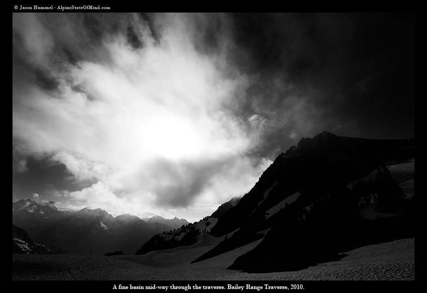
From our vantage point we were blown away by how much terrain we had already covered on the Bailey Range Traverse and how much was ahead of it.
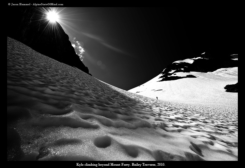
We passed quite a few peaks to make up for lost time but focused on Mt. Ferry which would allow us to descent to our camp in Eleven Bull Basin for the night.

Day 4: Last Day of the Bailey Range Traverse
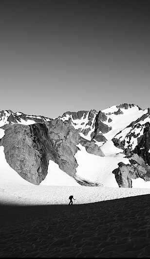
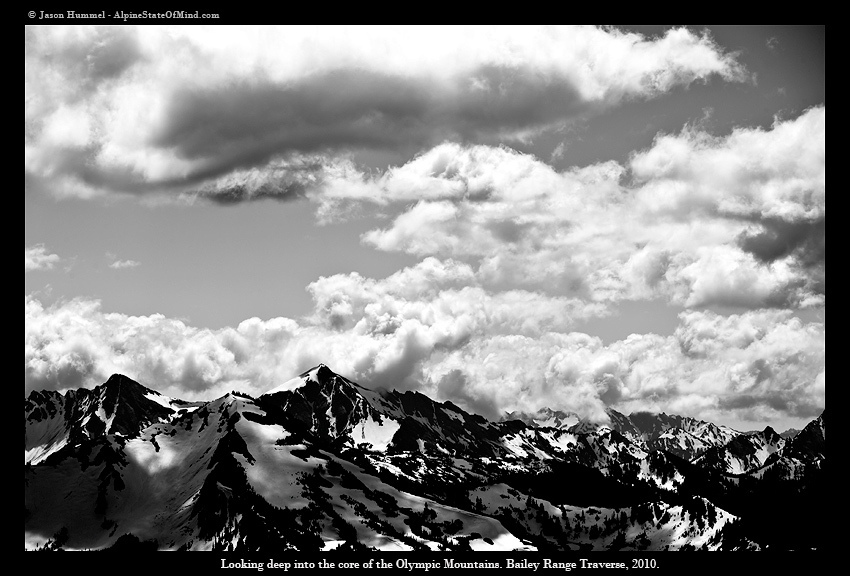
Here we were deep into the alpine with nothing but snow covered peaks all around us. We were now in the southern portion of the Bailey Range Traverse and right in the middle of the Olympic Mountains.

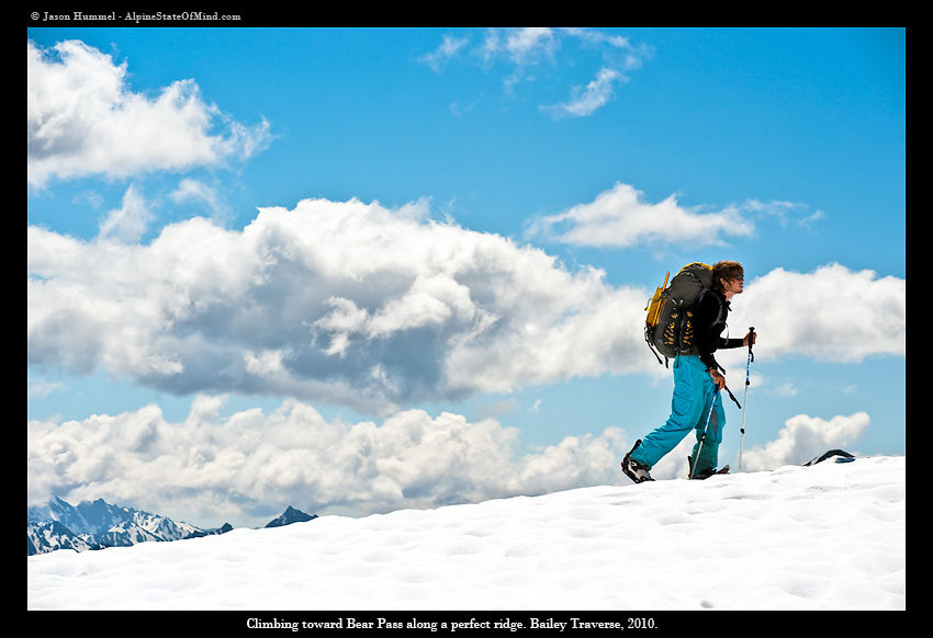
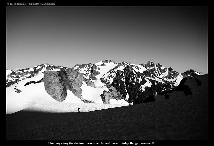
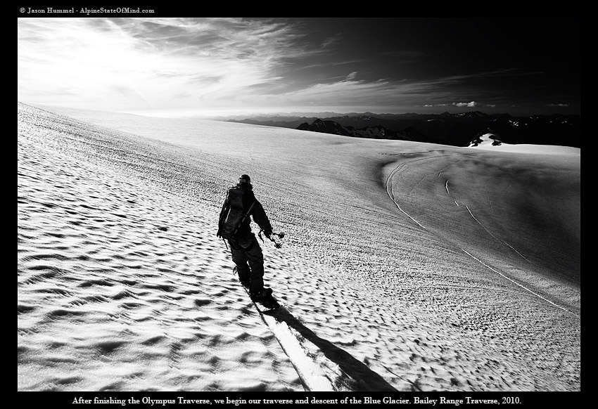
We climbed up Eleven Bull Glacier and before long made it to Bear Pass and the end of the Baileys. From here we would have to drop deep into the forests of Queets Basin then make our way north to Mt. Olympus via the Huhes Glacier.
We made our way down the mellow slopes of the Basin making sure to stay on the right and side of the quickly accumulating river which quickly became a 100 foot deep canyon. Within a hour of Bear Pass we were once again bushwhacking through dense forest trying to find a way past yet another steep canyon. According to the topographical map there were mellow slopes above us but after two hours of steep climbing we decided we preferred the canyon instead. The slopes were so ridiculously steep that we downclimbed with a ice axe and crampons. I grabbed on to anything and everything that I could as we slid down the steep canyon wall finally making it to Huhes creek.

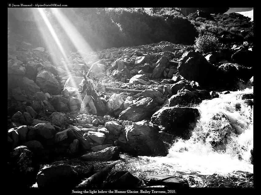
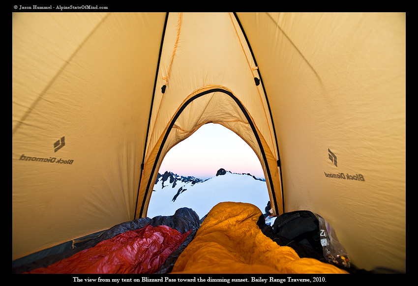
We were able to follow the creek all the way to its source, the Humes Glacier a 3 mile long ramp of snow and Ice. We climbed up the Humes while the sun was setting and skinned among with the late night alpenglow to our backs finally reaching our camp for the night Blizzard Pass.
From our camp we could see Mt Olympus directly east and Mt Rainier to the west as the darkness enveloped around us.
Day 5: Heading Towards Mount Olympus
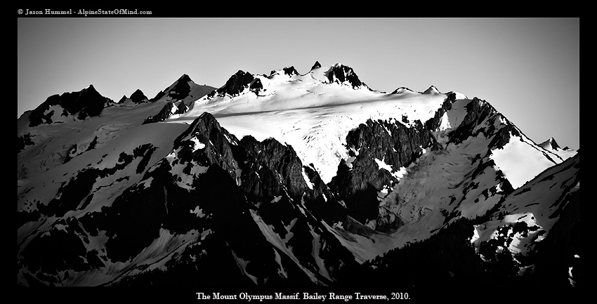
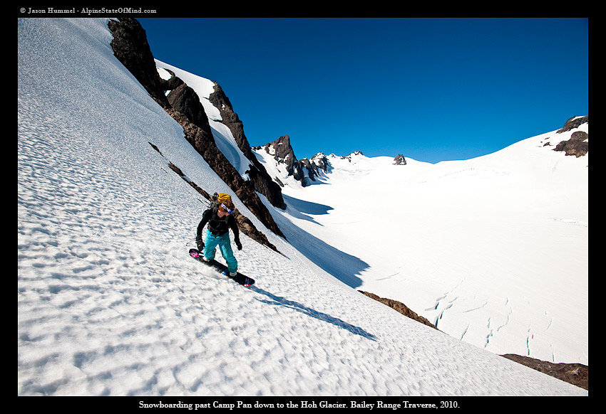
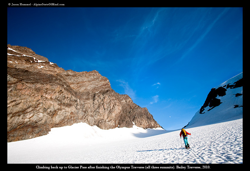
We had ended the Bailey Range Traverse successfully and now it was time to focus on the second objective, Mt. Olympus. We decided that we would pull off a one day traverse of the Mountain tagging East Peak, Middle Peak, Five Fingers and the West Peak in one westward swoop. It was quickly decided that we needed to go fast and light as we ditched our overnight gear on the Hoh Glacier. From Blizzard pass we rode down firm corn, navigating around cliffs and crevasses until finally stepping foot on the glacier.
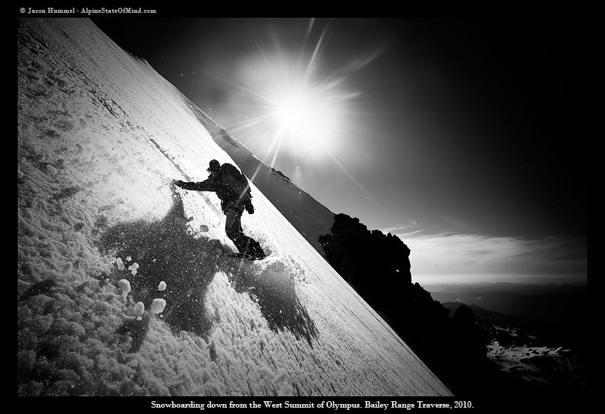
This was familiar territory for both of us, the previous season we had experienced a white out on the same glacier. We followed the mellow ramp up zig zagging around open crevasses and slowly creeping towards the peaks. With some careful navigation we tagged all of the summits with the highlight being the Blue Glacier Headwall on the West Peak and True summit.
The day was long and our ambitious goals had been achieved making a final run down to Glacier Pass and back to camp. That night we slept under a open sky on the Hoh Glacier anticipating a long day ahead, the departure through over 20 miles of well maintained trail.
Day 6: Exiting via the Hoh Valley
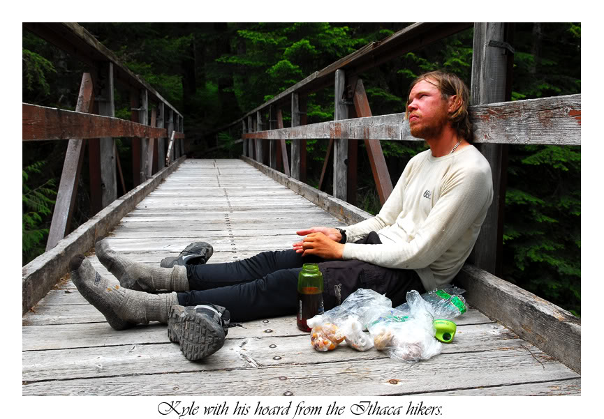
The previous season it had taken us 2 days to exit Mt Olympus and we expected the same this season. Our backs ached and our feet were swollen as we down-climbed the wide open trail with each step getting us closer to civilization. Keeping a constant pace we made our way past landmarks that reminded us of old times, mainly a bridge where this photo was taken.

What had taken us two days the previous year was pulled off in 9 hours, finally arriving at our car stocked full with beverages and random food.
Looking back at the 2010 season it was filled with brutal approaches and rugged mountain terrain. Unlike the previous season, parking lots and trailheads were few and far between. The Cascades have changed who I am and how I look at the world. People think that ski mountaineering is all about your Physical abilities but in my experiences I have found that the mental game of being alone and self reliant is far more taxing.
I can honestly say that I now look at the Cascades with new eyes and a much better understanding of the layout. This next season is going to push me harder then I ever though possible.
Thanks for taking the time to read this story and I hope you enjoyed it.
For Jasons Version Click here