Silver Star Mountain is one of the gems of the North Cascades and it is easy to understand why. With a summit of 8,876 feet it is the the high point of the Methow Mountains. From Highway 20 it is the dominant peak just north of Washington Pass. Being situated on the eastern side of the Cascades it offers a colder and drier climate. With the furthest east glacier in Washington it is popular for late season ski touring. The best access to the area is via Silver Star creek from the northern side. With a massive warm front smashing into the Cascades we decided to head that way. Our hope was that while most places had rain this was our only chance to find powder.
The latest front really managed to mess things up in Washington. Many of the access roads were washed out and most of the peaks were covered with Avalanche debris. We arrived at Crystal Mountain Monday morning to get our gear and ride some groomers. While checking out conditions we could see the surrounding peaks didn’t look good. The snow was firm as far as the eyes could see. Looking at the forecast it was going to be blue bird for the next couple of days.
We had planned on touring in the Central Cascades but decided it should wait for a later time. We needed to find somewhere else to ski tour. According to telemetry Washington Pass barely went above freezing level so it was our best bet at good snow. The plan quickly came together that we would drive towards Silver Star Mountain in the North Cascades.
The Long Drive to the East Side of Highway 20
Tuesday afternoon we made the 280 mile drive through the Cascades. Before long we were on the Eastern side of Highway 20. Looking for a place to sleep we camped at the Silver Star Creek Parking lot. It had been a long drive through Stevens Pass as Highway 20 was now closed for the winter.
Making Our Way up Silver Star Creek Towards Silver Star Mountain
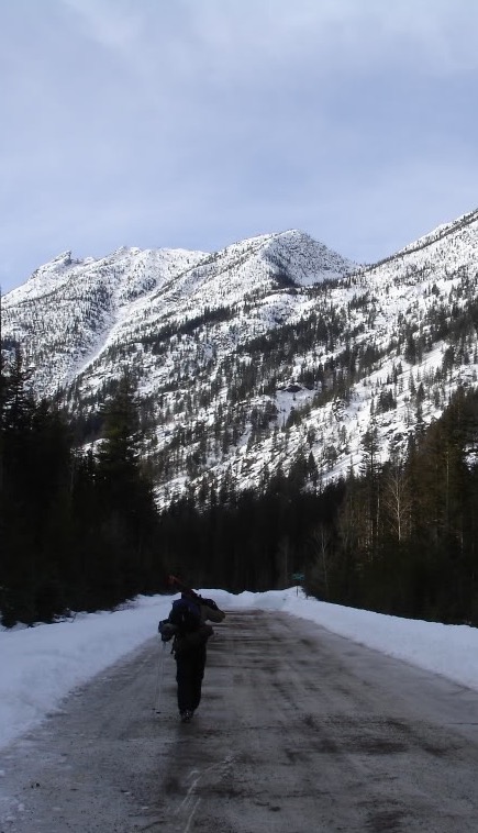
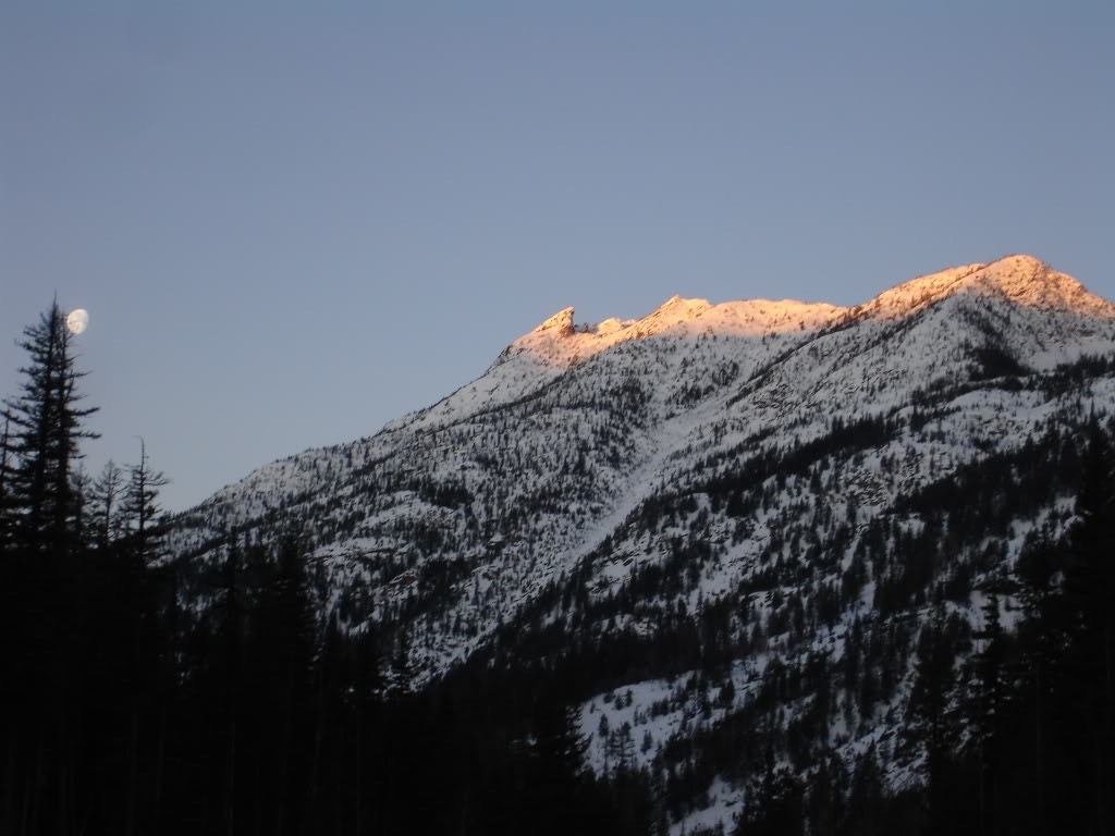
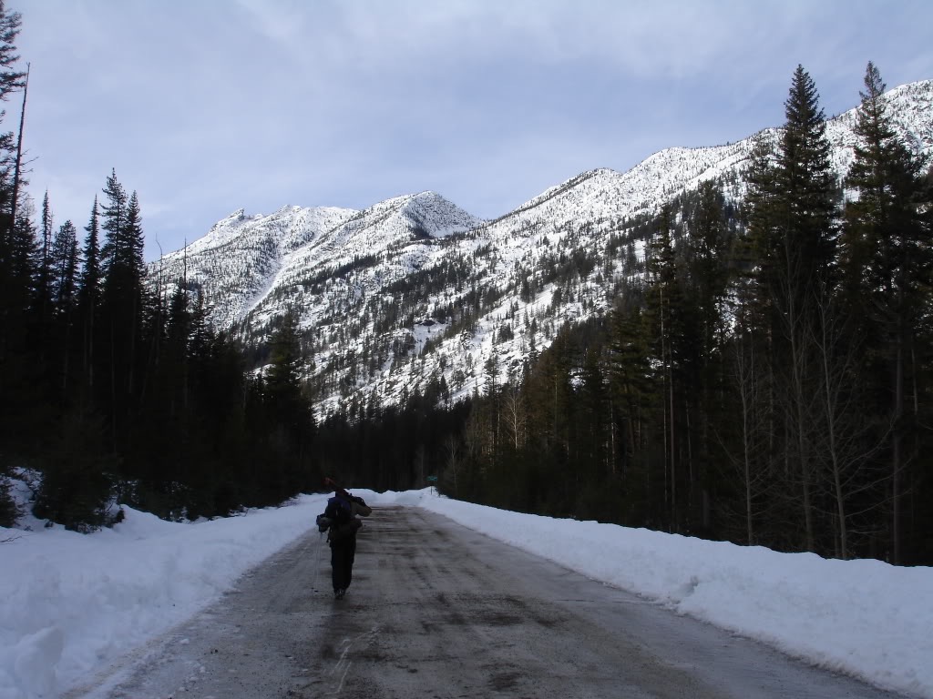
The next morning we woke up to clear skies and a beautiful alpenglow. It was going to be a long day heading into the base of Silver Star Mountain but we were excited. After a slow start to the day we finally started walking up Highway 20. While the gates were closed we were surprised to be walking on bare concrete. In every direction the mountains rose over 4,000 feet. We weren’t sure what to expect as we couldn’t see snow on the surrounding peaks.
Soon enough we made our way to Silver Star Creek and it was time to put on the skis. Soon enough it was time to head south loosely following the summer trail. Breaking our way through the forest the snow was firm. Along the way we would occasionally head into boulder fields. Our optimism was slowly fading as there was no powder to be seen.
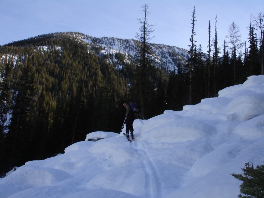
Along the way we would occasionally break into alpine sections. Surround us was steep faces covered in forest. We would have to earn each steep as we pushed forward. With backpacks full of camping gear we pushed on in hopes of finding a great basecamp.
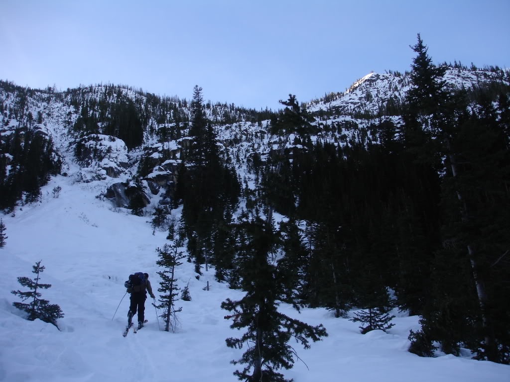
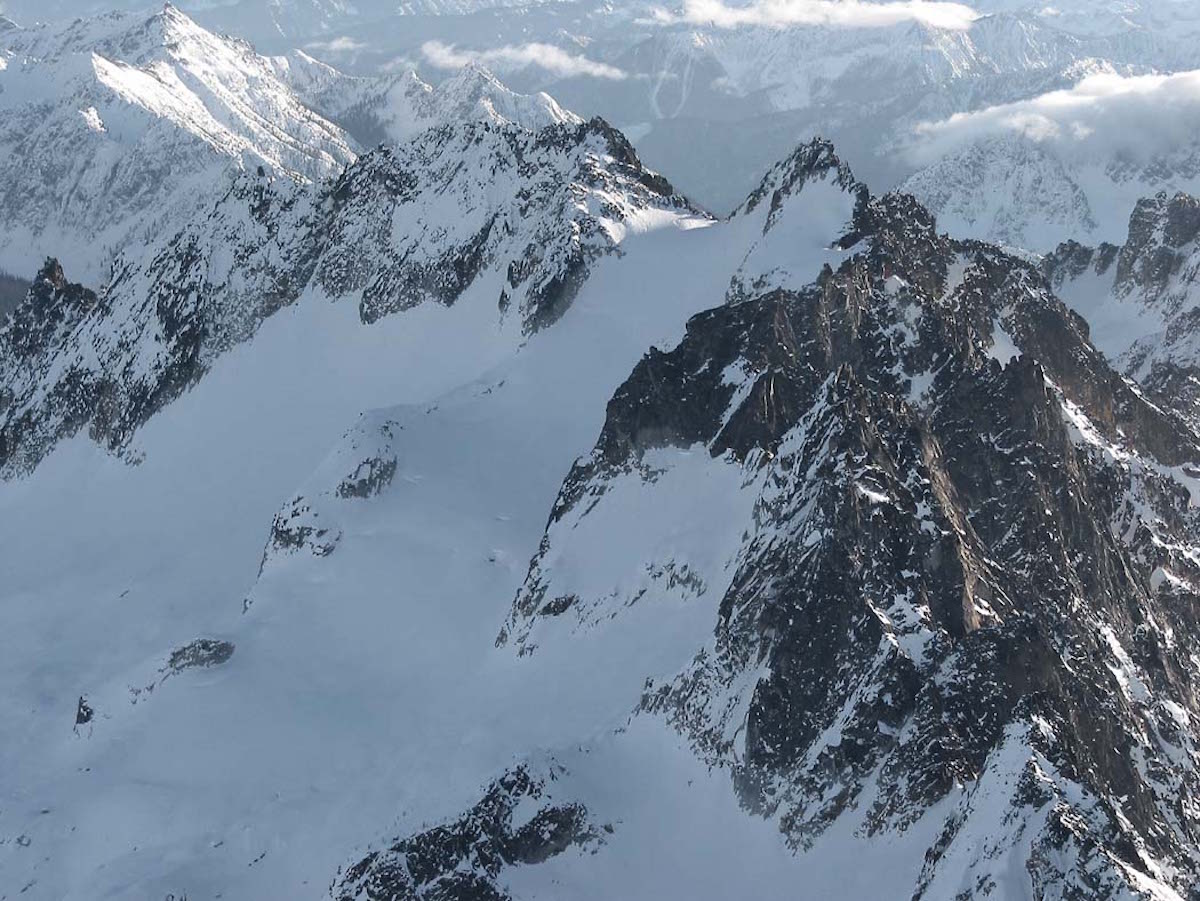
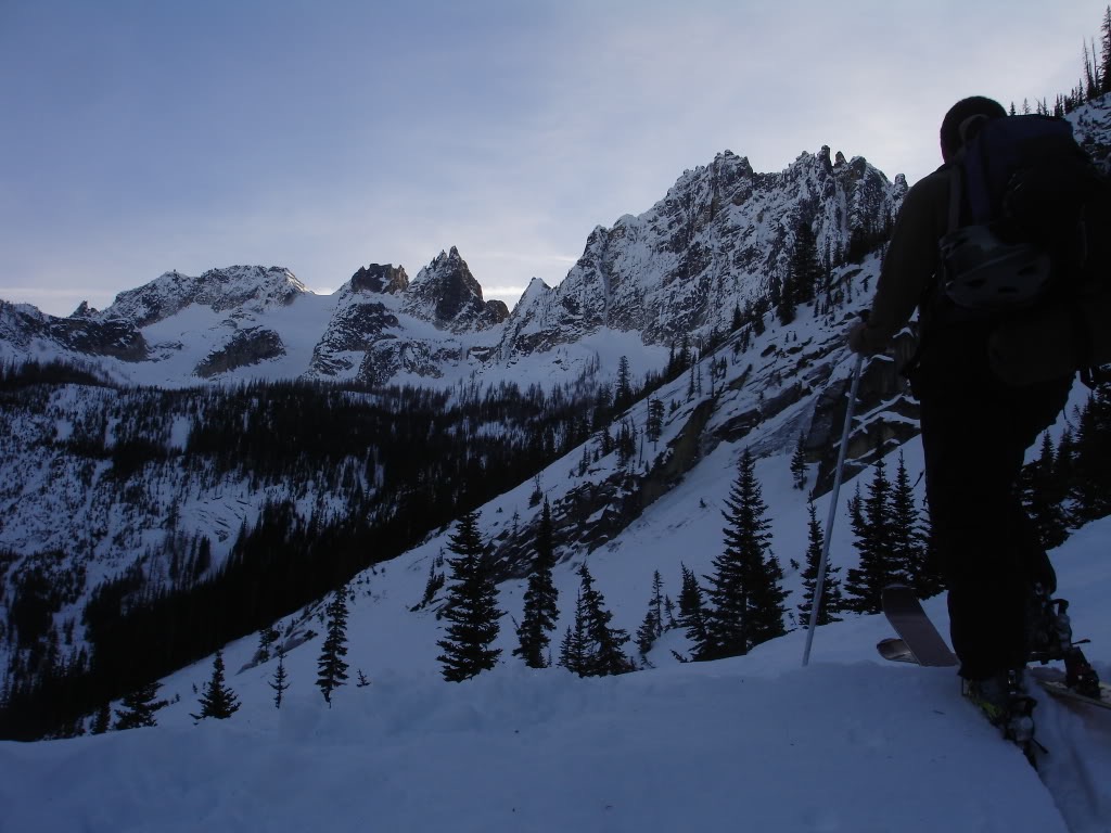
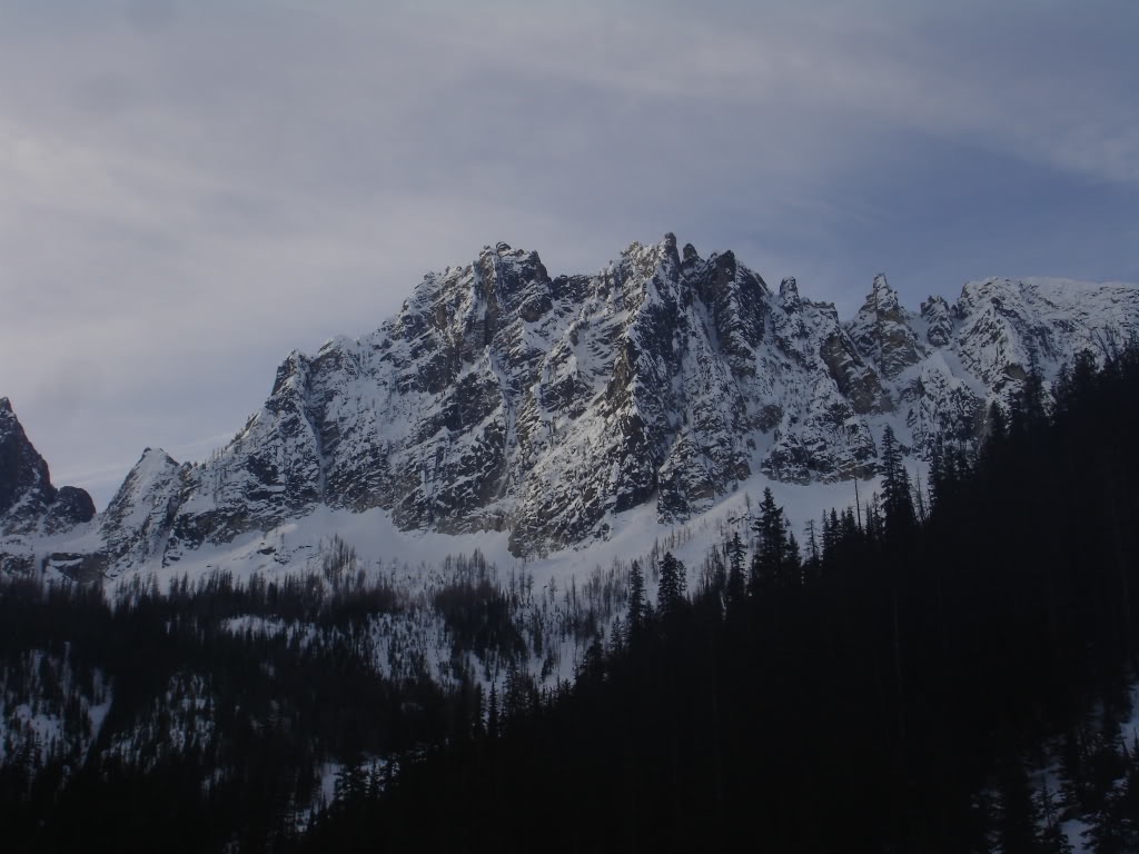
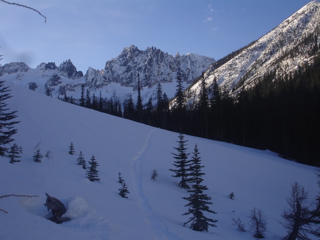
Soon enough we crossed a ridge and had our first view of Silver Star Mountain. Though we had been skinning for hours we were still a ways away. Looking towards the north facing glacier we knew that it had the best chance for powder. If we could break through the forest it was the place to get the best turns.
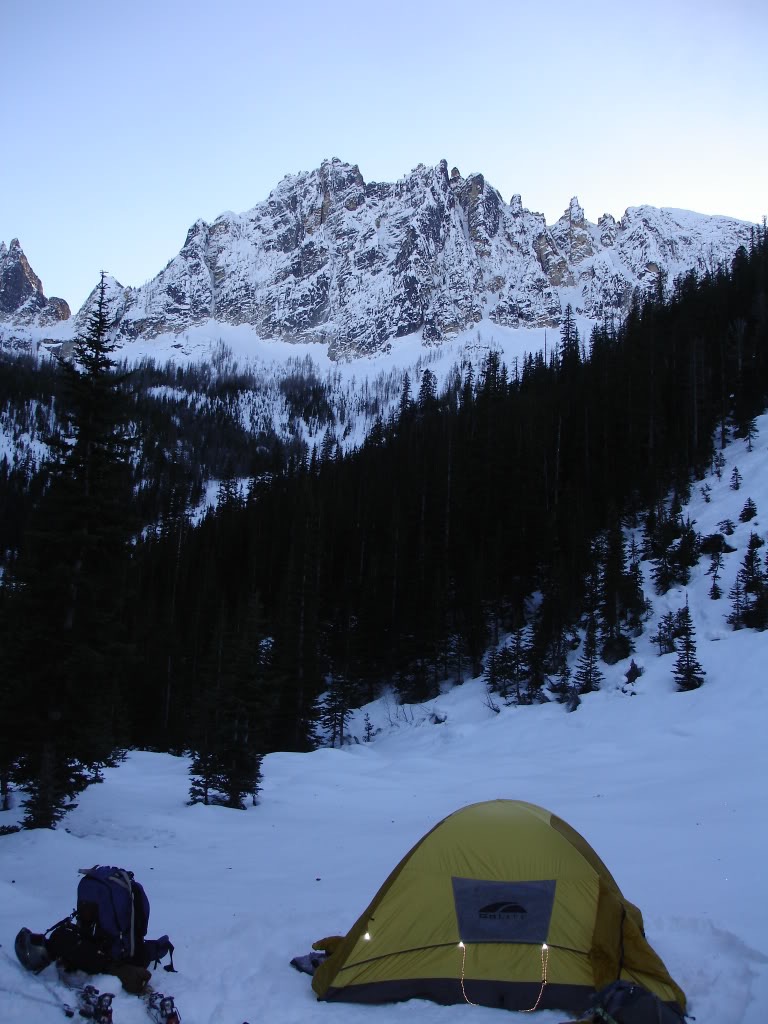
Setting up Camp at the Base of Silver Star Mountain
With the days being short it was time to set up camp. From where we were based we had a clean view of the eastern side of Vasiliki Ridge. We were still a ways away from our destination but light was fading fast. It was still December and the night was going to be cold. Before long we were in our sleeping bags and setting our alarm. We wanted to leave camp just after sunrise.
A Cold December Morning in the North Cascades
It was a brutal night as the temperatures dipped to single digits. An hour at a time we waited for the sun to rise and bask in its warmth. Soon enough it was light enough to start preparing for the day ahead. Watching the alpenglow on the surrounding peaks we started putting on our frozen gear. The plan was to take a run on Silver Star Mountain before driving home. With a short window of daylight we would have to make the most out of it.
After eating breakfast and drinking coffee we were moving. Though we had hoped the sun would come down to the valley we were wrong. We needed to get moving if we wanted to get in a run on the upper slopes of Silver Star Mountain. With frozen bodies we put on our skis and were making our way towards the alpine.
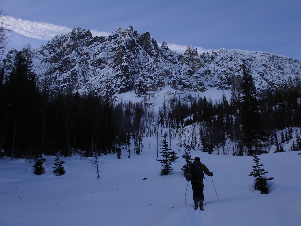
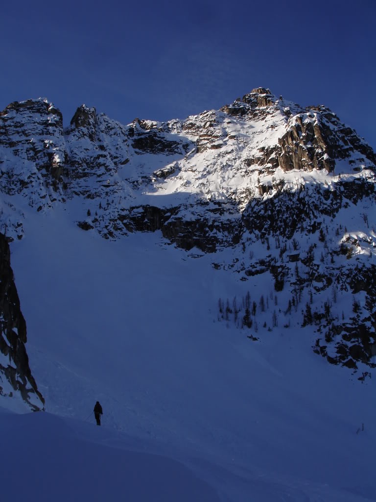
Finally we made our way out of the forests and could see our route above. We would have to skirt around the cliff faces but fortunately the terrain was straightforward. By now we had warmed up a bit but realized we wouldn’t get any sun. The terrain was just to steep and we were would soon be on north facing slopes.
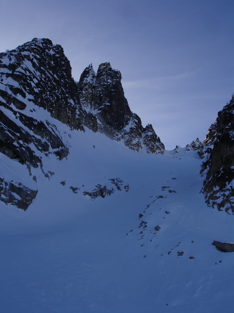
Arriving in the Alpine Of Silver Star Mountain
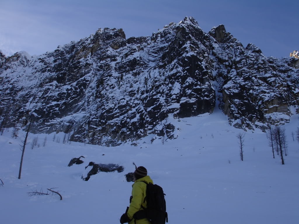
Heading towards the Silver Star Glacier we passed by some nice looking chutes. We kept a mental note of the terrain as it looked like a fun ski. If our plan A of finding powder of Silver Star Mountain didn’t work out we would head here. Being a bit more sheltered it could potentially hold good snow.
When we finally made our way to the head of the basin we were horrified by what we saw. It was wind scoured and had rocks exposed. Not only would it be a pain to climb but it would be horrible to ski down. We had worked for hours to make it towards the top of Silver Star Mountain and we needed to go with plan B. It was time to turn back and head for the couloir we had seen earlier.
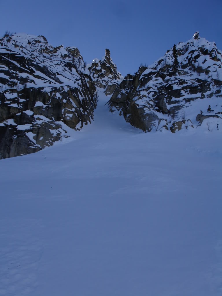
The Plan B Couloir
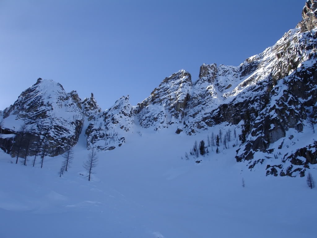
With a short traverse we made our way to the base of our line. Though there was a small bit of new snow down bottom we could still feel ice underneath. By now it was the heat of the day which didn’t mean much. We still had a few hours of light so at least we could get a run in exchange for all the effort.
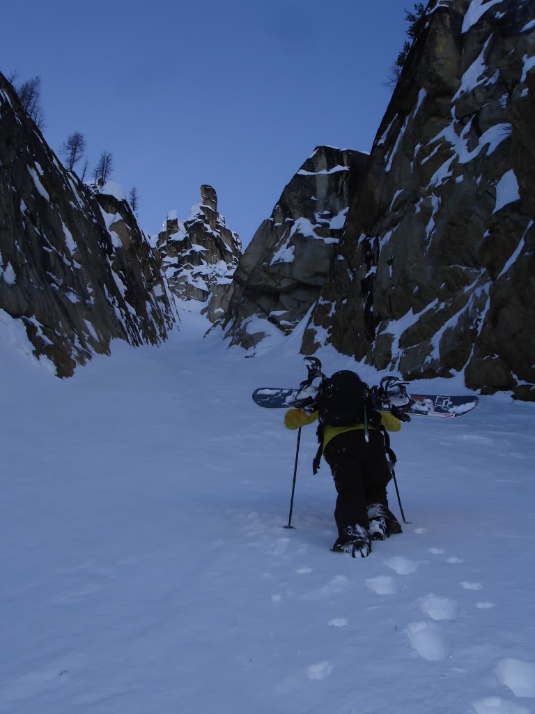
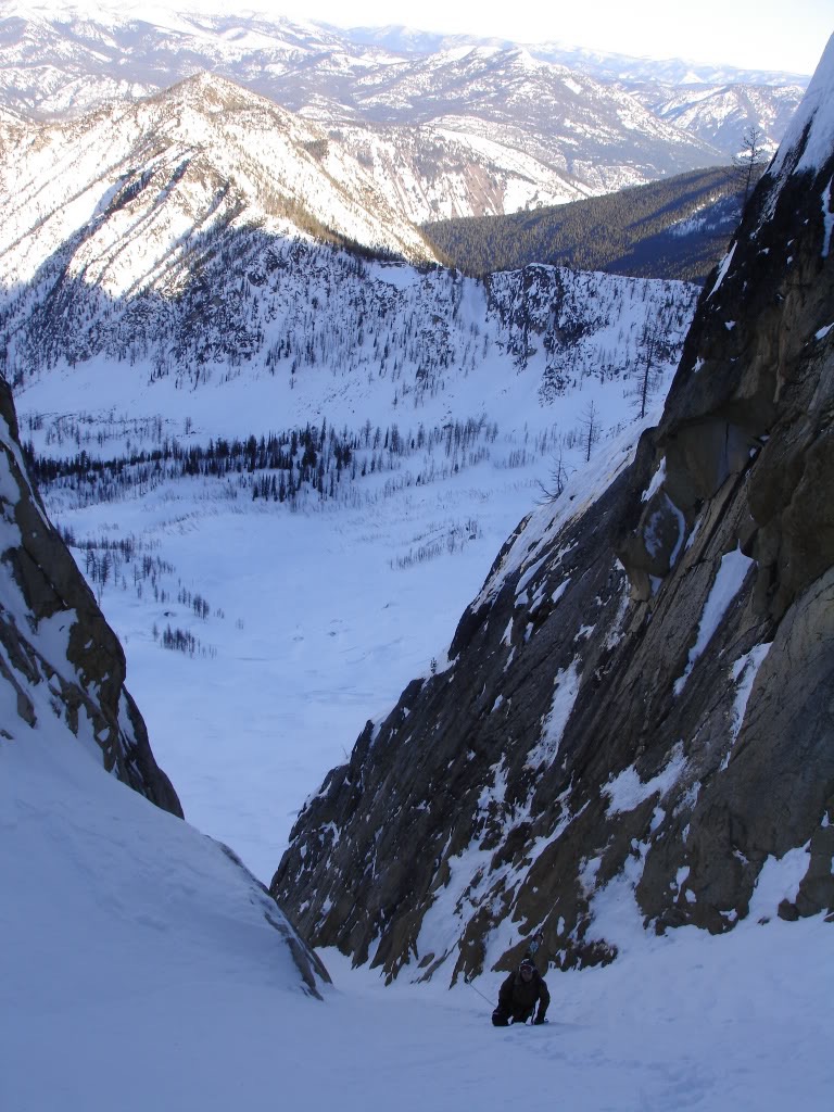
Looking up the couloir was both tight and steep. We weren’t sure how far it would go but we knew skinning wasn’t an option. It was time to switch over to climbing as we wouldn’t be able to skin it. Hopefully when we got higher we would find a route to the ridge.
Soon enough our boards were on our backs and we were kicking in steps. Immediately we found that there was a bit of wind packed snow. This both made it good for climbing and hopefully good for skiing. Though it wasn’t the line we had hoped for we were making the best our of conditions.
Pushing our way up we started having views of the Pasayten Wilderness. Our car was well over 10 miles away in the valley below. Beyond was and endless amount of peaks basking in the sun. Here we were brutally cold and in the only place that stayed in the shade all day.
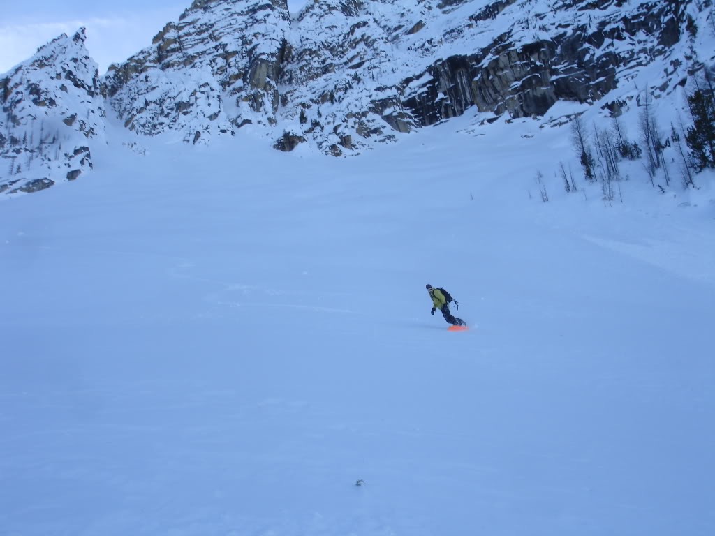
Snowboarding Down the Middle Finger Chute on Silver Star Mountain
Wrapping around the bend we found that the line didn’t go any further. Though it was nice it was only around 600 vertical feet before the open slopes below. Carefully we dug out spots to transition. Delicately I put my board on and we were ready to descend back to camp.
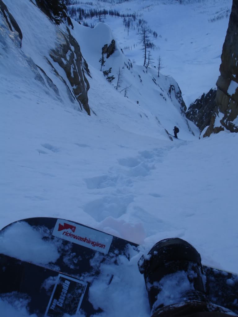
Dropping in the line was firm but edgeable. After a few steep turns we had made it around the dogleg. We had to be cautious of how deep we would dig in as below was a firm surface. While it was possibly the best turns in the area it was far from great.
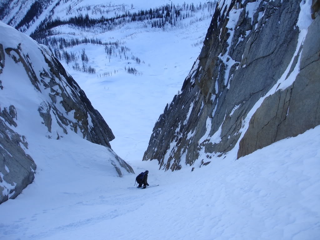
Before long we were taking turns on the apron below. Finally we weren’t constricted by space but all in all it was a fun line. We had made our way just below the ridge and had made the best out of a bad conditions.
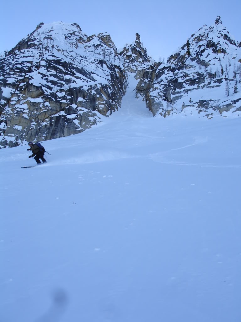
It was time to head back to camp as it was starting to get dark out. Working our way through the open slopes we followed our ascent route. Before long we were back at camp and coming up with our next plan. Though we thought the day was going to be short it turned out to be longer then we had expected.
We decided to camp another night not wanting to hiking in the dark. It was another long and cold night trying to sleep. Since it was early December we had 17 hours of darkness.
Day 3 Exiting Silver Star Creek
The next morning we broke down camp as fast as we could and started heading for the car. The coverage was still thin and the area was rather flat so I was forced to boot pack 90% of the way. Since Dan was on skis he was able to slowly skin down. After 90 minutes of making our way down Silver Star Creek and road we were back at the Car. Though the trip wasn’t as good as we hoped we had some great views of Silver Star Mountain. It was time for the 7 hour drive home.
Thank you for reading this trip report on Silver Star Mountain
If you want to see more ski tours within the the Highway 20 corridor check out this link.