The Tatoosh Traverse from Castle Peak to Lane Peak col was a trip the Boot and I had talked about for years. Wanting to ride down the south face of Castle Peak we had to wait for the perfect day to ride to Butler Creek in powder Conditions. Knowing that the sun would destroy the snow in minutes we patiently waited for the perfect storm. Finally the day arrived in early March and it was time to get out and do some riding.
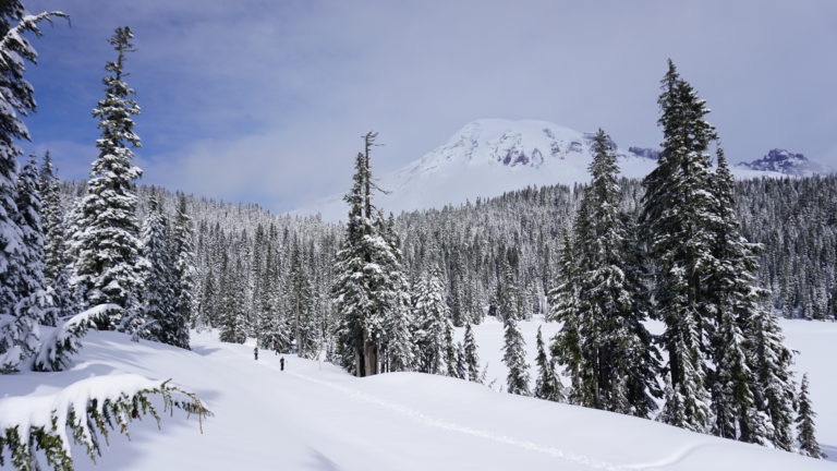
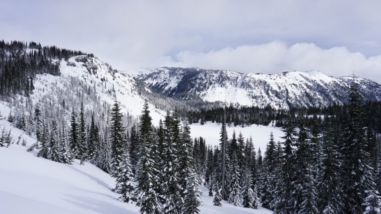
Breaking Trail up Stevens Canyon Road
It had been snowing for the past few days and was still calling for cloudy day at the tail end of the storm. We knew that this was the day we were looking for as the south facing slopes hadn’t been wrecked by the sun. With that in mind we drove up to the Narada falls parking lot and started skinning down the Stevens Canyon Road. In the background Rainier was sticking out as we were breaking trail with the trees covered in snow. Boot, Jason, John and I were excited that the conditions finally came together for the Tatoosh Traverse.
Putting the tracks up the road we saw that there was sun on the slopes. We were a bit concerned as we intended on riding down the south face of Castle Peak towards Butler Creek. Knowing it would only take an hour for the slopes to get cooked and ruin our chance for powder conditions.
Before long it was time to break off of the road and start heading into the Tatoosh Range. By now Mount Rainier had been swallowed by the clouds. This was one of those rare times that we were happy to see the weather turning for the worse.
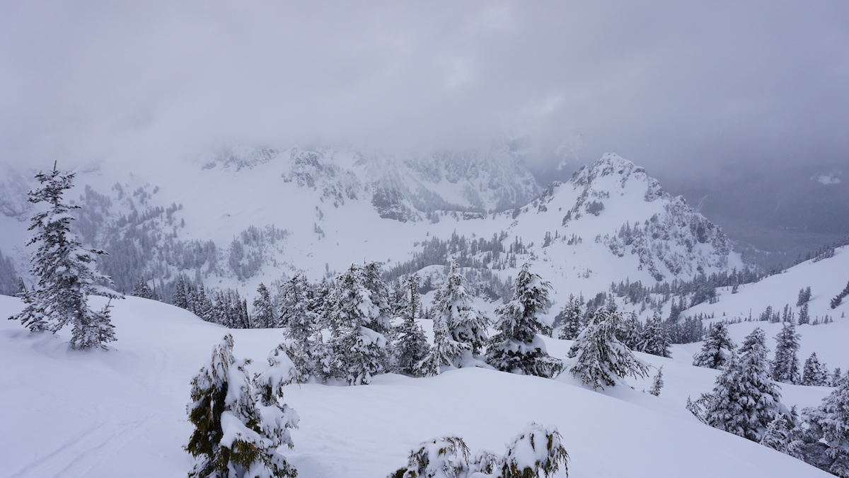
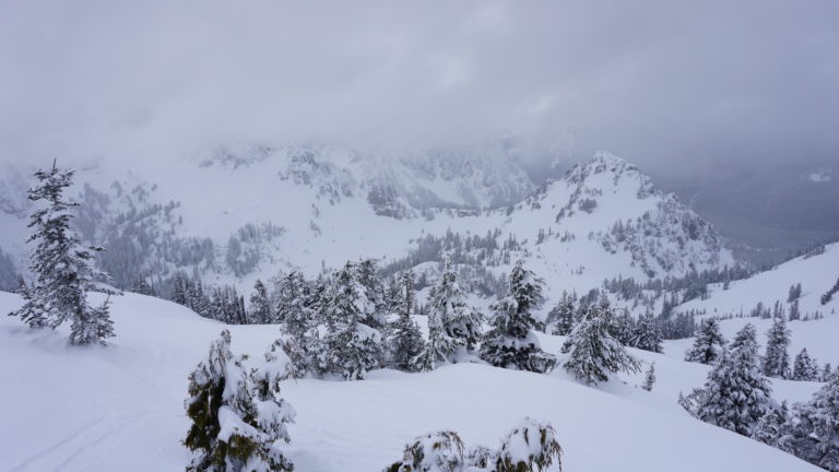
Heading into Sunbeam Basin and Starting the Tatoosh Traverse
After heading through the forests we finally arrived in Sunbeam Basin. We had rode this area numerous times in the past and considered if things turned for the worse we could just lap the terrain.
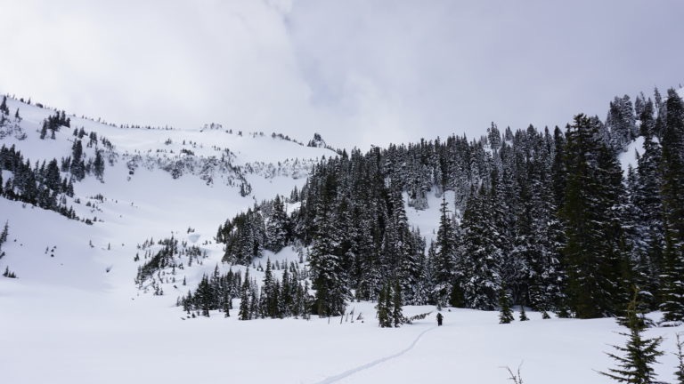
As we started putting the skin track we would occasionally stop to feel the snow. We would be in avalanche terrain and wanted to see if it felt unstable. We hadn’t seen any natural slide evidence but kept on edge as we started skinning towards Castle Peak.
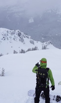
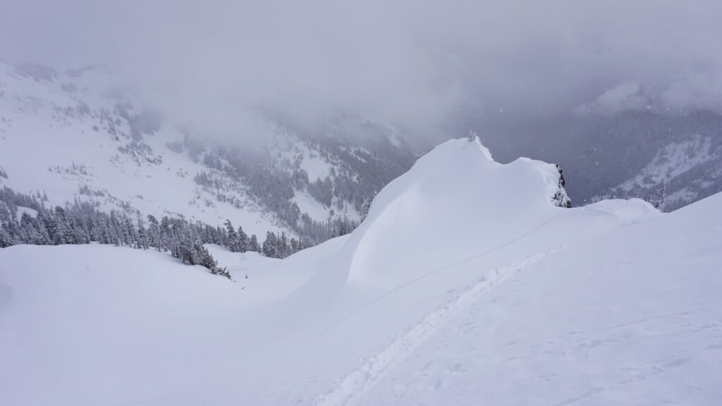
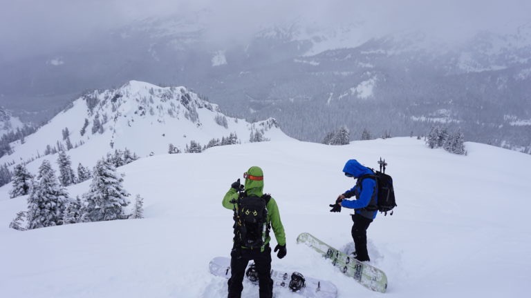
Working with the contours of the slope we soon found ourselves on the summit of Castle Peak. By now the cloud cover had gotten a little bit thicker. For the final switchback we had to go up the south side and the snow still felt good. If it was a sign of what was waiting for us in Butler Creek we were in for a great day.
Looking down into Butler Creek we could see that there was still snow on the trees down low. It was a good sign as it meant they hadn’t gotten cooked yet. While transitioning we talked over our route and potential descents. We were excited for our first run of the Tatoosh traverse.
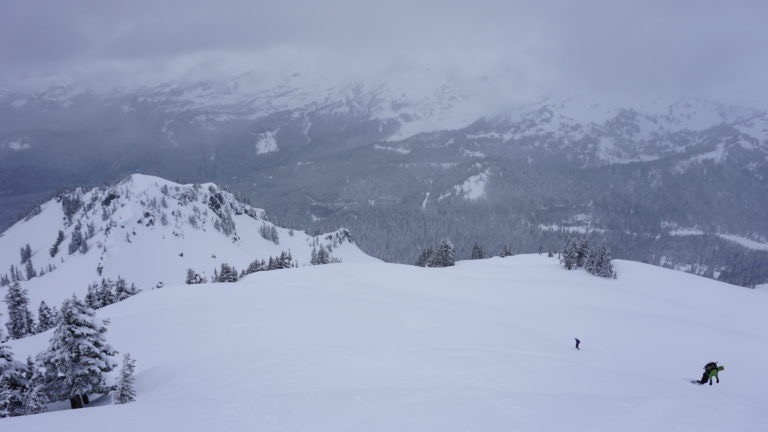
Our First Descent of the Trip Off Castle Peak
One at a time we dropped off the south side of Castle Peak before traversing to a safe spot.. The snow was as good as we could hope for being bottomless as we put in our tracks on a clean canvas.
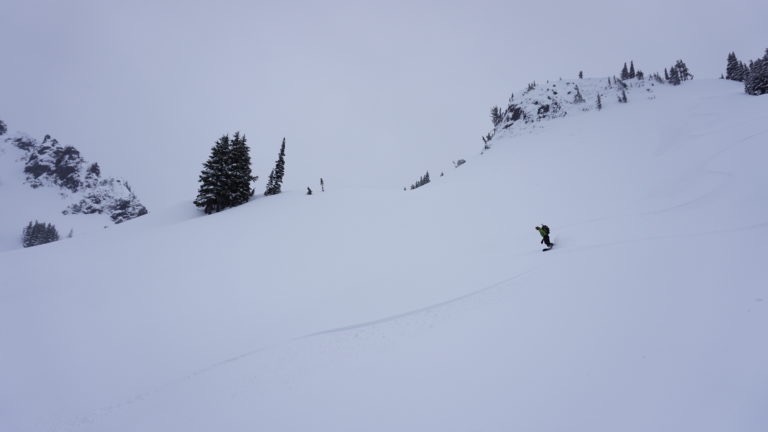
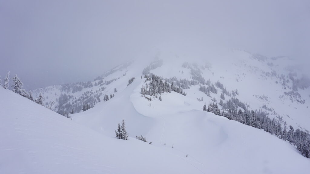
Before long we were riding down the main gully all the way down to Butler Creek. Since it was a more protected spot the snow was a bit more unconsolidated and blowing up with every turn.
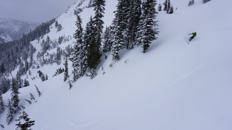
We made our way all the way down to the tree line at the bottom of the photo below before we regrouped. We had nailed the conditions and felt fortunate as these type of days are quite rare in the Cascades.
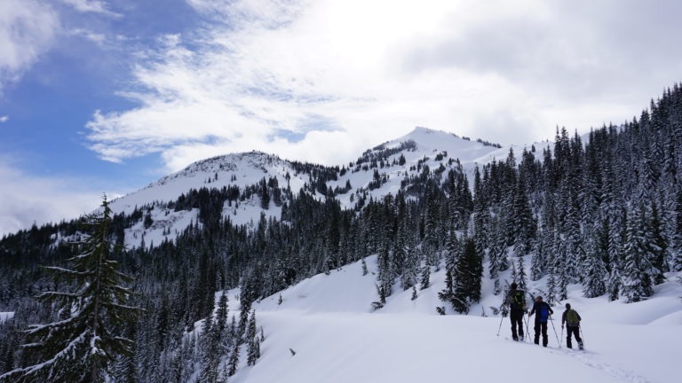
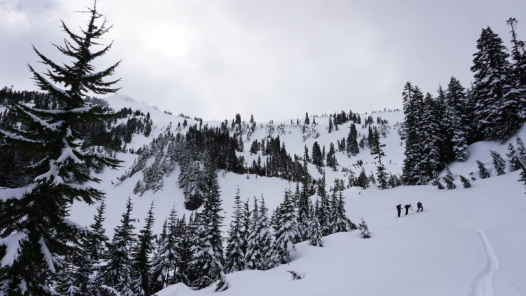
Skinning up Plumber Peak
It was time to skin up to our next peak of the Tatoosh traverse as we started climbing the southeast ridge of Plumber Peak. Knowing the main bowl was a huge avalanche slope we stuck to the trees as long as possible before one at a time skinning across to mellower slopes. Before long we were past the crux of the route and skinning up the final ridge to the summit of Plumber Peak.
Transitioning on the top of our run we were excited for what was in front of us. We would ride the the west bowl down to Cliff Lake before our final skin up to Lane Peak Col on its east side. We were already past the halfway point of the the trip and all that was left was two small skins. It was time to go for our second run of the day.
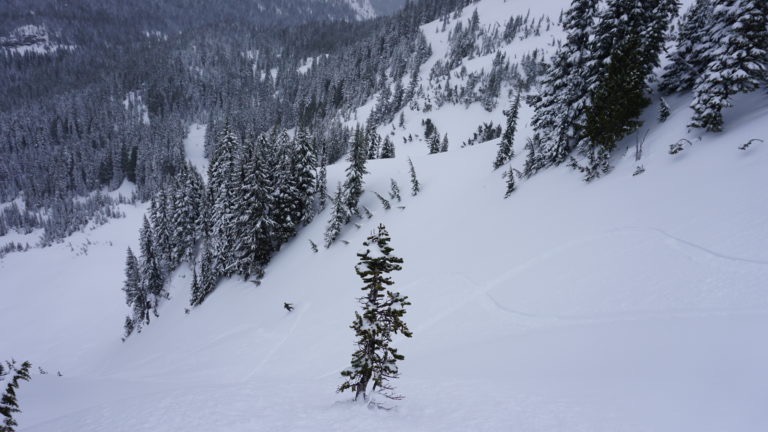
Riding down Plumber Peak was much mellower than our first run as we worked our way down. Though most of it was in sparsely treed slopes it was still in good conditions as we rode down to Cliff Lake before stopping.
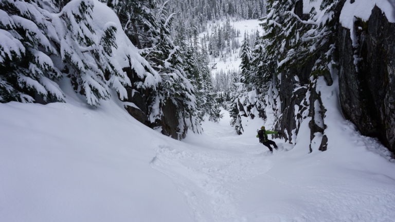
Our Final Run of the Tatoosh Traverse Down Lane Peak Col
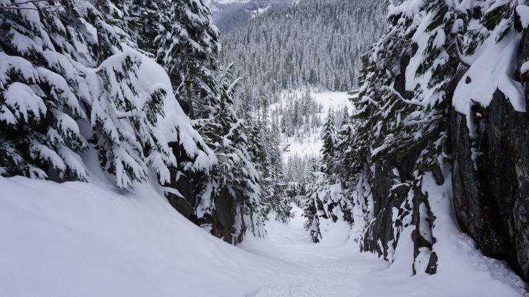
On the lake we switched back to skinning to climb up to the final col. It was a few hundred feet of breaking trail before we made our way to the exit chute. While it wasn’t the biggest line it was quite tight running down to Tatoosh creek.
Finally we were making our way down the final run of the Tatoosh Traverse to the flats below. Being that the run wasn’t that long we would ride it non stop making our way to the bottom. The snow was good up top but it got even better lower in the line in the spaced out trees.
We were super happy that the Tatoosh Traverse had gone so smooth as we broke trail back up to the Stevens Canyon Road. We had scored in both conditions an weather as if the clouds lowered we would have been in a white out. Making our way back to the Narada Falls Parking lot we rode the final few turns of powder down the switchback. It was a great way to end the trip with a few more faceshots. Back at the car we were happy to tick this trip off the list. It had taken years of patience but it had payed off in the end.
In Conclusion for the Tatoosh Traverse
It is a great day trip but you have to be very careful. The southeast bowl of Plumber Peak is a danger slope if avalanche conditions are questionable. Being that the initial run is south face to Butler Creek timing is everything. Like mentioned above we had to wait to pull this off for years. Not to say the conditions are rare but with the gate closure on Mount Rainier and so many other places to ride our time near Paradise Visitor Center was rare.
Thank you for reading this trip on the Tatoosh Traverse. If you want to see more ski tours within Mount Rainier Backcountry check out this link.