The Dakobed Traverse is a high alpine route from the Boulder Pass trail in Glacier Peak Wilderness to White Pass and the Pacific Crest Trail in Washington state. The trip starts off forest road 6400 and the White River Trailhead and can be coupled with Glacier Peak. Following the Dakobed Range it is one of the more scenic areas within the Cascades.
The Dakobed traverse had been a dream of mine for years and to end it off with Glacier Peak. Compared to other volcanoes this is by far the most isolated within the Cascade Range. For instance any approach to the mountain is a minimum of 30 miles compared to the parking lot on the lower slopes of Mount Rainier. Glacier Peak Wilderness is above all what I consider to have the most stunning scenery in all of Washington.
Dakobed Traverse to Glacier Peak
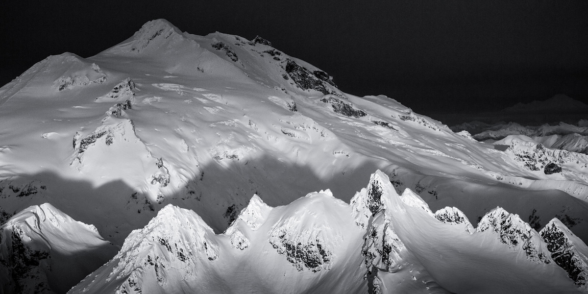
I had always looked at the Dakobeds (translated to mean Great Parent) in a sense of mystery. Studying the contour lines of the massive peaks hosting several glaciers lingering on the edge of granite cliffs. The Dakobed Traverse to Glacier Peak were to me as Mt Olympus and the Valhalla’s was to Jason Hummel. From the tiger striped gold tinted rock to the never ending crevasse filled glaciers. Glacier Peak Wilderness is easily one of the most amazing places I have ever set my eyes upon. We decided the perfect way to climb Glacier peak would be via the Dakobed Traverse.
Day 1 of the Dakobed Traverse Arriving into Glacier Peak Wilderness
We made a quick run through of the local Winco stacking up on food for seven days. From Crystal Light to Reese’s Pieces we wouldn’t make the same mistake we had on Mt Olympus. After a long drive across Stevens Pass and on to the eastern crest of the cascades. Soon we found ourselves at our starting point, the White River trailhead. We leisurely packed our bags being extra careful not to forget anything that could hinder the tour. What originally started as a few pesky mosquito’s soon evolved to an all out feeding frenzy..
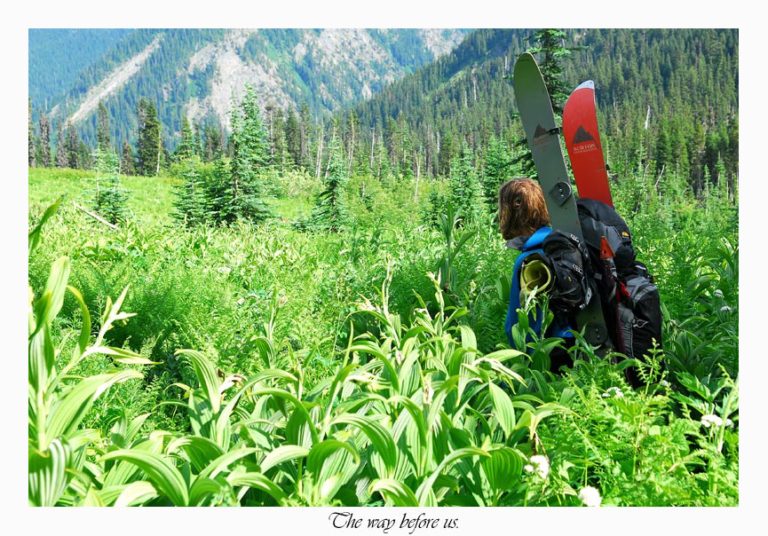
With our bags loaded with around 60 pounds of food, clothes and shelter our journey started at around 8p.m. Our plan was to knock off a few miles and hopefully deter a few mosquitoes along the way.
Starting the Dakobed Traverse at the White River Trailhead
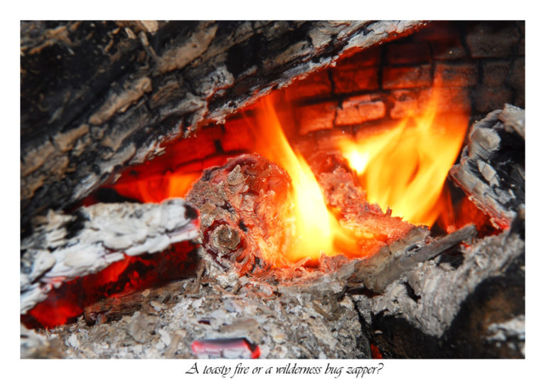
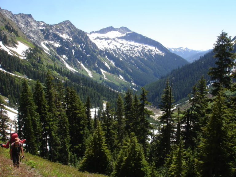
We pushed up the trail under a dusk sky passing lush vegetation and several unmaintained campsites. Finally we arrived at a camp below the trail junction to access Boulder Pass. We threw up the tent in a hurry for protection. Both the mosquito’s and us enjoyed a plethora of food as we sat by our hastily built fire.
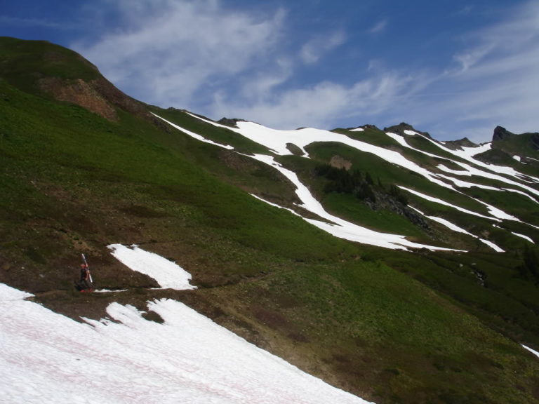
Day 2 Climbing into the Dakobed Range
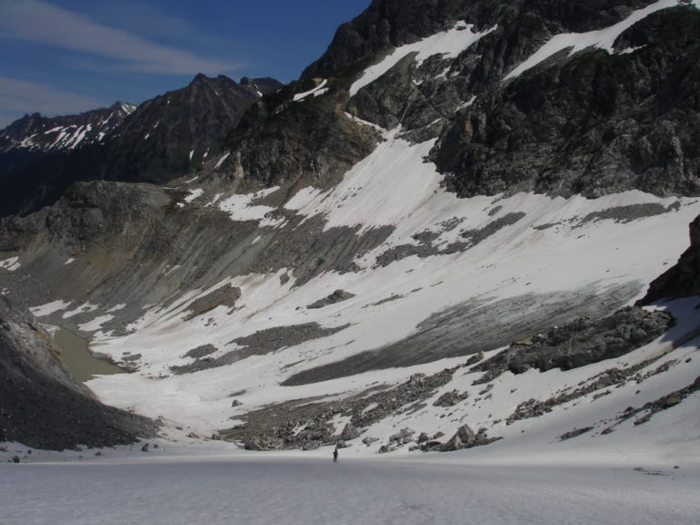
My feet were still swore and blistered from the nonstop climbing I had done the previous week. Using some duct tape I took a few minutes bandaging up my wounds for the climb. It was early in the morning as we started hiking through the endless switchbacks of shaded forest. Soon we arrived at the avalanche scoured alpine of Boulder Basin.
The Basin was amazing. Covered with steep green canyon walls and a stillness only broken by the overwhelming roar of Boulder Creek. Once arriving at the creek we were surprised to find that the water was raging. The late season snowmelt forced us to walk through the swift moving creek. We crossed the creek barefoot careful not to slip and fall into the shin deep icy cold water.
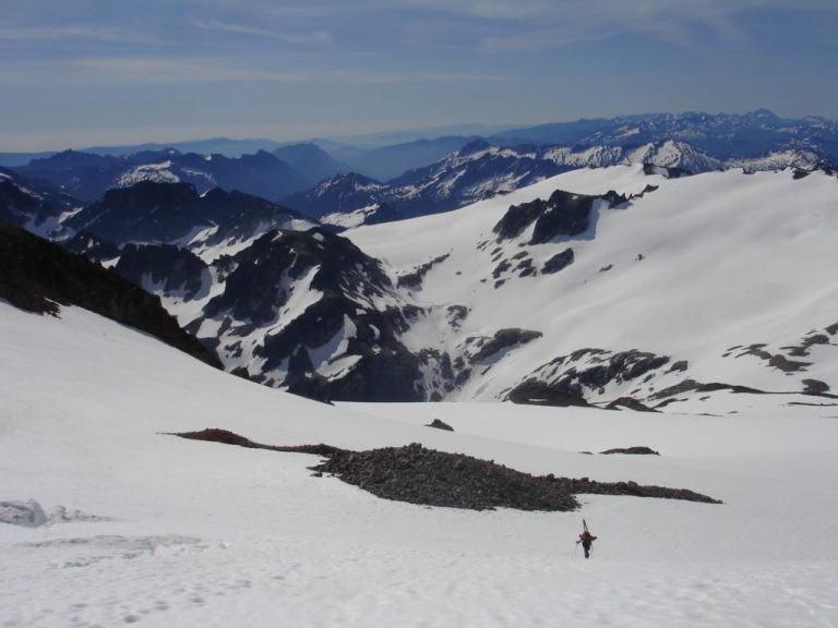
After quickly drying our feet we were back on the trail slowly gaining elevation under the scorching afternoon sun. Crossing several avalanche zones laden in debris, soon the trail disappeared under a foot of snowpack. It was not quite enough snow to skin but more then enough to slow down our progress. Finally we arrived up at Boulder Pass and the beginning of the Dakobed Traverse.
The Beginning of the Dakobed Traverse
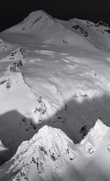
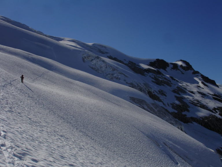
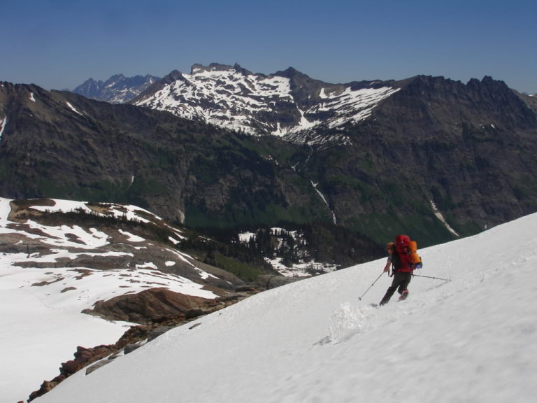
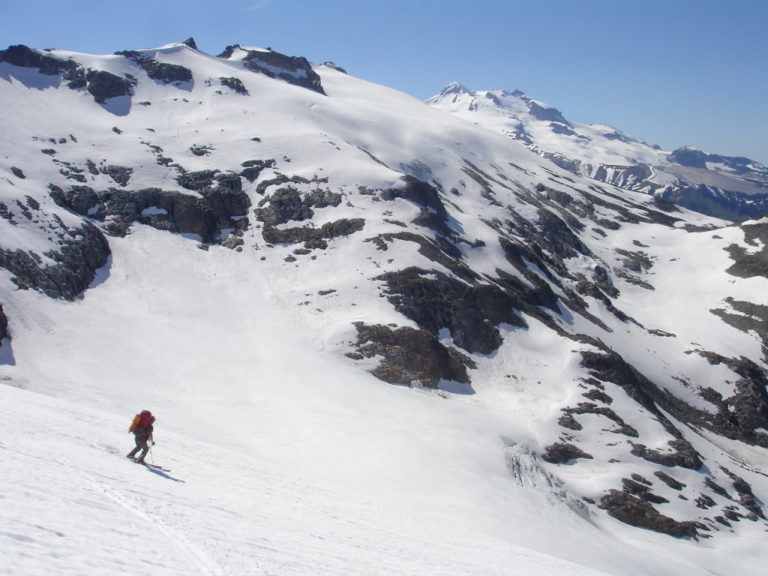
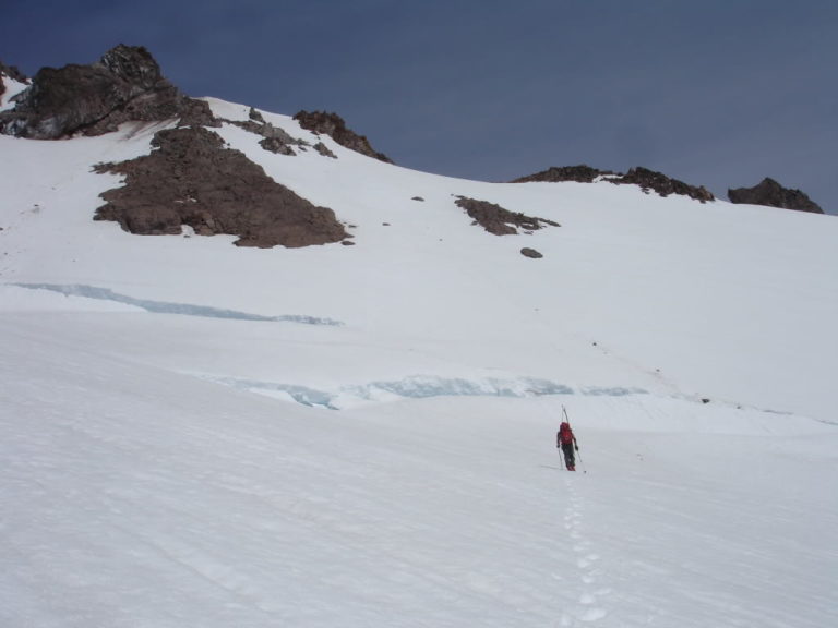
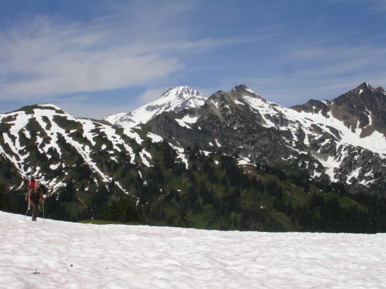
We switched our gear over from shorts and running shoes to ski pants and boots. Before long we were cramponing and started the Dakobed Traverse. Quickly we found ourselves standing on the first of many glaciers on the North face of Mount Clark. The view from the Walrus Glacier was breathtaking with a sea of frozen snow. Every few seconds we could hear them dropping like huge boulders thousands of feet down to the Napeequa valley.
We could see a faint track traversing through the maze of crevasses from across the ridge. Following them up the obvious route all while wondering if they were from a humans or animals.
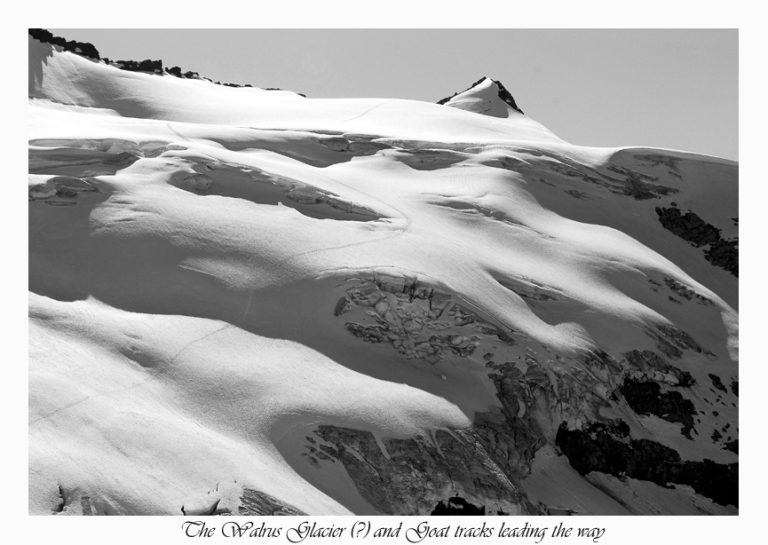
Heading up the Walrus Glacier
Heading up the Walrus glacier we weaved through crevasses and kept cramponing. The snow was too firm to skin and we were making fast progress. Racing the fleeting sunlight we knew it was about to get dark and we needed to find a camping spot.
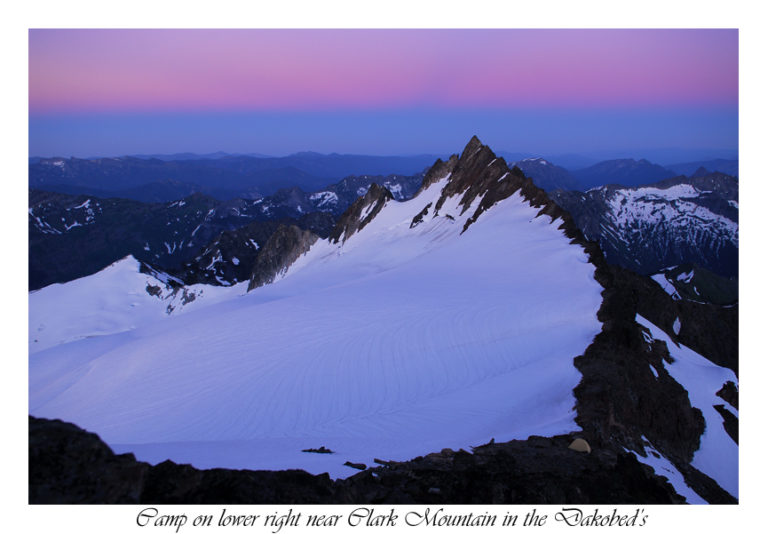
Reaching the upper Northeast ridge of Mount Clark we found a scenic and flat spot to pitch the tent. After getting our gear sorted we cooked our food and waiting for the light show.
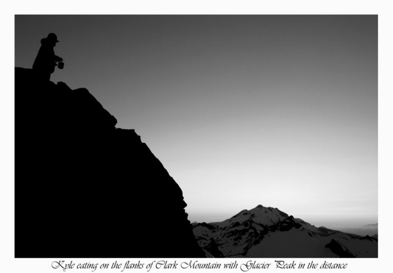
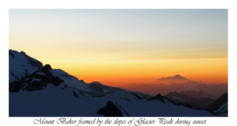
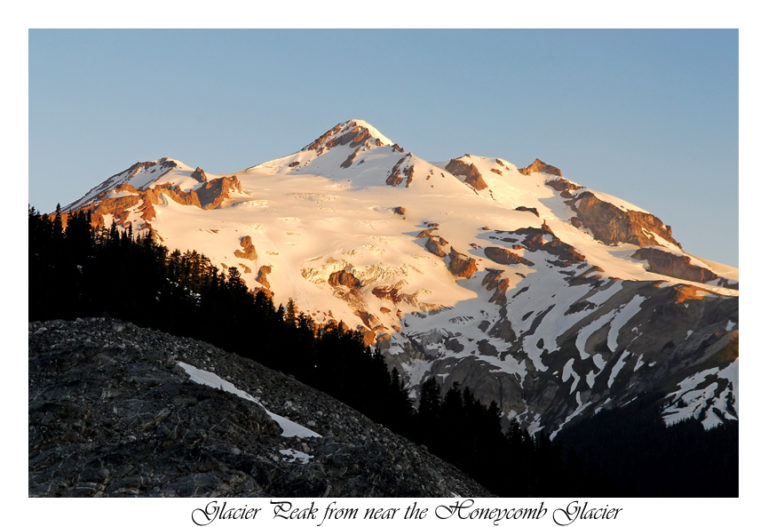
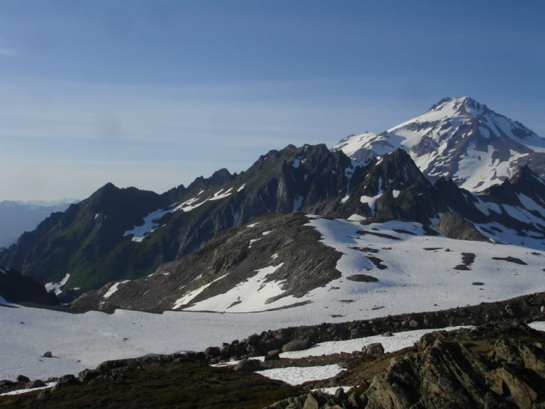
As the sun settled behind the horizon Mount Baker stood out in the distance. Looking in its direction it reminded me of riding the Squak Glacier earlier in the season.
As the light faded away the shadow line of the horizon started to take over to the east. We had traveled quite the distance and were happy to be done with the first day of the Dakobed Traverse.
Day 3 The Dakobed Traverse
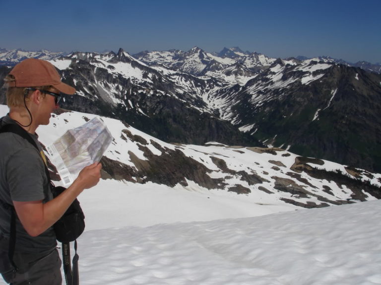
We woke up to the early morning sun beating down upon our high alpine platform. We overlooked the map multiple times as I boiled snow. That morning for breakfast consisting of oatmeal and Instant coffee, all while packing our gear. We had the ambitious goal of reaching Ten Peak Mountain by the end of the day.
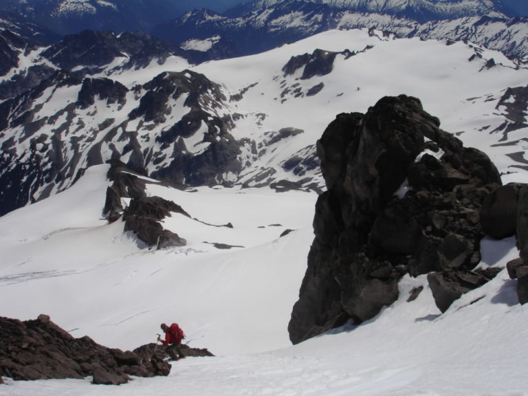
A Potentially scary situation
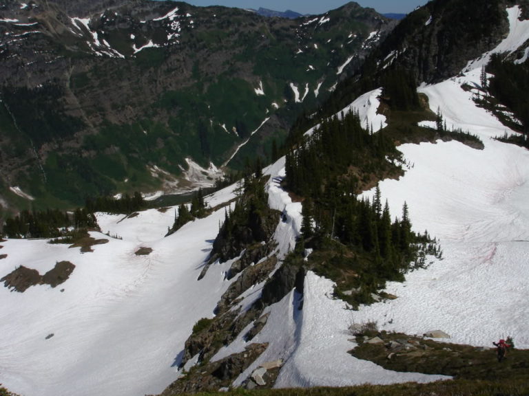
By 8 a.m. we were cramponing with Clark Mountains summit overhead and some nasty bergshrunds hundreds of feet below. I felt comfortable cramponing across the slopes carefully putting in steps on the sun softened snow. All of a sudden my foot slipped out. Sliding down the glacier I was gaining momentum and heading towards a gaping crevasse. Digging my Ice axe in I was able to self arrest coming to a stop at the top of a steep roller. I was well aware it was a close call as I up climbed collecting my gear along the way. It was the scariest part of the Dakobed Traverse.
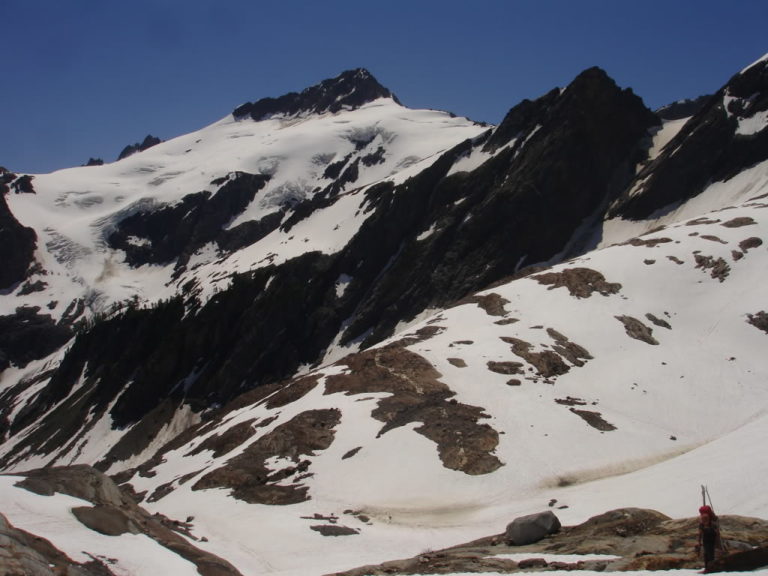
We had two options to access the Richardson Glacier. Our options were riding a serac riddled northern slope or ride a mellow south facing slope to a high col. From the high col it would get us onto the Richardson Glacier Headwall. We chose to head south skiing as Mount Rainier rose in the distance.
After a quick carry over we found ourselves looking down the Glacier and the lush green valleys below. Our route only allowed a few turns traversing west towards our next destination. 700 feet above us was a high col and the gateway to the Pilz Glacier. Switching back to crampons we traversed the moderately angled slopes being aware and cautious of the cliff band below. 45 minutes later we had reached our col.
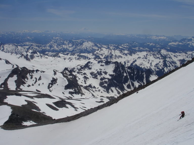
Snowboarding the Pilz Glacier on Luhna Peak
Here we were in the heart of the Dakobed Traverse. Looking upon the wide open slopes of the Pilz Glacier from near the summit of Luhna Peak. Finally we had reached an area where we could make some turns. We descended all 2000 feet of sun softened corn until arriving at the flat moraines at the base of the Glacier.
It was the heat of the day and we took advantage of the streams of snowmelt. We rested for a much need lunch break. After checking the map for awhile it became obvious we skied too far. Now we were 1500 foot below our intended col.
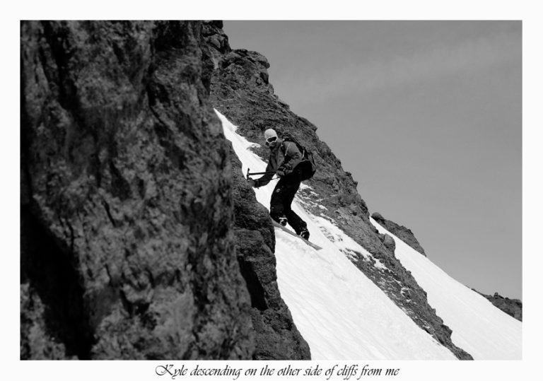
Jason decided to scope out another route and after deciding it was possible we traversed westerly. Soon we reached a rock ridge that stood between us and the Butterfly Glaciers. The steep slopes riddled in crevasses, seracs and cliffs. We were blocked by a cliff that varied in size as we climbed the ridge. Finally we reached a spot we felt comfortable down climbing.
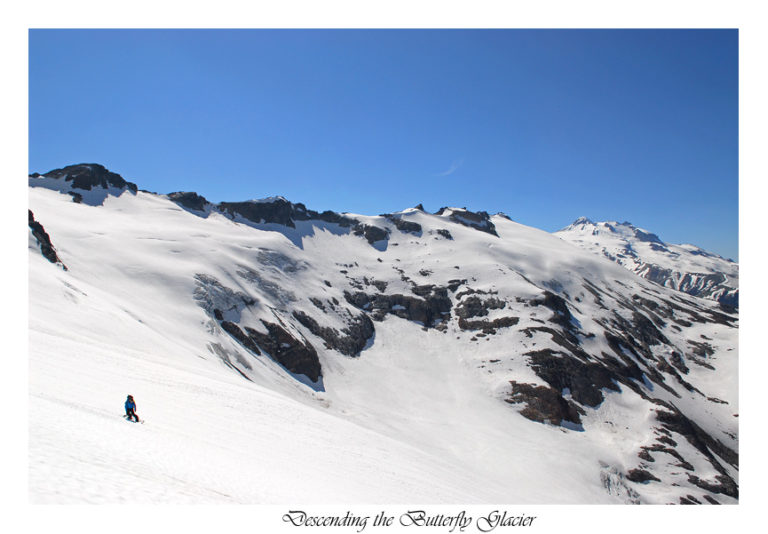
Descending the Butterfly Glacier
We looked upon the vast Butterfly Glacier noticing a possibly skiable route. Finally we were once again on a 2000 foot fall line ripping down the perfectly softened corn.
Jason skied down the steep slopes first yelling up navigating me through the maze of crevasses and bare glacial ice. After some tense moments we had reached the flat lower slope.
After a while it was obvious that the Dakobed Traverse was much more traversing then fall line skiing. I was becoming exhausted by all of the bootpacking cramponing across the east face. While Jason effortlessly slid towards our final col of the day.
After 30 minutes of kick stepping I reached the pass thirsty and exhausted while Jason sat resting and drinking. We were both in good spirit as we regrouped and down climbed to Butterfly Lake.
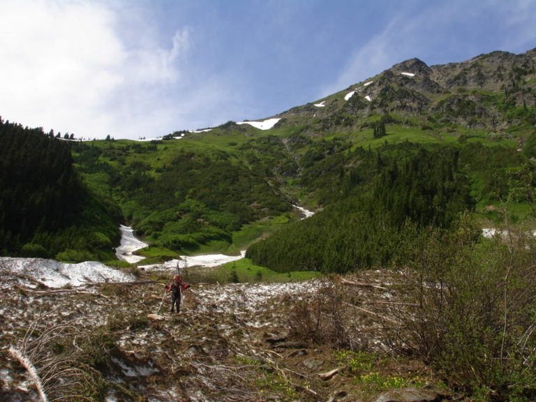
The Grueling Traverse of Ten Peak
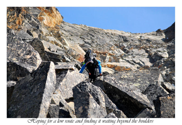
According to the topo we were about to embark on the hardest part of the day. It was a grueling mile and a half traverse across steep slopes. We were smashed between rock headwalls above and enormous cliffs below. We kept pushing forward knowing that once finished easier terrain would be abundant .
The terrain in front of us was a sample of everything. Dirt, rocks, multiple creeks and lush green vegetation with the occasional vain of snow slowed down our progress. Jason attempted to patch ski with multiple carryovers. I decided to stick to bootpacking keeping close to stable rocks embedded in the soft soil.
The Crux of the Dakobed Traverse
Before long we reached a steep snow covered creek that cut 20 foot walls into the rock. Below I could see a huge waterfall. By now I was frustrated with the never ending torment brought to us by the Dakobed Traverse. Soon enough Jason spotted a ramp that we could ski and would get us into the creek. I had spotted a potential ramp that would get us onto the other side. We were back in business.
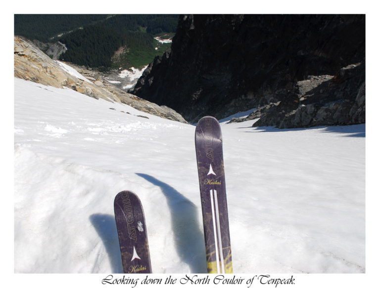
Soon the creek was roaring as we made turns within feet of the gaping holes exposing the raging current underneath. Carefully we made it to our ramp on the opposite side. By know we were in the shadows of the massive granite slab known as Ten Peak. I had always looked at Ten Peak with a sense of amazement from topographical maps. Finally after years staring at it with my own eyes. While my mind was stoked my body was exhausted as I slowly crossed snow patch after snow patch. Following the kick steps Jason put in and before long we reached our final decent of the day.
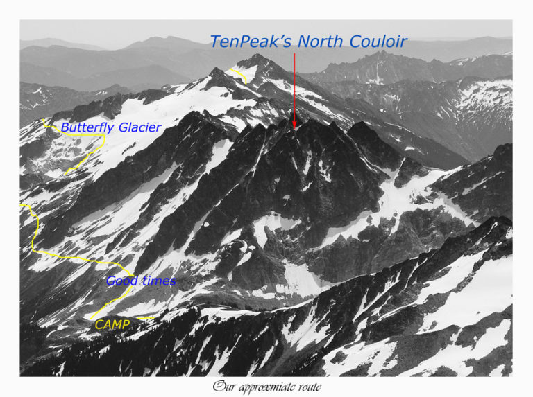
Final descent of the day and Dakobed Traverse
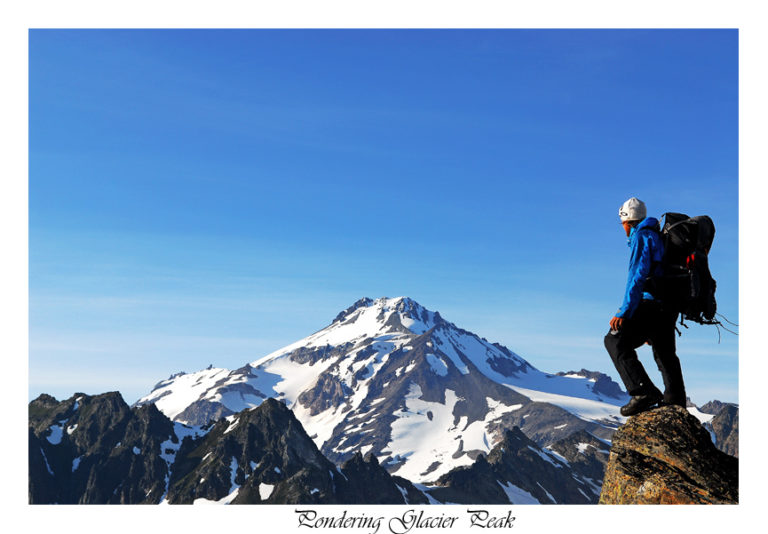
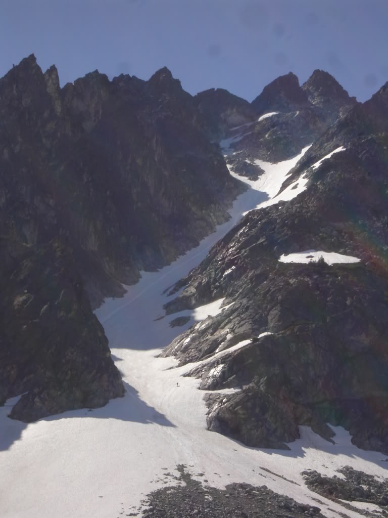
According to Jason’s map we were 500 feet above a tarn lake at the bottom of Ten Peaks NW couloir. With my last bit of energy I rode down the snowfield cautiously missing the rocks strewn all about. Soon we were at our destination for the day. At the lake I tossed my gear on the ground and traversed until reaching a camping spot. It was the perfect location with fresh water and an amazing view of Glacier Peak and the Chocolate Glacier.
After the excruciating traversing throughout the day I was more then happy to put up the tent. After that I and stuffed my face with some much needed calories. Before long I was in my sleeping bag as the final rays of sun illuminated on the North Cascades. We were out of the Dakobed Range.
Day 4 Leaving the Dakobed Range for Glacier Peak
I was awoken by the noise of Jason getting his gear together. He had woken up early in the morning to watch the sunrise alpenglow over Glacier Peak.
The day before we had both showed interest in skiing the massive aesthetic couloir on Ten Peak. It was hovering above us and he asked if I still wanted to do so. I felt the conditions were going to be sketchy as it hadn’t had the time to soften. Instead the best decision was to rest and let me boots dry while Jason went at it. I felt I had been pushing my luck a little bit too much recently.
I watched Jason ski down the slope somewhat jealous but more then that antsy to get moving. He had skied an amazing line back to camp.
After a few minutes of talking back and forth about the day’s route I walked over to my snowboard. An animal had eaten the rubber off my bindings high back, my poles handle and my duct tape. I was rather pissed and ready to get out of the Dakobed Traverse and on to Glacier Peak.
Heading for Glacier Peak
Finding what seemed to be an easy spot I climbed to the col first and started down climbing. What seemed to be nice boulders quickly turned into Glacier polished smooth rock. This wasn’t what I hoped for tossing my poles and carefully down climbed to moraine lake.
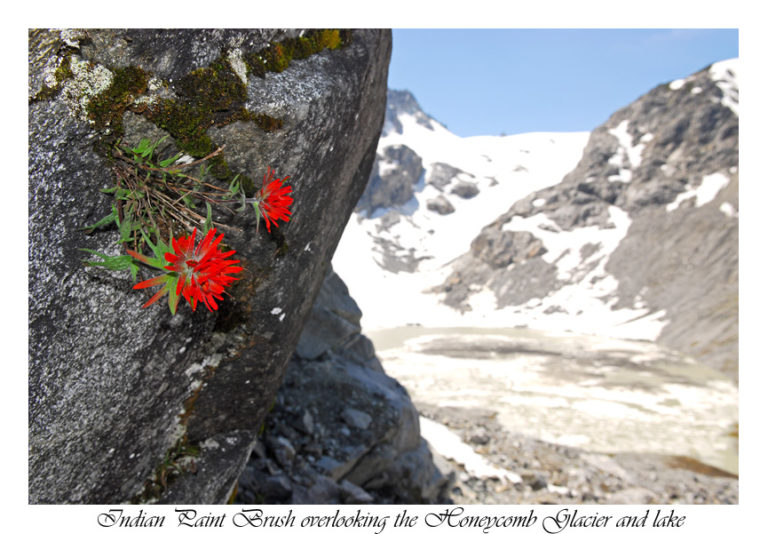
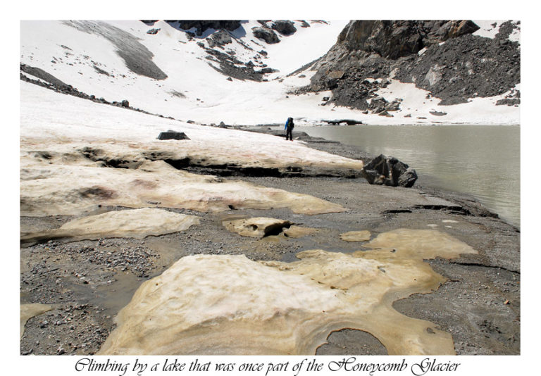
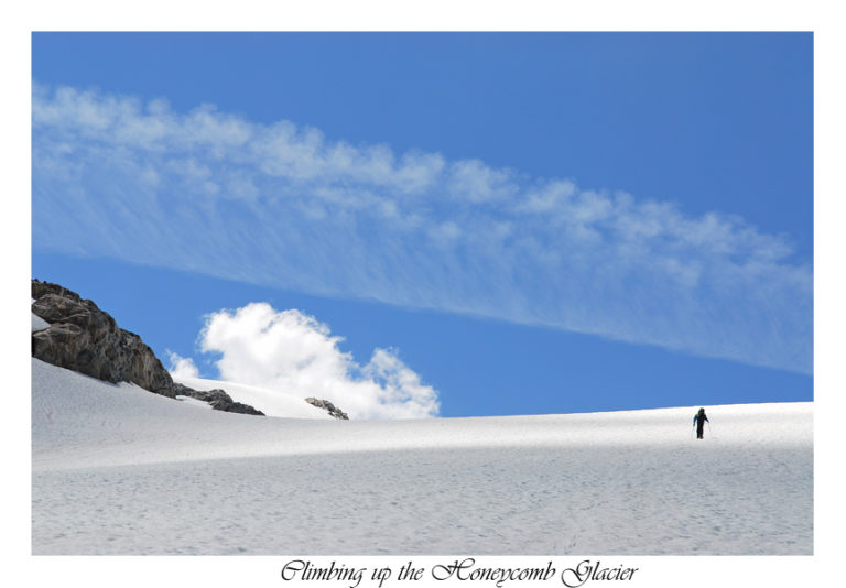
In the not so far distance we could see the low angled Honeycomb glacier as we wrapped around the lake. Switching to skinning we made our way over snow, mud and streams preparing to final skin towards Glacier Peak.
The weather was endless blue sky with the occasional cloud. We enjoyed a nice breeze as we skinned up the mellow Honeycomb glacier taking in the views.
We skinned up the Glacier at a fast pace covering as much terrain as the day before within hours.
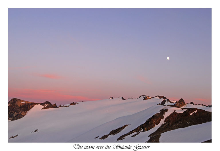
Before long we were skinning on the mellow slopes of the Suiattle glacier. Slowly uphill traversing we were within an hour I was putting up our tent. Finally we were at our destination was the dirt covered ridge of disappointment Peak.
An Afternoon resting on Disappointment Ridge
It was still somewhat early in the day so we rested under the warm afternoon sun. Here was our chance to dry our boots and loading up on calories. All of the traversing and skinning in wet boots had taken its toll on Jason’s feet. Soon it was time for a much needed rest.
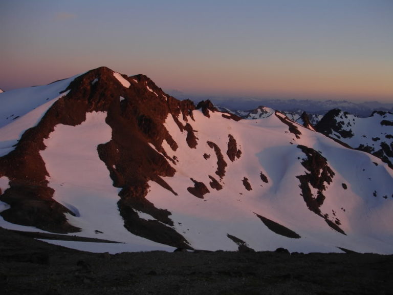
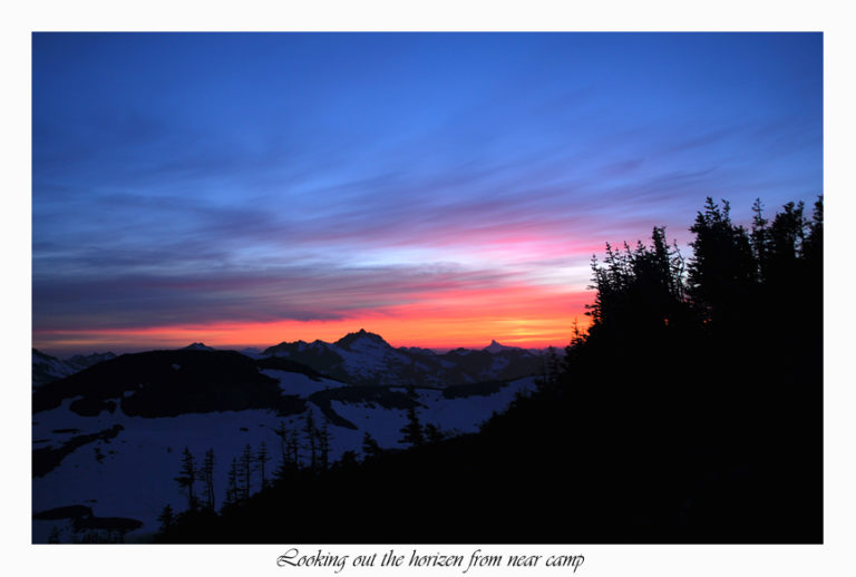
From our vantage point we were looking out among the vast landscape of the Central Cascades. Soon the sky started to brighten from the sunset over the horizon. The Suiattle Glacier was a vibrant red from the Alpenglow.
Our route for the next day was still somewhat up in the air between a few different options. We discussed the possible route and decided to based it on the conditions the following day. That night we went to bed stoked that we would be on the summit of Glacier Peak the following day.
Day 5 Climbing Glacier Peak
We hadn’t seen anyone for 4 days so I was surprised when I heard people hiking by our tent. I jumped up seeing two people heading for the ridge around 7 a.m. We didn’t have access to water so we decided to melt and eat breakfast before leaving.
We started off the day in running shoes hiking up Disappointment ridge before getting onto the Suiattle Glacier. Traversing towards a prominent rock surrounded by ice found a small stream cascading of the rock walls. We forced down as much water as possible before I switched to skinning. Jason stuck with running shoes until the slope got steeper.
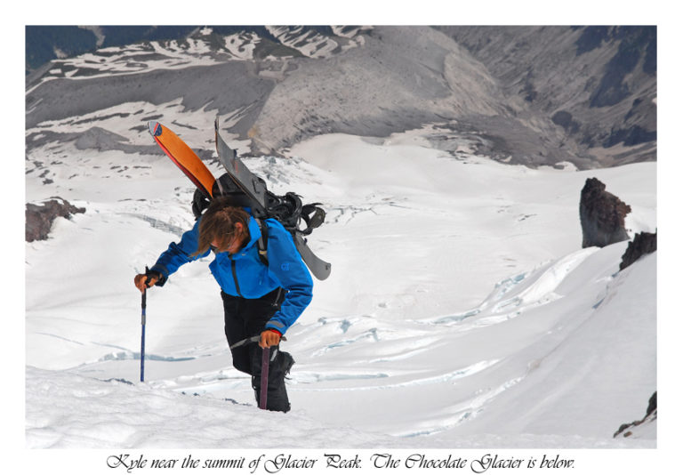
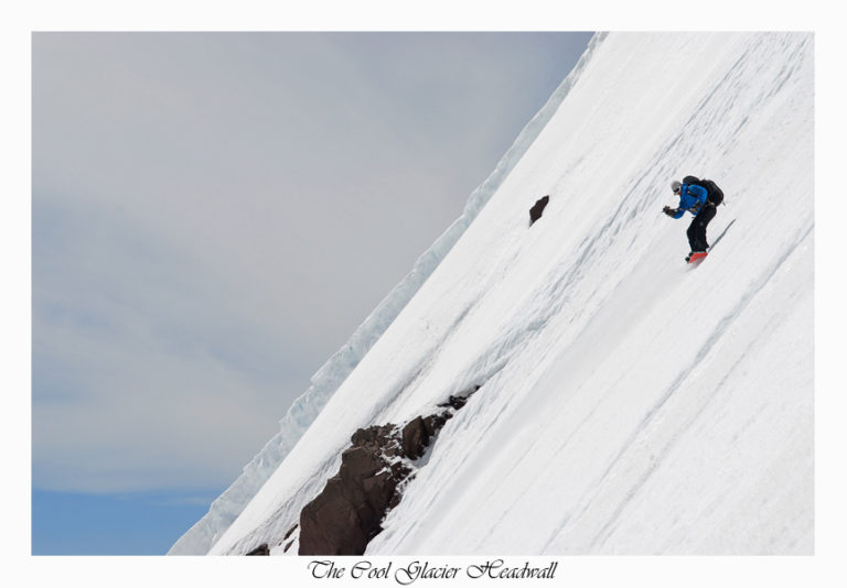
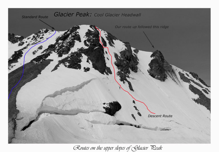
My big thing was that I didn’t want to climb the route that I had done the year prior. We decided instead of taking the standard route to head directly up the Cool Glacier headwall. Soon we both switched over to cramponing in our ski and snowboard boots and started heading towards the steep face. We traversed around some deep crevasses and soon were at the base of our climb.
Climbing the Cool Glacier Headwall
We took out our Ice axes and started kick steeping up the face with Jason leading the way. After 45 minutes we were on a high ridge that separated the Chocolate and Cool Glaciers. The ridge was exposed on both sides with a minimum of a 1000 foot drop. Soon the ridge connected with the Chocolate Glacier headwall. The headwall had some massive shrunds on it that crossed the entire face but luckily they were small enough to cross. After a few quick hops we were standing on summit proper.
Out of every volcano I have ever been on top of Glacier Peak by far has the most outstanding view. We were amazed by the distance we traveled on the Dakobed Traverse. From the Glacier carved massive peaks to a view of all the Volcanoes in the Washington Cascades. This was one of the best views around.
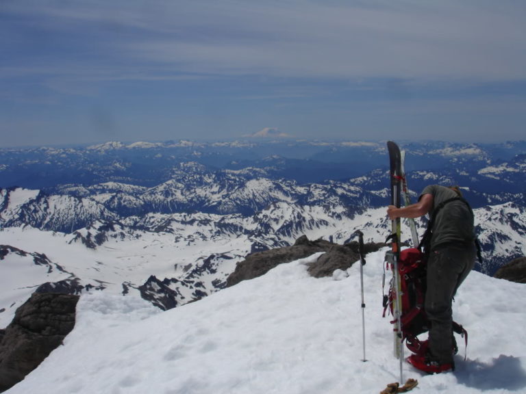
We slowly put our downhill gear together and discussed all of the different possibilities that were in front of us. The original plan was to ski the Chocolate Glacier. Once on top we decided the sustained fall line of the Cool Glacier Headwall looked better. We had seen it earlier in the day and knew it was going to be steep but fun. It would be the most direct line back to base camp.
Snowboarding off the Summit of Glacier Peak
Jason scouted the line first taking a few turns before giving me the green light to drop in.
The snow had softened quite dramatically in the early afternoon sun. We took extra cautiously we rode down making sure not to cause any wet slides on each other. We carefully turned down the steep 55 degree face with an exposed cliff band right below us. Riding with Ice axe in hand I carefully made my way to the open face.
We carefully made turns down the face until the slope mellowed out and we felt more comfortable ripping down. Once we finally arrived onto the lower flanks of the Cool Glacier our blood was pumping. We were excited looking up at the 1500 foot sustained 55 degree slope with our tracks.
We decided to take advantage of good fall line skiing instead of the long traverse of the Suiattle Route. Climbing an additional 500 feet to the summit of Disappointment peak we were ready for the next run.
Riding Down Disappointment Peak
The face was steep but nothing compared to what had just been skied. With a bit of confidence we opened up with perfect arc turns. The snow was great as the slope mellowed out. Soon enough we were riding the low angled glacier directly back to camp.
At camp we packed our bags and started heading towards the White Chuck Glacier. This would spare us a few miles of hiking the next day. Skinning across the flats of the remaining Glacier soon we arrived at a spot I had camped at the year prior. It had an amazing panoramic view, dry ground and running water which were all the qualifications we needed.
Soon we were watching the sunset over Mt Baker and the mountains around Darrington. Since the next day was going to be a long hike out rest was needed.
Day 6 Exiting the Dakobed Traverse
We slept in until around 9 a.m. By now the heat was too unbearable to stay asleep and we planning to exit that day. The question was would we would leave via the White River trail or Indian Creek. We had spoken with a trail maintenance guy who said they were clearing out the Indian creek trail. This would be the most efficient way.
We packed our gear for the exit of the Dakobed Traverse. From camp we skied the flat slopes of the white chuck until arriving below White Mountain. We climbed up the well beaten in path without the use of crampons until standing on the high ridge. After down climbing a few hundred feet on dirt and grass we were on the PCT.
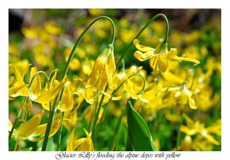
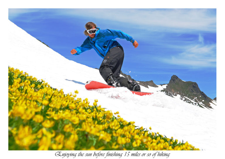
The wildflowers were in full bloom with vibrant whites and yellows as we arrived at White Pass. I was easily persuaded to take a few turns on a patch of snow next to the flowers.
Hiking Out From White Pass
We rested for awhile and talked to another hiker about the trail conditions. The person confirmed our beliefs that the Indian Creek trail would be far more efficient. Soon we were taking a quick break and switching to running shoes and back on the PCT.
The trail still had a lot of snow cover around the Pass but it slowly dwindled as we lost elevation.
Indian Pass Trail Exit
By the time we reached Indian Pass the trail was completely snow free. Travel was easy other then the occasional avalanche path. As we hiked down the valley the vegetation changed dramatically from huge trees to dense vegetation. Then back to huge trees, this area had it all.
The miles went by fast as we kept a consistent pace. We knew that we had around 10 miles until we arrived at the car. The lower in elevation we got the worse the mosquito’s, soon becoming a huge mass swarming over our heads.
Things went smoothly until my foot became submerged in a creek. Slipping on a rock my right foot was now soaking wet. After that I was motivated to get back to the car as fast at possible. What I thought was the final 2 miles turned out to be 5 miles as the trail kept going. Finally in the distance was the car as the sun was setting.
We had planned on camping but with mosquito’s and bad weather the next day it wasn’t worth it. Quickly we threw our gear in the car and were heading home. Finally we had finished the Dakobed Traverse and had a bonus summit of Glacier Peak.
In Conclusion
The Dakobed Traverse was a brutal tour but it is an amazing place to visit atleast one time. With well over 60 miles of trees, alpine, Glacier and rock traveling it was truly a mixture of everything. This one was my favorite and some of the best scenery in the Cascades. Thank you for checking out my trip reports and I hope you have enjoyed my journey.
For a much better written version of the Dakobed Traverse to Glacier Peak check out Jasons Trip Report
and his other site for exclusive photos not featured in this trip report
Thank you for reading and If you enjoyed reading this and want to see more ski tours within the Stevens Pass and Highway 2 area check out this link