Sauk River to Highway 2 was connecting the lines in the Washington Cascades between the 14 Lakes Traverse to the Suiattle Traverse. Starting on the Mountain Loop Highway we would loosely follow the Pacific Crest Trail for 6 days and over 50 miles. After starting on the North Fork of the Sauk River we would head southeast through the Poet Range. Then halfway through the trip we would descend west to the Little Wenatchee River before following the Pacific Crest Trail to Stevens Pass. With the traverses being almost a week long it was all about the right weather window. Fortunately that came in early May and it was time to attempt it.
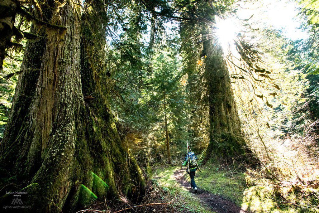
There’s something special about the North Fork of the Sauk River. It is one of the last remaining old growth forests in Washington state with trees over 10 feet in width. After 5 times walking through the jungles of the valley heading in a northerly direction towards Glacier Peak this time we would be going south. We were going to get 4 days of sunshine but the problem was that it would be a 6 day trip.
Sauk River to Highway 2 Day 1 Up to White Pass
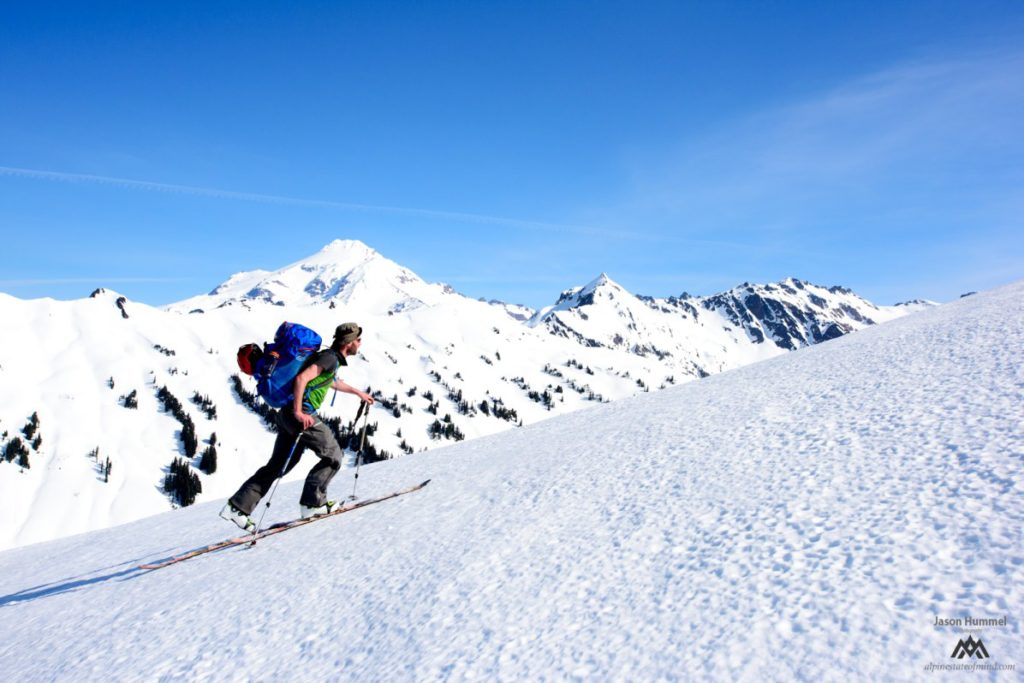
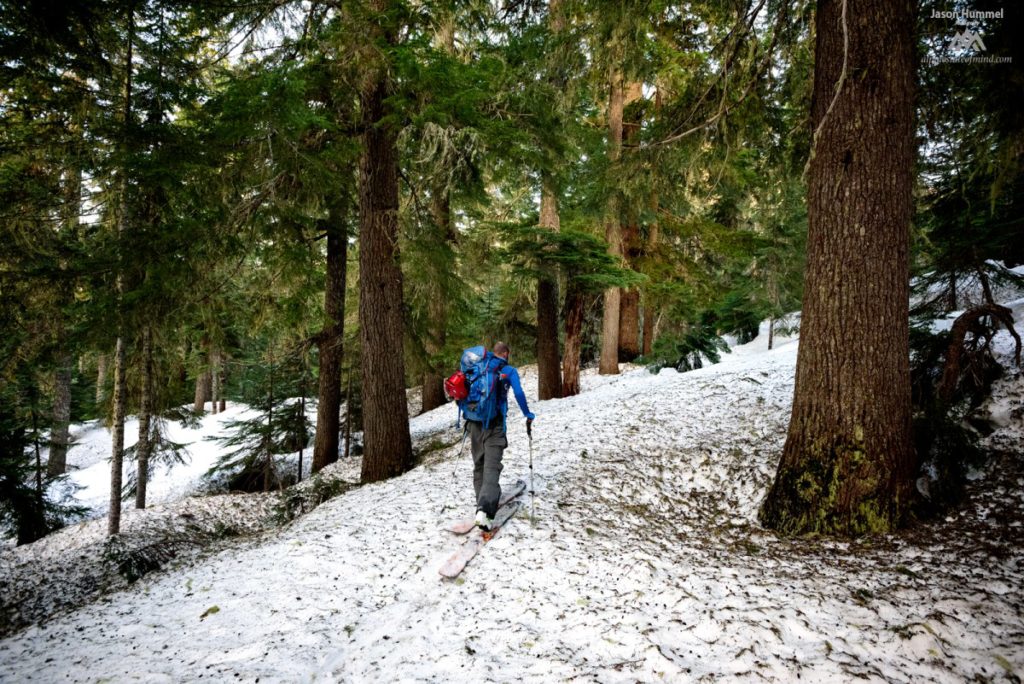
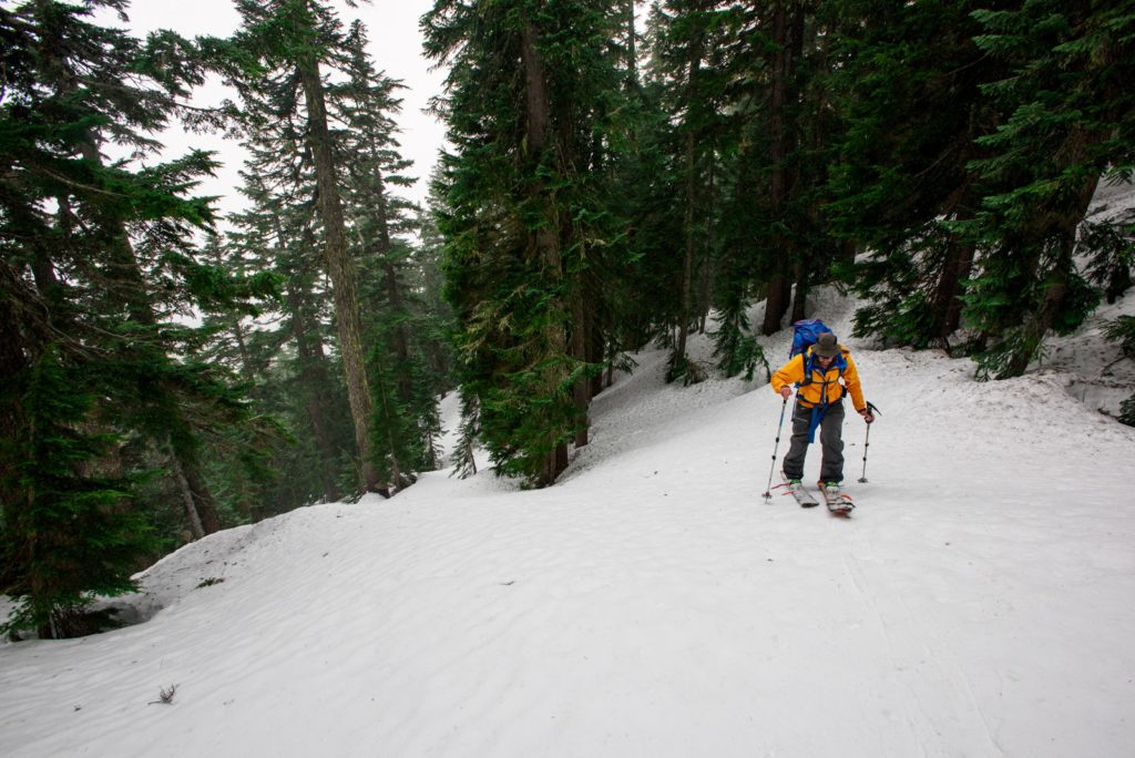
We made our way up the Mountain Loop Highway both eager and nervous as we turned off on the North Fork Road. We were in a Ford Fusion and making our way down a road infamous for washouts. A mile at a time we kept moving forward waiting for the moment travel in the car wasn’t feasible. Each 5 minutes in the car would be 20 minutes on foot so we were happy when we arrived at the trailhead.
We were almost shocked that we were able to drive to our destination. We had a lot of ground to cover in the first day as we put our backpacks on. Pushing forward we were happy not to see snow for the first 5 miles on well maintained trail. It was only a matter of time before we would be climbing into the alpine and skinning for the next 5 days.
Around the time to the Mackinaw Shelter we needed to gain elevation. During the summer there are switchback to get into the high country but this time of year they were buried in feet of snow. Knowing our final destination of the day was White Pass we started a 2 mile traverse heading east. The goal was to access the ridge as well as make our way to the head of the valley.
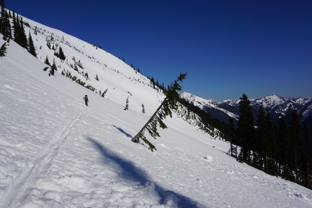
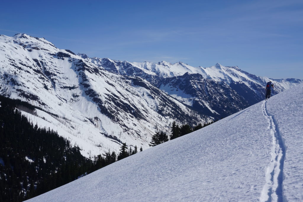
Arriving in the Alpine and Heading for White Pass
The time slipped away fast as we made our way towards our destination. We were on a race against time as within an hour it would be dark. We still had to find a spot and set up camp. Finally we made it up to the ridge and kept climbing as Glacier Peak was basking in the alpenglow.
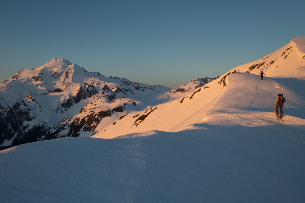
The plan was to climb White Mountain before descending a few hundred feet south. While we would be riding in the dark it would be well worth it in the morning.
Transitioning on the top of White Mountain we watched the last rays of the sun drop to the west. While it had been a grueling day we were now in the alpine and hopefully travel would be easier for the rest of the route.
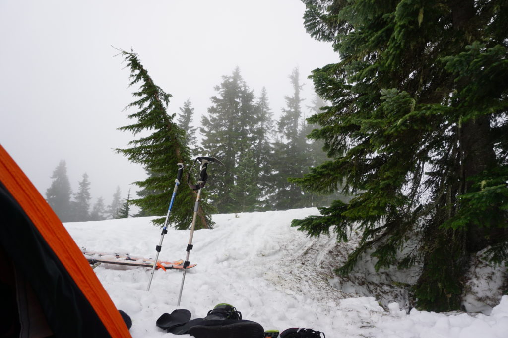
As we put on our boards to took one last glance at Glacier Peak. This would be the closest that we would get to the volcano and before long we were snowboarding south. Arriving at a wind scoop we set up camp on White Pass. Jason and Ben set up a small 2 person tent while a dug a meter deep into the snowpack. We were asleep within an hour and happyto be in dry base layers.
Sauk River to Highway 2 Day 2 White Pass to Whittier Creek
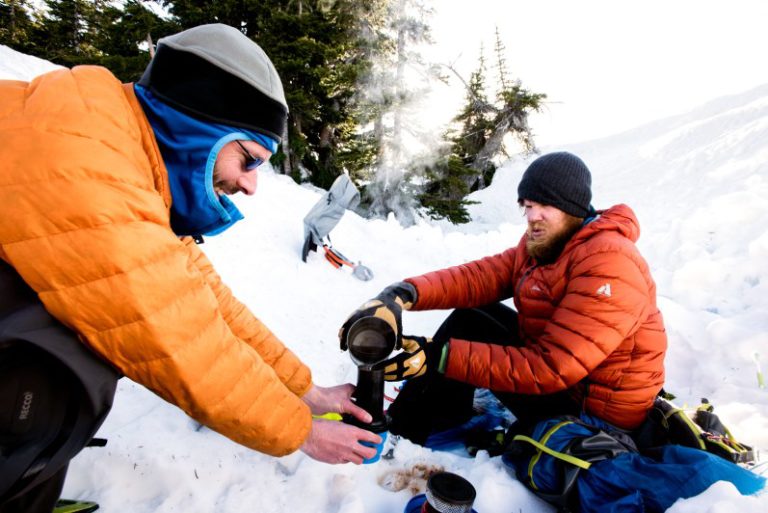
As we woke up it was a beautiful and clear morning. We had arrived in the dark so we had no clue what to expect when we made our way out of our sleeping bags. Within a few minutes we were packing our bags, making breakfast and drinking coffee. There was little time to relax as we had a lot of ground to cover during the day.
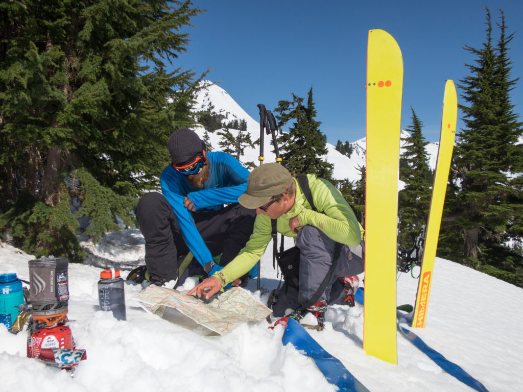
Studying the map we were now at our first crux point. We could either take the mellower route to the west following the Pacific Crest Trail or we could do the eastern route. I had been a huge advocate for the second route as it had big ascents and descents. Before long we were committed to the southern route and there would be no turning back.
As we packed up camp we kept looking down the North Fork of the Sauk River valley and were happy with our progress. It had taken a full day to get into the high mountains but hopefully from here on out things would be straight forward.
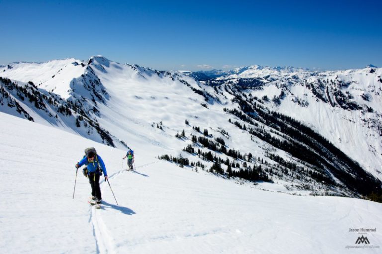
Before long we were following the high ridge of White Pass heading south. We were deep in the heart of Glacier Peak Wilderness and slowly making our way towards Indian Head Peak.
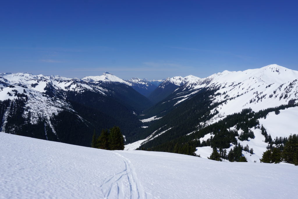
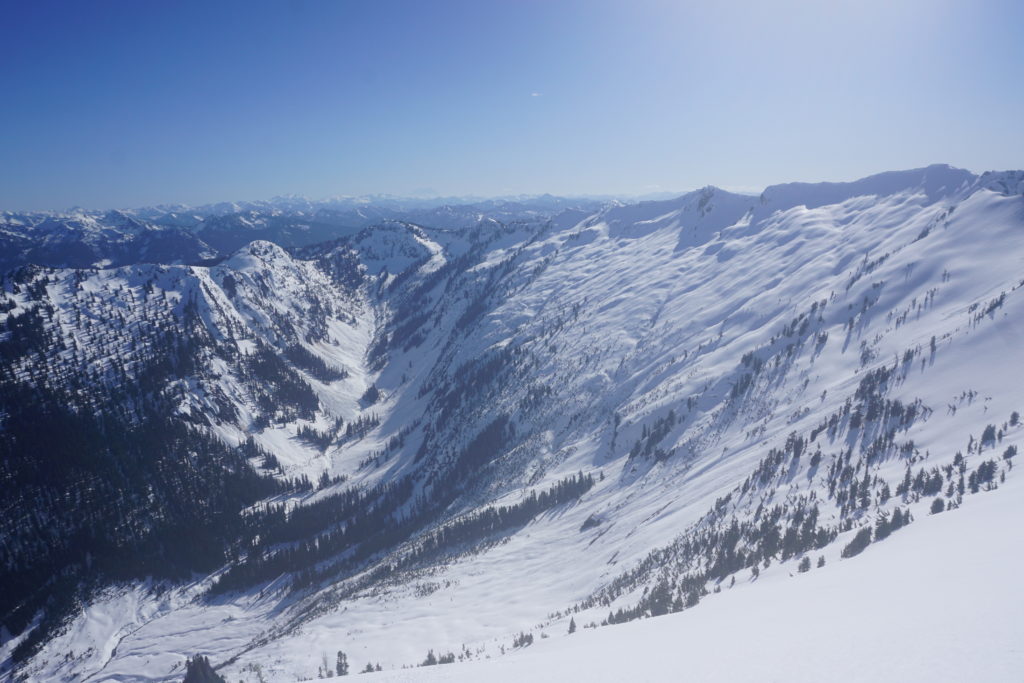
Working our switchbacks with the terrain the Dakobed Range and White River Valley was on full display. I had been in the area a few times before but this was a completely new perspective.
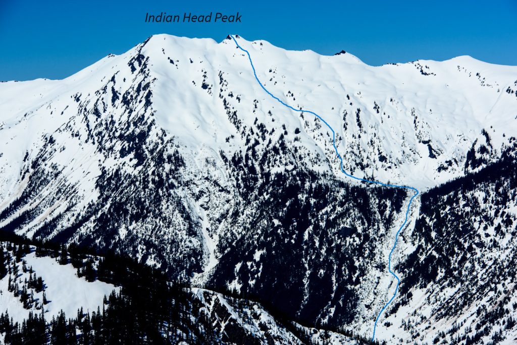
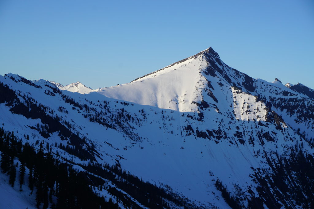
Climbing up Indian Head Peak
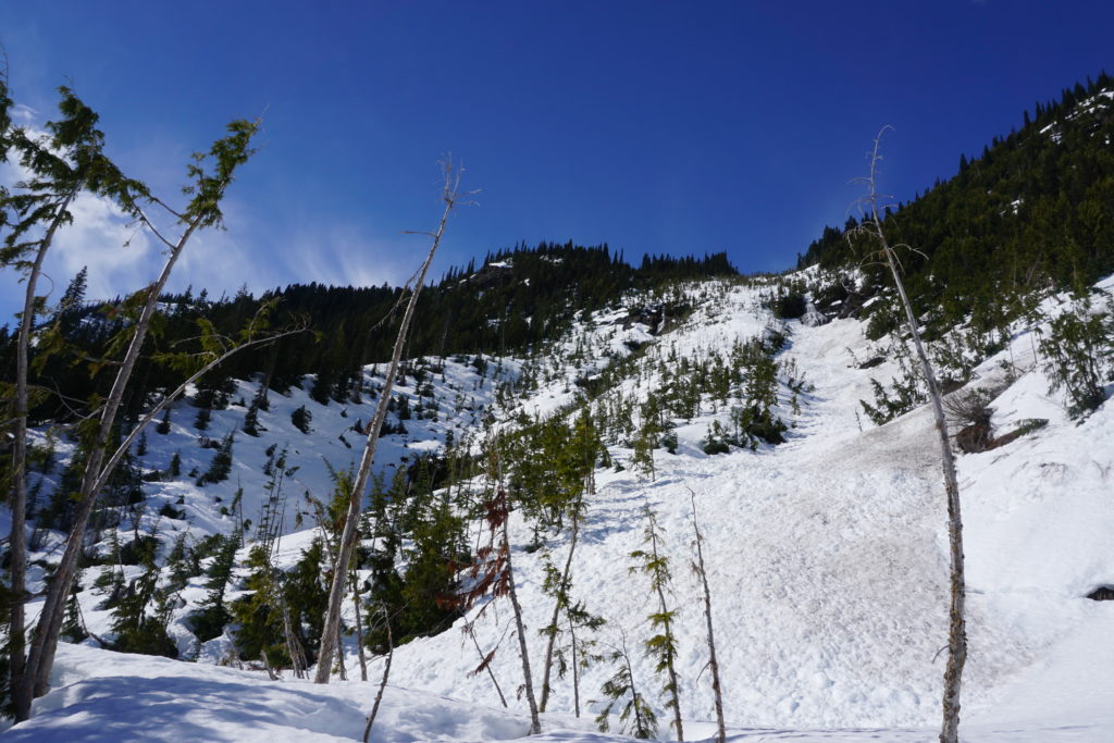
Before long we were off the general route of the Pacific Crest Trail and heading up the southwest face of Indian Head Peak. We wanted to turn it into a snowboard run riding into the valley, so it was time to climb to the summit. Putting our boards on our backs we started kicking steps up the semi steep face as the Central Cascades dropped below.
After 30 minutes of climbing we were on the summit ridge of Indian Head Peak. With each step we were getting better views of the Western Cascades and the Monte Cristos opening up.
For the final section up to Indian Head Peak we switched over to skinning again. This was an area that was new to all of us and we were excited about our view into Glacier Peak Wilderness. Making sure not to get to close to the edge we made our way east.
Before long we were taking the last few steps up Indian Head Peak . The view of the North Cascades was starting to open up around us. Across the valley we had a clean view of Glacier Peak and Tenpeak Mountain.
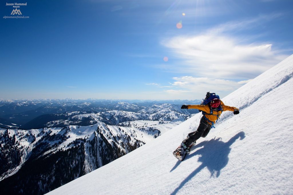
Snowboarding down Indian Head Peak
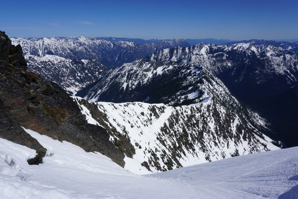
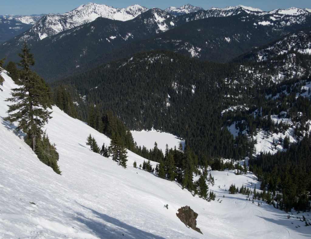
When we made it to the summit we were excited by both the view and the descent below us. It was a beautiful day without wind and we were making our way smoothly from the Sauk River to Highway 2. After looking at the topographical map we had the plan to drop the southeast face and descend 3500 feet to the valley below. We just had to stay out of the main drainage and tight contour lines and then hopefully we would be fine.
In front of us was 30 miles of mountains between us and Stevens Pass. It seemed like an impossible route as the valleys looked like they just dropped off. Hopefully with some solid routefinding we would be at our destination in 5 days.
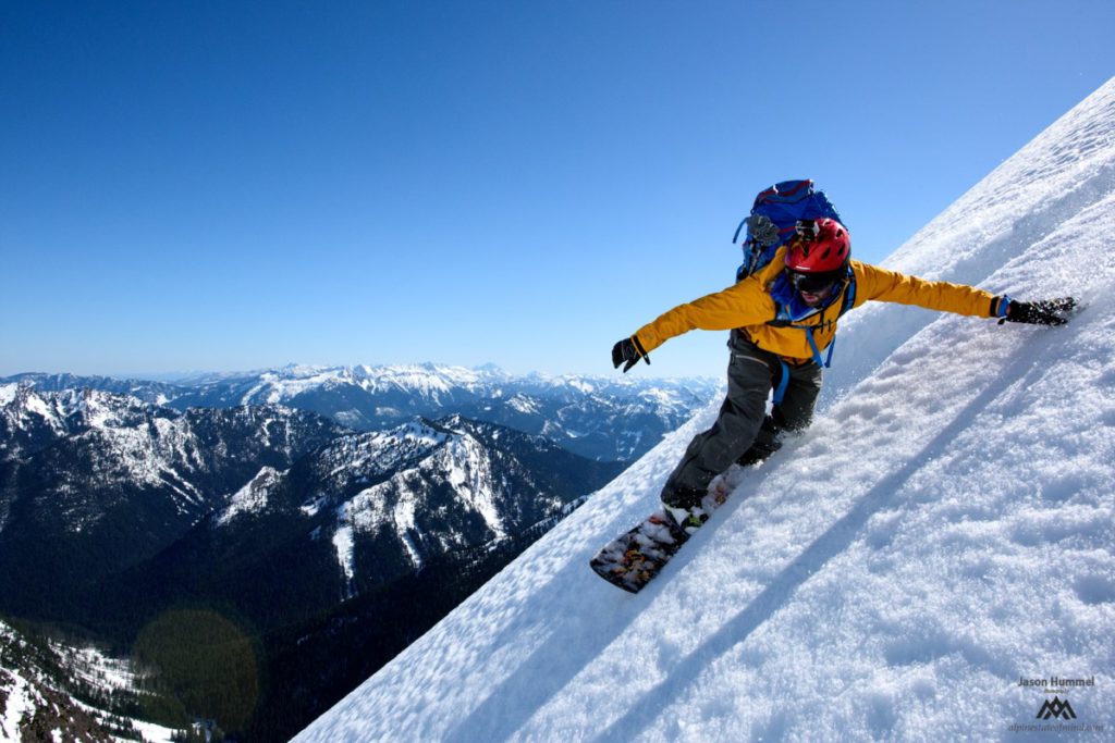
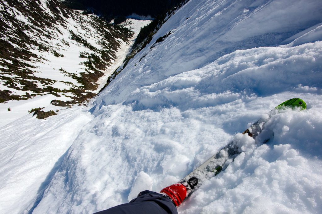
With our boards on our feet it was time to get moving. If all went according to plan we would be able to ride for miles down into the valley. Dropping in we were happy to make scenic turns down the wide open southeast face hoping all would go well.
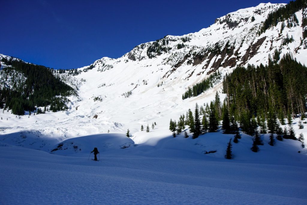
Before long we were out of the alpine and making our way through the lower forests. Fortunately there was still a sufficient snowpack as we made our way through an open avalanche swath to the valley floor.
There was a sigh of relief as we arrived at the base of Indian Head Peak. Looking up the terrain seemed far more complex then when we were riding down. By now it was official that we were committed to the valley. If we wanted to continue the traverse we would have to keep heading south.
Making our way to Whittier Creek
Our next crux was crossing Indian Creek as we were on the north side and needed to head south. Fortunately in front of us was a slide path that had built a bridge over. Within minutes we were on the opposite shoreline and heading down stream. Our goal for the night was to get into the northern basin of Whittier Peak before dark.
Once we turned south into the Whittier valley we decided to set up camp immediately. It had already been a long day and there was no way we would make it to alpine before dark. While Jason and Ben set up there tent I dug a hole and we enjoyed a little bit of rest.
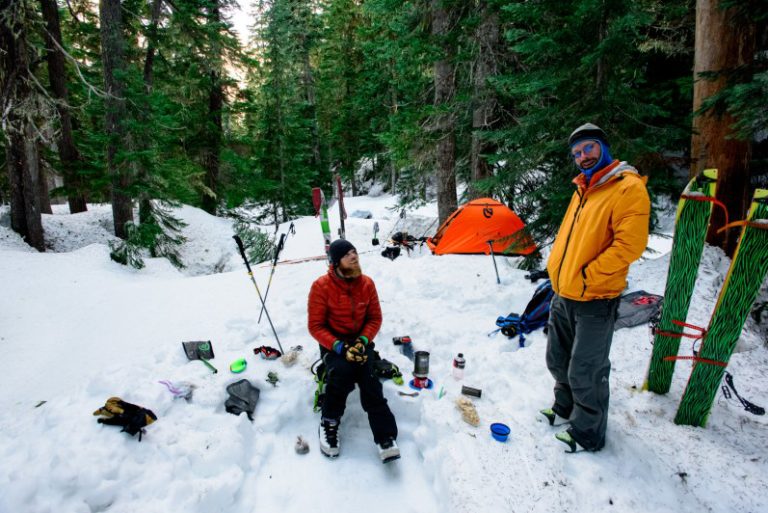
Taking off my boots I noticed there was a puddle of water still in my shell. With a mixture of sweat and snow melt my feet had been getting worked.
Sauk River to Highway 2 Day 3 Whittier Creek to Poet Mountain
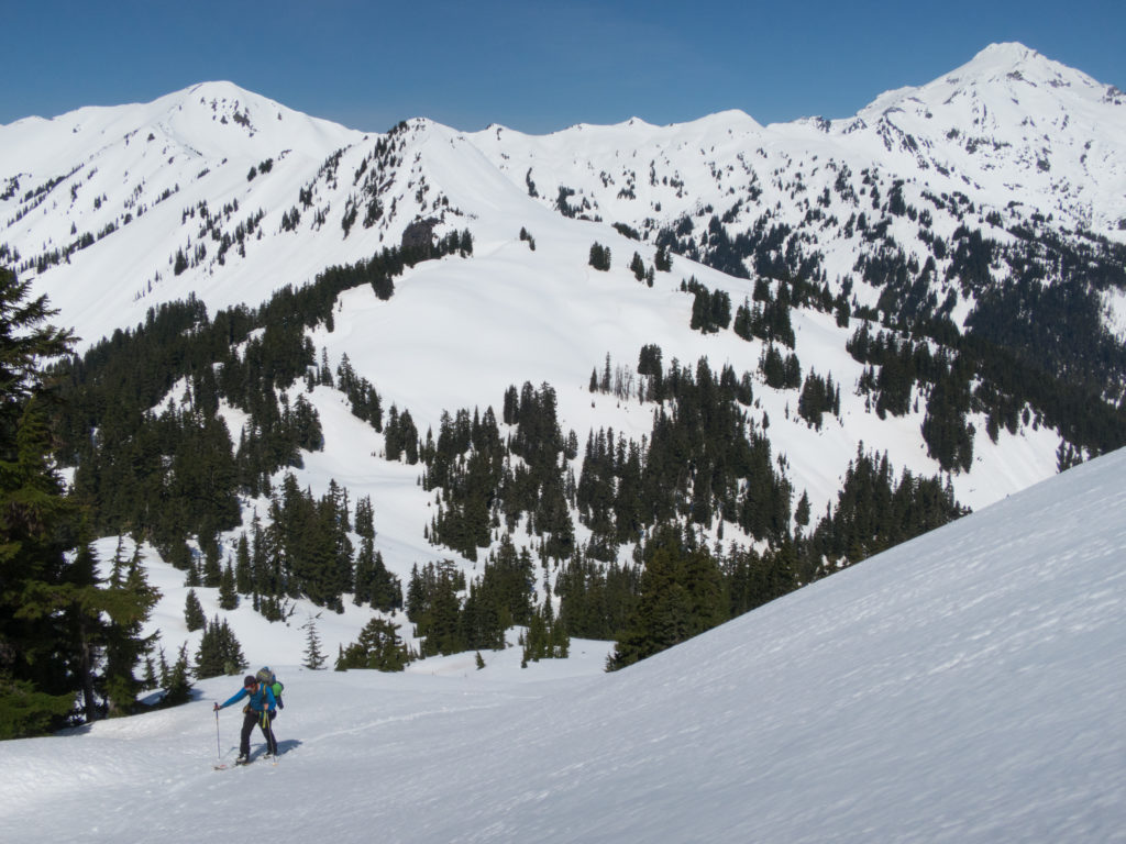
Waking up we were happy to look up and still see blue within the sky. Like the previous day we were heading into an area where I knew little of other then topographical map contours. Quickly we packed our bags and started moving up valley excited to get back into the alpine.
As we arrived at the head of Whittier creek the trees just abruptly stopped in most spots. We were surrounded by avalanche paths in most directions and the terrain was steep. After resting in the sun and drinking some water it was time to move. We were going to have to climb the eastern slopes to get to the summit of Whittier Peak.
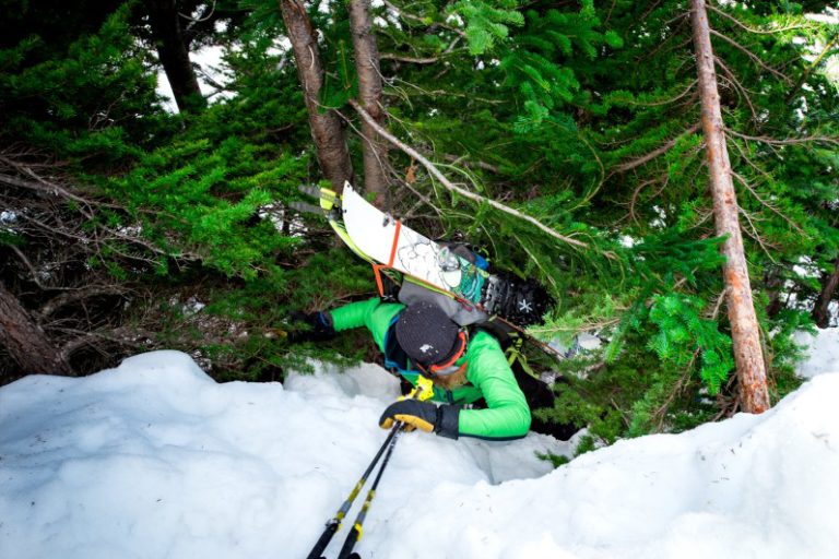
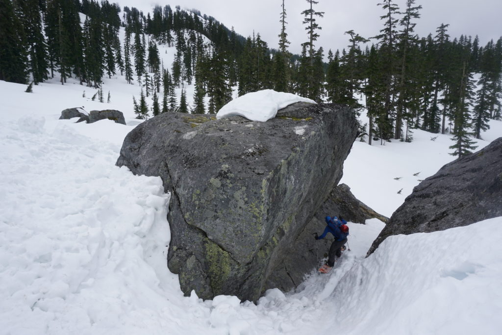
As we made our way up we found ourselves at a crux section. A cliff band had blocked our progress above and left us with two choices of what to do. We could either follow an obvious creek up not knowing how hollow it was or crawl through some steep trees. Not wanting to drown if the snow collapsed we chose to make our way through the steep trees.
After getting to the top of the small cliff the slopes opened up above us. We were excited as we put our skis back on and started making our way towards the summit.
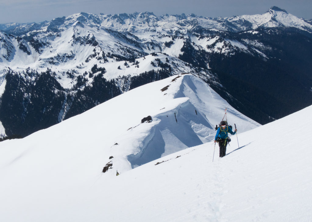
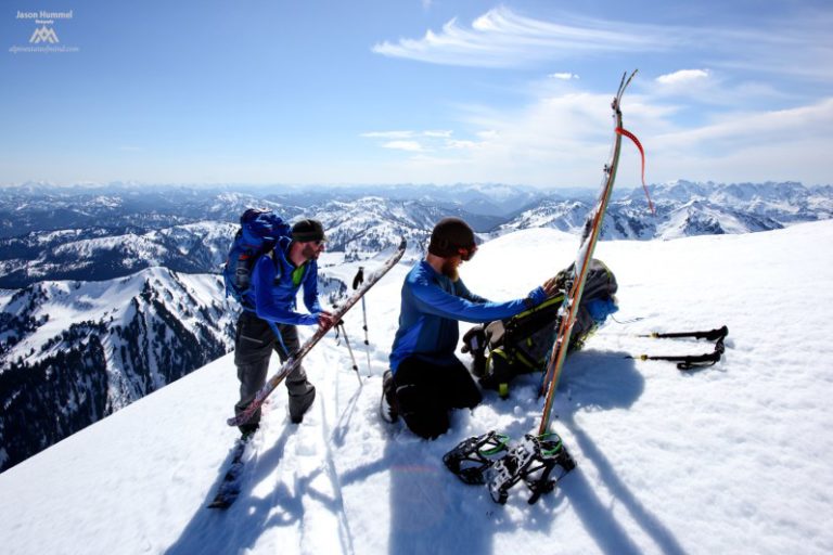
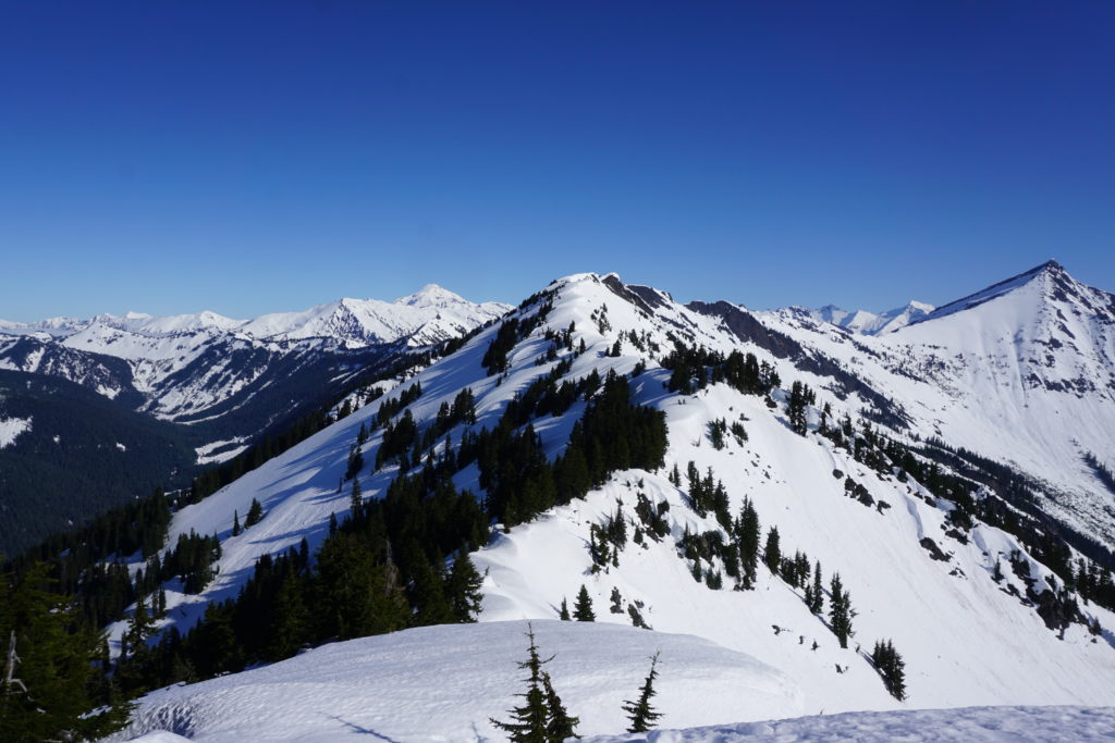
Before long we had made our way up near the summit of Whittier Peak and were about to look at our line. Everything had gone as smooth as we could hope for. By now we were almost half way done with our traverse from the Sauk River to Highway 2.
Arriving at our High Point on Whittier Peak
Looking back we had a clear view of our descent down Indian Head Peak the previous day. We were fortunate to have spotted the perfect route as most other ways had cliffs to negotiate.
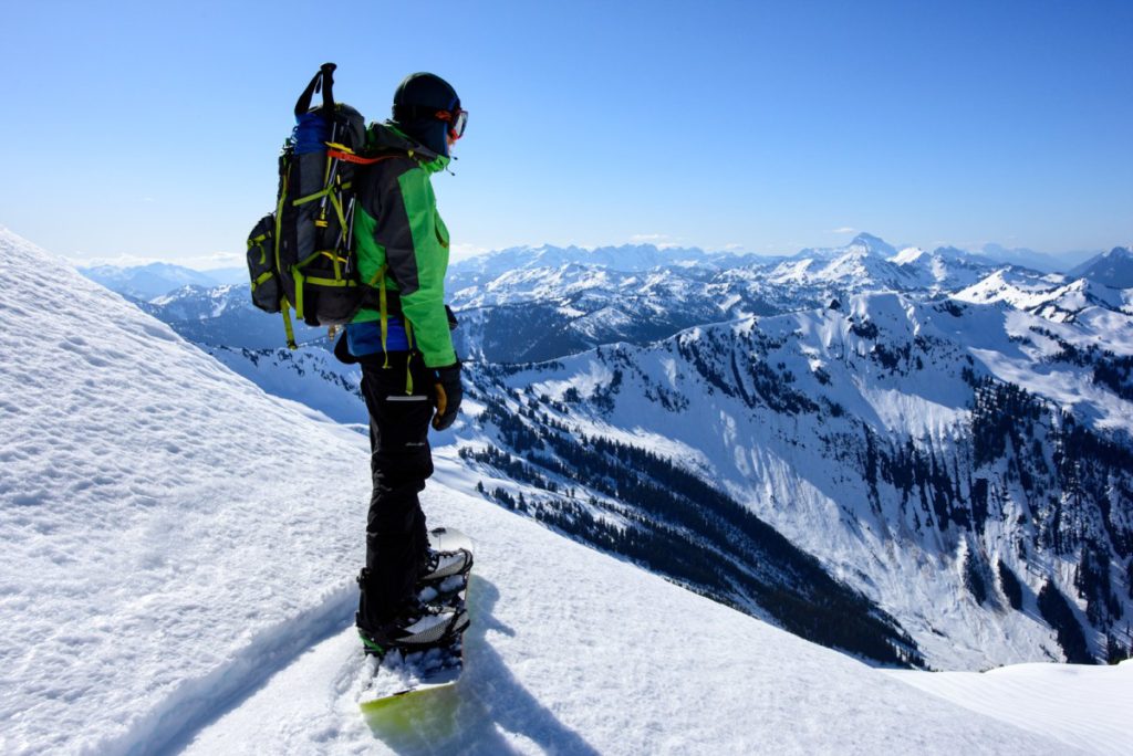
Standing on the summit ridge of Whittier Peak we were looking down one of my main lines of Interest. A few years earlier I had spotted a massive couloir while doing the Rock, Howard and Massive traverse. Knowing this was our one chance to ride it we were finally looking down the blind roller and wondering what was underneath.
It was decided to take a few turns in hopes of getting a view down the main part of the line. Carefully Ben dropped into the southeast facing slope causing a wet slide under him. Before long we could hear the snow crashing through the gut.
Jason was able to take a few steps down into the line where he had a better view. He could see the top and the bottom but he couldn’t see the middle. By now the snow was sliding with the heat of the day and we knew we had to bail. I don’t think any of us were disappointed as the snow looked horrible top to bottom.
Retreating to Ride the Southwest slopes of Whittier Peak
Hiking back up to the top of Whittier Peak we changed our plans. To the southwest we had an open bowl that would give us clean access to the valley below. Though snow was moving with the sun we would be cautious of where we made turns. The most important thing was to not ride above each other.
Looking to the head of the valley we could see Poet Mountain. Our plan was to camp on the summit if all went according to plan. The next morning would be the next crux of our route from the Sauk River to Highway 2. Dropping off the opposite valley down the west face all the way to 3,000 feet.
Dropping into the southwest face of Whittier Peak was one of the highlights of the trip. Not only was it steep but it was direct making our way into the valley. Withing a few minutes we were on the valley floor and ready to start skinning west towards Poet Mountain.
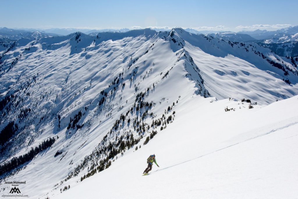
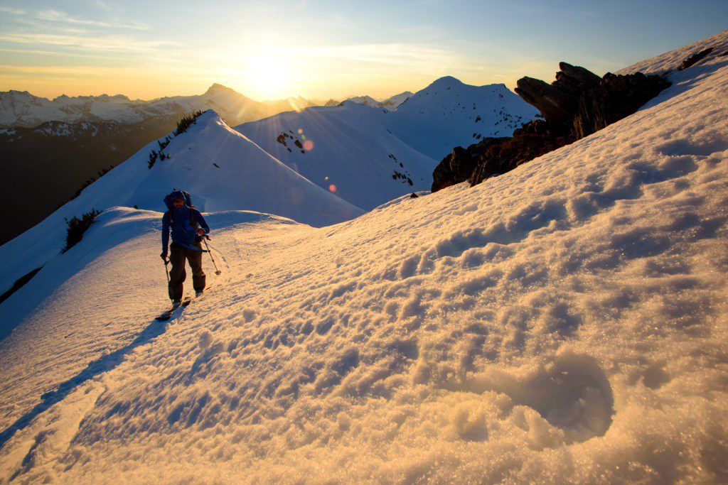
Climbing up to Poet Mountain
Like the previous two days it was a race against the light as we made our way towards Poet Mountain. Occasionally we would look back at our line off Whittaker Peak as the last of the light shined on our descent route
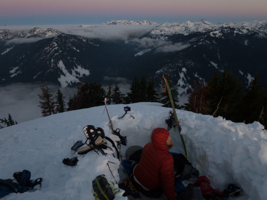
We had gained the ridge only a few minutes before the last of the sun faded to the west. Fortunately everything was straight forward making our way to the summit of Poet Mountain. We had made it just before the darkness arrived setting up our camping spots with the last bit of light and it was time to get some sleep.
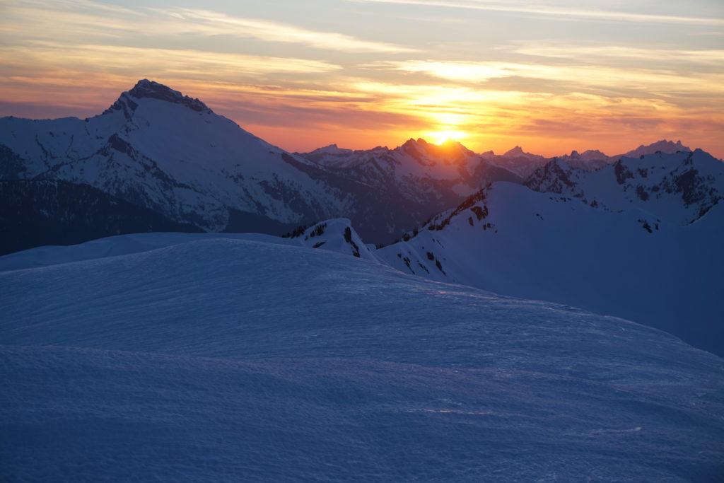
Sauk River to Highway 2 Day 4 Poet Mountain to the PCT
We woke up to a beautiful sunrise over the North Cascades from our vantage point. This day would be the make or break of the trip as we had to connect with the western Mountains. We had to snowboard down 3,500 feet to the Little Wenatchee River before finding a bridge to cross and get onto the Pacific Crest trail. By now everything had gone to smooth during our traverse from the Sauk River to Highway 2. We were waiting for our luck to change.
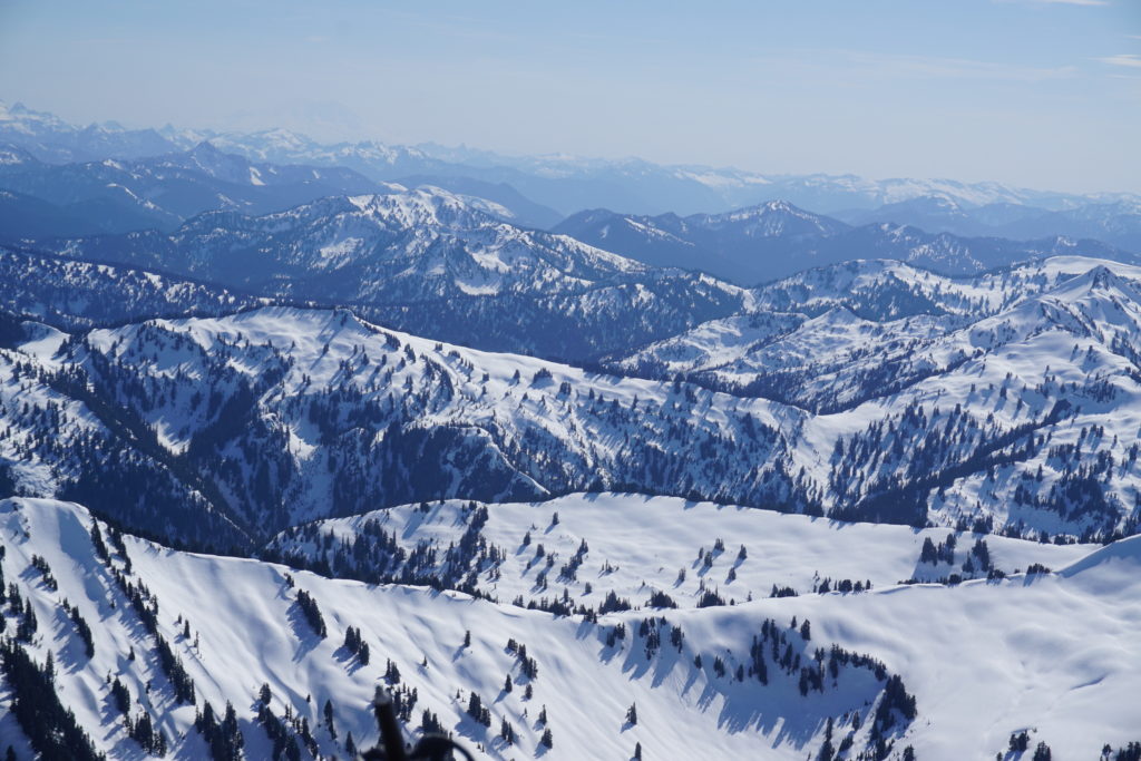
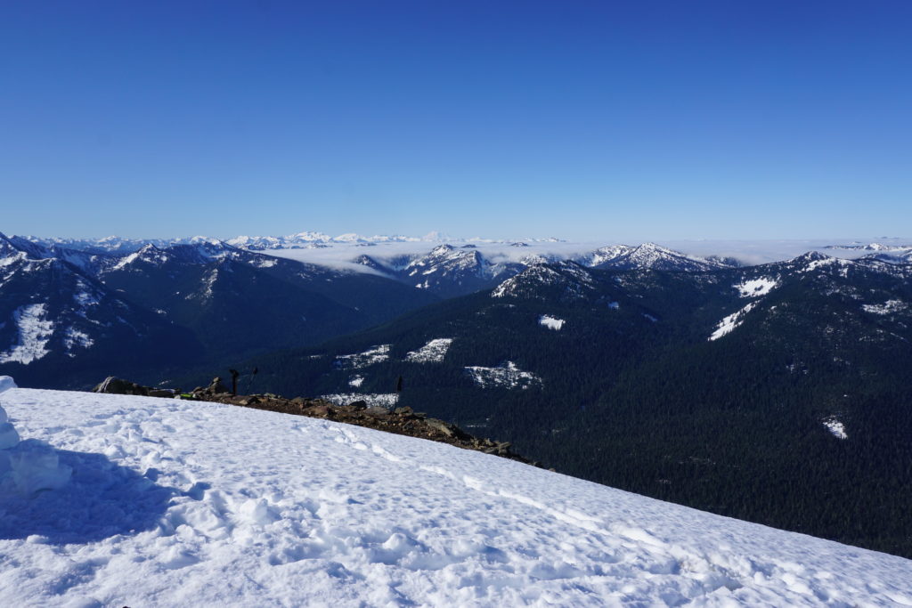
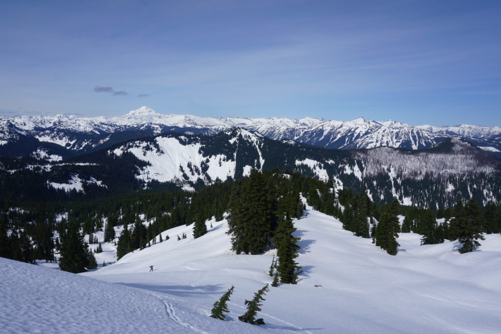
Looking to the north we had a clear view of the land we had covered the past three days. The peak to the right is Whittaker Mountain. In the far Middle is Indian Head Peak and behind that is Glacier Peak. On the left side was the valley we were going to drop down.
We couldn’t tell much of the route below us as it was a blind roll over. Being that the slope was west facing we would have to wait for it to soften. We knew it was steep and the last thing we wanted was drop into an icy slope with full backpacks. Looking to the opposite side of the valley we were hoping to be in the high country by the end of the day.
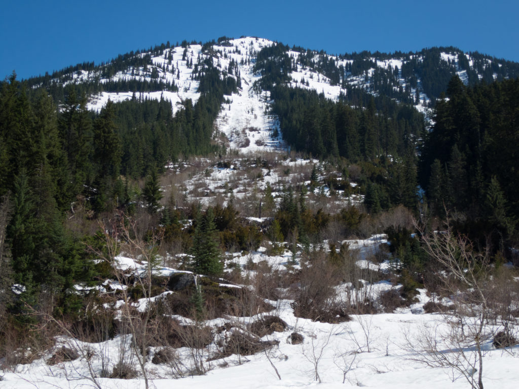
The snow was still a bit firm as we dropped off the west face of Poet Mountain. Fortunately the lower we rode the better the snow got but also the thicker the brush was. Making our final 200 feet we wondered if the bushes would stop our progress. Soon enough we were on the road and were ready for our next ascent.
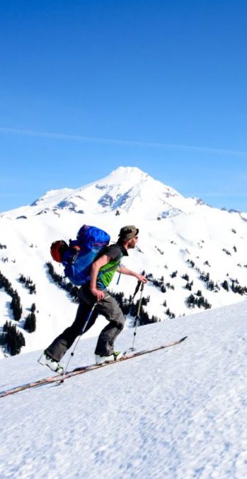
Heading up the Little Wenatchee River
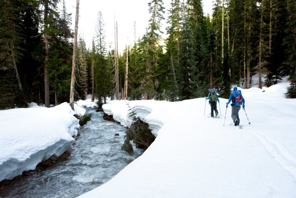
Our time on the road would be short lived as we needed to skin north for a mile until reaching a summer trailhead. If the maps were correct there would be a bridge over the Little Wenatchee River and this was vital.
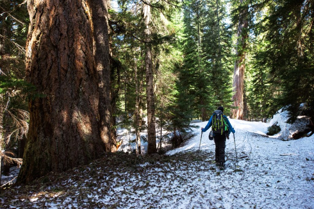
Soon we were at the parking lot and making our way through the woods. Trying to stick to the summer trail was vital as it would bring us to the bridge.
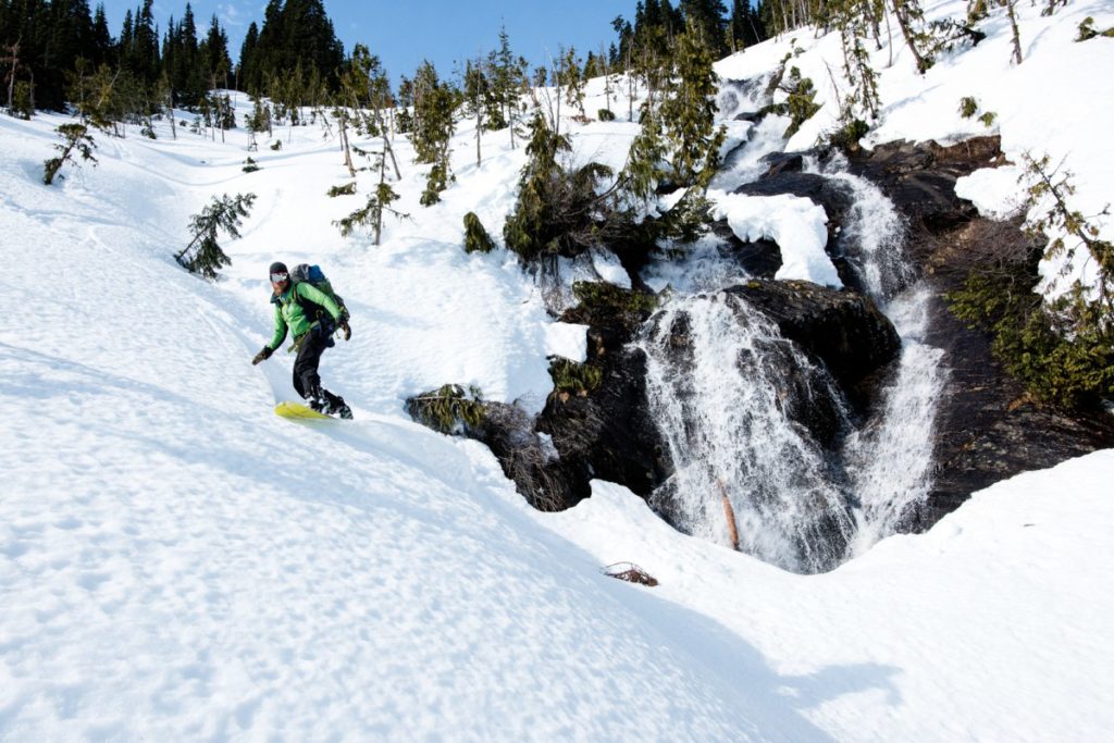
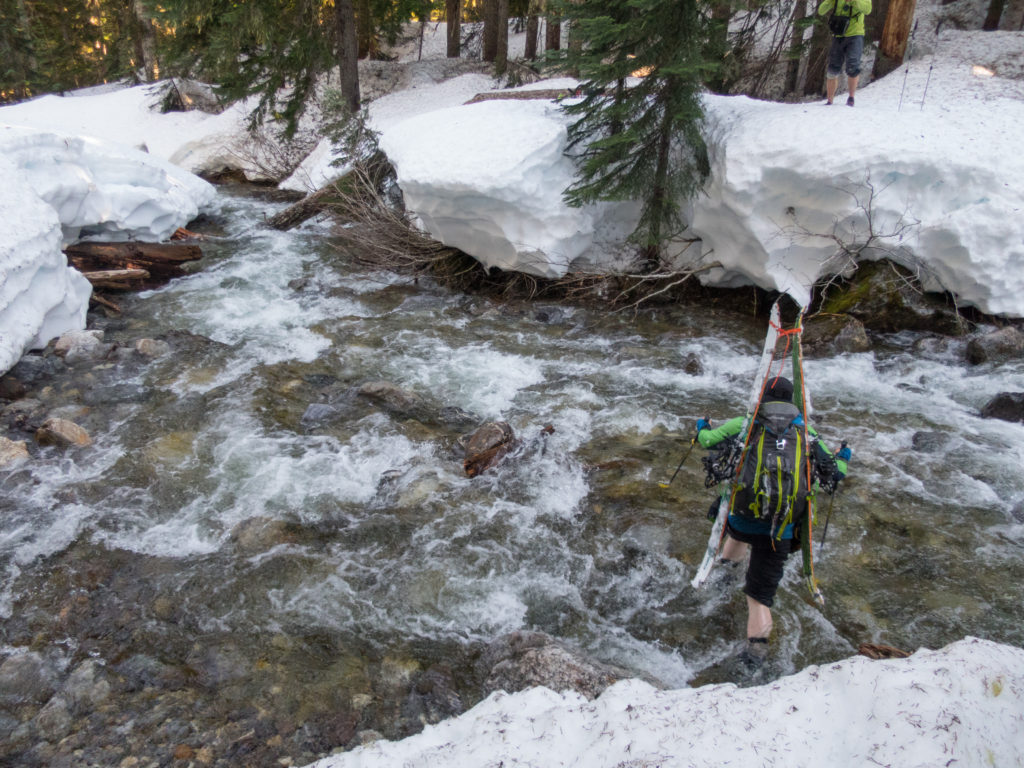
Getting near the river we could hear the roar from a ways away. Soon enough we were standing on the opposite side and happy to see that we could cross. It would have to be a balancing act as there were feet of snow on the bridge. I’d take that any day over crossing a chest deep river.
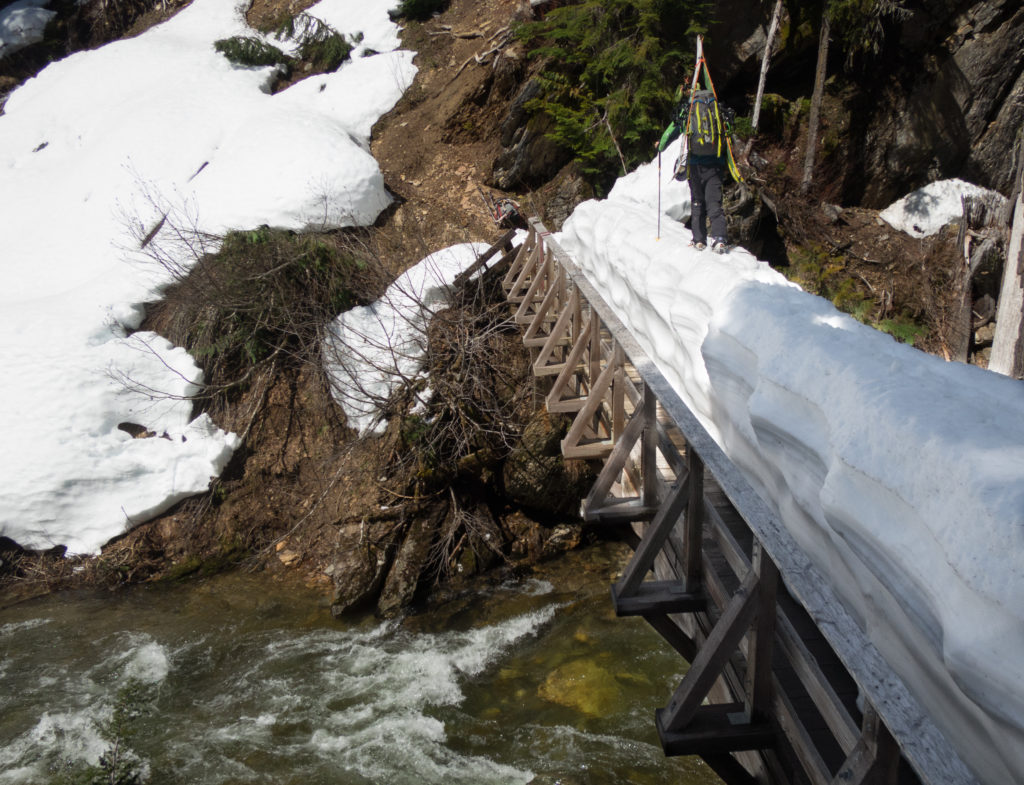
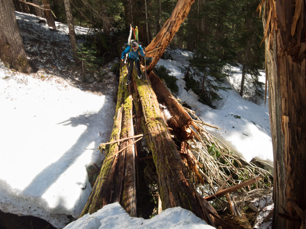
The valley was low and there were numerous crossings but we would always find a bridge. Be it snowpack or a fallen tree we kept moving up the valley being resourceful and gaining ground fast.
An Unexpected Crux of the Trip
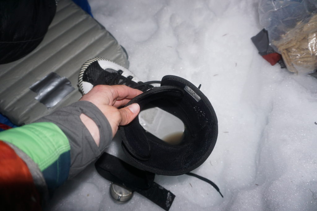
And then we made it to a creek that stopped us dead in our tracks. There was no bridge or anyway to get across without getting our feet wet. We had two options we could either turn back or commit to wet boots for the next two days. Before long Jason was on the other side and Ben was making his way through the cold current.
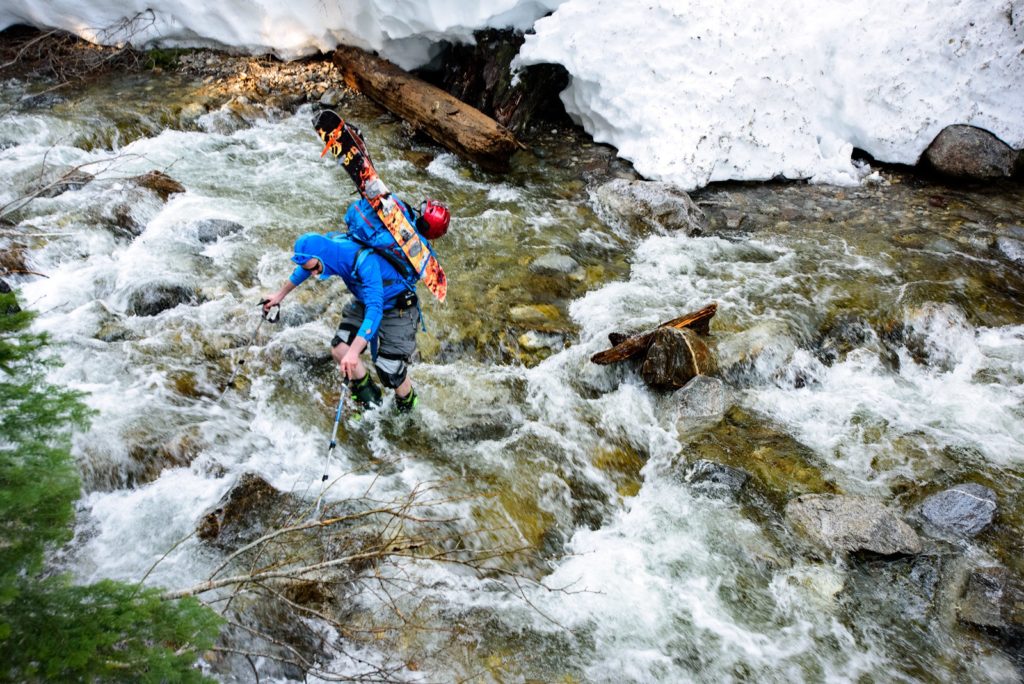
Crossing the water was the easy part but getting up onto the snow pack was a tad bit trickier. Once near the shores I would have to kick in a foot step and then drag myself up. Before long we were all on the other side happy to be done but not so happy about our wet boots.
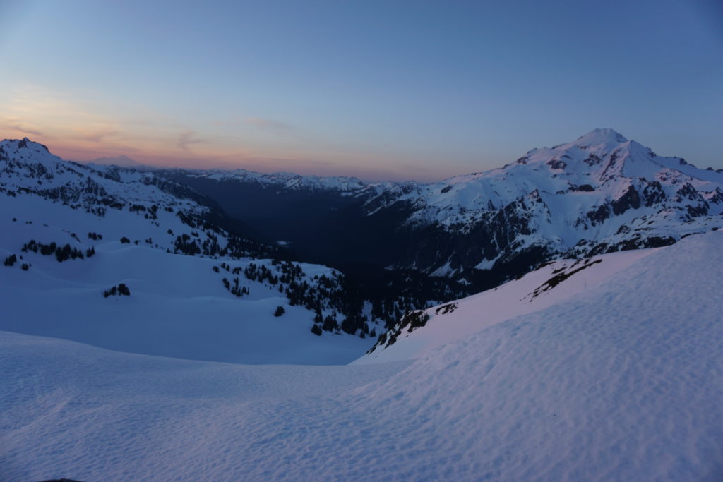
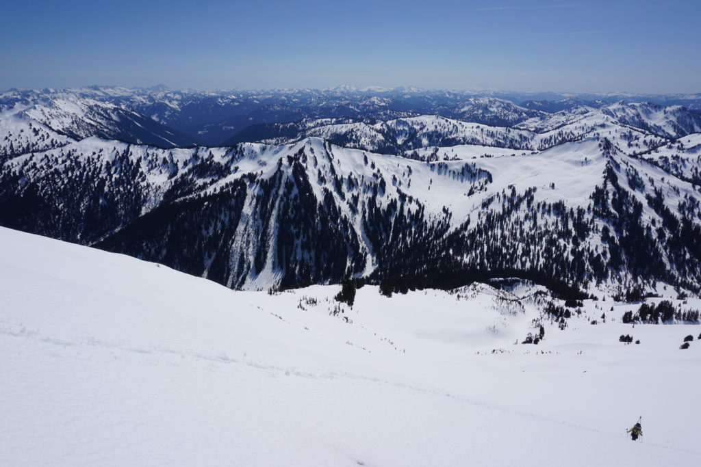
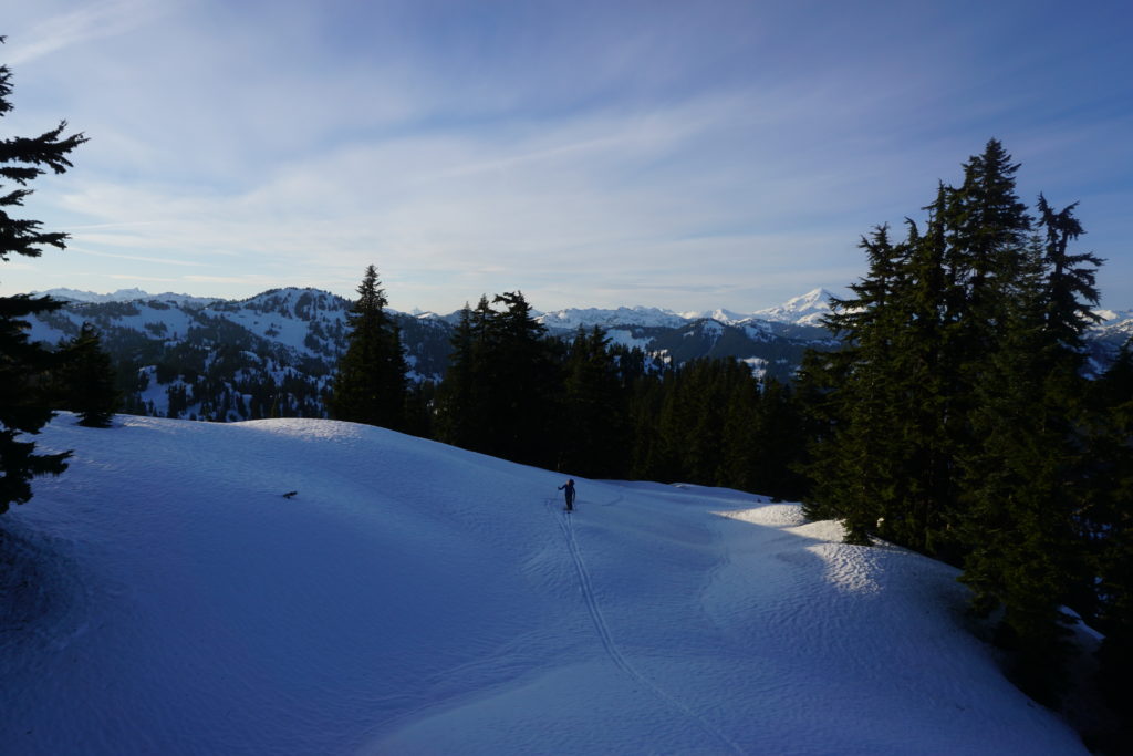
For the rest of the day we kept our heads down and kept moving west to the end of the valley. Before long we were gaining elevation again and the slopes were opening up. We had made it back to the alpine and hopefully we were on the Pacific Crest trail. As the last of the sunlight faded away we set up camp. From here on out would be the easy part of our traverse from the Sauk River to Highway 2.
Sauk River to Highway 2 Day 5 PCT to Janis Lake
When we woke up the weather had changed for the worse. No more was the days of blue sky and now the visibility was limited. Sure we were on a trail but trail is a loose word when it is buried under 5 feet of snow. We would be traveling on the crest of the Cascades and hopefully the clouds were on the western side. Breaking down our tent we knew there was no point in waiting according to the map everything would be straight forward.
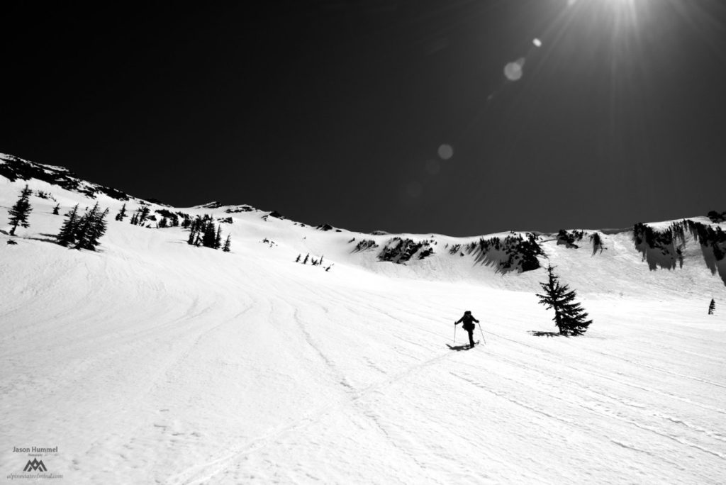
We would attempt to snowboard as far as we could but the terrain was flat. With a bit of stubbornness we would skin a little bit then use our snowboards to traverse for a little bit longer. This was the story for the first hour as we battled both the terrain and the clouds.
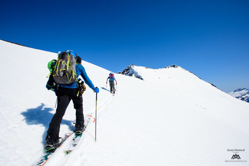
After a while we finally made our way up to an east/west col and were happy to see the clouds burning off. We were right about the weather being better on the east side. Within minutes we had rode down to the shores of Pear Lake and were back to climbing.
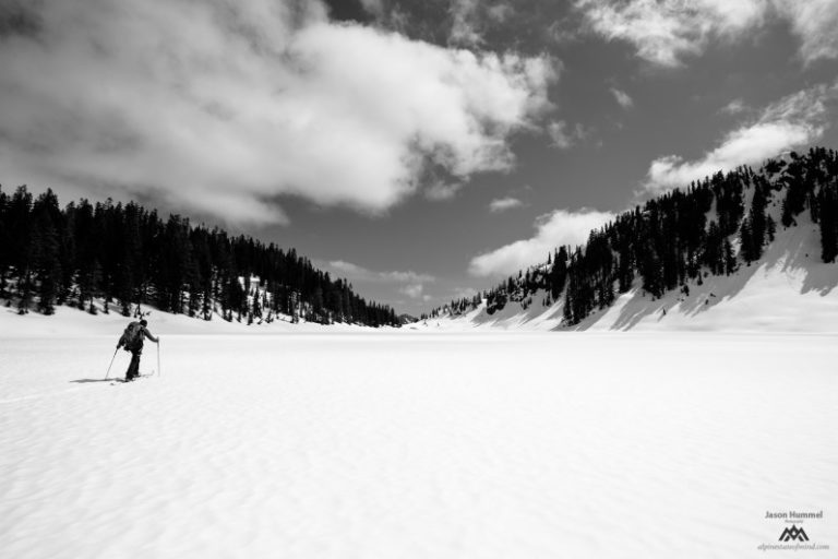
Not being exactly sure we were on the Pacific Crest Trail we kept moving south. We were fortunate that the route was going smooth and the weather had cleared up. Every so often we would check the map to make sure we were going the right way. Once we confirmed we were on the right area we would start moving again.
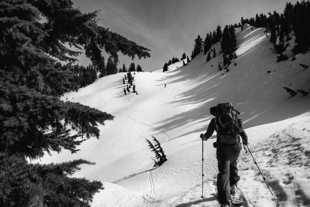
Following the Pacific Crest Trail
Making the most out of the terrain we would ride down a valley before skinning up the next one. Since two out of three of us were snowboarders it was majority rules. While we could have traversed most the way it would have been hours of torture. I was more then happy to sacrifice vert in exchange for snowboarding.
Finally we were making our last skin of the day as the sun started to drop. As we started cresting the ridge we had no clue that it would be the last time we saw Glacier Peak and the Dakobed Range. We had made it a long way over the past 5 days. Hopefully within 24 hours we would be riding home from Stevens Pass.
We crested the ridge with the last of the light on the far mountains. The only thing between us and Janis Lake was around 2000 feet and a summer trail. Once we were all on top we quickly transitioned as we were all tired and ready to get some sleep.
We were able to ride fall line most of the way before we hooked up with the summer trail. The last little bit of the valley was barely light enough to see where we were going. Soon enough we were on the flats and in open slopes. We knew immediately we had made it to the lake and it was time to set up camp.
Sauk River to Highway 2 Day 6 Janis Lake to Highway 2
The final day was a blur with just one last mountain to climb. By now the weather had turned and it was starting to rain so we put our heads down and started climbing. Making our way up the north slopes of Jove Peak we knew that within a few hours we would be at Stevens Pass ski Resort and finishing our traverse.
After riding down Jove Peak via the south east face we were back on a Forest Service Road. By now it was a race as we could almost hear the cars in the distance. After 3 miles of skinning we were up on rainy pass and transitioning to ride down to highway 2. We were minutes away from taking off wet boots.
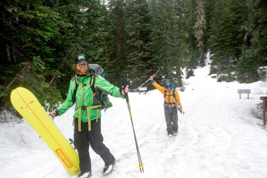
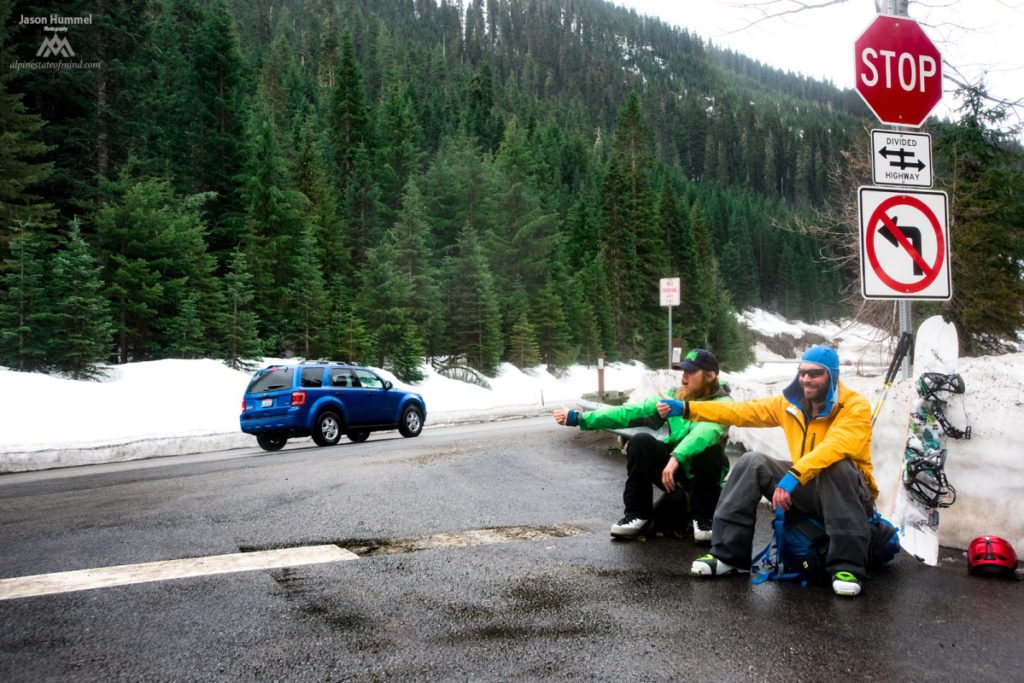
Finally we were at the gate and finishing our traverse from the Sauk River to Highway 2. It had been an amazing six days but it was obvious that the weather had changed for the worse. Sitting on the side of the road near Stevens Pass we put our thumbs out to hitch hike back but there was no one stopping. Soon enough Ben’s girlfriend arrived in his van and we were back to civilization.
Completing Our Traverse from the Sauk River to Highway 2
In the end we were able to link both the Poets and the Pacific Crest Trail via a fun route. There was both big descents as well as nice open alpine terrain. The Sauk River to Highway 2 traverse can be easily broken down into two separate sections. The Little Wenatchee River was definitely the crux of the route. We were fortunate that there was just enough snow as it was easy to follow the trail but it wouldn’t have been possible a few weeks later. It was great getting this section of the Mount Rainier to Mount Baker traverse down with.
Click here to check out more of our trips from Mount Rainier to Mount Baker
Thank you for reading this trip on our trip from the Sauk River to Highway 2. If you want to see more ski tours within the Stevens Pass Backcountry check out this link.