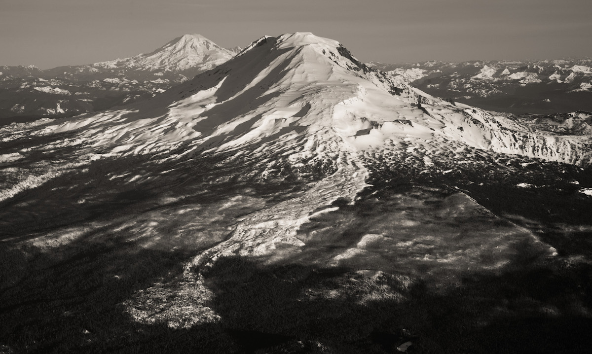
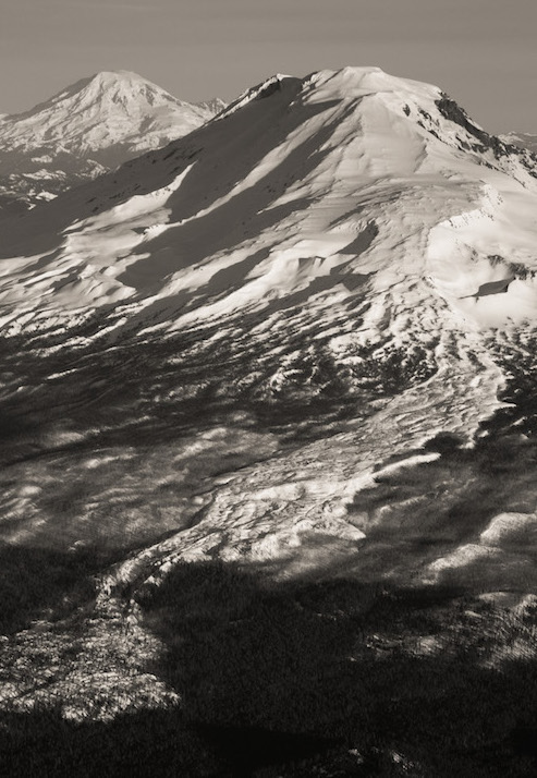
The Southwest Chutes on Mount Adams are some of the best steep skiing available on the Cascadian Volcanoes. With a straight forward and non technical ascent it is easy to get to the summit. Once there and with a small bit of route finding you can find yourself on top of the Southwest Chutes. Being a consistent 33 degrees for 3 thousand feet it is the perfect place to find early afternoon corn. Dropping off the Southwest side of Pikers Peak you don’t actually need to make your way to the summit. While the area can be skied all season the best time is June and early July but expect a lot of climbers and skiers. My plan for the season was to ride the 5 volcanoes of Washington and with Mount Saint Helens done it was time to head for the Southwest Chutes.
Leaving For Mount Adams and the Southwest Chutes
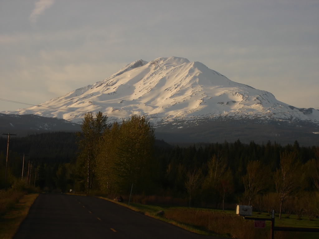
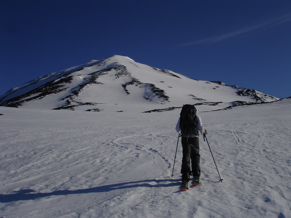
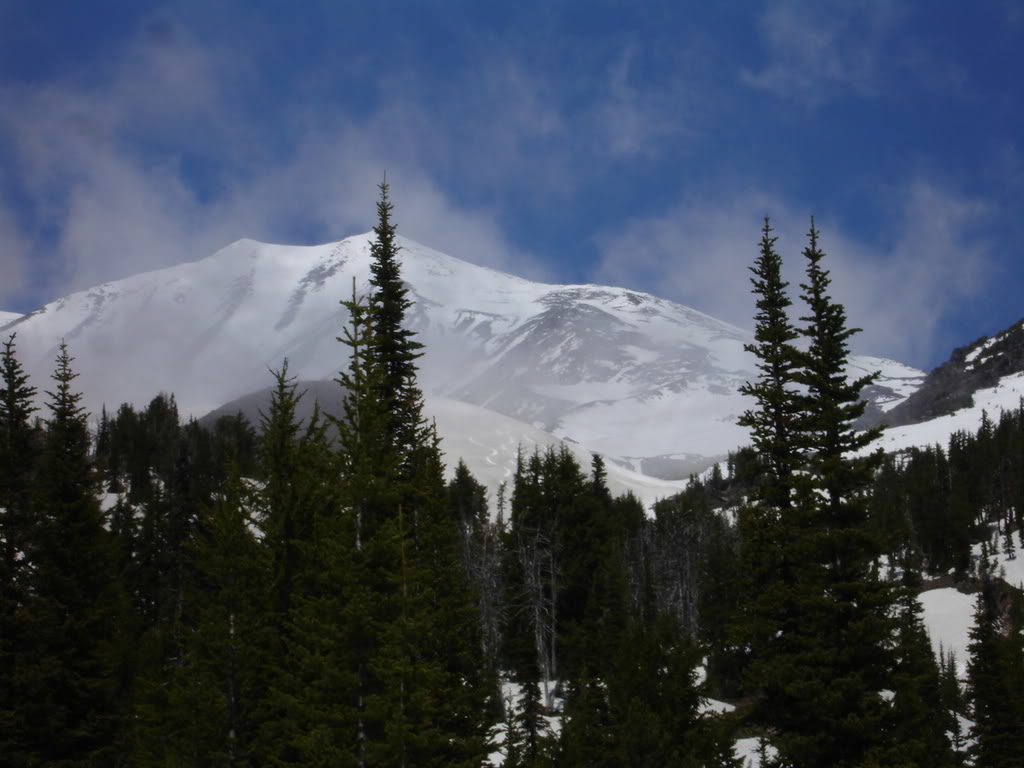
After a week of bad forecasts finally a weather window came together. With clear skies and no winds we made our way towards the base of Mount Adams. Leaving Seattle around 1 p.m. Dan, Kyle and I made plans to camp half way up the climb before summiting the next day. Making our way down we stopped by a store to grab some camping food and finally were making our last 10 miles towards the base. As we got closer we had a clear view of Mount Adams and the Southwest Chutes in the early afternoon sun. It was late May and they still had a thick winter snowpack.
We were blocked by snow about 6 miles from the trailhead around 6:15. With a few hours of light left we threw our gear into our backpacks and started moving towards the Cold Springs Trailhead. We made our way up boot packing on the road before switching to skinning after the first mile and a half. Chasing the afternoon light we were soon in the alpine and gaining elevation fast. Soon enough we were at 6’500 feet before finding a melted out spot and putting up camp for the night. We were within easy striking distance of the summit of Mount Adams and the Southwest Chutes.
Our Summit Day and Hopeful Descent of the Southwest Chutes
The next morning we were up and moving by 4:45 and skinning by 5:15. Being early in the morning the snow was still firm but we were sure that it would soften up later. Looking to the south we could see the occasional cloud but it seemed to be in the valleys. As we made our way up we decided if it was white out conditions instead of riding the Southwest Chutes we would instead ride the way we climbed.
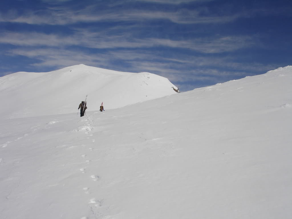
Within an hour we were making our way up to the Lunch Counter. To the north we could see the summit of Pikers Peak and our access to the Southwest Chute. Though it was still firm we were able to keep skinning as long as the terrain was flat. With it being a clear and windless day it was only a matter of time before the snow softened.
Before long we were making our way up the lower slopes of Pikers Peak. A switchback at a time we laid in a skin track waiting for the moment to switch over to bootpacking. Being in the area in late May the terrain around us was still smooth with minimal climbing tracks. It was well over a month before the main groups would show up and we had Mount Adams to ourselves
Climbing up Pikers Peak
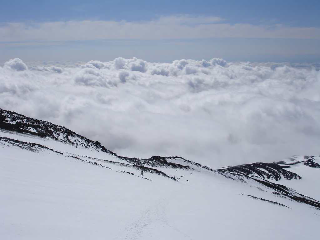
Soon the terrain steepened and we put our boards on our packs. Knowing that skinning wasn’t worth the effort we made our way up one step at a time. Though not that soft it was still good enough to kick in steps. Though we had brought crampons they weren’t needed as we felt comfortable with the terrain. Before long we were heading up the final pitch to the summit of Pickers Peak. By now the valley was thick in clouds but they were still lower then the Southwest Chute. As long as conditions stayed the same we would go with our original plan.
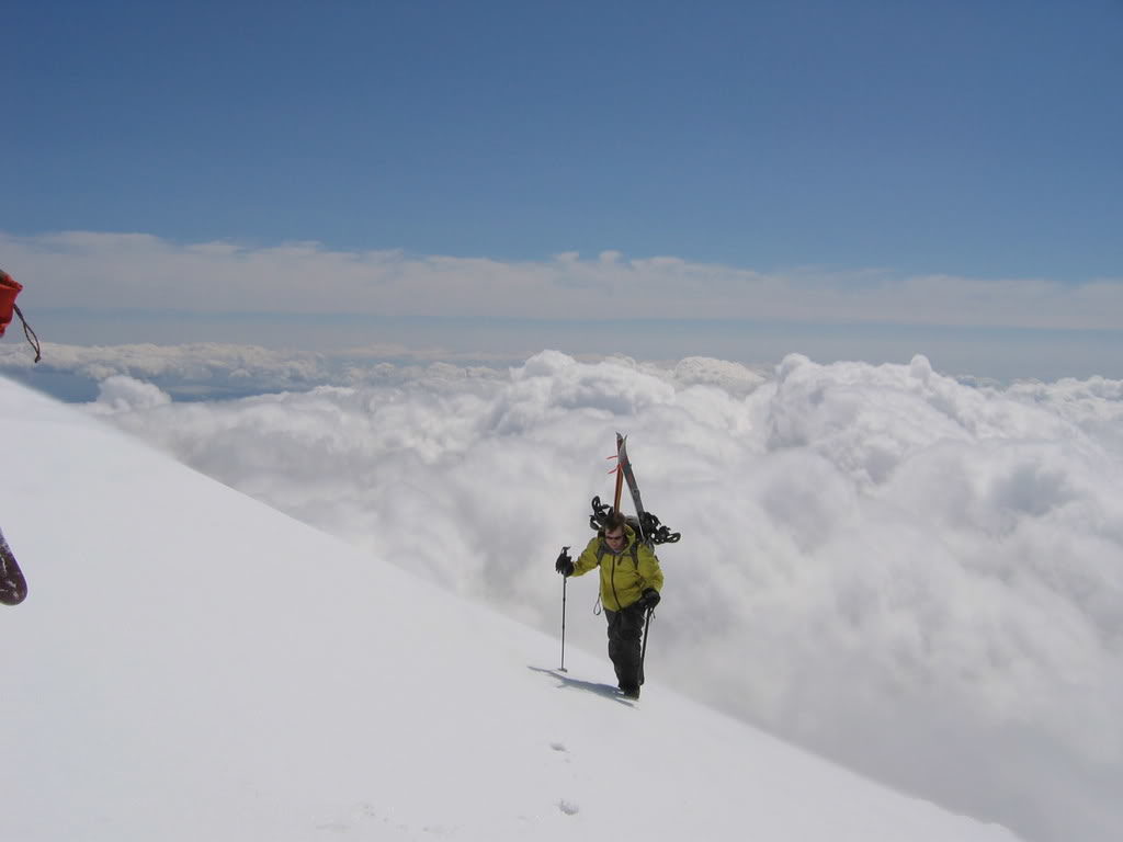
Finally we had our first view of the true summit of Mount Adams. From the Lunch Counter it was hidden behind Pikers Peak. In front of us was the final 600 feet of south facing slopes. With the plan to climb the Washington Volcanoes and more then enough time we made our way towards the top.
Arriving on the Summit of Mount Adams via the South Route
30 minutes later we were standing on the summit of Mount Adams. It was the perfect day in the Cascade Range without any wind and a clear view all the way to Mount Rainier. We were still a bit early and had an hour to wait before the corn softened up. Waiting until 12:30 we watched the sea of clouds making sure that they weren’t rising.
As we prepared to descend to the Southwest Chutes another group of two made there way to the summit. Once seeing our ski gear they started chatting with us about what we were planning on doing. They had hiked up and would soon we walking back down the standard climbing route. After a bit of talking is was time for our to start our descent.
The true summit was firmer then we had expected but the snow was edgeable. It was a bit concerning as soon we would be riding something much steeper. Once hitting the flats on the summit plateau we made sure to keep up speed. We still needed to head over to Pikers Peak if we wanted to ride down the Southwest Chutes.
Looking for the Southwest Chutes
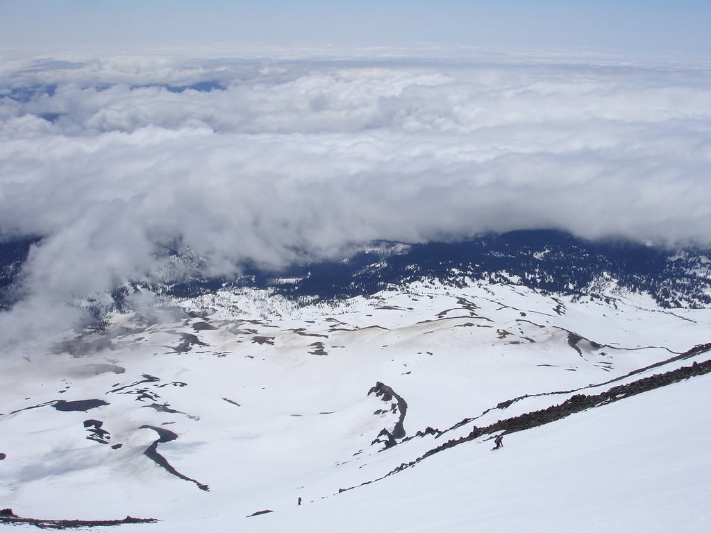
On the top of Pikers Peak we started looking for our descent route. Not having skied the Southwest Chutes before we were a bit cautious as we moved towards the edge. Looking down the terrain and then at the map we were pretty sure we were at the right place. We decided that we would ski down a bit lower and if we were wrong we would hike back up.
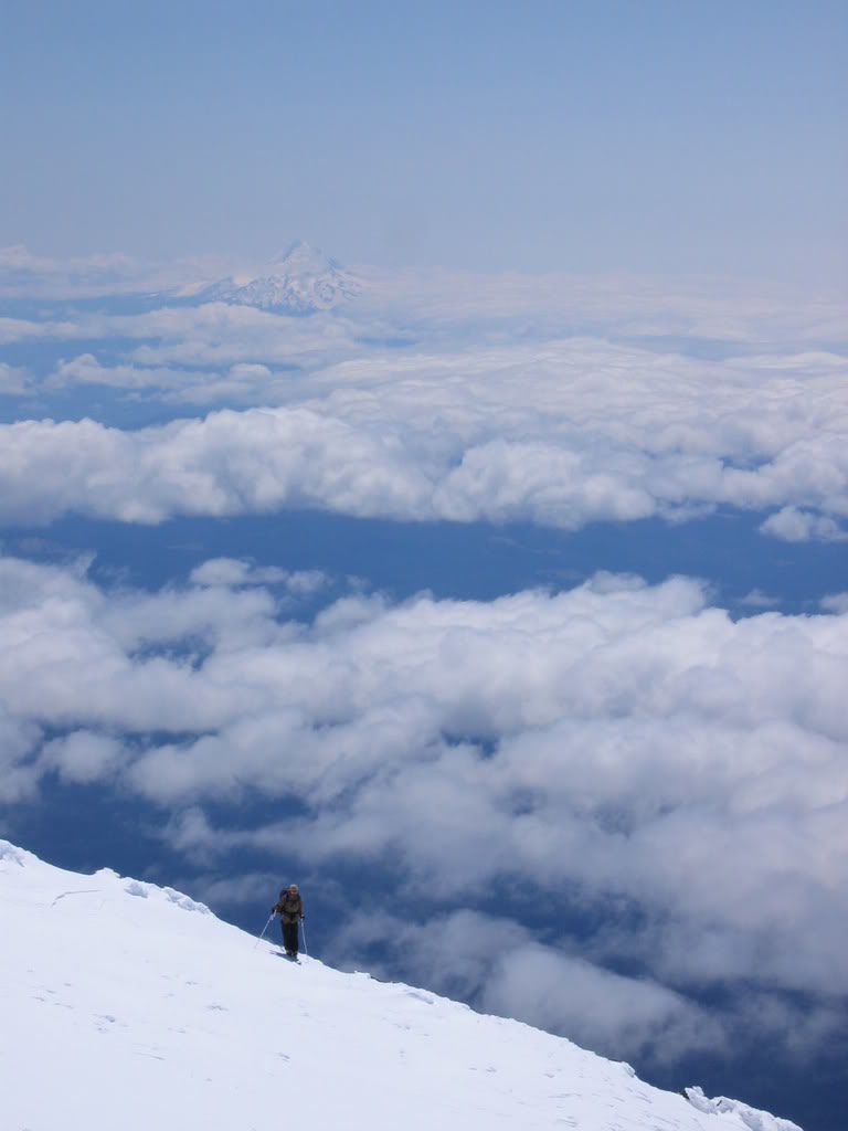
Making our way past the summit rhime ice the terrain below opened up under us. The firmness that we had feared off the true summit had quickly softened up. Making the situation even better it seemed that the clouds were getting thinner and we had a clear view down the entire line. Soon we were all together again and preparing to make our way down the Southwest Chutes.
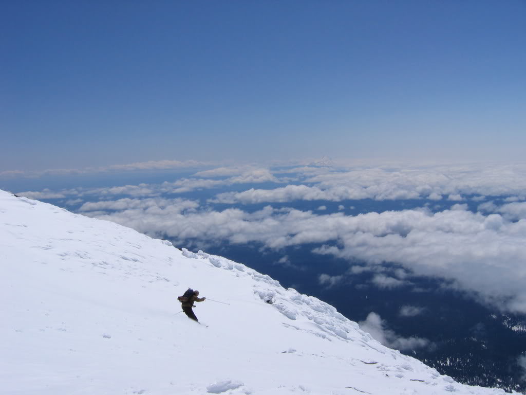
Riding Down the Southwest Chutes
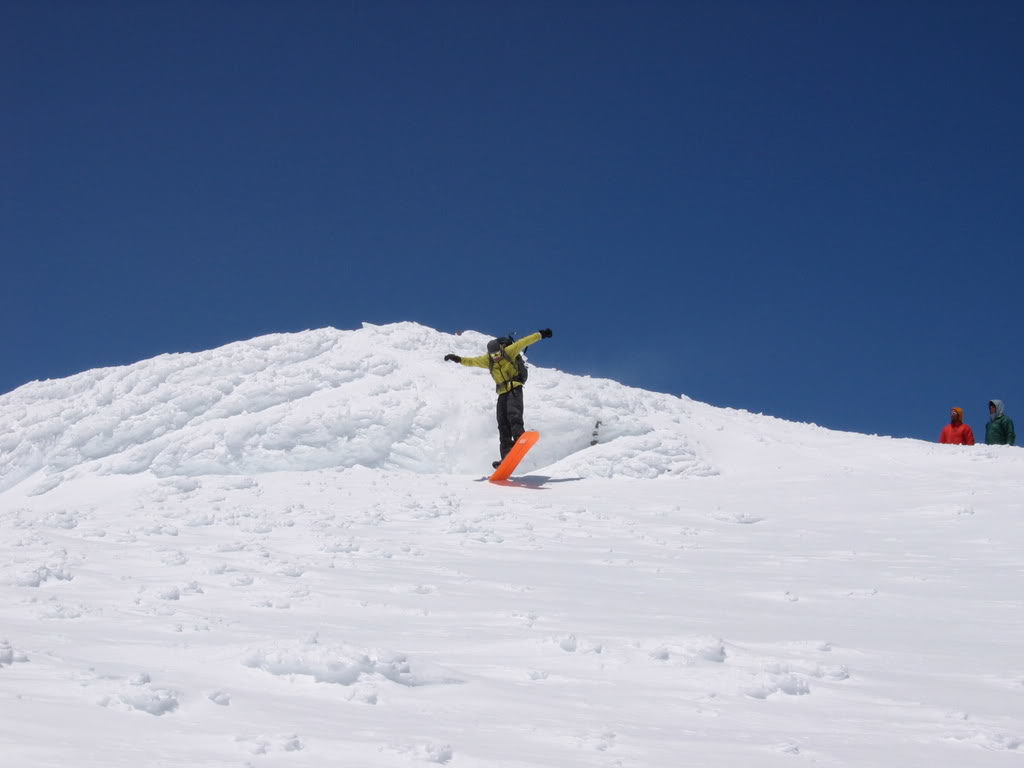
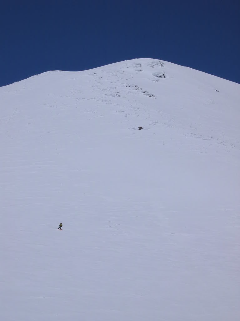
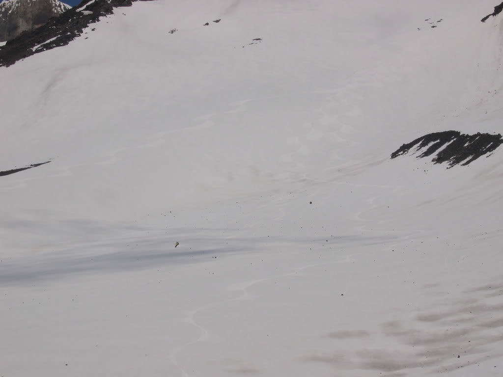
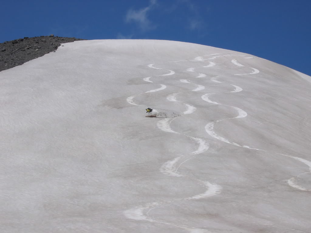
The first few turns were the steepest as we entered the line. Fortunately the snow was in perfect conditions not being too soft nor too hard. We could easily put our edges into the snow as we made our turns down. From what we could tell there were no other tracks to be found.
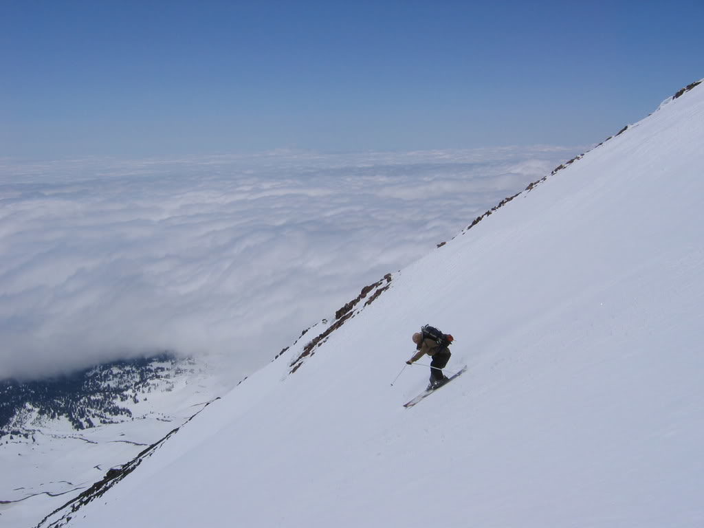
Being well over 3,000 feet the Southwest Chutes kept the same consistency from top to bottom. With terrain in the mid 30 degree terrain it was steep but not too steep. We would ski the line in sections to snap photos of each other once we traversed off to the side.
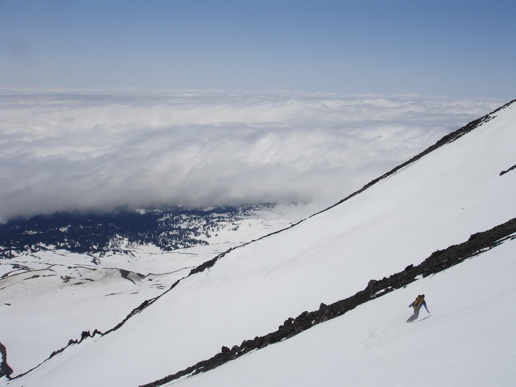
Soon enough all 3 of the Chutes had formed into one bigger line. Though we were loosing elevation fast the snow was still in its prime. We had dropped into the Southwest Chutes at just the right time.
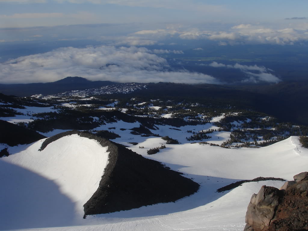
5 minutes and over 1000 turns later we were finally reaching the end of our line. Below us was some flat terrain that wouldn’t be great for Splitboarding. Though we weren’t looking forward to the exit it was worth a descent of the Southwest Chutes.
Making our Way Towards the Round the Mountain Trail
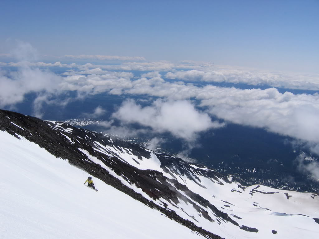
Finally we were taking our last turns onto the flats below and making sure to keep up speed. With two of us on snowboards and on on skis we needed as much speed as possible. Fortunately the terrain was smooth and not to soft as we made our way across the flats.
Soon enough we had passed the flats and were heading down the valley. By now the snow around us was covered in dirt as we laid in our tracks. We had feared that conditions would be too soft but they were still good.
With our car parked 6 miles lower in the valley we decided to go as far down as possible before skinning back to the car. It had been over 7,000 feet in total and good from top to bottom.
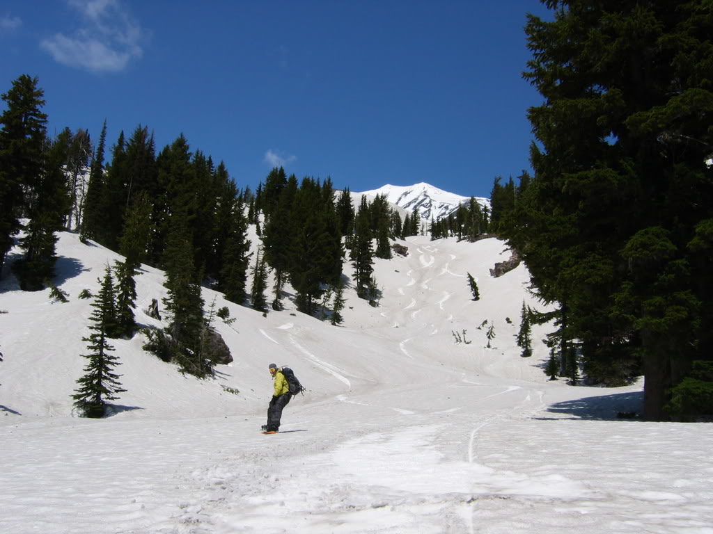
As we transitioned for the final skin back to the car we looked back up towards our route. In front of us was our tracks in the dirty snow and in the distance was the Southwest Chutes. We knew that the terrain would be fun but it was much better then we expected and an easy route to climb. Fortunately we still had a few hours of daylight left as we started skinning towards the car.
With a low snowpack we were able to make our way through the valley before descending to the road. Having a GPS we were able to skip the Cold Springs Campground and shave off a few miles. The plan to climb the Washington Volcanoes was coming together with climbs of both Mount Adams and Mount Saint Helens. All that was left was Mount Baker, Rainier and Glacier Peak which just so happened to be the 3 more technical routes.