
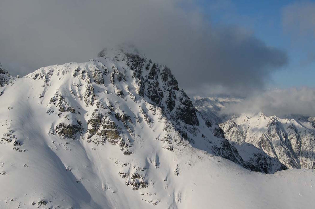
Black Peak is one of the bigger lines off of Highway 20. At 8,975 feet it is the 20th highest Peak in Washington State. Being in close proximity from Rainy Pass it is popular with both hiker and skiers. With an open south face the drains towards Bridge Creek it is a great ski run. The north face runs towards Fisher Basin and is much more remote. With the opening of Highway 20 for the season Joe Bell and I decided to make our way north.
Heading up Highway 20 for the Spring Opening
On Saturday night I met up with Joe in Seattle and made our way up to Highway 20. By now the road had just opened up earlier in the day. Driving next to Granite Creek we were soon at the Rainy Pass trailhead and setting up our tent. After dinner we fell asleep to clear skies with a plan to ride Black Peak the following day.
Heading to Heather Pass From Rainy Pass
We woke up to clear skies as we packed our gear and started moving. Breaking our way up the sparse forest we were happy to reach Lake Ann. Skinning across the frozen surface we could see old avalanche scars in the mountains above. Happy to be out there for corn snow we wouldn’t have to worry about loose snow slides.
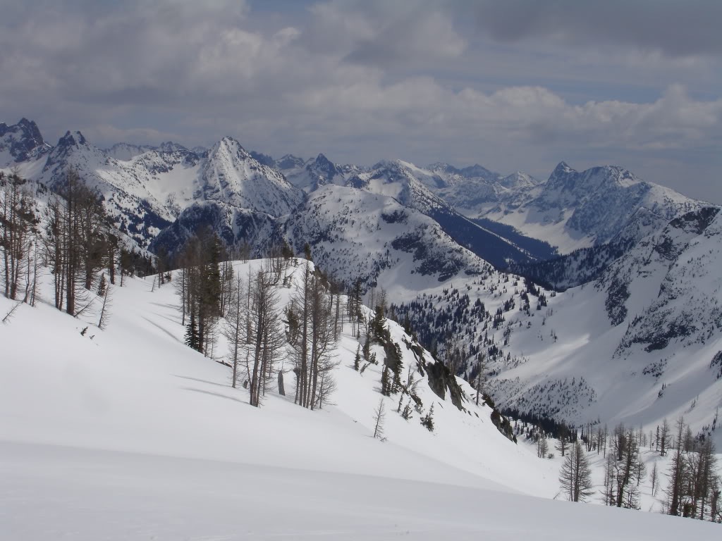
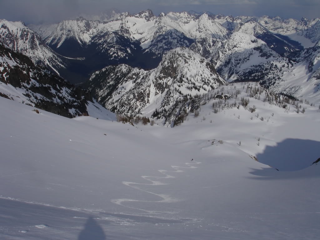
The Long Traverse to Black Peak
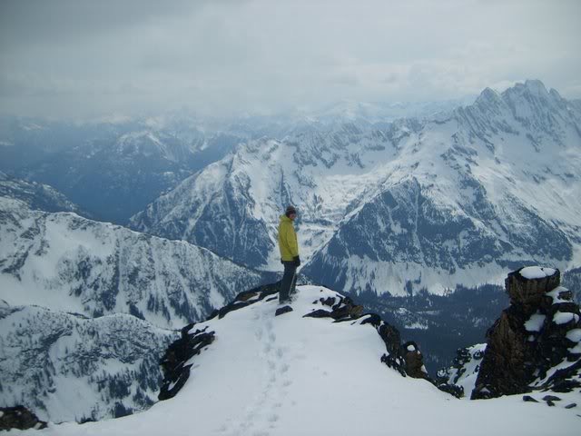
Putting switchbacks in above Lake Ann we were soon looking at our route. Standing on Heather Pass we had a clear view of Black Peak rising in the distance. From what we could tell the route would be easy but require a bunch of sidehilling. Being a snowboarder I planned on a quick snowboard descent before skinning. Joe was on skis so his preferable route was a high traverse.
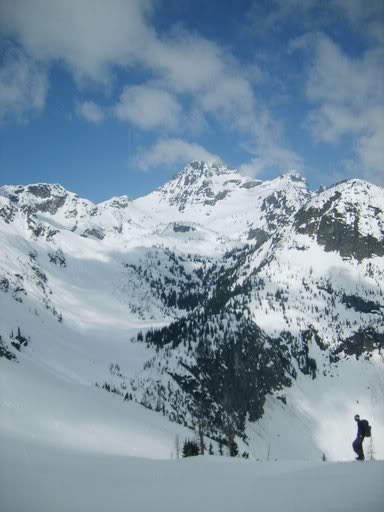
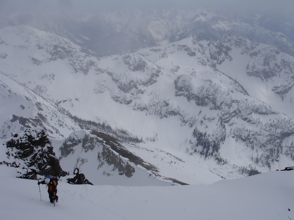
Though we both used separate modes of transportation we were soon back together. Skinning towards Black Peak we passed numerous north facing slopes basking in the sun. By now more clouds were coming in but the weather still seemed to be good. Our only concerns were that the snow would soften and that we would have visibility.
As we gained elevation we could start seeing peaks rising in the distance. Looking down at Highway 20 we could see why so many people tour in the area. From Silver Star to the Golden Horn we were surrounded by mountains. Though we had just experienced two hours of painful sidehilling we were now at the base of Black Peak.
Soon enough we were looking at the east col of Black Peak. Above us was rocky slopes all the way to the summit but to the south was a rideable face. Putting in mellow switchbacks we quickly made our way up to the col. By now the weather was changing fast.
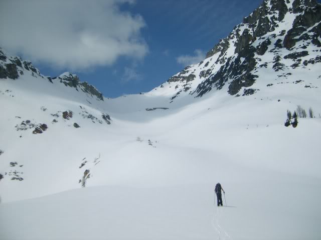
Climbing up the South Face of Black Peak
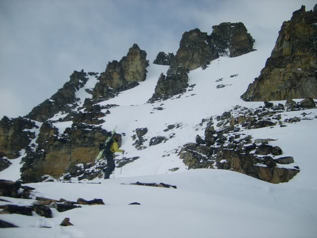
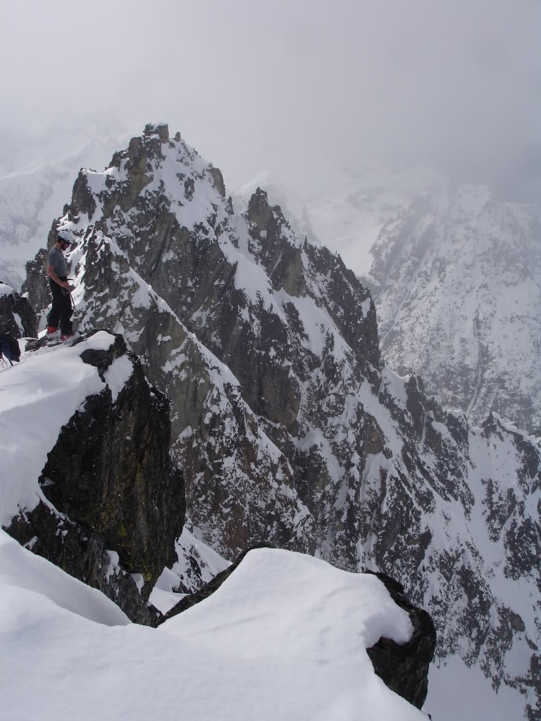
Once on the col we found ourselves in some thin clouds and strong winds. Above us was the open south face of Black Mountain. Immediately we knew that we would have to start climbing with crampons. Taking a quick break to transition we ate a snack and put our gear on the backpacks.
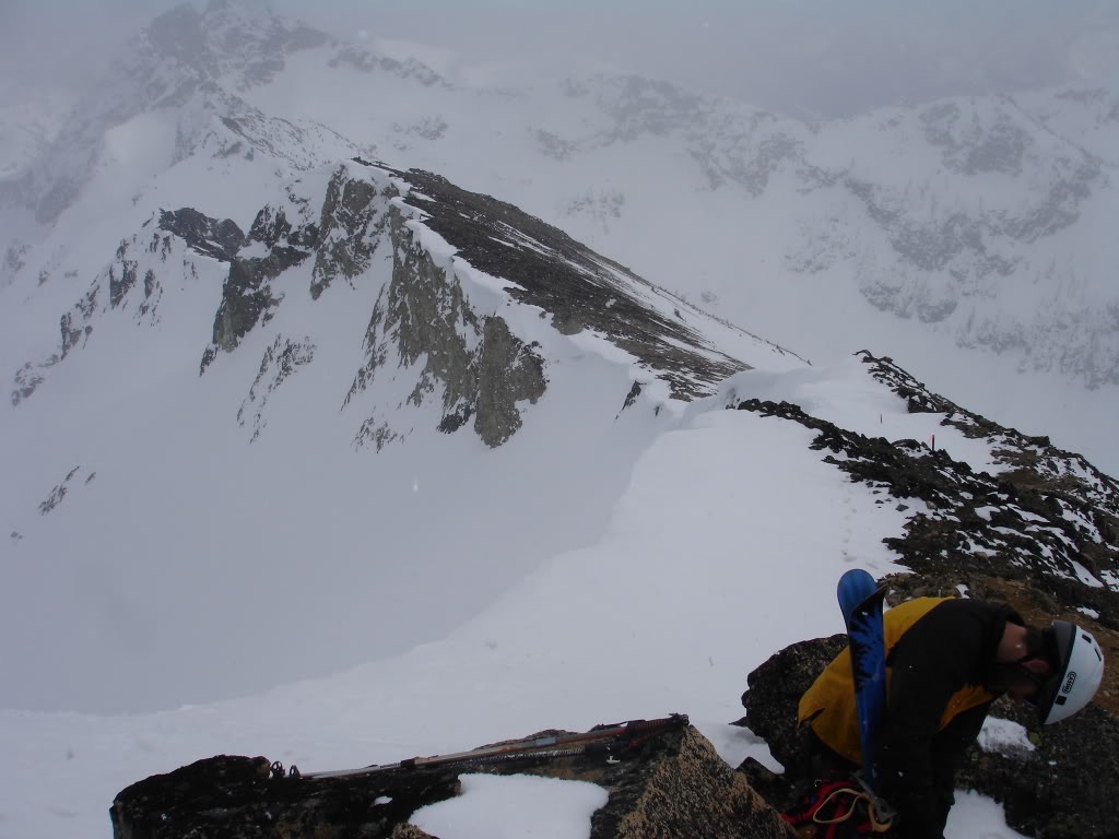
Above us was a straightforward route to the summit of Black Peak. Working with the rocks as long as possible we made our way up a foot at a time. Paying attention to the slopes we noted numerous descent routes. Though the slopes were still firm we were a bit concerned that they wouldn’t soften for riding.
Pushing up the South face of Black Peak we had a filtered view of the North Cascades. Below us was the upper slopes of Woody Basin and Mount Benzarino. We were only scratching the possibilities of what was available in the North Cascades.
A Scenic Summit in the North Cascades
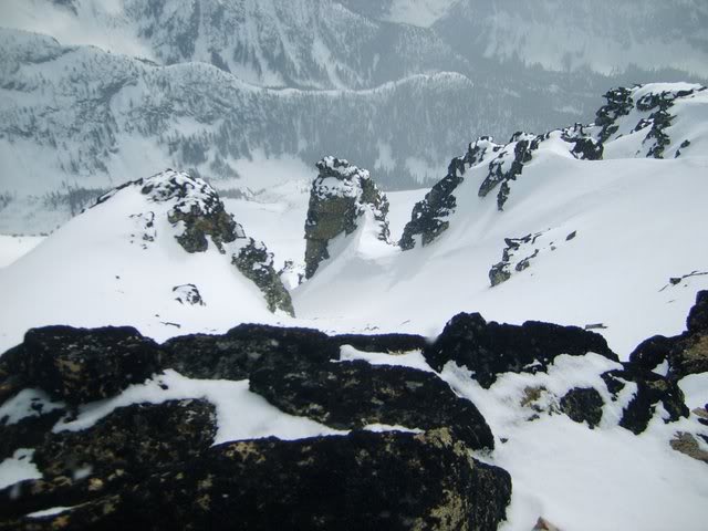
Before long we were standing on the summit of Black Peak. Slowly transitioning we soaked up the views of the surrounding mountains. Seeing them in the sun we quickly realized that we were in a thin layer of clouds.
Standing on the edge we carefully looked down the north face. Below us was a small glacier that made its way towards Fisher Basin. It was hard to tell from above but it seemed to require rappelling. We were looking for a laid back day and it was a bit more technical then we were interested in.
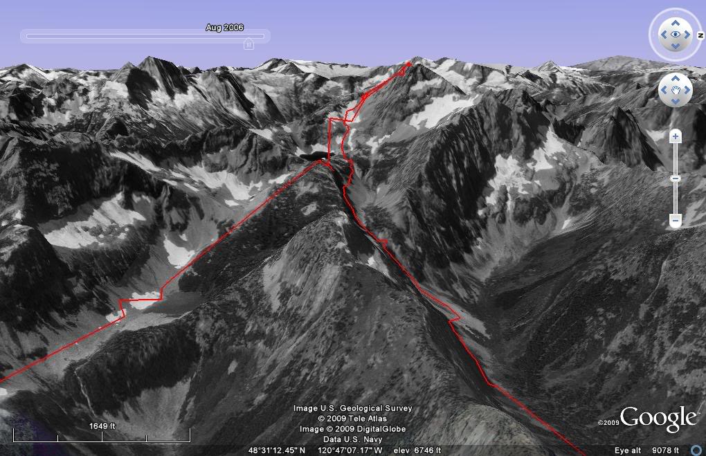
To the east we could now see our entire route for the day. From Friso Peak to Silver Star Mountain we were now looking down upon the North Cascades. While we were in the clouds we could see sun spots. It had taken around 5 hours to make it up top but fortunately is was pretty easy.
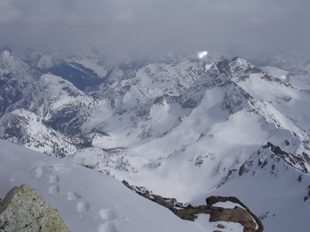
Looking to the South we could see North Fork Bridge Creek and Goode Mountain. In the distance we could barely make out the mountains around Bonanza Peak and Holden Village. We had 360 degrees of views.
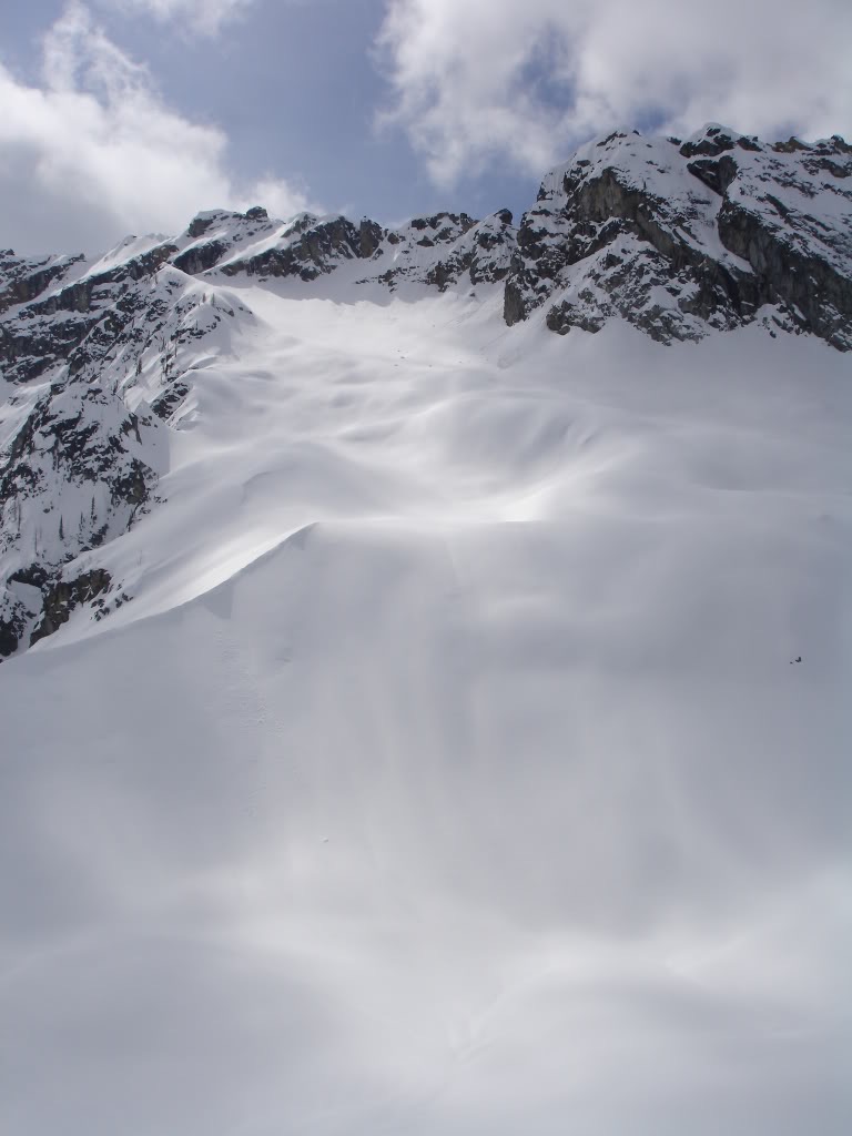
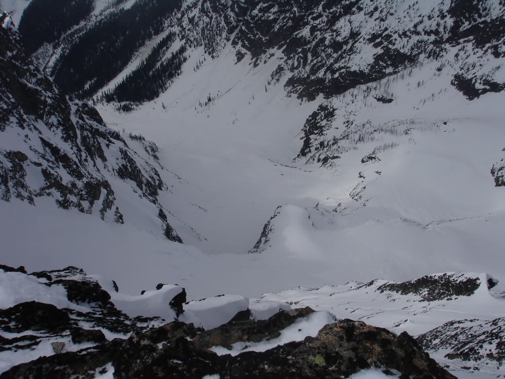
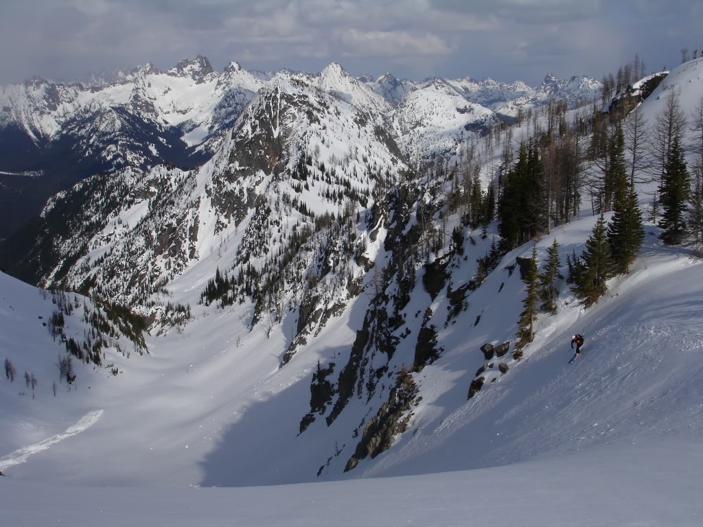
Looking down we had a clear view of the south face of Black Peak. Though we had climbed the eastern most chute the middle one got our attention. From what we could see it looked like a fun line. With towers of rock on both sides we quickly decided it was the way we were going to descend.
Snowboarding down the South face of Black Peak.
We sat on the summit for over 30 minutes before it was time to ride. Strapping into my board I was happy to find great and edgeable snow. Working with the terrain we made our way down in a few minutes.
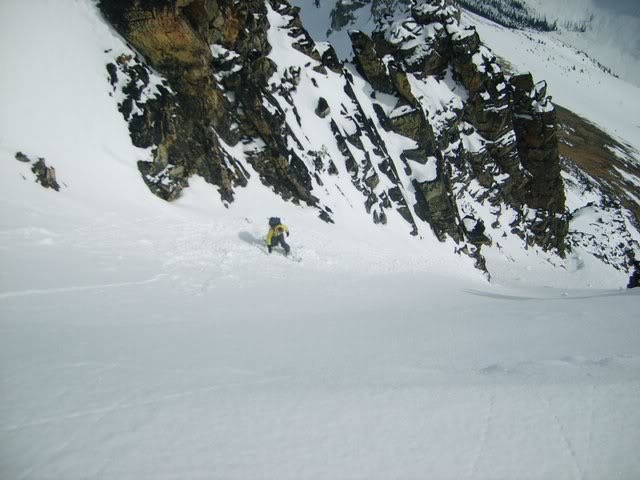
Soon enough we were at the base of the chute and making our traverse towards the col. Though short it had been an aesthetic line. With a quick traverse we were back on the rocks and walking towards the col.
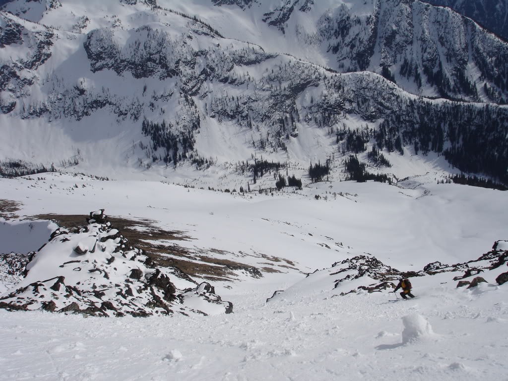
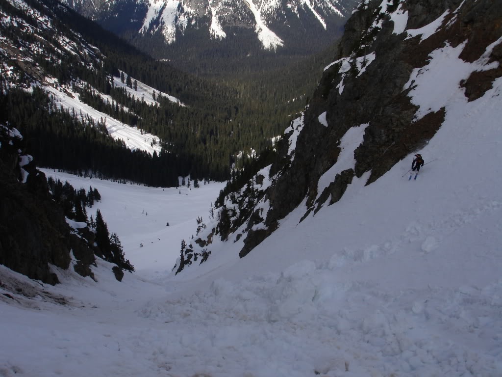
Though the snow had been good on the south face of Black Peak it was much better below the col. Not being South facing it was both smooth and fast as we made our way towards Highway 20. What had took us hours to climb was descended in seconds.
Taking an Alternative Route to Granite Creek
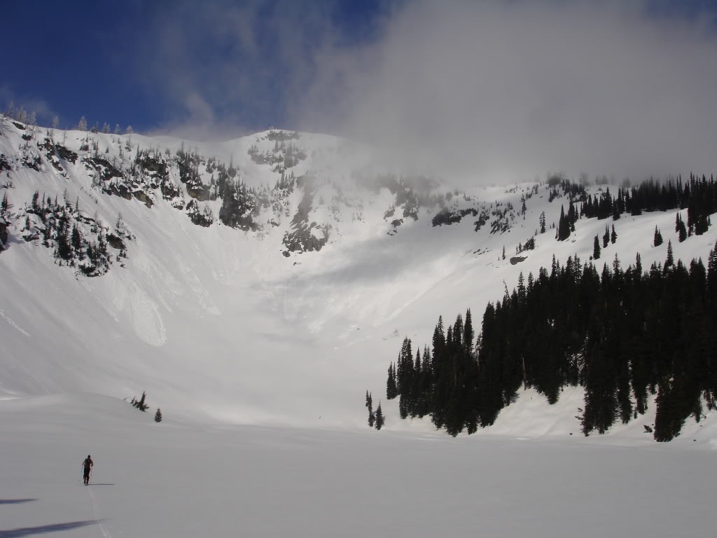
Instead of heading back the way we came we decided to go another route down. Directly to the East was a canyon that would go to Granite Creek. Though it would take us a few miles down the road it would be much better fall line. Soon enough we were dropping in and finding the best turns of the day.
After making our way down a low bench we were in the second and main gully. Though filled with debris we milked up the sidewalls and rode into the flat basin below. Before long we were back in the lower forest and riding low angle slopes to Granite Creek. Soon enough the terrain was to flat and we were skinning down the valley.
After skinning for over an hour we were able to make our way over Granite Creek. By now we could here cars in the distance and knew we were close. After a few steeper switchbacks we were back on the road and hitching a ride to the car. After 20 minutes standing there we had a ride and were back up to Rainy Pass. It was a great day riding Black Peak and we looked forward to another tour in the area. While it was a fun ski descent we were happy we had took the variation.
Thank you for reading this trip report on Black Peak via the South Face
If you want to see more ski tours within the the Highway 20 corridor check out this link.
and for a full and text only list of all Trip Reports Click Here