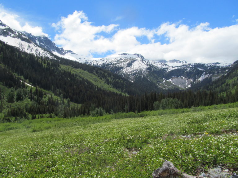
The Extended Ptarmagin Traverse is a ski tour from Cascade Pass through Glacier Peak Wilderness to Holden Village over 7 days in Washington State. Traveling through the Cascade Crest it passes through some of the more isolated Mountains within the Cascades. While the standard Ptarmagin Traverse ends at Downey Creek this is an extension that reaches Railroad Creek. Roughly the route is around 45 miles with numerous climbs along the way. This was the second section of the American Alps Traverse and linked both the Isolation Traverse to the north and the Suiattle Traverse to the south. This route was pioneered by Lowell Skoog via Miners Ridge but we decided to make a different route heading through Bannock Lakes.
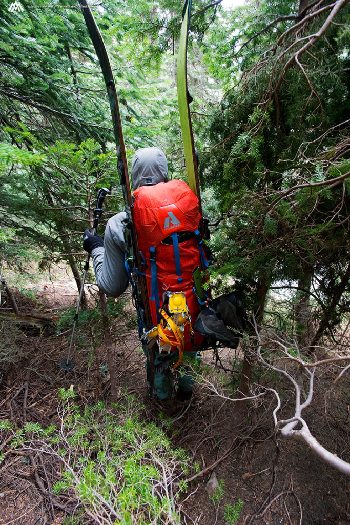
Starting the Extended Ptarmagin Traverse
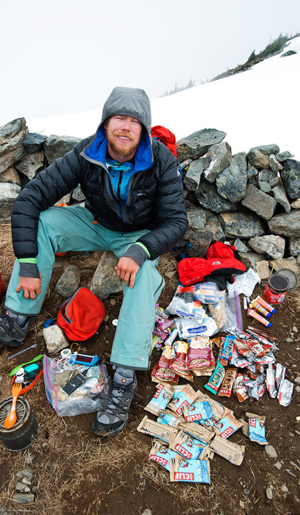
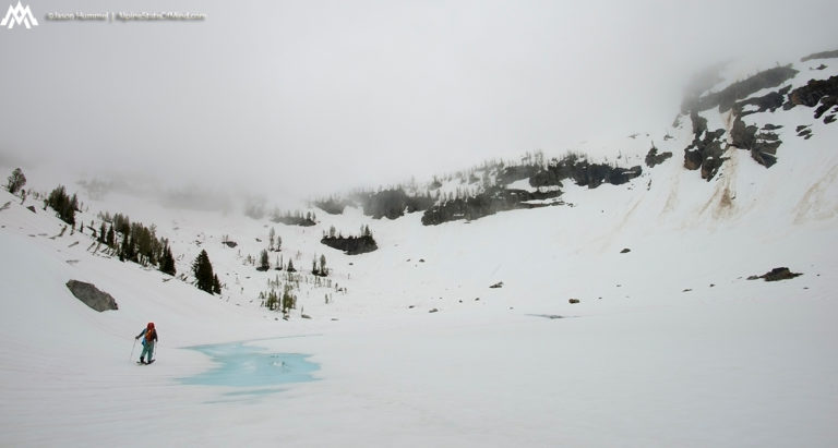
I woke up with a sore body and was as we had just got done pulling off the 4 day the Isolation Traverse. With a new cache of food we pack it for up to 10 days of travel. If we had everything correct The Extended Ptarmagin Traverse would be the longest portion of the American Alps Traverse. Our plan was to do the standard route and once at Dome peak we would pioneer a new route through Bannock lakes. According to the maps it seemed to be a more direct route though there one small section that was unknown. This section drove my mind crazy, as I wondered if it would go or not.It would be a big question but we had to check it out and the only way to do so was to move forward.
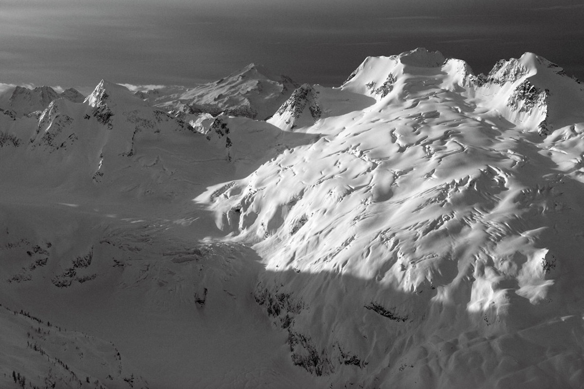
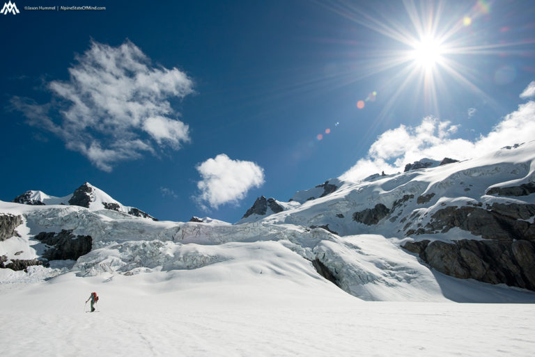
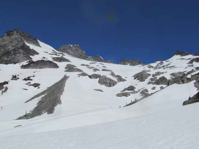
Soon enough we on the top of Cascade Pass and skinning towards Cache Col. There was one section just past Cascade Pass to the southwest with a semi steep traverse above cliff bands that I was concerned about. From a distance it looked intimidating but once on the slope I found it to be better then expected. Soon enough we dropped onto the mellow glacier below Cache Col and switching back to skins.
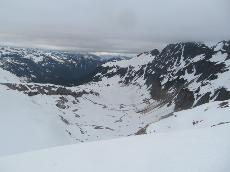
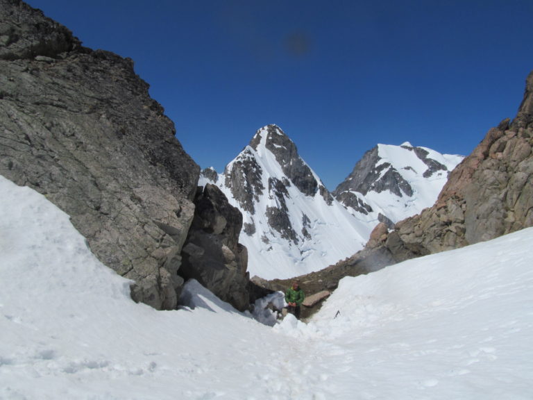
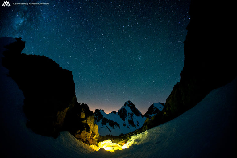
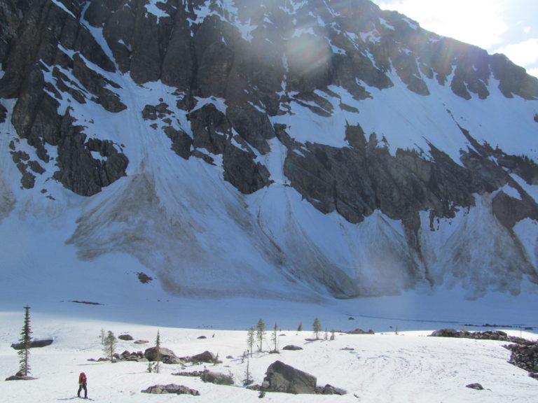
Once up on Cache Col we set up camp a few hours before sunset. It was decided that the area actually had spots for tents on the dry ridge we shouldn’t pass it up. Knowing that the next 10 miles were guaranteed to be on snow we would have a short day. Once everything was set up we started eating as much food as our stomachs would allow. Hanging out on the ridge we joked that everything we ate would make our bags lighter.
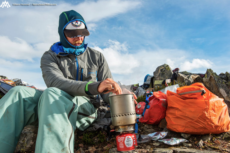
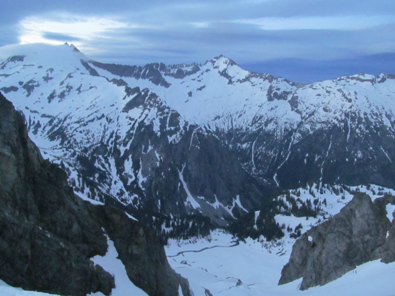
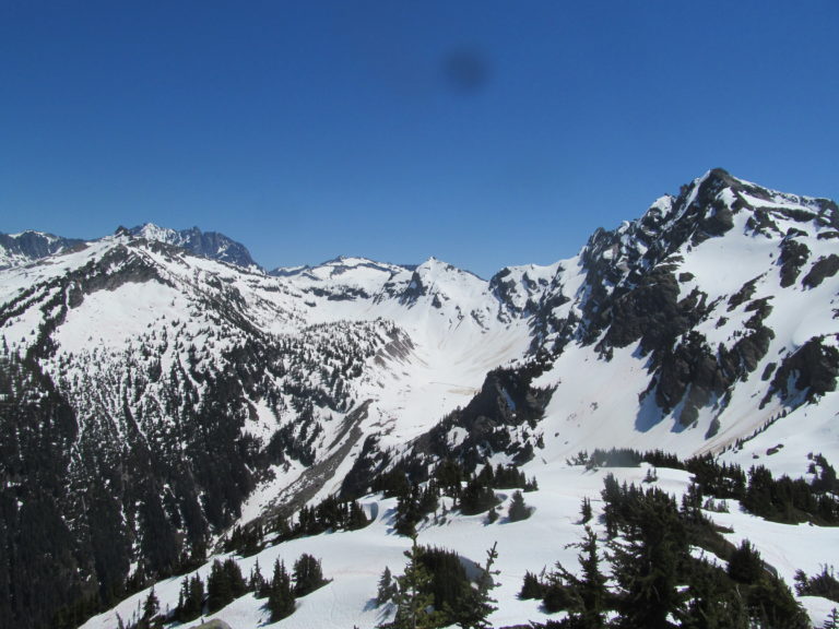
A Scenic Camp on Cache Col
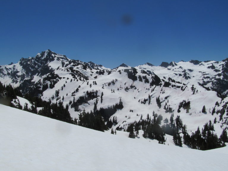
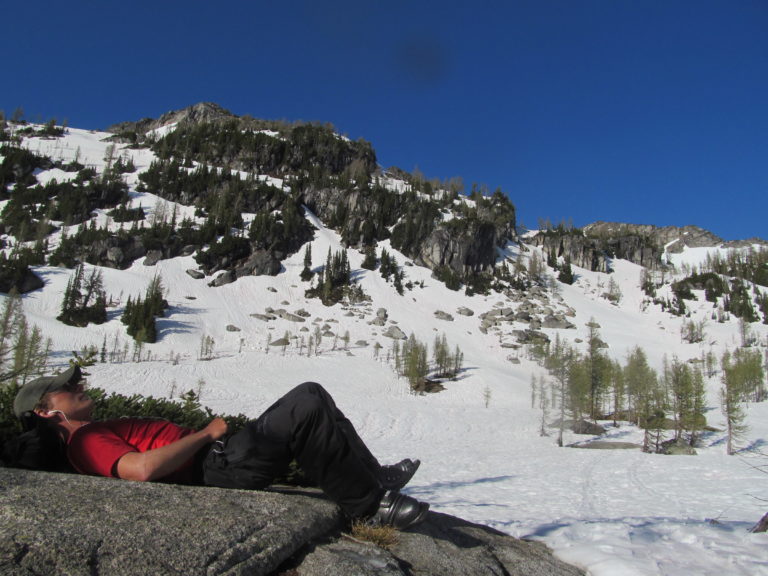
Resting on the ridge we had a stunning view of Johannesburg Mountain to the North. In the far distance we could also see the terrain we had just covered during the Isolation Traverse. It had put into perspective what was now behind us but more importantly what was in front of us.
Directly across the Stehekin River Valley the clouds would come in and out like an oceans waves. Watching the summit of Sahale Mountain become engulfed in a world of white we were happy to be up at Cache Col. Below the cloud lines we could make out Doubtful Lake which seemed to still be getting the sun.
To the East we had a clear view of the Stehekin River Valley and the mountains that bordered it to the North. In the far distance we could make out Mount Logan and Goode Mountain bordering North Cascades National Park rising over 9,000 feet.
The mountains in front of us ran like a backbone of the North Cascades. With each one of the peaks we held different memories of both Sahale Mountain on the left and Mount Buckner on the right. In the valley below was could see our basecamping spot when doing the Magic S Loop.
Day 2 of the Extended Ptarmagin Traverse and an Unintended Storm Day
We woke up in the clouds as the weather deteriorated. There was a back and forth chat between Hummel and I over if we should keep moving or wait it out. Occasionally it would rain lightly and I really didn’t want to start the traverse in wet gear. In the end it was decided to wait the day out and combed through our gear. It was great having some rest but we would have to make up the distance the following day.
Day 3 of the Extended Ptarmagin Traverse from Cache Col to White Rocks Lake
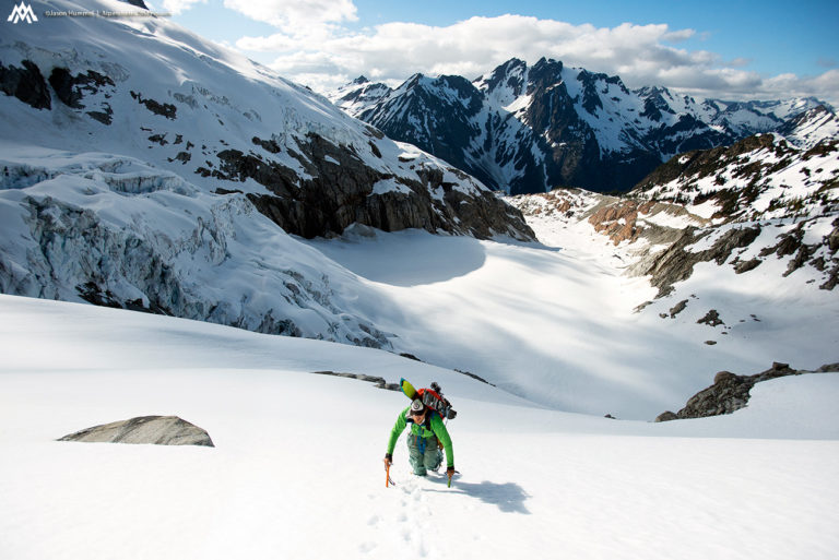
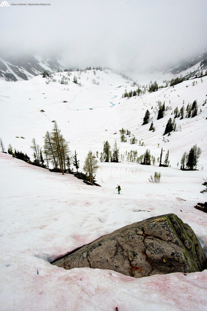
The next morning we woke up and were itching to start moving. Quickly packing our bags we pushed off on the Extended Ptarmagin Traverse in early morning firm snow. The plan was to take advantage of daylight and if travel allowed we would stop at one of Hummel’s favorite camping spots that night.
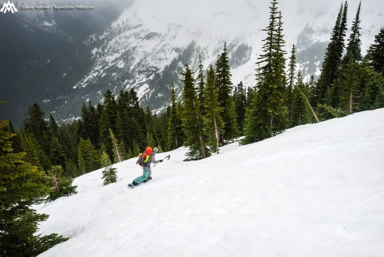
This section was pure misery for me on a splitboard as there was really no snowboarding. Instead of climbing I quickly found that the Ptarmagin Traverse was mainly sidehilling. Jason would put on his skis and traverse a mile while I would ride a few hundred feet, boot pack a few hundred feet than repeat. This would go on for hours as I would finally reach Hummel beaten and he was fresh to keep moving. Though it was exhausting we both knew there would be no breaks if we were going to the intended camping spot.
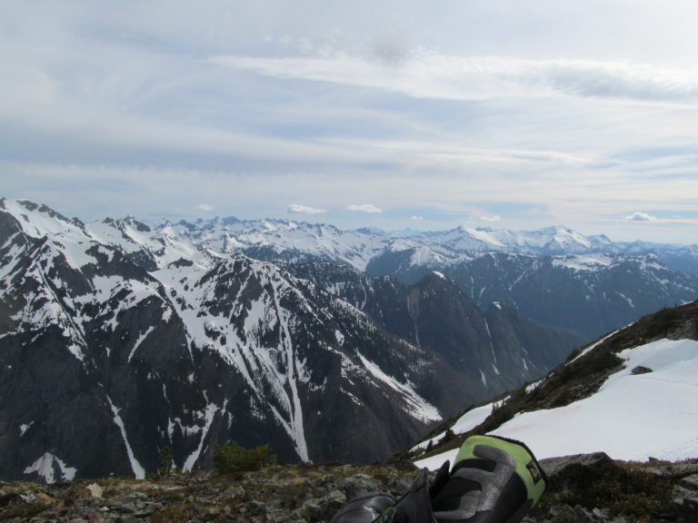
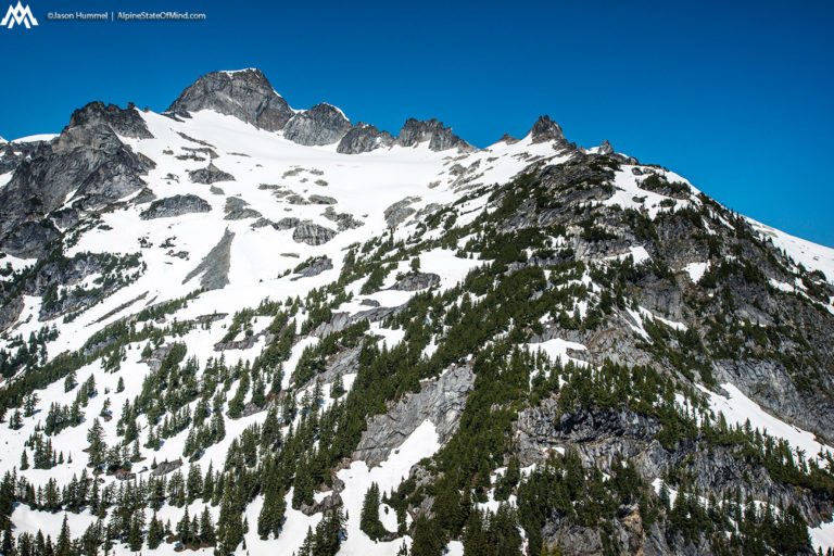
The weather was in and out as we kept pushing south. I had checked out the Extended Ptarmagin Traverse on maps numerous time before but it felt different then expected. The area was rugged as we passed the Le Conte Glacier and made our way to the South Cascade Glacier.
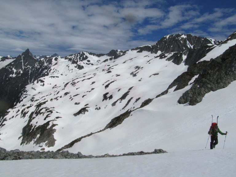
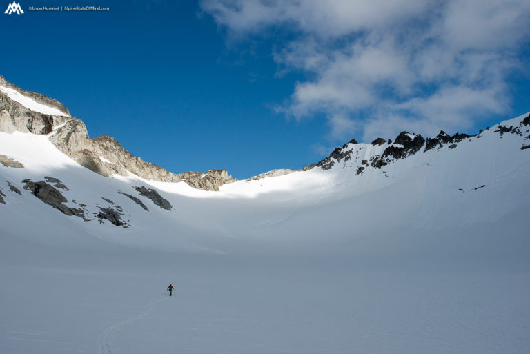
After about 8 hours we finally rode down to our camp just across West Fork of Agnes Creek from Dome Peak. We were happy to find that the shores of White Rock Lake were dirt and the perfect spot for the night. This would be the spot where we split off from the Ptarmagin Traverse and get into the extended route.
Setting Up Camp at White Rocks Lake
Our plans was to drop into the West Fork of Agnes Creek below and skin directly up the Chikamin glacier instead of an up and over of Dome Peak. It looked like it would go but we couldn’t see the entire route. We knew that the only way we would know was if we went down and checked it out.
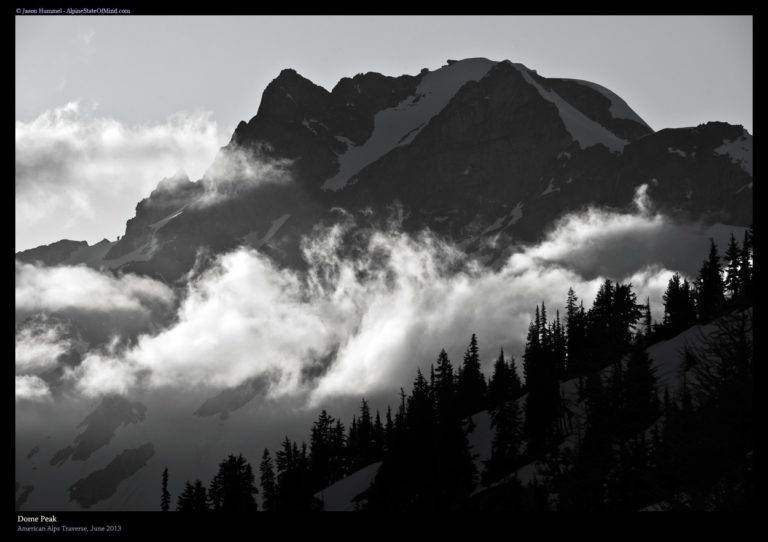
Looking directly across the West Fork of Agnes Creek we had a clear view of Dome Peak. It looked to be a challenging climb to go up and over and confirmed our thought to go across the valley. Though we were in the sun we could see the clouds coming in and out over the western crest of the North Cascades.
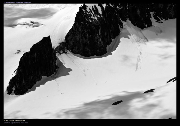
While we never ran into anyone while doing the Extended Ptarmagin Traverse at one point we saw people skinning the Dana Glacier. Somehow they had passed us without us noticing and it seemed they were finishing off the standard traverse. These were the only people we would see during the whole American Alps Traverse.
For the rest of the of the day we took in the views surrounding us and made our plans to see if the route went. While hanging around camp a marmot took interest in an extra pair of Hummel’s ski gloves. Soon enough one of them was gone leaving Hummel with 3 gloves for the rest of the trip.
Day 4 of the Extended Ptarmagin Traverse From White Rocks Lake to Gunsight Notch
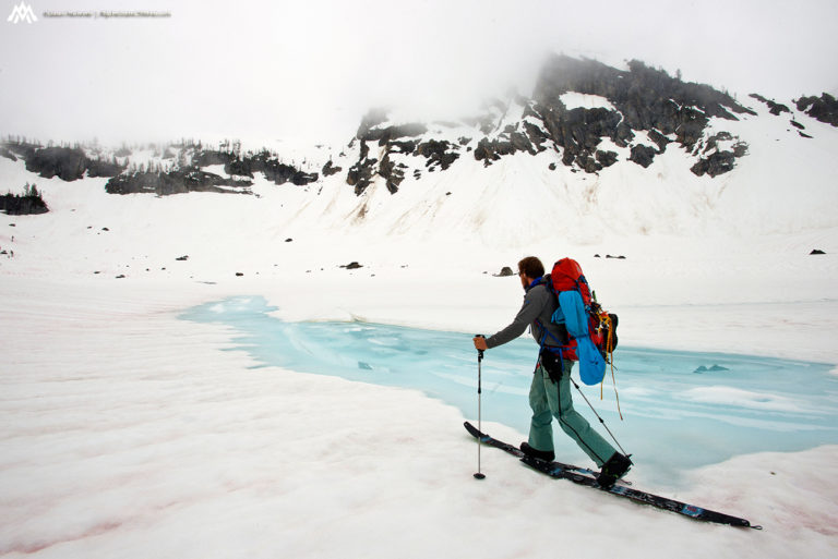
Things aren’t supposed to go this easy was what I was thinking as rode into the West Fork of Agnes Creek. Looking above us we were happy to find a mellow route onto the base of the Chikamin glacier. My heart sunk as we looked up the route as it seemed like a crevasse ran the entirety of the glacier. By now we were all in so we decided to keep moving and hopefully there would be a route through.
Looking to the west Dome Peak rose dramatically above the Chickamin Glacier. Between us and the summit was a maze of crevasses and seemed to be a route finding nightmare. We were happy with our decision to go up the glacier but we were still concerned whether the route would even go.
When we made it to the lower bulge of the glacier we found a snow ramp on the left hand side. We were happy to see that it would allow us to bypass the massive cracks in the glacier.Making quick quick progress we went over to the base of the ramp before taking a quick break to snack and water. Soon we would be putting the skis on our packs and pushing past the glacial ice fall.
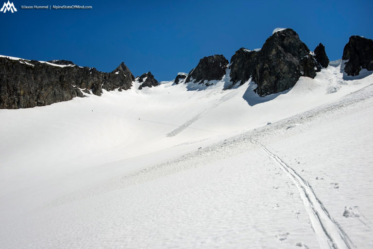
The First Crux of the Extended Ptarmagin Traverse on the Chikamin Glacier
As we made our way up the ramp we were surrounded by stunning views of the Chikamin glacier and the lower slopes of Dome peak. The route had gone as smooth as we could have hoped for and now we were heading into the Extended Ptarmagin Traverse.
We had bypassed Dome Peak which was occasionally buried in clouds. It had been a good call to wrap around and we had saved quite a bit of time. Finally we could put our skis back on our feet and cover some ground towards our next camping spot.
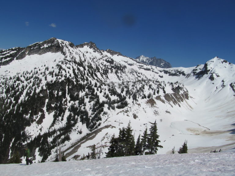
Arriving at Gunsight Notch we were happy to find that it wasn’t entirely snow covered. The day was starting to get late and the sun was starting to drop to the west. Knowing that we were possibly at the best spot for miles we decided it would be the best spot to set up camp.
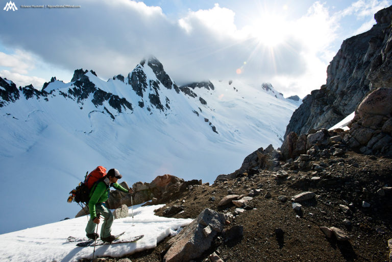
With a stunning view of Dome and Chickamin Peaks we happily rested the rest of the afternoon. We were past the halfway point and the closest way to civilization was to follow the Extended Ptarmagin Traverse. For the rest of the afternoon we looked over the views and studied the map. The next day would be the crux of our trip and soon enough we would find out if our route actually went.
A Scenic Camping Spot at Gunsight Notch
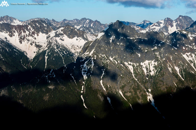
Looking to the east there was a wall of mountains that were unknown to us. Unlike the snow plastered summits we had traveled through this area was covered with rocks. It seemed every peak would be both a challenge to climb but even harder to access. This was an area where trails were few and far between and a land of mystery.
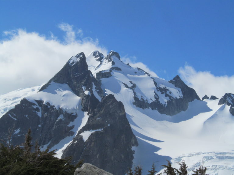
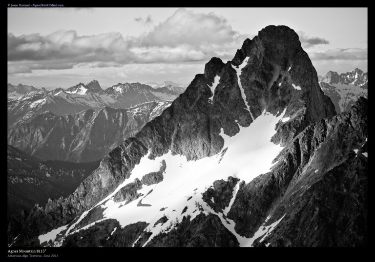
Directly east of us we had a clear view of Angnes Mountain via the west face. I had heard of the peak numerous times but here we were being what felt like a stones throw away.
As the sun set and the stars came out we could see the light pollution of the Puget Sound. We were in the middle of nowhere but this reminded us that we weren’t that far from civilization. All that was between us and the cities below was a wall of Mountains and the Suiattle River.
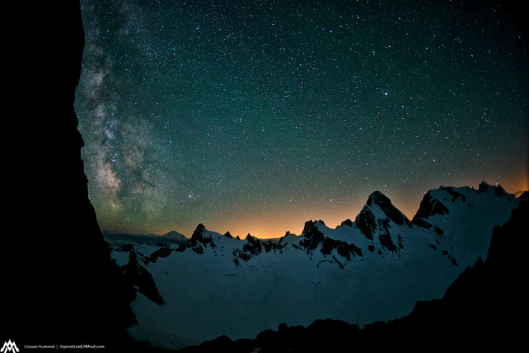
As the night got dark we enjoyed the warmth of our sleeping bags between heading out for photos. It was a beautiful and clear night and we were happy knowing there were no clouds. We had been spoiled with clear weather as we moved deeper into the Extended Ptarmagin Traverse. Hopefully the weather would hold for the rest of the route all the way to Holden Village.
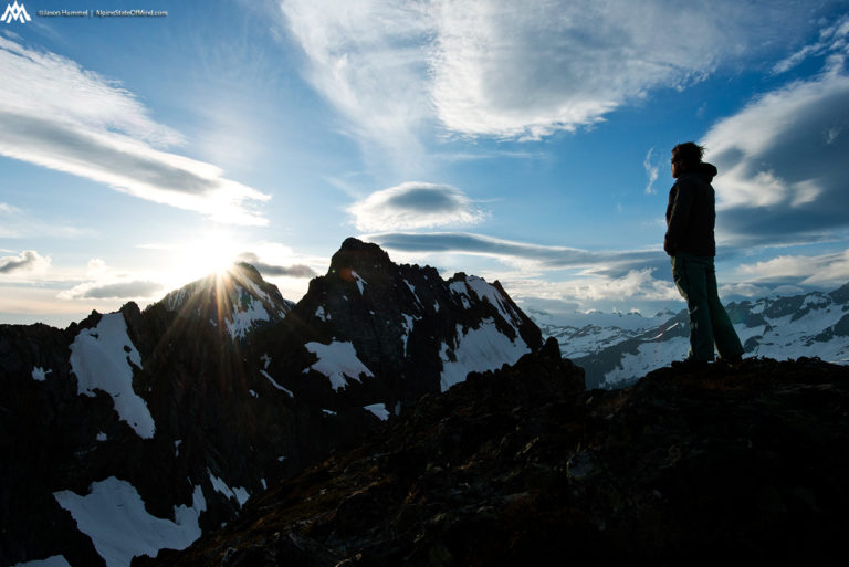
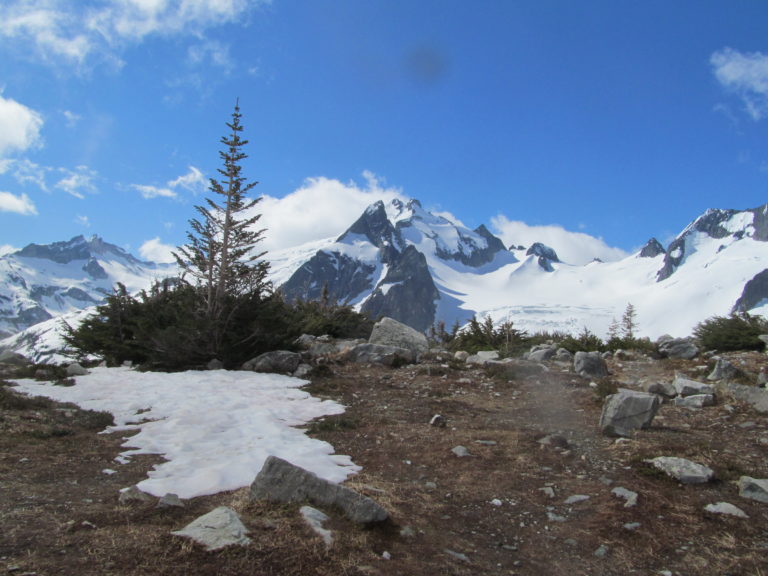
Day 5 of the Extended Ptarmagin Traverse from Gunsight Notch to Bannock Lakes
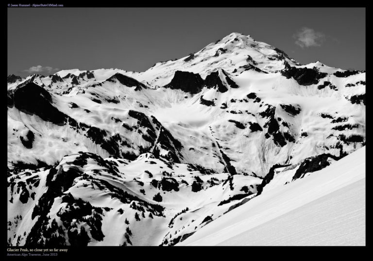
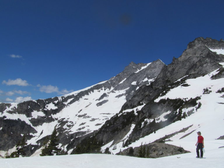
The next morning we woke up to clear skies and a stunning view of the north side of Glacier Peak. This would be the final summit of the American Alps Traverse but it felt so far away. Sitting at camp we waited a while for the snow to soften while we broke down camp wondering what was in store the next few hours.
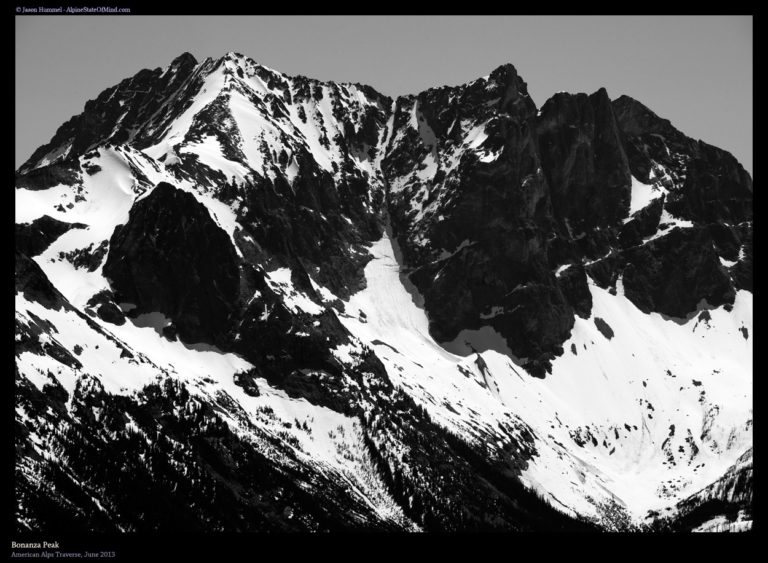
Directly to the southeast we had a clear view of Bonanza Peak at the head of the South Fork of Agnes Creek. We would have to wrap around the south side of the mountain before heading down to Holden Village. If all worked out as planned we would be camping near its base in two days.
With our gear on our feet it was time to start riding down. Doing a clockwise traverse we started riding from Gunsight notch to the Southeast. Before long it was time to head directly south and drop thousands of feet towards the Hanging Gardens.
Dropping down it was a beautiful and wide open run before making it to the low ridge. The snow was both soft and fast as we made our way down enjoying some fall line riding. Looking back we were happy as it was a great run and start the day.
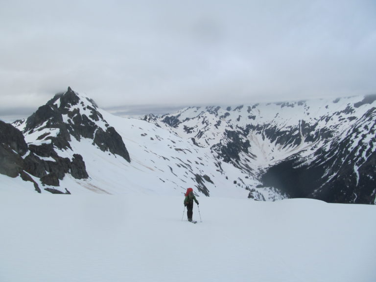
In the distance I could see the rocky mass of Bannock peak making me more and more nervous.We could see most of the route but it was the one spot we couldn’t see that I was worried about. If it didn’t go we would have to add an additional day to the trip and a whole lot of sidehilling.
Arriving at the Hanging Gardens
Following the ridge towards Bannock Lakes we had a full view of our previous line. We were officially in the middle of nowhere and coming upon an area I had been studying for months. Within the next hour we would know if our intended route went but so far everything had gone really smooth.
Once in the Hanging Valley we took in the views of Dome Peak behind us and had a quick water break. Each step was taking us closer to the crux zone and we were walking into the unknown. Hummel felt sure that it went but I was still incredibly anxious but soon enough we would find out.
Finally within a kilometer I got a better view of the area and it was obvious that we wouldn’t be able to skirt under it. Instead we decided to cross midway up the slope in a snow covered section. Once there hopefully there would be a way to ride down to Bannock Lakes.
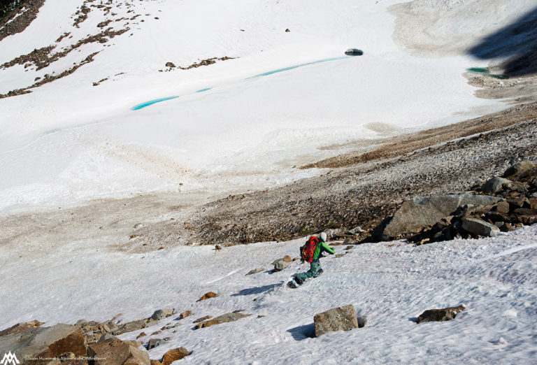
Once on the knoll we had a blind roller that was the barrier between us and Bannock Lakes. Jason decided to do a few steps down and found open slopes running into a snow covered section through the cliff bands.The route barely went and we would be able to keep heading southeast. It was like a weight being lifted and we were pushing foreword on the Extended Ptarmagin Traverse.
Snowboarding Past the Second Crux of the Extended Ptarmagin Traverse to Bannock Lakes
We ripped our skins started riding towards Bannock Lakes. The slope was wide open but scattered with boulders sticking out. With all of the stress over the past few days it a few core shots was the least of my worries.
Once on the shores of Bannock Lakes we were taken back by how beautiful the area was, There were small ponds everywhere and it was a wide open and flat basin.
It was starting to get dark and we needed to find a spot to camp. We kept skinning until we would find the perfect spot to set up the tent. It had been a long and stressful day but we had pasted the crux and were pushing towards the final stretch of the Extended Ptarmigan Traverse.
Once we found a nice flat rock we dropped all our gear, put up camp and relaxed for the rest of the day. It had been 9 days since I took a shower and I decided I had to do something. Soon I jumped into an icy creek next to camp while Hummel called me crazy. 10 minutes later I was dry and feeling refreshed and he was doing the same.
As we watched the last of the sun drop over the horizon we watched clouds come in from the west. Fortunately it didn’t seem as though there would be bad weather as we went to bed. Hopefully if everything went to plan we would be spending the next night camping at Lyman Lake.
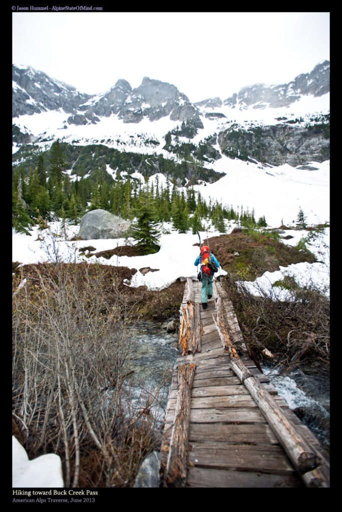
Day 6 of the Extended Ptarmagin Traverse From Bannock Lakes to Lyman Lake
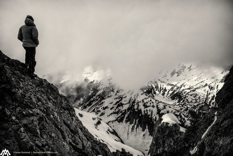
We woke up to cloudy skies but decided to keep moving as we wouldn’t be traveling in alpine. Once past Bannock Basin we would be in tree line and heading up the South Fork of Agnes Creek. According to the maps we would be able to follow the Pacific Crest Trail all the way to Lyman Lake. If that was the case we would be a few hours hike from Holden Village and the end of the second leg of our trip.
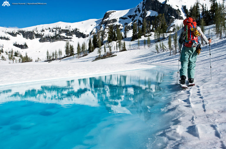
The high country was covered in clouds as we started skinned towards the ridge. The blue of the lakes was a stark contrast to the world in front of us. We hadn’t expected the clouds to roll in but there they were. Though it was a pain to have the weather move in this was the best day for it.
Once near the ridge we had a sweeping view of the Bannocks Lake area. The place was much more stunning then I had expected. Though it was covered in snow you could tell the place would be amazing in summer. It was as if the area was a smaller version of the Enchanments with a big flat basin and stunning lakes.
Snowboarding into the South Fork of Agnes Creek
Once on the ridge we ripped our skins and decided we would go as low as the snow allowed. Below us was the Pacific Crest Trail and we knew it would be obvious when we hit it. Fortunately we were now below the cloud deck and heading towards the South Fork of Agnes Creek.
We kept riding until the snow finally switched to dirt. We still weren’t at the Pacific Crest Trail but it was just a few hundred feet below. Things were going relatively smooth and hopefully we would have a bit of dry trail to cover ground.
Throwing our gear on our backpacks we were happy to find that the forest wasn’t that thick. We had feared that it would be a vicious battle through the vegetation but that wasn’t the case.
Traversing Around Sitting Bull Mountain and Heading Towards Cloudy Pass
After some semi easy bush waking we made our way onto the Pacific Crest Trail before quickly loosing it. Traversing the slopes of Sitting Bull we came up with a game plan to traverse a bit high on the slopes. When the terrain allowed we would then ride all the way into South Fork of Agnes Creek. It was a pretty ridiculous area being on steep slopes in the middle of nowhere hoping we would find a way down.
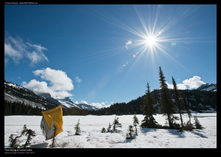
Before long we found a spot and descended to the South Fork of Agnes Creek. Fortunately there was a solid snowpack and it allowed for easy skinning to get over Cloudy Pass. By now the sun was setting to the west and we were on a race against the darkness. Once on Cloudy Pass I transitioned and rode 2000 feet to Lyman Lake below. On the shore we set up camp and were happy that soon we would be on a hiking trail down to Holden Village. We had finished following the mountain crests of the Extended Ptarmagin traverse and the rest of this section was hiking down the Railroad Creek.
Day 7 of the Extended Ptarmagin Traverse From Lyman Lake to Holden Village
We woke up to a beautiful morning as we got out of the tent. It would be a short day down to Holden Village so we decided to dry all our gear in the sun. Setting our tent up in a tree we watched the water vapors dissipate as the sun rose to the east. Soon enough all of our layers had dried off and it was time to get moving.
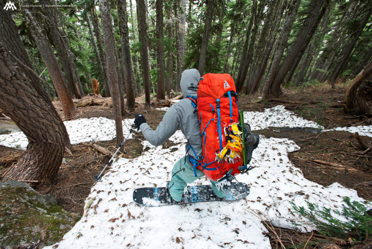
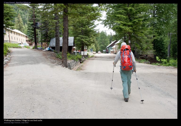
With our gear in our packs we started heading east towards the Lyman Lake trail. Arriving at snow line we stashed our gear off the trail in a spot where no Marmot could steal our gear. It was time to ditch the snowboard boots and switched to hiking shoes. Within a few hours we would be arriving in Holden Village.
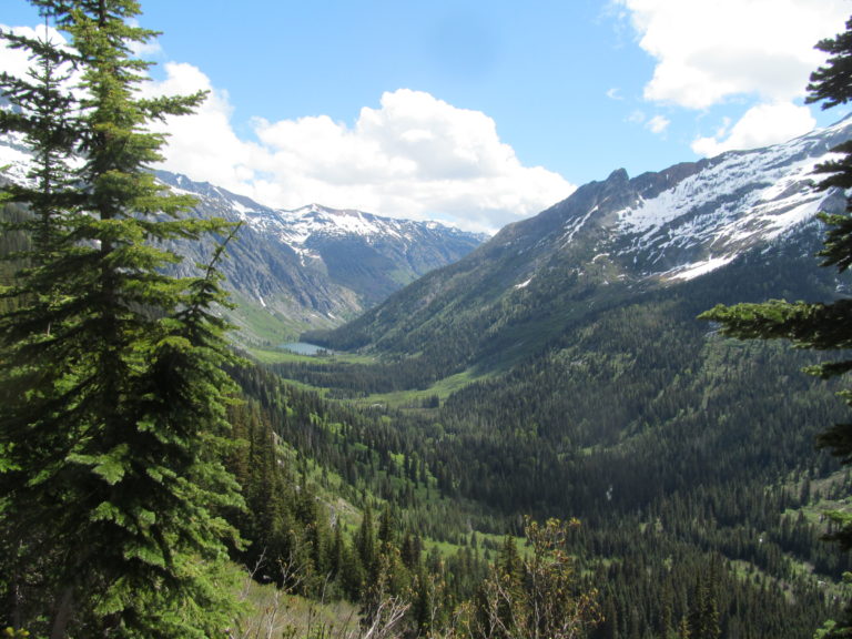
As we climbed down into Railroad Creek the landscape turned from white to green. Looking back towards the west we could see clouds hanging on the crest and were happy with a short break from the mountains. We would be back in the area in 2 days but at the moment our minds were on the food stashes we had waiting for us.
Hiking Down Railroad Creek to Holden Village
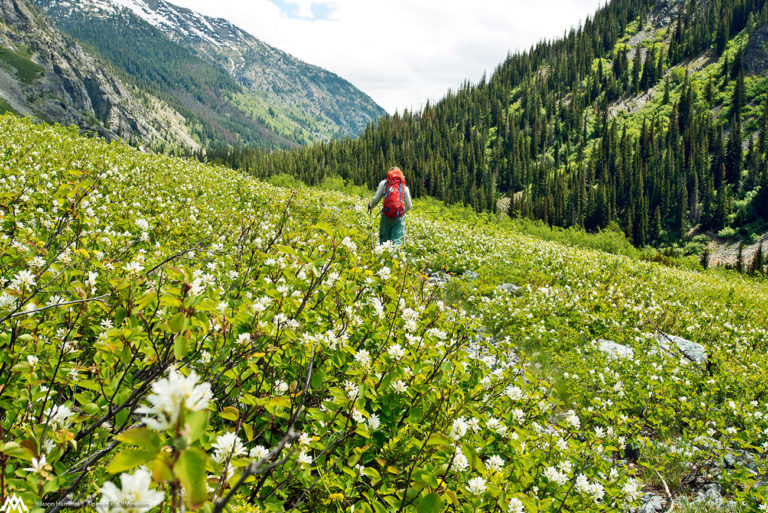
The whole Railroad creek area was covered in flowers and the smell was strong. We had been skiing through the mountains for more then a week and everything felt so fresh. We were happy to be on a well maintained trail and covering miles fast. As we made our way down we passed by Bonanza Peak to the north and Mount Fernow to the South.
Arriving in Holden had a weird vibe to it as it was closed to the public because of a mine cleaning operation. Here were 2 random people coming down from the mountains covered in dirt from head to toe. Word quickly traveled through town that two skiers had arrived and they were happy to take care of us. The last time we were there was the previous year when we did a 4 day trip out to Mount Maude and Seven Fingered Jack so by now we knew a few people there.
Finishing Off the Extended Ptarmagin Traverse in Holden Village
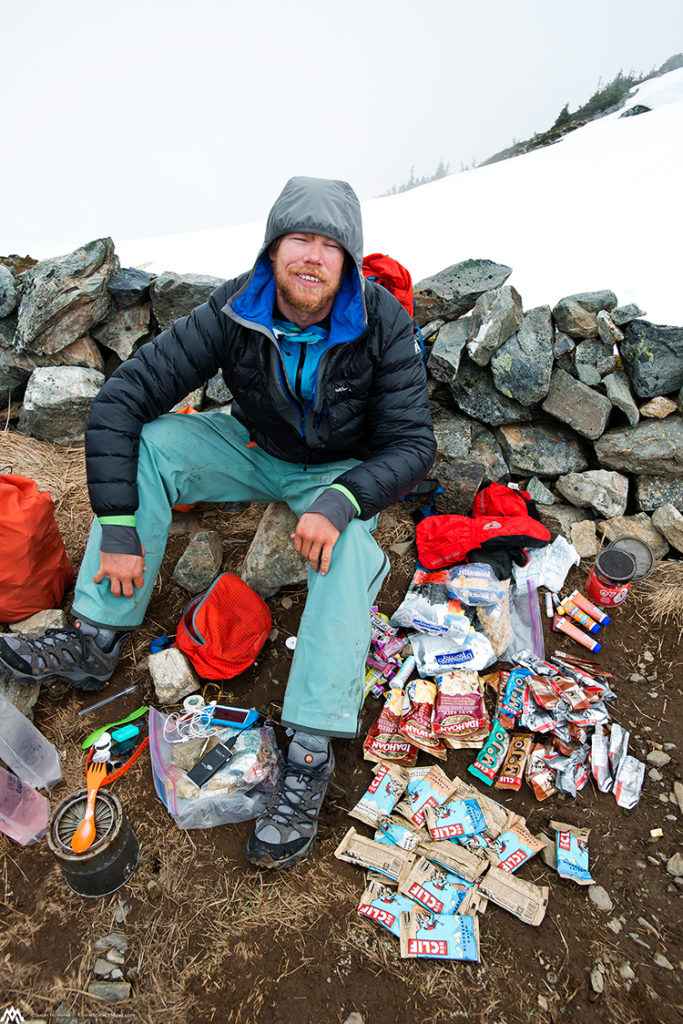
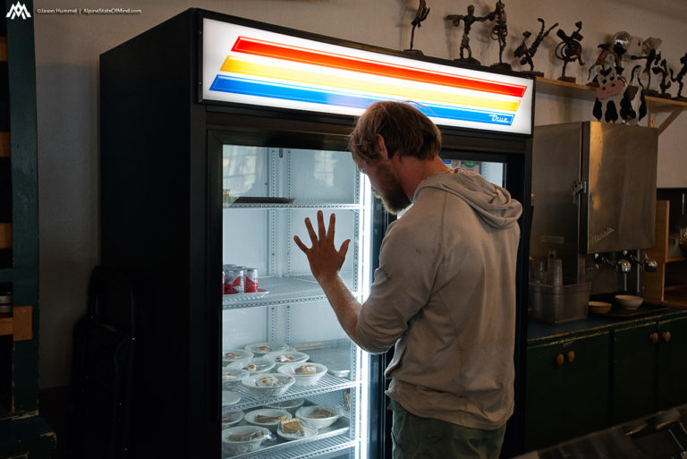
We went from semi rationing our gear to an all you could eat desert buffet. The next few hours were a blur as I drank endless amounts of coffee followed by a much needed sauna. It felt like heaven compared to the long slog over the past week. We had planned to stay a few nights but once we looked at the forecast it became apparent we would have to leave the next day. There were 4 days of good weather before a huge storm arrived.If we wanted to pull off the the Suiattle Traverse we would have to get moving.
Thank you for reading the Extended Ptarmagin Traverse section of the American Alps Traverse. If you want to see more ski tours within the Stevens Pass Backcountry check out this link.