The Suiattle Traverse is a high route from Holden Village near Glacier Peak Wilderness to the White Chuck Road. Over 4 days this was the third part of a continuous traverse of the North Cascades from Highway 20 to Glacier Peak. Being the 11th day of our trip we had just finished both the Isolation Traverse and the Extended Ptarmagin Traverse. By now we were exhausted and racing against a forecast that promised rain for the foreseeable future. We had four solid days to complete the Suiattle Traverse and in the end finish off the American Alps Traverse. This section would link up Stevens Pass to the Sauk River to the South and the Pickets Traverse to the North. In the large scale this trip would tick off a huge chunk of our goal to traverse from Mount Rainier to Mount Baker.
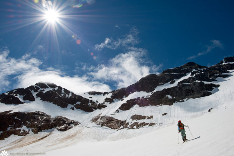
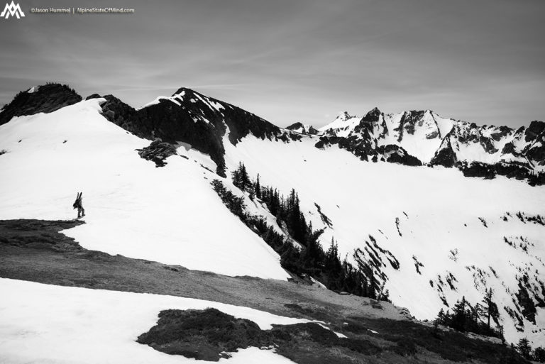
Starting the Suiattle Traverse From Holden Village
We were on a race with the weather from the moment we got back on the trail. We had mailed a weeks worth of food to Holden Village and quickly scanned through what was needed and what wasn’t. Packing our bags the plan was to have 5 days worth of food between us allowing for an extra weather day if needed.
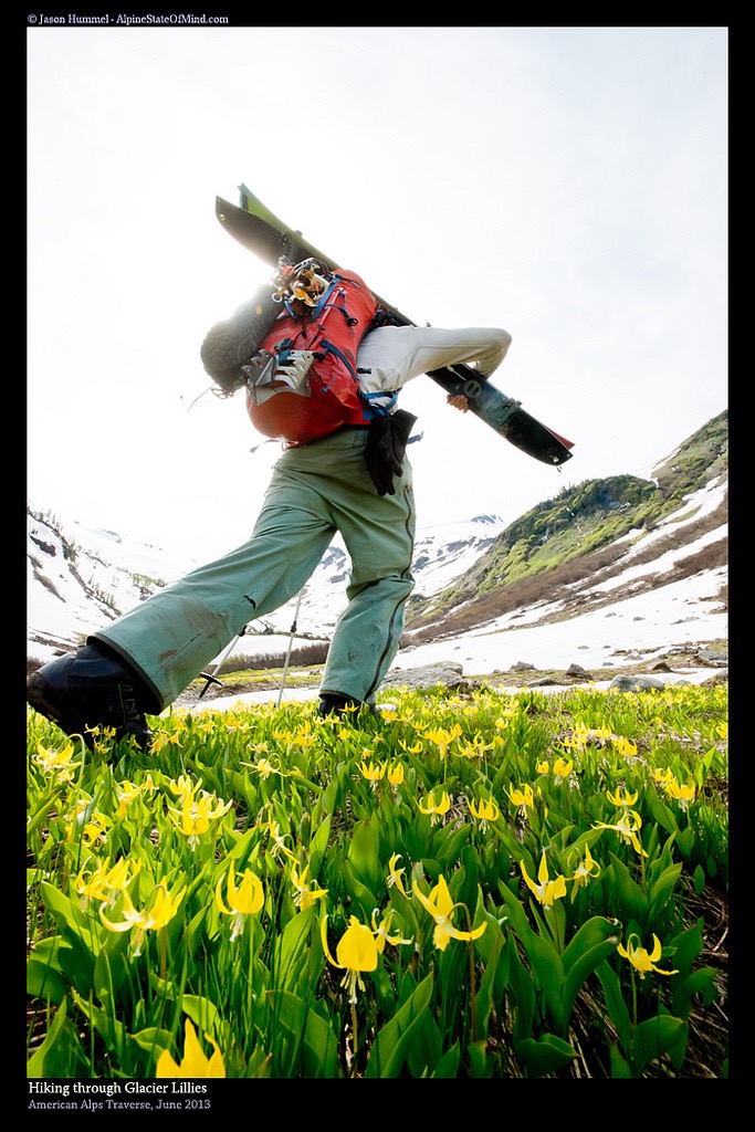
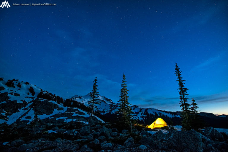
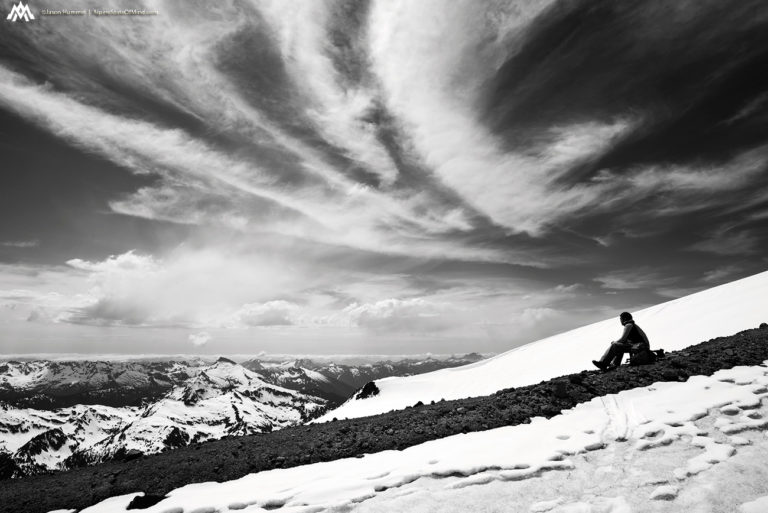
Before long it was time to leave Holden Village to start the Suiattle Traverse. Pushing west towards Lyman Lake we passed numerous trailheads and previous adventures. From the Big Copper Circuit to Bonanza peak we passed the rugged landscape while pushing up the valley. Though we had been there for numerous trips this was our first time at he head of the valley. Soon enough we hiked up to our ski gear which we had abandoned before heading to the valley. With camping gear in hand we set up our tent on the shores of Lyman Lake and prepared for an early morning start.
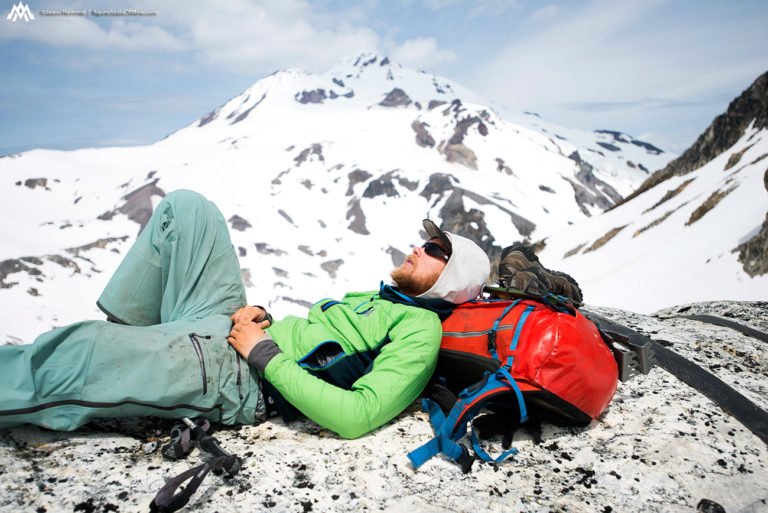
Sleeping on the shores of Lower Lyman Lake we were both excited and nervous. We were thinking the crux of the trip was now over with being the Extended Ptarmagin Traverse and soon we would be on familiar ground. When we woke up in the morning to our surprise there were thick clouds everywhere. The forecast we had seen in Holden Village called for sunny skies but that wasn’t the case. Knowing we only had 4 good days before a front slammed into the Cascades we decided to get moving. Hopefully as we climbed the weather would clear up and we were just dealing with morning clouds.
Starting Day Two of the Suiattle Traverse From Lyman Lake to Buck Creek
Within an hour we had passed Upper Lyman Lake and were on the lower slopes of Chiwawa Mountain. Occasionally the clouds would disappear long enough for us to see the route before swallowing the surrounding scenery. Knowing that the cloud layer was relatively thin we kept climbing feeling confident things would improve over time.
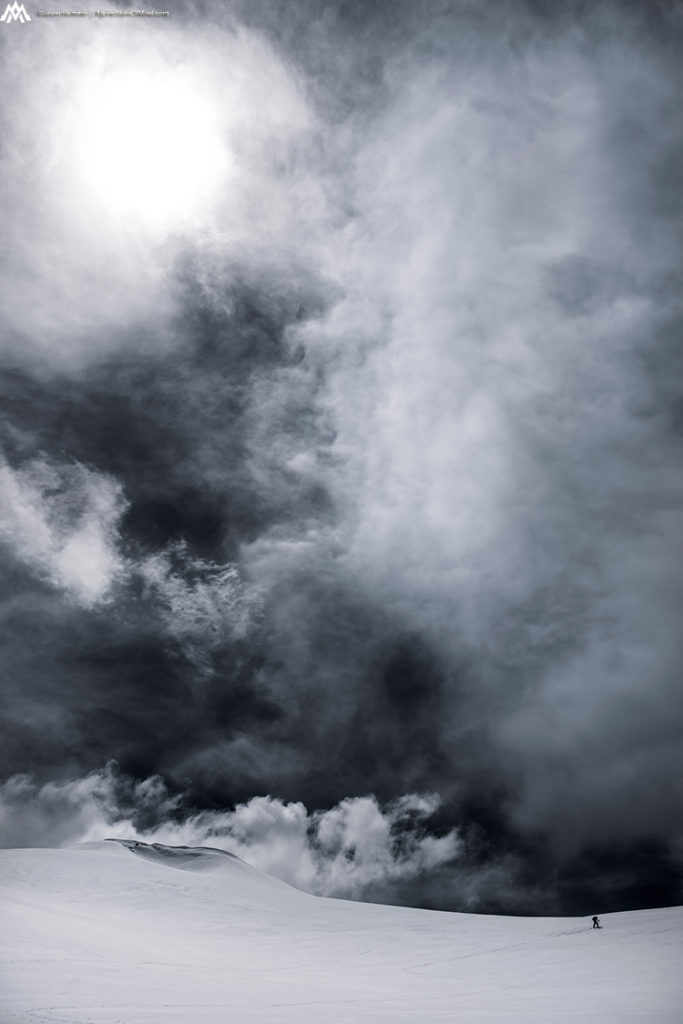
Once at the base of the northern headwall of Chiwawa Mountain we switched to bootpacking. The snow was a mixture of slush with a small bit of freeze on the surface making for great climbing conditions. While exhausting we pushed up one step at a time switching lead every few minutes. Once near the top clouds once again came in and we found ourselves in a white out. Fortunately we had seen the whole route from the base and knew we just had to keep climbing straight up. There was nothing technical both above and below and soon the clouds would just blow as we walked towards the heat of the day.
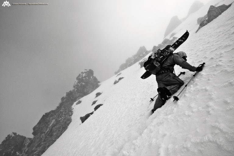
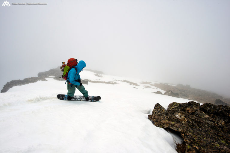
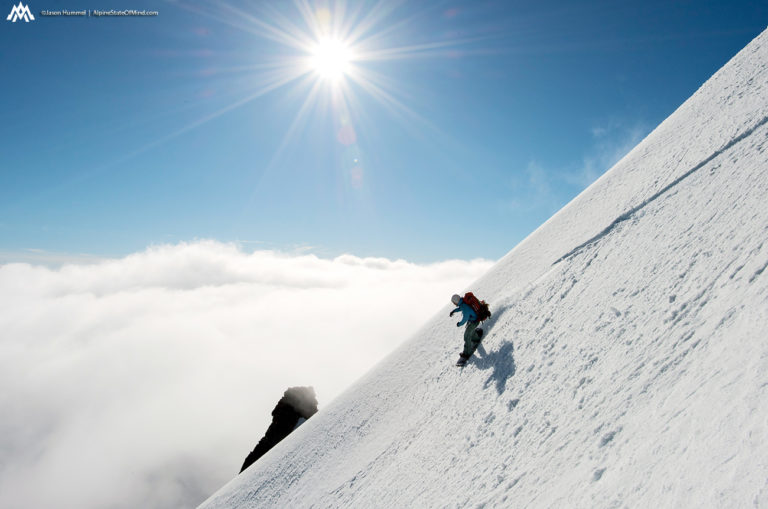
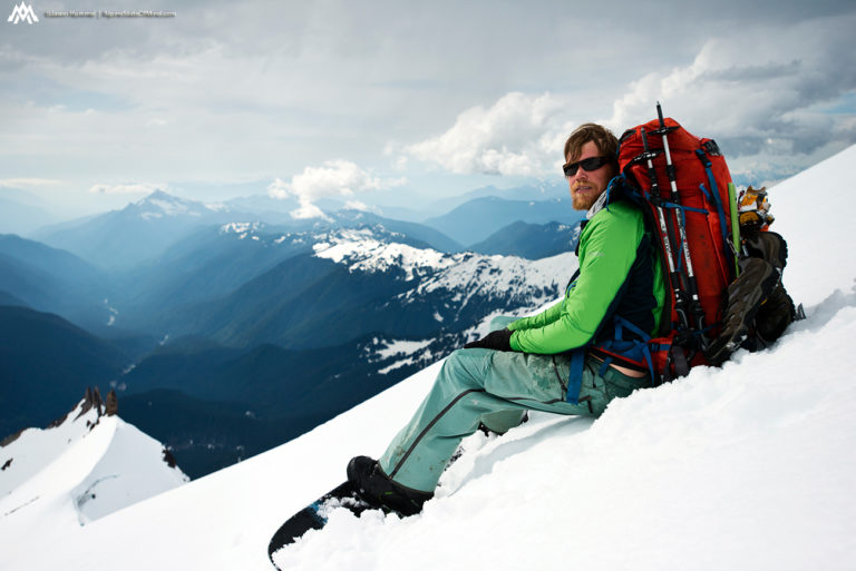
Soon enough the slope flattened and we realized we were on the summit ridge. Though we couldn’t see much in the distance visibility was good enough to see the drops on both sides. Knowing there were cornices we delicately walked the ridge making our way to the summit of Chiwawa. We would have to ride down the western slopes to a low col which would give us access to Fortress Mountain. We were happy having made ground on the Suiattle Traverse but we could barely see anything in front of us.
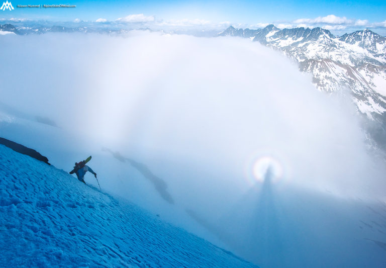
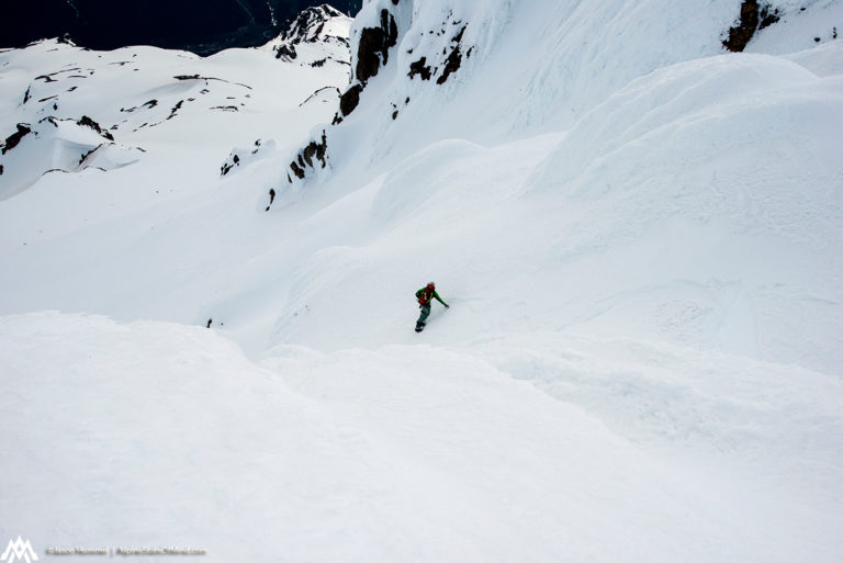
Snowboarding into a Whiteout on Chiwawa Mountain
Before long we were taking our first turns down the west slope of Chiwawa Mountain. While we couldn’t see much we could tell that we had to be careful riding along the ridge. From the faint outline we could see that there was a massive drop off to the south. One wrong turn and we would drop into oblivion.
Soon we made our way over to the west face and found a ribbon of snow to ride. This was my first time in the area but after staring at maps compulsively we both knew there was no technical terrain below us. A turn at a time we were getting deeper into the thick clouds and making our way towards Fortress Mountain.
We were happy to find a rock wall to reference as we made our final turns towards the low col. Before long we and the flats and could tell it was time to switch over. Though we couldn’t see anything it was obvious that we were on the southeast slopes of Fortress Mountain. While transitioning we went over ideas of what to do next as we waited in hope that the clouds would burn away.
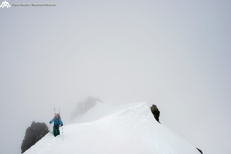
The Crux of Day Two on the Suiattle Traverse Climbing Fortress Mountain
After a bit of waiting it became obvious that the weather wasn’t going to improve. Both Hummel and I kept looking at the map and debated over either a high or low route. This was my first time in the area but Jason had actually skied Fortress Mountain years before. With a bit of prior knowledge he concluded that there was a clean east west ridge. We would just have to climb up then it would be smooth sailing all the way to the summit.
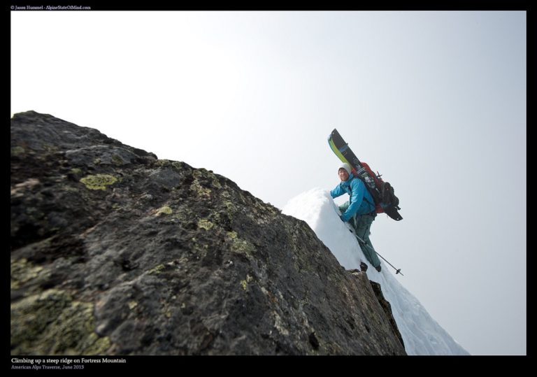
In a sense Hummel was right as we put in the last steps to the ridge. It was climbable but it was sketchy as we straddled the rocky ridge with a huge drop on both sides. By now I was looking at my watch knowing that the sunset was getting close. This was not the place we would want to stay overnight and it was quickly consuming time.
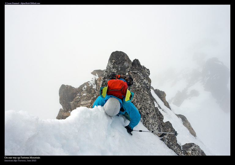
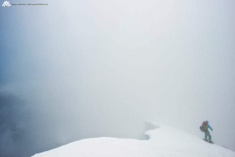
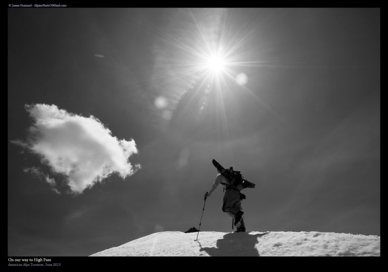
Before long the ridge turned into an open slope and with each step we were moving above the clouds. Jason shouted in celebration to let me know a Brocken spectre was behind me. All of a sudden we were in the sun and could see the vastness of the North Cascades. It was like a light had been switched as we made the final steps to the summit of Fortress Mountain.
Arriving in the Sunshine on Fortress Mountain
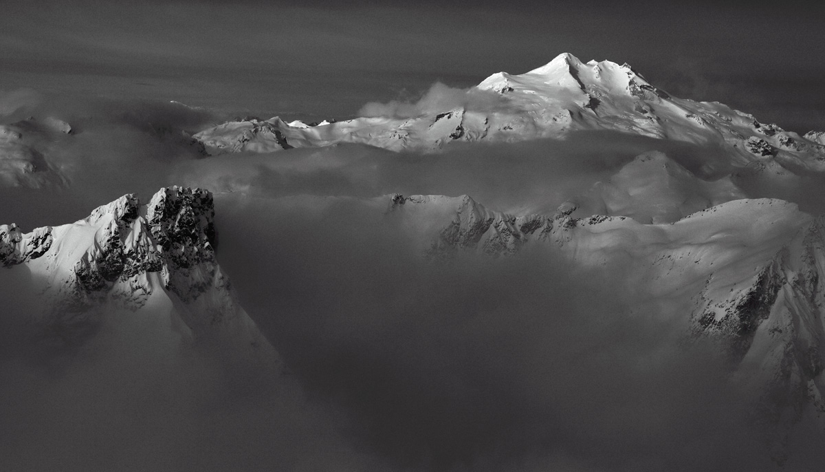
Once on the summit we could see Glacier Peak poking through the clouds. After 12 days in the mountains it felt close enough that we could touch it. We were still two days away but we had been using it as a reference for the past two weeks. At first it seemed like it was an impossible distance away but here we were. Things were coming together and hopefully we were done with the crux of the Suiattle Traverse.
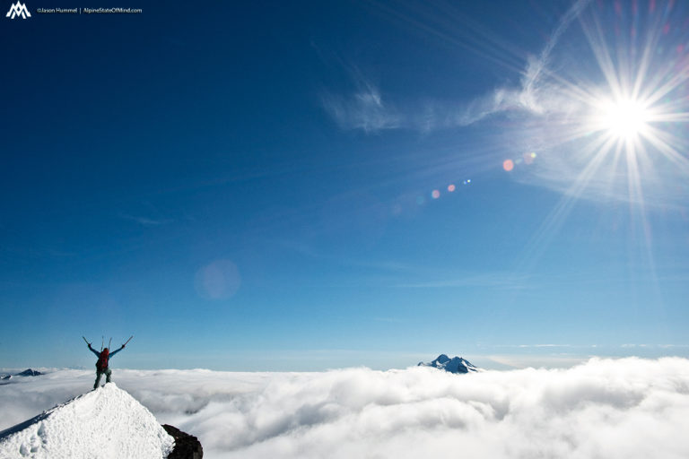
The clouds seemed to have been a wall on the western side of the Cascades. To the east was nothing but clear skies from Trinity to the Mount Stuart area. Looking to the south we could barely see the next days route poking through the clouds. Within minutes we were transitioning to downhill mode and ready for our final descent of the day. Strapping in we wondered if we would wake up to clear and cloudy weather the next day.
Our First Descent of the Suiattle Traverse off Fortress Mountain
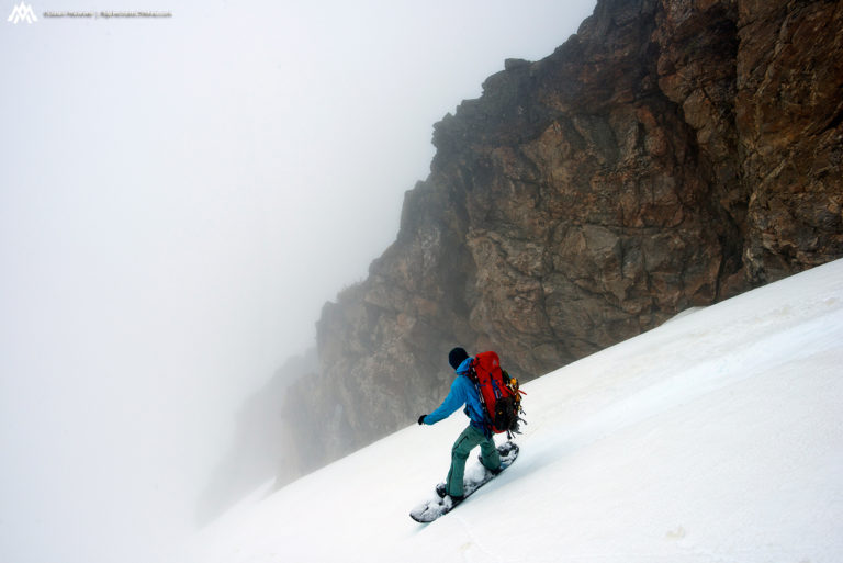
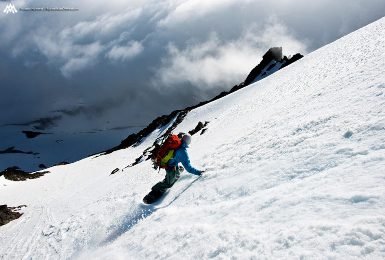
As we made our first turns down the west face of Fortress Mountain we were happy to be in the sun. Though the descent wouldn’t be to technical there was terrain below we had to watch out for. It had been a bit disappointing that the weather had been so cloudy in the Trinity area. Finally I was getting both my first real turns as well as views of the Suiattle Traverse.
Making our way down we could see that the sea of clouds were still persistent to the west. Though we had climbed Fortress Mountain in a white out we were enjoying every second in the sun. The last hour had been stressful but now it was behind us. As we rode the western slopes we were happy with the though that the crux of the Suiattle Traverse was now behind us.
A turn at a time we descended almost 4000 feet all the way into the valley below. This would put us at 4’800 feet and hopefully a dry spot to camp. We were on a race against time riding down to Buck Creek but soon enough we were in the trees. We had made it through a massive hurdle throughout the day and soon we would be on familiar ground.
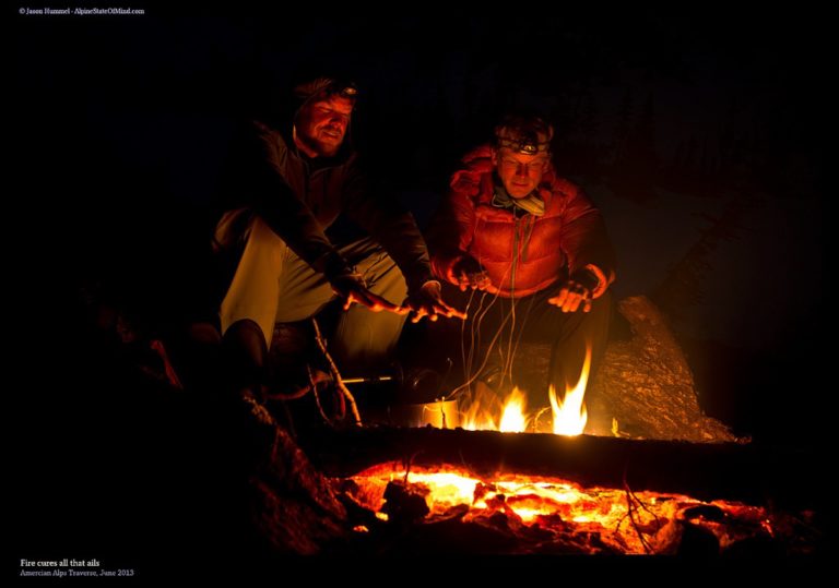
Arriving in Buck Creek Basin
Being below alpine it was our one and only time to start a fire. We were now near Buck Creek Pass and would be heading through the Napeequa Valley the following day. Every other night we had camped in the snow but this time we were on dirt. Around us was an abundance of firewood and water as we enjoyed a late night camp fire. It had been an interesting day but we were happy to have it behind us and start the third day of the Suiattle Traverse.
Day Three of the Suiattle Traverse From High Pass to Tenpeak Mountain
Waking up I was really excited about the day ahead. It would be my first time in the High Pass area and I had always been interested in the zone. Soon we would be climbing through a brief stretch of unfamiliar terrain but after that the rest of the Suiattle traverse would be on familiar ground. Before long it was time to pack up camp and get to moving. Our first goal of the day was to try and follow the summer trail up to High Pass.
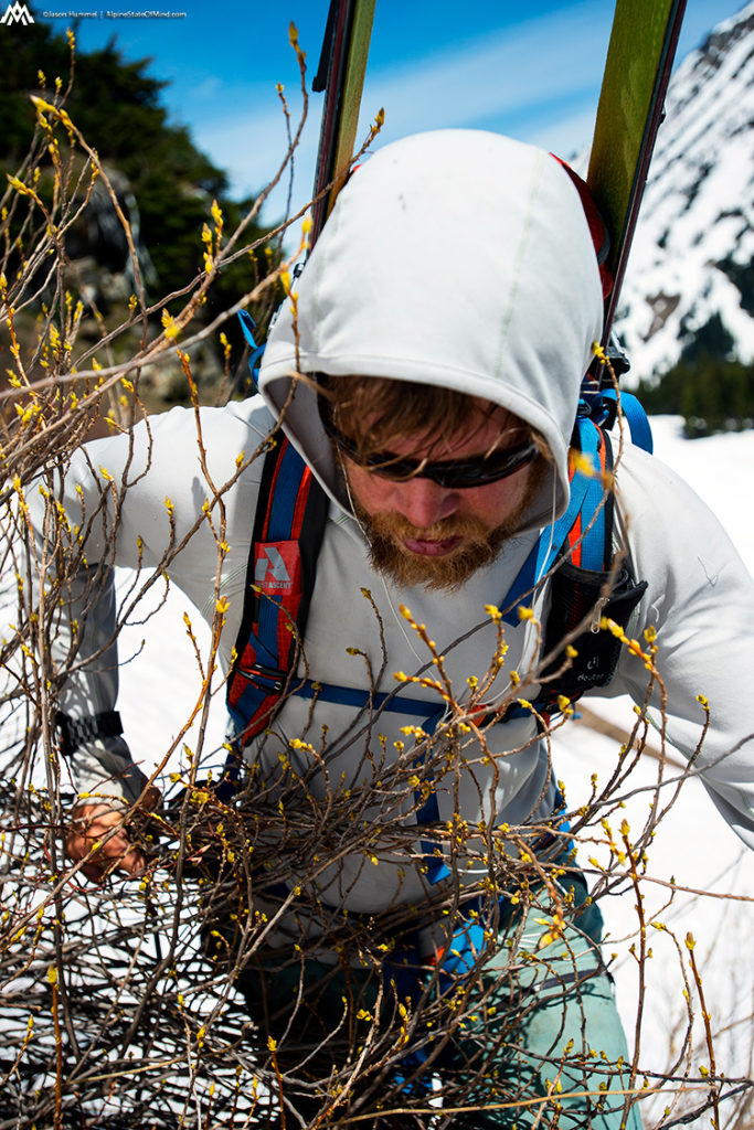
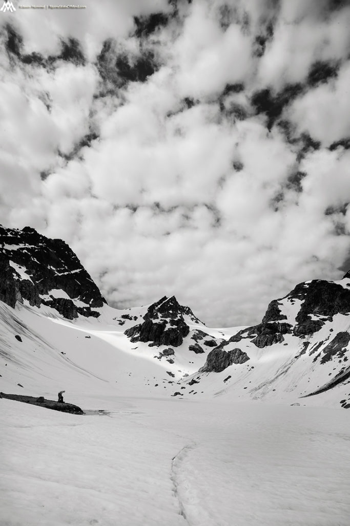
After pushing our way through the thick bushes we were back in the alpine. Looking south through the High Pass Area it wasn’t going to be straightforward. To stay on the ridge meant we would have to weave up and down through the terrain. While it would be relatively easy we would be bootpacking most the route.
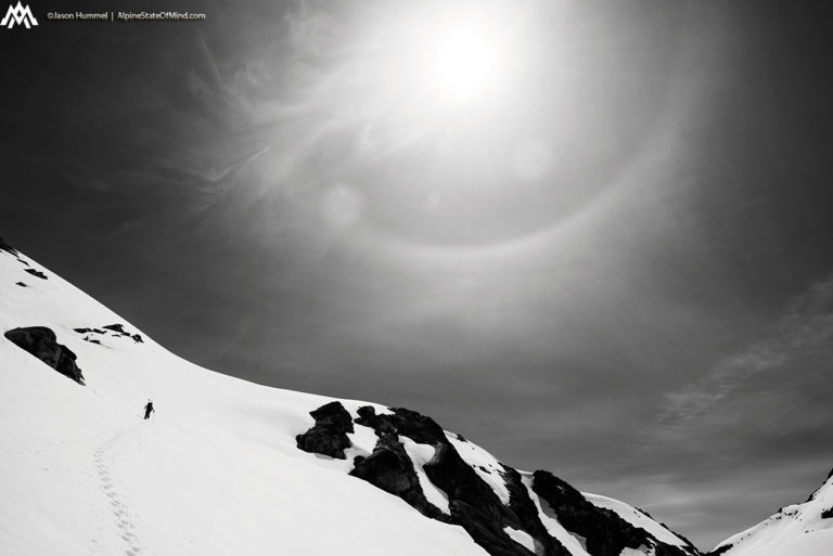
Fortunately the weather had improved dramatically compared to the previous day. Not only was it clear out but there was no winds. While it had turned out to be a much hotter day it was well worth it to be able to see the North Cascades. Each little bump and small col would be getting us closer to the Dakobed Range and familiar ground.
As we were making our way south we could faintly see a sun dog. Normally this is a sign of bad weather and it reminded us that a storm was on it’s way. If the forecast stayed correct we had 48 hours before things shifted towards the worse. If the forecast was wrong we were in for a brutal exit and lots of nasty creek crossings.
Heading Down to the Napeequa River
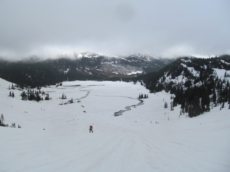
Finally we were on the last bulge of High Pass and ready to start descending. Below us was the Napeequa valley and familiar terrain for both of us. Transitioning we would be making it down to the upper 1/3 of the valley. We would be past Bandit Peak and at the base of the Dakobed Range skinning around 5 miles to the valley head.
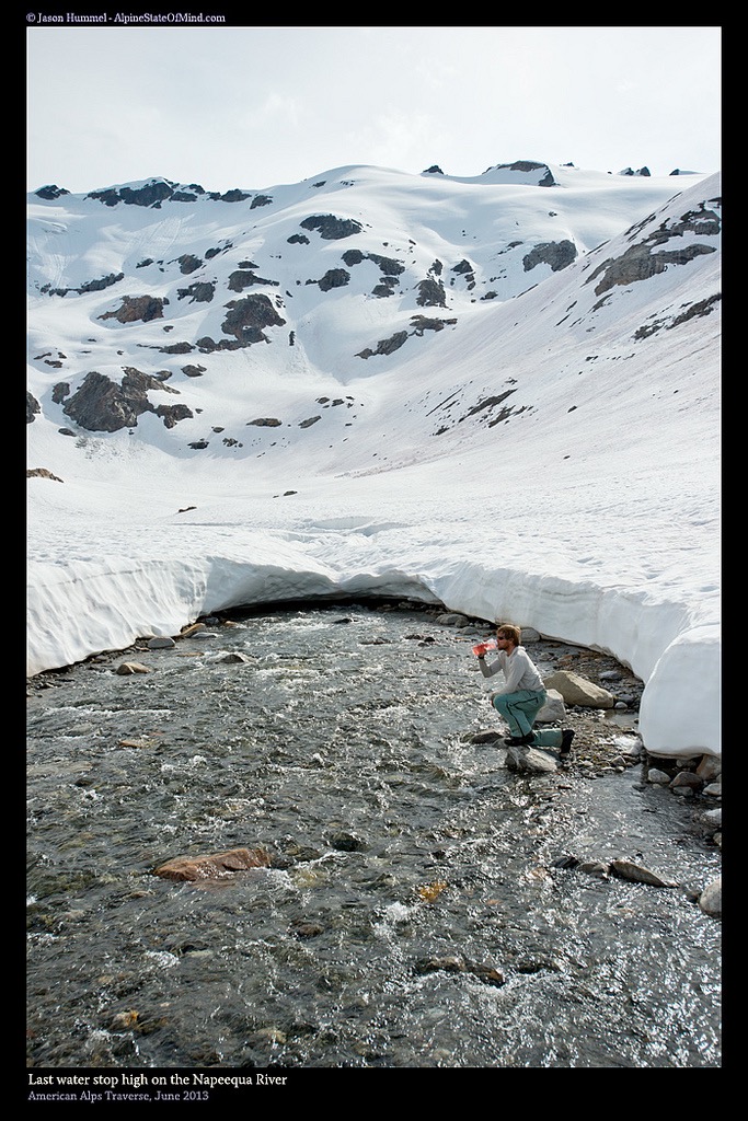
We followed a goat trail down through the thick bushes before the terrain opened once again.We were hiking along the banks of the Napeequa river where I had been two months earlier. While the intentions of the last trip were to ride Tenpeak Mountain this time we would head right past it. Walking through the dirt and flowers we were looking forward to the moment we could start skinning again.
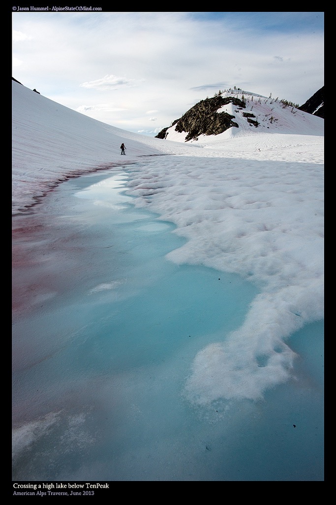
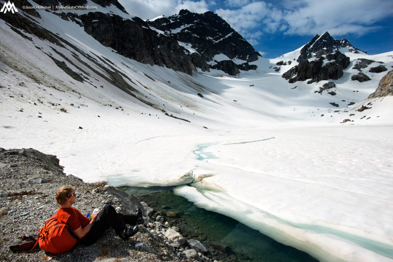
Before long we were at the head of the Napeequa Valley and stopping at the last water hole. We were happy to be more than halfway done with the day but we had another crux ahead of us. From previous experience while doing the Dakobed Traverse we knew that the traverse of Tenpeak Mountain would be a pain. It would be a mile long sidehilling through both technical terrain and numerous little canyons before reaching flats again.
Traversing Across Tenpeak Mountain
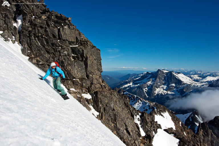
Passing by Butterfly Lake we were finally on the northeast side of Tenpeak Mountain. Looking west to the slopes we were relieved to see a thick snowpack. The previous time we had come into the area we were traversing between snow patches. This time we could ride most the way with the occasion bootpack up for me and side stepping for Hummel.
After less then an hour we had passed Tenpeak Mountain and put camp under its northwest slope. This was the same spot we used during the Dakobed Traverse and were happy to be back. We were now within a reasonable distance to Glacier Peak. If all went well this would be our last night in a tent and the end of the Suiattle Traverse.
To the northwest we had a clear view of Glacier Peak as the sun set over the horizon. Looking up the valley we could see our descent route when we rode the Chocolate Glacier all the way down to the Suiattle River. We weren’t exactly sure of which way to exit the American Alps Traverse but decided we would choose when we arrived on summit.
Day Four of the Suiattle Traverse From Tenpeak Mountain to White Chuck River
Waking up both Hummel and I were excited to start the day. If all went according to plan we would be at the car within 12 hours. We couldn’t help but notice there were clouds in the sky but we could still see. The only thing between us and the roads below was Glacier Peak.
With our bags packed it was time to push for our final day. Before long we at Honeycomb Lake and filling our water bottles. This would be our third time on this route and we knew it was pretty straight foreword. Soon we would be on the summit of Glacier Peak and riding towards civilization.
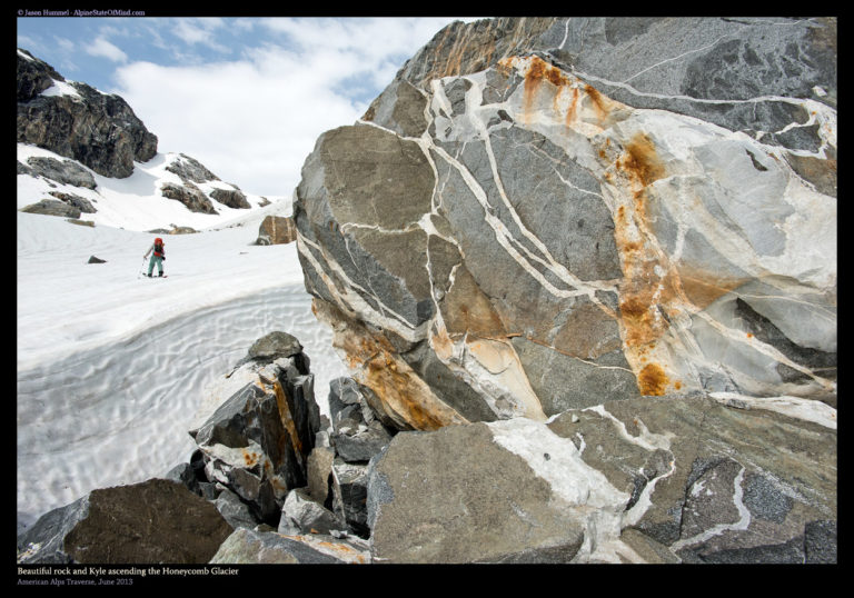
Making our way up to the Honeycomb Glacier the rocks would remind us that we were still in the Dakobed Mountains. With the quart and the colors being unique in the area they were a welcome reminder to where we were.
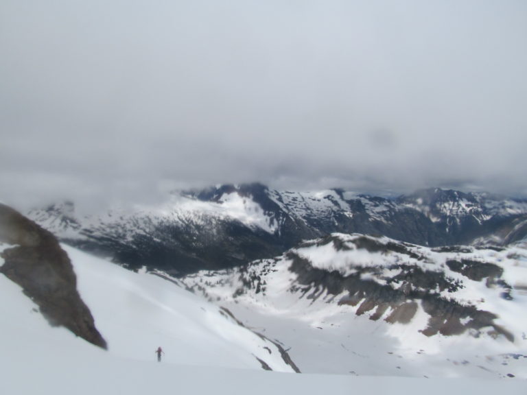
As we wrapped around the Honeycomb Glacier finally the south side of Glacier Peak was on full display. We would be climbing the standard Cool Glacier route and although it would be a few hours it was non technical. After 14 days of traversing both Hummel and my bodies were pretty beat. It was our last day of the Suiattle Traverse and decided to take a few breaks along the way. From here on out dry rocks would be rare so when we spotted one it was time to take a quick rest.
Climbing the Cool Glacier Route to the Summit of Glacier Peak
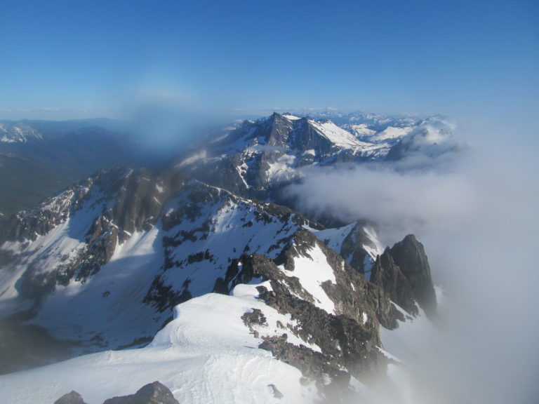
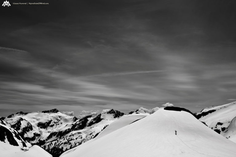
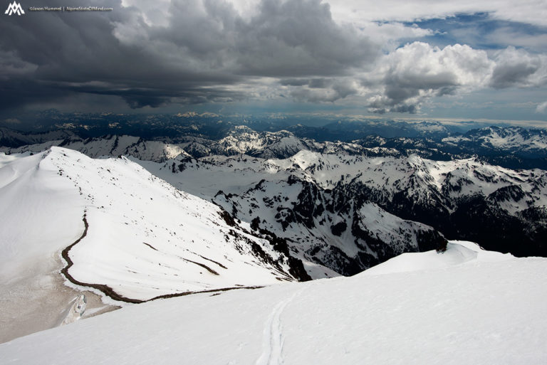
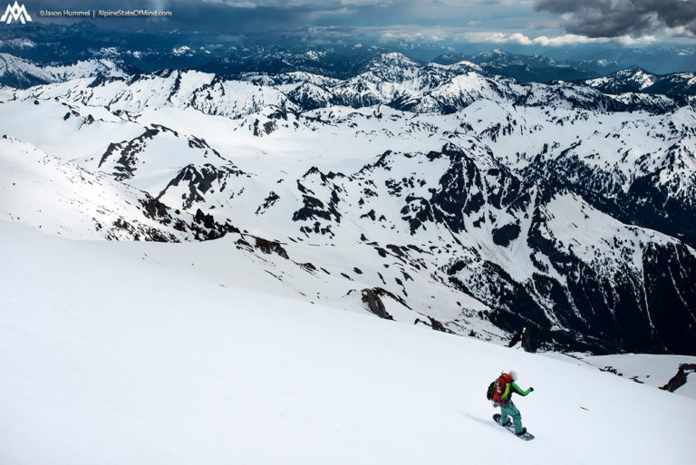
Soon we were skinning on the Suiattle Glacier and making our way towards the summit. Though there were clouds in the sky the weather was still good with visibility but things were deteriorating. We had a little over an hour left in our climb before the final descent so we needed to get going. Putting our heads down we made our way up now on a race against potential rain or white outs.
As we climbed it was obvious the clouds were only on the west side. To the east it was a beautiful and clear day with the North Cascades on full display. In the foreground we could see our low traverse on Tenpeak Mountain. Behind that was the high points of the Dakobed Range. Sadly we weren’t heading east so although the views were great we would be riding towards the clouds and the front coming in.
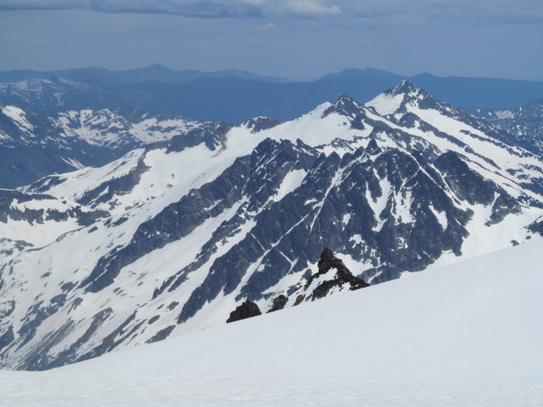
To the South we could see the Mountains between the Sauk River and Stevens Pass. In the far distance I could see both Mount Daniel and Mount Hinman and the generalized Snoqualmie Pass Backcountry. During the American Alps traverse we had connected a lot of our previous traverses from Mount Rainier. It was wild to look off in the distance and know we had followed the mountains all the way we where we were standing.
As we climbed it became apparent that a thunder storm was moving in. We could see flashes in the distance and feel the electricity humming off of our ice axes. I remember joking with Hummel that if we got stuck by lightning that it was a pretty epic way to go.
The Final Ascent of the Suiattle Traverse on Glacier Peak
As we made it up Disappointment Col we were finally making our last steps up Glacier Peak. By now the weather was changing but the Cascades were on full display. We could see everything from the Monte Cristo Range to Mount Stuart in the far distance. We knew we were only steps away from our final descent of the Suiattle Traverse and the end to the American Alps Traverse.
Before long we were standing on the summit of Glacier Peak and celebrating. It was time to decided which route to go down as we had no car waiting for us. Which ever where we ended someone would have to hitch hike back to Highway 20. We had left the car there as we started the Isolation Traverse over 2 weeks earlier.
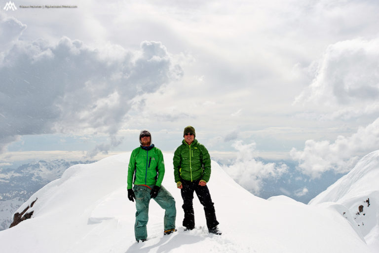
We could hear lightening going off in the distance as we got our gear together. There was a feeling of euphoria as we were on the last summit of the American Alps Traverse. It would have to be short lived as weather was coming fast. After a quick photo we decided it was time to leave and make our last descent of the Suiattle Traverse.
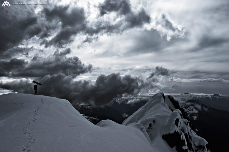
Snowboarding Down the Sitkum Glacier on Glacier Peak
Being my 5th time off the summit I really wanted to ride down the Sitkum Glacier. My previous trip there two months earlier I had wanted to ride it but settled on the Scimitar Glacier. We chatted a while and decided that it would be a great descent to finish our trip. We knew the exit trail had washed out sections from over a decade earlier. In the end we joked “Well we did the traverse how bad could it really be” we had no clue……
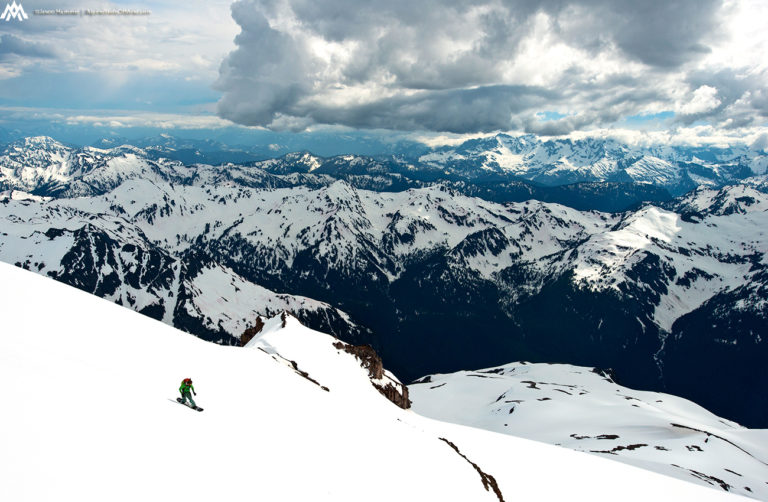
Once through the rime ice gateway we were on the open slopes o the Sitkum Glacier. Below us was over 5,000 feet of fall line turns on a smooth surface. Though we weren’t sure what to expect the snow was soft and we were happy to ride the biggest descent of the American Alps Traverse. Finally after so many trips we were making our way down the Sitkum Route.
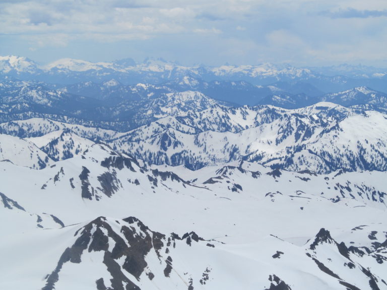
Below us the North Cascades were on full display and we still had thousands of feet before hitting tree line. In the distance we could see from Indian Head Mountain all the way to Jove Peak. The clouds were darkening fast but it didn’t matter as soon we would be in forests. The only thing between us and the road was a washed out Kennedy Hot Springs trail and the White Chuck River.
The Final Turns of the Suiattle Traverse and the American Alps
While the Sitkum Glacier definitely wasn’t corn it was nice and edgeable slush. With every turn it was getting heavier but fortunately it was just steep enough to be fun. Since it was early spring we started riding into pollen covered slopes as we dropped lower in elevation. It was like riding on ice then hitting a patch of glue literally turning a sprint into a crawl.
With a few hundred feet before hitting tree line we decided to take a break. We had a clear view of the White Chuck River and what would be the next few hours. By now we were about to drop below snowline and have our boards on our packs for the rest of the trip. It was the last section of the Suiattle Traverse and both of us wanted to be out before the rain came.
By the time we made it to the tree line my board was covered in pollen. The last few hundred feet went by at a snails pace but now it was time to put or boards on our packs. By then it had started raining but we didn’t really care. We had made it down in the last hour of the weather window before it started falling apart.
Following the Kennedy Hot Springs Trail to the White Chuck River Road
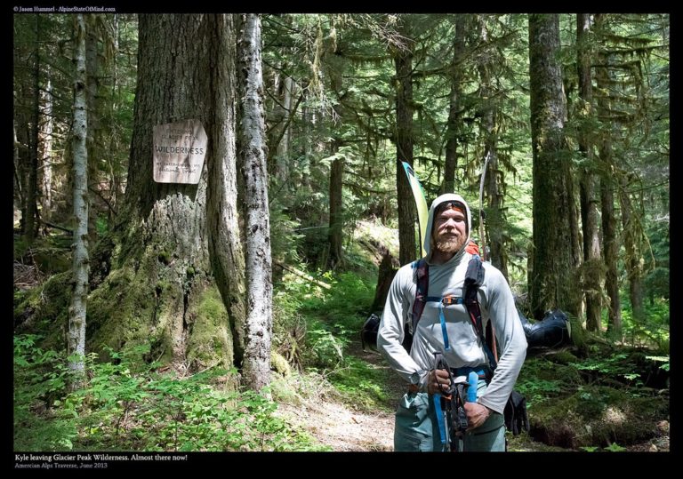
We started dropping elevation immediately heading towards the White Chuck River. At first we were just descending through the woods but after a bit we hit a faint trail. Back in the days the Sitkum Glacier route was by far the most popular trail but it was falling apart a year at a time. Soon we were in the valley and following the Pacific Crest Trail as it started raining lightly. Though most bridges were gone the trail was in much better shape then I had imagined.
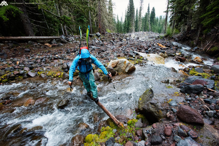
Thought the trail was a mess it was still pretty easy to follow. The lower down we got the more we could see the damages left after a decade of storms. We crossed numerous broken bridges and downed trees wondering if this was the worst the trail had to offer. Soon enough we passed the Kennedy Hot Spring area and were on our final 5 mile stretch to the road.
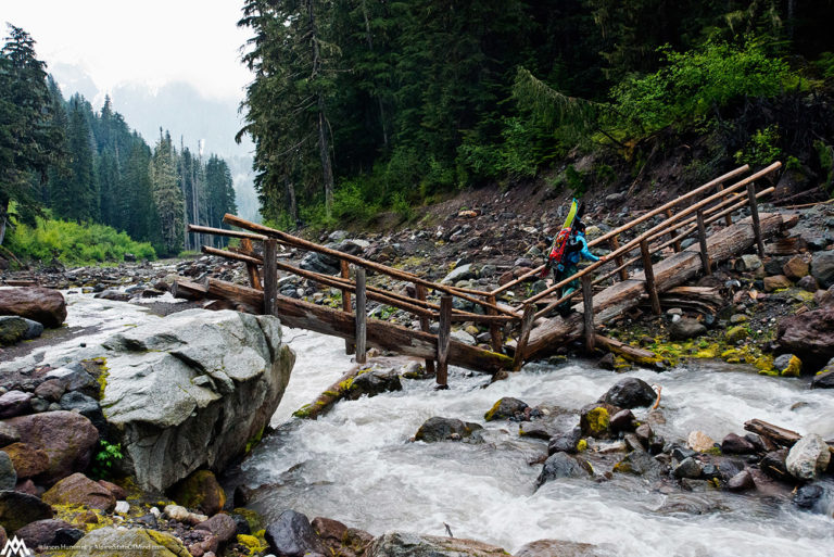
Arriving at the Kennedy Hot Spring Trail Washouts
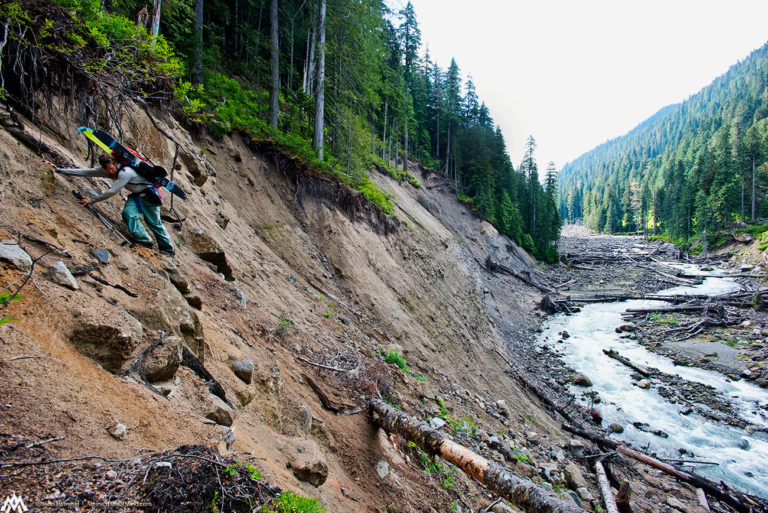
Soon enough we made our way to the washed out sections. The river had destroyed both sides of the banks and we were having to walk on its shores. There was only a handful of miles left but things had slowed down dramatically. It turned out that this was the crux of the Suiattle Traverse not the high alpine slopes.
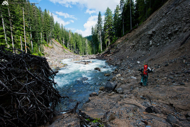
Washout after washout we would bounce from the tail to the side of the river. It was amazing seeing the amount of destruction as crawled up the embankments, only to repeat a few minutes later. Being both soft and steep each step would barely hold and a fall would put us into the river. Searching for solid rocks and the occasional root we pushed our way forward until returning to the trail again.
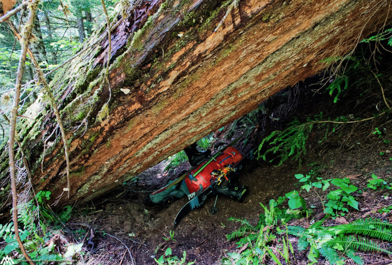
If the washouts weren’t enough when we were on solid ground we had to deal with the trees. Every few feet there was another old growth log that had smashed onto the trail. Though we were moving down the White Chuck valley every foot had to be earned.
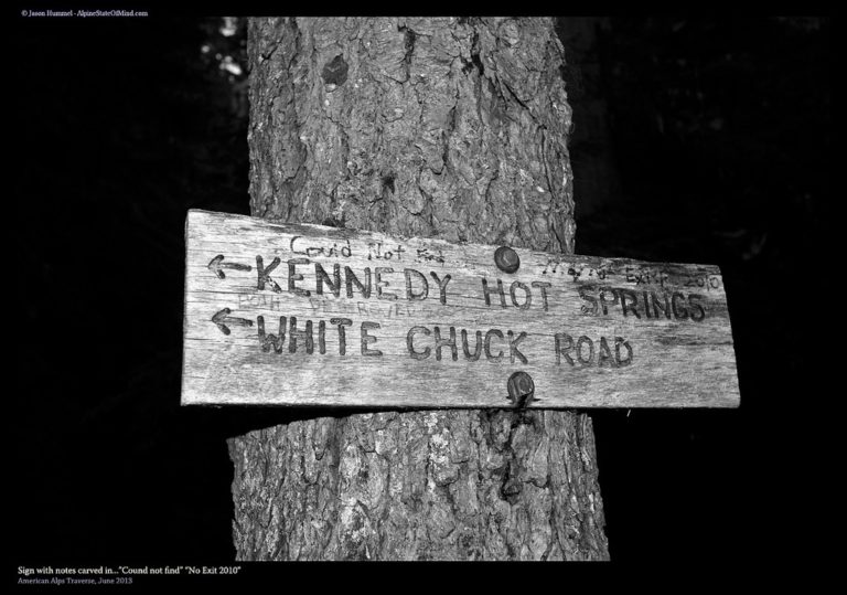
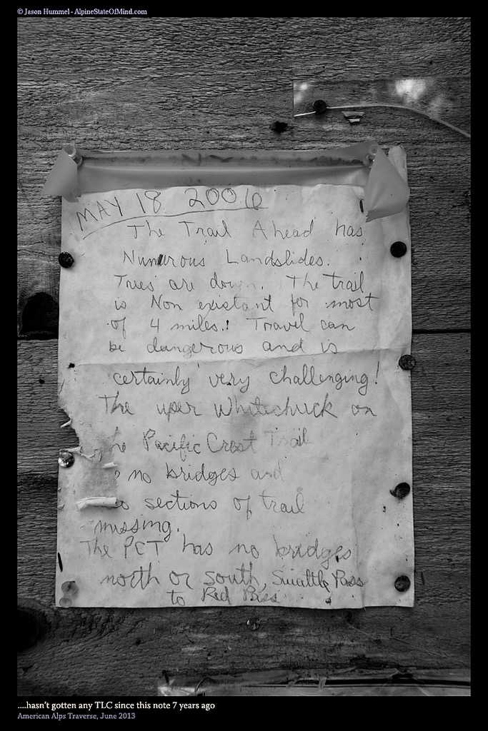
Making our way towards the end of the trail we started to see old signs. It had become obvious we were only a handful of miles from the road but we couldn’t relax yet. Any minute we could run into a washout that would stop us in our tracks. This belief was confirmed when we saw a sign that stated “could not cross river”. According to the map there were no creek crossings but what if we were wrong. If so it could take us days to retrace our steps up Glacier Peak.
The End of the Suiattle Traverse and the White Chuck River Road
Before long we made it to the trailhead and noticed a note on the board. Though it was written 7 years earlier the conditions had remained the same if not worse. As if another weird twist of fate it was written on May 18th which happens to be my birthday. After a quick laugh we were walking down a closed road, beat and in a almost dream state.
Walking down the closed we were both ecstatic and waiting for the moment to take off or packs. We had traversed 160 miles of untamed mountains with not another skin track along the way. We had completed the Isolation Traverse, Extended Ptarmagin Traverse and the Suiattle Traverse all in a single push. Finally we were at the road and after Hummel was able to hitch hike to his car we would be done.
Finishing the American Alps and the Suiattle Traverse
Three hours after Jason left he was back with his car. It was a wild story of how he was able to get rides but fortunately it didn’t take that long. The moment I got in the car rain started pouring down hard on the windshield. We knew we had really dodged a bullet beating the front. While a challenge everything turned out to perfectly on the Suiattle Traverse . Jason Hummel and I were fortunate to be the first group to complete the American Alps Traverse in a single push.
Huge thanks have to go to James Rowe for being the food cache at Eldorado Trailhead, Holden Village for taking us in, Lowell Skoog for putting together the concept of the traverse and to Jason Hummel for being a great partner.
Thank you for reading the Suiattle Traverse section of the American Alps Traverse. If you want to see more ski tours within the Stevens Pass Backcountry check out this link.