
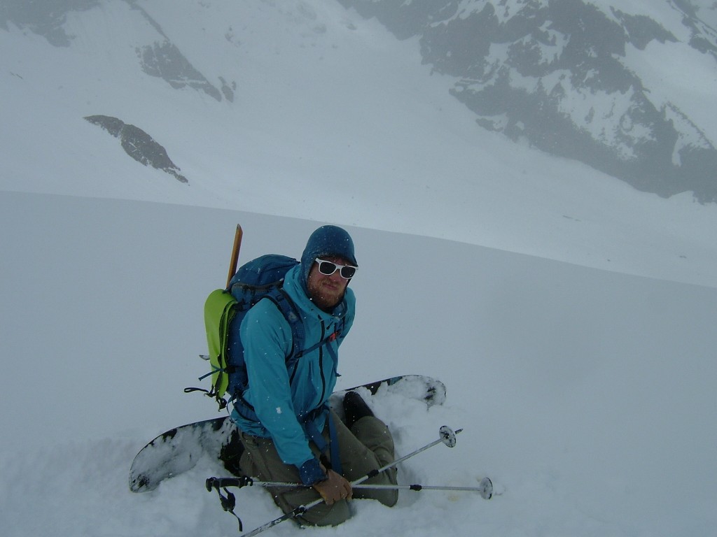
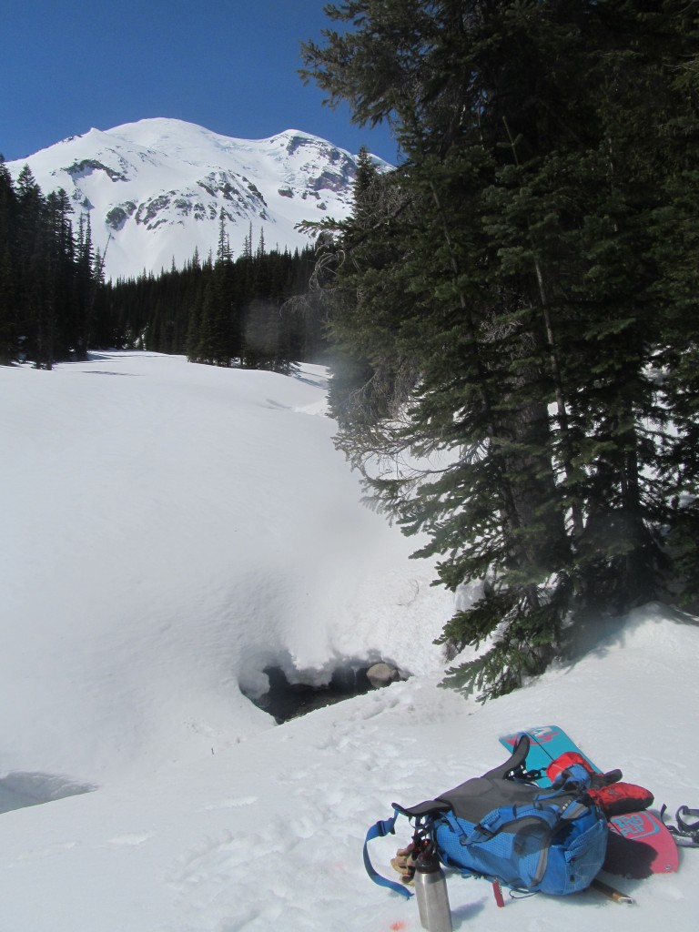
The Paradise to Carbon River ski Traverse in Mount Rainer National Park was something that just fell together. Being quite familiar with the terrain that surrounded the area I had always wanted to link these areas together. Once again I wasn’t interested in a traditional ski traverse and wanted to put together a more up and down route. With 3 weeks of high pressure I found myself doing this tour right after a solo week on Glacier Peak and again was going solo. In all it would be 5 days, 45 miles and 23,000 vertical feet of some of the nicest lines in the park.
Getting a solo permit from the rangers was a tad bit of a pain of I arrived at Paradise Visitor Center. It took 4 of them to figure out how to issue backcountry camping permits. They thought I was crazy as I told them the plan. Once they found out I was going to cross the lower Emmons they said I would need a climbing permit. Being that I wouldn’t be going above 10,000 feed I had never heard of that. I agreed to stay off of the glaciers as they would produce a solo climbing permit but luckily my fingers were crossed.
Day 1 Paradise to Carbon: A Ski traverse on Mount Rainier
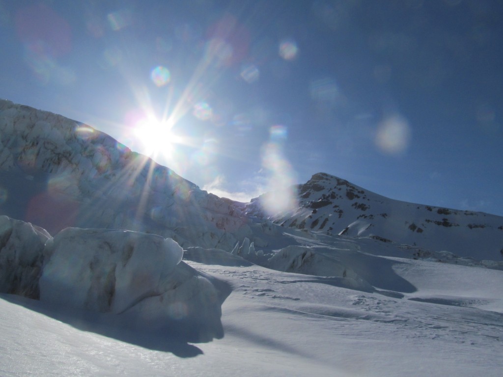
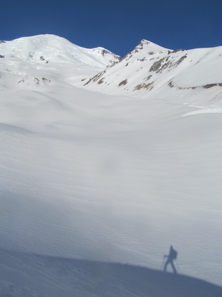
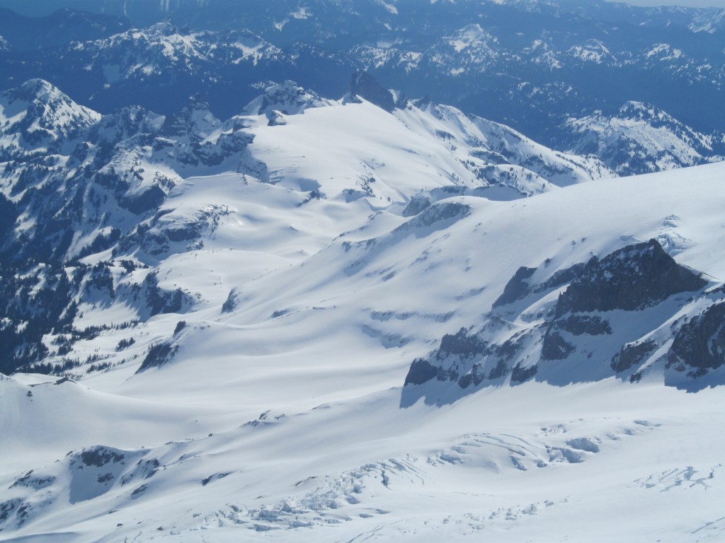
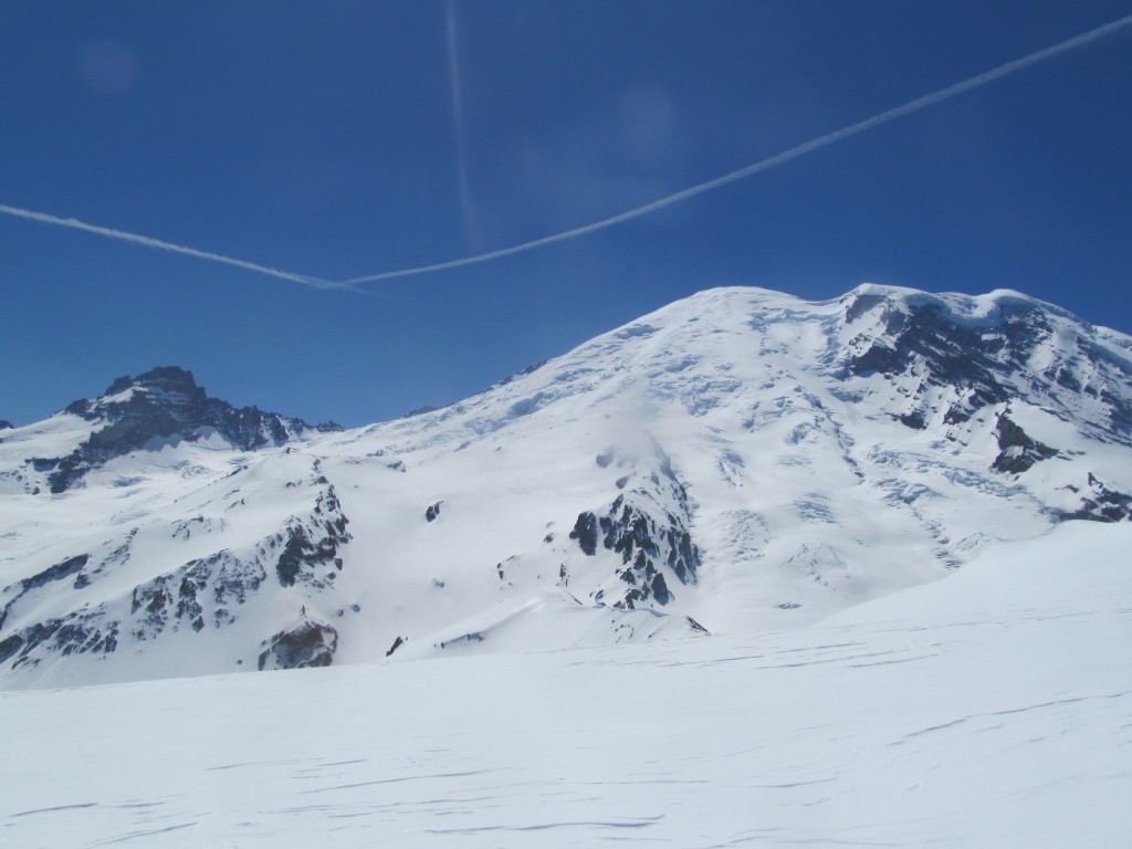
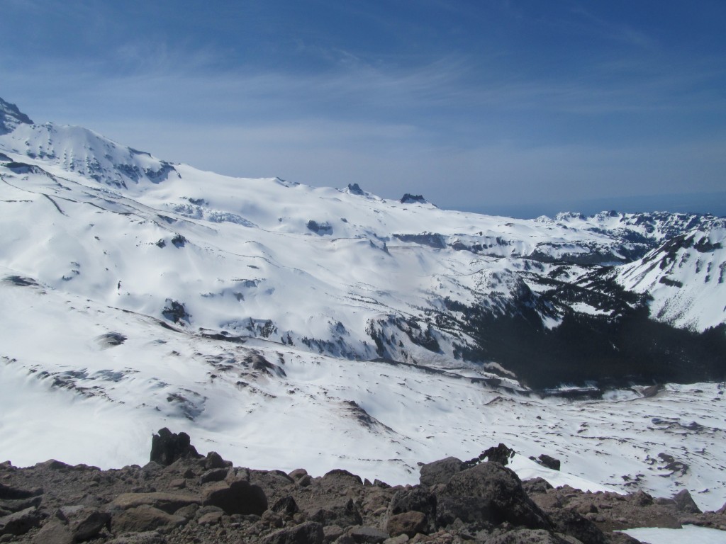
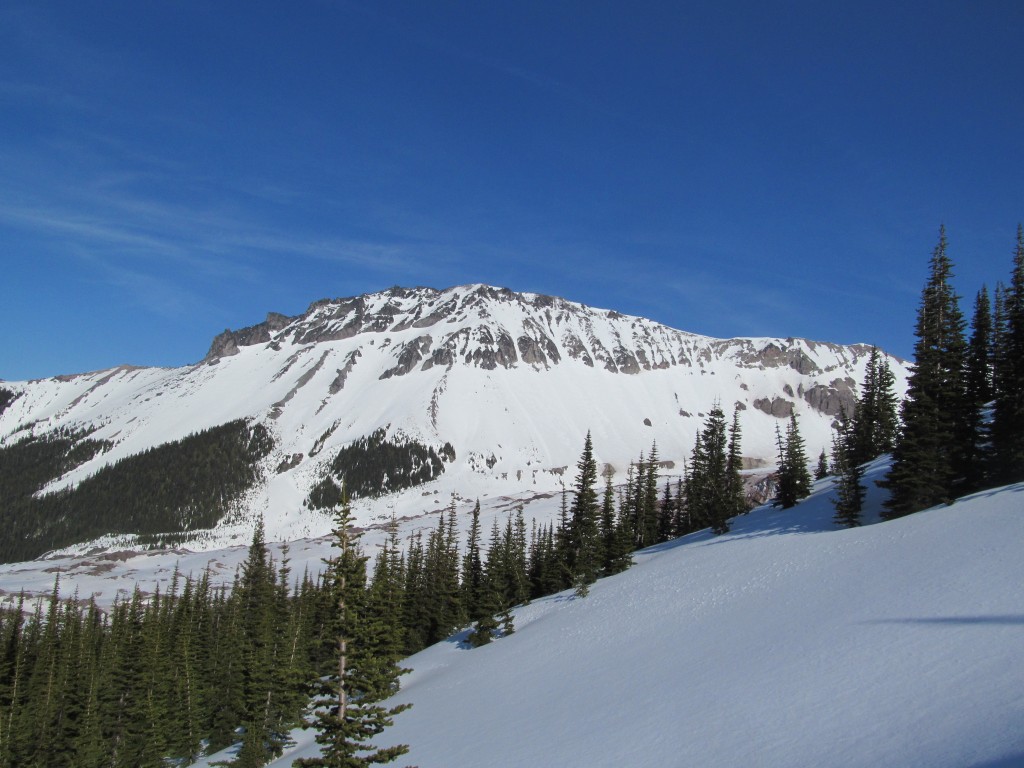
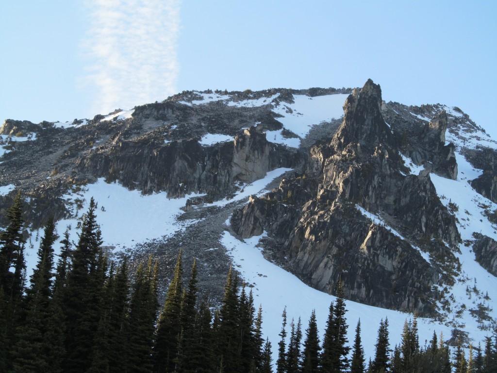
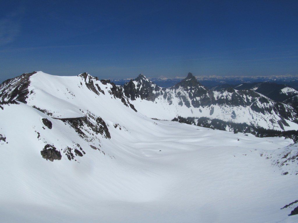
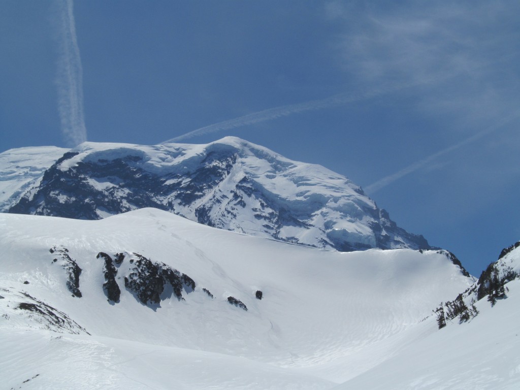
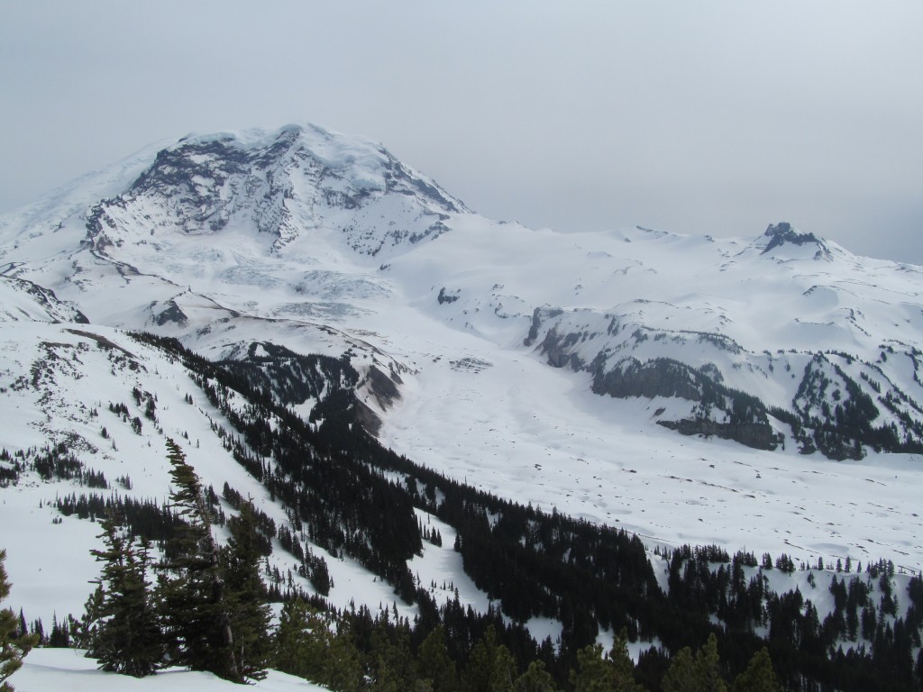
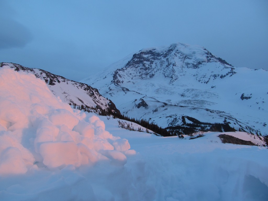
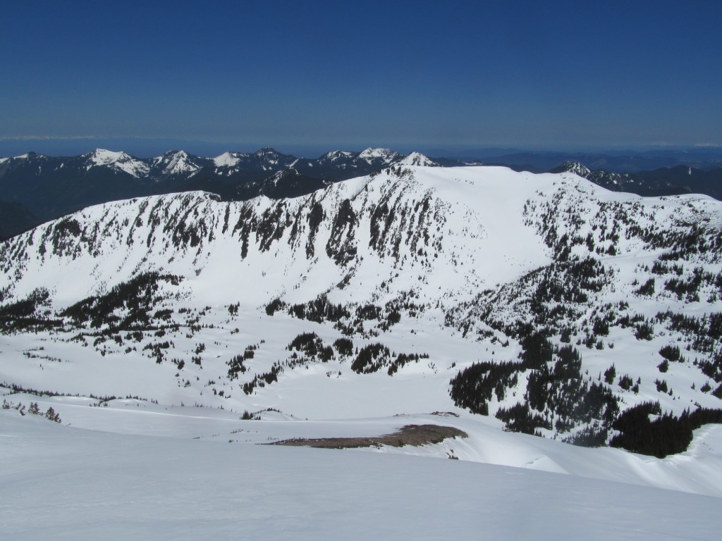
Heading up to Whitman Peak
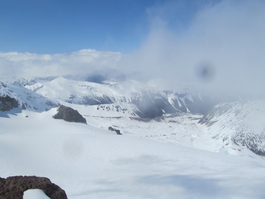
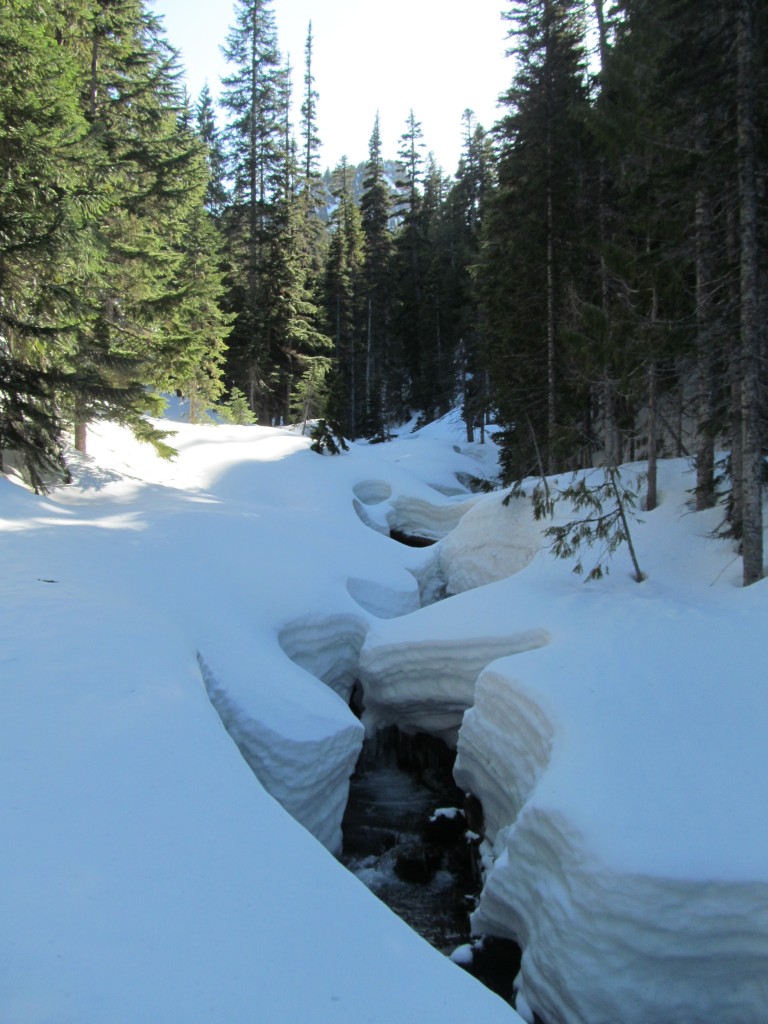
I started skinning with my great friend Boot toward the Cowlitz Glacier in a whiteout. The forecast had been calling for a few clouds the first day but after that it would be a week of clear skies. Breaking in trail I was not happy that 6 inches of snow had fallen on the South side of Rainier. This had the potential to dramatically slow down my progress, breaking trail in deep snow.
The snow for the Cowlitz Glacier run was wet and sticky. Not only was the riding not so fun but it was total vertigo riding in a white out. I considered turning around but kept pushing towards Whitman Crest with Boot hoping conditions would improve. He was kind enough to loan me some wax and I proceeded to talk his ears off while we climbed the further away from Paradise. Soon enough the clouds started to part as we were skinning up the Whitman Glacier.
Arriving on the summit of Whitman Crest it was time to make a decision. Either I would stick with my plans or turn back and ride to the car with Boot, abandoning my plans. After a few minutes of debate I decided I would push forward. So we said our goodbyes and he snowboarded to the South while I prepared to snowboard to the North.
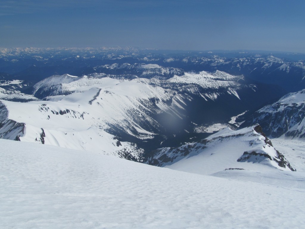
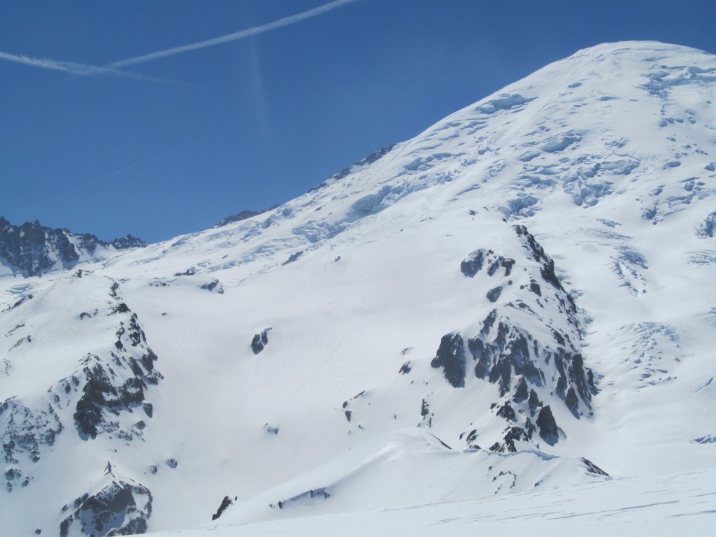
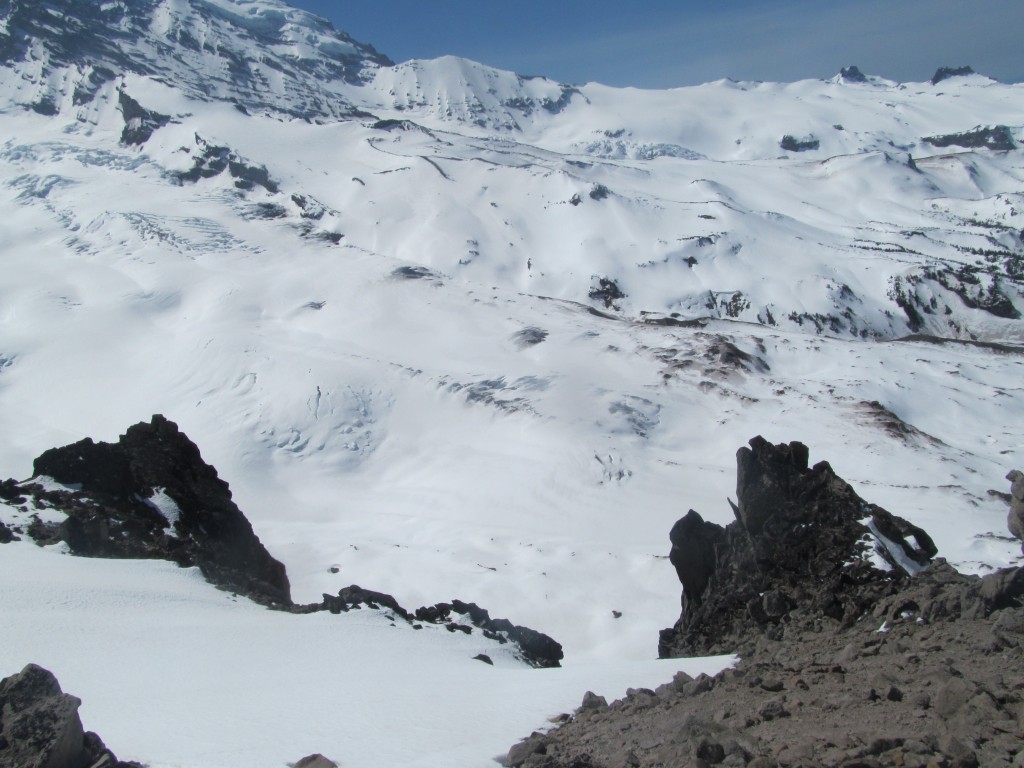
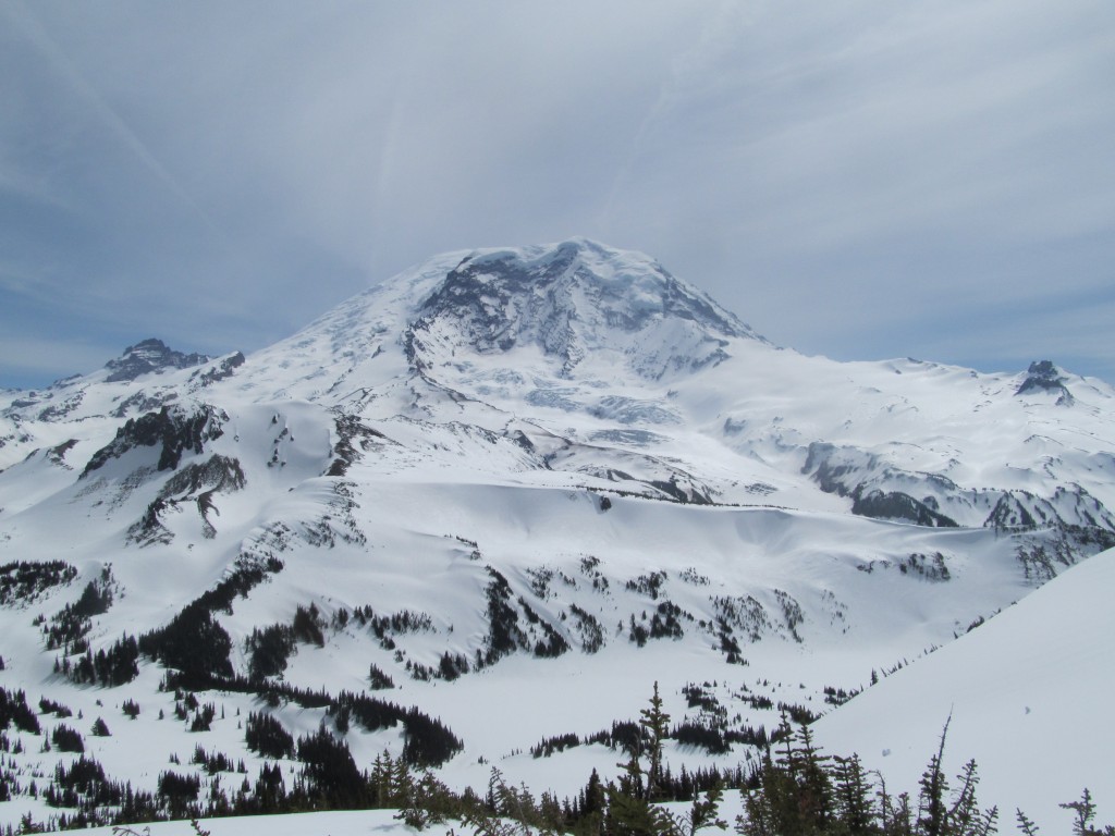
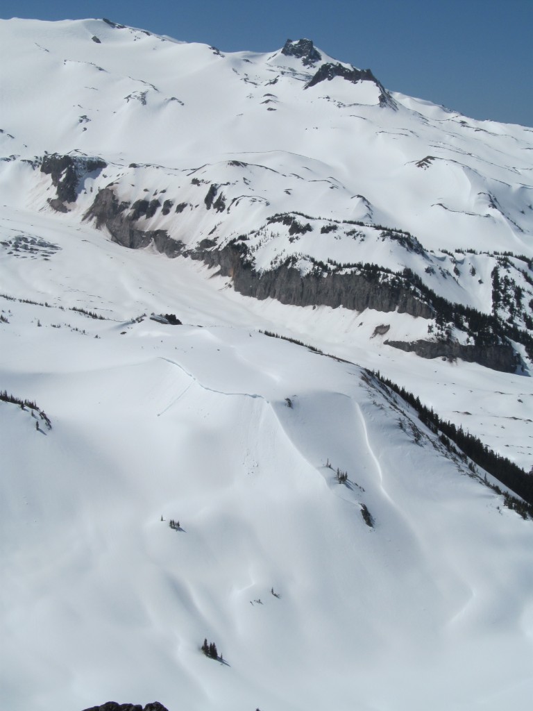
The First Run of the Trip Down to Summerland
I watched Boot ride down in 5 inches of powder as he got smaller with every turn. To the North the wind was ravaging the slopes and I feared I would be dealing with firm slopes. There was no turning back now as my 30 liter (yes 30 liter) pack was filled to the brim with food, clothes and shelter. The second line of my trip started with a blind roller so it just added to the nervousness. But with hopes of better snow down lower I dropped off Whitman Crest and rode the Fryingpan glacier all the way to Sumerland.
The snow was firm yet edgeable as I made my way down. My dilemma at the time was should I drop the more aggressive slopes of the headwall onto the Emmons or the mellower line to Summerland. In the end since I was solo I decided to head down the less aggressive slopes. The route would be a little less direct of I would have to skin over the mellow ridge of Goat Island Mountain to gain the access Emmons Glacier.
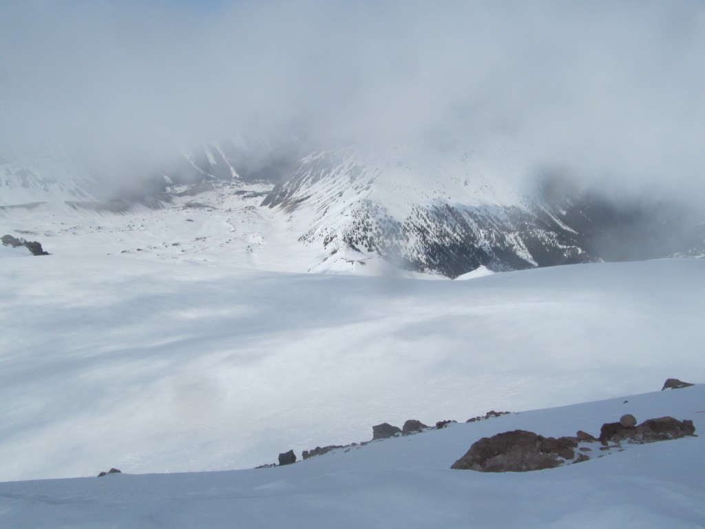
The snow was much better once I got lower and past the wind exposed ridge. Luckily I was in the rain shadow of Rainier for a bit. This area had the best chance of the sky being blue.
Heading Over to the Emmons Glacier
Once at the base of my second run it was time to start skinning. Heading west I made my way over the source of Fryingpan Creek to the low col separating me from the upper slopes of Mount Rainier. From my view point I had a clean view up the Upper Emmons Glacier and Mount Ruth which seemed to still be in the clouds.
My plan was do to a slowly rising traverse of the Emmons. I knew it would put me in the Serac fields in the center on the Glacier but I decided to see if I could make it through. With only 3 hours of light left I made a fast pace and enjoyed the scenery on the largest glacier in the lower 48.
I felt confident on my route finding abilities as I weaved wide around obvious crevasses until I ran into a dead end. An hour had passed as I tried to find a route around but it just wasn’t happening. I had two choices of what to do. I could spend more time trying to find an alternative route and hopefully make it Camp Sherman around dark or drop down to a lower elevation and water before calling it a night.
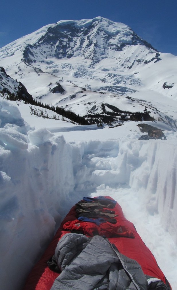
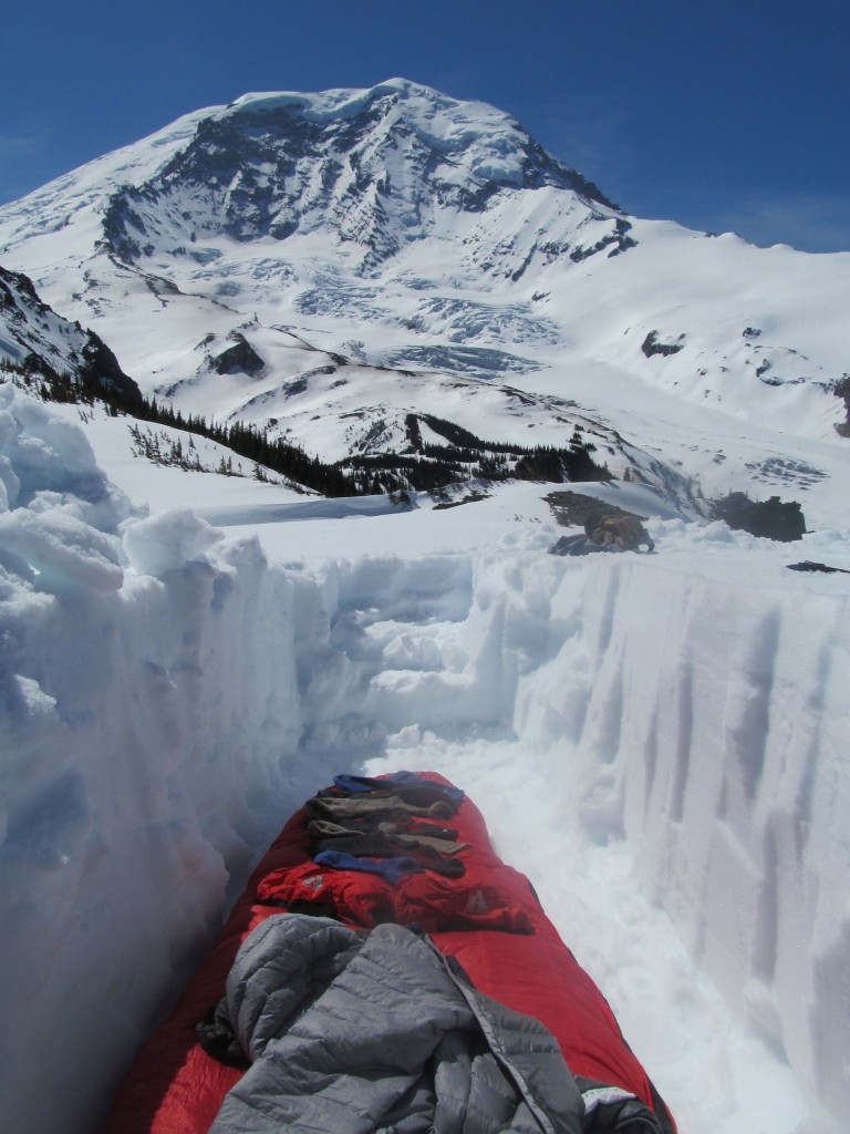
Camping on the Emmons Glacier
I decided to play it safe and rode my board 2000 feet in smooth and semi firm snow until I spotted a glacier tarn and stopped there. With access to water and a freshly dug 3 foot deep trench I got cozy on the Emmons Glacier.
Day 2 Paradise to Carbon: A Ski traverse on Mount Rainier
I like campsites where I can just open my eyes and pop my head out of my sleeping bag for epic views. This was one of them as I watched the alpenglow slowly run down Ingraham Glacier from the warmth of my sleeping bag. I had a long day ahead of me as I planned to make it over to Mystic Park by the end of the day.
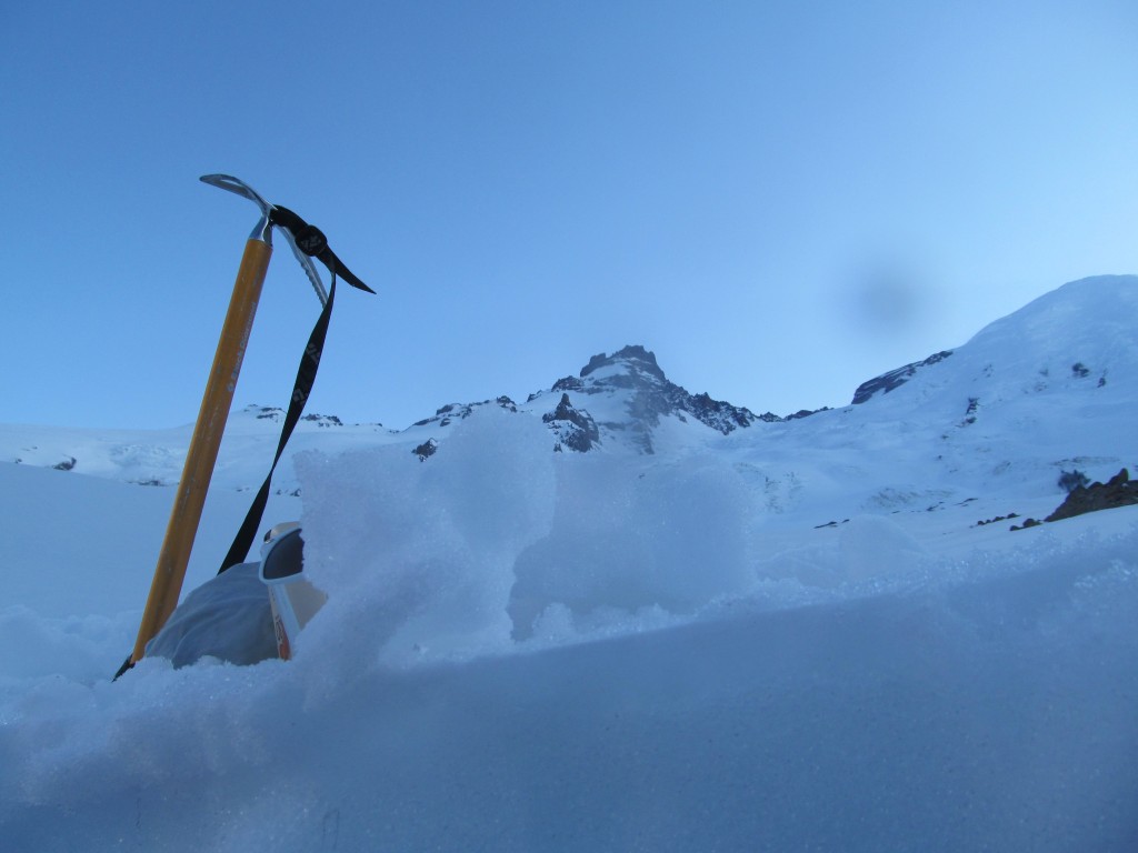
Skinning up the Emmons Glacier Towards Steamboat Prow
It had been a cold night as I slowly waited for the suns warm rays to hit camp. After some coffee and breakfast I packed and was happy to know that I was going to be in the sun all day. knowing the day was going to be arduous I couldn’t sit around and check out the scenery for ever. I left camp around 8 A.M. and skinned up the right hand side of the Emmons Glacier. This was a route I was very familiar with as I had done it a handful of times.
In the early morning sun I made my way up the smooth ramp towards Steamboat prow. It was a beautiful and silent morning as my only company was my shadow. It was the perfect start to the second day of the ski traverse from Paradise to the Carbon River Valley.
The snow was firm as I pushed my way up the Emmons Glacier. I was fortunate that it made for fast travel as the views started to open up. I had originally thought the 4000 vert would take 4 hours but in the end it only took half the time.
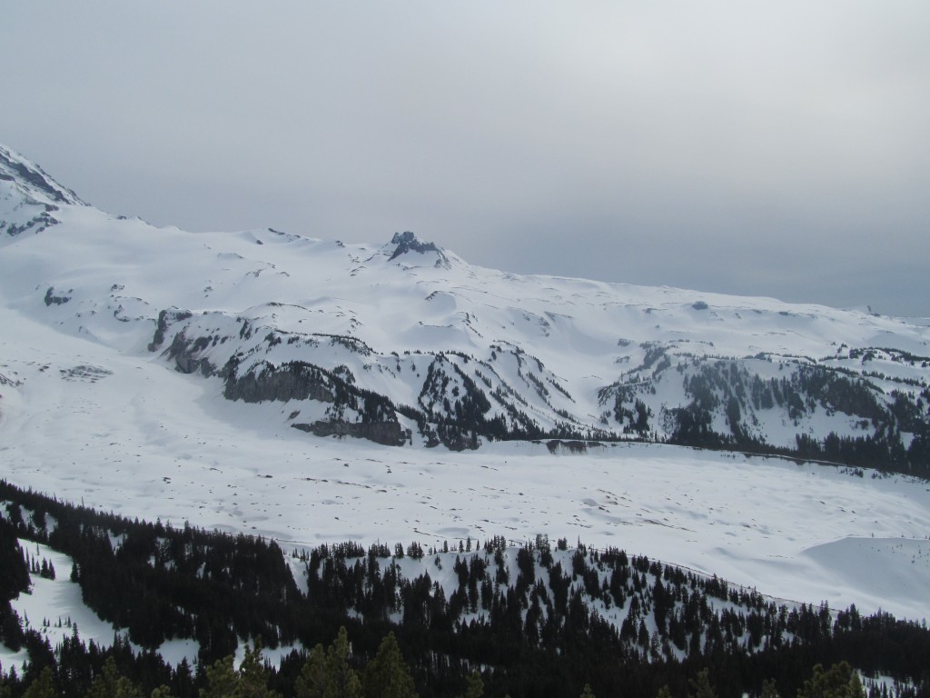
Summiting Steamboat Prow
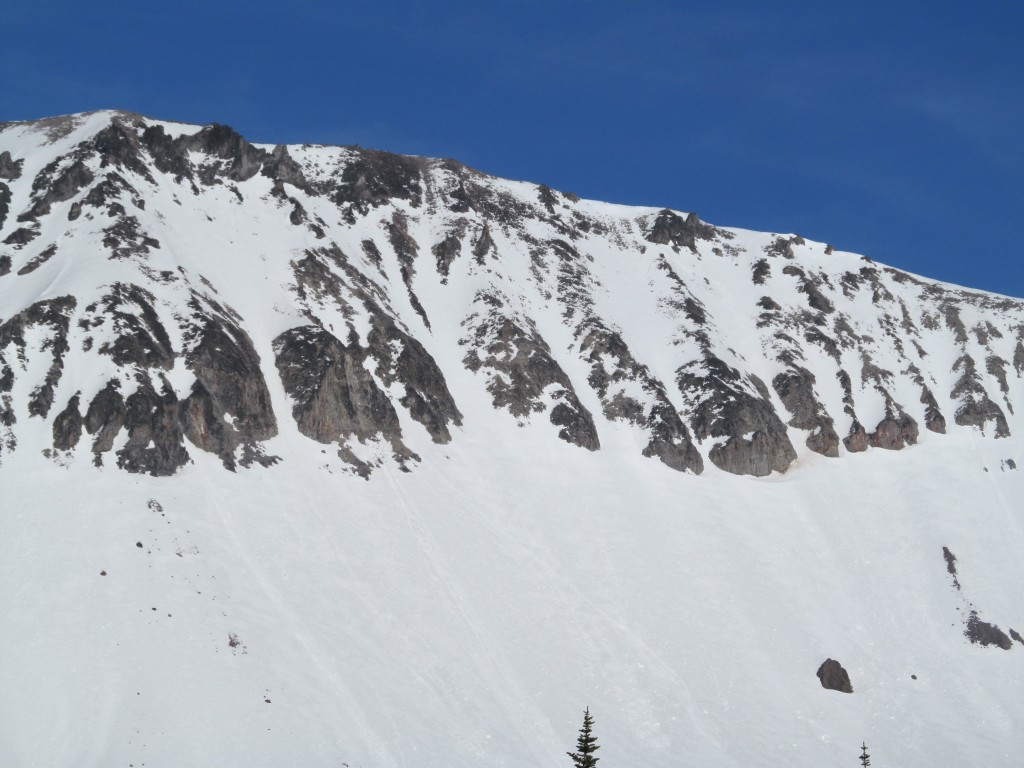
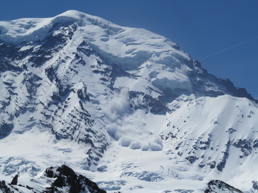
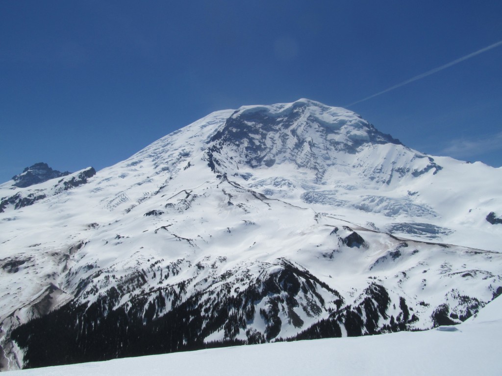
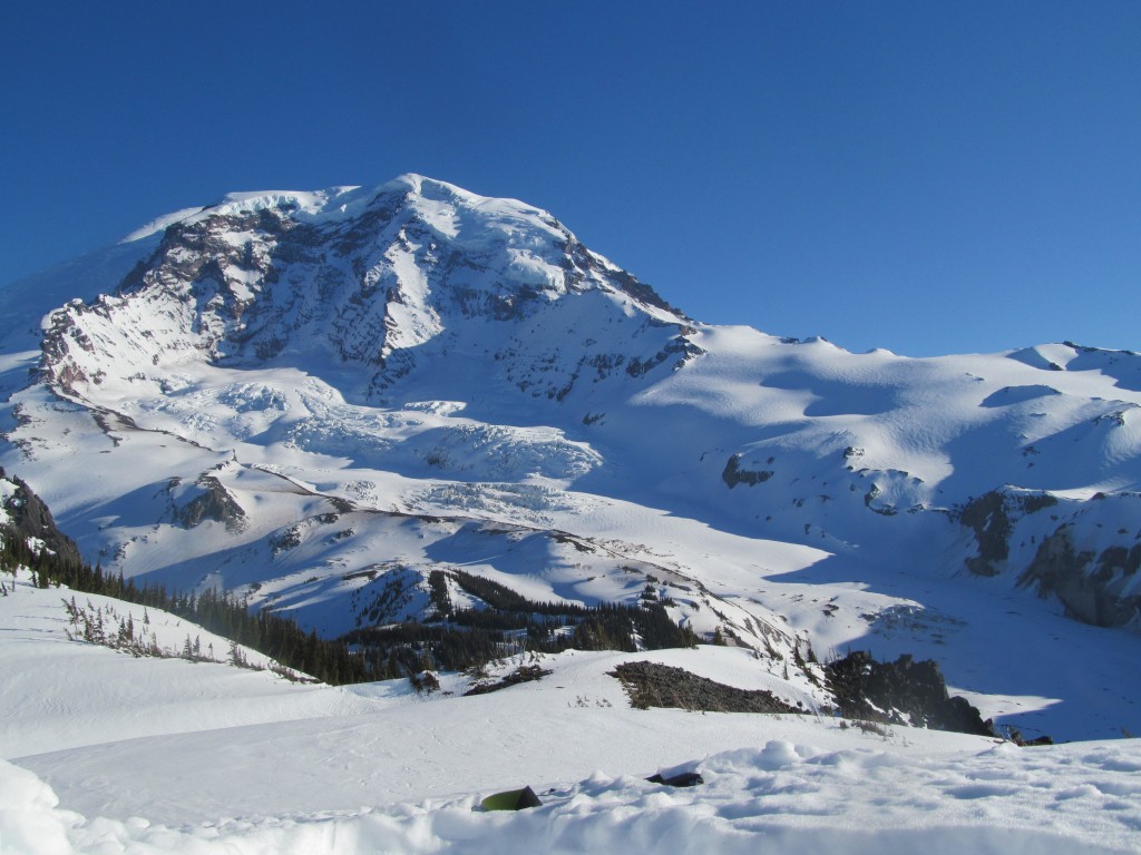
Finally I arrived at Steamboat prow and I checked out the upper slopes of Mount Rainier. I was at the high point of the Paradise to Carbon River ski traverse. Originally I had considered riding down the Winthrop Glacier but it was broken up with no clean routes. I would have to go with plan B and ride both the Interglacier and the west face of the 3rd Burroughs.
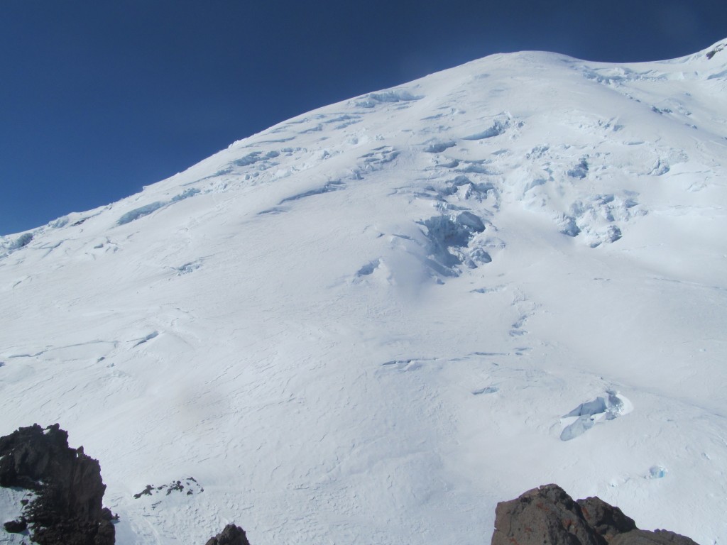
From my vantage point I took some photos of my potential line on the 3rd Burroughs west face. This was a line I had wanted to do for years and it looked like the route was clean. Once on the top of the mountain I would use this photo for reference.
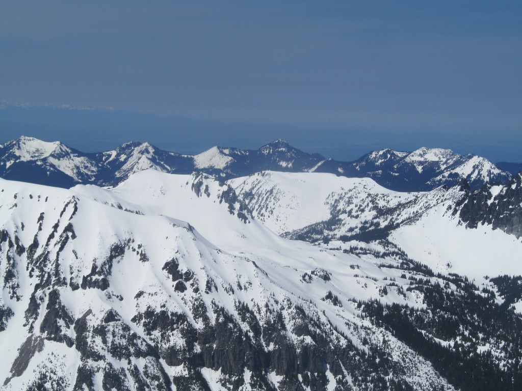
To the east was the terrain Jason Hummel and I had traveled through on the Paradise to Crystal Mountain ski traverse. I had a clear view of the Cowlitz Chimneys in the middle of the photo. Below that was the Ohanapecosh area and to the left was the Sarvant Glacier.
Looking north was the entirety of the Sourdough range. More specifically the Burroughs on the right side with Mount Fremont behind it, in the middle is Sunrise Visitor center and off to the right is the Crystal Mountain area. The far background is the North Cascades.
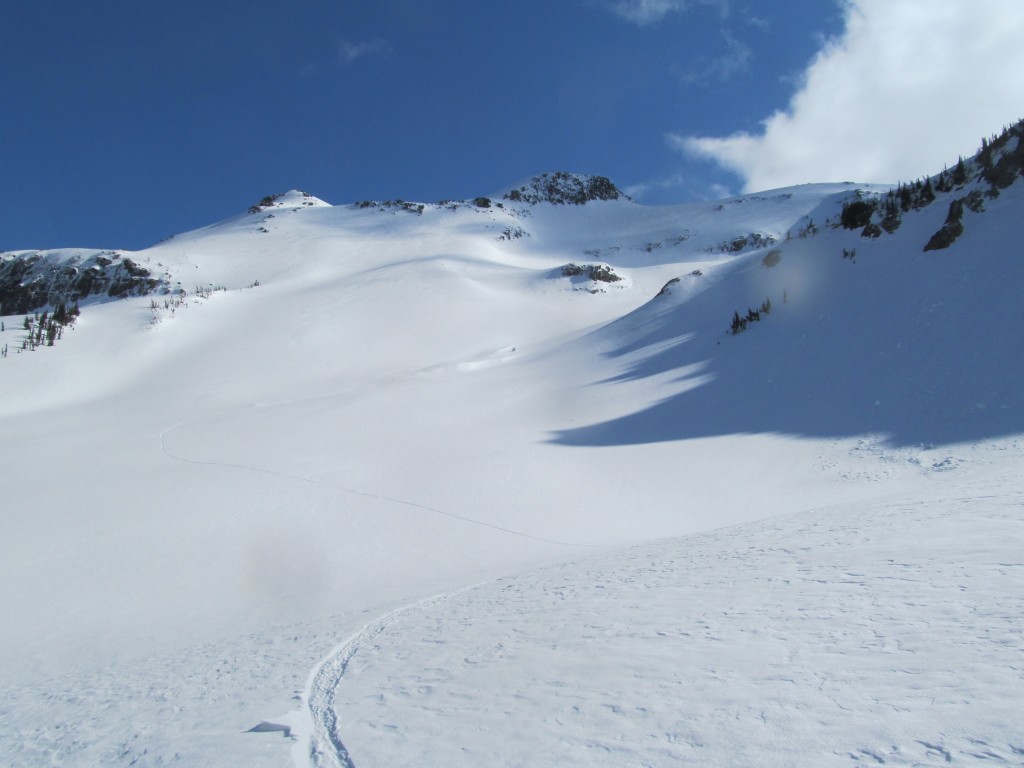
Riding Down the Interglacier
After soaking in the view it was time to get moving for my first run of the day. Putting on my snowboard I rode down the Interglacier all the way down to tree line without stopping, It was 4,500 feet of powder up top transitioning to corn snow
I stopped at the first hole in what would become the White River lower and took the opportunity to drink water. It had been a great run and I had a long skin up the 3rd Burroughs. After taking in the view of Mount Ruth and Glacier Basin it was time to get moving.
Climbing up the Southeast Face of the 3rd Burroughs
I made my way down the Glacier Basin trail for less then a quarter mile before starting to ascend into the SE bowl of the 3rd Burroughs. I was surprised by how steep and firm the snow was making my way up the South face. With a little bit of hard work and 2 hours I finally arrived at the col between the 2nd and 3rd Burroughs.
Once on the col I enjoyed a mellow skin up the open tundra arriving on top of the 3rd Burroughs at noon. I have found that when I tour solo I base everything off of time and my watch. I had planned on descending the 3rd Burroughs at 3:00 so I sat on the summit and took a nap for the next few hour in one of my favorite spots. From my vantage point I had a clear view of my solo tracks down the Interglacier.
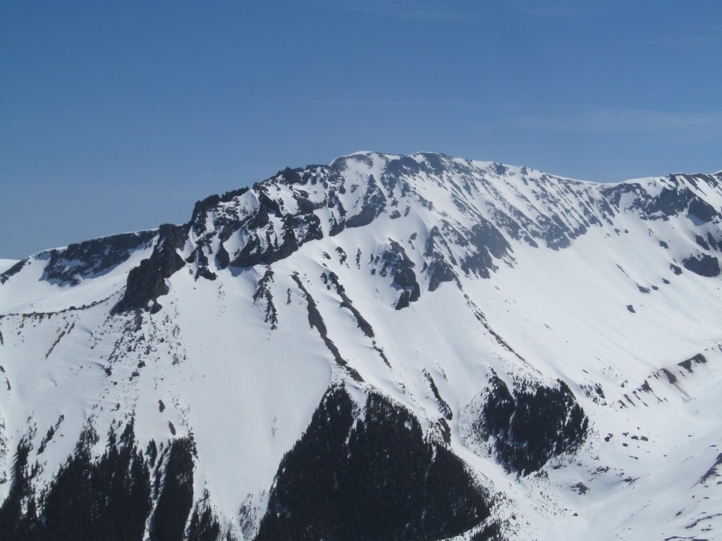
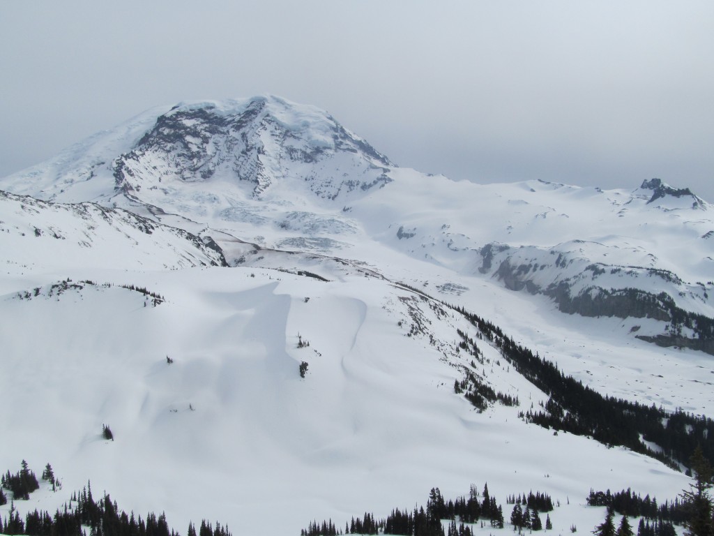
Summiting the 3rd Burroughs
Resting on the 3rd Burroughs I could see that the route down the Winthrop Glacier would have gone. I knew I would have saved some time but I was happy with my bonus descents down the Interglacier and the West face of the 3rd Burroughs.
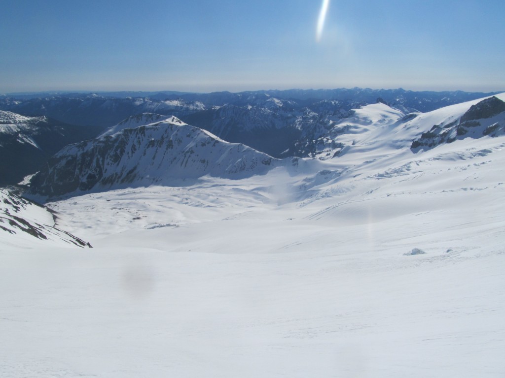
Off in the distance I could see the main area I was interested in on the Paradise to Carbon River ski traverse. This was a great opportunity to ride around the Moraine Park area with a full winter snowpack. Off in the far distance I could see the Olympic Mountains barely sticking out.
Looking to the west I had a clean view of the terrain Ben, Jason and I had rode during the 3 day Osceola Traverse. On the far ridge was the Mowich Lake area with Echo and Observation rock. In the Middle of the photo is the Mystic Lakes area with Curtis Ridge.
Snowboarding Down the West Face of the 3rd Burroughs and the Half Way Point of the Paradise to Carbon River Traverse
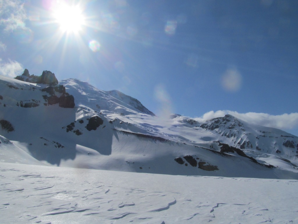
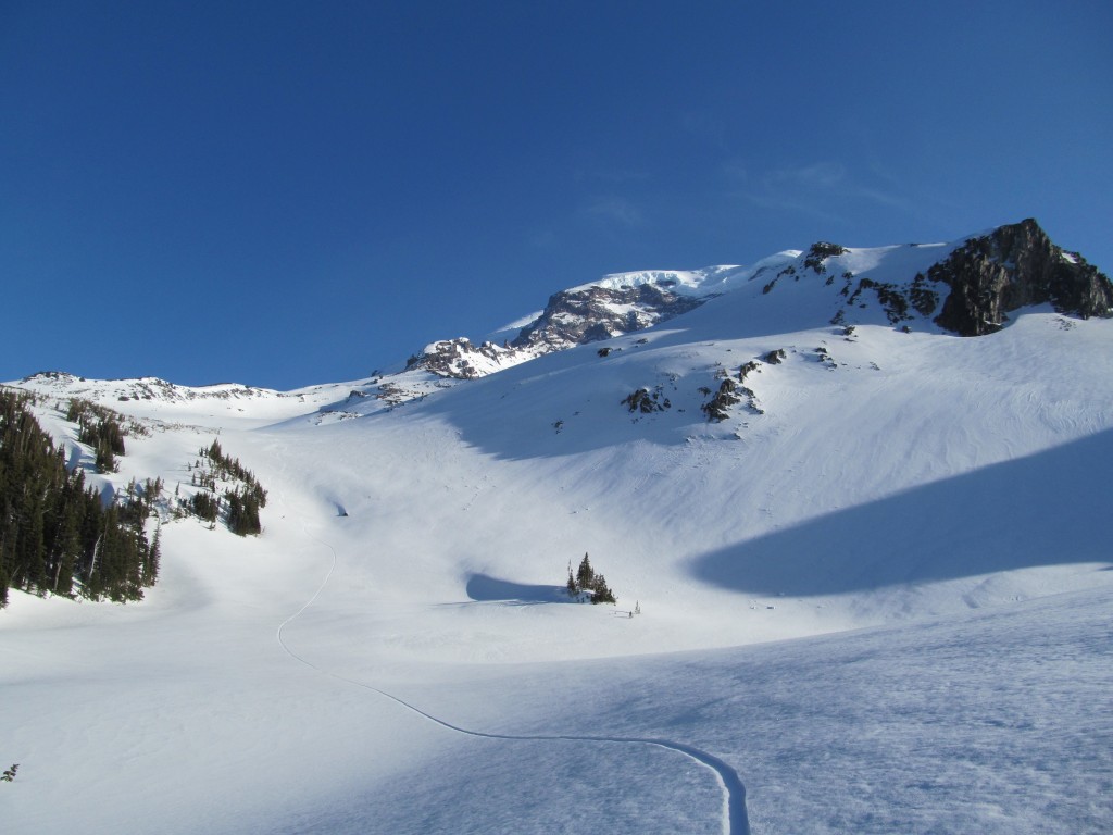
At 3p.m. I packed my bag again and hoped the snow had softened enough on the West face of the 3rd Burroughs. With numerous checks on my camera I found the line I was looking for. Dropping in was intimating as the whole area looked different from above but once past the tight choke the terrain opened up. It was was a steep face riding all the way down to the Winthrop glacier.
Once on the Winthrop glacier I had two options. Either I could traverse the entire glacier or ride it fall line and skin across. I decided to ride all the way down to the toe after snapping a shot of my line. It was a total blast with two inches of soft snow an additional 1000 feet on top of the original 2000 foot line.
Crossing the Winthrop Glacier
Once at the toe I grabbed some water out of a small stream and made my way across the lower slopes of the Winthrop glacier. I was impressed by the width of the river of ice cascading down the upper slopes of Mount Rainier. For the most part things went smooth with only a small down climb off the Moraine. Before long it was time to head up the creek towards Mystic Lake.
Heading up to Mineral Basin
Following what I though was the creek up to Mystic lake I had actually followed a different one. It was hard to tell the difference as from the bottom it seemed like this was the main drainage.
I quickly decided to gain elevation and get into the alpine instead of battling the creek that was giving me problems. Soon enough I found myself in open forests and looking back at the line I had rode off the west face of the 3rd Burroughs.
From this perspective I had a direct view of the face and the numerous different options. I was fortunate that I had made it out there in early spring as this face was melts off fast.
Once above treeline I made a mellow traverse west into Mineral basin before switching to snowboard. I decided that I would ridge down to the Mystic lake area as I rode of few inches of sheltered powder.
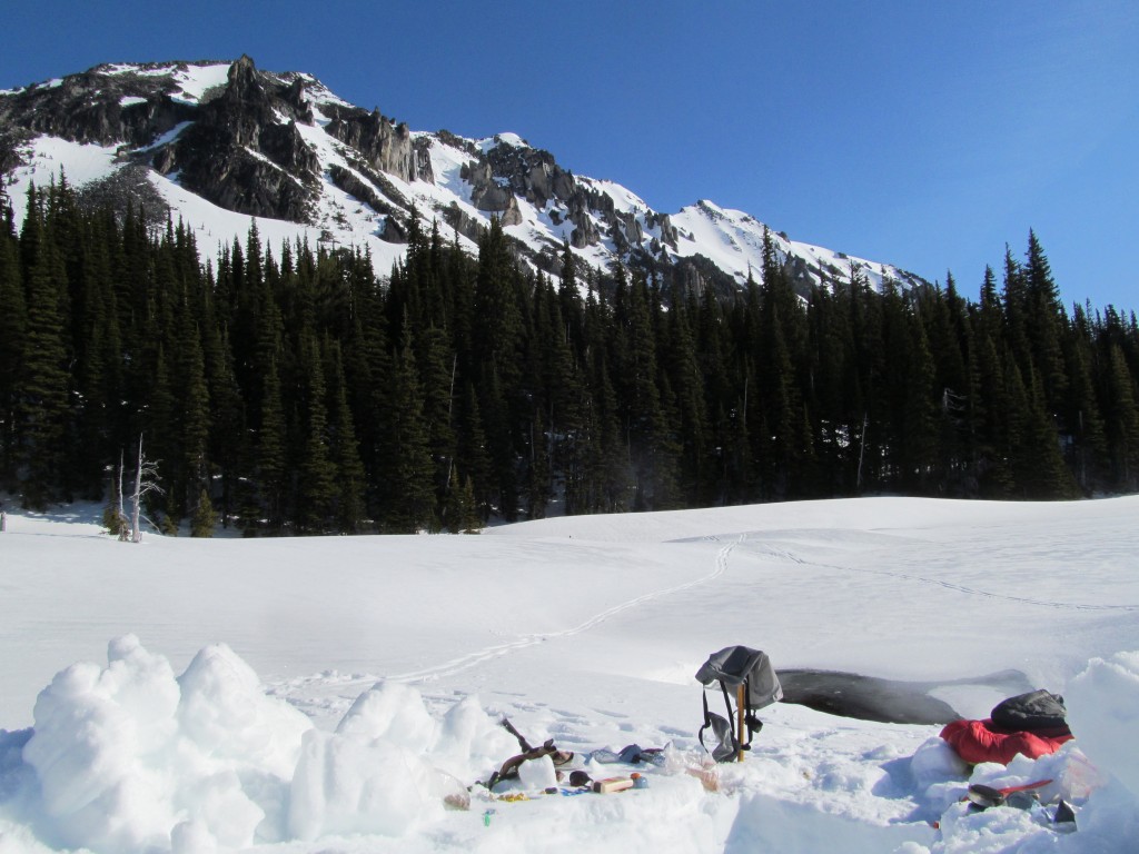
Camping at Mystic Lake
Once on the shores of Mystic lake I decided to call it a night as the sun was starting to set. I quickly found a small water hole and dug in my trench for the night as the last rays of sun hit Old Desolate.
Day 3 of the Paradise to Carbon River Ski Traverse
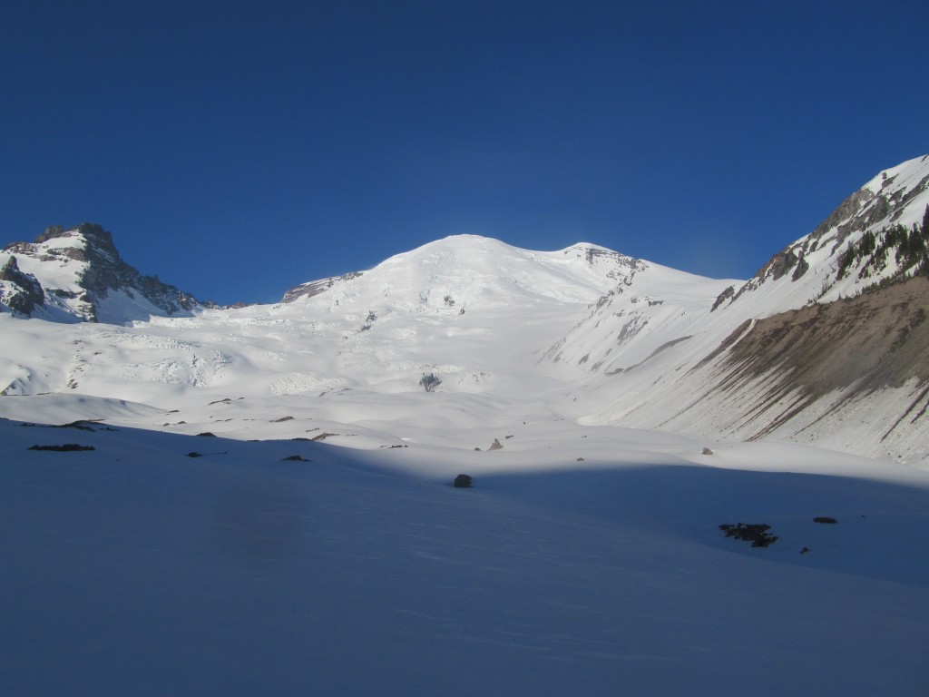
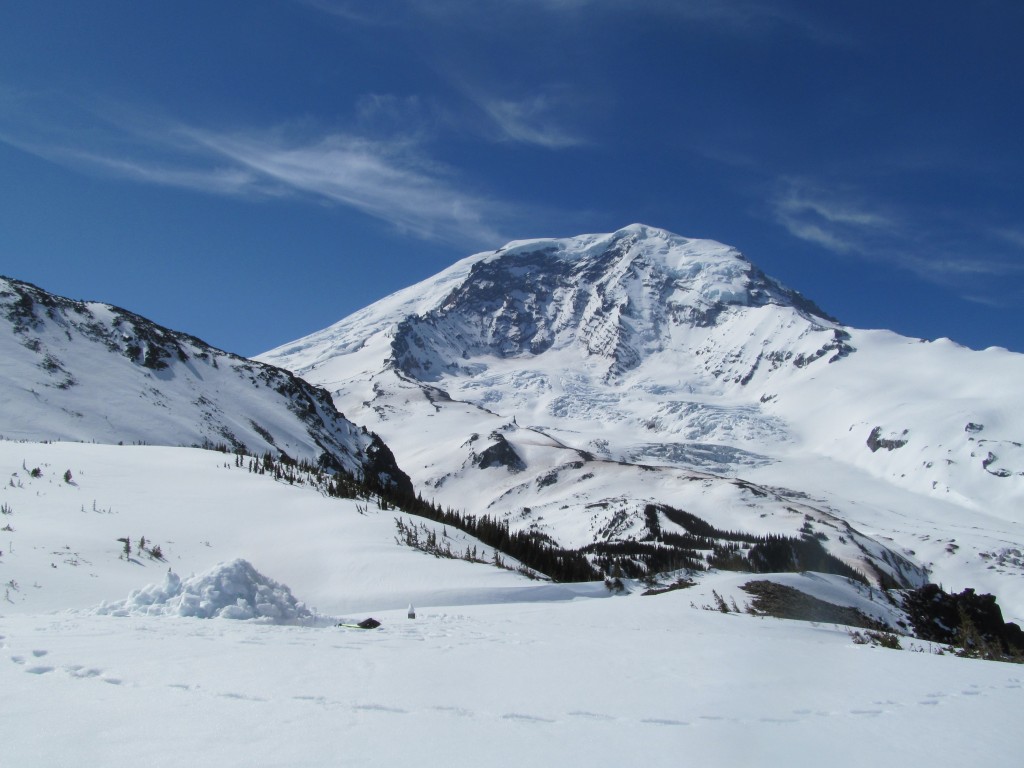
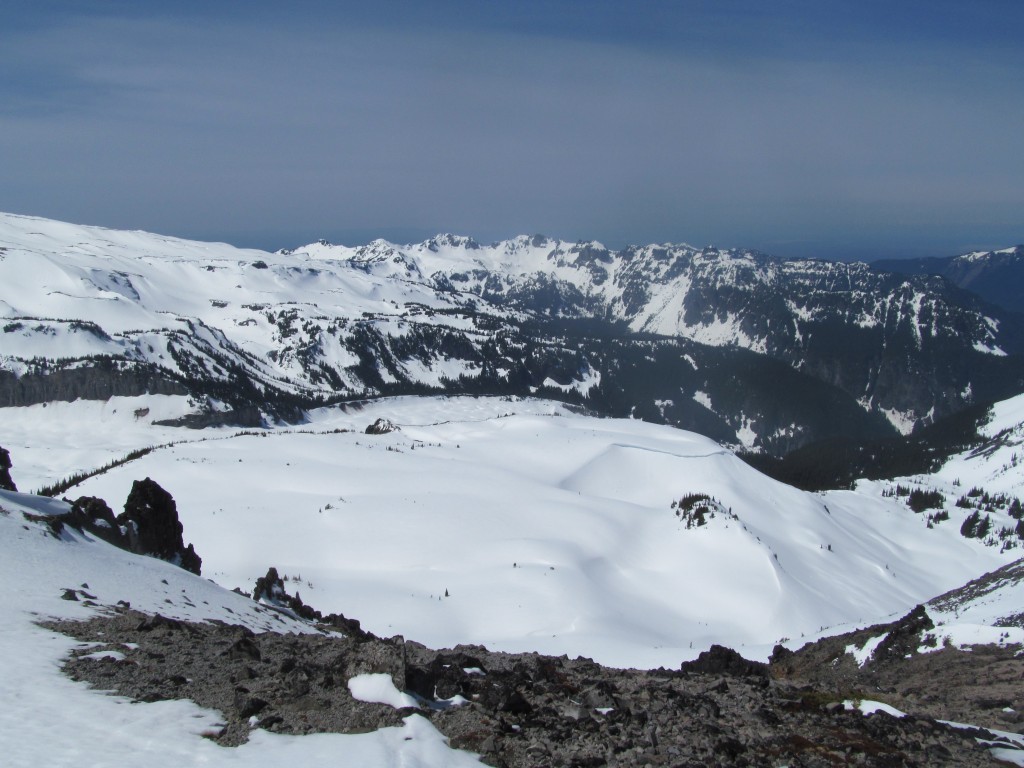
The morning was bright and sunny as I laid back and enjoyed the warmth of the sun. Eating breakfast I started coming up with the plan for the day. I was still tired from the previous day as I started to pack my gear for the day ahead. The plan was to head up to Moraine Park and set up base camp out there.
Heading towards Moraine Park
Soon enough I had my gear packed as was back to skinning. I loosely followed the Wonderland Trail the was buried under 10 feet of snow.
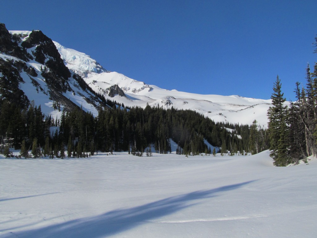
I skinned up to the low col to the west and the view of Mount Rainier and the Willis Wall started coming out. Instead of skinning down the other side I decide I might as well snowboard into the basin. While it was a short lap it had by far the best wind protected pow of the Paradise to Carbon River ski traverse.
Setting up Camp in Moraine Basin
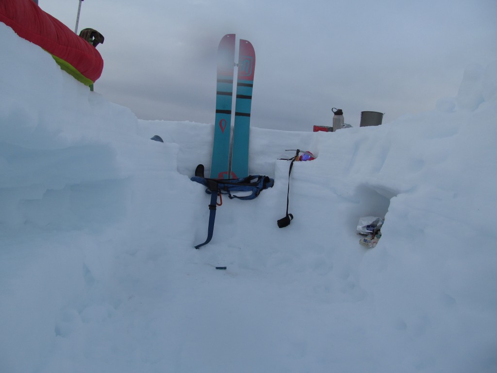
From the basin I skinned directly up to Moraine park. By now my knee was giving me some issues so I decided I needed it rest day. With the extra time I spent the afternoon focusing on building a bomber camping site. After finding the perfect view I dug for two hours in the end having 4 foot walls and more then enough room for me to move around.
Best of all I built a chair at the head of it with the splitboard to lean on and my backpack to sit on. For the rest of the day I just rested and took in the surrounding views.
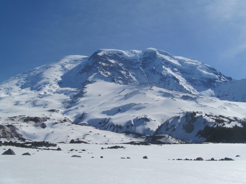
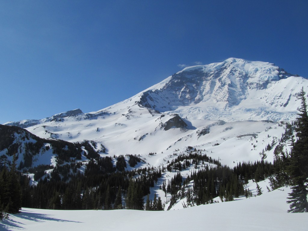
It was an amazing camping spot with one of the best views of Mount Rainier. I was super happy to be out there and would start exploring the area the following day.
Day 4 of the Paradise to Carbon River Ski Traverse
With my knee feeling a bit better I waited until around 1 before I started moving. My intention for the day was to run around and the surrounding terrain. I would head for Crescent Lake and keep myself entertained along the way. It was a hot day but I made the best out of the views waiting to ride south facing slopes once they softened up.
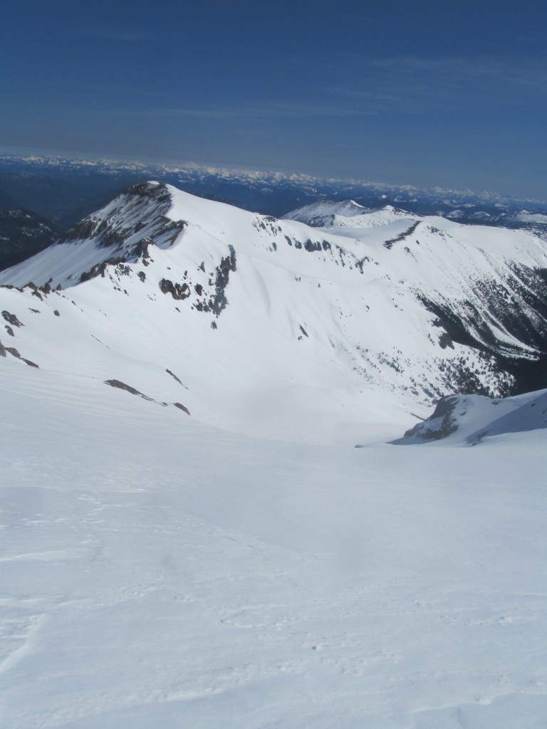
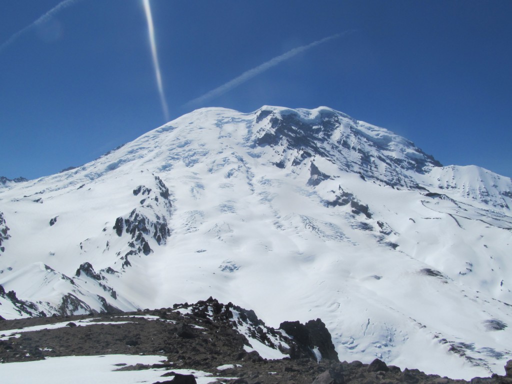
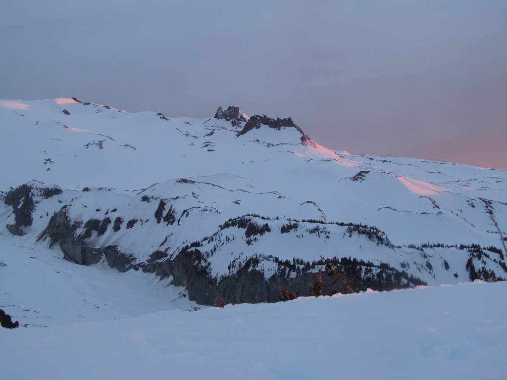
Heading up Old Desolate
Once I felt the snow had softened up enough I made my way to the top of Old Desolate. It would be my entrance to the Elysian Fields and hopefully a descent down to Crescent Lake. It had been a long trip so far but I was happy to be in a new zone and exploring.
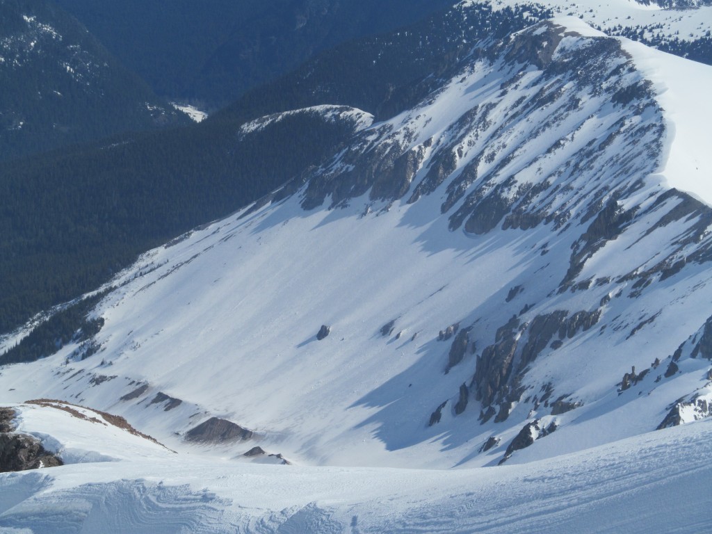
From the summit I had an unobstructed view of Mineral Park and Mount Rainier. It was great to see the area Jason, Ben and I had climbed on day 3 of the Osceola Traverse.
Looking to the East I had a different perspective of the west face of the 3rd Burroughs.
To the west I had a great view of camp and the Mowich Lake area. There had been so many times that I had looked this way from Knapsack Pass and finally I was looking back.
Snowboarding Down Old Desolate and Heading Towards Crescent Ridge
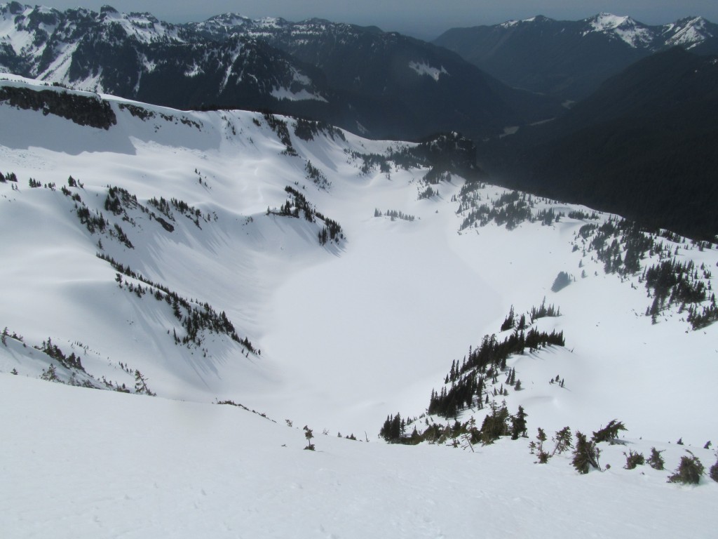
From the summit of Old Desolate I rode the NE face down to the base of Elysian Peak. The snow was nice and smooth corn as I put tracks into the canvas. It was time to start skinning over to the Elysian fields as I followed the mellow contours over to a low col.
Once on the col I made a short descent into the Elysian Fields. After transitioning I made my way up to Crescent ridge. Making my way up the view just kept getting better with every step. Soon I was standing near the top and taking in the views of Mount Rainier and Elysian Peak.
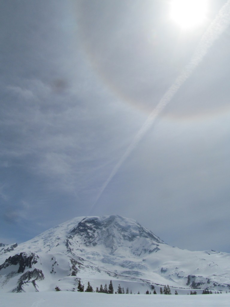
From the summit of Crescent Peak I sat there for a bit soaking in the views. There was a sun dog above Mount Rainier and I feared the weather was going to turn for the worse.
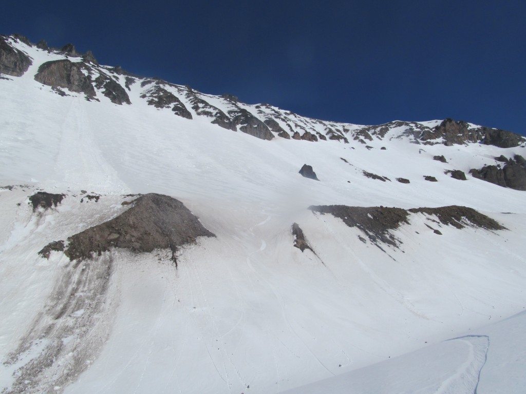
Attempt of the NW Face of Cresent Ridge
Once on the ridge I attempted a line down the NW face. Being there before I knew there was a nice face but it was a steep roll over. The further I went down the spicier it got so I decided to abort and follow my tracks back up.
Heading Back to Camp From Pacific Point
Wanting to get back before the weather turned I rode down the south slopes before climbing up to Pacific Point. By now a cloud deck had formed and I wondered if I was going to get hit by a storm. While transitioning I snapped a few photos of the scenery before moving on.
To the Southwest I had a clean view of the Mowich Lake and Spray Park areas. Echo rock just seemed to rise sharply out of the snow with Observation Peak hiding behind it.
From Pacific Point I descended back into Moraine Park and skinned up to camp. It was a rad loop and I wanted to tour longer but I was concerned about weather.
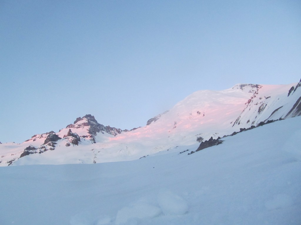
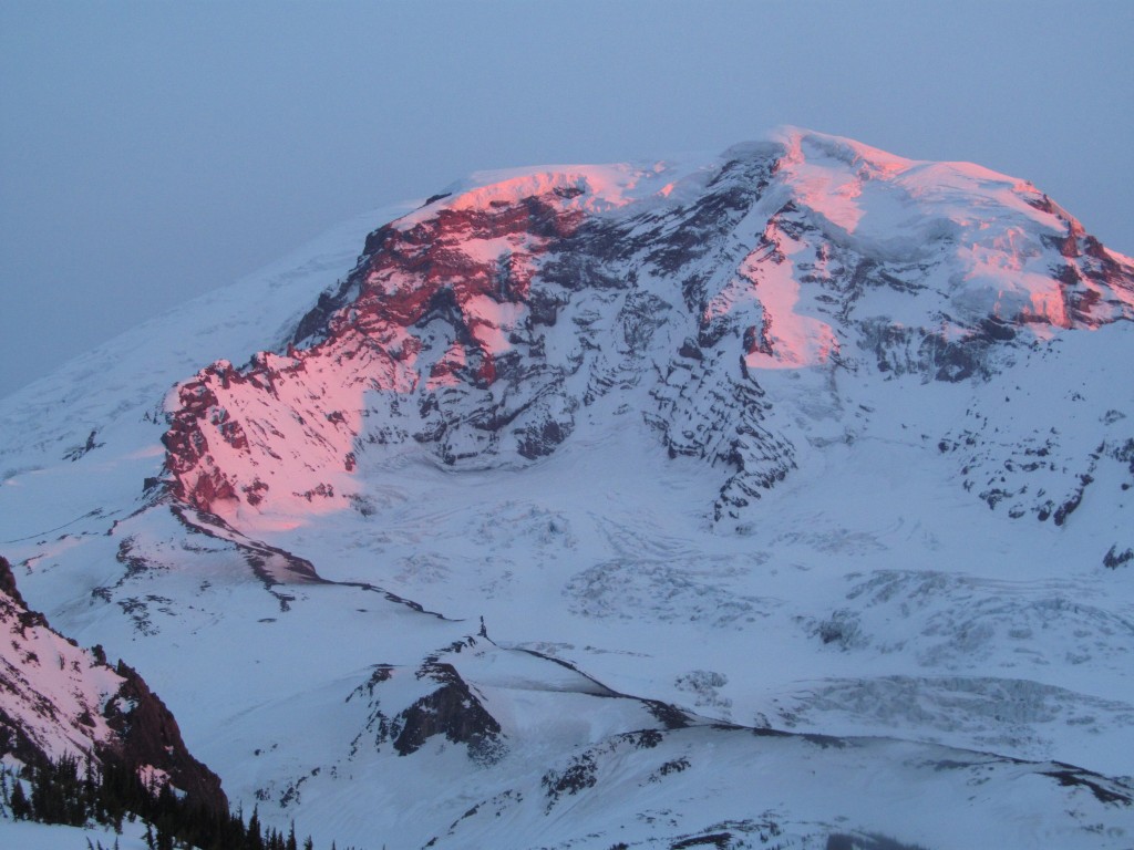
A Stunning Sunset
I was concerned about rain so I dug in my shelter a tad bit more ate some food and patiently waited for the sun to set. I quickly realized I was in store for an amazing sunset once the sun made its way under the clouds.
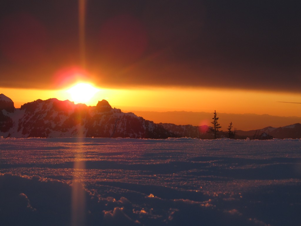
As the sun went down the alpenglow started to run up the mountain. It was surreal and I was so excited feeling like a kid opening his Christmas present.
Little by little the upper peaks started to light up. The alpenglow was slowly creeping higher by the minute.
Finally it was time for the main event as the North face of Mount Rainier glowed dark red. One of the reasons for heading out to the zone was for the view. I was rewarded big time
Day 5 of the Paradise to Carbon River Ski Traverse
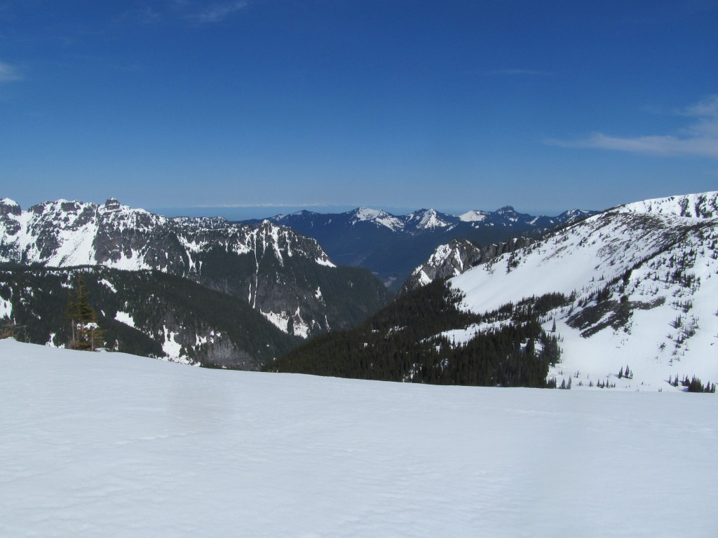
I woke up to blue skies and it was perfectly clear. Off in the distance I could see the Olympic Mountains rising out of the Puget Sound I was stoked and wanted to get out a brief tour on the slopes of Elysian peak before the heat of the day. It was my last day in the alpine and knew I should rest before my long exit down the Carbon River.
Heading Towards Elysian Peak
I started the day at 9 a.m. with a quick climb up Old Desolate before ring to the SE base of Elysian Peak. I decided I would ride a few different aspects of the face as I broke trail up to the summit. From up top I had another great view of the terrain I had rode the previous day.
With the sun heating up the south facing slopes first I dropped off the south face before heading up my skin track and riding the north face. With a few hours of daylight left I was ready for my final run off the southwest face back to camp.
The rest of the day I rested, ate food and took in the view of Rainier before calling it a night. Sadly the sunset from the night before put this one to shame so I didn’t take as many photos before going to bed.
Day 6 of the Paradise to Carbon River Ski Traverse
During the night a big windstorm had ripped through the area. I could hear stuff moving but I was fine in my shelter knowing all my vital stuff was inside. Waking up up and looked to see if anything was missing and noticed I only had one skin. Quickly I realized that the wind had literally picked it up laying flat on the ground and moved it. On one side I had a huge alpine bowl but to the west was the Carbon River Valley. Sadly the wind had blown my skin into the Carbon River Valley. I had one of those how are you going to fix the situation moments and decided to use numerous Voile straps. Long story short It worked!
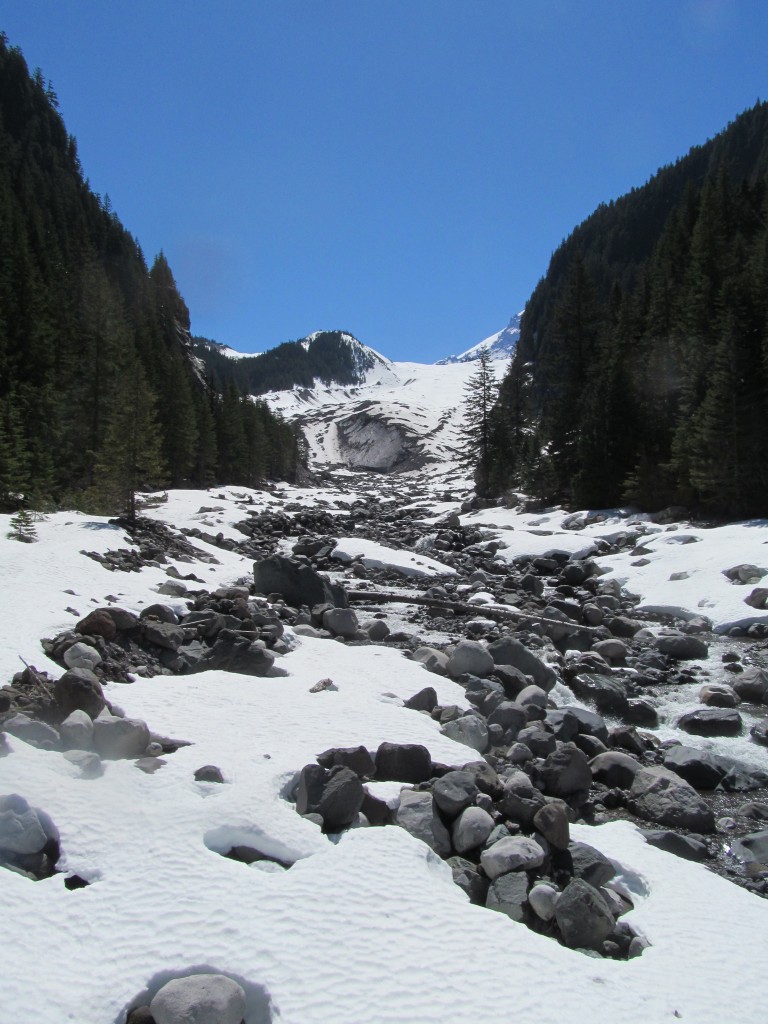
Exiting via the Carbon River Valley
I descended down the Carbon Glacier Moraine, skinned over it with four Voile straps on my left ski and traversed to a section of the glacier that had good fall line riding before transitioning. From there I rode the Carbon Glacier from around 5,500 feet to its toe at 3,500 feet. and followed the melted out river bed. It was the final descent of the Paradise to Carbon River ski Traverse.
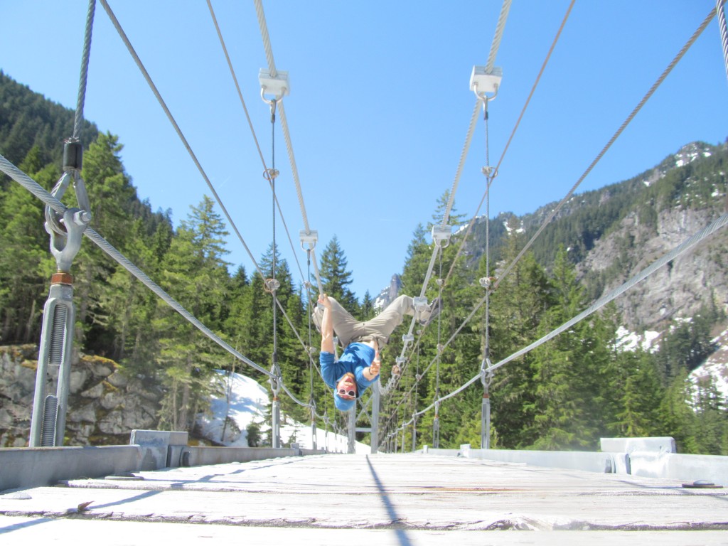
Once at the suspension bridge I took a break and ate some food before the long slog down valley. I was super happy as I had completed the Paradise to Carbon River ski traverse. The next 8 miles were a blur as I started running into hikers.The trail became dry once it hit the western side of the river around before the 8 mile death slog out of the Carbon River Valley. Soon I arrived at the old Ranger Station where Boot was waiting for me with celebratory beers.
In Conclusion for Paradise to Carbon River Ski Traverse
In total I made my way on 9 separate glaciers and it was an amazing experience. When solo touring there are so many more elements in the adventure. As an afterthought I feel the only mistake that I did was left my skin out but who was ever heard of a skin flying away!
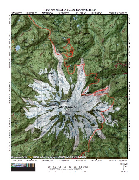
The Paradise to Carbon River ski traverse took me over 45 miles and 23,000 vertical feet. What is so rad about it is theoretically you could do it anytime during the winter as the access points are open year round (except on the days the park gets shut down to the public). Here is a map of the trip.
Thank you for reading this from Paradise to Carbon River Ski Traverse. If you want to see more ski tours within Mount Rainier Backcountry check out this link
and for a full and text only list of all Trip Reports Click Here