
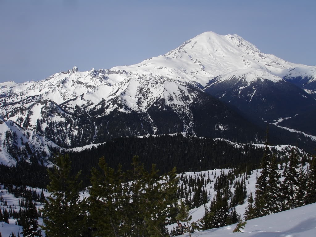
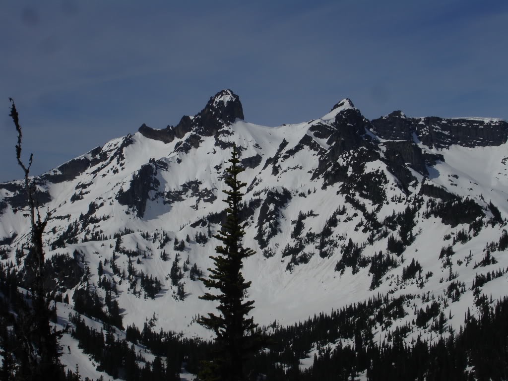
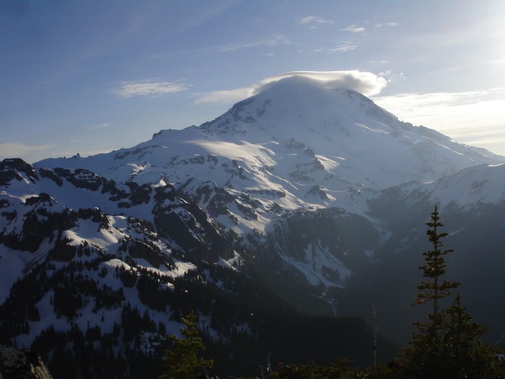
Cowlitz Chimneys in Mount Rainier National Park is one of those lines that stands out from Crystal Mountain. There have been multiple occasions where I’ve had discussion with patrollers about accessing the Giant. The Cowlitz Chimneys have a unique formation as well as a massive East Facing gully. With the opening of Cayuse Pass it seemed this would be the most direct way to get there. Once there I would attempt to link it with Tamanos Mountain.
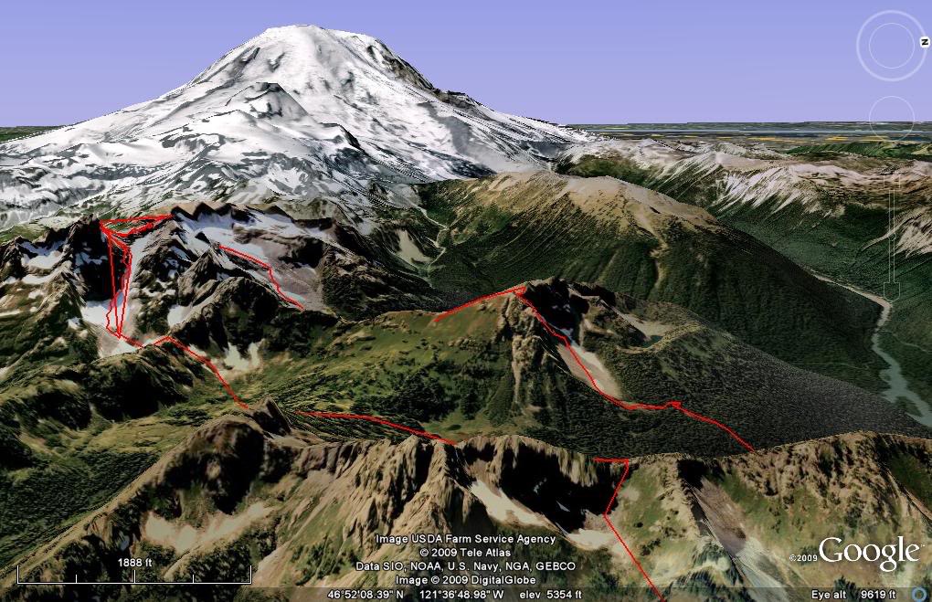
When people think of Mount Rainier National Park the first place that pops into there mind is Paradise. For me the best area and place where I would call home is the NE/E side of the park. This area has a few massive peaks with crowds that are 1/10 the size of the crowds at Paradise. I came up with a circumference tour starting out at Cayuse Pass and ending up at the White river road. The trip would exit via Tamanos Mountain and if the time allowed I was going for it.
Starting the Climb From Cayuse Pass
I started at Cayuse Pass around 8:00 in the morning. Hiking up 600 feet just south of sheep skull gap. From the gap I made a downhill traverse east to around 4800 feet. Once in a good spot I switched over to skins for an ascent up Governor Ridge.
I was able to find a low col in the Alpine bowl just North of Barrier peak. This spot gave me access to the Owyhigh lakes valley to the East.
From 6’200 I was able to take a 1000 vert run down to Owyhigh Lake. Once making it into the basin I took a quick break and refilled on both calories and Water.
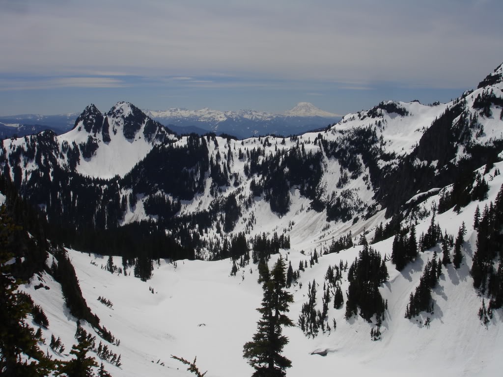
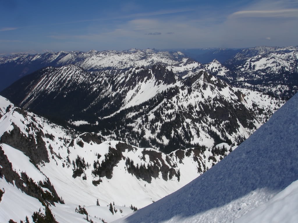
Heading to Cowlitz Chimneys from Owyhigh Lake
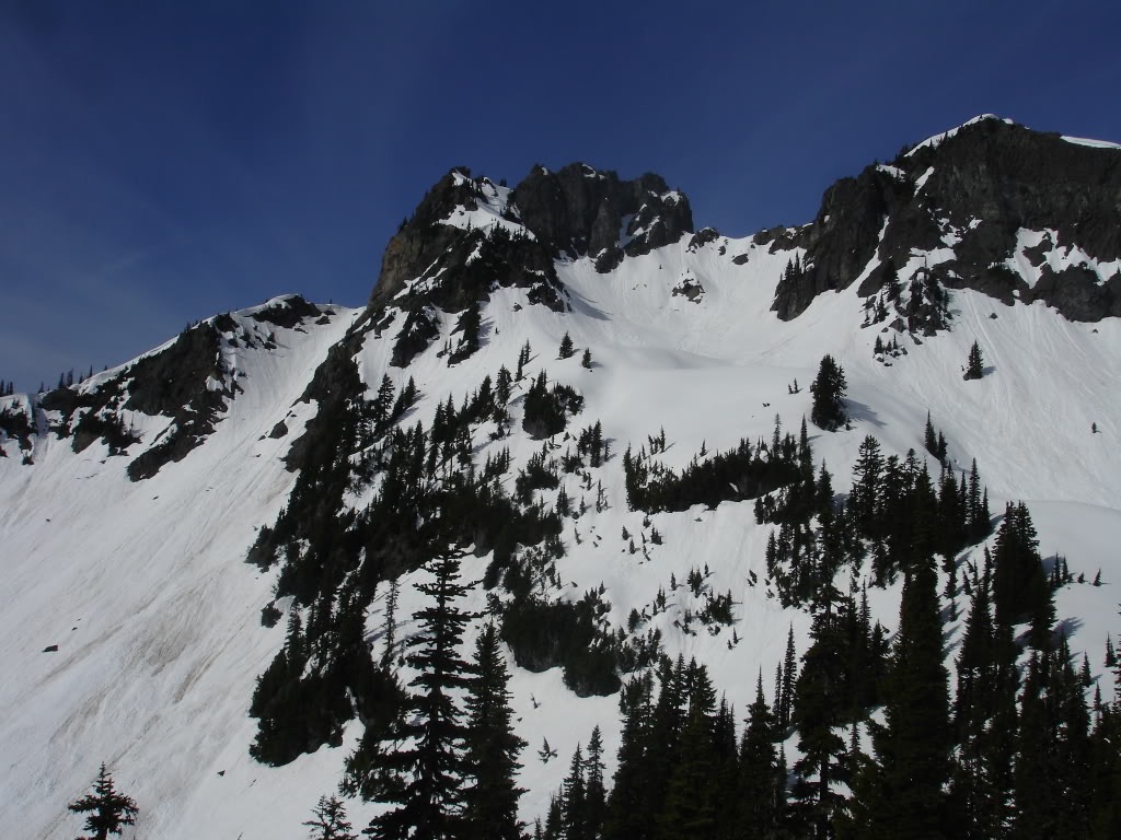
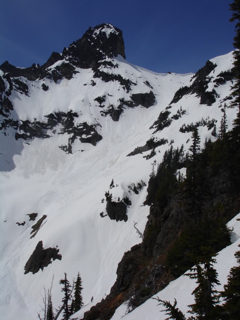
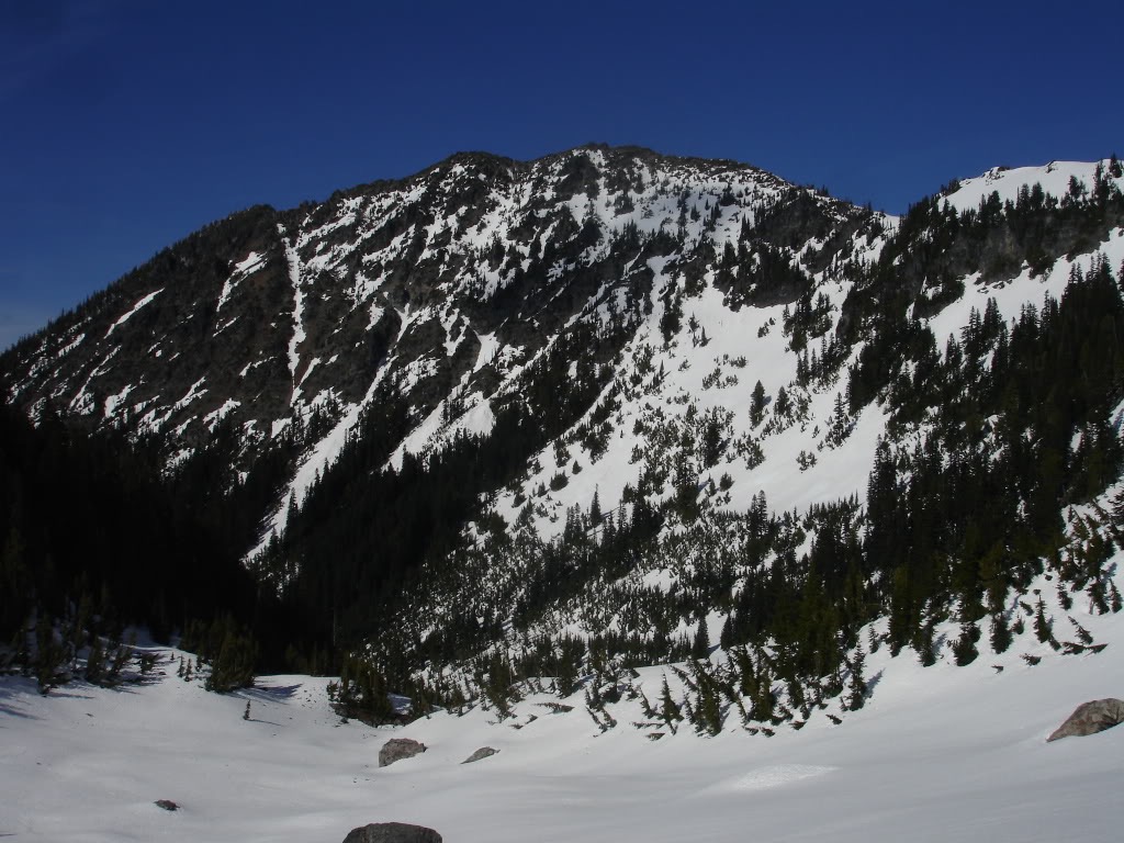
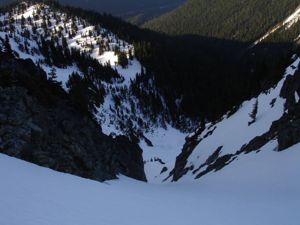
Once at Owyhigh Lake I skinned south to a ridge that Separated Barrier peak and the Cowlitz chimneys. By now wet slides were becoming a concern. I decided the safest way to climb was to go up a slope that had slid and had no exposure. So after finding a feasible area I switched over to bootpacking and climbed 700 feet up to the ridge. From the ridge I got my first up close view of the Cowlitz Chimneys which was filled with avi chunder. With conditions the way they were I was happy to see that it had already slid. I was somewhat lucky that I had climbed up where I did. This was one of the only places where I could ride down with no exposure. Carefully I rode down the 300 feet making sure not to get nailed by any wetslides along the way.
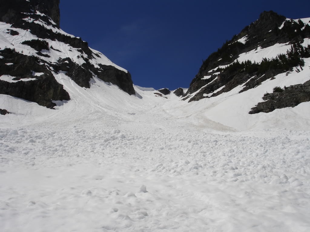
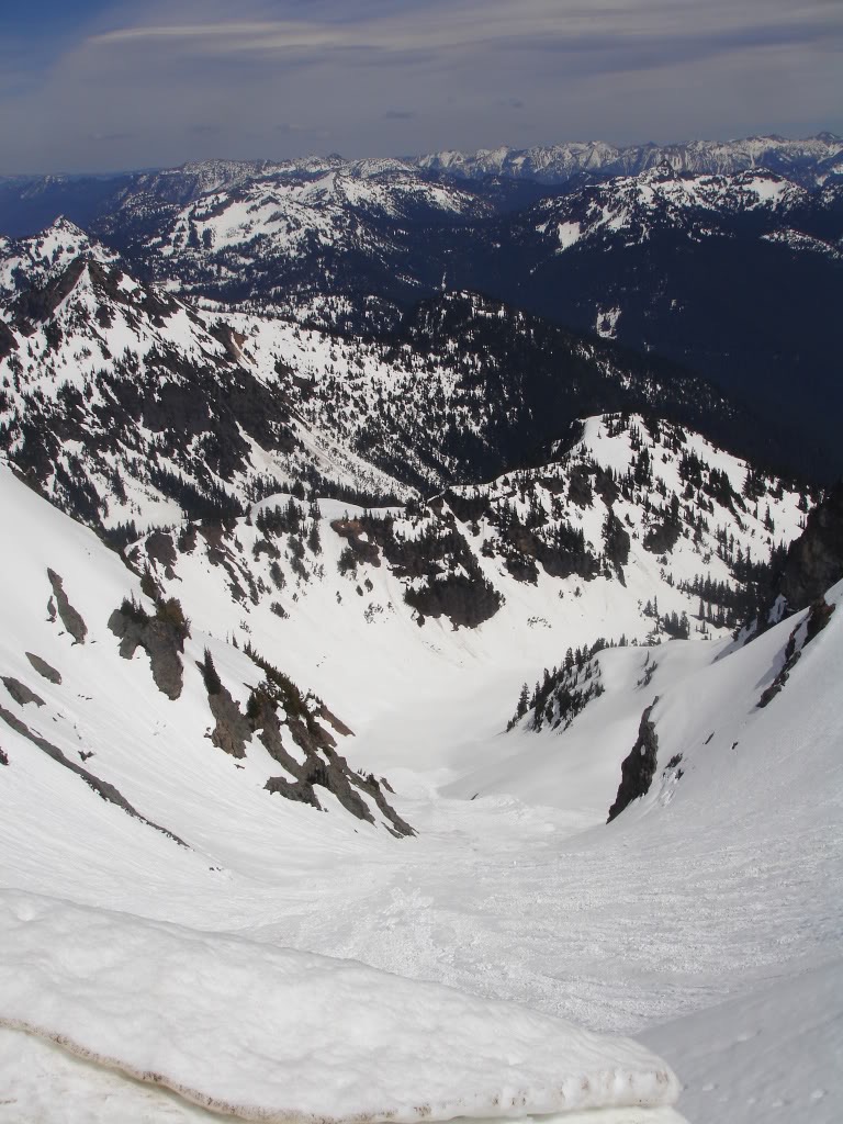
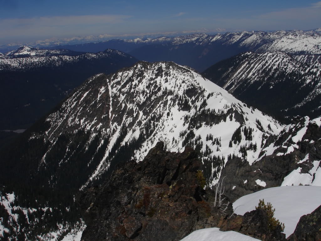
Climbing the Cowlitz Chimneys
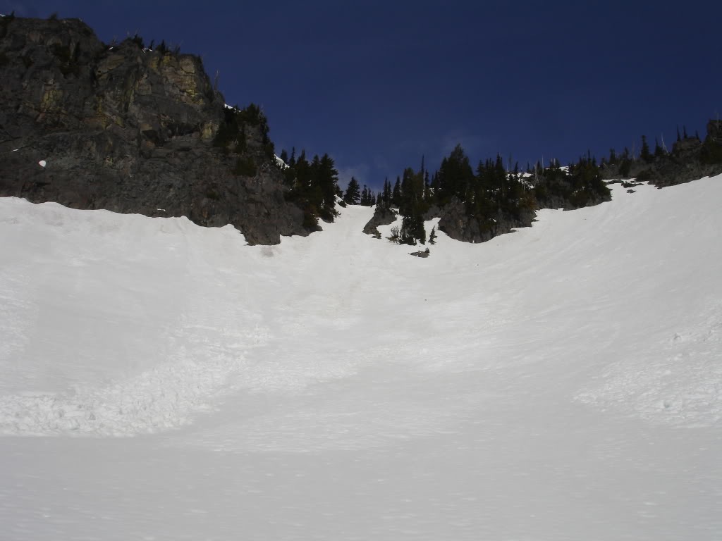
Finally I was at the base of the Cowlitz chimneys. For years I had wanted to ride this aesthetic line and know it was easily in my grasp. The crux area was steep so I decided I bootpacked the 1800 vert to the summit. I had given myself a timeline that if I didn’t reach I would have to turn around. The timeline was an hour so I ran up the chute in 50 minutes.
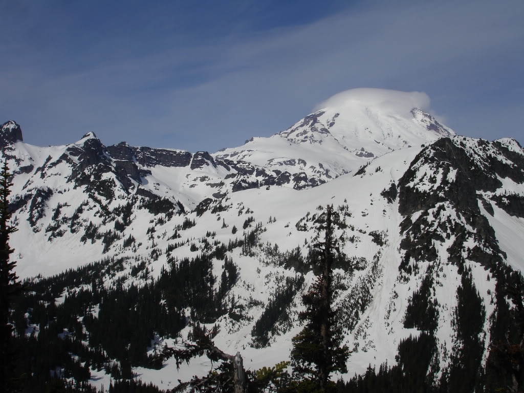
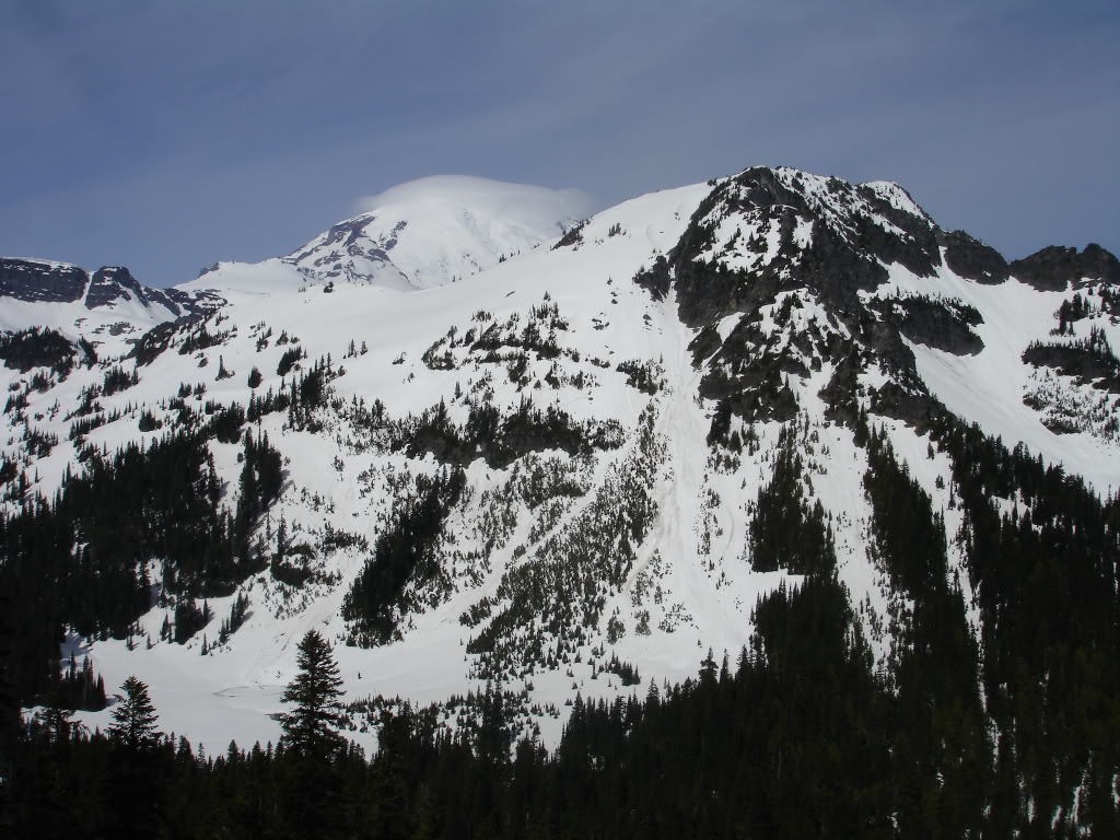
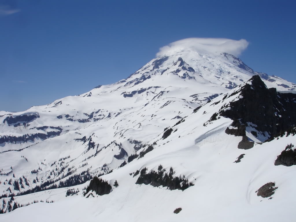
From the col I did some rock scrambling up to the high point at around 7400 feet. It was the perfect spot to check out conditions on the Sarvant Glacier and Tamanos Mountain. Everything had a healthy snowpack and therefore everything seemed easily rideable.
Snowboarding down the Cowlitz Chimneys
I rode down the Cowlitz chimneys back to my original starting point taking . One the way down I made a few turns on steep slopes then traversing to safe spots. The line was quite enjoyable and I was had to finally ride the area. After that I climbed back up my bootpack to the top of the chimneys which saved me some time.
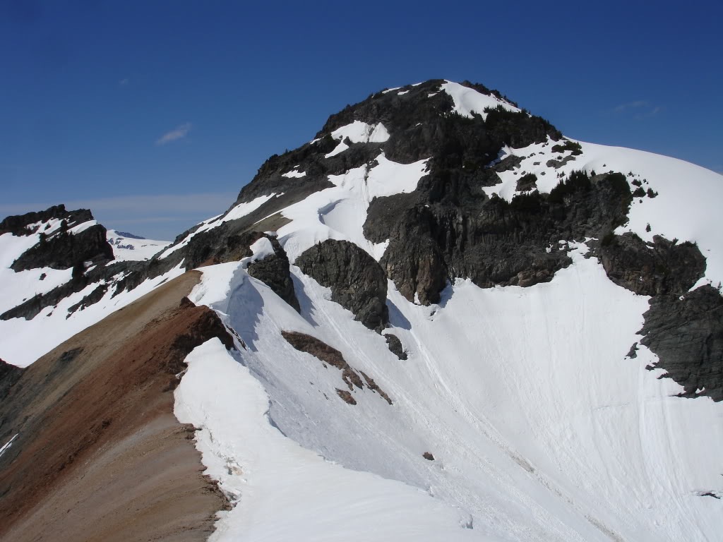
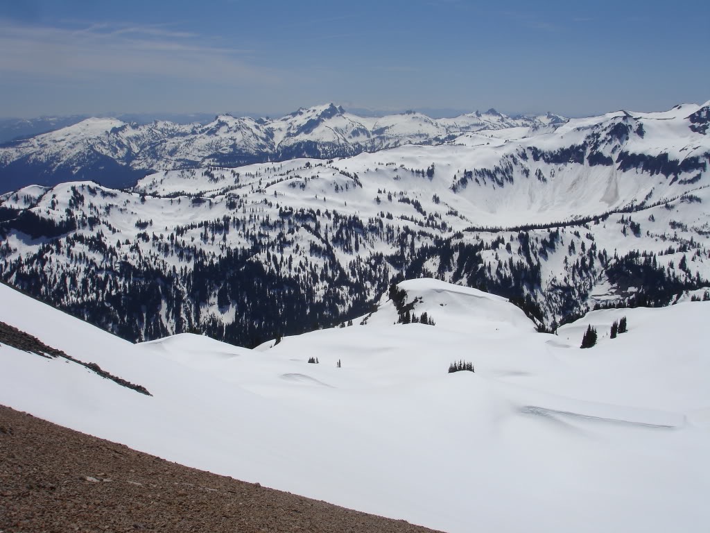
Riding the Sarvant Glacier
At the top of the col I made a 500 vert traverse east and climbed up to another low col. From the summit of the col I accessed the Sarvant Glacier.
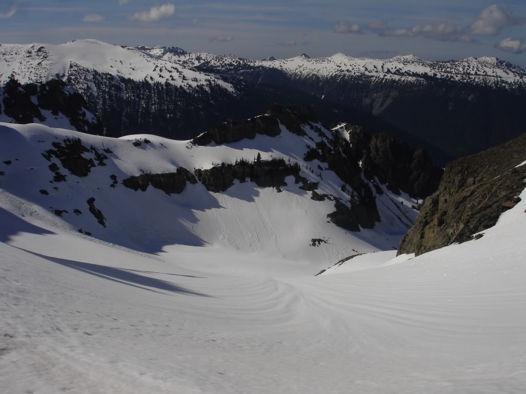
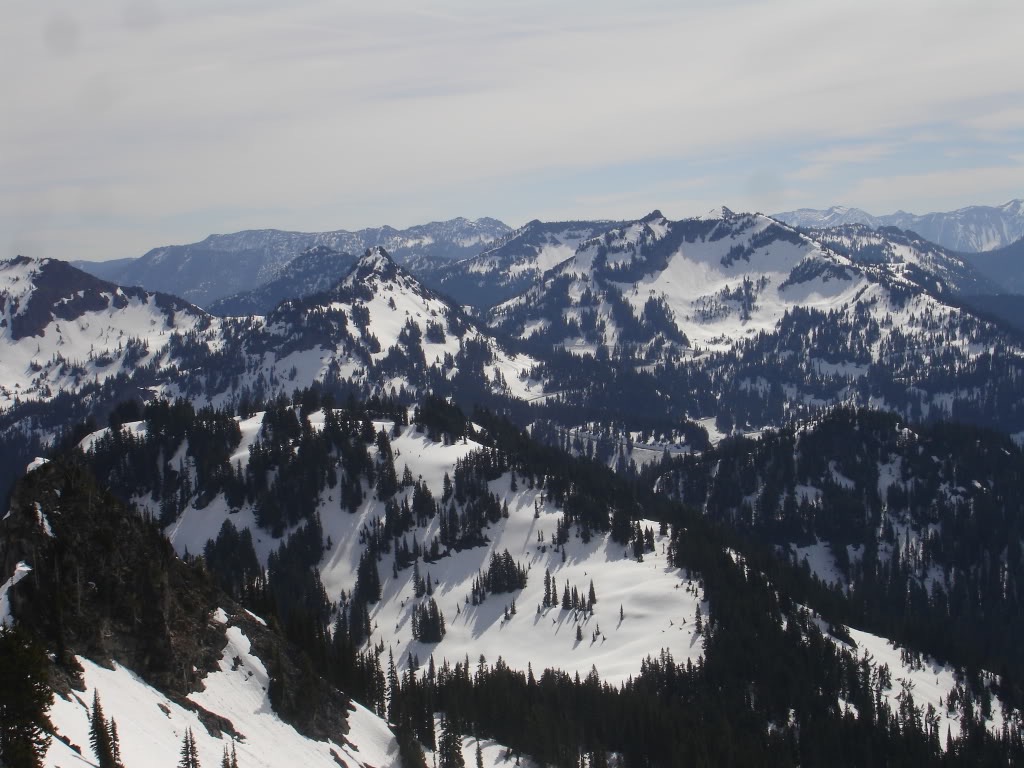
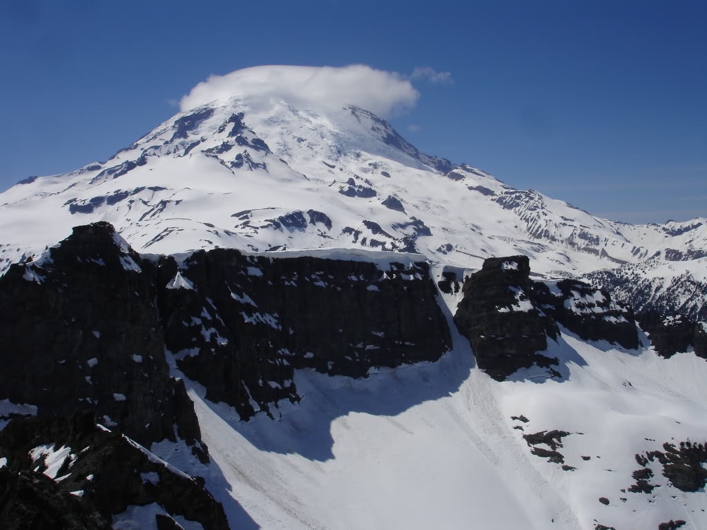
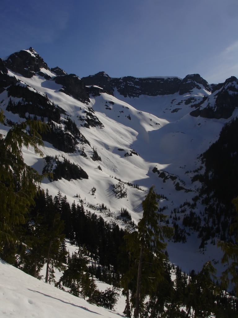
The Sarvant Glacier was a amazing low angle perfect corn snow run that ran for 2000 vert. Once in the basin I took another quick break to refill on water and calories. I had rode from 7200 feet down to 5200 feet and was sitting at the base of Tamanos Mountain. From there I would ascend up a low saddle and get the summit. By now my boots were soaked from all the bootpacking. I decided I would skin until the terrain became too steep for comfort. Conditions on the west slope were perfect for skinning not too wet and not too firm. Climbing up I was able to skin all the way to the col then the summit of Tamanos Mountain. From the summit I got amazing views in every direction.
The Long Exit via the Tamanos Chute
From the top of Tamanos I spotted a chute on the NE face that went down to the trail. Hopefully I would be able to ride all the way to the white river. Conditions in the chute were great by the time I dropped with the snow barely refrozen. It was still carve able and had minimal sluff. I ripped down occasionally stopping in a safe spot letting the sluff run. After riding 1400 feet I had met up with the trail. Trails are almost impossible to spot when they are covered in a five foot snowpack and this was the case.
After checking my map I made the conclusion I would ride down to Shaw creek. From there I would follow the creek to the White River road. I was finally in a drainage that went perfectly to the creek and as I dropped around 700 feet. Soon I started hearing a noise you never want to hear when riding a drainage. It was a waterfall and henceforth it was big enough that I wasn’t going to down climb it.
The Long Walk to the Car
It was around 7:45 and though I was close to being done I was on a race against dark. Soon I put my board on my back and traversed north through the woods slowly loosing elevation along the way. It was amazing how different the forest was compared to the forests of the backside of Crystal. After about fifteen minutes I finally was able to access Shaw creek. With a few small hops here and there I walked all the way down to the white river road. I was stoked the tour was over and I had made it out before it was dark mission accomplished.
WRONG!
My car was up at Cayuse but I was sure that someone would pick me up along the way. The 3 mile hike to the junction of 410 was generally uneventful as not a single car came by. By the time I made it to 410 it was dark but the moon was providing enough light. This made hiking back to the car easier. I would just keep moving and stick out my thumb when a car came by. In conclusion it was an additional 4 miles back to the car which I arrived at around 10:30.
In Conclusion
This was an amazing ski tour filled with numerous different lines. It was amazing to link together so much terrain I had looked at previously. It was much better to exit via Tamanos Mountain compared to heading back the way I came in. If someone asked if the ski tour was worth it I would definitely recommend it. Therefore if you are looking to get out to the Cowlitz Chimneys I highly recommend this route.
Trip Stats
Ascent/Decent 10,500 feet
Around 11 miles + 7 miles back to the car.
Thank you for reading my trip out to the Cowlitz Chimneys. If you enjoyed this and want to see more ski tours within the area check out the Mount Rainier Backcountry section in this link.
And for a complete easy to read layout of all my trip reports click here