
Glacier Peak is the most isolated volcano within the whole Cascade Range and gets little attention compared to its larger brothers. Earlier in the season I had made a goal to summit and ski all five volcanoes in Washington State realizing that the biggest challenge was going to be Glacier Peak on the Cool Glacier with an approach of at least 35 miles. Earlier in the Season I had spoken with someone knowledgeable about the area and he said that the road was closed because of flooding causing an extra few miles. Well after doing some research I found that the extra few miles was 6.5 each way making the total trip 48 miles.
The plan was to start Thursday night directly after work. We would climb up the North Fork of the Sauk trail as far as possible before night fall. Dan and I planned on a 3 day trip with one day to summit the volcano. This was the final peak of my goal to summit and by far the longest slog. With over 50 pounds of gear we were going to be on a trail that had not been maintained for at least a year.
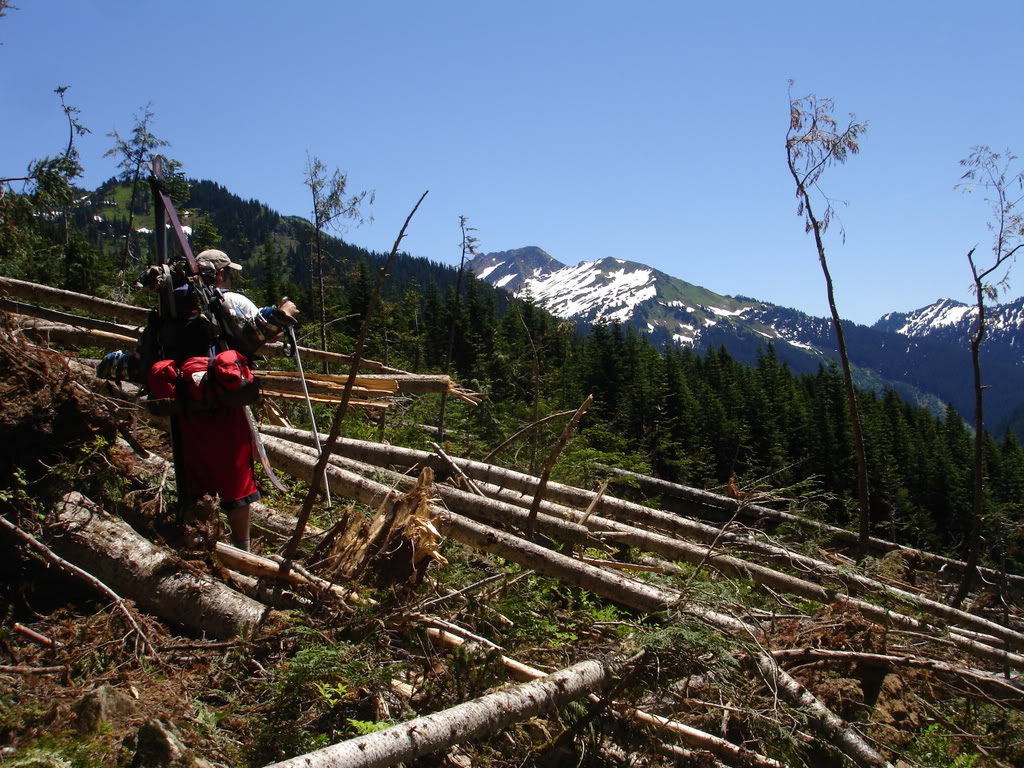
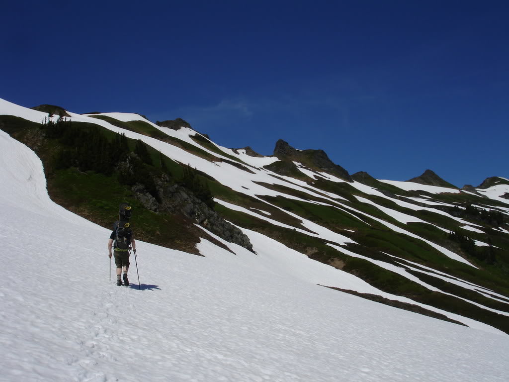
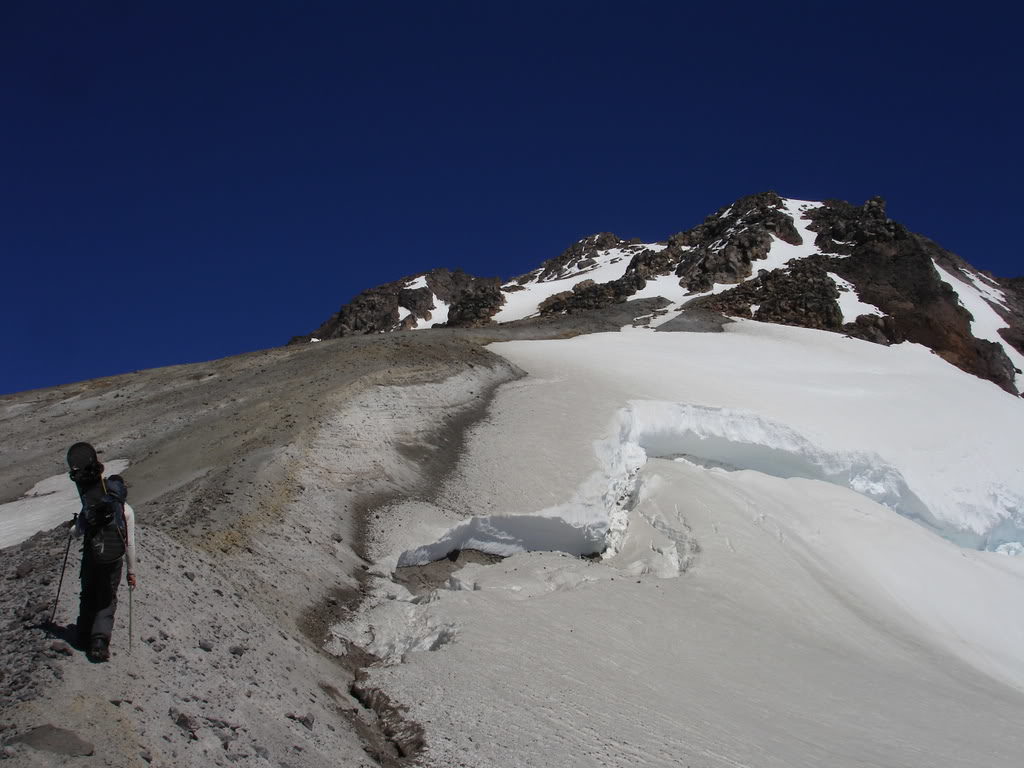
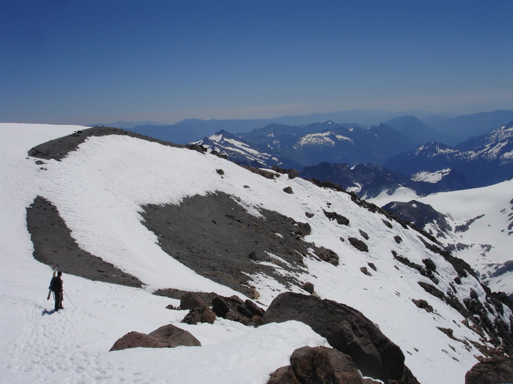
Hiking up the North Fork of the Sauk River
After getting off work and meeting Dan in downtown Seattle we left immediately for the Mountain Loop Highway. We arrived at the road closure for the trailhead a little bit before 6:00 and were off on the abandoned road. Hiking as fast as we could we arrived at camp in the total darkness around 10:00pm. We decided to make camp at the base of Red Creek and were happy to have 10 miles behind us.
Day Two of Our Trip to Climb Glacier Peak via the Cool Glacier
Red Creeks bridge had been destroyed by the floods in 06 so we were going to have to find our own way across. The river was strong so wadding was not an option. Fortunately we found a few unstable logs and hastily made our way across the creek.
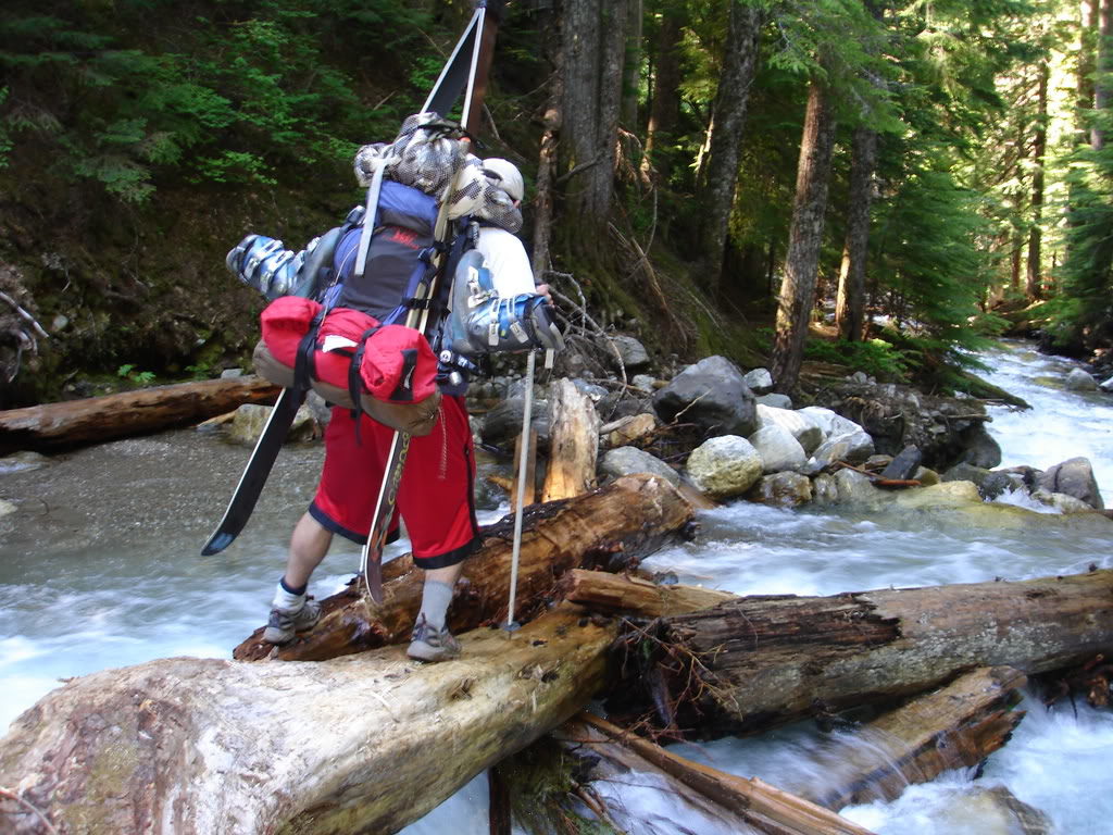
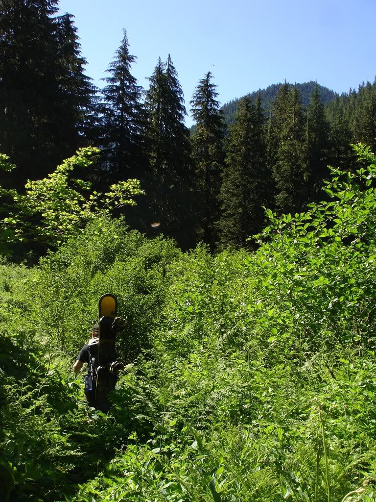
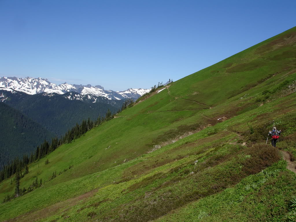
Since the trail had not been maintained in a long time we quickly found ourselves in dense vegetation. Bashing through the with the Devils Club we slowly kept moving towards White Pass. Though it was time consuming we felt fortunate that there was a trail we could follow.
After hanging out at Mackinaw shelter for a few minutes we were pushing towards the alpine. On our way up the switchbacks there were numerous spots covered by avalanche debris.
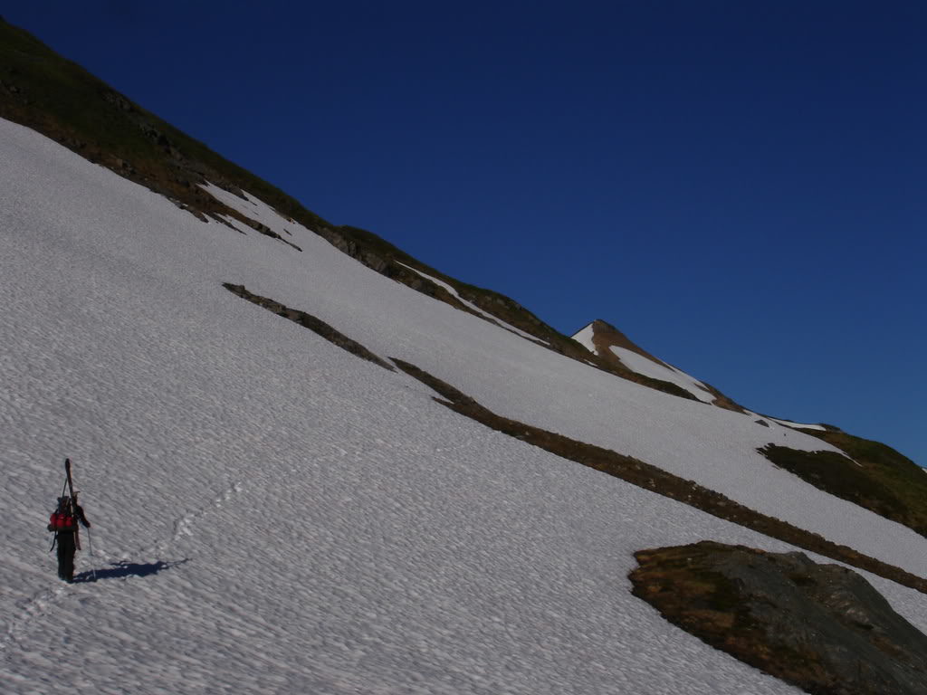
Finally we made it into the alpine and were making our way towards White Pass. We were struck by how lush green the vegetation surrounding us. By now most of the snow was melted out and the trail was in much better shape. We were beyond the obstructions that had slowed us down before.
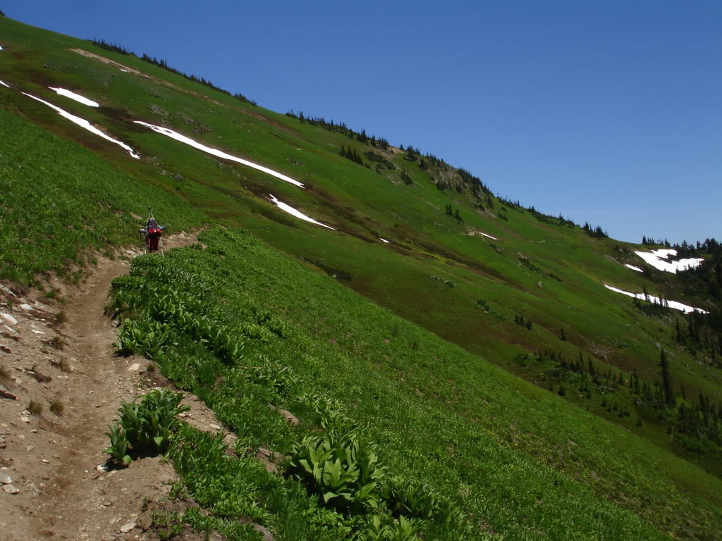
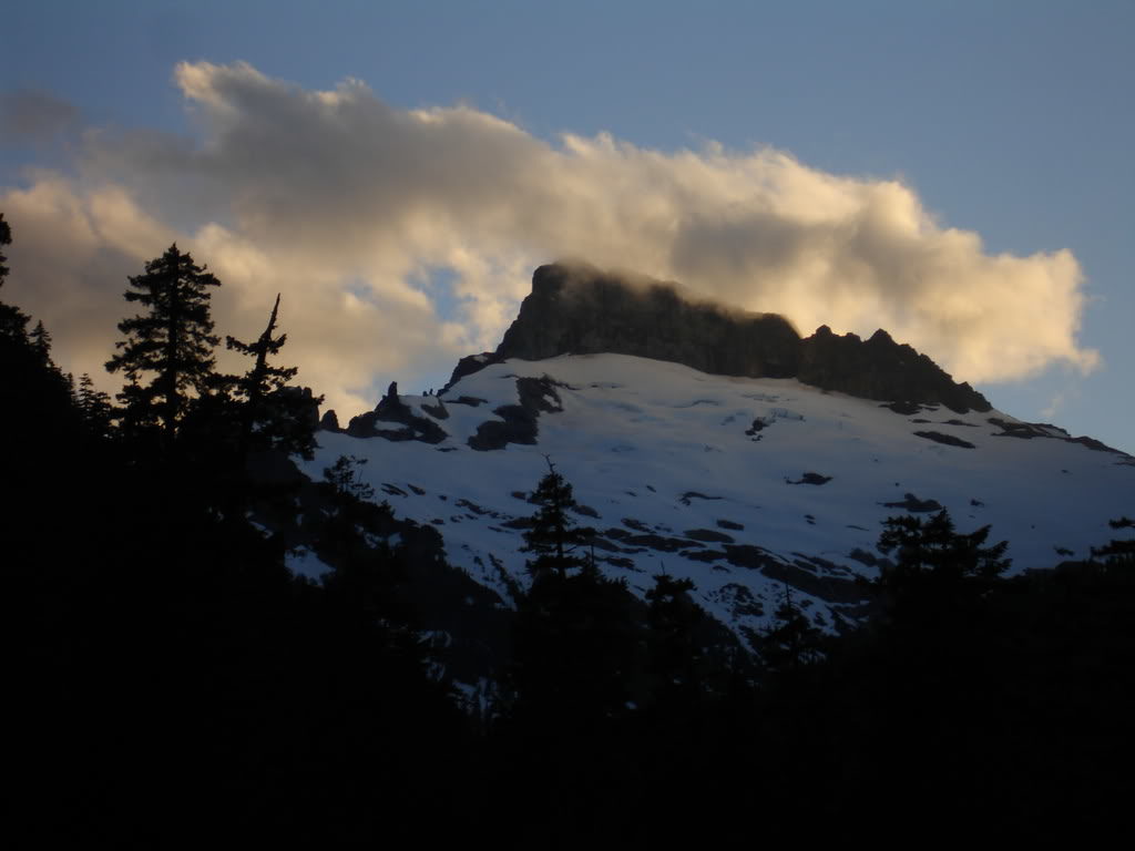
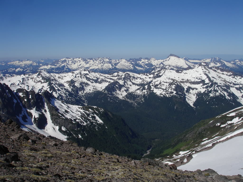
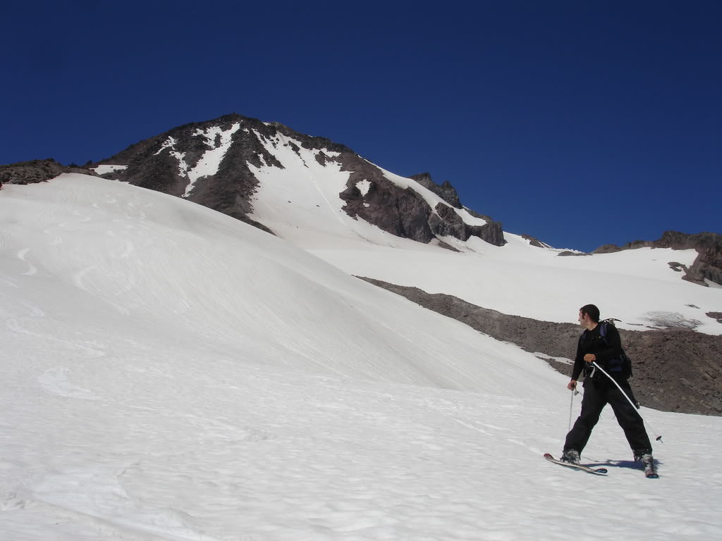
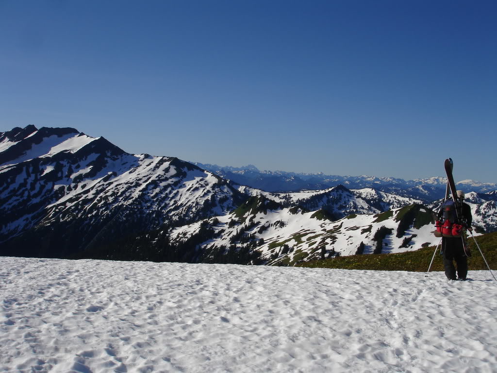
Arriving at White Pass on the Summer Trail
Soon enough we had made it up to White Pass and had our first view to the east. In front of us was Indian Head Mountain with snow on its north facing slopes. By now the wild flowers were out and the bright yellow covered the high alpine slopes.
Looking to the north the southeast slopes of White Peak still had veins of snow. While we were climbing at the moment we were happy to see we could ski down when exiting. It was a sign that validated our bringing of the skis and promised good runs at a higher elevation.
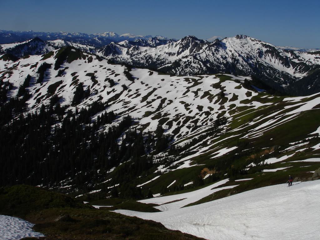
From White Pass we traversed northeast passing numerous snow fingers. The plan was to make it to one of the low saddles before heading north. Hopefully with all of the snow we would be able to ride down to the White Chuck Glacier.
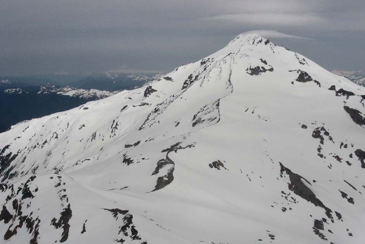
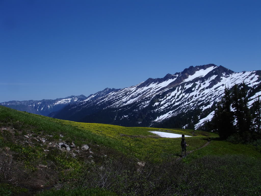
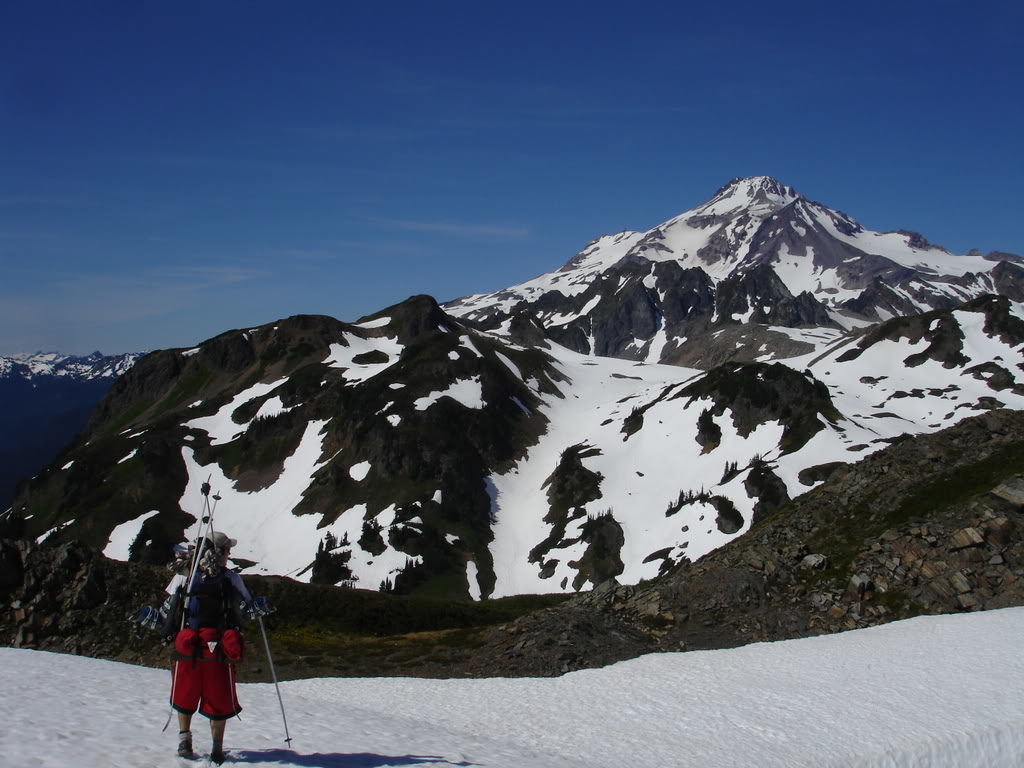
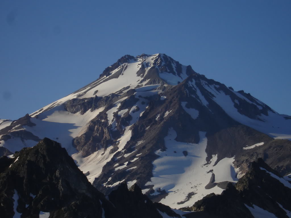
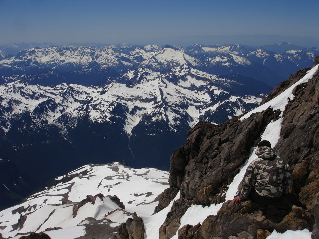
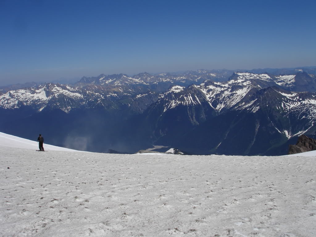
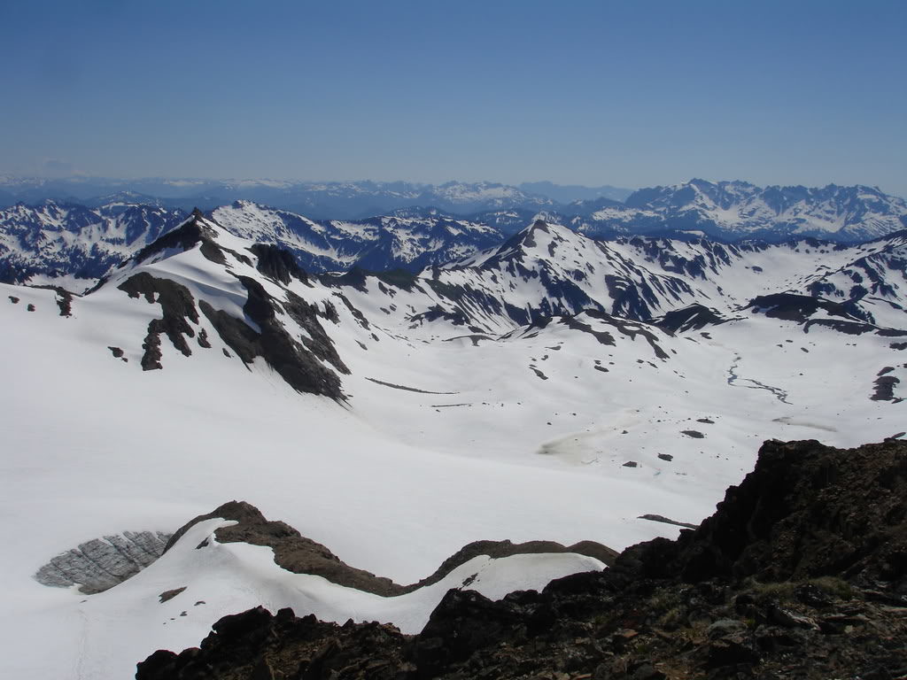
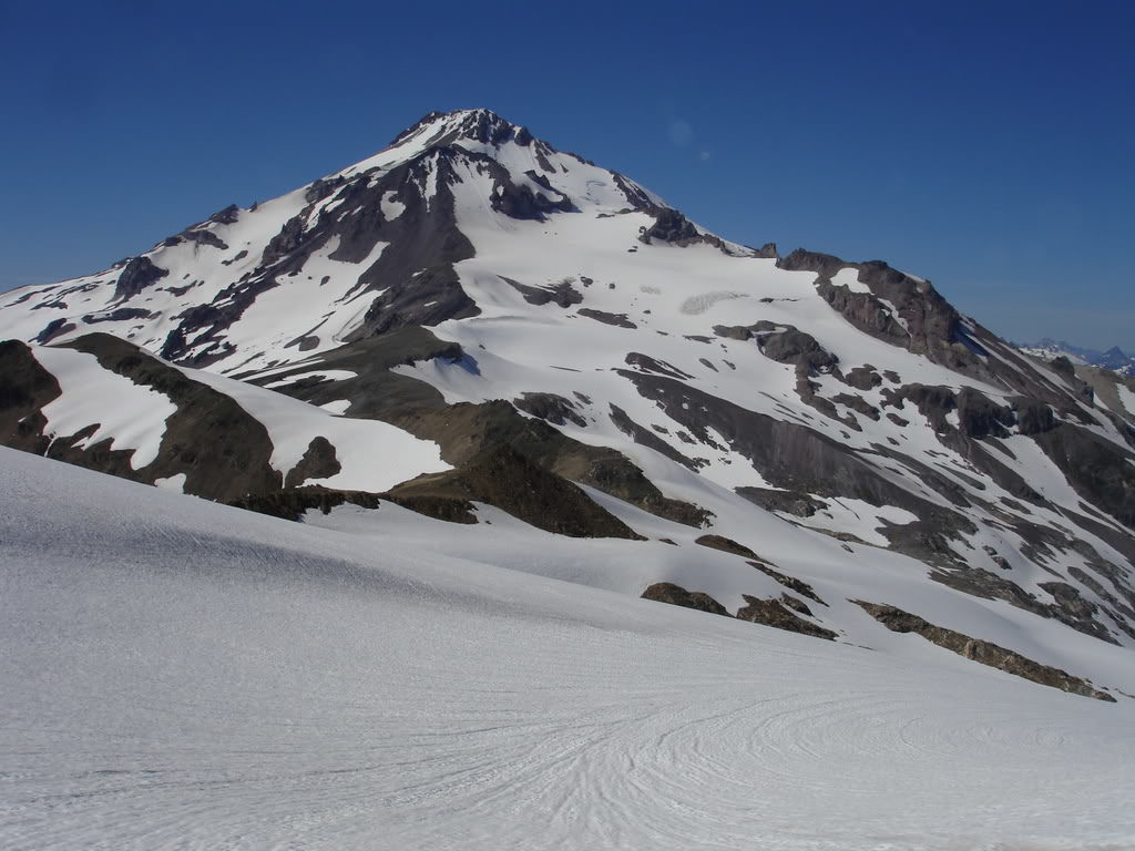
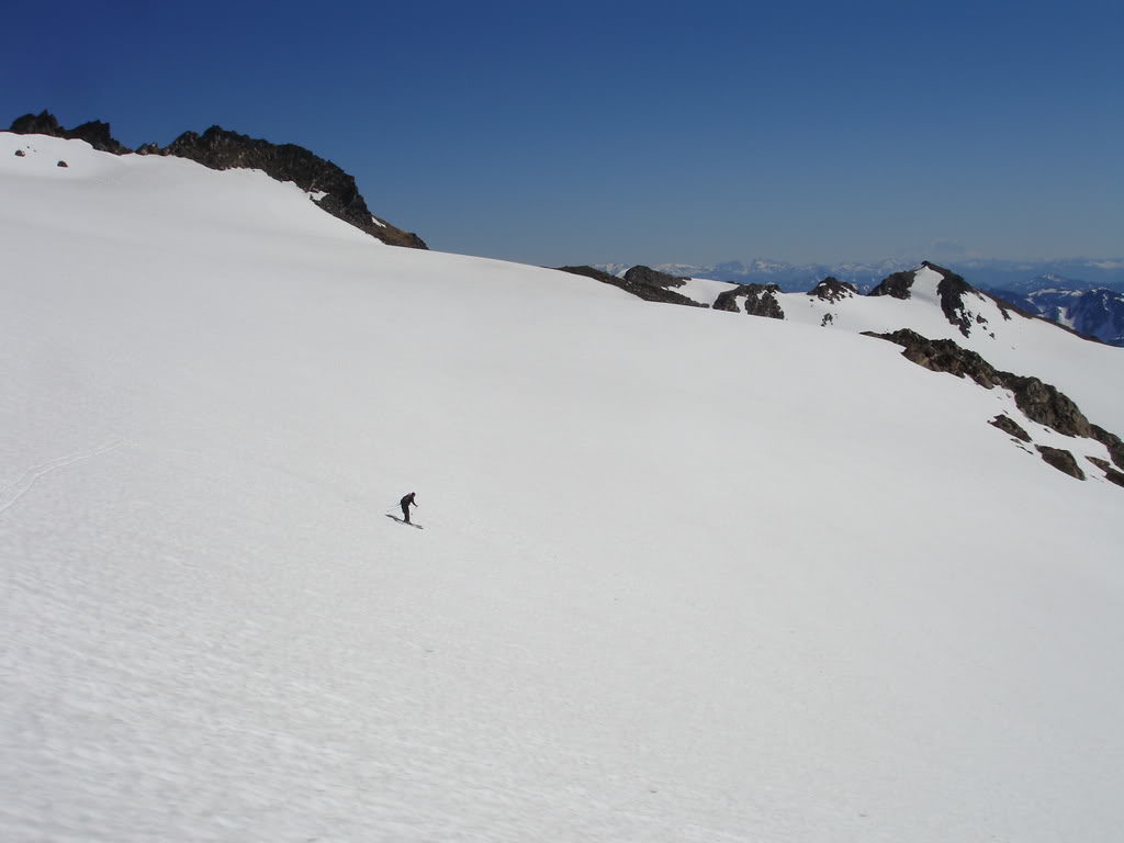
Our First View of Glacier Peak and the Cool Glacier
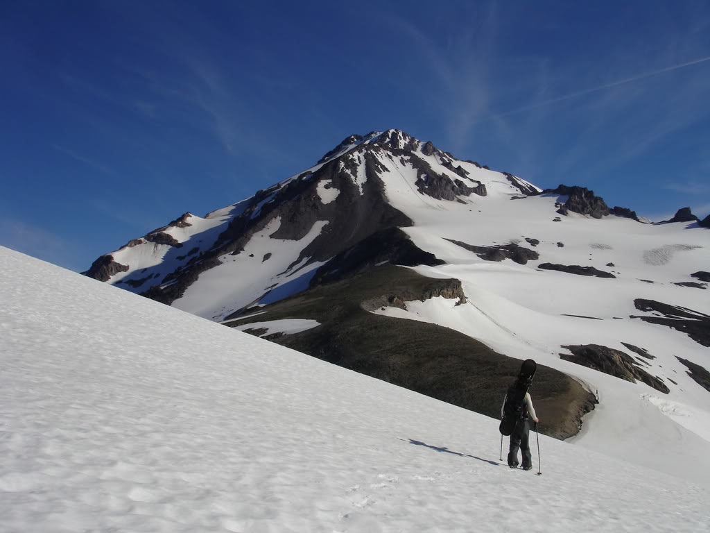
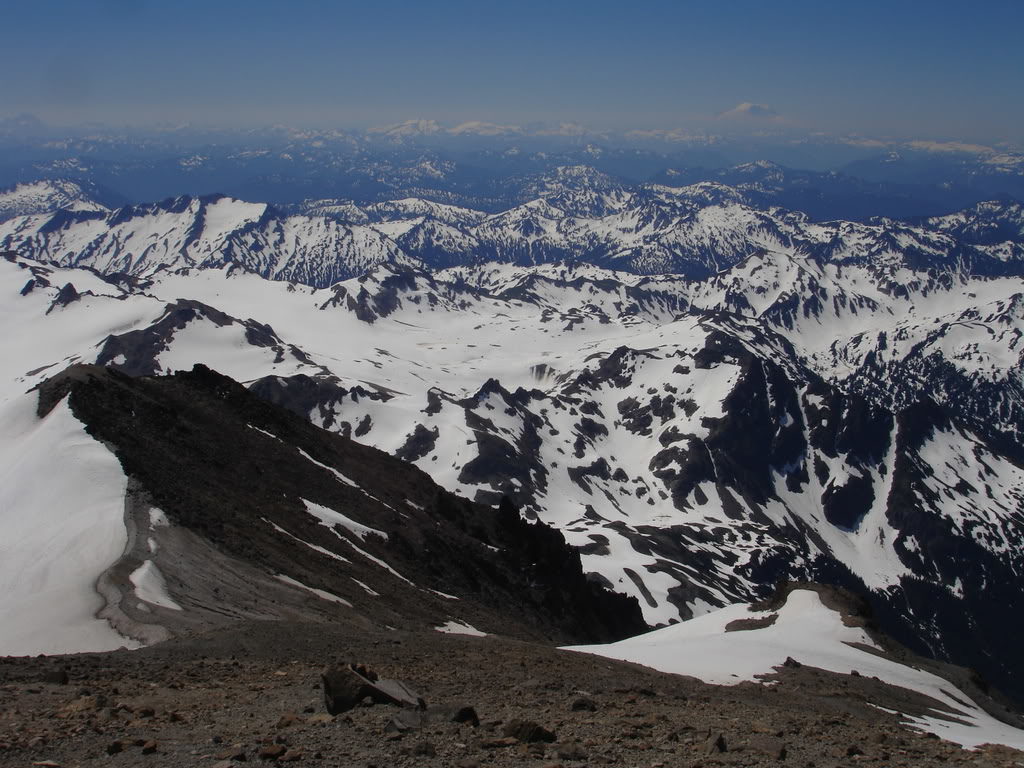
Finally we were on the ridge and had our first view of Glacier Peak in the distance. While most of the area was melted out there still looked like there were numerous options for ski descents. We knew we had a long trip ahead but we would set up camp and the following day head for the summit.
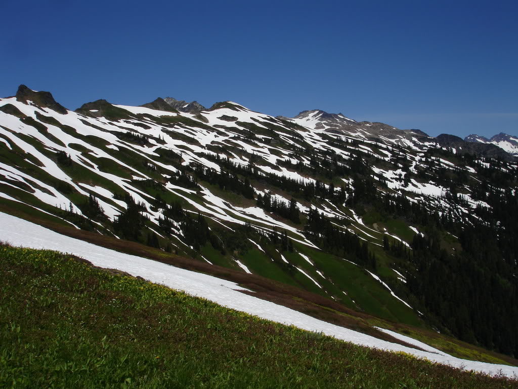
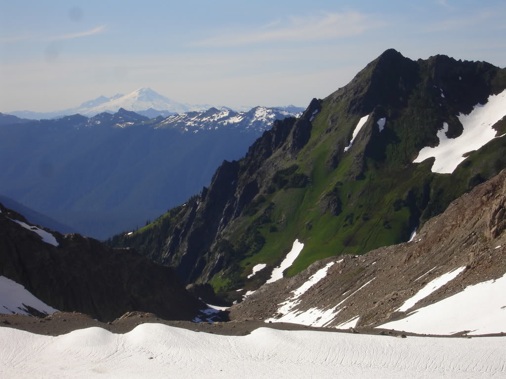
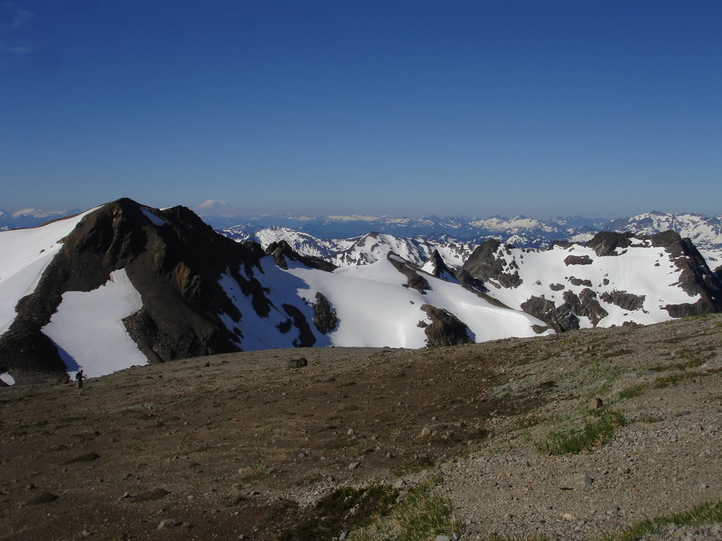
Traversing the ridge we wanted to find a snow finger to ride into the basin. It was stunning seeing the stripes of snow between the green patches. By now we could see Mount Baker and its south facing slopes to the north.
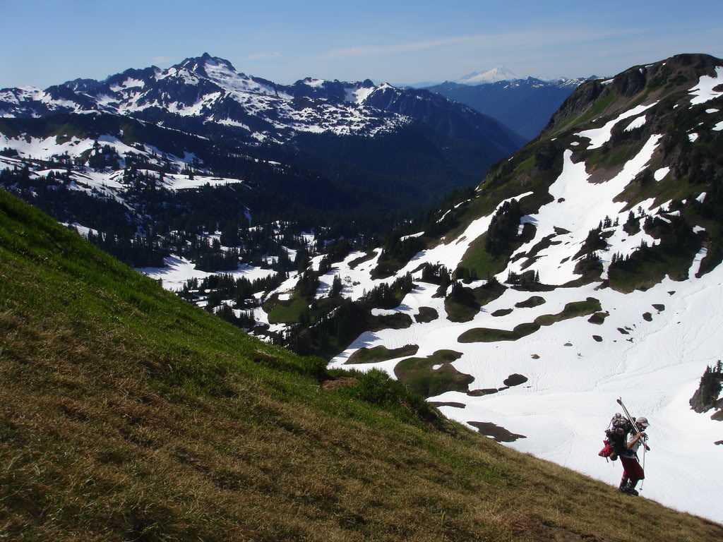
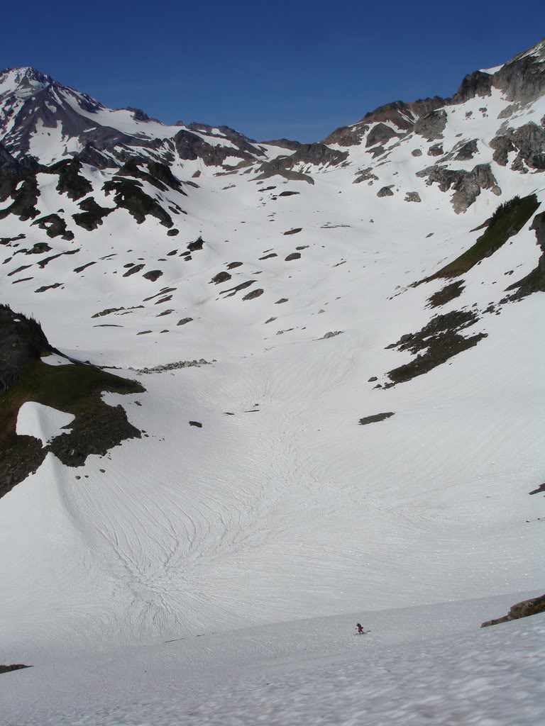
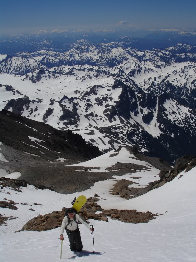
Soon enough we had found a snow ribbon that we could ski to the basin below. Happy that we wouldn’t have to downclimb we put our gear on and prepared for our descent. This was going to be our first turns of the trip after hiking almost 20 miles.
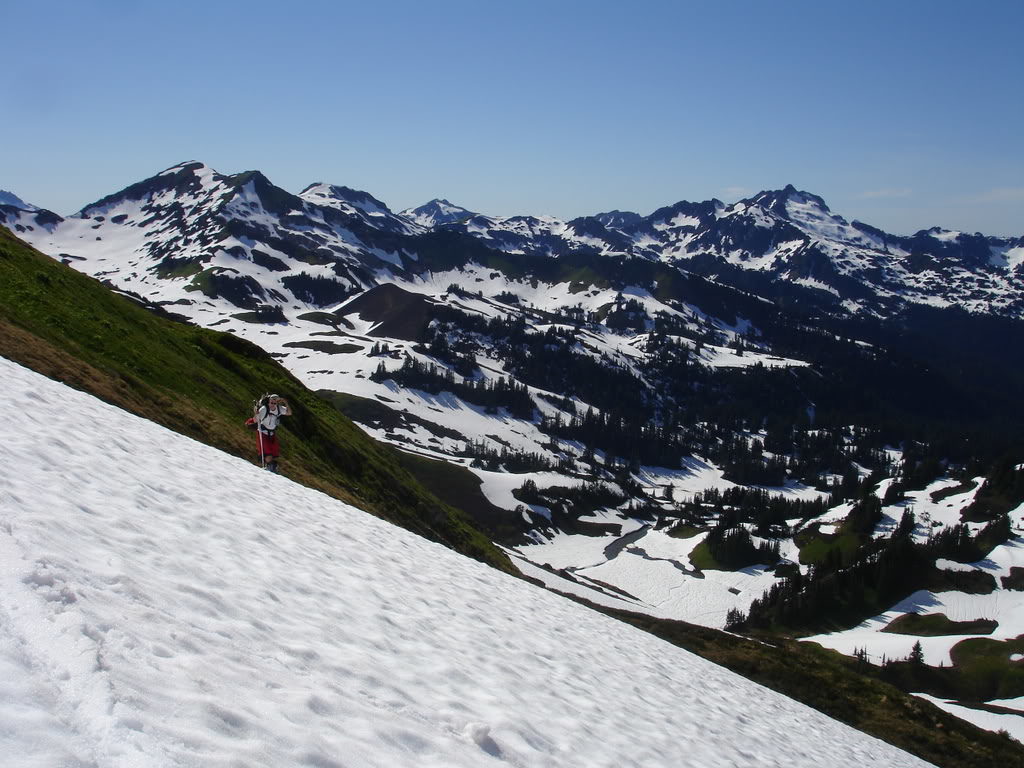
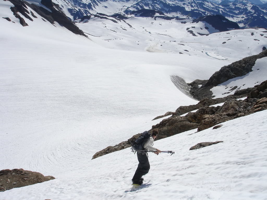
After a few seconds were in White Chuck Basin and making our way towards Glacier Peak. It was starting to get later in the day so we needed to find a camping spot. In the distance we could see some melted out spots so after transitioning we were on our way to check them out.
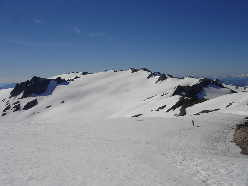
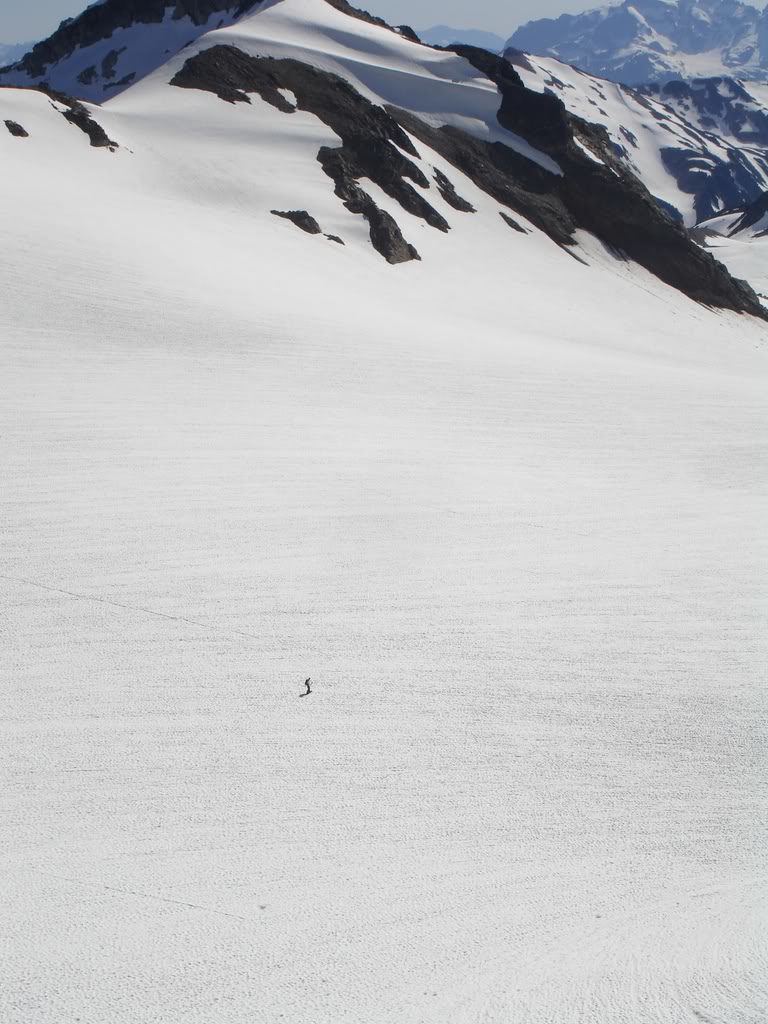
Setting up Camp on the White Chuck Glacier
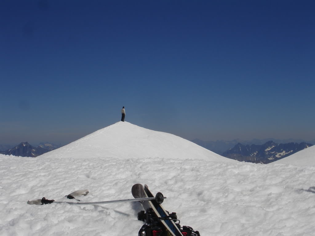
We hiked up the basin for around a mile to a high point offering 360 degree views. It was a dry spot with running water and in close proximity to Glacier Peak. This would be the perfect spot to set up tent for the next two days.
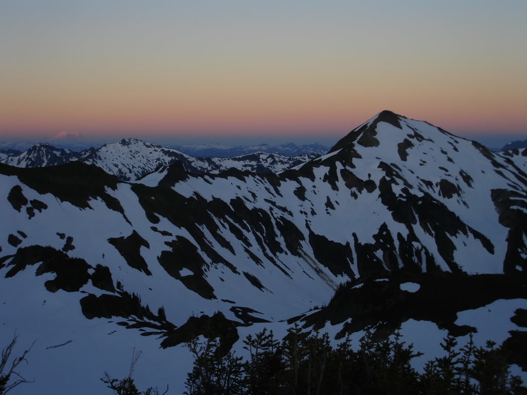
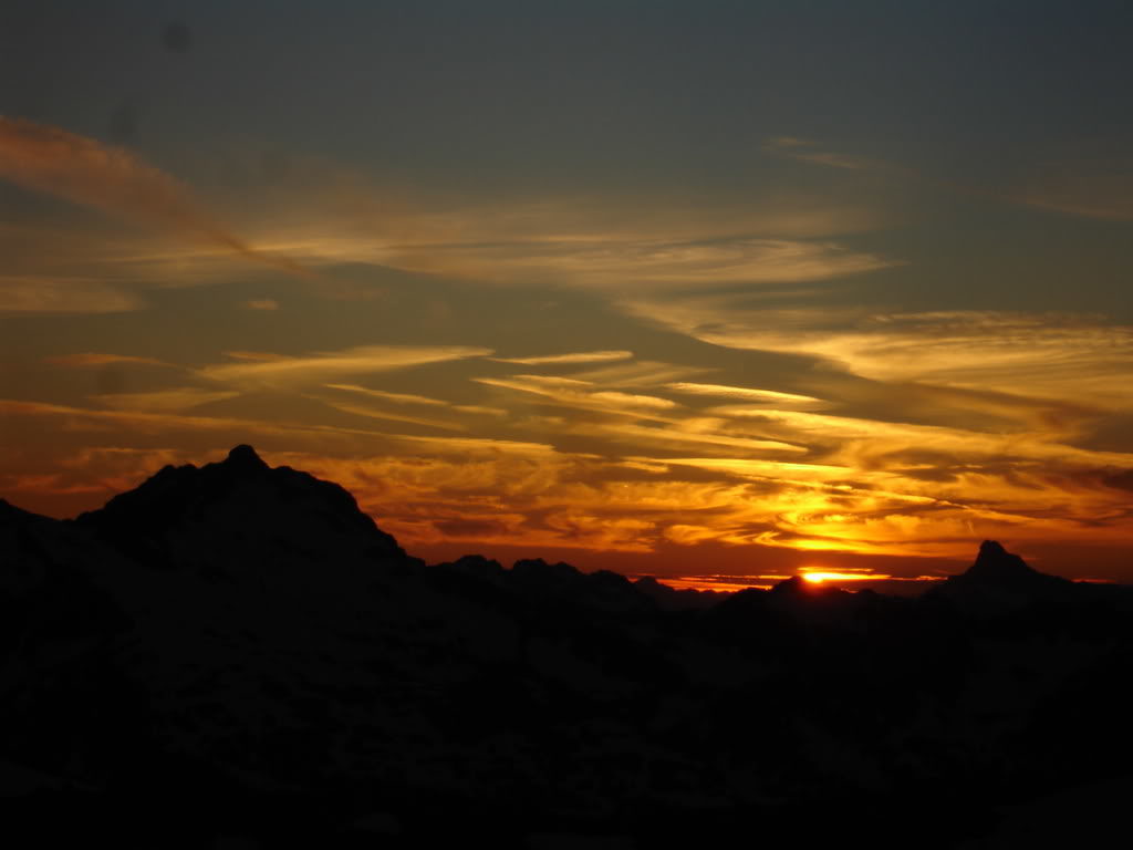
We watched the Sunset over the Cascade Range and rested in the warm sun. We knew we had to get asleep early as we would start before sunrise. It was a stunning clear night with views all the way into the Southern Cascades.
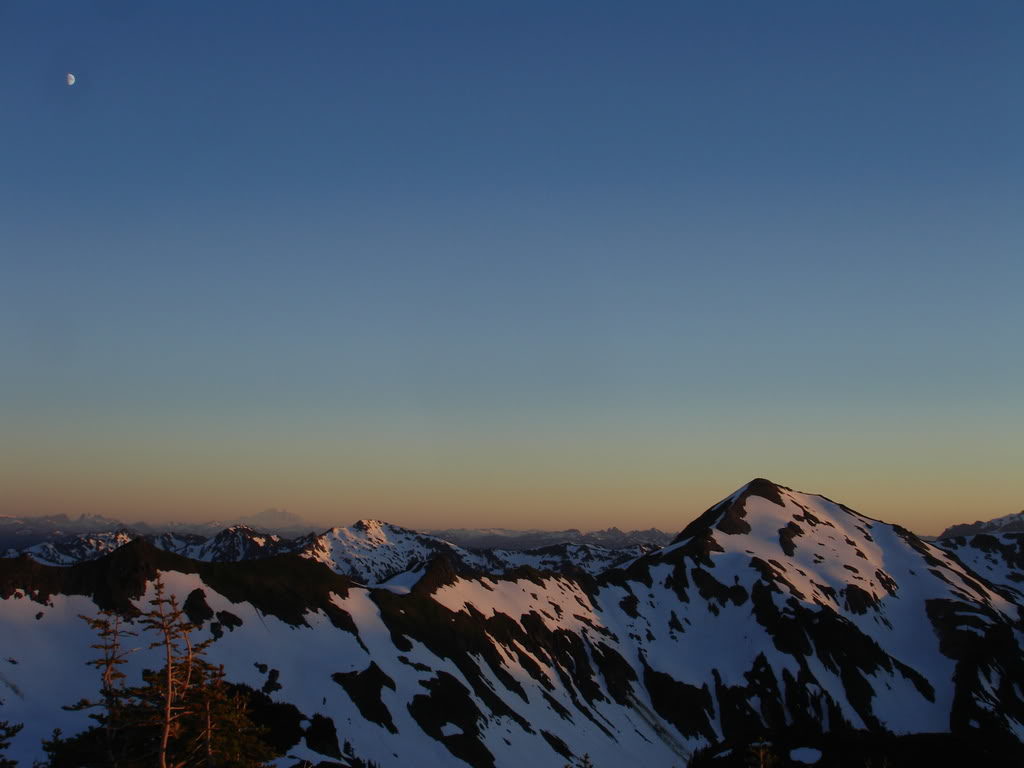
To the west we could see the contours of the mountains off the Mountain Loop Highway. Making out the shapes of peaks like Three Fingers and Whitehorse Mountain.
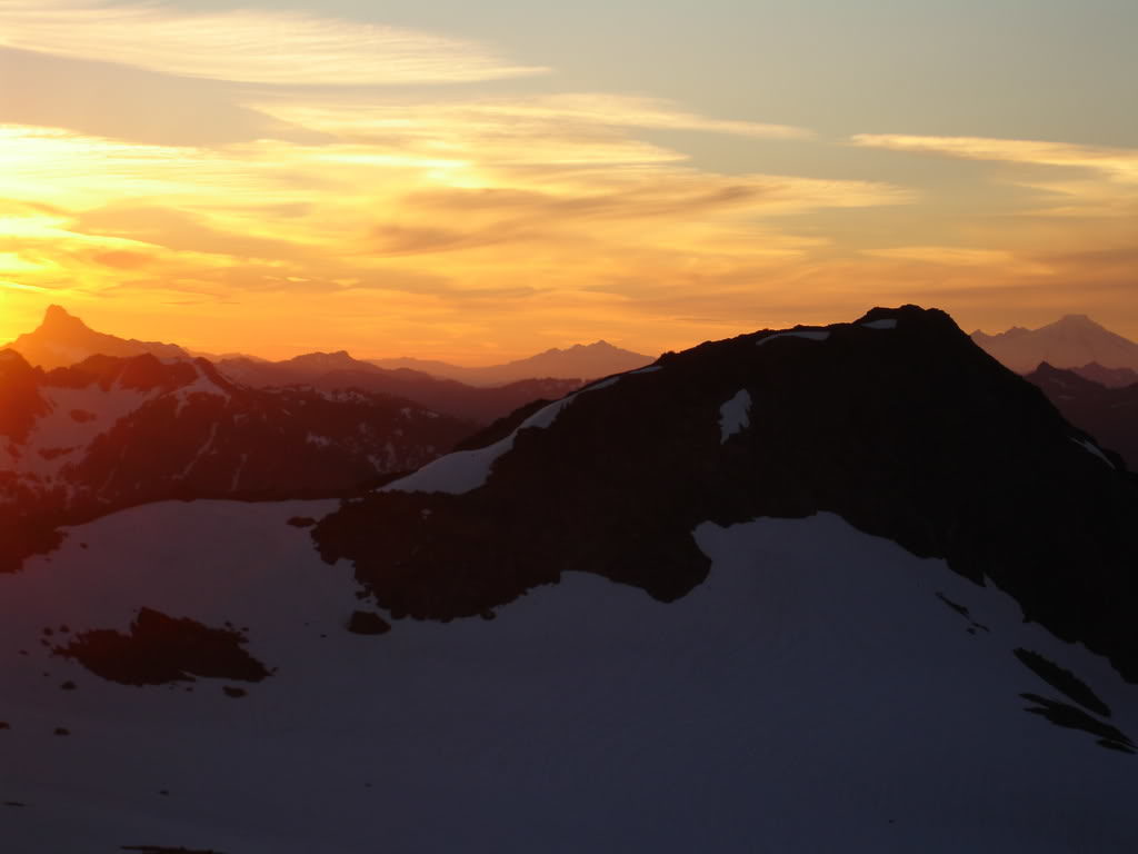
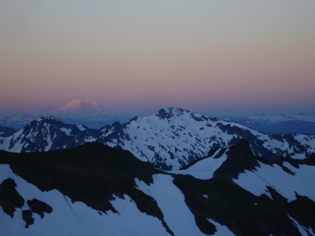
To the south Mount Rainier was basking in the sunset alpenglow. Looking back at our route in the day we were happy to have found a ribbon to ride down. Before long the last of the sun had set to the west and it was time to get some sleep. The next day we would be waking up early to climb Glacier Peak via the Cool Glacier. Wanting to make the most of the day we set our alarm for sunrise.
Day Two and Our Summit Attempt of Glacier Peak via the Cool Glacier
The Next morning we watch the sunrise while making breakfast before our push up Glacier Peak. To the South Mount Rainier was bright with the early morning alpenglow and it was our sign to pack our bags.
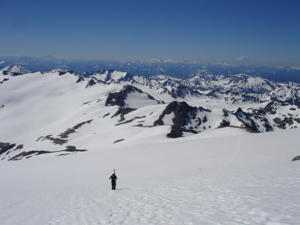
We were off for the Summit around 6:30 making a steady pace though the White chuck Glacier Basin. Soon enough we were at the base of Disappointment Ridge. Instead of hiking up the Suiattle Glacier we would be able to hike on dirt most the way.
The ridge was a flat ramp that climbed the south side of Disappointment Peak. The higher we climbed the more the views of the Cascades would come out.
Before long it was time to get off the ridge and head to the Suiattle Glacier. In the distance we could start making out the peaks. From Sloan Peak to the Monte Cristo they were all on display.
Getting on to the glacier was easy as the terrain was flat. While traveling on Disappointment Ridge was easy we were happy to be on snow once again.
Since we had already gained most of the elevation of the Suiattle Glacier we did a low traverse around Disappointment Peak. Soon we would be making it over to the Cool Glacier and making the final push towards Glacier Peak.
Heading up the Cool Glacier
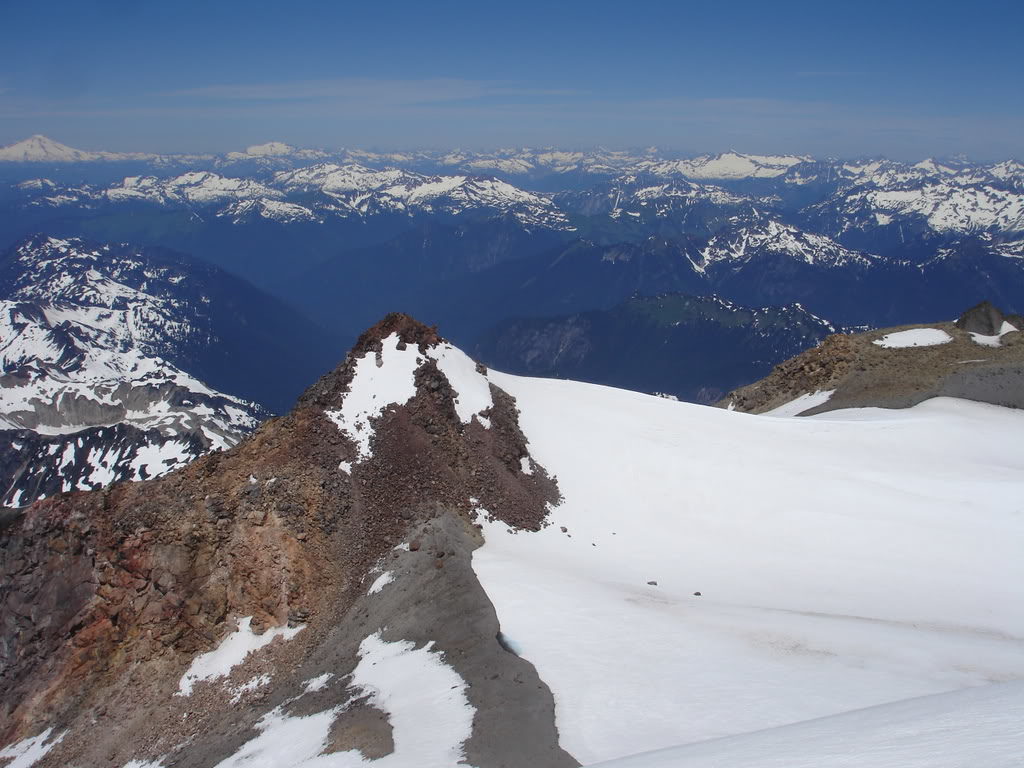
After the long traverse we had made it to the split between both the Suiattle and the Cool. In the distance we could see Tenpeak Mountain and start making out the eastern Cascade Mountains.
On the Cool glacier we had to deal with Crevasses so we traversed to were the snow bridges looked safest. In the distance we could see the Dakobed Range, Seven Fingered Jack, Mount Fernow and Mount Maude. Before long we would be on the summit of Glacier Peak via the Cool Glacier route.

Arriving on the ramp between Disappointment Peak and Glacier Peak we were once again traveling on dirt. The route up would be on a mellow pitch until the final few hundred feet.
Climbing up the ridge we had a clear view of Glacier Peak Wilderness and Alpine Lakes Wilderness in the distance. It was a beautiful day with spotting Mount Daniel and Hinman all the way to Mount Rainier.
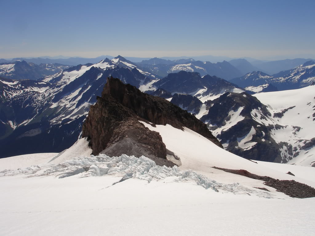
The last part of the push up to the summit required climbing up a steep couloir for about 400 vertical feet. Looking at the photo below it wasn’t that technical from bottom to top.
Finally we were taking our last steps to the summit of Glacier Peak via the Cool Glacier Route. By now the Southern Cascades were in full display underneath us. There was a lifetime of skiing opportunities on display.
Arriving on the Summit of Glacier Peak
Before long we were standing on the summit of Glacier Peak without anyone around. It had been a brutal approach but it was worth it for the isolation.
Standing on the summit of Glacier Peak I had finally completed my goal to ride the Washington Volcanoes. While this wasn’t nearly as technical as Mount Rainier it was by far the longest trip. Now we were on the summit Cap with clear skies and no wind.
To the north we could make out the peaks with Mount Baker standing proud. While harder to see we noticed Mount Shuksan and the Picket Range. Later I would connect all the terrain to where I was standing linking together the numerous traverses. The longest of which was the 14 day American Alps Traverse of the Isolation, Extended Ptarmagin and Suiattle Traverses.
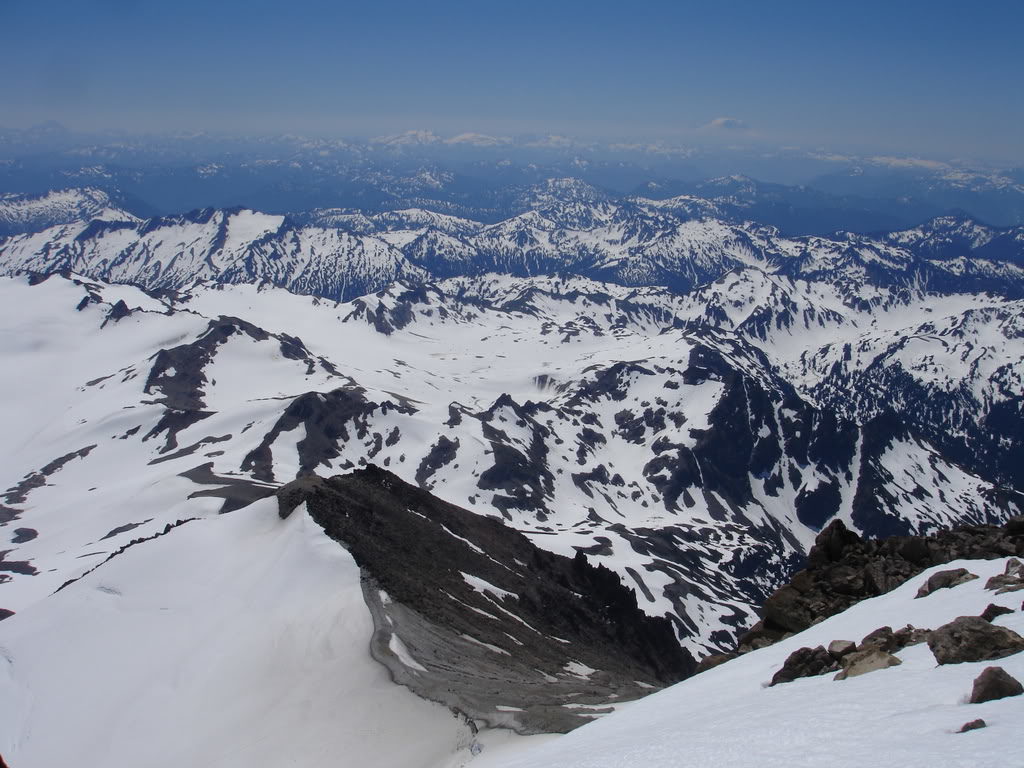
Below us and to the south we could see the entire climbing route up Glacier Peak via the Cool Glacier. We had covered a lot of ground over the past two days and would have a long exit the following day.
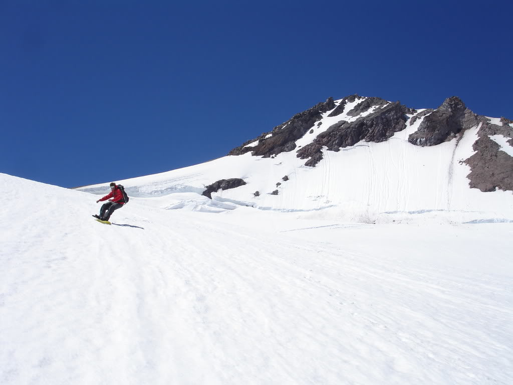
The skiing was not going to be continuous but we were able to find a nice chute. It dropped over a thousand feet from the summit southwest before we would have to traverse over to the Cool Glacier.
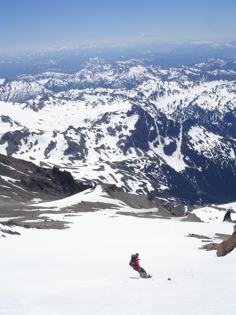
Snowboarding Down the Southwest Side of Glacier Peak
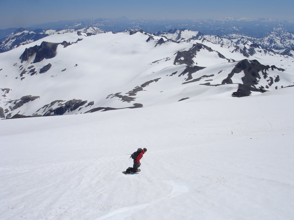
Soon enough it was time to start riding as Dan took the first turns off Glacier Peak. By now the snow had softened up to perfect corn and he was making his way down.
Once he was past the chute he traversed over to the side and waited for me to drop in. We were making our way down in minutes what had took us hours to climb.
We made our way down to the end of the snow pack before it was time to start climbing. It was great to finally ride off a peak I had wanted to climb for so long.
Putting our gear on our packs we retraced our descent route heading east. Before long we were at the Disappointment Col and making low angle turns towards White Chuck Basin.
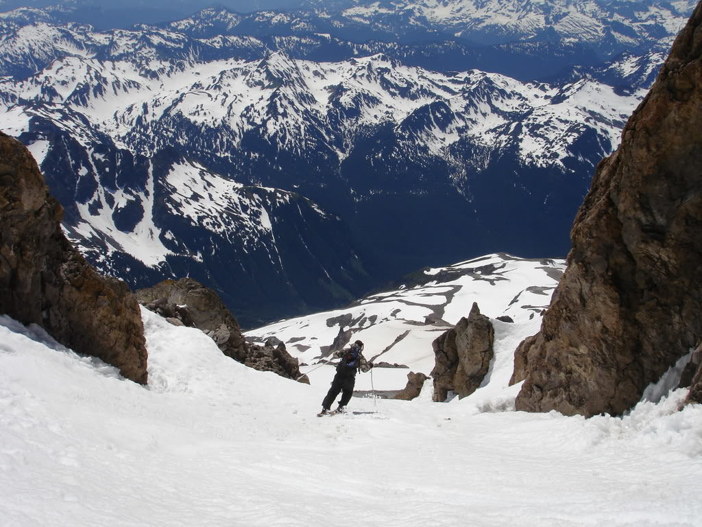
Snowboarding Down the Cool Glacier to White Chuck Basin
Like our previous run we were happy to have soft corn as we started riding east down the Cool Glacier. Making our way past the crevasses we were in wide open slopes and able to ride thousands of feet below.
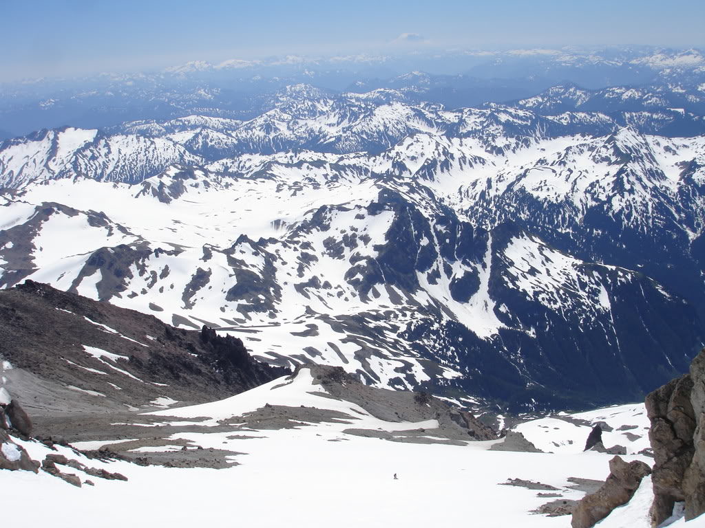
After taking the last turns on the Cool Glacier we traversed over to the Suiattle Glacier. The plan was to ride as far as the snow would allow before heading back to camp.
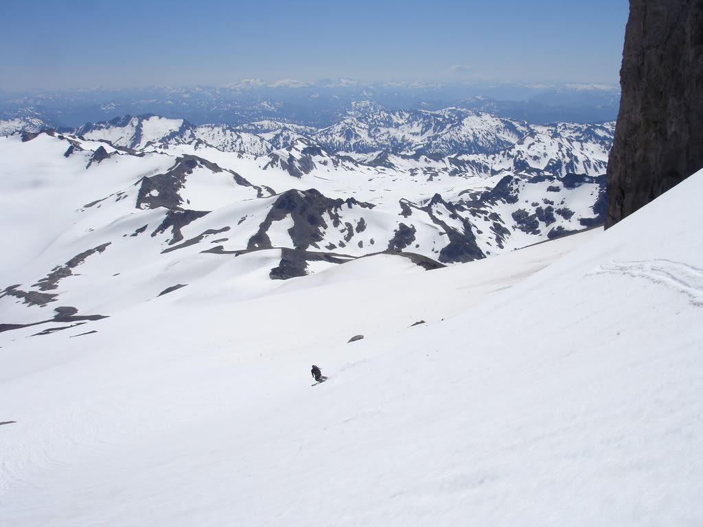
There were no crevasses below so we were able to open up on the Suiattle Glacier. It was both great snow and a scenic run as we made our way towards the White Chuck Glacier.
We were able to connect the snow patches all the way down to White Chuck Pass. What had took us hours to climb was done in minutes. Now it was time to head back to camp and prepare for the long exit the next day.
Instead of hiking through the flat White chuck Glacier Basin we decided to traverse the ridge up the south side of the Suiattle Glacier towards Kololo Peak. From there we found a nice spot to ride the White Chuck Glacier all the way back to base camp.
Standing on the ridge we took one final view of the peak before our descent. It had been a great climb heading up Glacier Peak via the Cool Glacier. Now it was time to put it behind us and make our way towards camp.
Snowboarding the White Chuck Glacier Back to Camp
After some navigating we found a good drop in spot that would lead us right back to camp. You can see where are tent was on the dirt in the middle of the photo.
Dropping in we were happy to ride back to camp. Since we had climbed the standard route we knew it was flat and would be painful to walk back on. This way we knocked out the flat exit.
Before long we were riding on to the lower White Chuck Glacier. With a 5 minute hike we were back at camp and resting in the warm sun. It had been a great day climbing Glacier and we didn’t want to leave. As we soaked in the views of Glacier Peak Wilderness we prepared for the long day ahead.
As the last of the light dropped over the Cascade landscape it was a fire red sky. It felt like a fitting sunset as it had been a fun climb exploring a new area. Both the remoteness and the landscape had left an impression on us. Before long we were setting the alarm for the early morning and asleep in our sleeping bags.
Day 3 of Our Climb of Glacier Peak via the Cool Glacier and a Long Exit Ahead
We woke up around 5:30 and got our gear situated while quickly eating breakfast. Within an hour we were off and climbing out of White Chuck Basin before the snow softened to slush. It was going to be a long day so we broke it down into small objectives. Looking at our watches our hopes we be to get to certain areas in intervals of hours.
Soon enough we were back at White Mountain Ridge and about to ride down to White Pass. We were happy with the early departure as the firm snow made for easy travel. Looking to the south we were staring head on with Indian Head Peak and looking for a patch of snow to ride down.
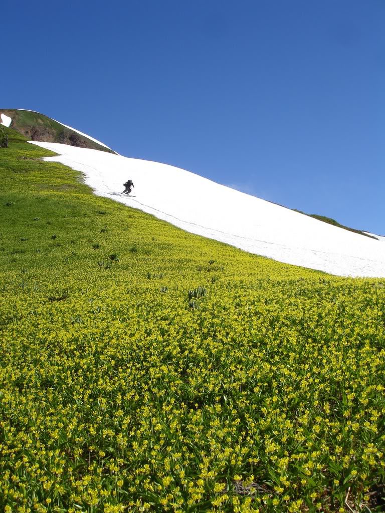
Soon enough we spotted a line that would bring us down to the trail. Putting on our skis we were dropping elevation and enjoying perfect early morning corn. By now we had already been moving for two hours but we were gaining ground fast.
Hiking along the trail we were off a world of white and back in a land of green. Passing by the wild flowers we stopped to take a quick lap. It was too beautiful of a spot to just walk past. Though it would add a few minutes to our departure it is not often you get to ride in this type of environment.
Back on the North Fork of the Sauk River Trail
Soon we were back on the North Fork of the Sauk Trail and loosing elevation fast. Soon enough we would be down in the valley and working our way out of the overgrown trail. Each mile felt like a stand alone mission as our bodies were tired. Soon enough we had crossed Red Pass Bridge and on the final stretch to the car.
In the end the last day was exhausting hiking 20.5 miles back to the car. It had been an amazing introduction to Glacier Peak and in the years the Mountain would keep having me come back for more. Every side has phenomenal riding and I have been able to do numerous routes on different aspects. The Sitkum Glacier to the West, Scimitar Glacier to the North, Chocolate Glacier to the East and the Cool Glacier Headwall to the South. Each on was a trip on its own and worthy of a repeat.
Thank you for reading this trip on Glacier Peak via the Cool Glacier Route. If you want to see more ski tours within the Stevens Pass Backcountry check out this link.
and for a full and text only list of all Trip Reports Click Here