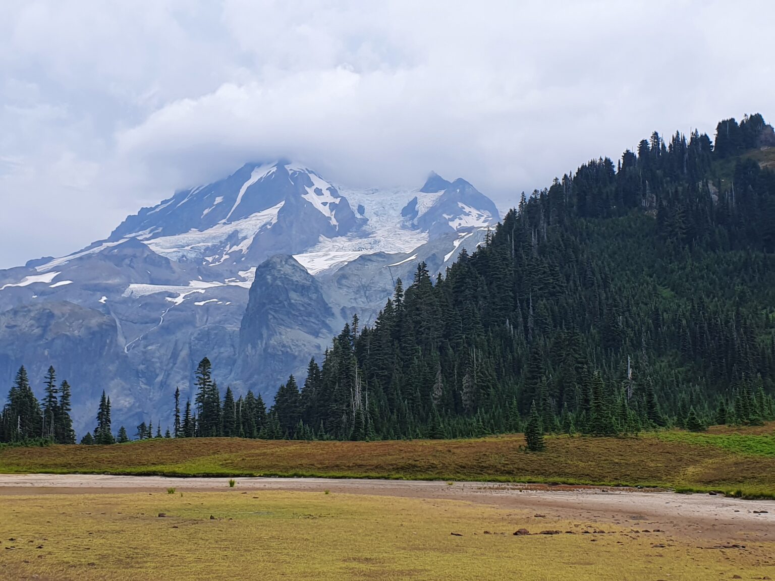
The West Side of Mount Rainier is possibly the most quiet with no road side trailheads and few options for trails to travel on. The area is linked together by the Wonderland Trail and has the most elevation gains and loss with 4 separate ridges between Longmire and Mowich Lake. The West Side Road was built in the late 1940’s but has shut down to cars since the early 2000’s because of getting washed out. This side holds dramatic views of Mount Rainier with the Tahoma Glacier coming down from the summit.
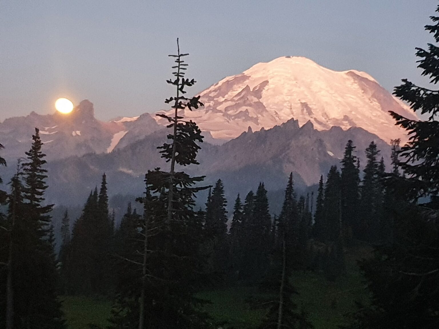
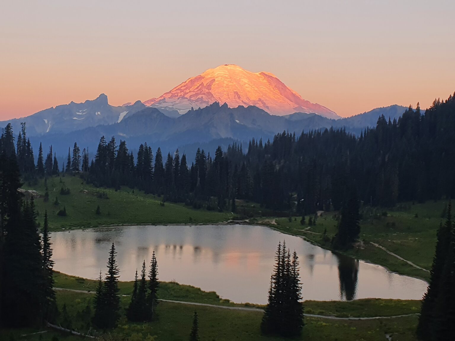
Starting off with a Sunrise over Chinook Pass
Wanting to start early in the day we camped as Silver Springs Campground at the base of Crystal Mountain. My friend Ben had taken a few days off from work and it was my final few days in Washington. Having just finished a 4 day hike on Mount Rainier on Friday morning Ben and I were sleeping in his van Friday night.
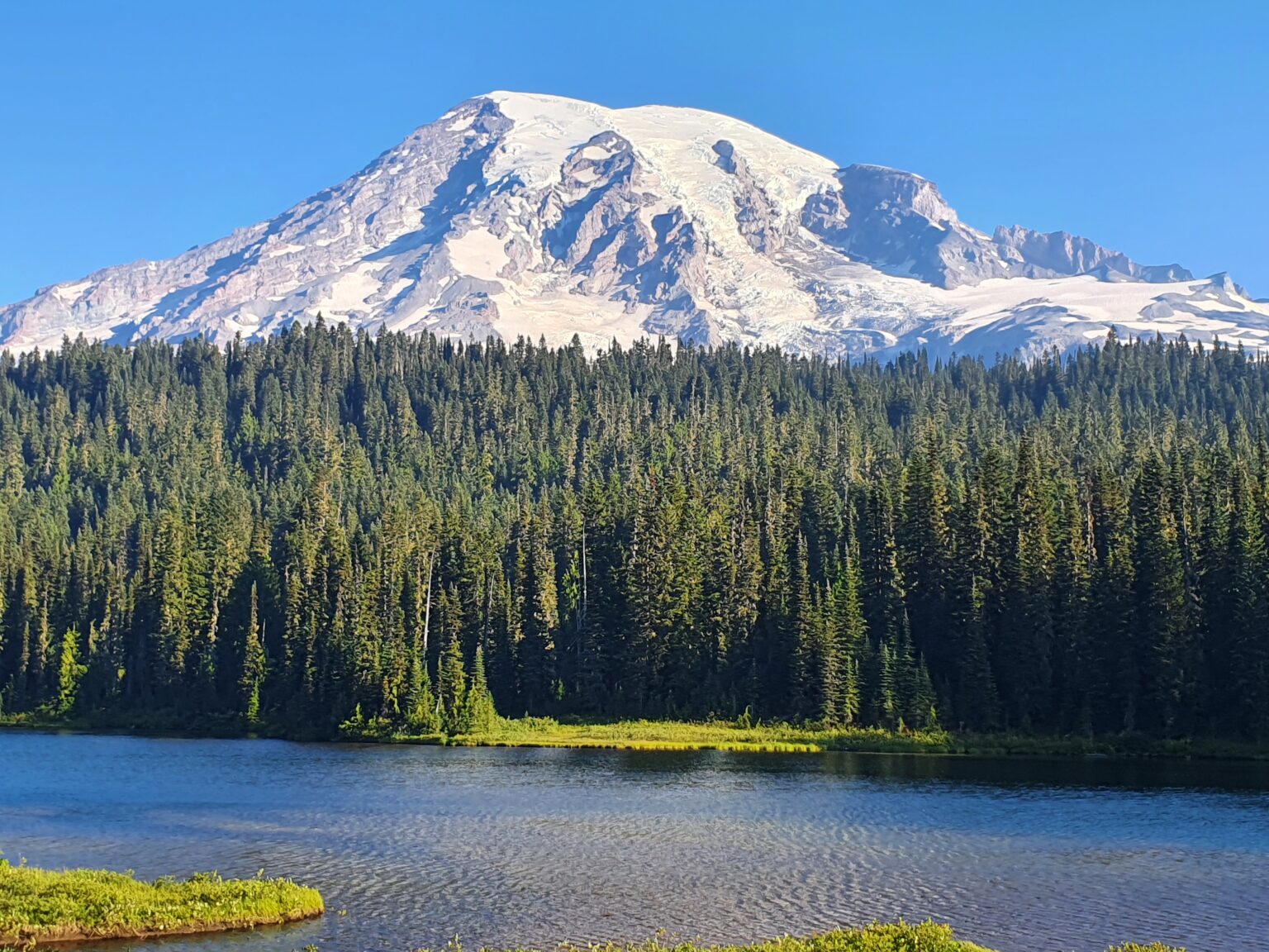
Waking up before sunrise we drove up to Tipsoo Lake at Chinook Pass and watched the Sunrise over Mount Rainier. Enjoying the light show we made breakfast and watched the light slowly move into the valleys.
Driving through the Stevens Canyon road we would occasionally stop to take in the views of Mount Rainier.
Day 1:Kautz Creek to Pyramid Peak Trail
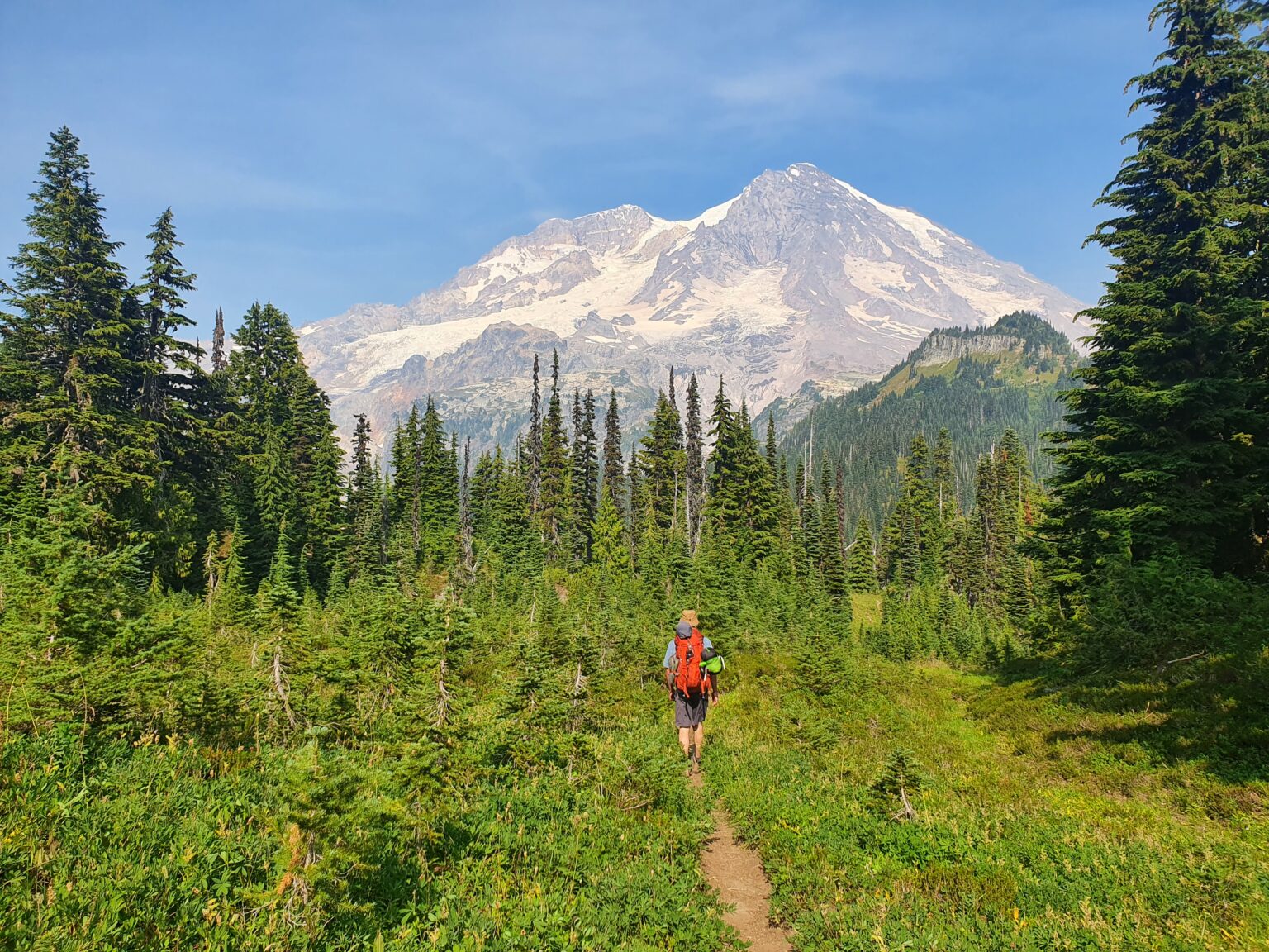
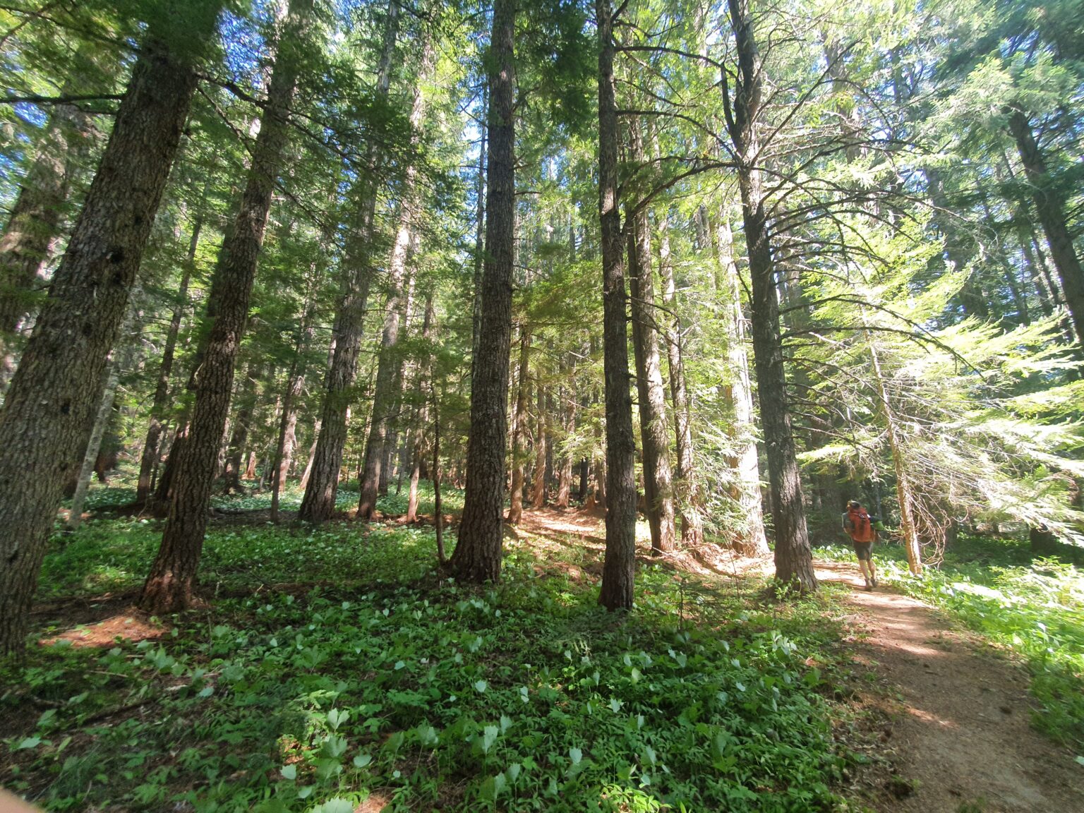
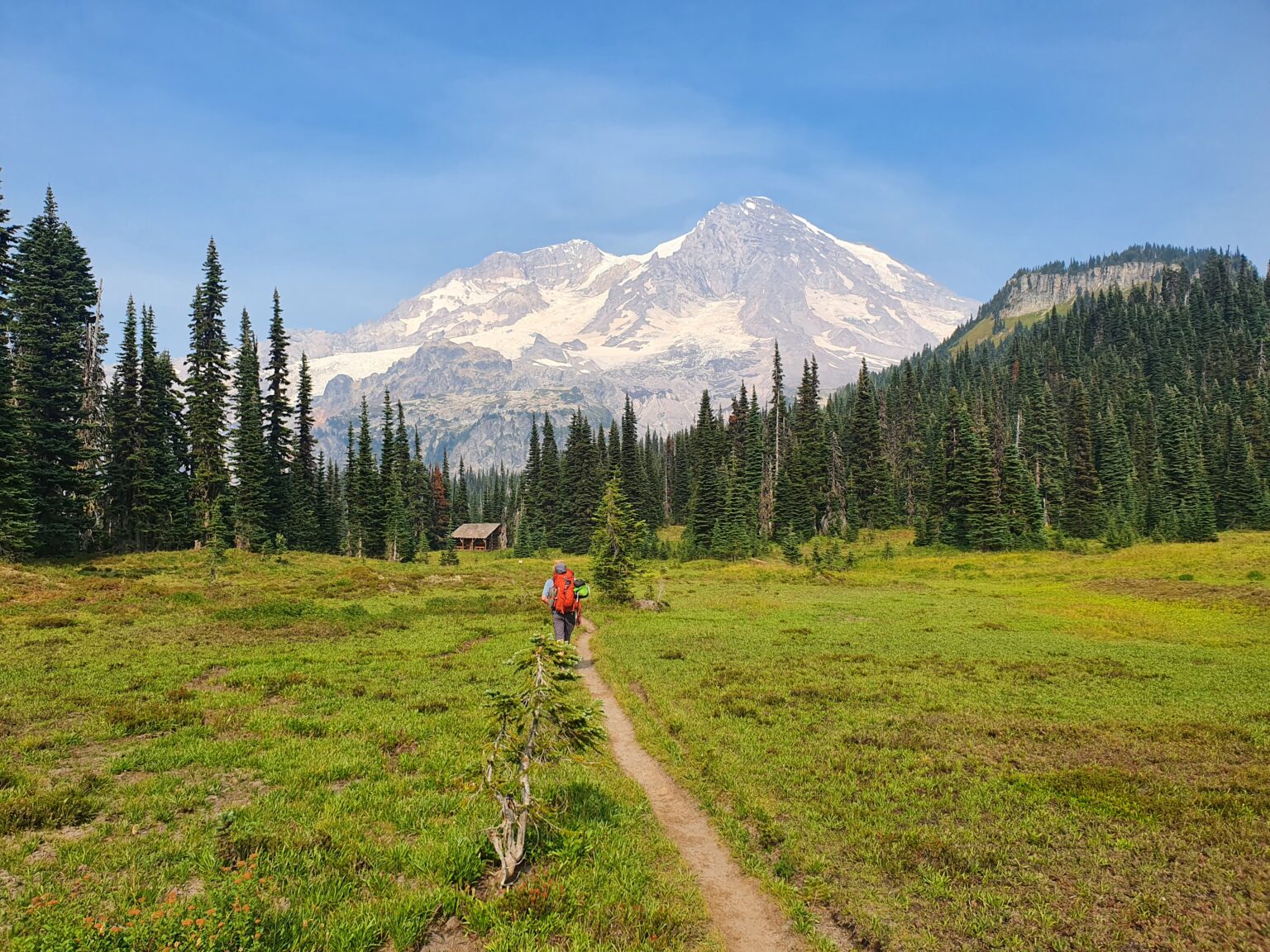
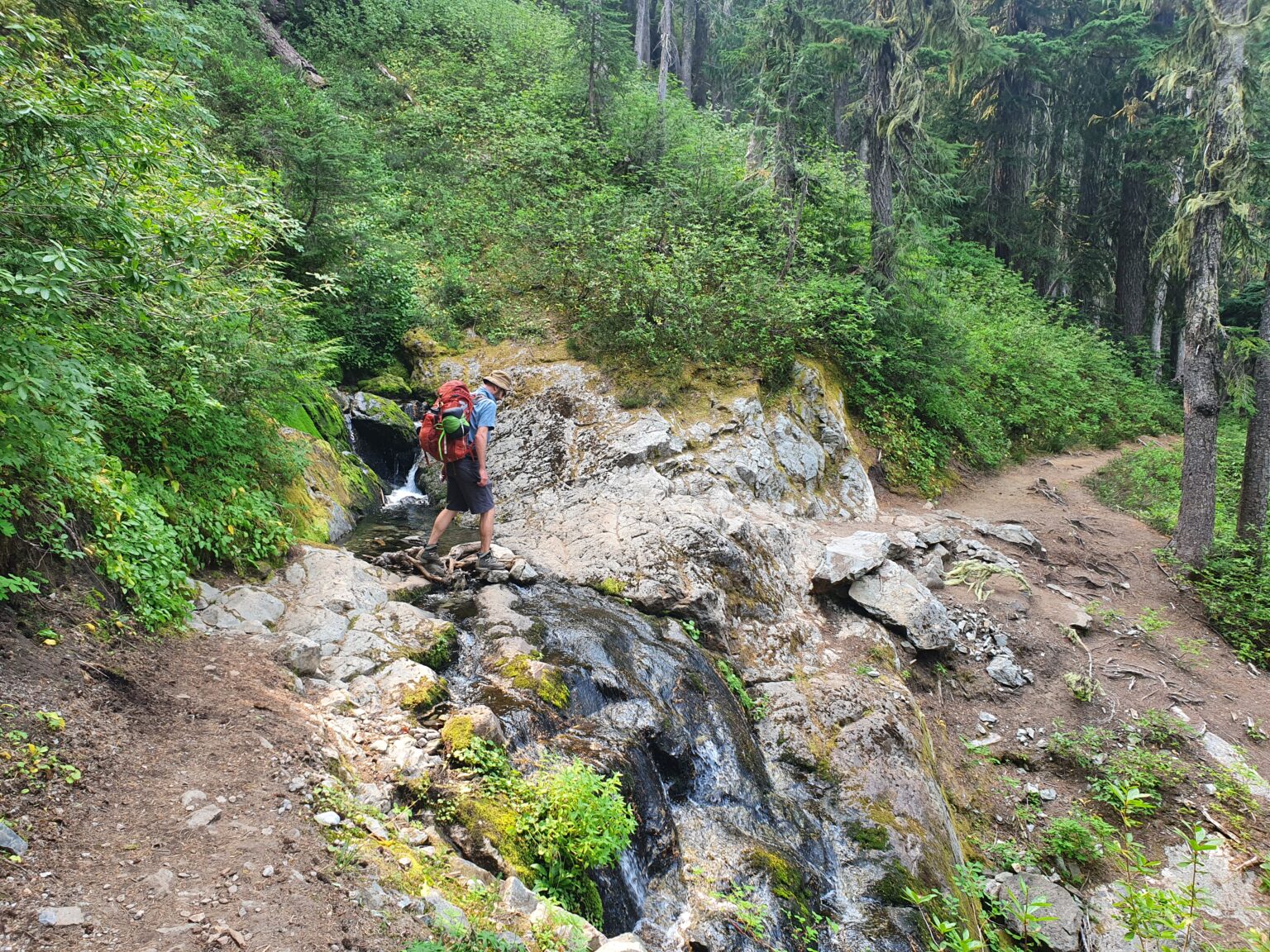
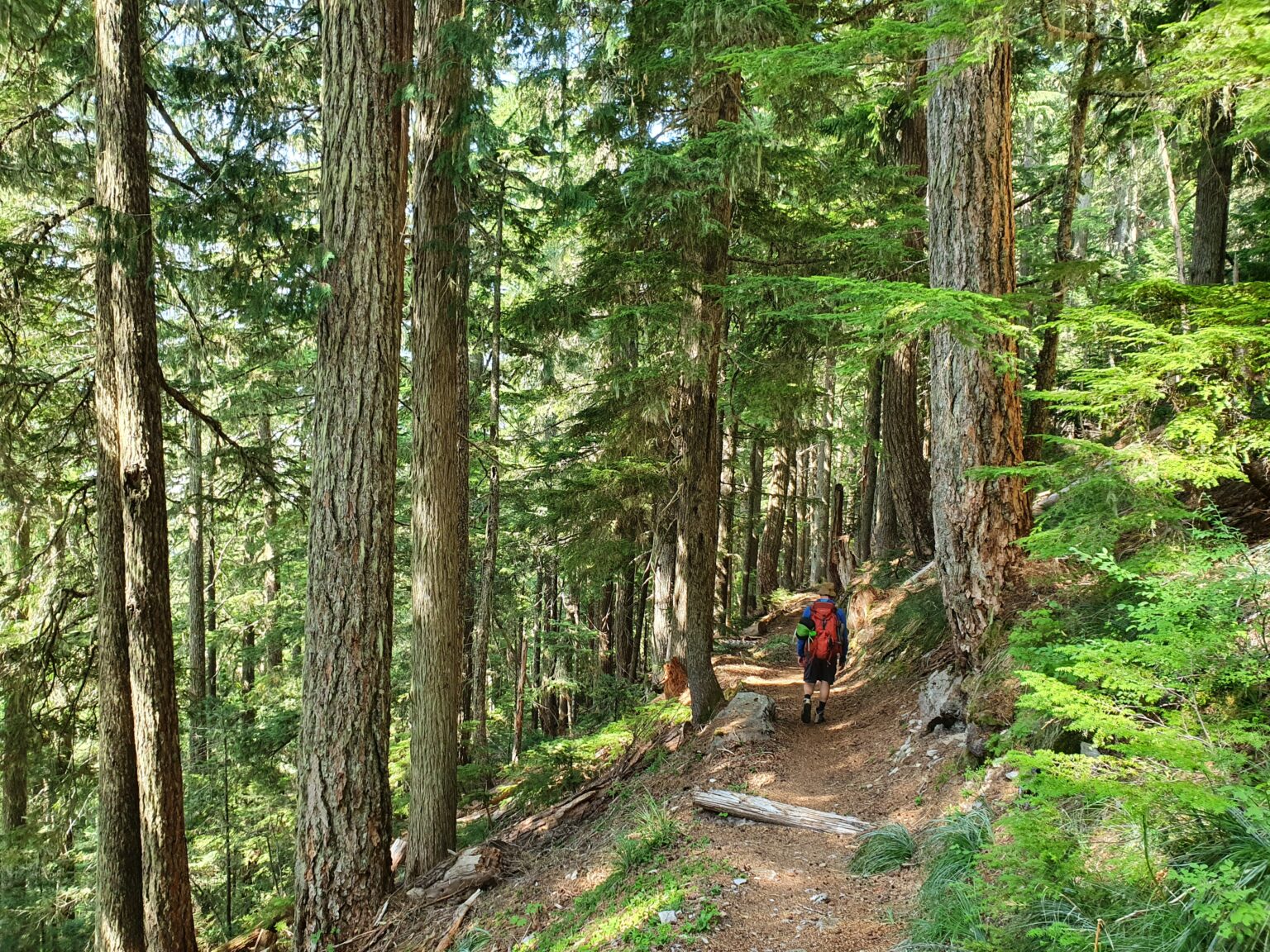
Grabbing our permit at Longmire we started our hike on the Kautz Creek trail. Even though I had been on the West Side of Rainier numerous times I wanted to check out new trails.
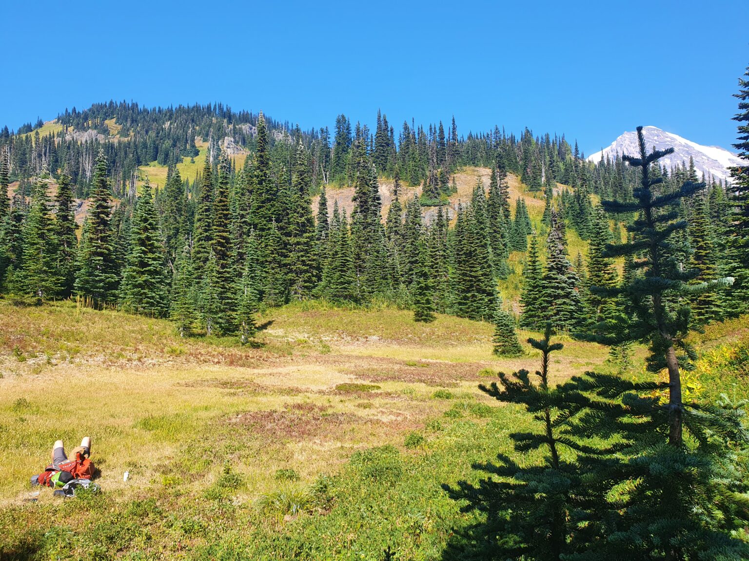
Before long we finally got into the first section of alpine and took a break. We were still dealing with a heat wave and decided to take the trip slow as we had more then enough time to complete our loop.
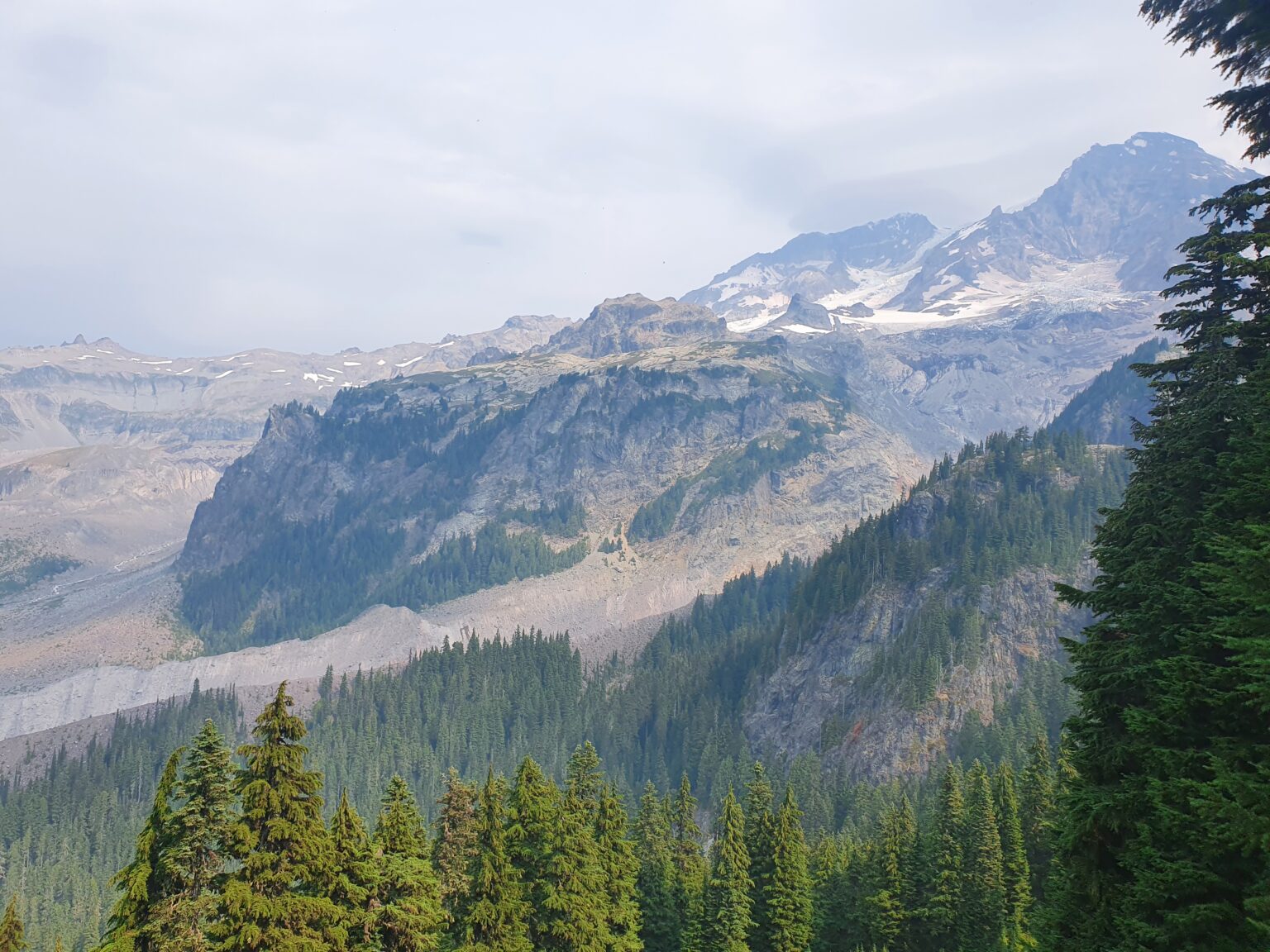
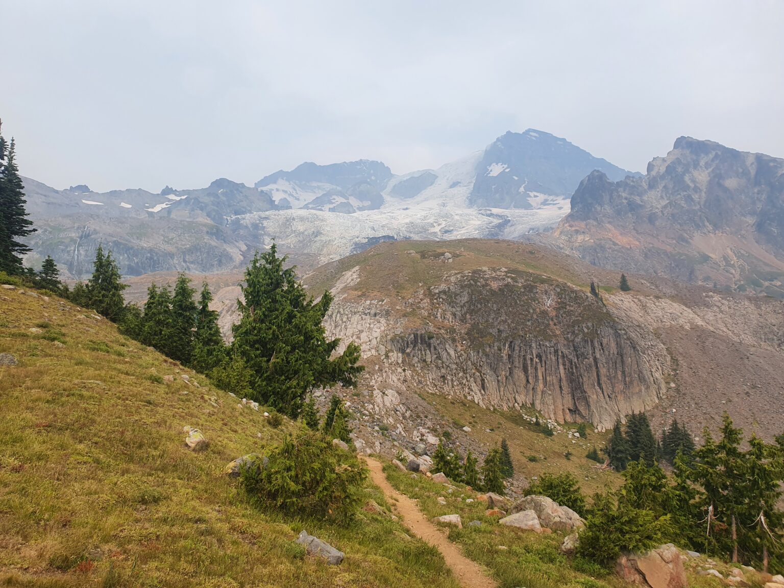
Before long we crested over Mount Ararat and had our first open view of Mount Rainier. By now the blue sky had started to get a bit of haze as there were wild fires to the East. From our vantage point we could see the Success Glacier Headwall to the right and the Tahoma Glacier to the left.
Then the Smoke Arrives
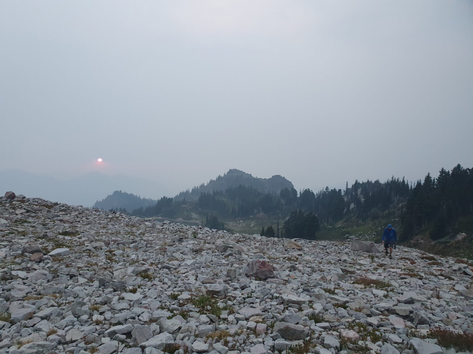
Making our way past Indian Henry Hunting Ground we left the trail for a side trail up to Pyramid Peak. Like a light switch going off the smoke had come in with our view of Rainier being obscured.
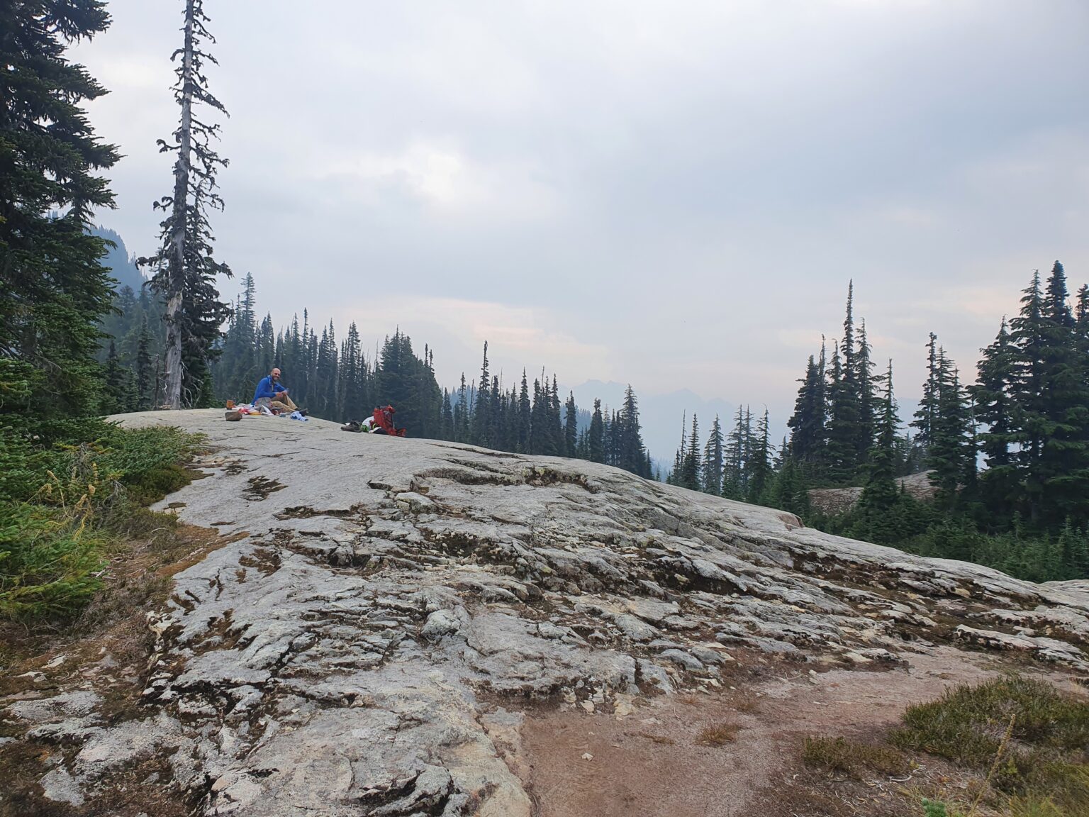
The plan was to hike to the summit of Pyramid Peak but there was no point as we couldn’t see anything. It was hard enough to breath just hanging around let alone hiking. We came up with a plan B and found a smooth rock to camp on and debated over heading back home the next day or continuing our trip.
Day 2: Pyramid Peak Trail to Saint Andrews Lake
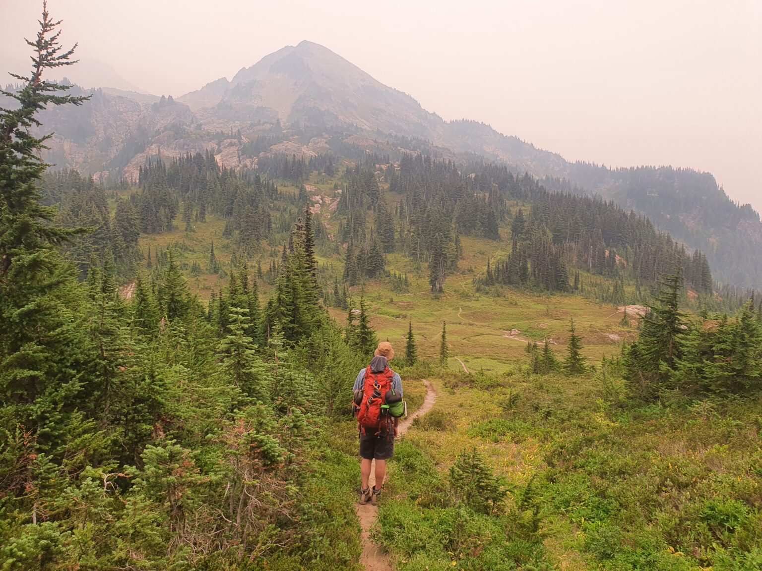
When we woke up we were happy to see that the smoke wasn’t as bad as the day before. Although the view was hazy we could still see Mount Rainier. We decided to continue on as the area between Indian Henry Hunting Ground and Saint Andrews Lake is a beautiful area Ben had never been to.
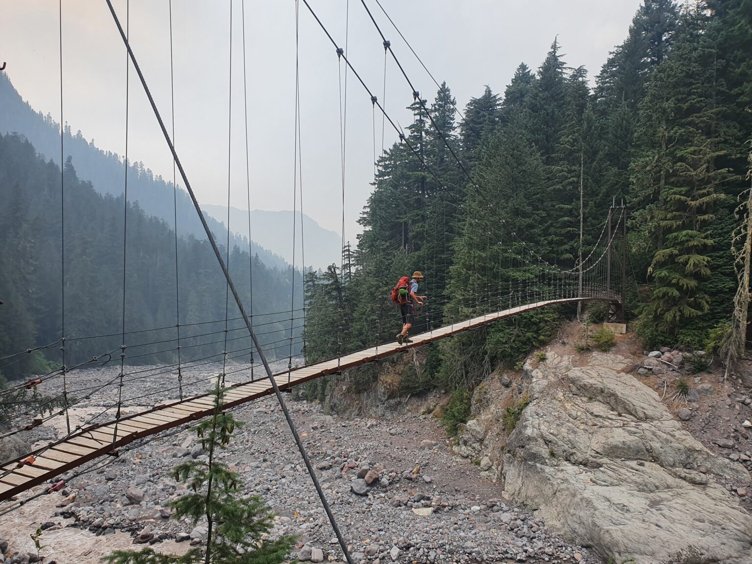
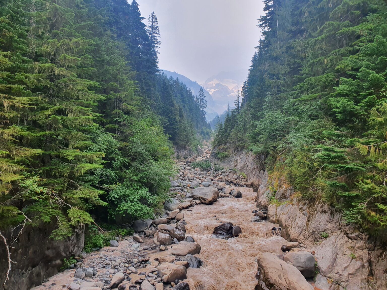
Dropping down to Tahoma Creek we prepared for the next climb up Emerald Ridge. We would have to do 2 big climbs in the day and this was our warm up.
Hiking Down Emerald Ridge
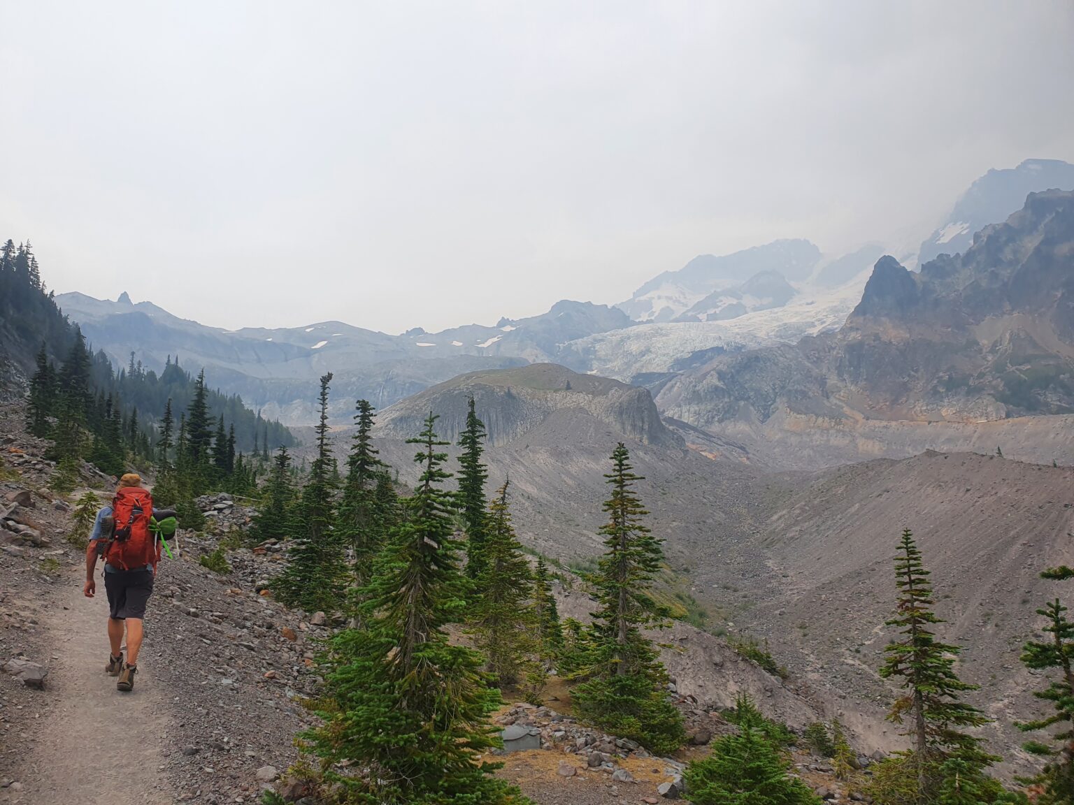
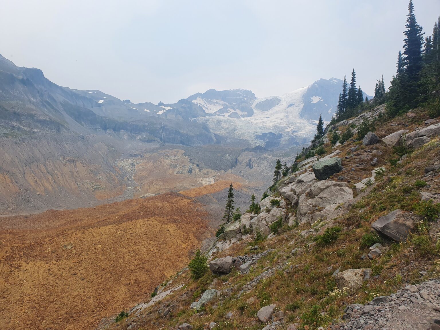
Arriving up on Emerald Ridge it seemed to Spilt the Glacier in two separate directions. The mountain seemed like it was a stubborn landmass that was unwilling to move compared to the erosion of other mountains.
If you have ever hiked down Emerald Ridge you understand the pain as it drops fast. Fortunately the trail sticks to a cliff far above the South Puyallup with numerous views along the way.
Arriving at the river it was time for our final climb of the day. It was starting to get into the late afternoon as we followed what seemed like endless switchbacks to gain elevation.
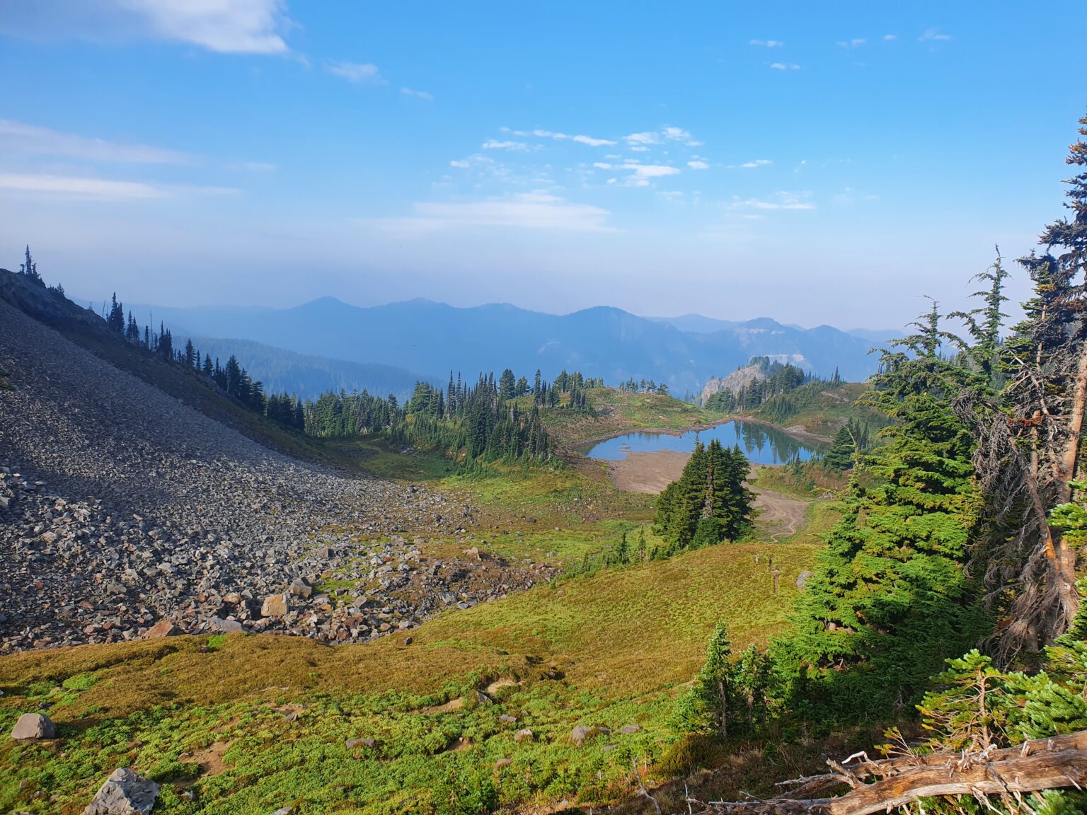
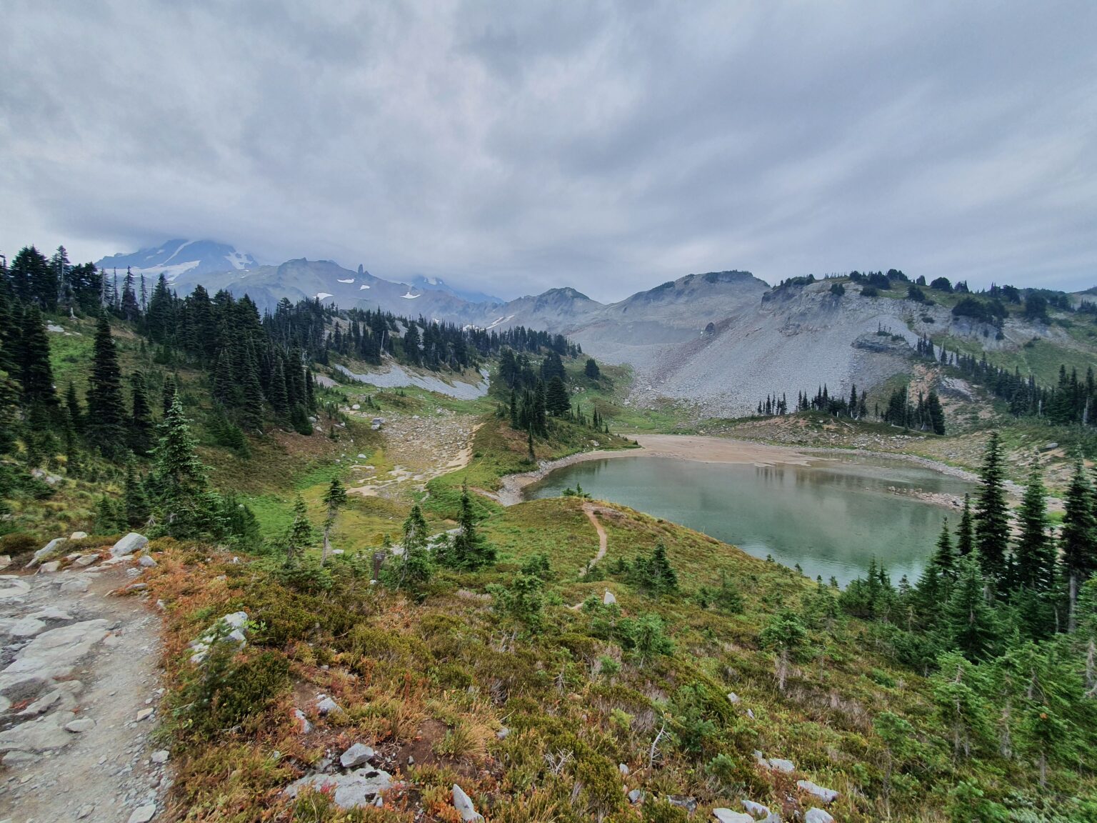
Back in the high country we followed the main trail over to Saint Andrews Lake where we would break off from from the standard route.
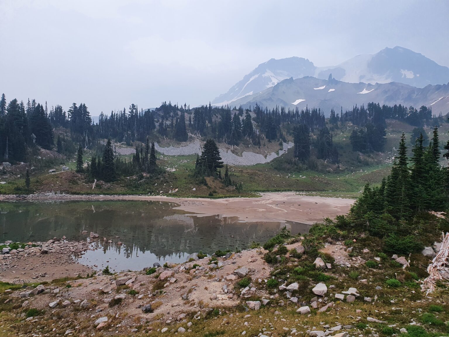
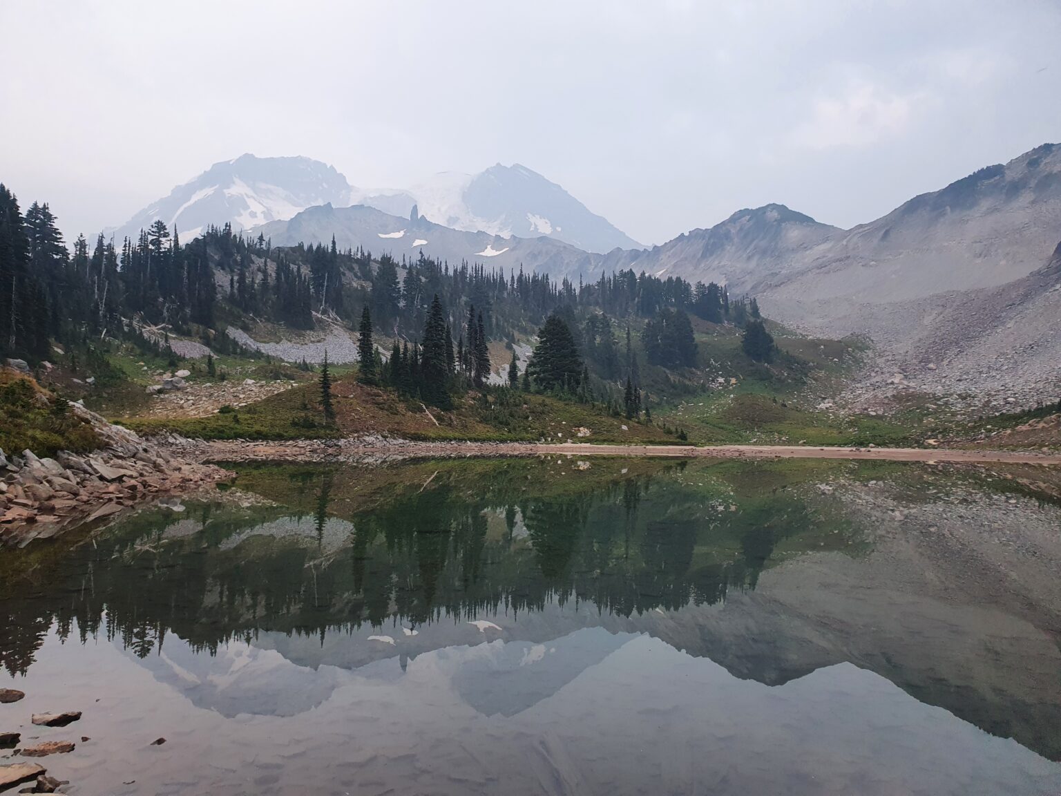
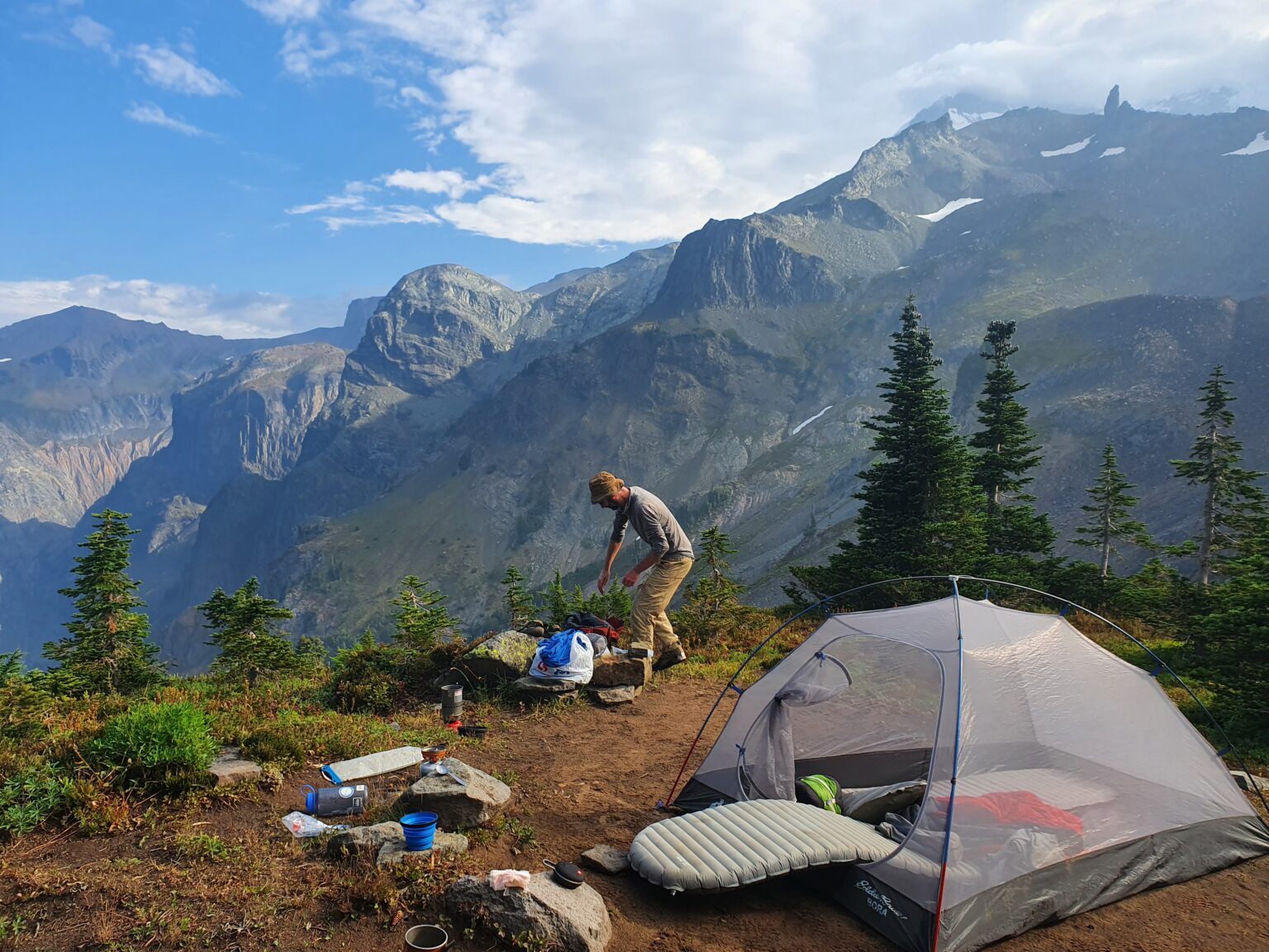
Arriving at Saint Andrews Lake
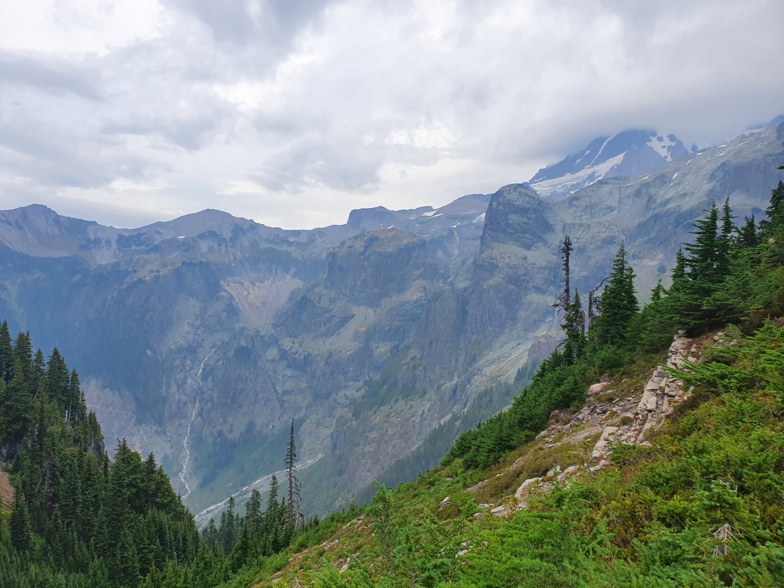
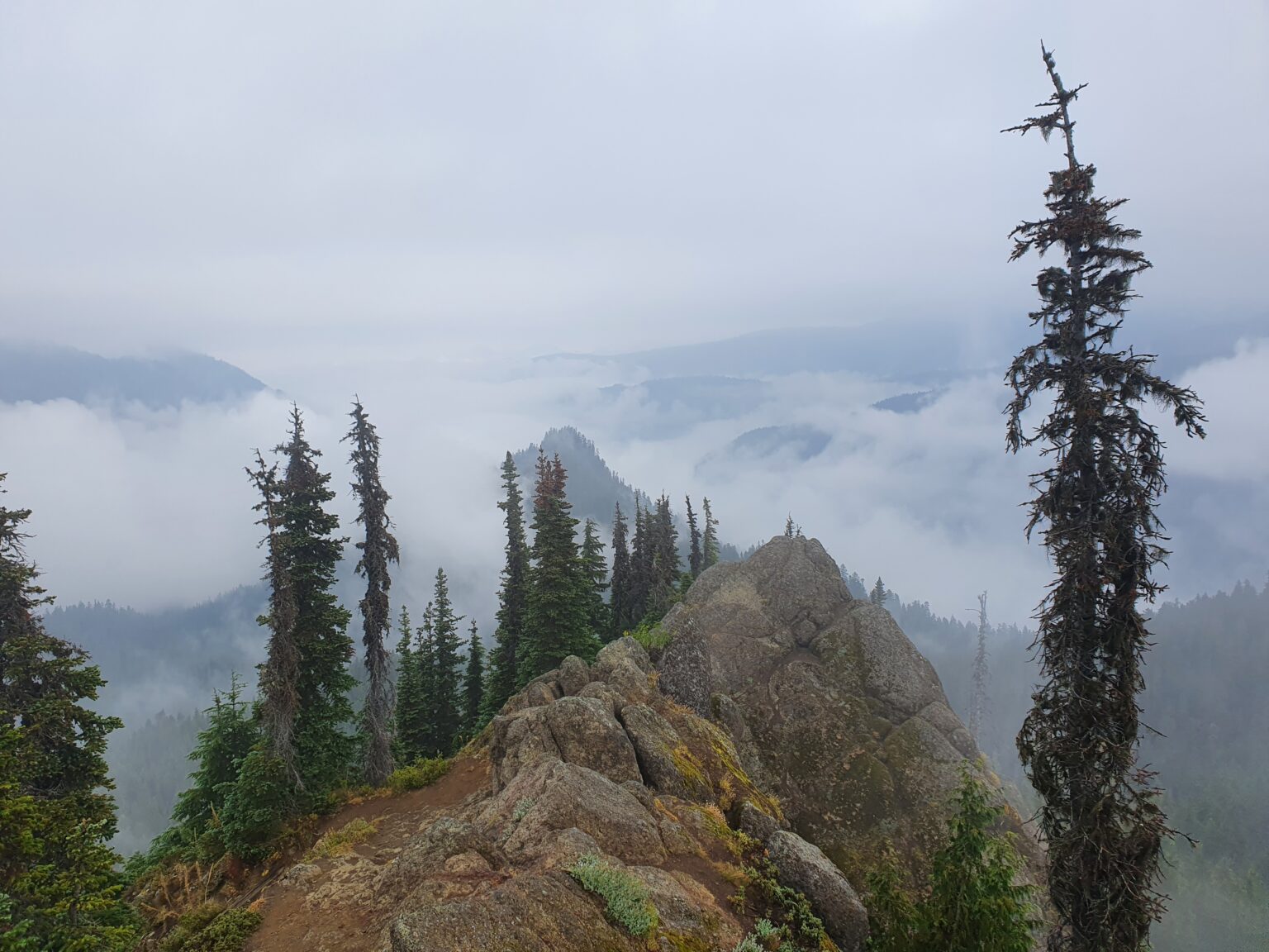
Once at Saint Andrews Lake we took in the hazy views of Mount Rainier before grabbing some water and heading higher up the mountain. Having been there a few times before I took us to a backcountry trail to get onto the lower ridge in the photo below.
We arrived at our camp right as the sun was setting. By now we were in the clouds and had no views as dusk quickly approached. Falling asleep in our tent we could hear multiple waterfalls in the distance.
Day 3: Saint Andrews Lake to George Lake
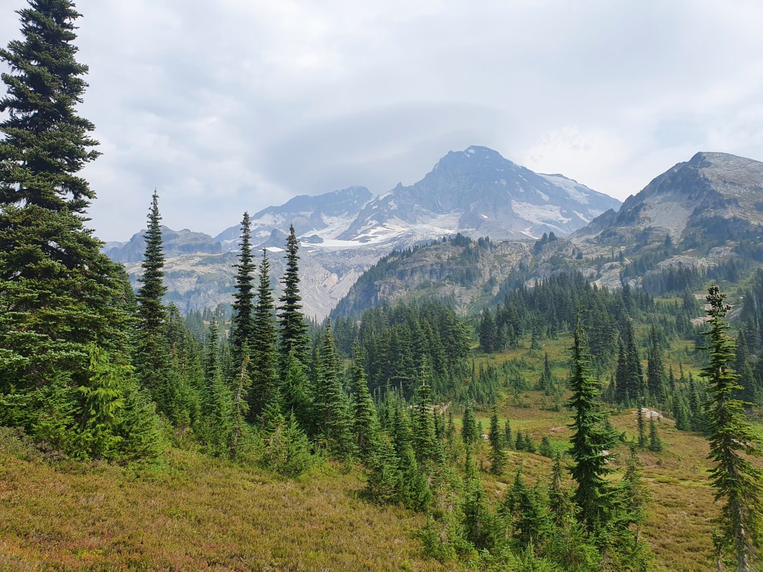
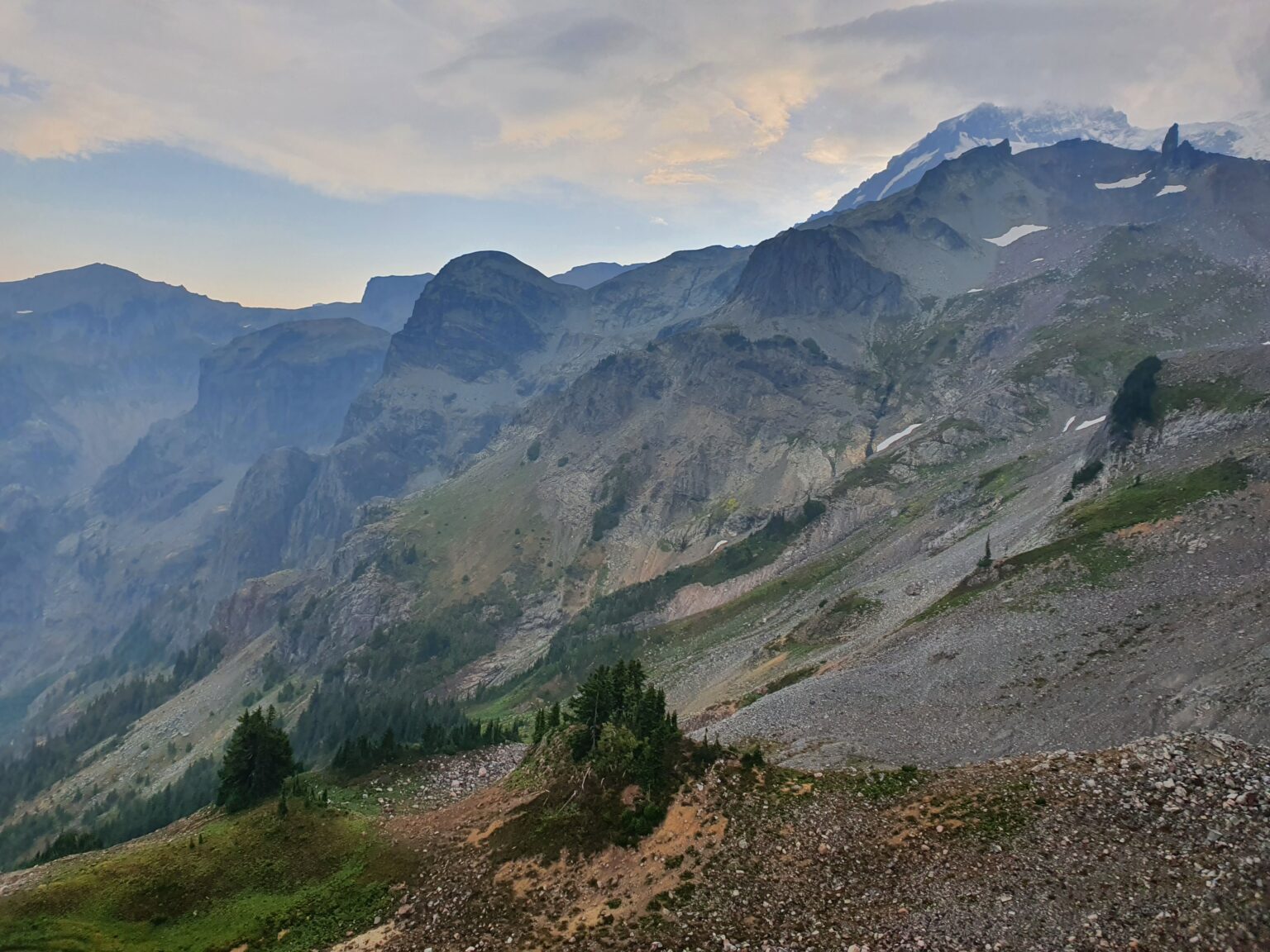
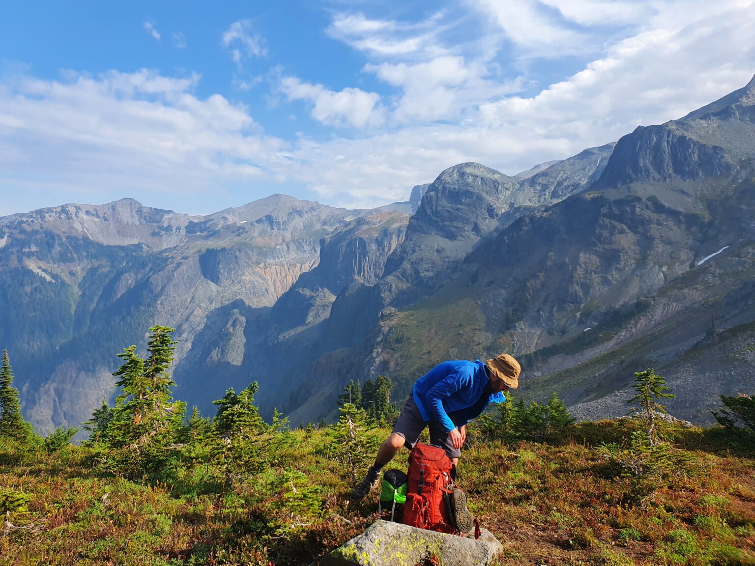
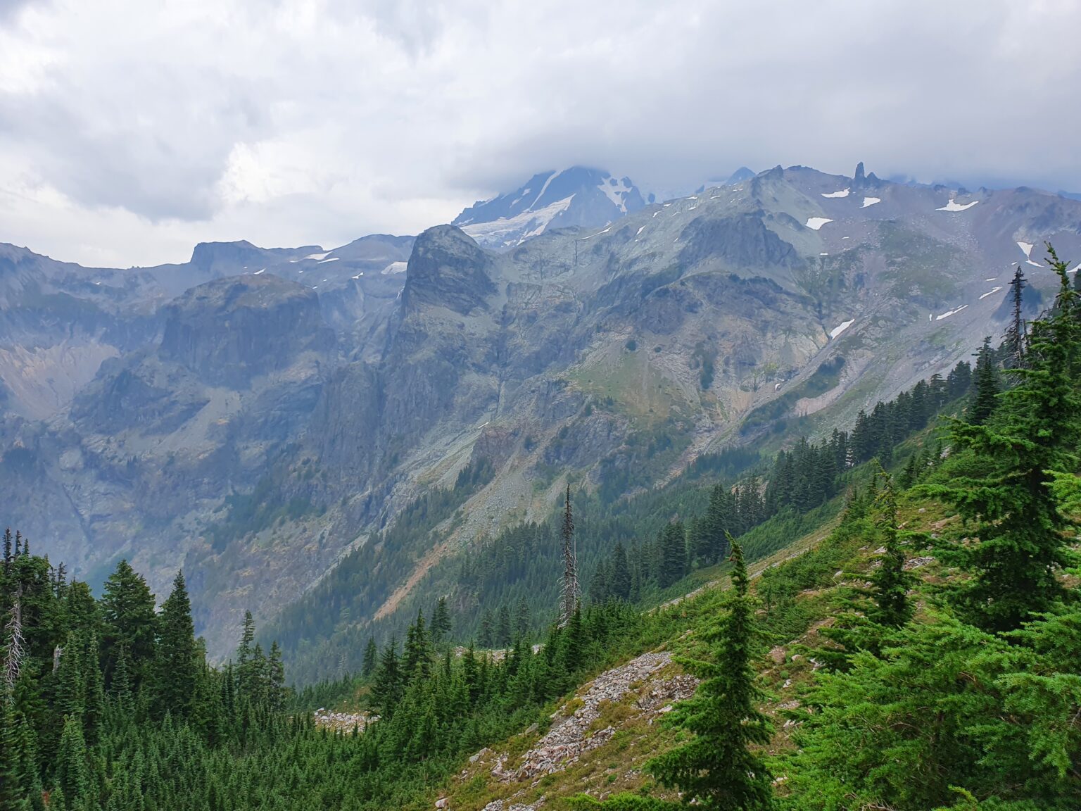
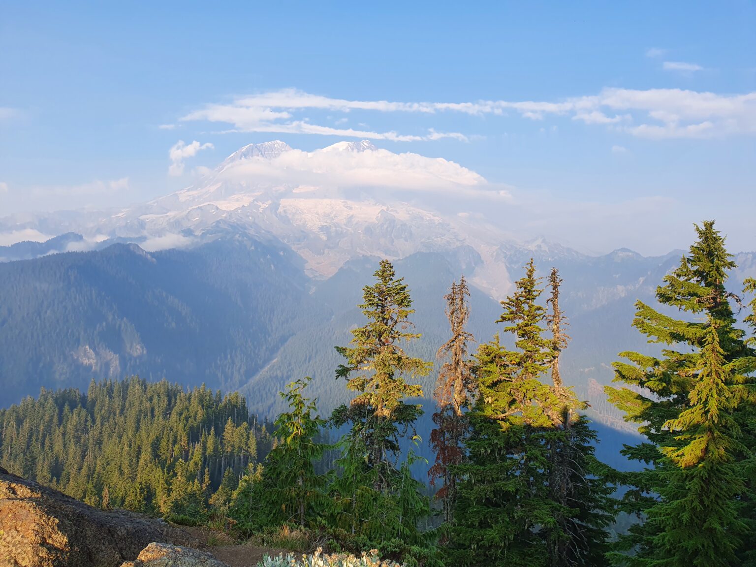
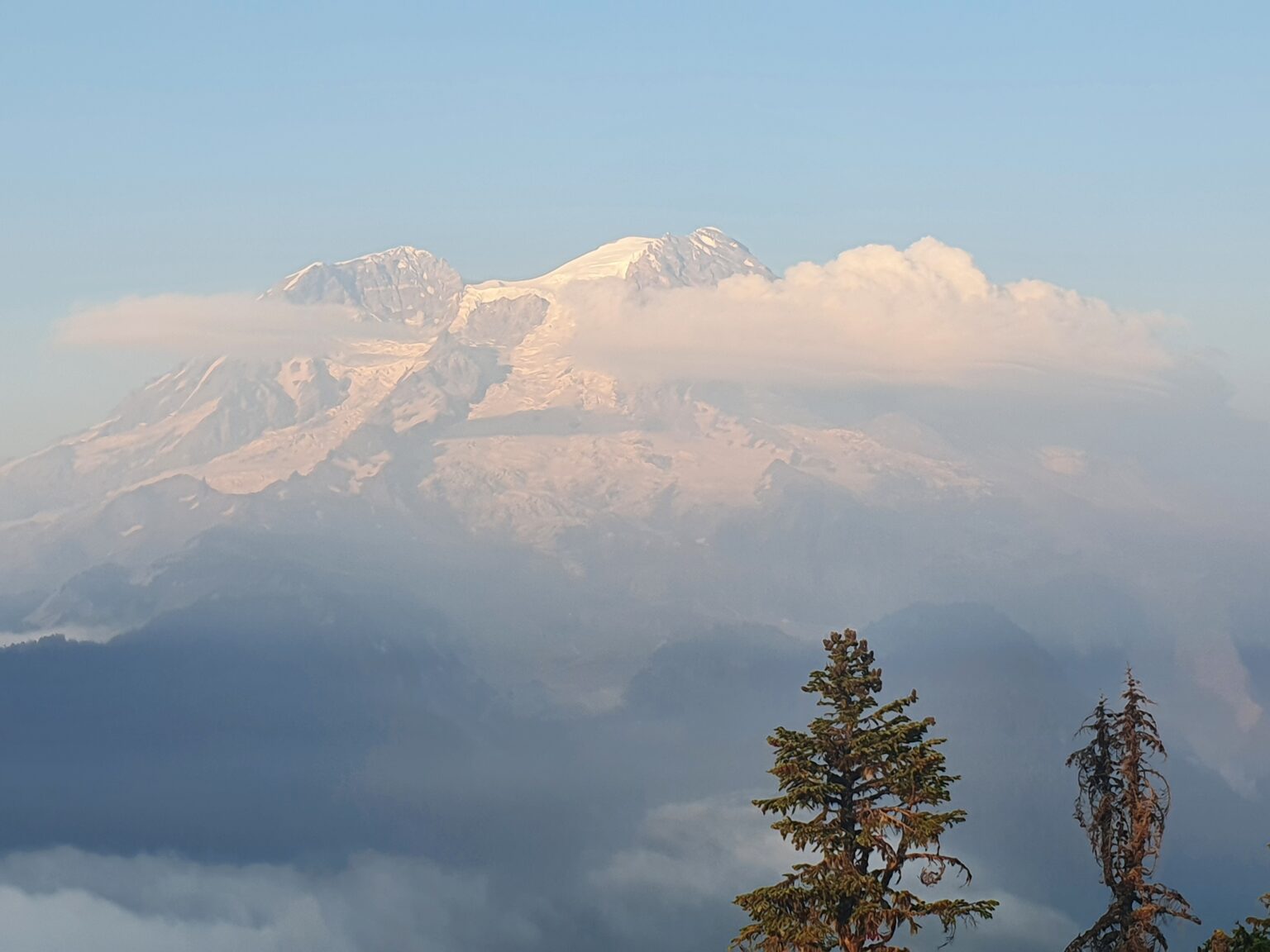
Waking up a little before sunrise we were happy to see that visibility had improved. We could see most of Mount Rainier but a lenticular cloud had taken over the summit. With the occasional blue patch we were optimistic that conditions would quickly improve.
After breakfast the sun started breaking through the clouds and we could finally get a good view of our surroundings. Off in the distance we could see the Tokaloo Spires and we’re happy with the decision not to cancel our trip the day before. By now we were half way through theMount Rainier West Loop.
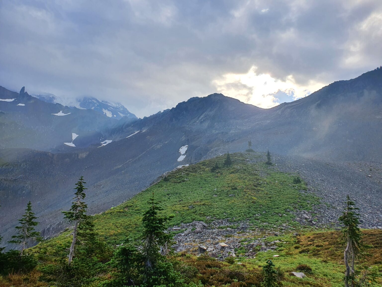
The third day was going to be easy but long as we planned to follow Auroura Ridge down to the West Side Road before climbing to George Lake for the night.
The sun came and went as we walked down to Saint Andrews Lake. By now the upper slopes of Mount Rainier were obscured in clouds but the smoke had seemed to subside.
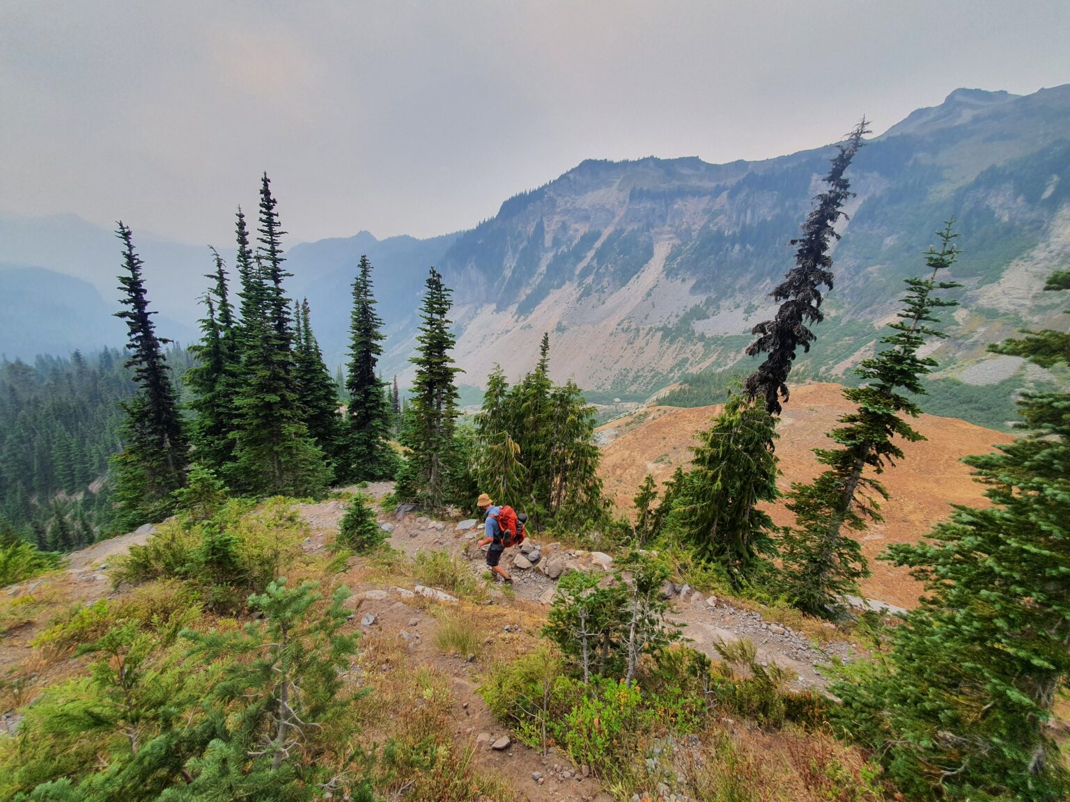
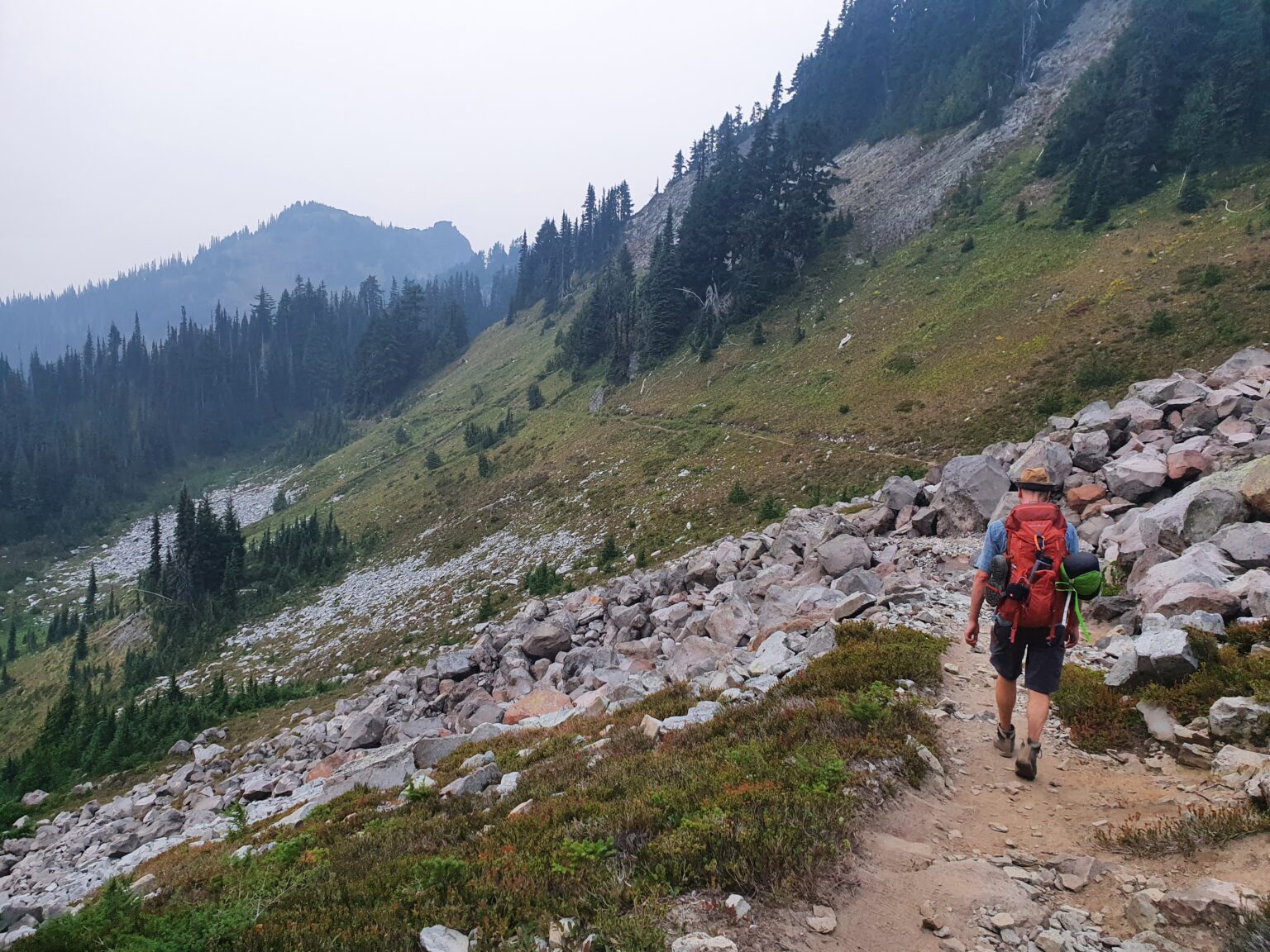
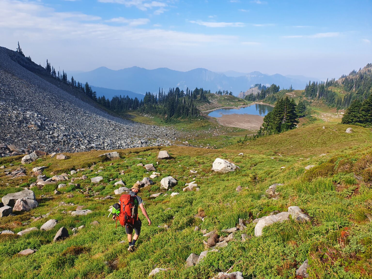
Heading Down Auroura Ridge Trail
Walking down to Auroura Lake I was surprised to find that it had dried up. There hadn’t been rain for months now and there wasn’t a drop of water left in the area.
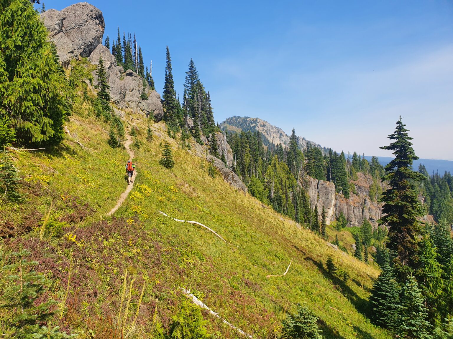
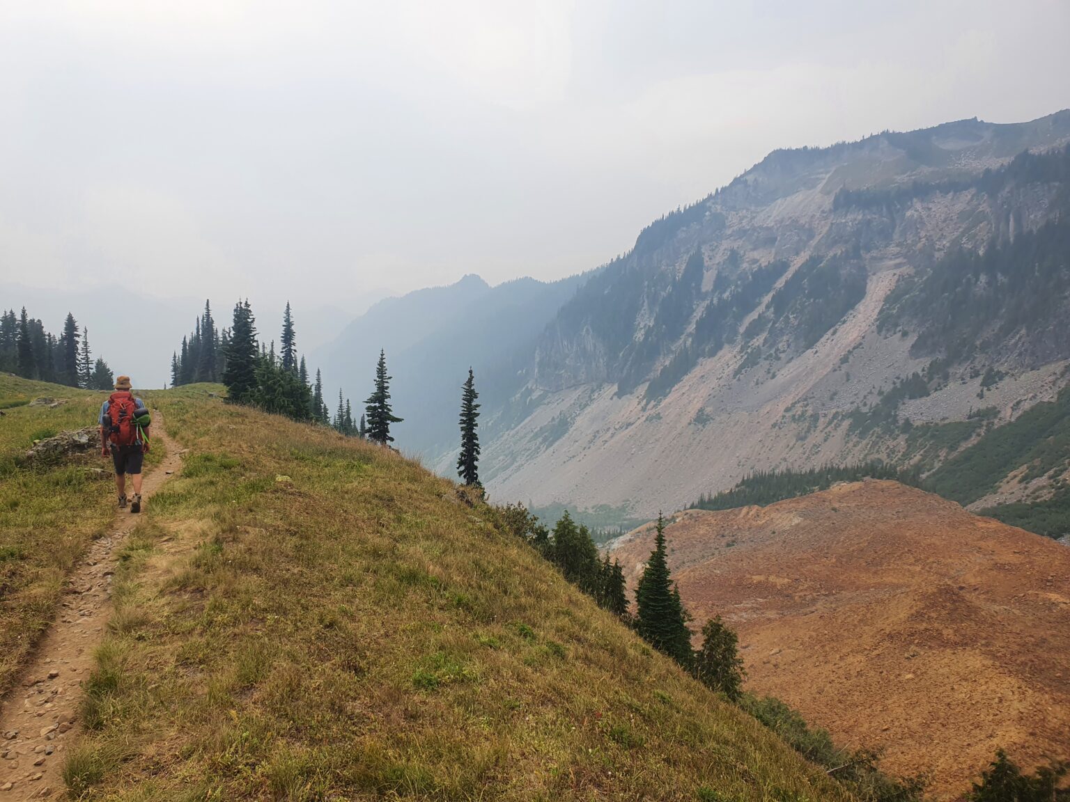
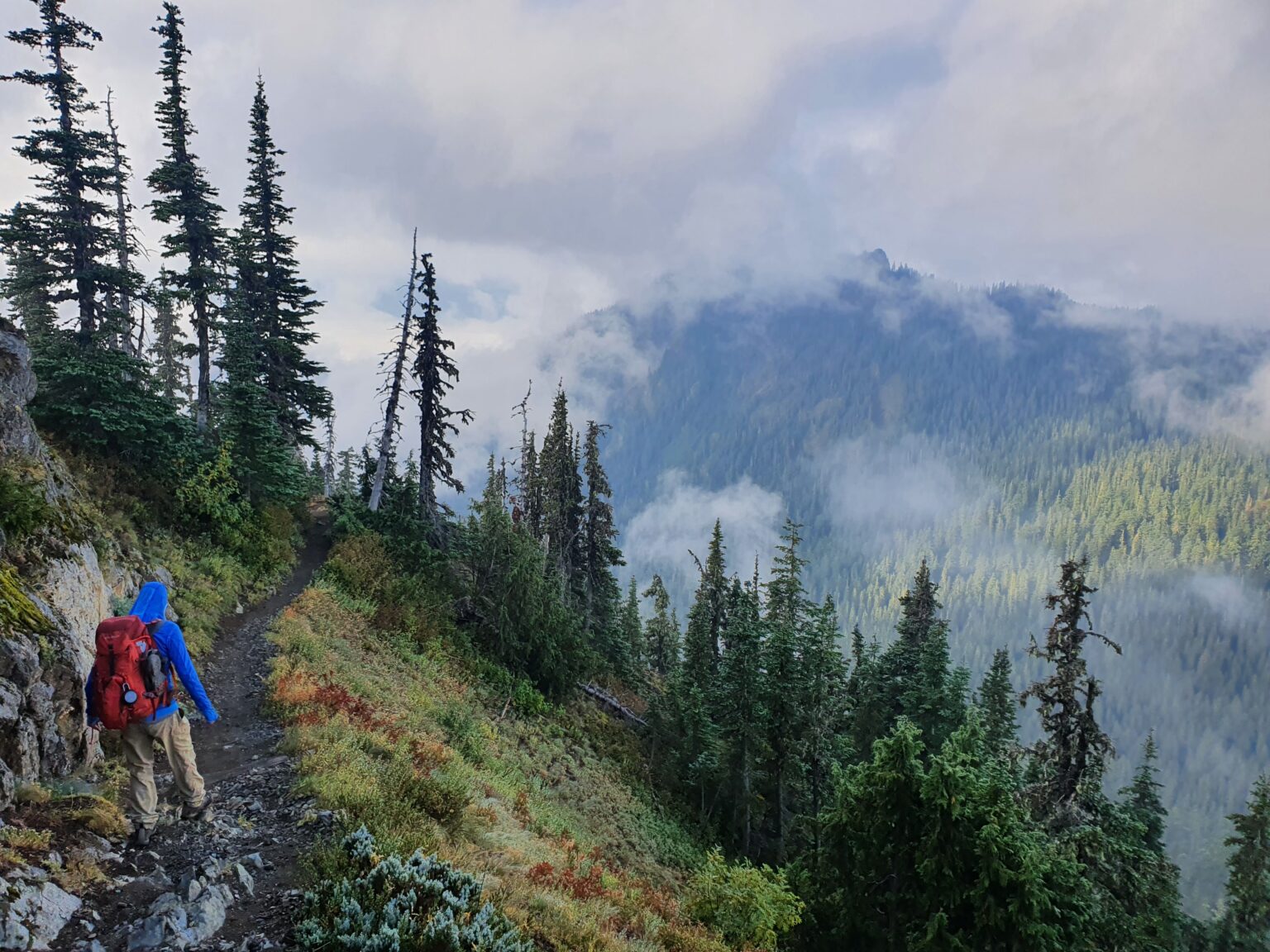
Auroura Ridge was another trail I had never been on and I was fearful that the trail conditions would be bad. Walking down I found that it was in great conditions with a well laid out trail following the high ridge before a few switchbacks down to the road below. It turned out to be one of the nicer trails I’ve been on and a shame that the approach is so long to access it.
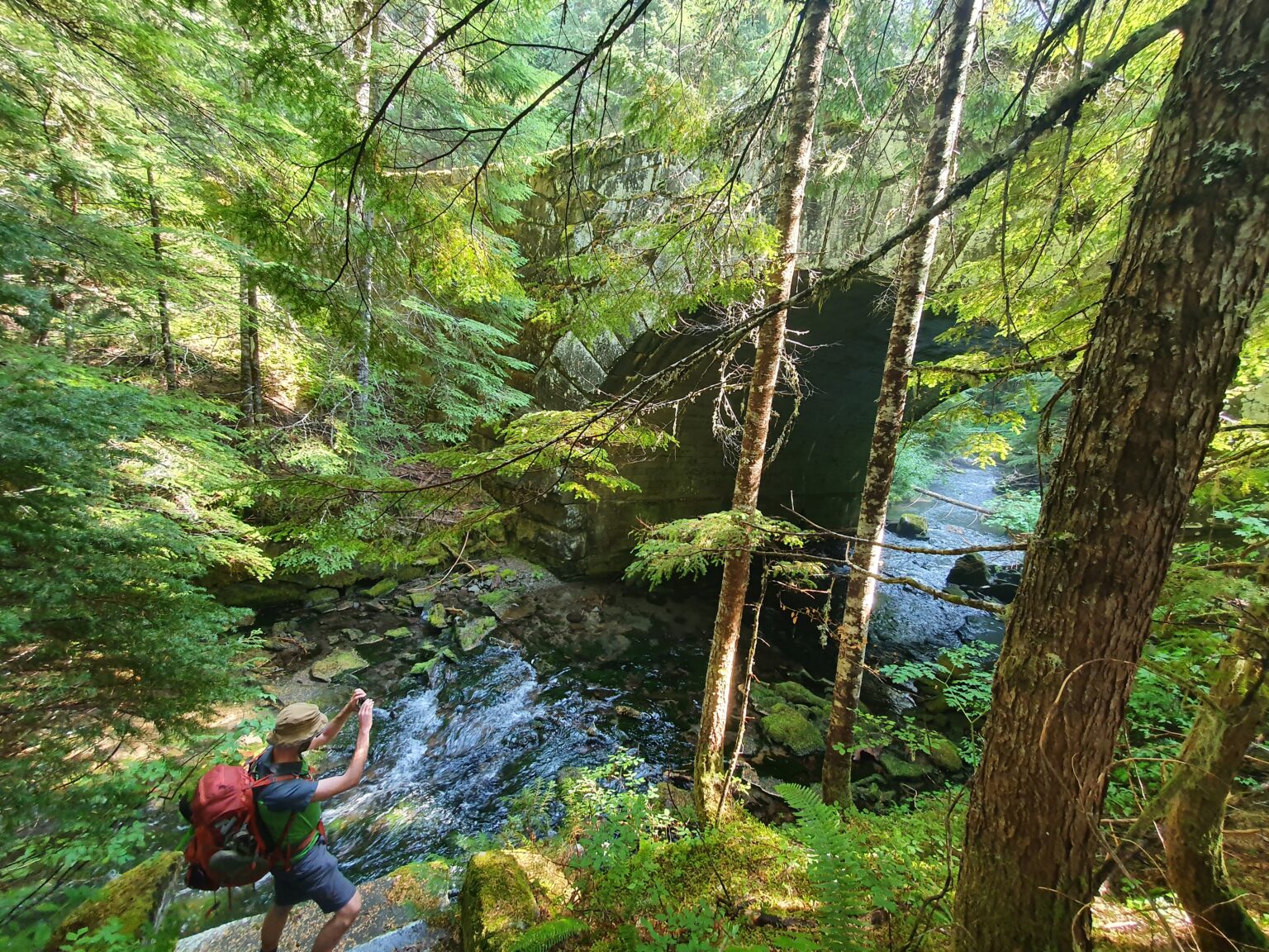
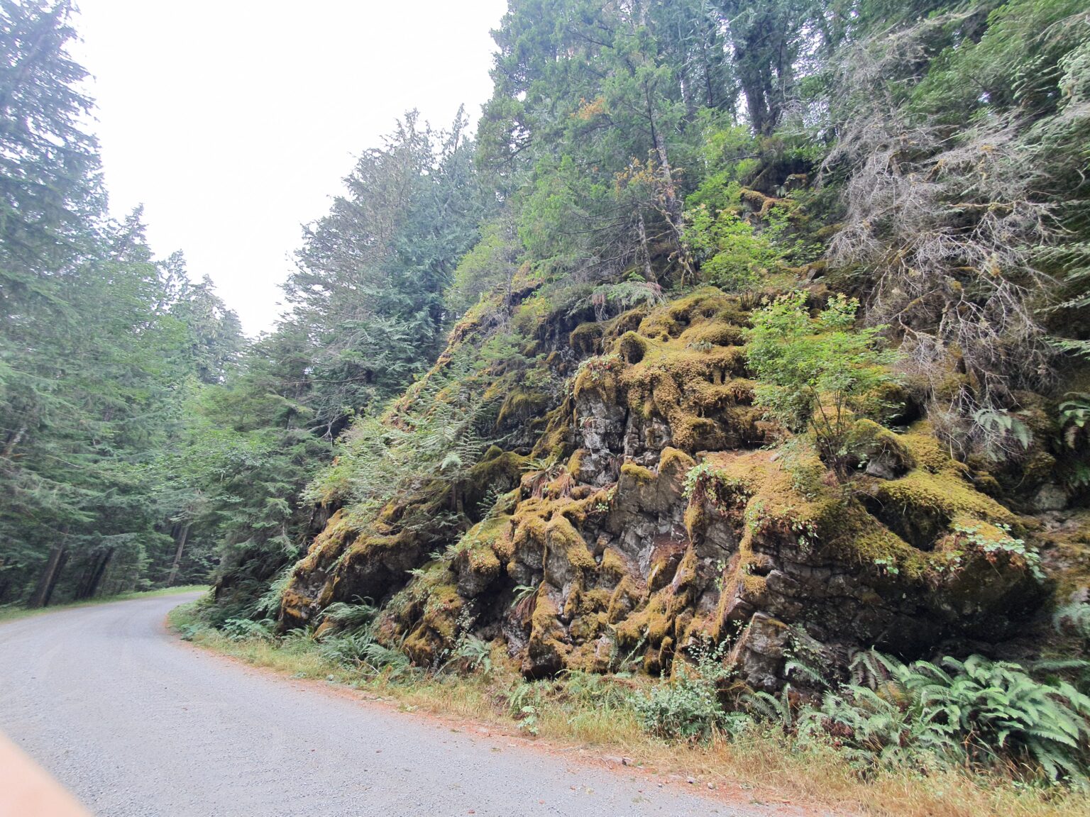
Walking back on the West Side Road we made sure to stop by all the random view spots on basically an abandoned area.
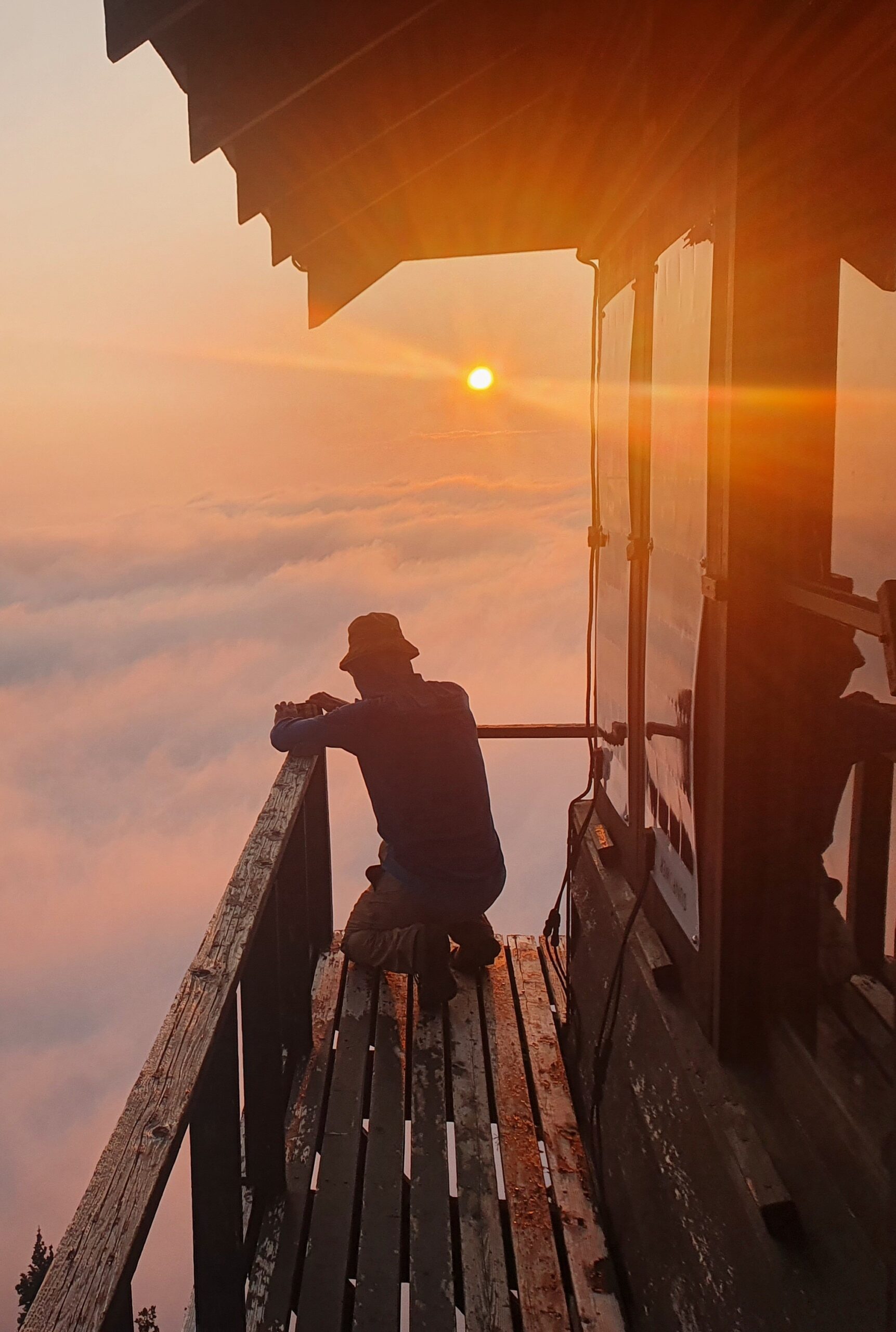
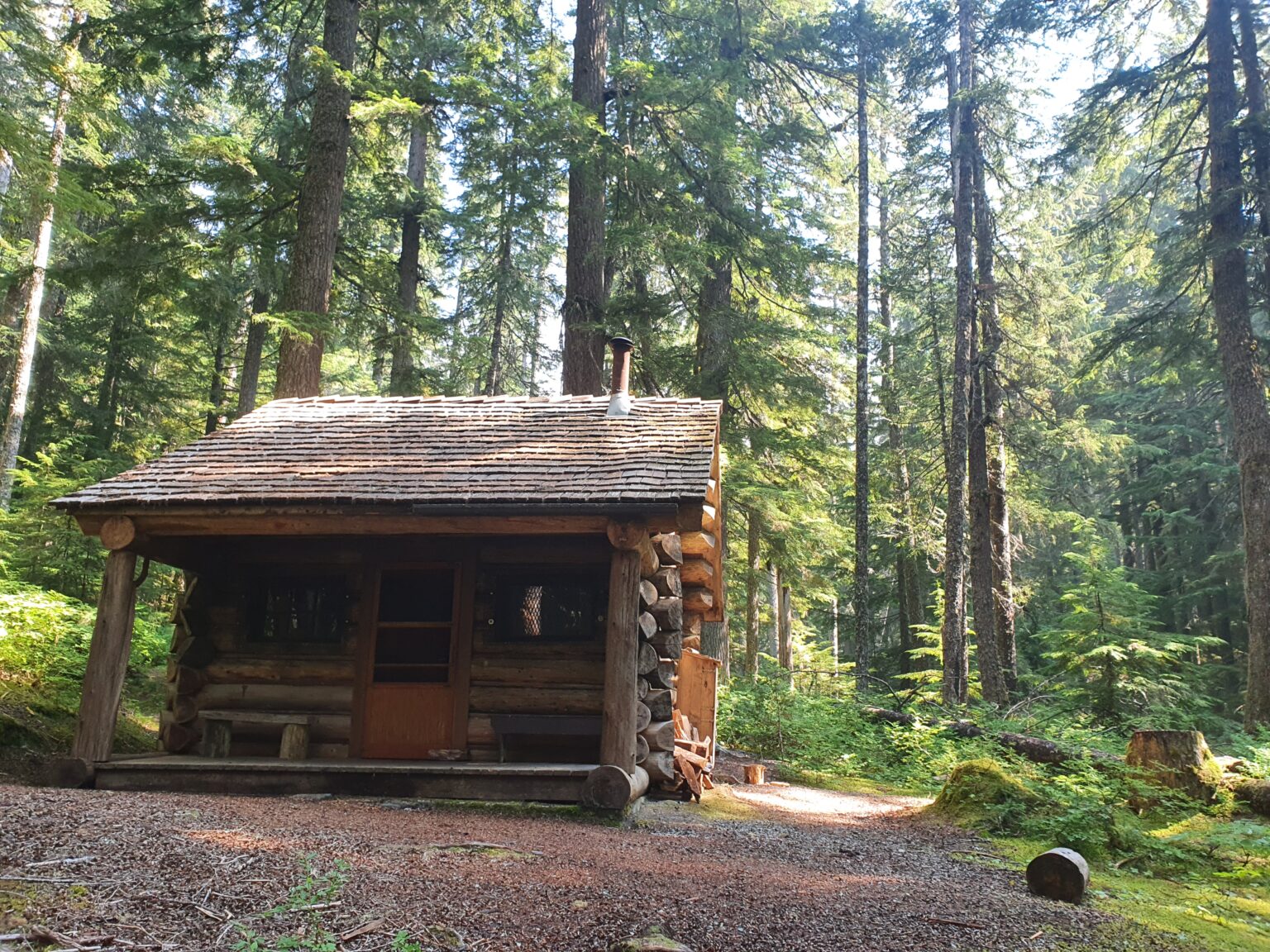
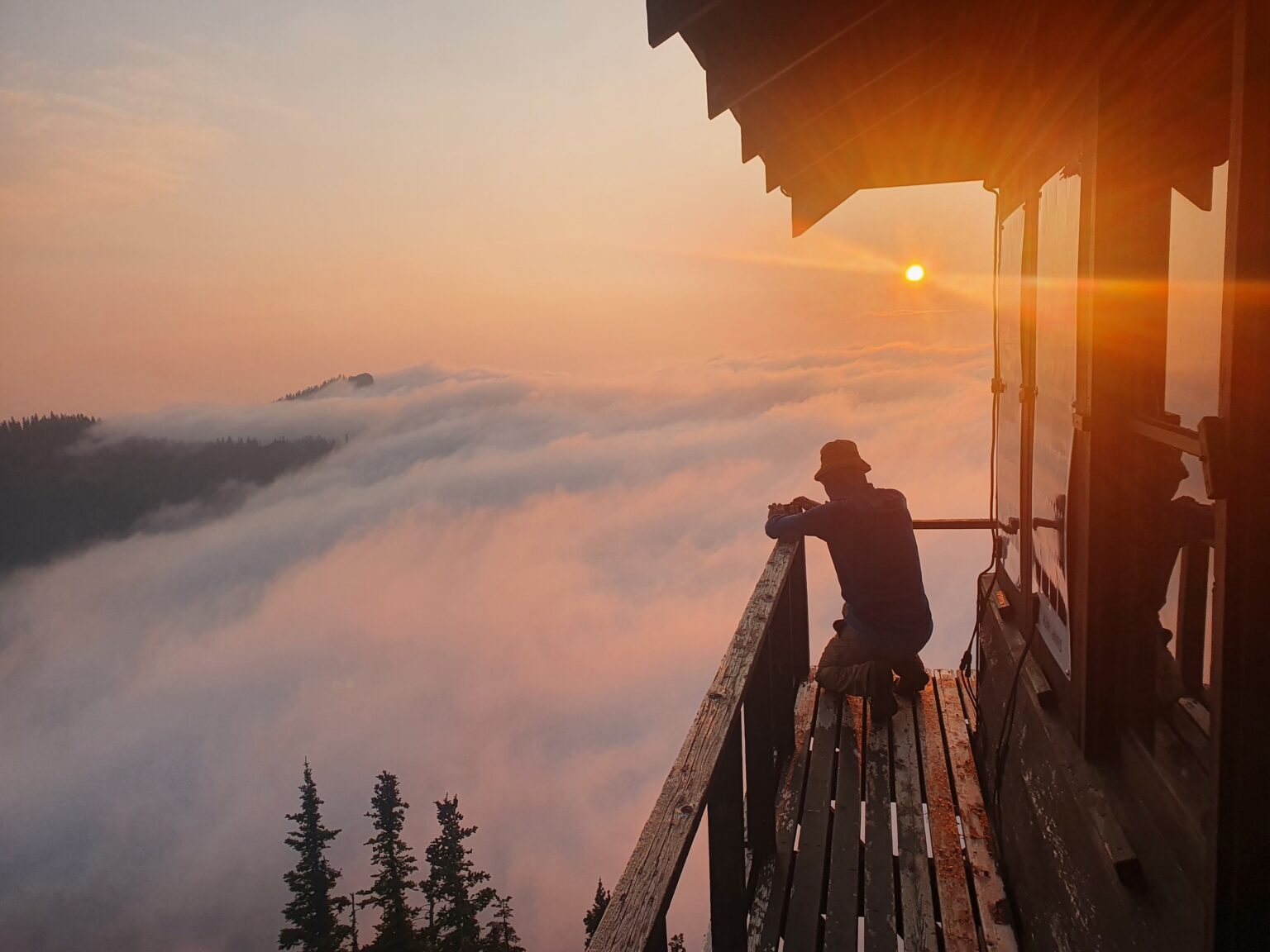
Sunset at Goblers Knob Lookout
Putting our heads down we followed the road up to the George Lake Trail and once arriving on the shores we set up our camp. It was still a few hours before sunset so we grabbed our headlamps and walked up to the Lookout tower. Arriving at our view point Rainier was in view but there were a few clouds that obscured a full view.
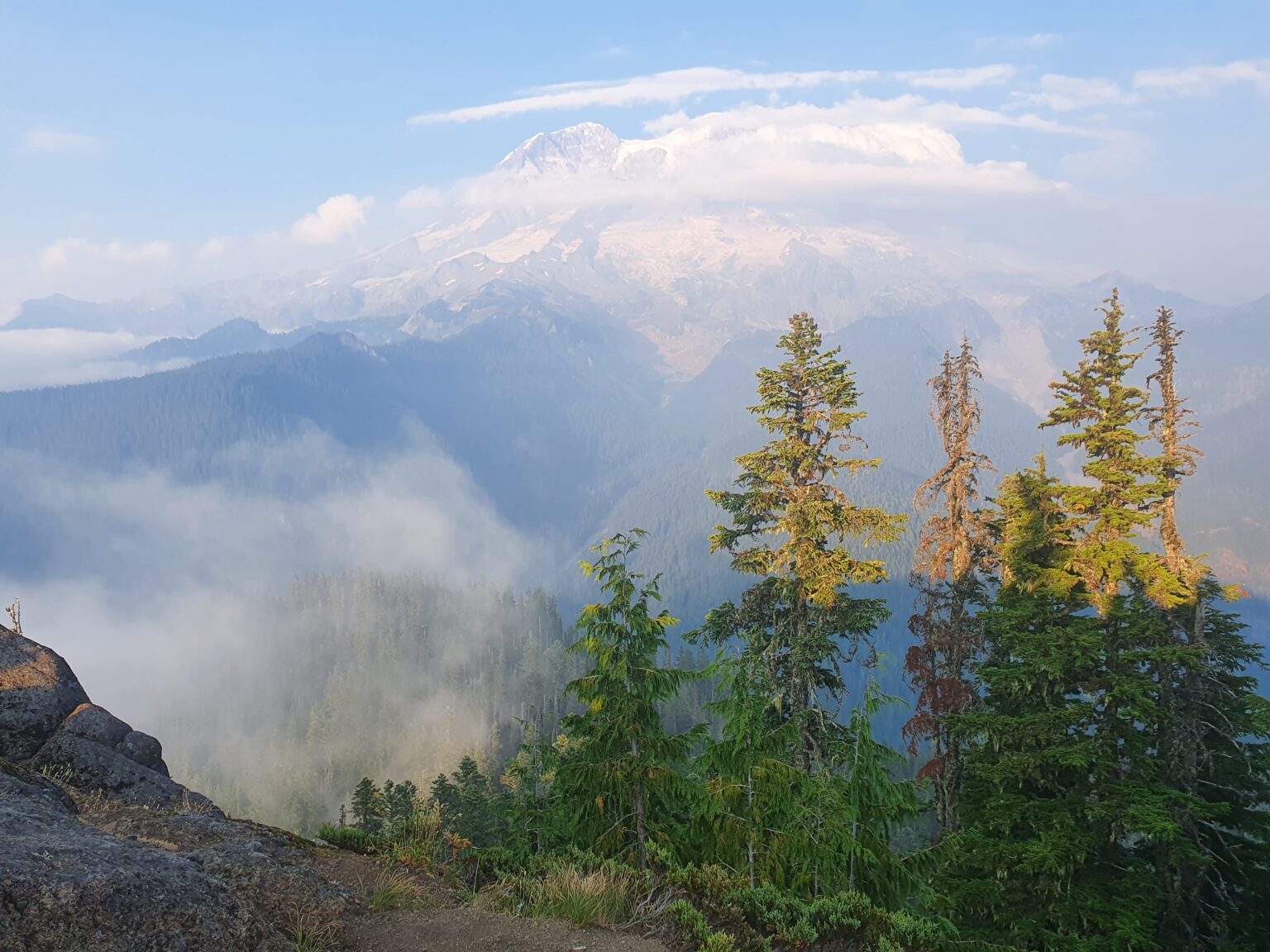
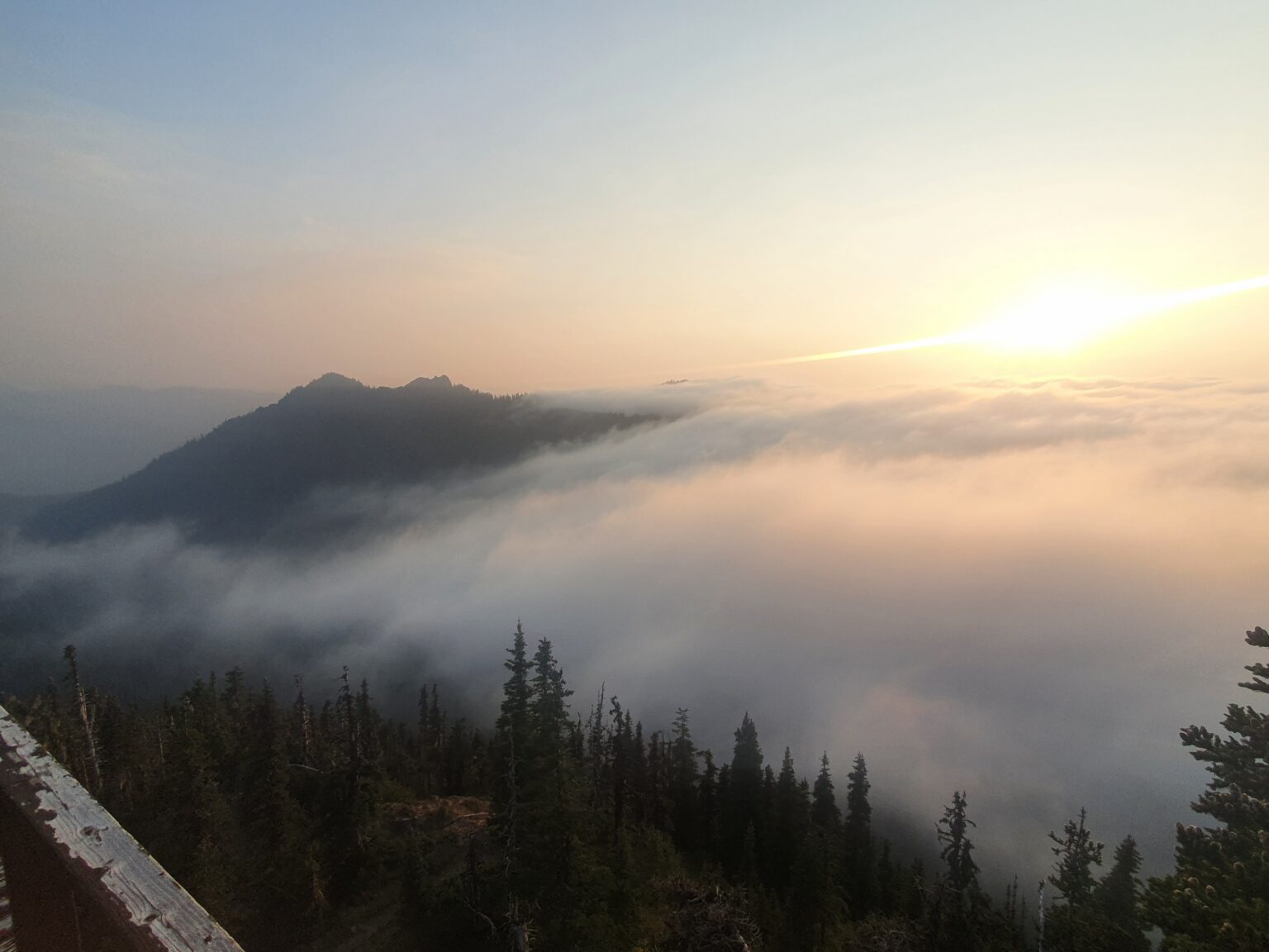
Off to the west was a sea of clouds slowly heading our way. In the distance we could see it coming and going but it seemed we were just far enough away to not get engulfed.
Once the sun went below the clouds we walked back down to camp and immediately went to sleep so we could return for the Sunrise.
Day 4:Exiting to Kautz Creek Trail
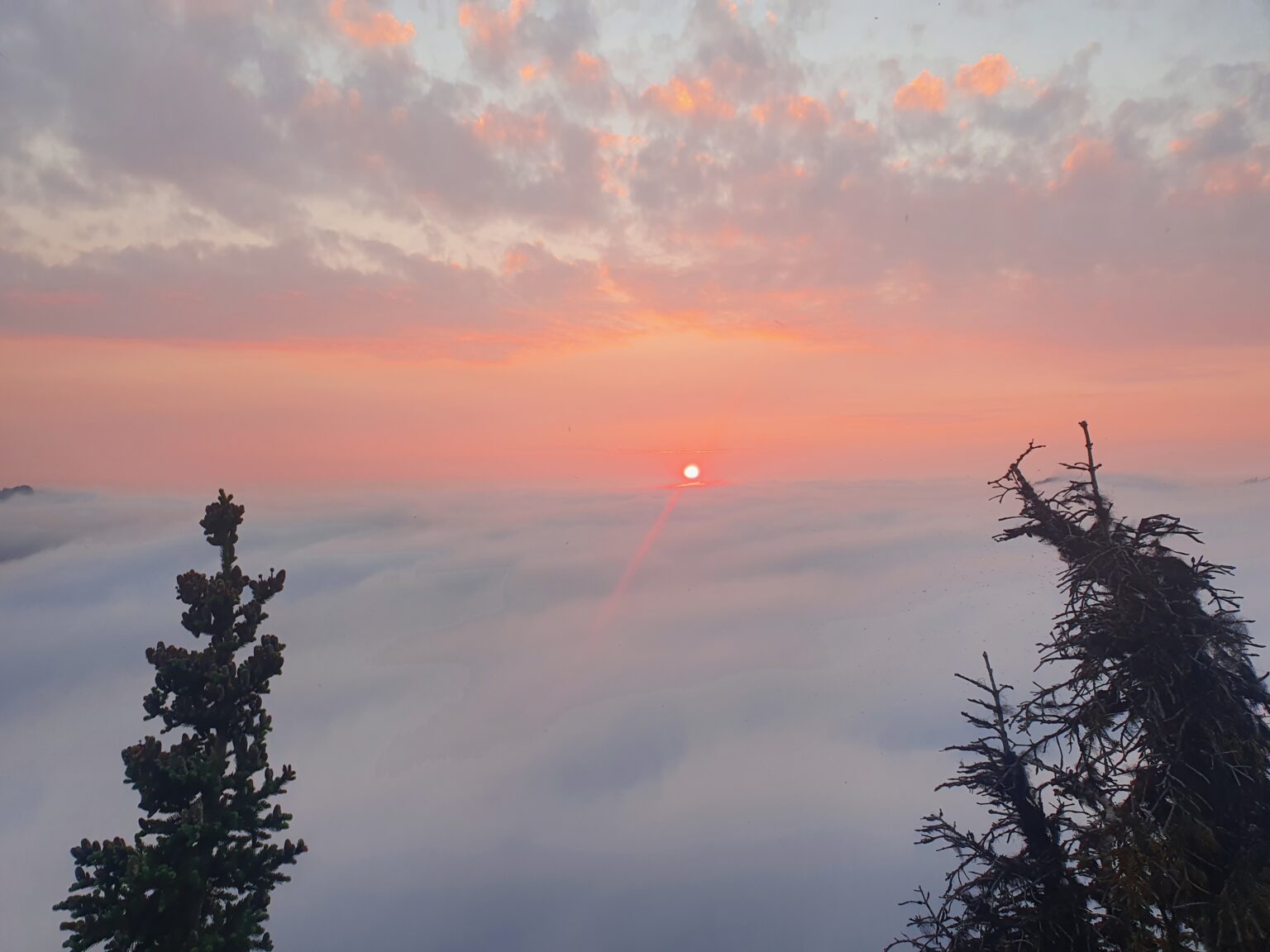
Walking up to the lookout tower in the dark we wondered if it was even worth it. Walking through thick clouds we finally broke above them but there was no view of Rainier to be had.
After eating breakfast and enjoying our last morning on Mount Rainier it was time for the long exit. Walking back to George Lake we threw our gear back into our packs and started moving down valley.
The next few hours were a blur as we walked down the West Side Road and back to the Kautz Creek Trailhead. By then our shoes were alling apart and being held together with tape. Arriving at Bens Van we were happy that the shoes had survived the West Side Loop. Though the weather hadn’t fully cooperated with us it was still great to get out on one final trip with him on my favourite mountain.
It was my final trip in Mount Rainier National Park for the summer of 2022. I was a bit sad to say goodbye to friends, family and the mountains that hold so many memories to me. A few days later I was back on a plane to Northern Finland. Once arriving home I joked that I felt like I went from Hawaii to Alaska. It was time to put the shorts away and start preparing for a long and cold winter.
Thank you for making it to the end and here is a list of the hiking trips in Summer 2022.