Stevens Ridge and Cowlitz Park on the Southeast side of Mount Rainier National Park is a rare area without trails in beautiful alpine terrain. Stevens Ridge itself is a 3 mile scenic almost knife ridge which drops away to the Stevens Canyon Road 2,000 feet below being mostly without trees. Cowlitz Park is numerous huge alpine bowl rarely visited by both hikers and climbers. Combining this two areas into one big loop would be a great way to explore new zones and get great views of Mount Rainier.
When you hear about the South side of Mount Rainier there is a good chance Cowlitz Park doesn’t come to mind. This year around I tried to come up with new hikes within the park and my friend Boot mentioned Stevens Ridge. Studying the map I connected Cowlitz Park by hiking to the base of the Cowlitz Glacier before climbing back into the alpine. By parking in Stevens Canyon we would turn it into a loop by exiting using the Wonderland trail via Indian Bar.
Day 1: Stevens Canyon to Stevens Ridge
The roads to Mount Rainier have been a mess this season with them doing construction on the Stevens Canyon road. From Mondays to Thursdays the only way you could access the Box Canyon Trailhead was via the East Side.
After a morning pilgrimage to Safeway grocery story in Greenwater we parked at Box Canyon where the road was closed any further. After being told that we couldn’t walk on the road we crawled through the forest until reaching our starting point a kilometre further up the road.
Climbing through the forests up to Mud Lake started easy but quickly turned into thick vegetation. Soon enough we arrived at a 10 foot rock band and careful made our way through. For the next 30 minutes we thrashed through forests before finally arriving at Mud Lake
Wrapping around Mud Lake we were able to find a small animal trail climbing up a mellow ridge in much more open forest. While the surrounding vegetation was thick we were happy to find a route through.
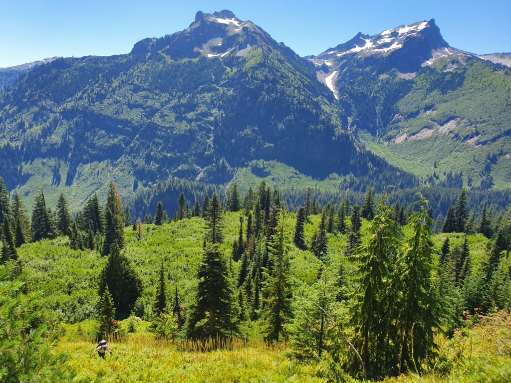
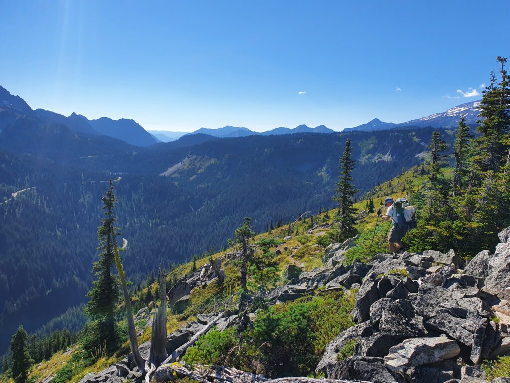
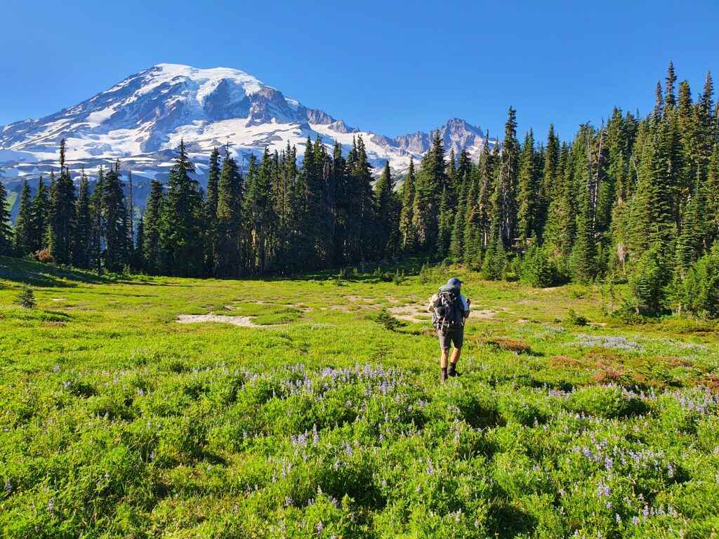
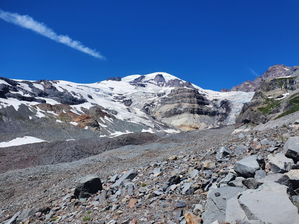
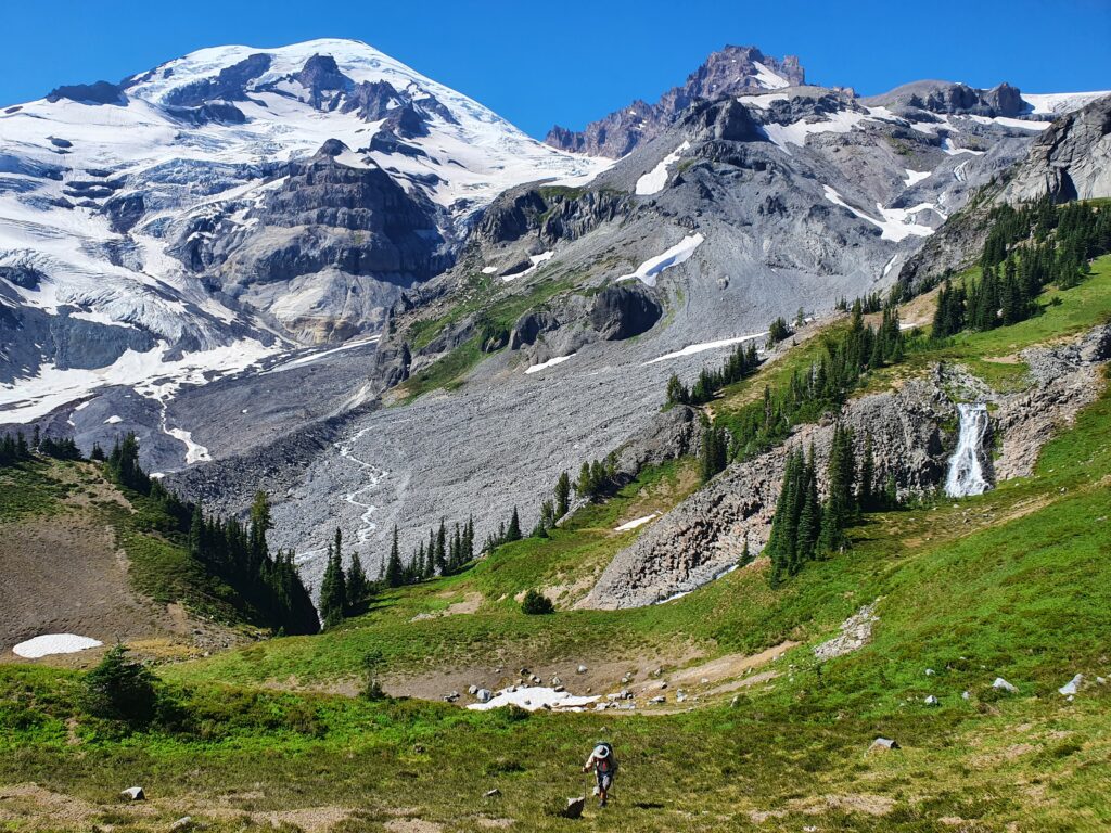
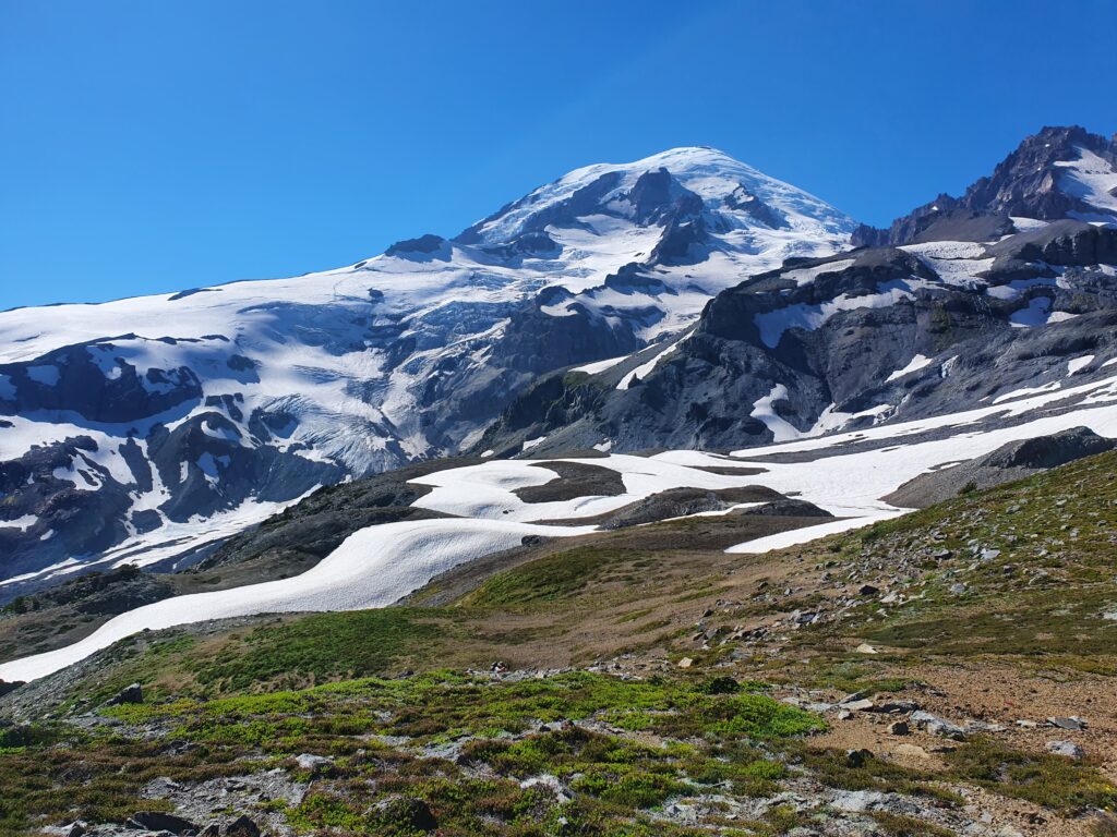
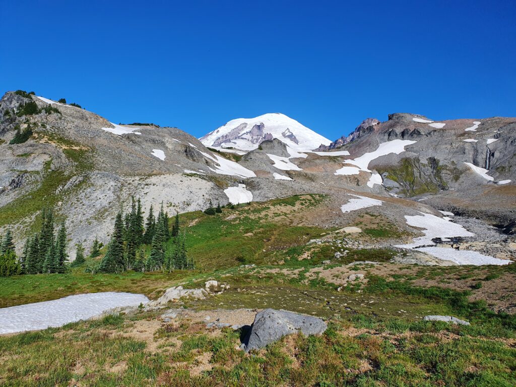
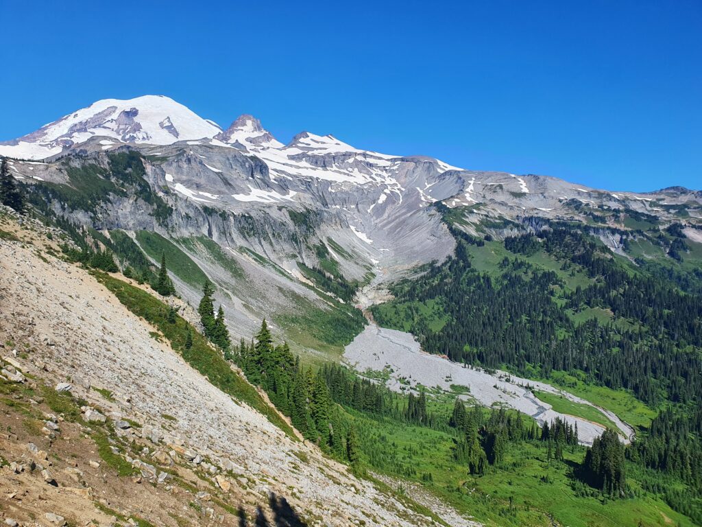
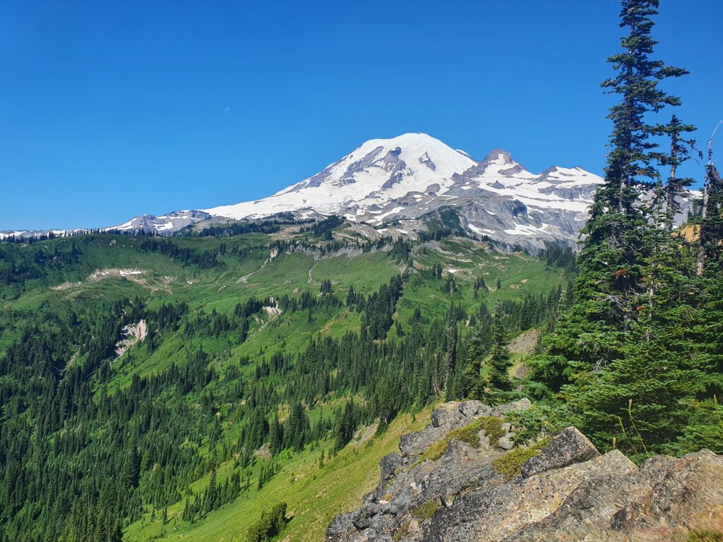
Crawling up the steep hill in the afternoon sun was draining but when we arrived on the ridge it was all worth it. Finally we had our first view of Mount Rainier as well as our route. The lower left area is Stevens Ridge and the far right where the green stops is Cowlitz Park.
Hiking along the ridge was just wide enough to be comfortable. Making our way across we would keep running into open chutes that went all the way down to the Stevens Canyon Road. All I could think of is how amazing it would be snowboard them.
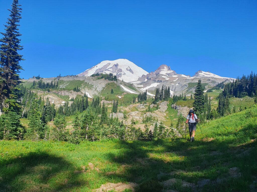
The terrain switched from open trees to pure alpine with an animal trail making progress much faster.
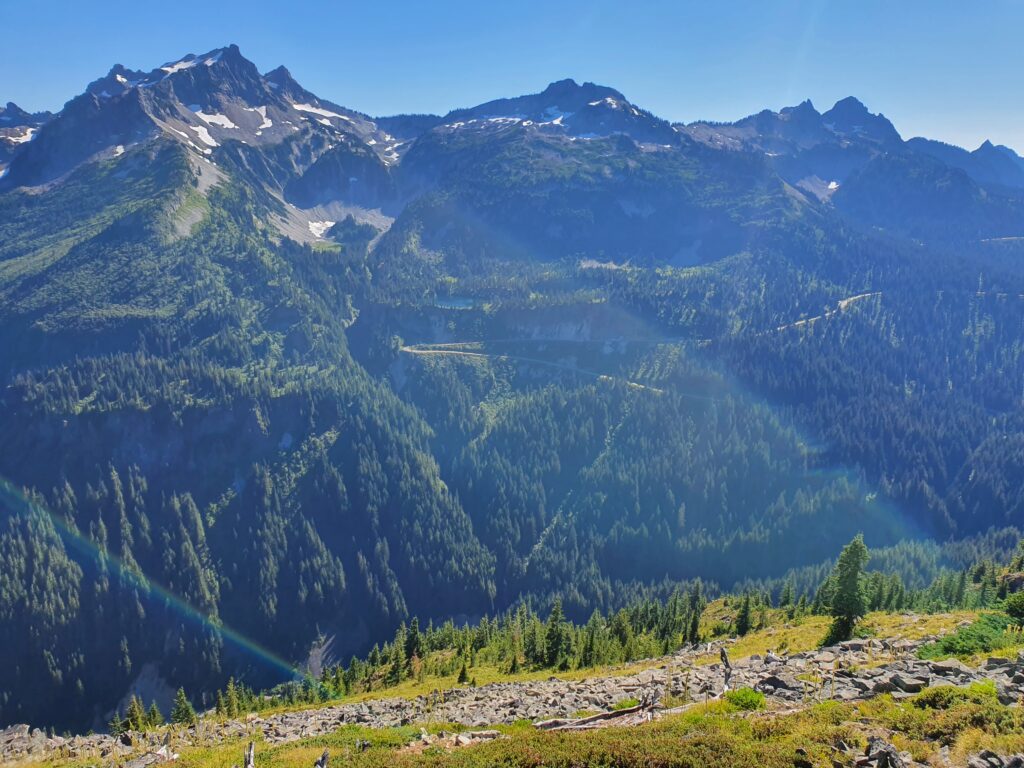
To the South was the Switchbacks of Stevens Canyon Road with the whole Tatoosh Range in the background.
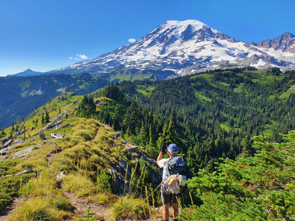
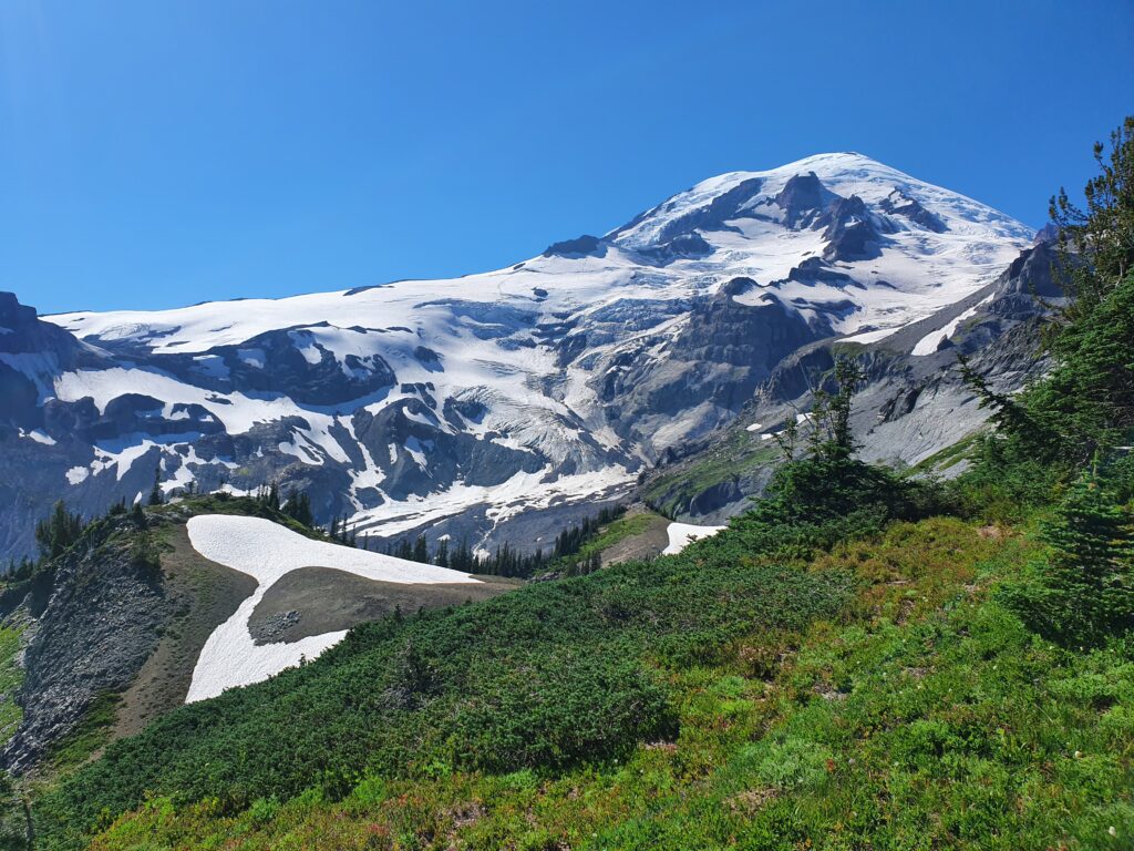
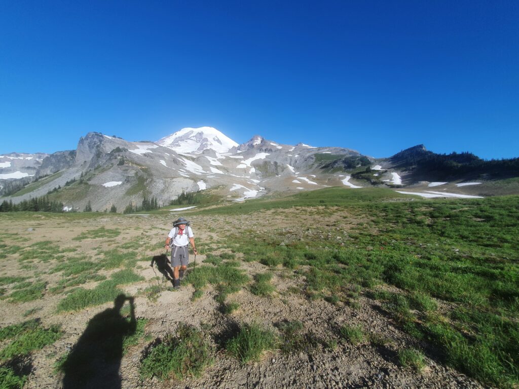
From here on out the route up Stevens Ridge was on a wide open trail with easy open bowls and stunning views of Mount Rainier.
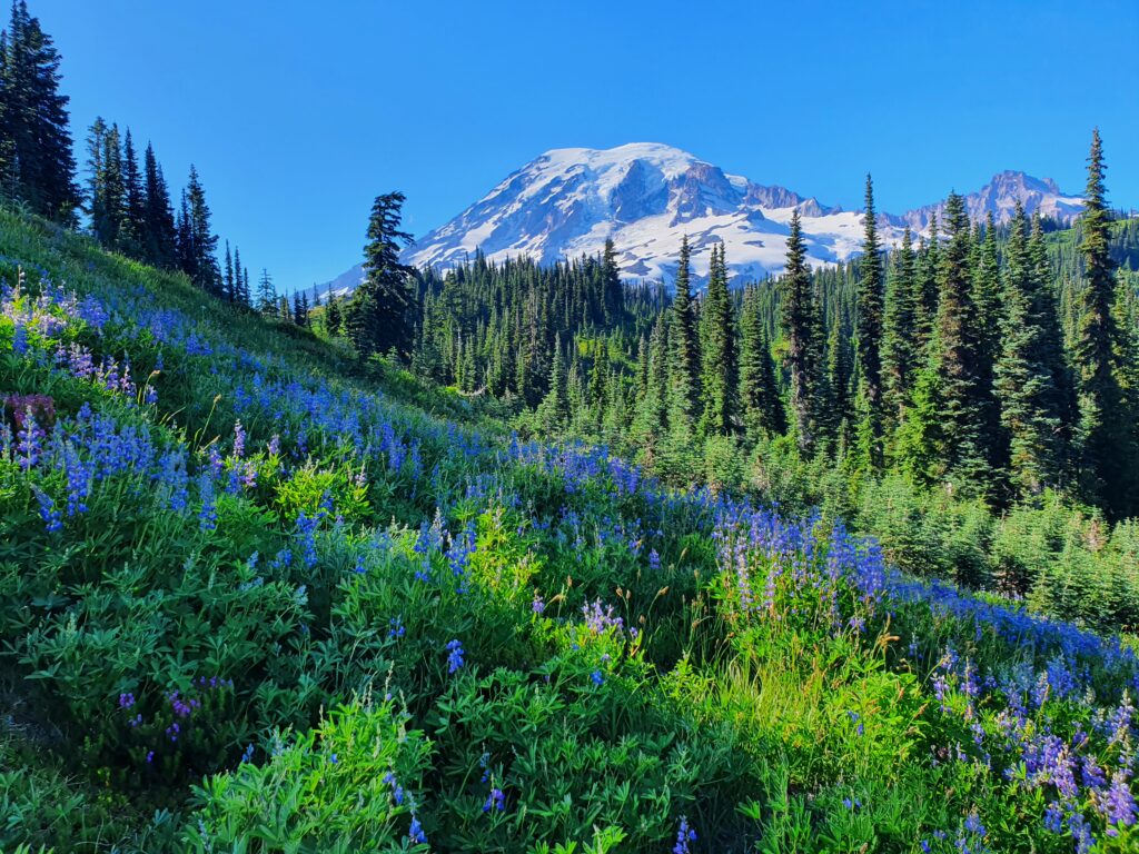
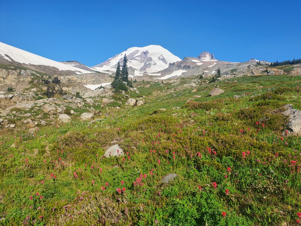
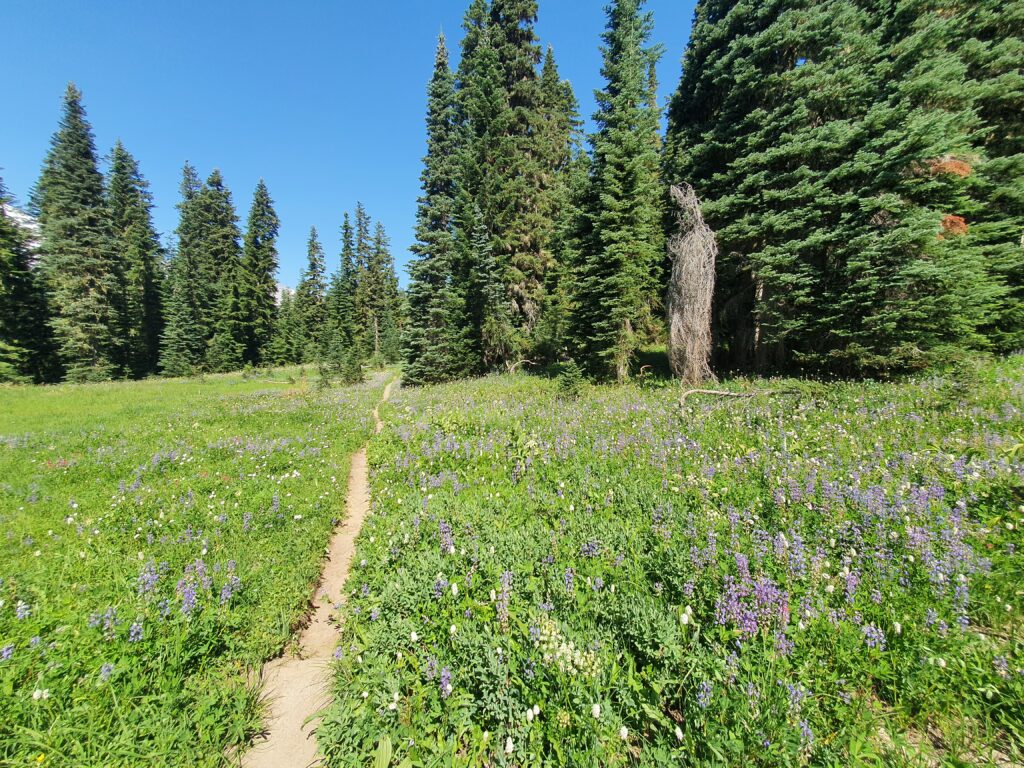
We decided to go into a lower bowl to check for water. Arriving in the bowl it was lush green with Wildflowers blooming everywhere.
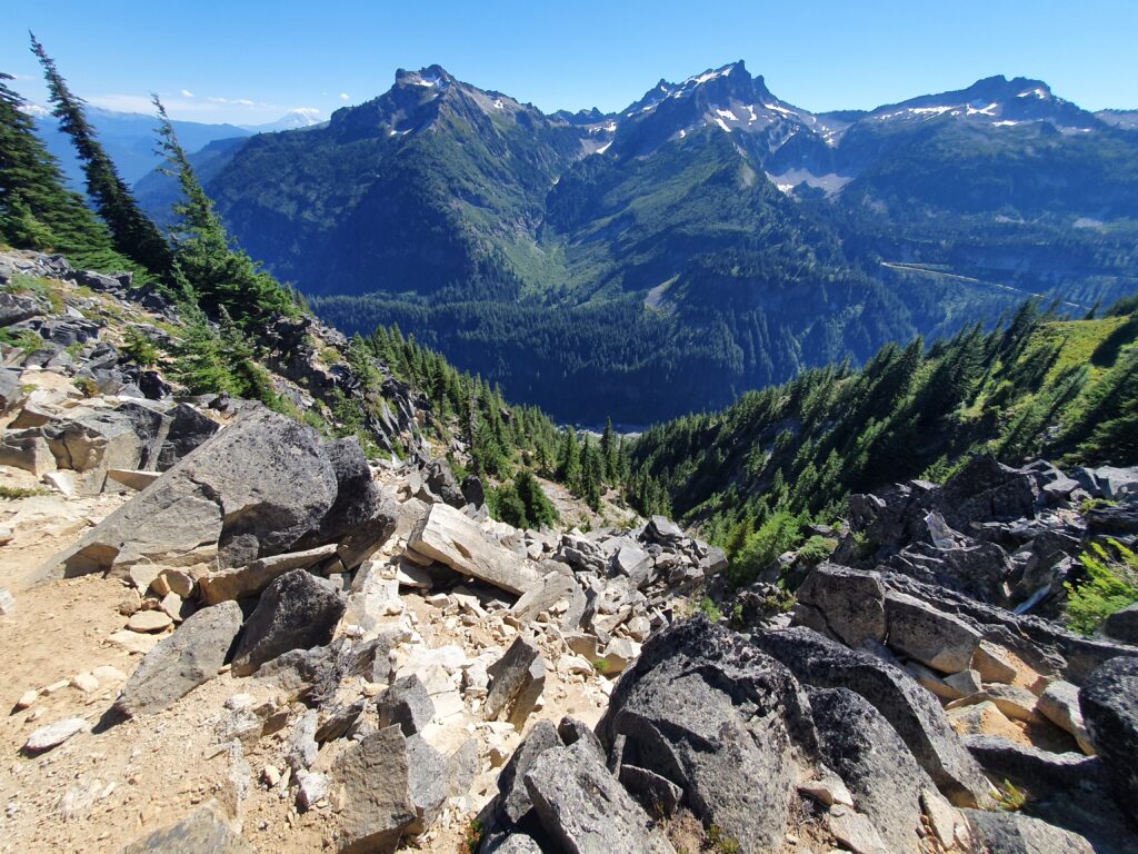
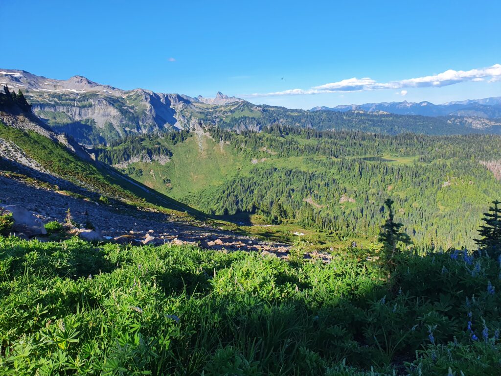
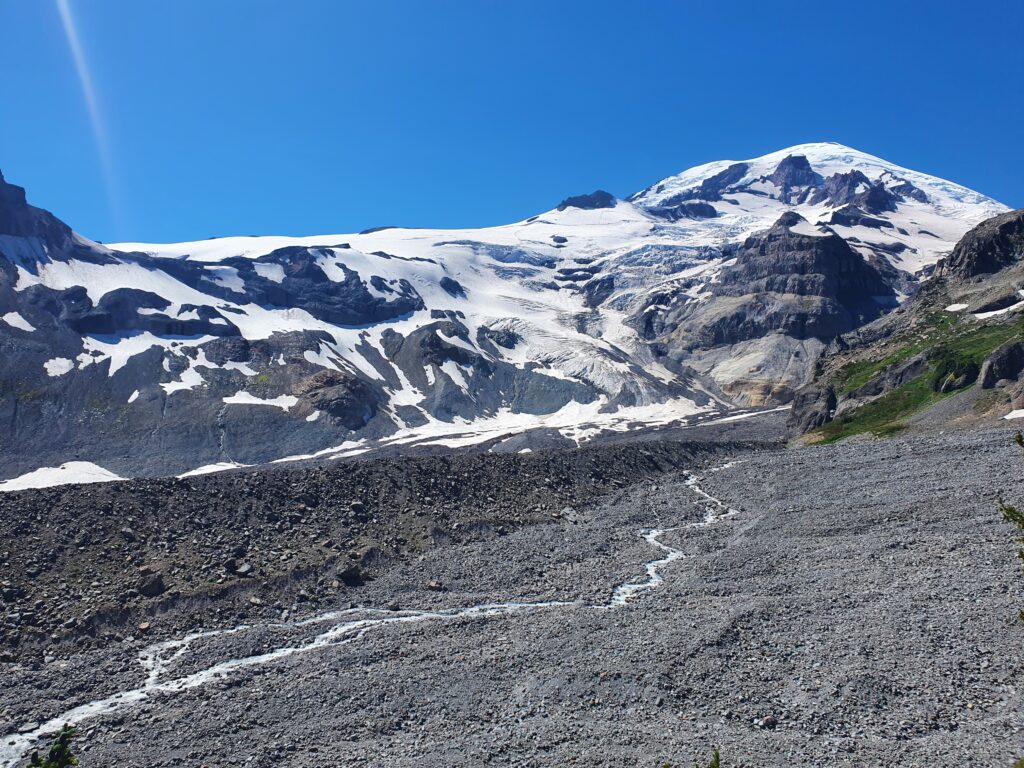
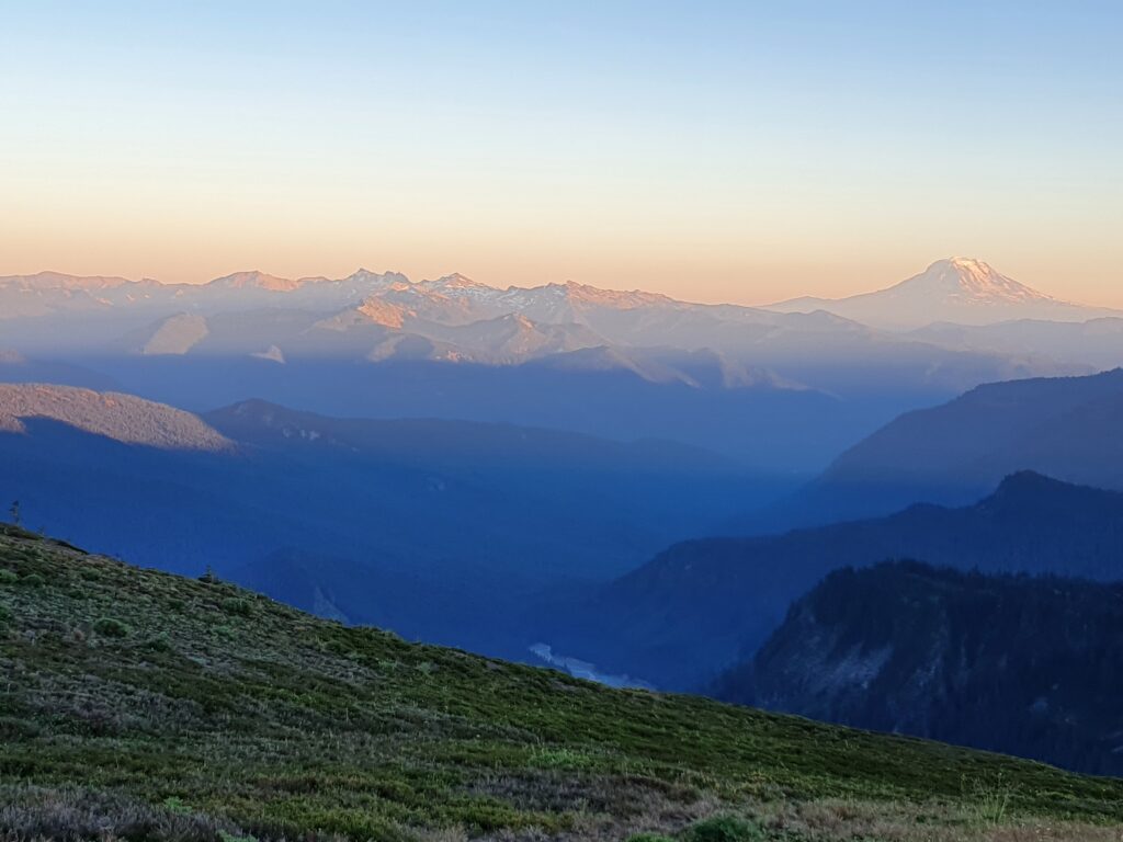
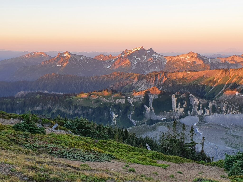
The further we climbed the more elevation we gained and the views of the Cascades started to open up. The area to the left is Stevens Ridge and the route we followed.
Looking to the East was Cowlitz Park far in the distance. By now it was getting into the late afternoon and we needed to start thinking about a camping spot. We still hadn’t passed any open water so we needed to find a camping spot near an open creek.
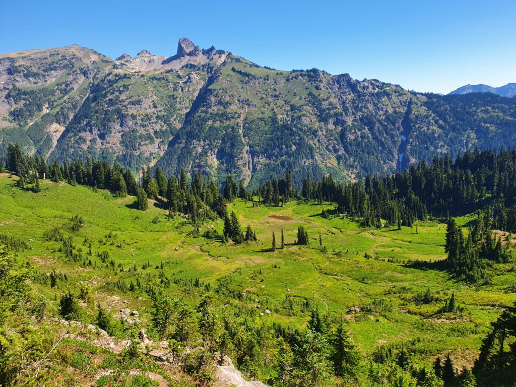
Looking towards the Cowlitz Rocks we decided to do a low traverse into the bowl to the green section just before the shaded slope in the middle of the photo.
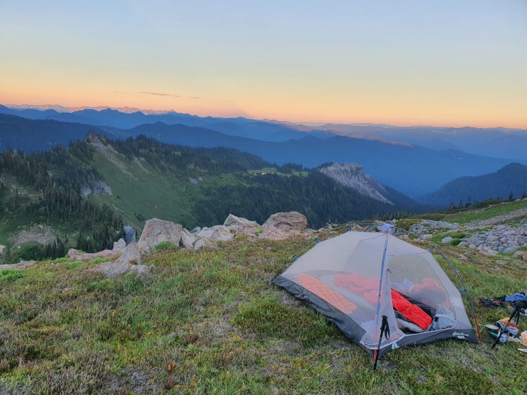
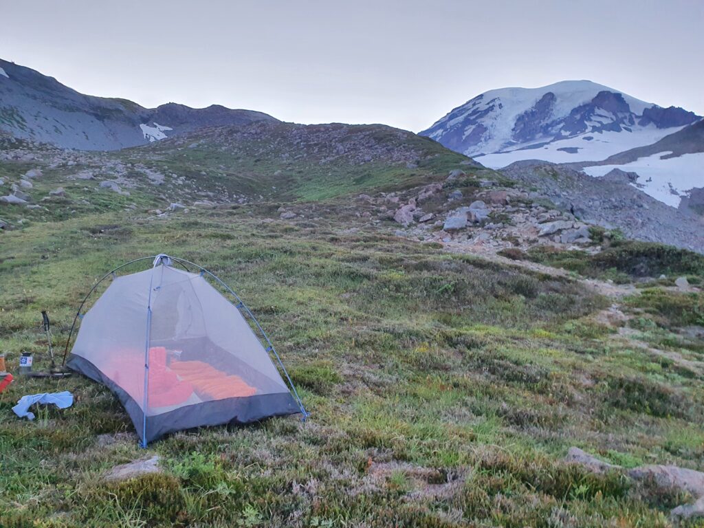
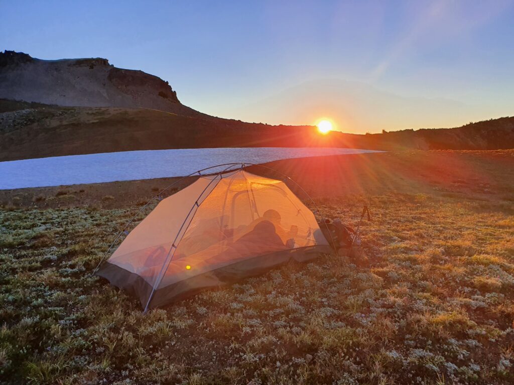
As soon as we found a stream we set up our tent and took in the sunset. From our camping spot we walked 2o feet over a massive drop to the valley below and could hear the crashing of waterfalls everywhere.
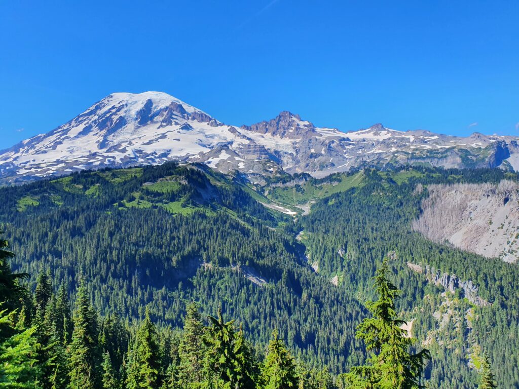
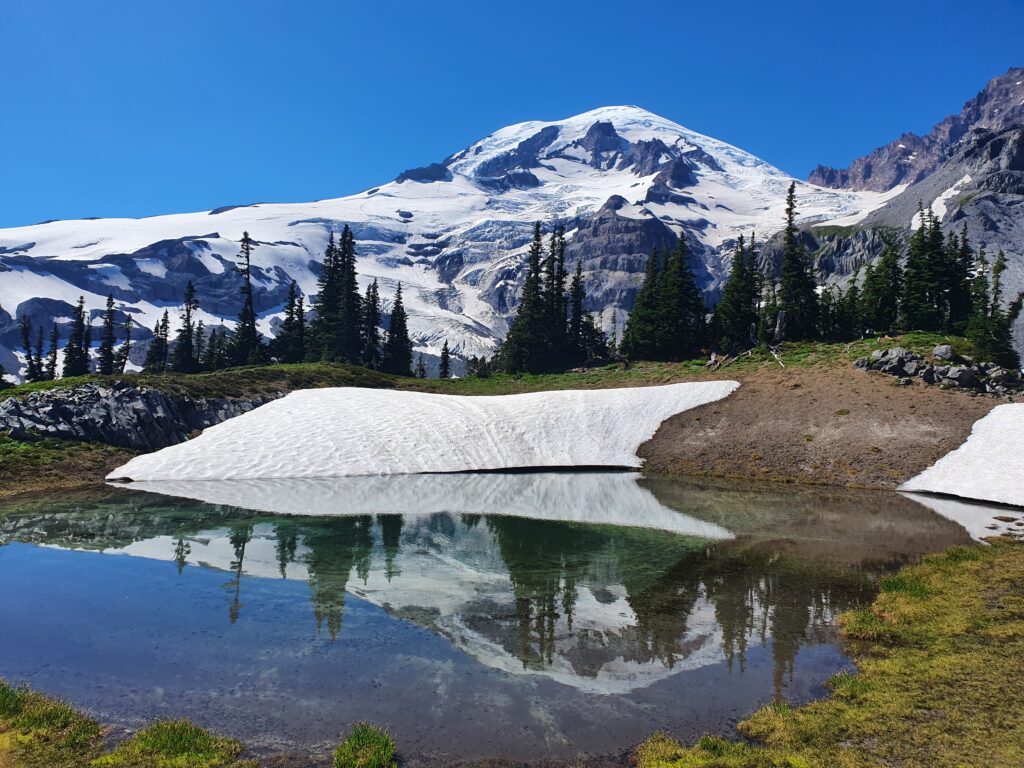
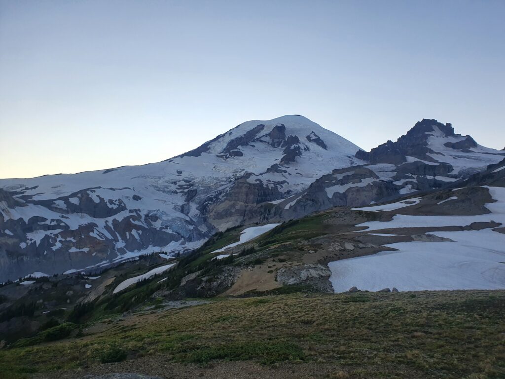
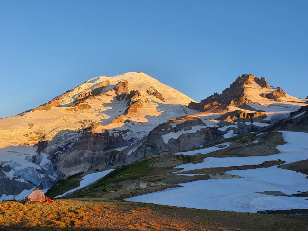
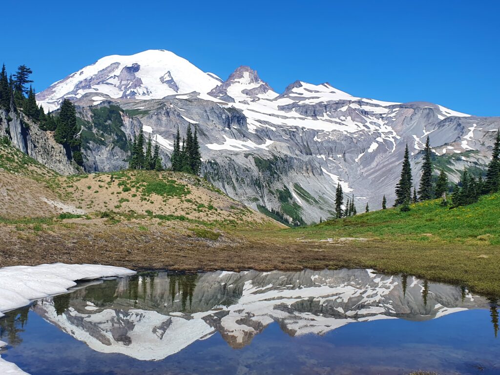
To the North we had a blocked view of Mount Rainier and could only see the upper slopes and the Muir Snowfield.
Day 2: Stevens Ridge to Cowlitz Park
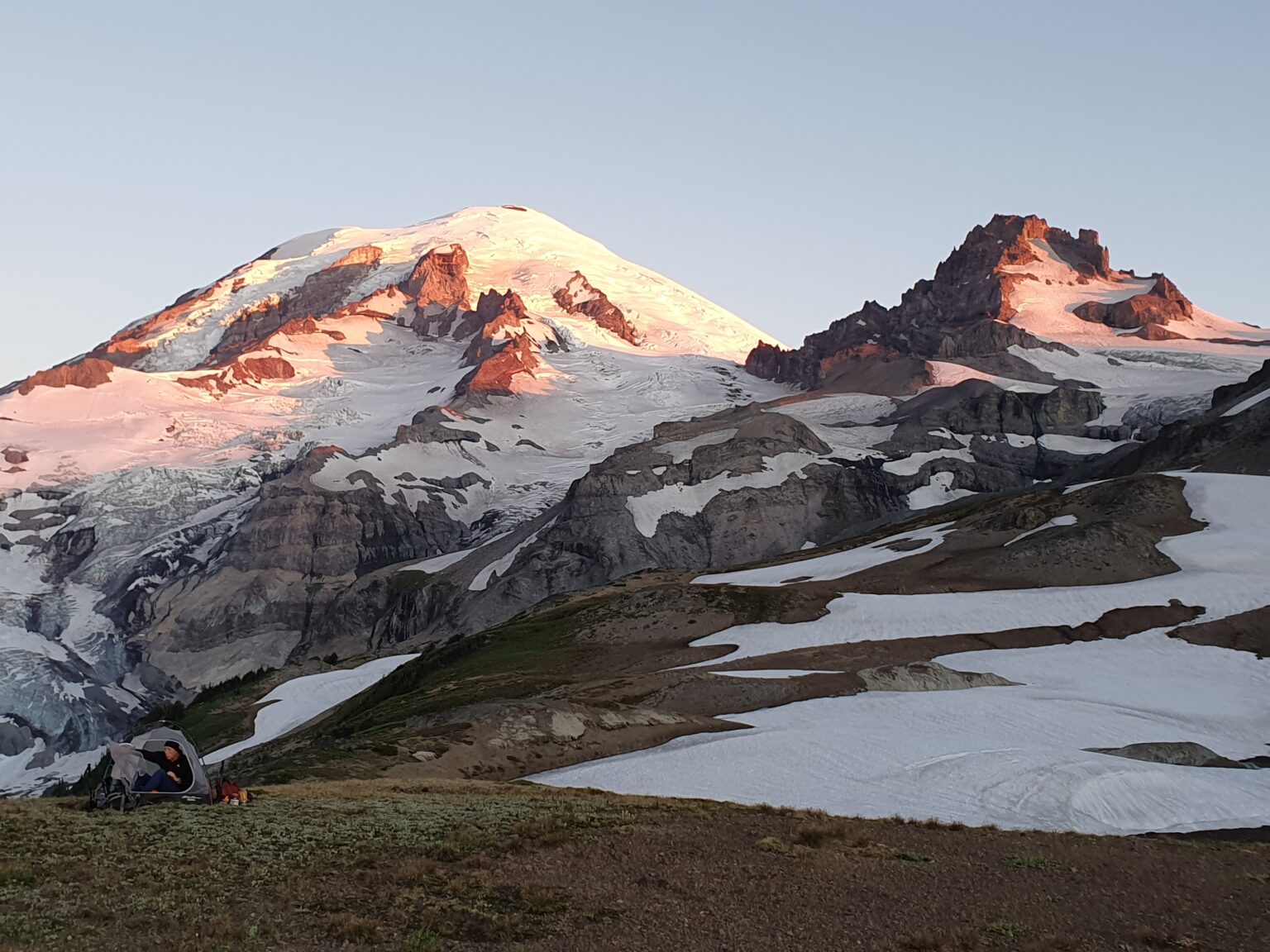
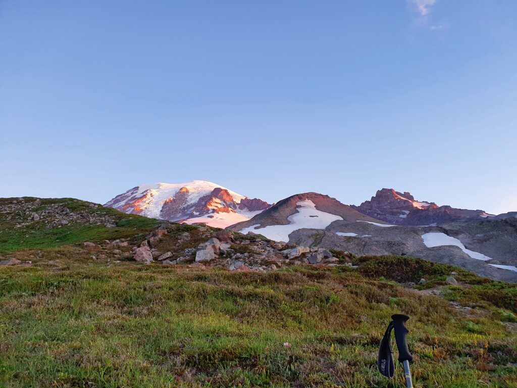
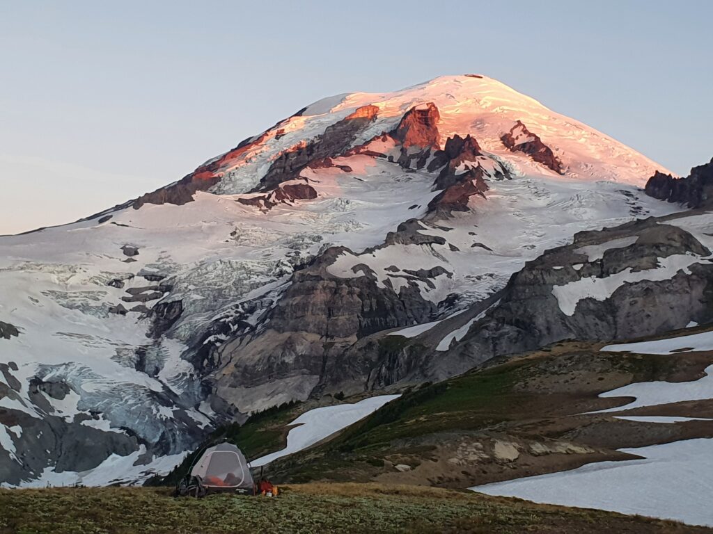
I woke up 30 minutes before the sunrise making sure I didn’t miss the show. Before long the dark blue sky turned pink on the upper slopes of Mount Rainier.
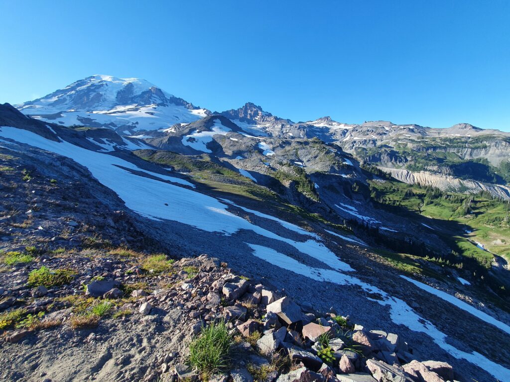
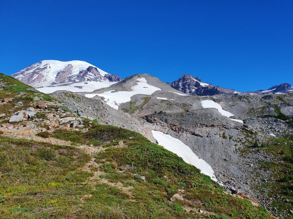
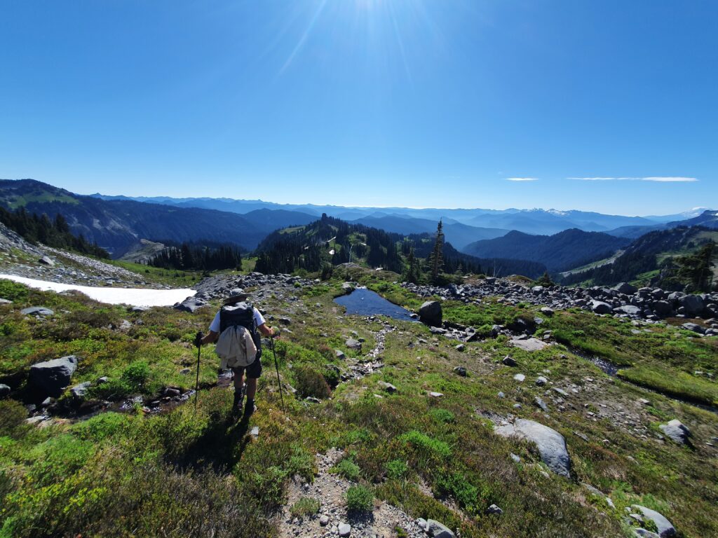
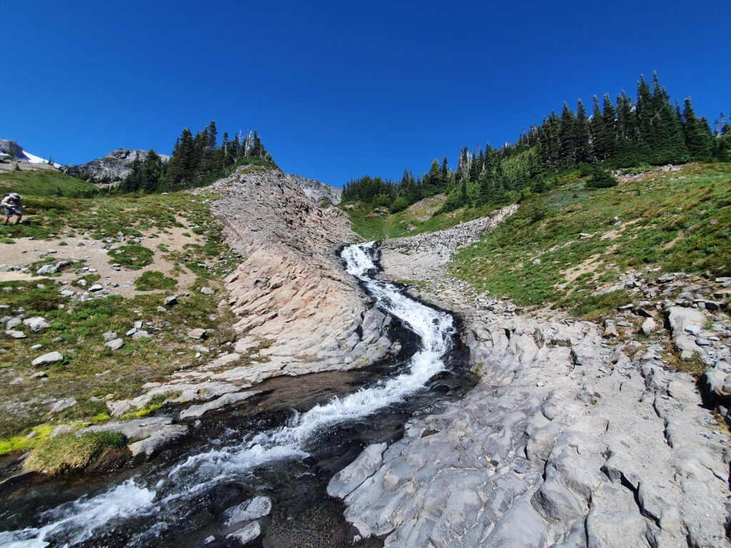
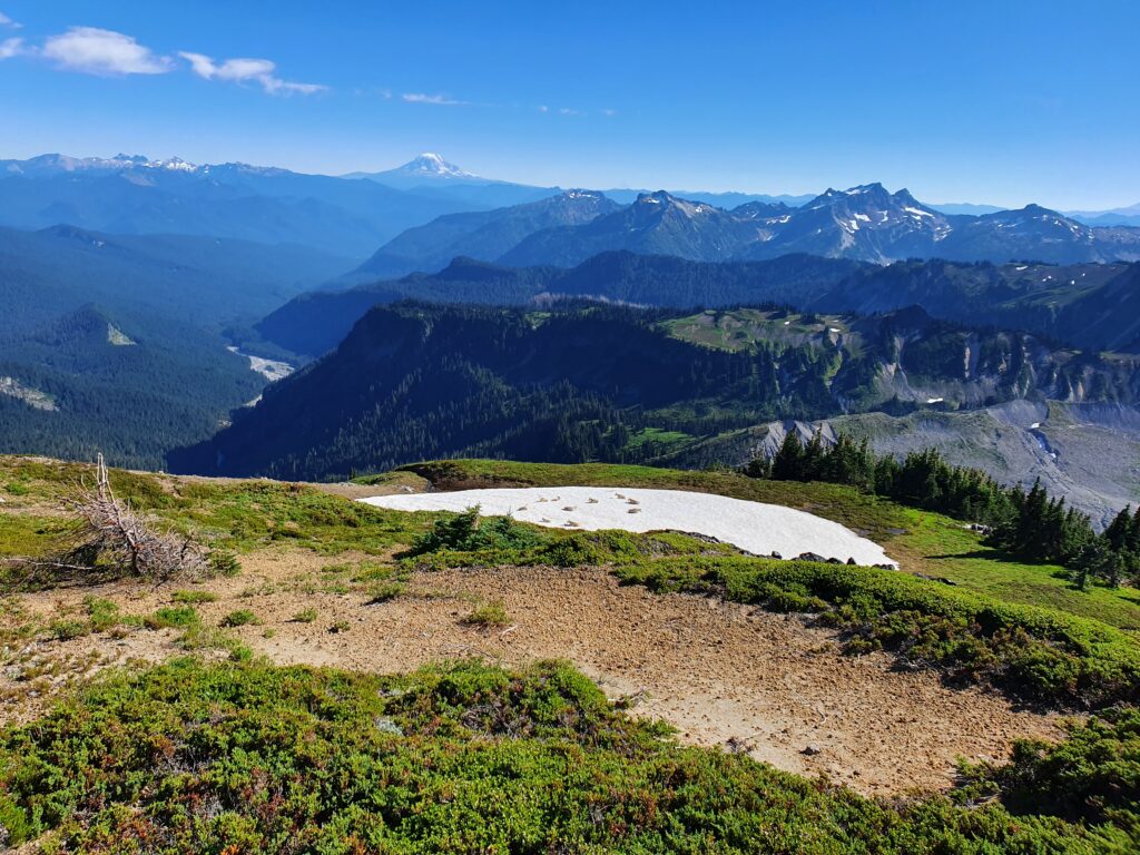
After eating breakfast it was time to get moving. Following our route we did a low traverse just above the snow patch in the photo below.
Travel was easy and we kept switching from boulders to open terrain. We were on the edge of where it was too high for vegetation to grow.
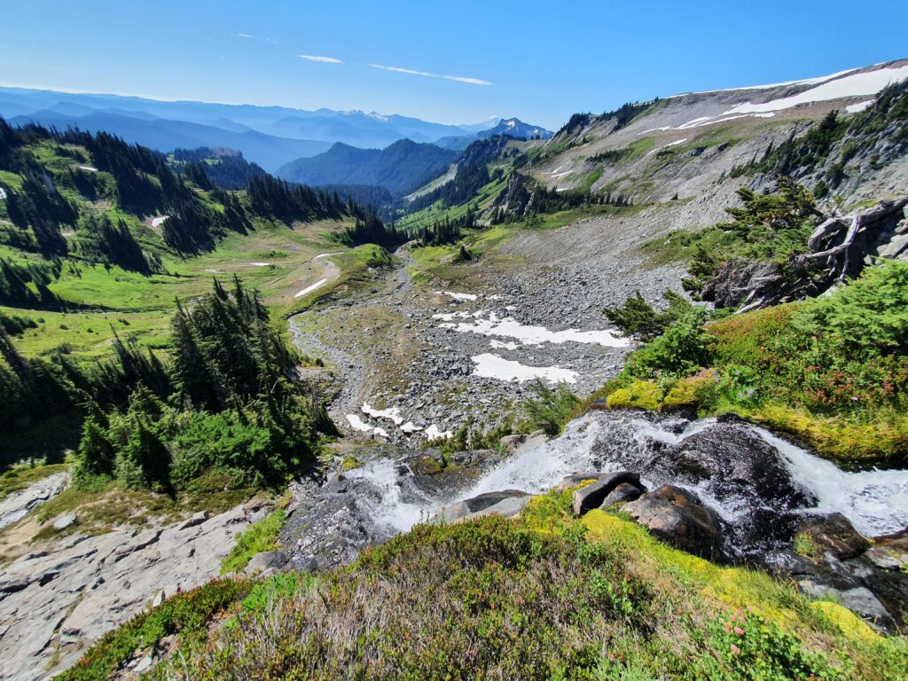
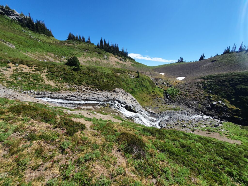
Heading across Williwakas Creek I couldn’t help but to go check out the waterfall. From the vantage point I could see our camping spot just above the cliffs on the right side.
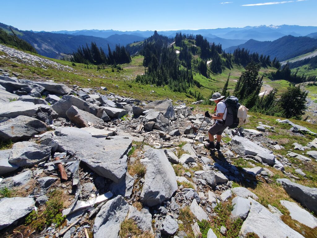
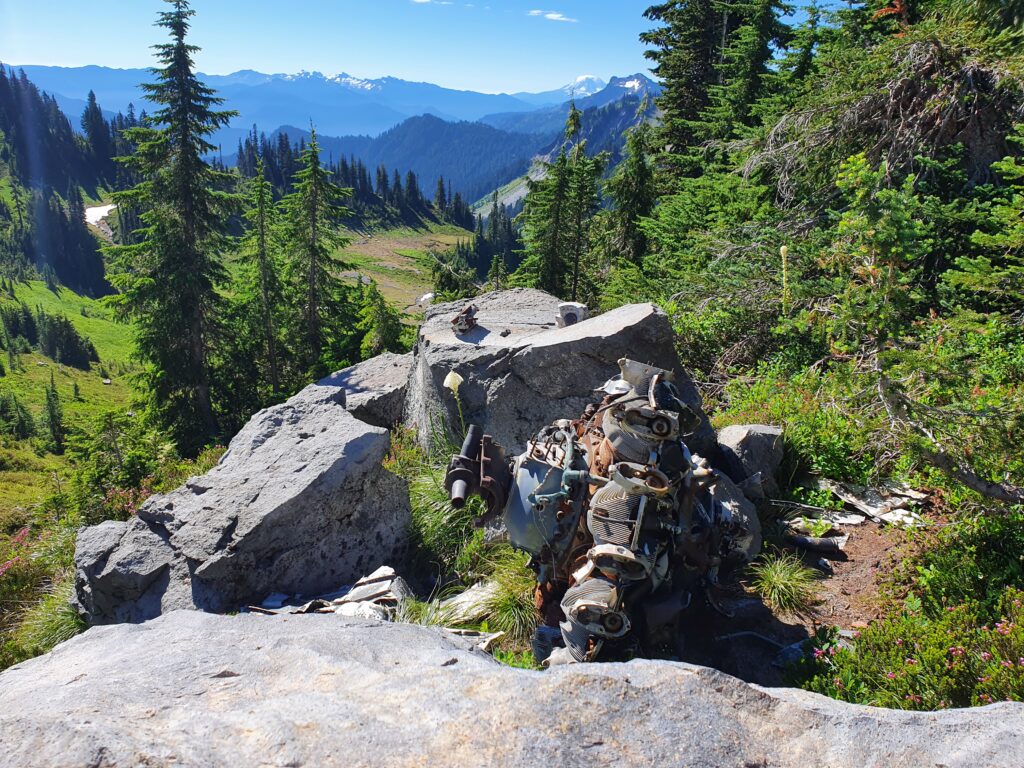
Making our way towards the Cowlitz River we did a low traverse to a low col before dropping down. Hiking past some plane wreckage we made our way to the trees in the distance in the photo below.
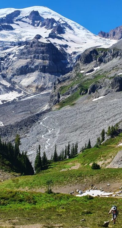
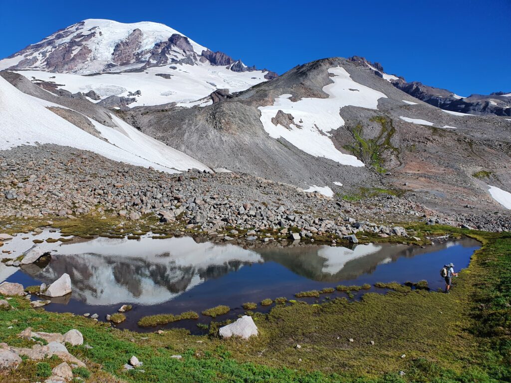
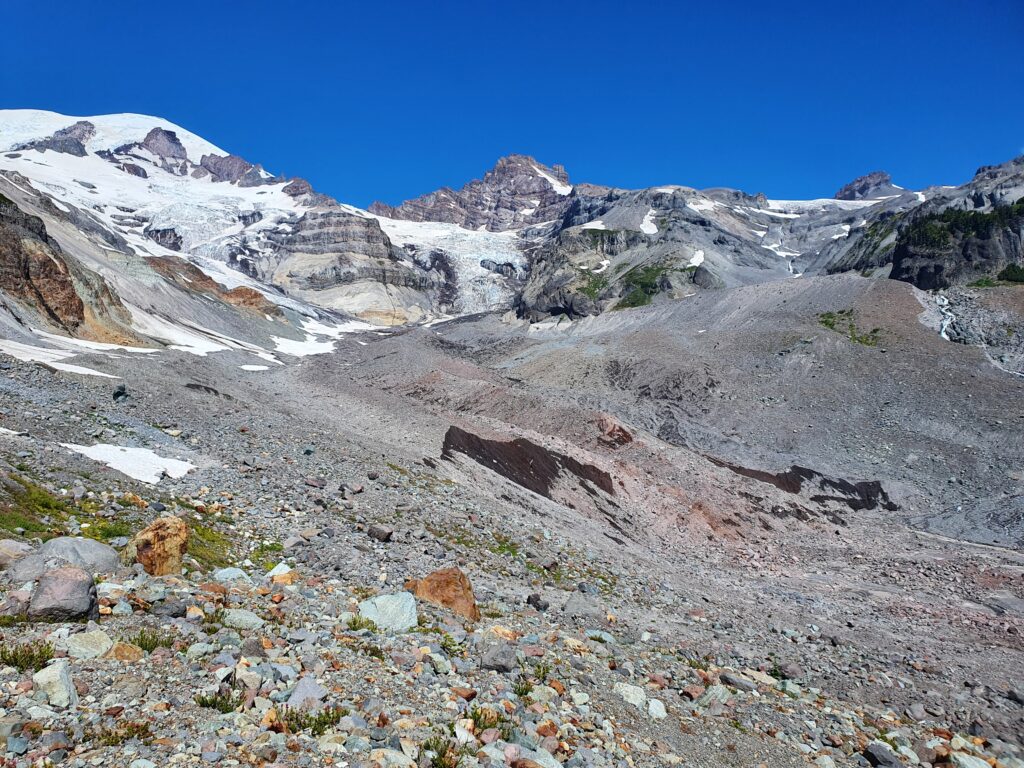
Downclimbing into the Cowlitz River Basin was steep for 800 feet before we arrived in the flats and had our first view of the crux of the route.
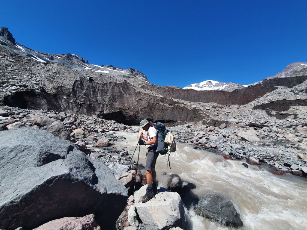
Heading across the river valley we finally arrived at the Toe of the Cowlitz Glacier. We were hoping to cross it but quickly decided agains’t it. Plan B was to climb on and over the toe of the Cowlitz Glacier
The rocks were loose as we crawled up a mellow ridge and onto the mellower slopes above.
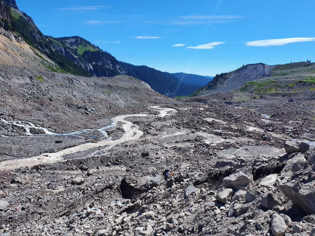
Wrapping around the river took an additional 20 minutes but was well worth it and relatively easy to get onto the other side.
The next 400 feet was open and loose moraine as we climbed up the mellowest slopes we could find to get access to Cowlitz Park.
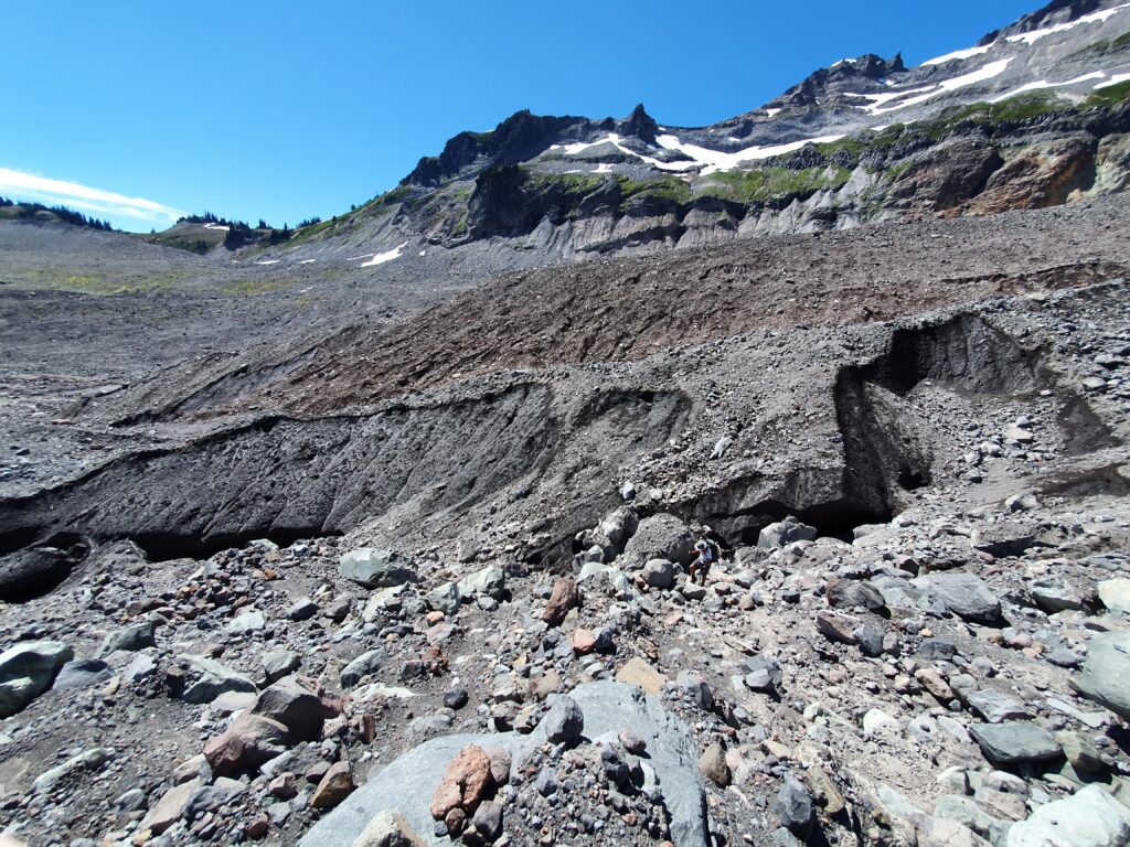
Finally arriving at Whitman Basin we were at the gate to Cowlitz Park. After 30 minutes of searching we finally crossed the stream with a few boulder hops and heading south to a cliff band that seemed climbable.
With closer inspection of the cliff band we found it was easily climbable. This was the crux of the trip and once we made our way up the terrain opened into lush green bowls again.
We quickly gained elevation to make our way to the upper bowls all within view of the terrain we had covered.
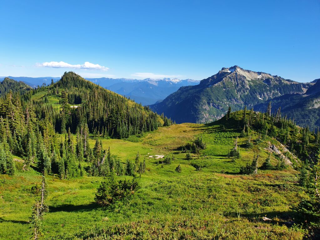
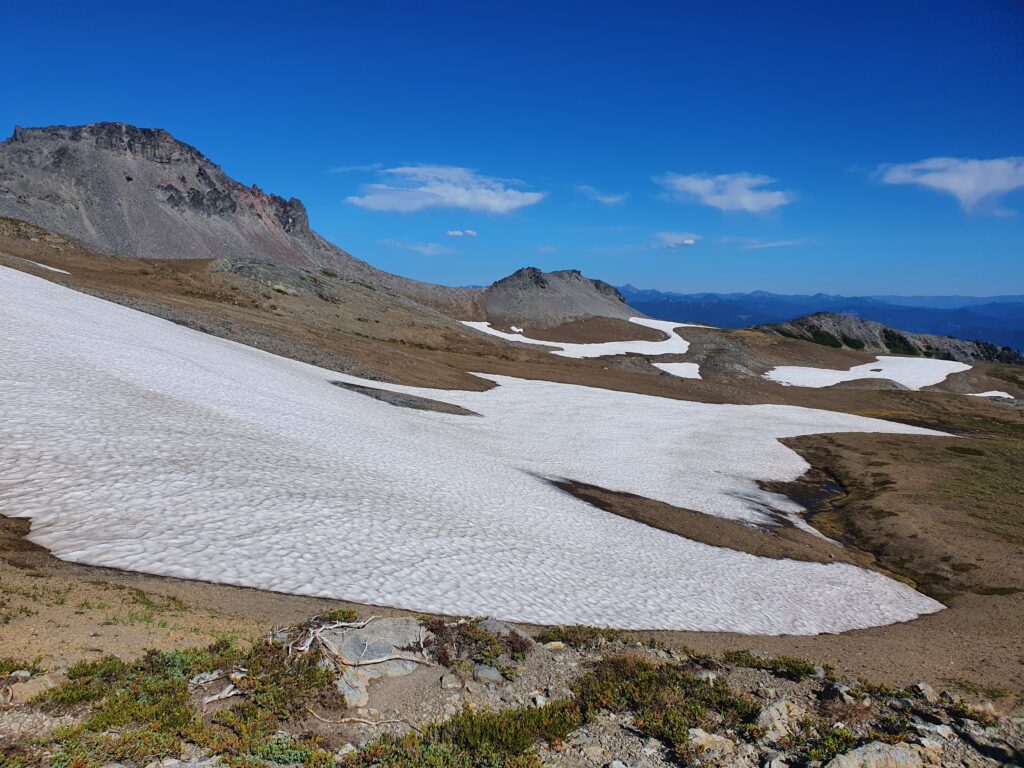
Following the mellowest slopes up we finally reached the upper bowls of Cowlitz Park. The terrain was vast and seemed to go on forever
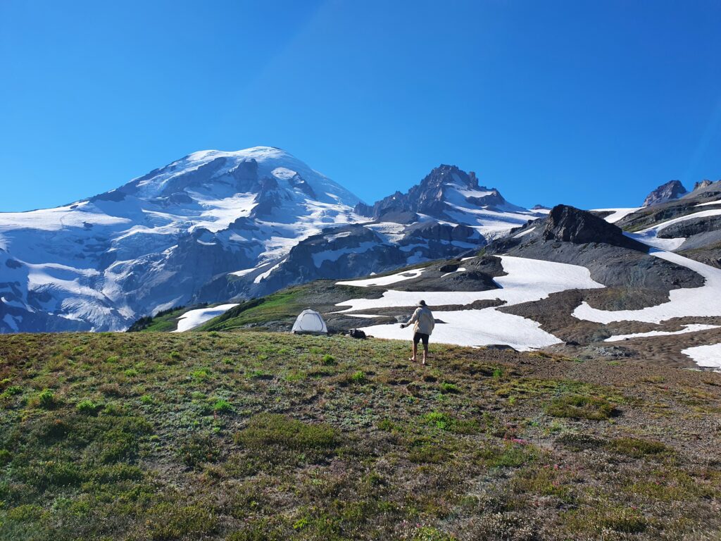
With a few more hours of sunlight it was time to start thinking of putting up a camping spot. Knowing if we went any further we would have an obstructed view of Rainier we decided to camp in the upper bowl.
For the rest of the afternoon we took in the views as a group of goats hung out on a snow patch to cool off.
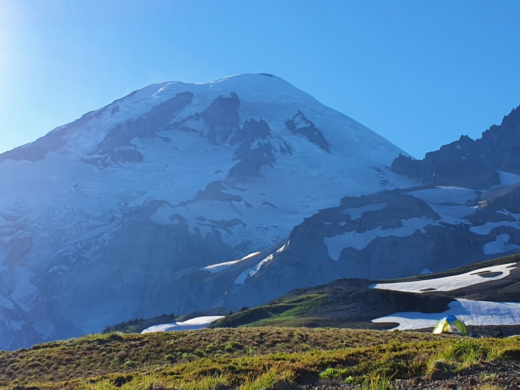
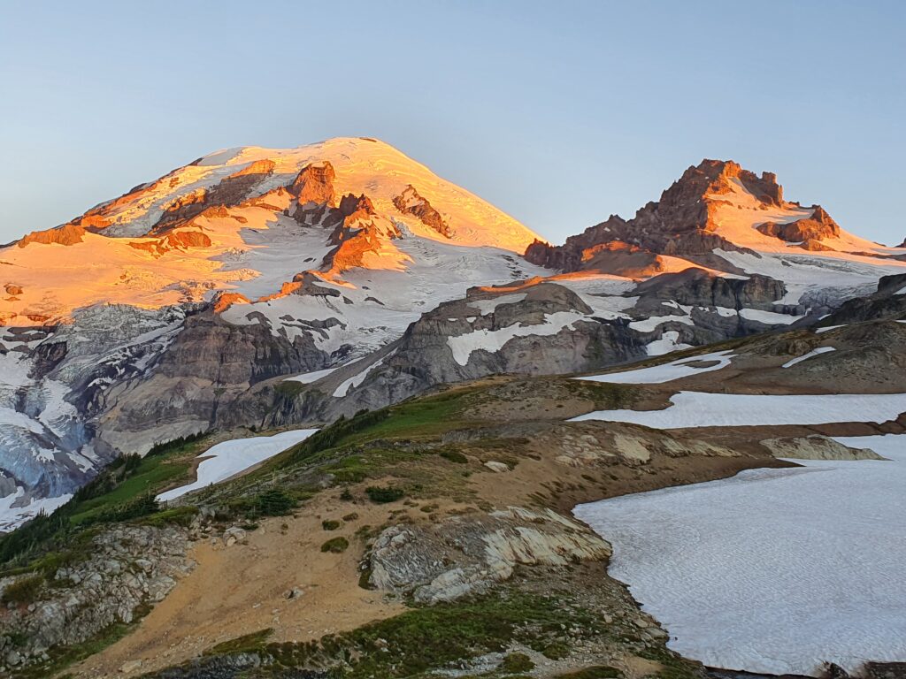
Once again I woke up 30 minutes before sunrise making sure not to miss out.
Sound enough the light show started over Mount Rainier with the Ingrham and Emmons Glaciers glowing
Once the sun reached the tent it was time to start packing. Our hope was to hike through Cowlitz Park for the next few hours before arriving on the Wonderland during the heat of the day.
Bowl after bowl we made our way to the southeast following numerous little creeks.
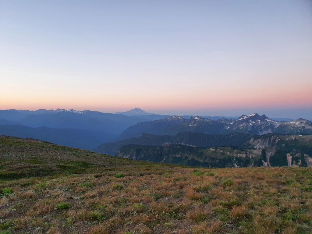
The whole Cowlitz Park area was stunning as we looked back at the terrain we covered.
Soon enough we reached the ridge just above Indian Bar and the Wonderland beyond that. In a few minutes we would be back on well maintained trails.
There was a quick celebration as we arrived back on the trail. The traverse had gone smoother then I feared and from here on out we didn’t have to wonder if we were going the wrong way.
The rest of the route followed an open ridge and views in all directions.
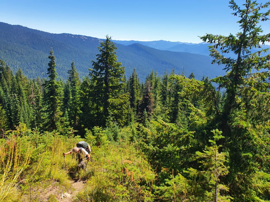
The next two hours we made our way from the alpine then into the forests finally arriving at the Box Canyon trailhead.
In the end the Stevens Ridge to Cowlitz Park hike was a great and unique way to explore Mount Rainier National Park. If you are willing to thrash through the forests of Stevens Ridge then it is well worth it. I had heard that hiking had exploded within the Park but we didn’t see anyone until arriving onto the Wonderland Trail.
Thank you for making it to the end and here is a list of the hiking trips in Summer 2022.