The Spider Gap Buck Creek Loop had been a trip in the making for many years. Being a section of Glacier Peak Wilderness the trail goes through some of the more scenic parts of the North Cascades. My good friend Skier Dan had moved to the Leavenworth area and we plotted a 4 day trip. After a train ride from Seattle and a night checking out his new property we were at the Phillips Creek trailhead and doing the trip in a Clockwise direction.
Spider Gap Buck Creek Pass Loop
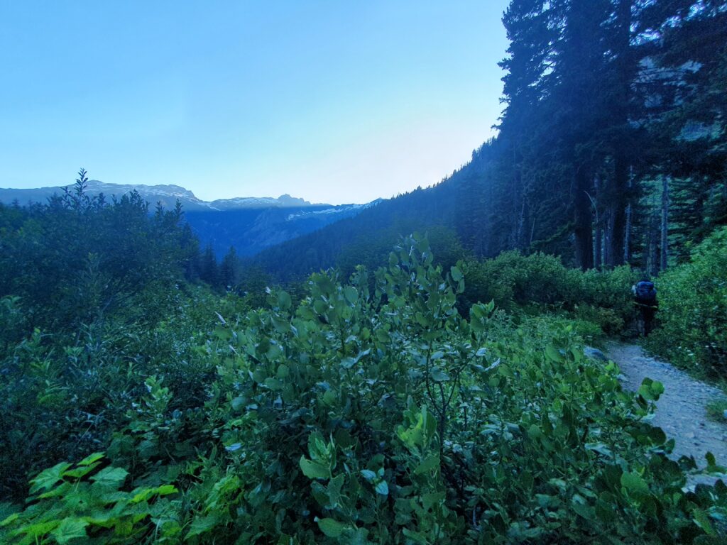
Wanting to avoid the heat wave with temperatures reaching 100 degrees we started our hike at 6 P.M. With our headlamps easily available we made our way up the Phillips Creek Valley hoping to spot a good camping spot along the way. We arrived at Spider Meadows just as the last bits of light were in the sky. Finding a flat spot we quickly set up camp happy to knock off a few miles before the real climb started to begin.
Day 2: Up and over Spider Gap to Cloudy Pass
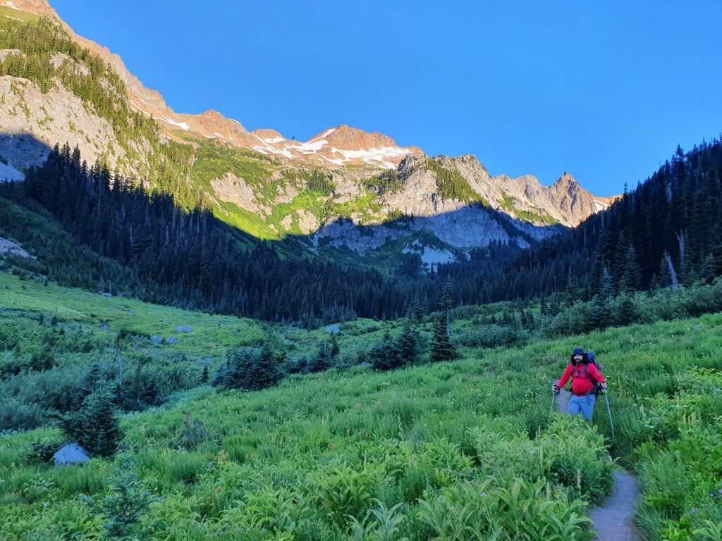
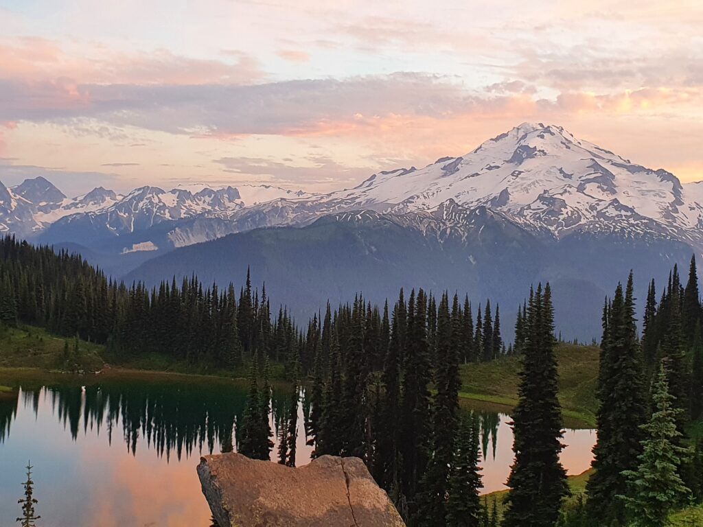
Having arrived at our camping spot in the dark we were a bit surprised when we opened our tent. We were surrounded by steep mountains basking in the early alpenglow. We had accidentally camped at one of the more scenic spots around.
After taking in the light show and drinking coffee it was time to get moving. The forecast called for it to be another hot day and we hoped to get out of the valley while it was still in the shade.
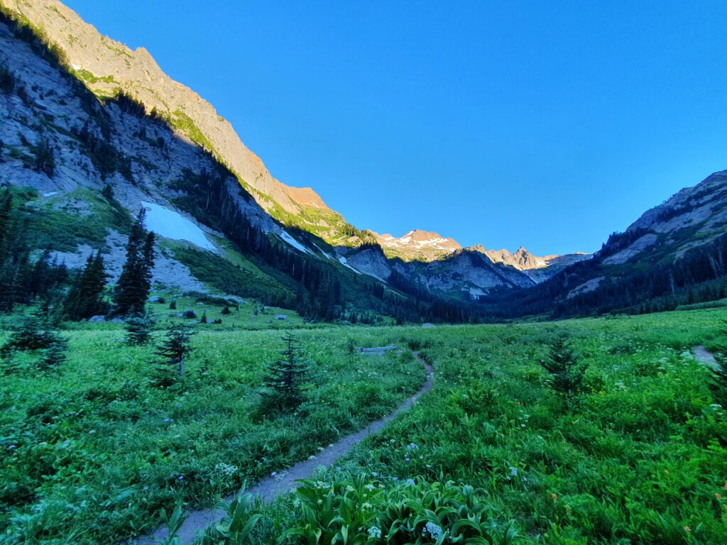
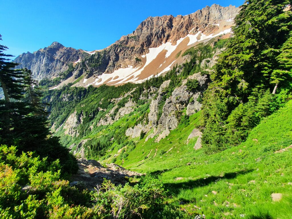
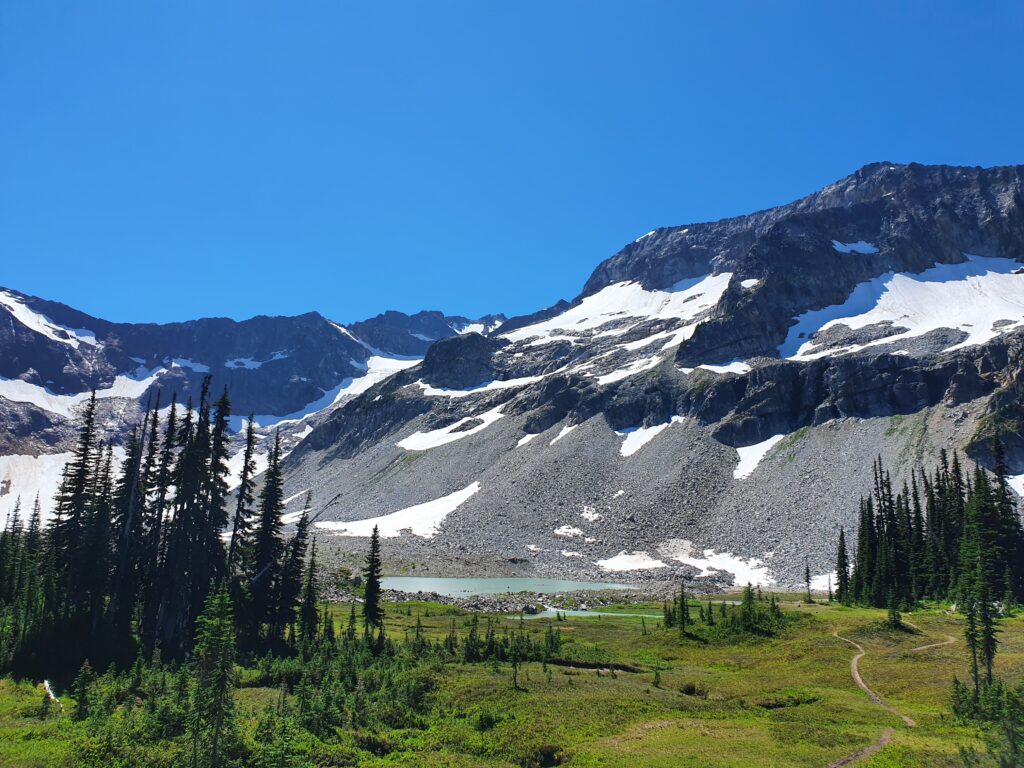
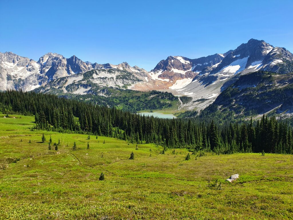
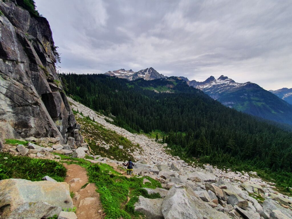
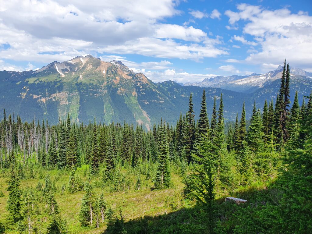
The trail rose slowly through the forest valley before up started traversing into the alpine. Below us we had a clean view of our camping spot on the far end of Spider Meadows.
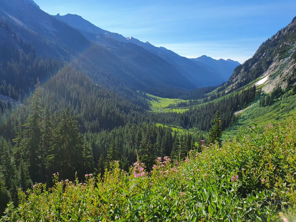
Looking up at the mountain from below we couldn’t see the route but before long we were on a well laid out trail just above the lower cliffs. By then we would be in the sun for the rest of the day.
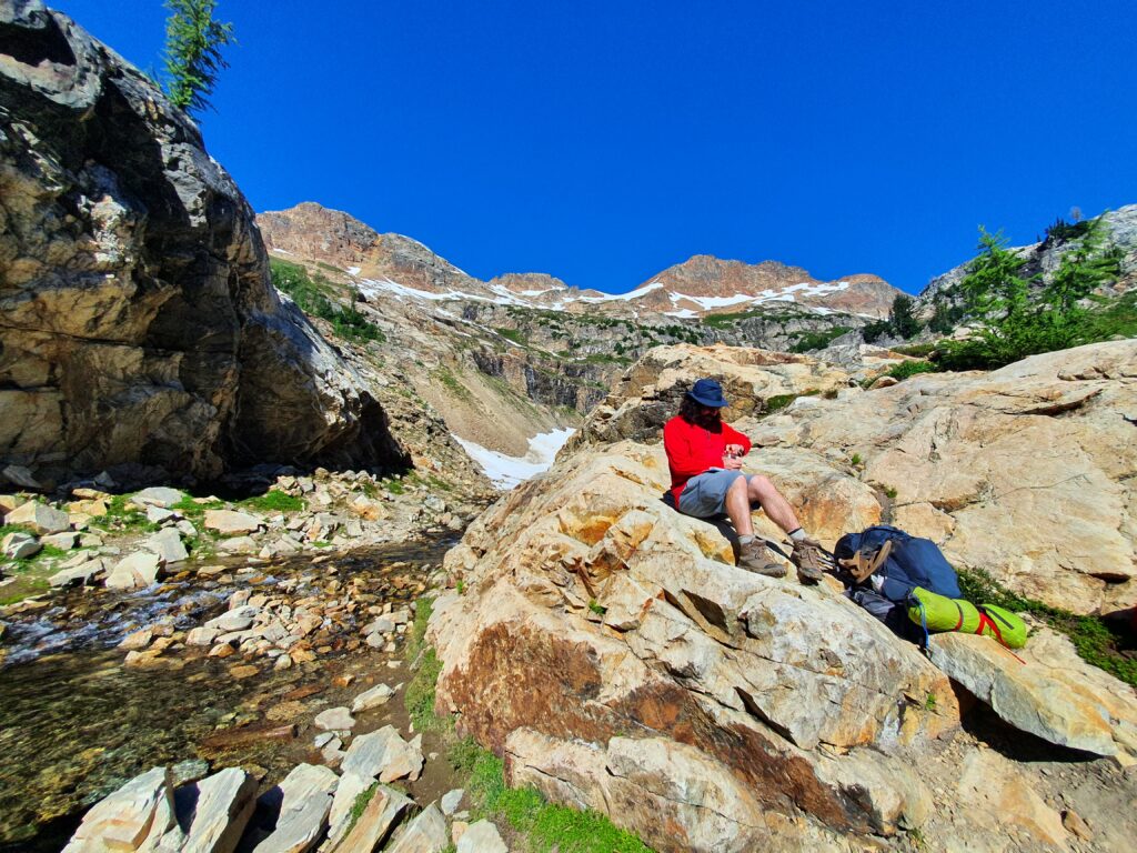
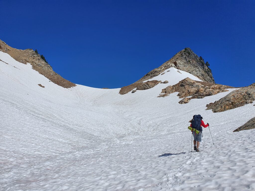
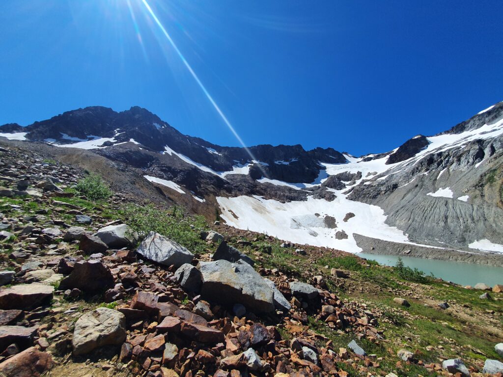
After around 2 hours of hiking we had arrived into the upper alpine bowl of Spider Gap. Being the last spot where there was water flowing we took a small break making the most out of the sun and views before the heat of the day was arriving.
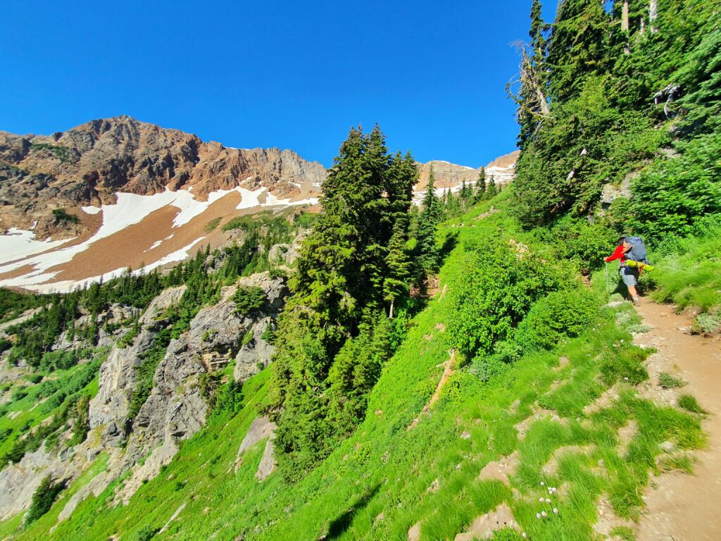
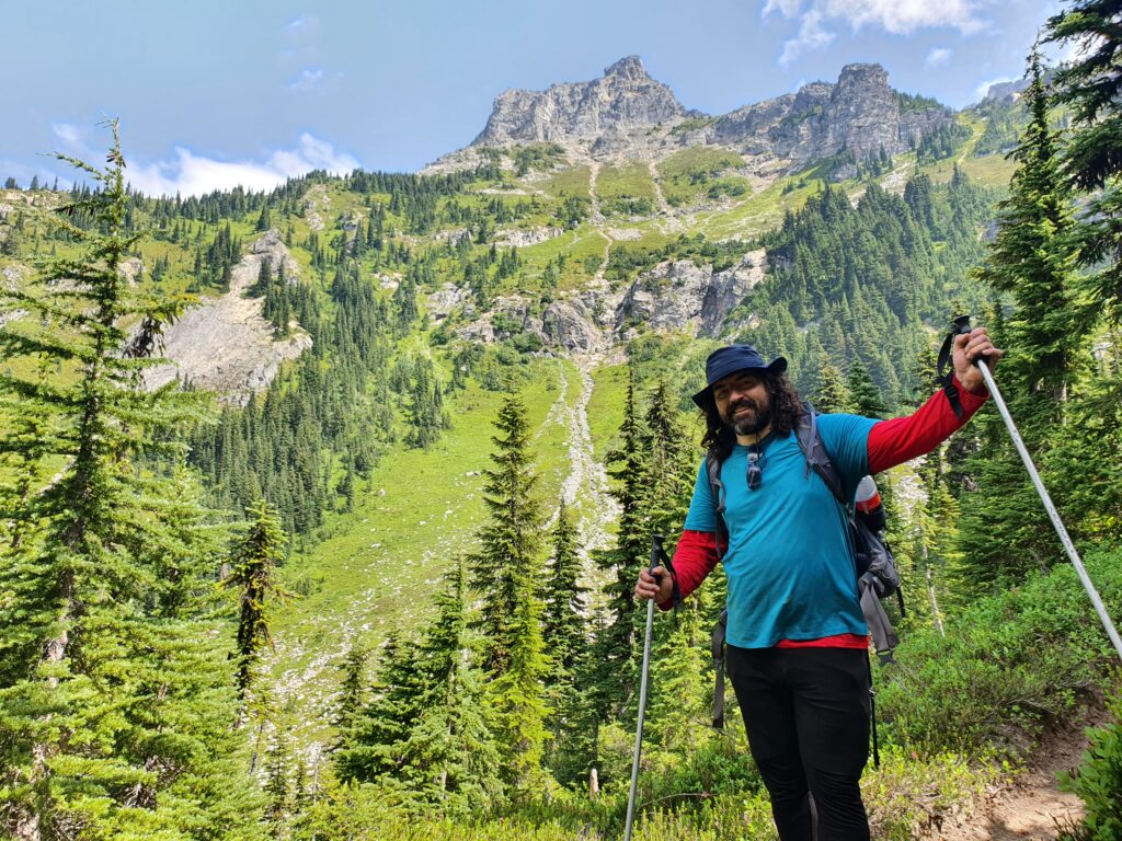
This was our first time crossing over Spider Gap so we had no idea of what to expect other then some easy snow climbing up to the pass. Looking at Chiwawa Mountain above us it seemed like we were surrounded by a wall of rock.
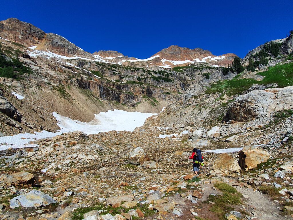
Soon enough the dirt switched to snow with a 800 foot climb up the mellow gully. Neither Dan nor I had snowspikes but the sun had softened up the snow enough to easily make steps up.
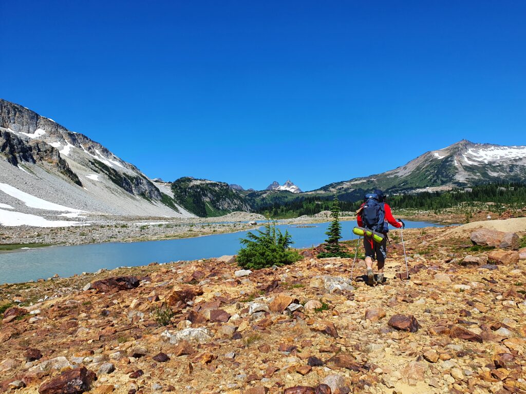
After a few annoying rollers we finally made our way to the top of Spider Gap but were happy to find the climb really easy. By now it was around noon and there was a cool breeze in the alpine. If I was correct we had just gone over the crux of Spider Gap Buck Creek Loop.
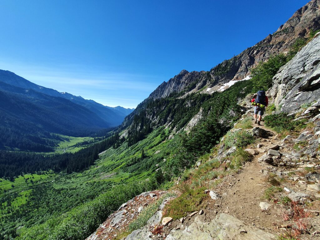
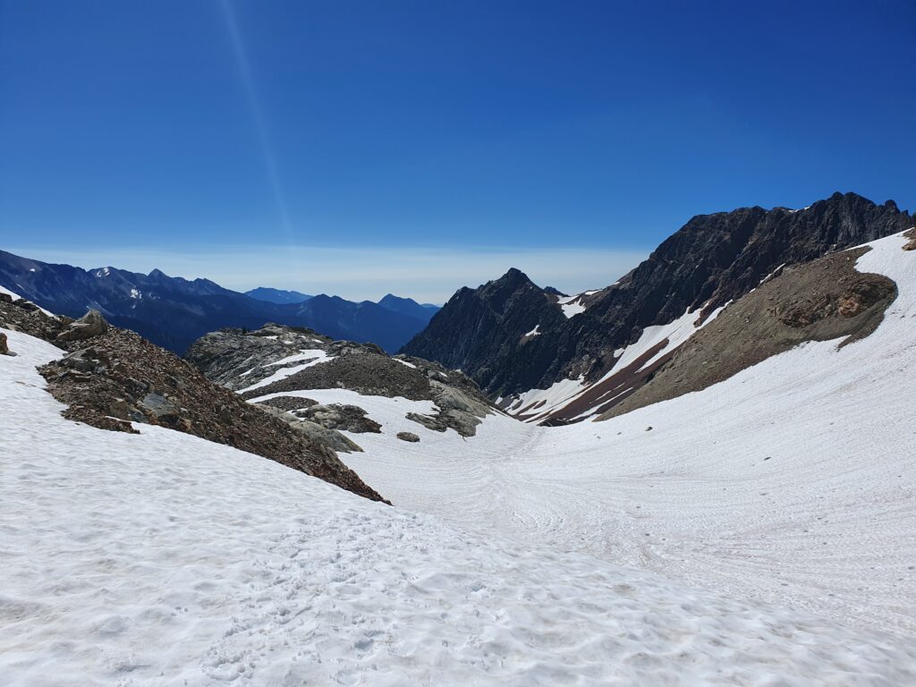
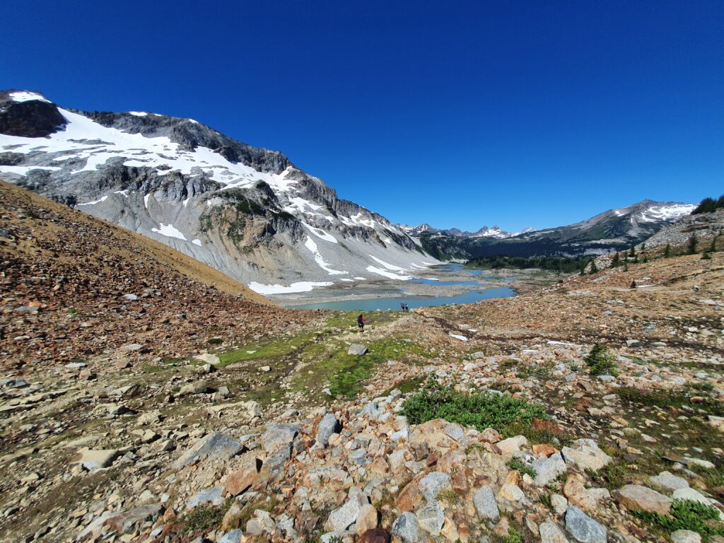
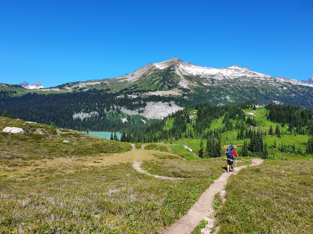
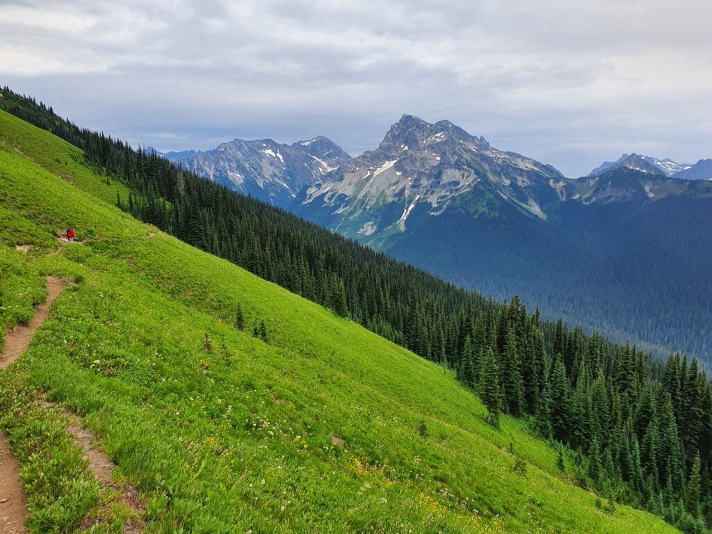
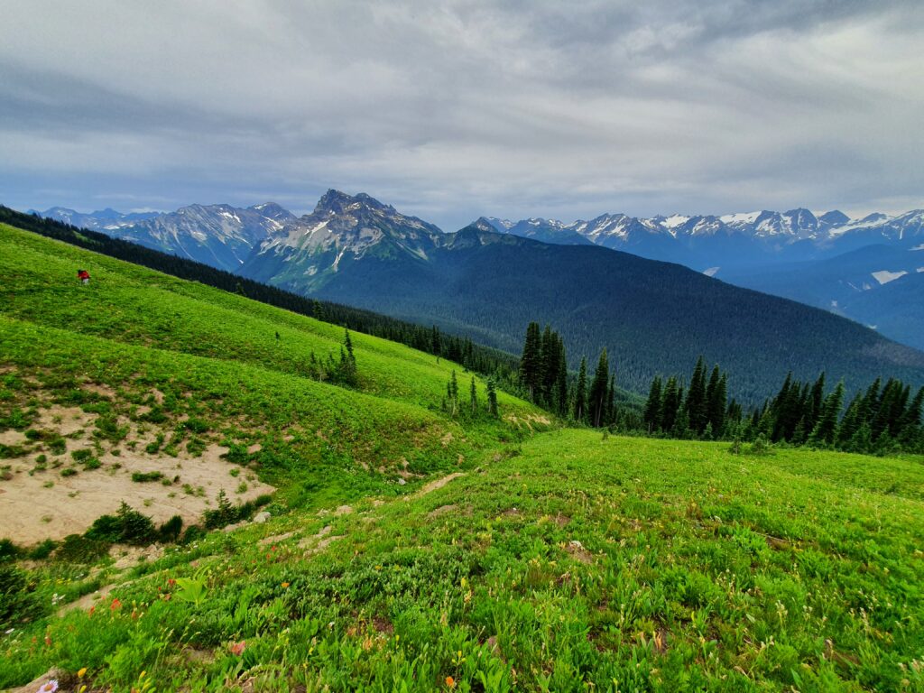
Looking to the North we could see Upper Lyman Lake and Railroad Valley in the distance. Beyond us was a section of the trail I’d been on numerous times. With Holden Village 10 miles down the valley we would instead be heading west going over Cloudy Pass.
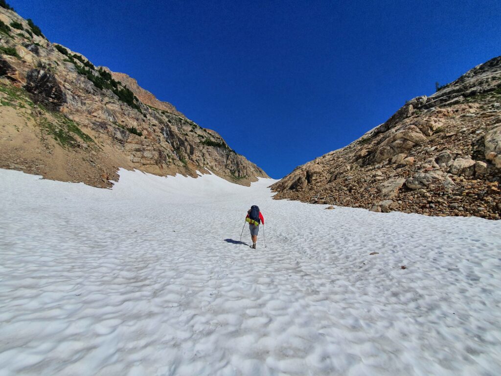
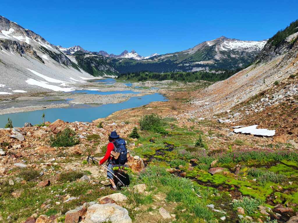
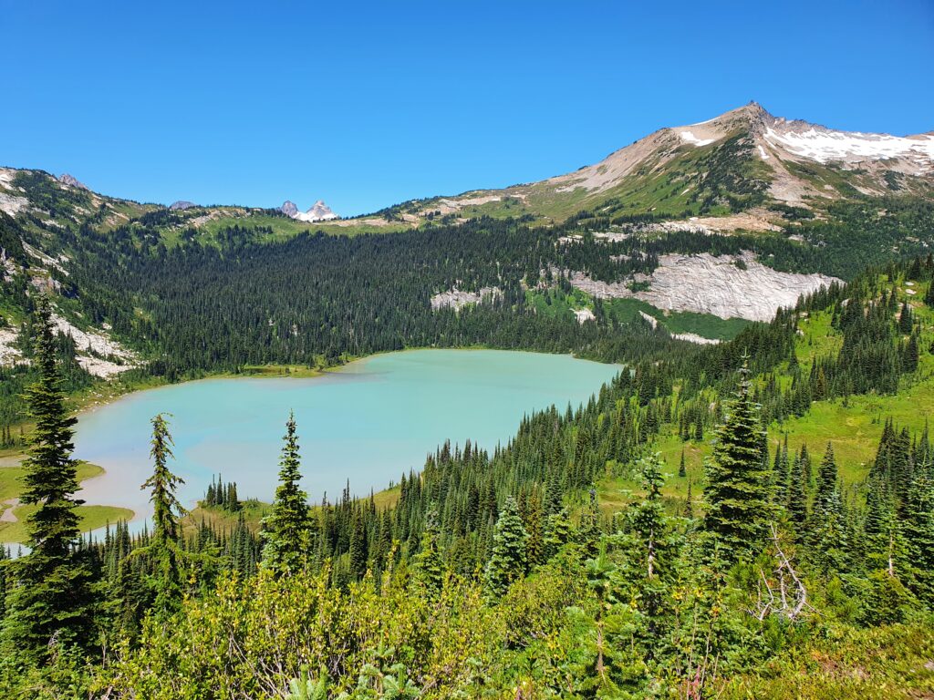
Hiking down to Lyman Lake we were switching between steep rock and an open snowfield before reaching the lower and mellower slopes. We hadn’t come up with a plan of where to camp and decided to choose a good spot along the way.
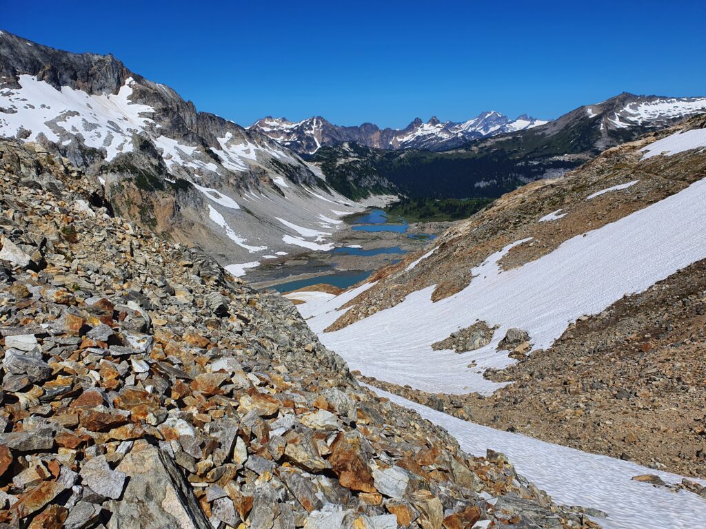
Looking back up towards the upper basin we had a clear view of Chiwawa Mountain. Around 10 years earlier Jason Hummel and I had climbed this route during the American Alps Traverse and snowboarder down the West Ridge.
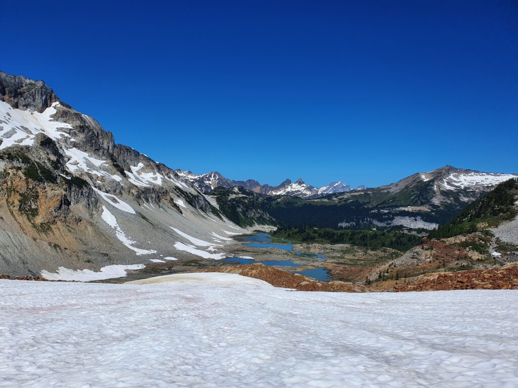
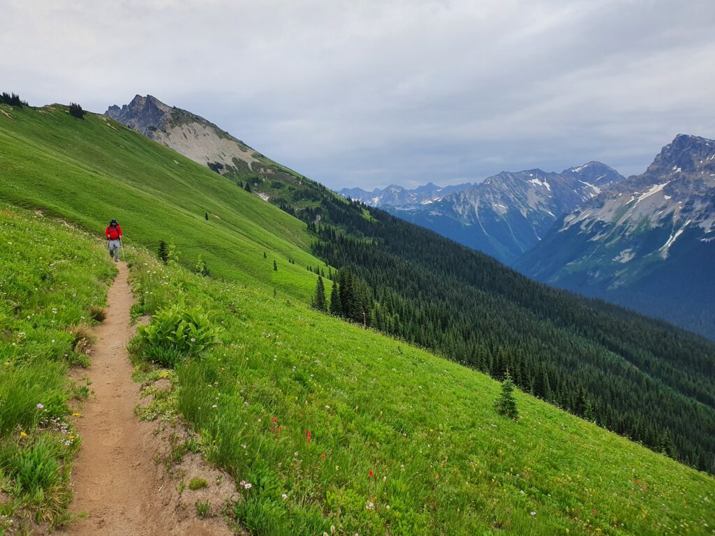
Hiking around the Upper Basin of Lyman Lake there were a few people camping at the main good spots so we decided to continue down the trail. We would have to decide wether to camp at Lyman Lake or up at Cloudy Pass in the distance.
When arriving into the valley we were at the junction trail up to Cloudy Pass. After a few minutes of thinking we decided to get the next climb out of the way and find a camping spot with a view.
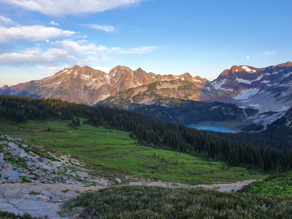
Finally arriving at Cloudy Pass we found a flat spot to put up our tent for the night. By the afternoon the bugs had come in and I sat around in the tent before heading out for the evening lightshow. Across the valley we had a clear view of our hiking route as the last rays of sun basked over the surrounding mountains.
Day 3: Cloudy Pass to Image Lake
We woke up at sunrise only to find that clouds had moved in overnight. Unlike the day before there was a little bit of rain so we packed up quick knowing in a few hours the clouds would burn off.
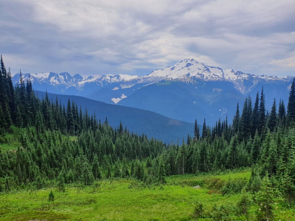
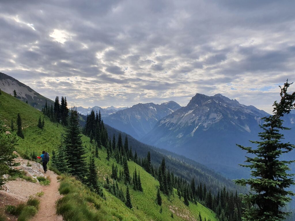
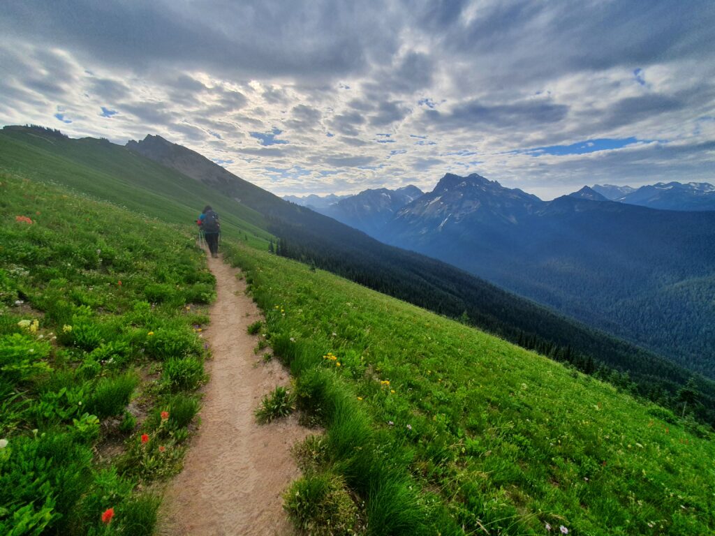
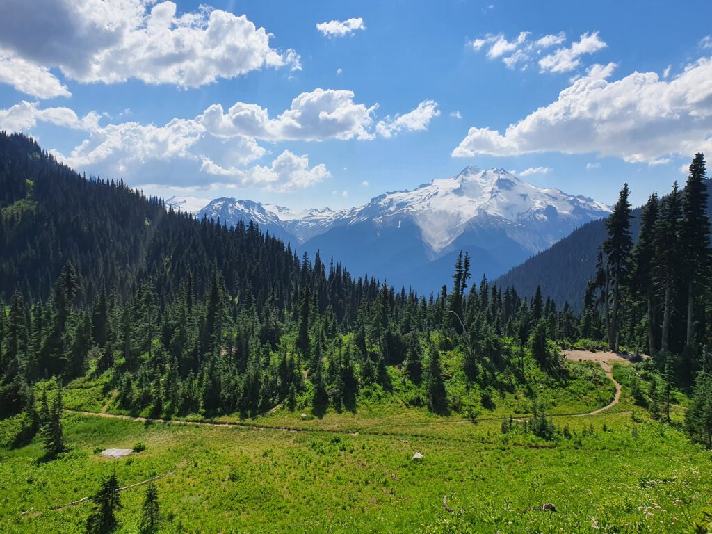
Heading over Cloudy Pass we were hiking onto the Western Side of the Cascade Crest. Off in the distance we could see the side of Glacier Peak while doing a low traverse towards Suitable Pass.
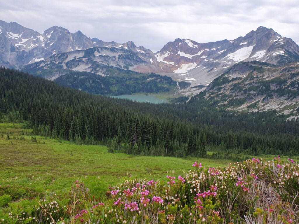
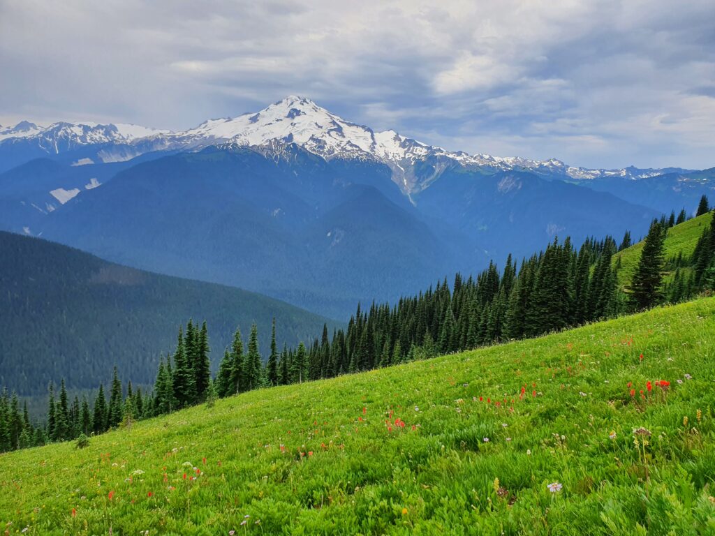
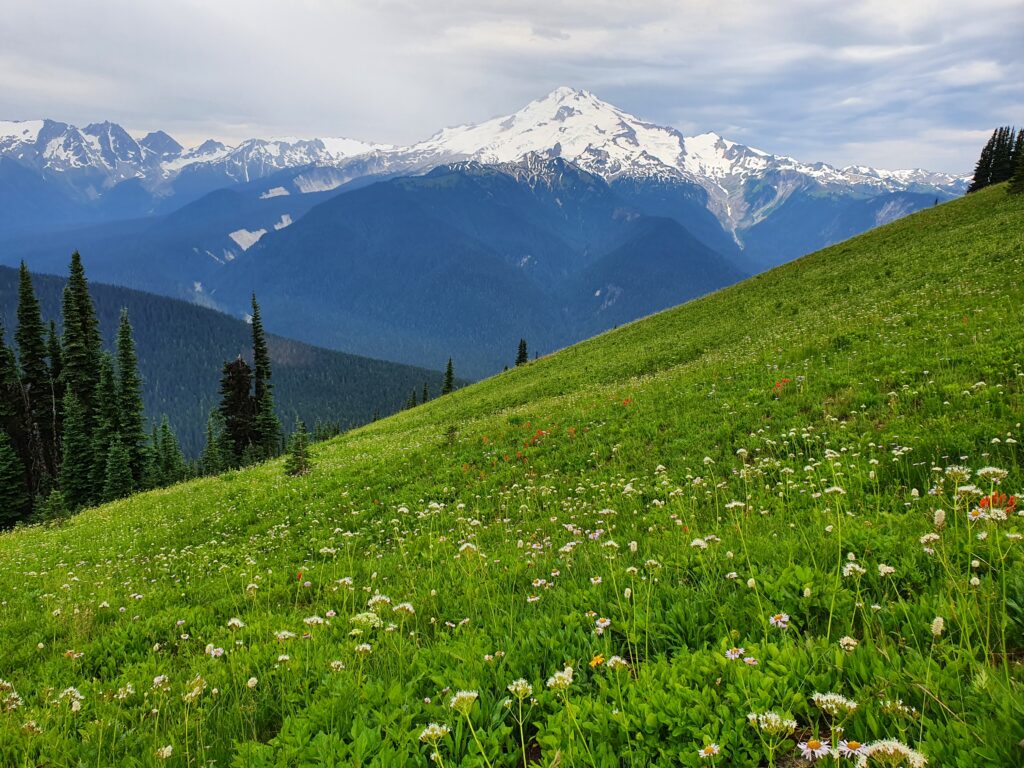
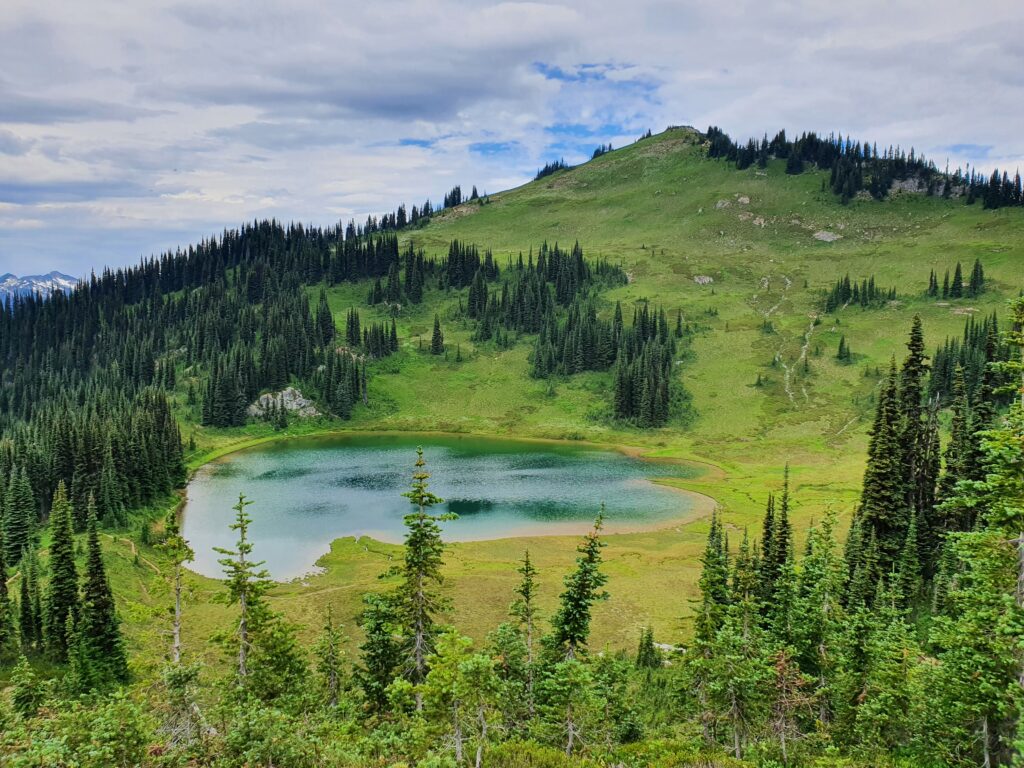
Once passing over Suiattle Pass we hiked down valley around 2 miles before heading onto the Image Lake Trail. After a few switchbacks we were back in the alpine with one of the best views of Glacier Peak.
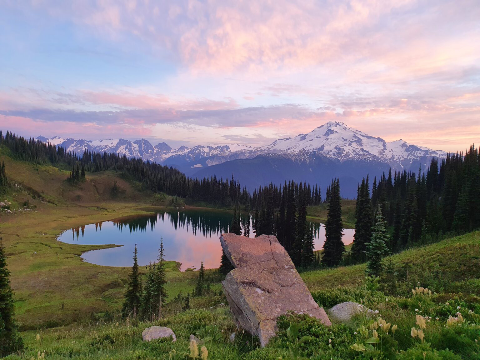
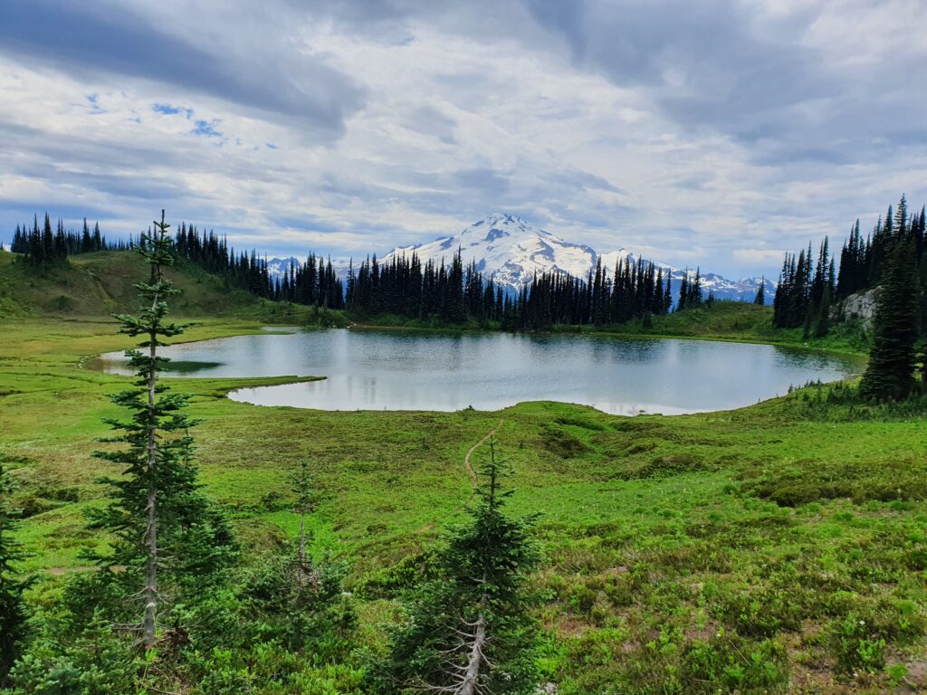
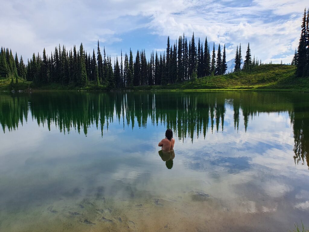
Before long we arrived at Imagine Lake and quickly set up our tent in one of the camping spots before heading up to the lake. This was Dans first time in the area and we had many hours before sunset. The next few hours we walked around the area and took a quick swim in the frozen water waiting for the sunset light show.
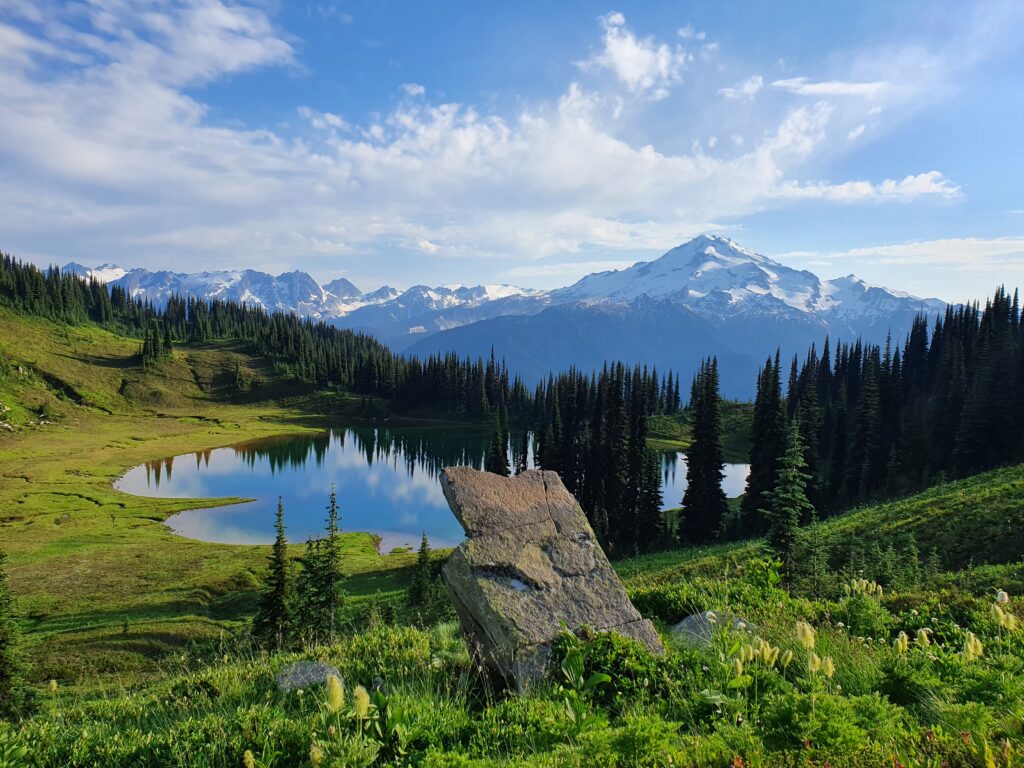
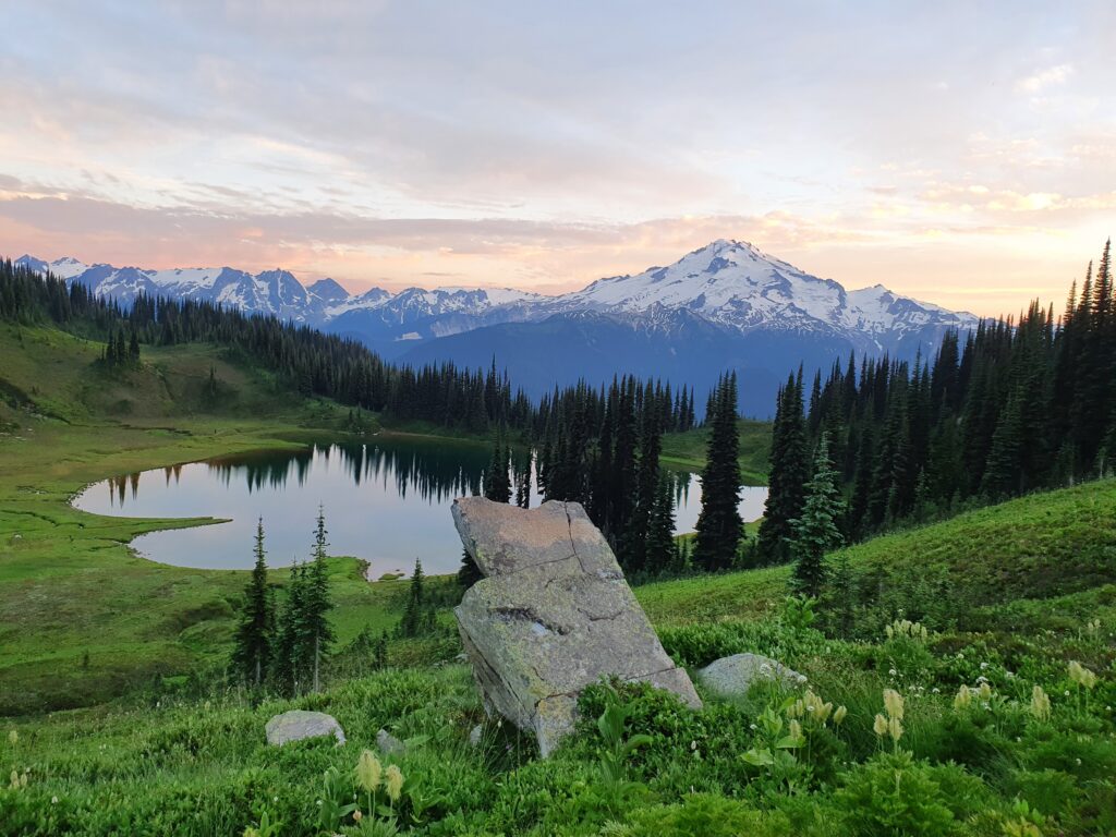
After eating dinner we still had an hour before sunset so we hiked up to get a better view and waited. With the sun setting to the west the shadow lines slowly started to envelope the valley bellow.
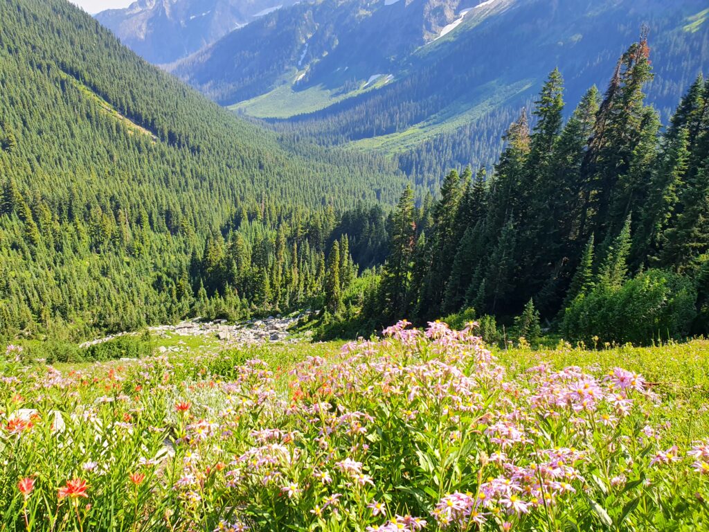
As the last light faded away I was brought back to mercies of climbing Ten Peak Mountain and the Dakobeds in the distance. The area to the left in the photo below is one of the coolest and most isolated areas in the North Cascades. Before long it was time to head back to the tent and get some rest before the next day.
Day 4: Image Lake to Trinity Trailhead
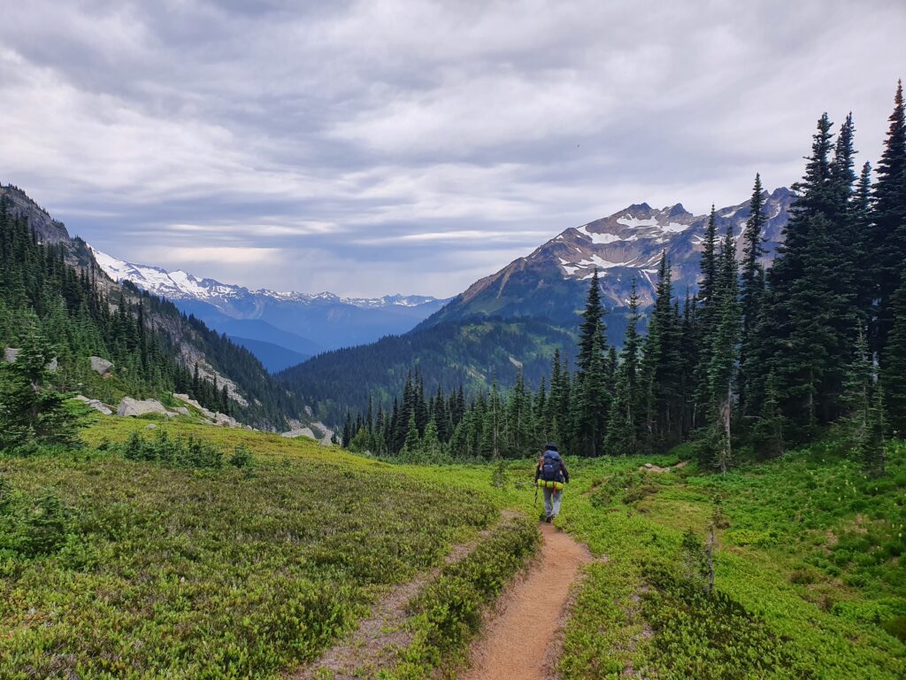
Once again we woke up to cloudy skies packing our bags and starting to move. It seemed like this would be the longest day of the hike going over Buck Creek Pass so we wanted as much daylight as possible. Soon enough we were retracing our steps from the day before heading back down to the Suiattle River Valley.
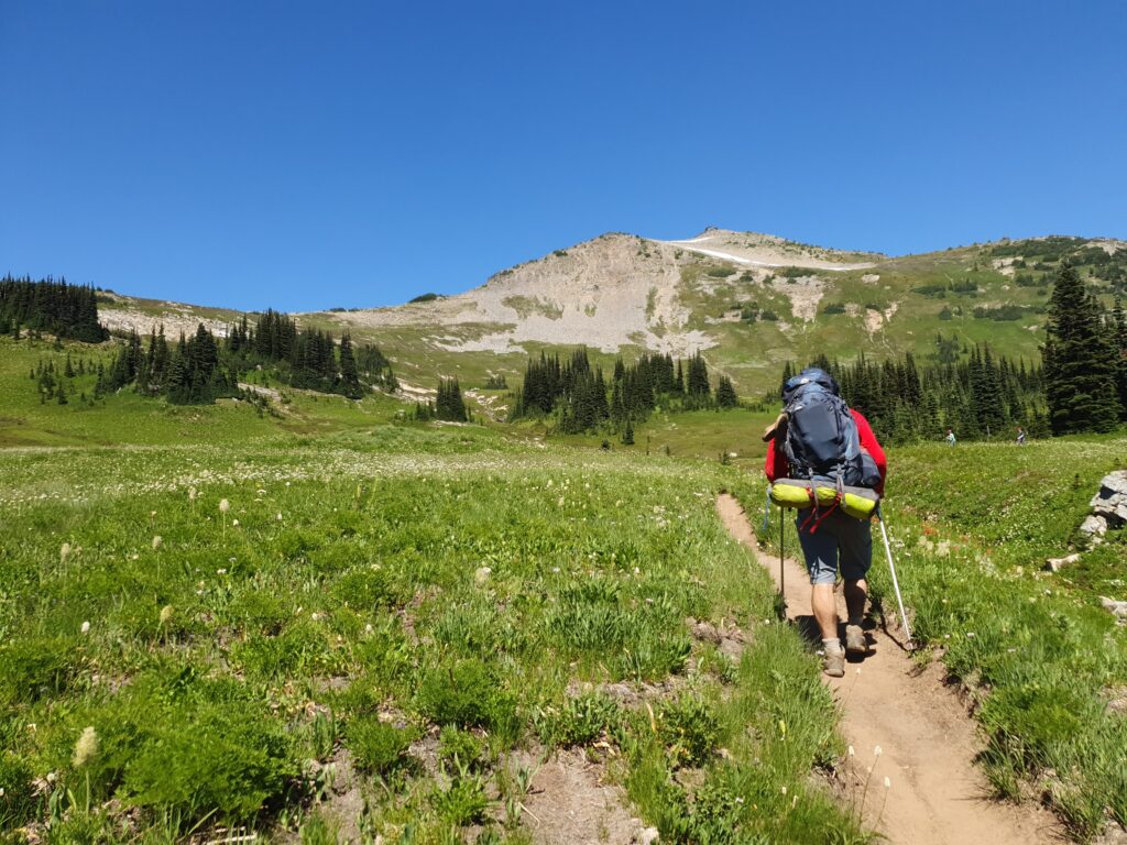
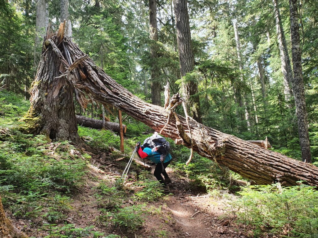
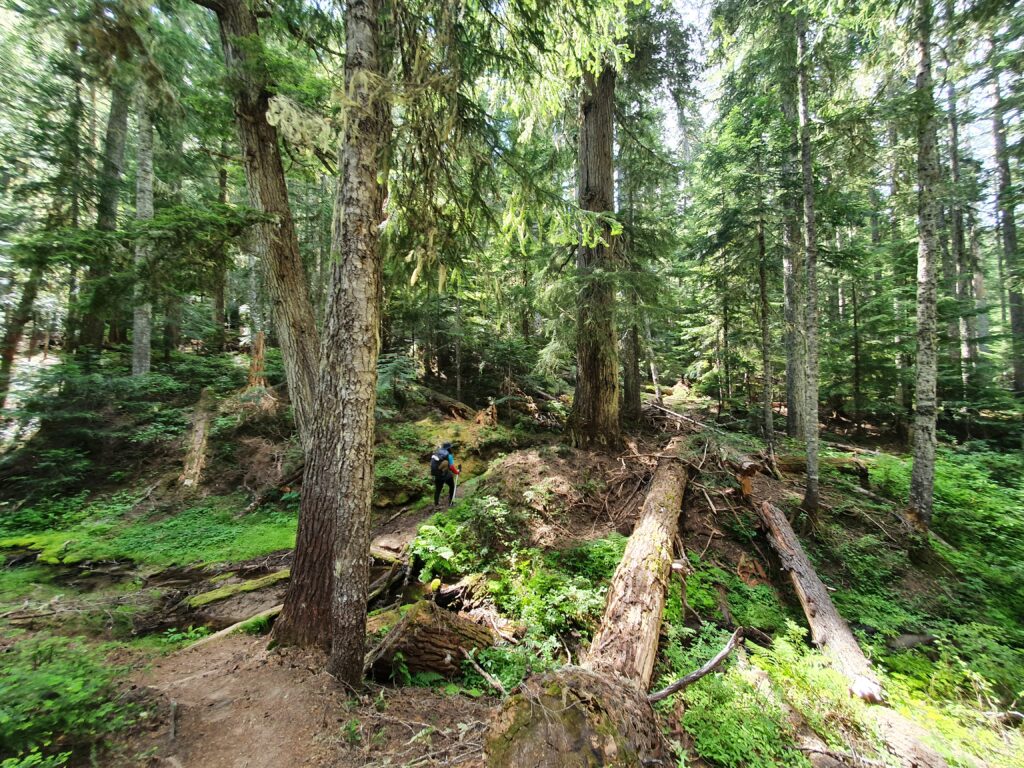
Arriving in the valley we followed the Pacific Crest Trail for a mile before turning off to the Buck Creek Pass Trail. While the PCT was in great shape our trail still needed a bit of work as we ducked under trees along the way.
Putting our heads down we made our way back into the alpine. In total the climb was around 3,000 feet before the final descent to Trinity.
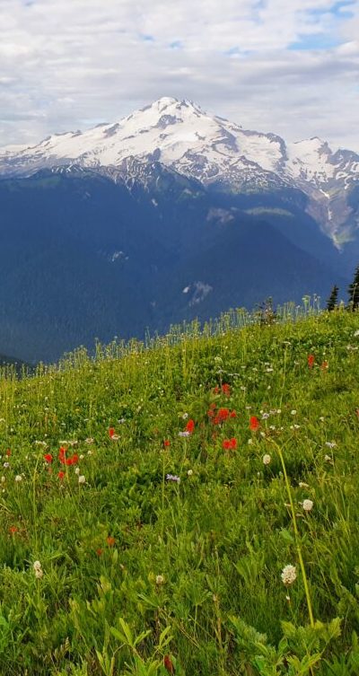
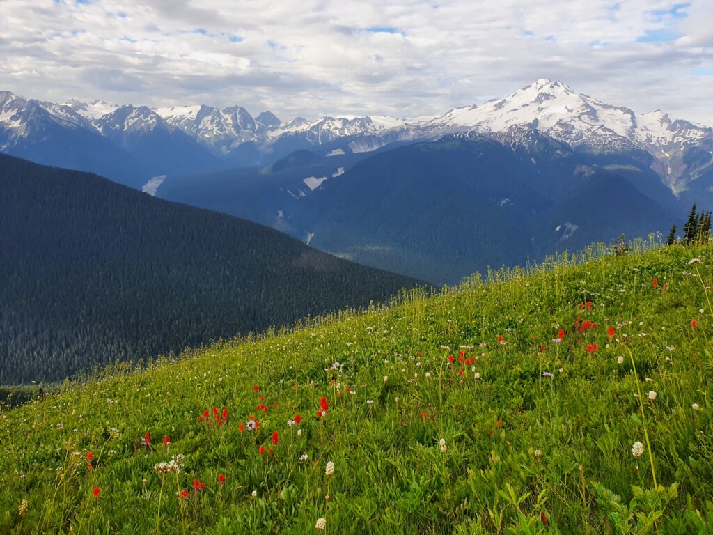
Soon enough we arrived at Buck Creek Pass and took in the views while bugs swarmed around me. The forecast was calling for lightening so it was decided to camp lower in the valley. With a few hours left of sunlight we decided to push as far as we could go before it got dark.
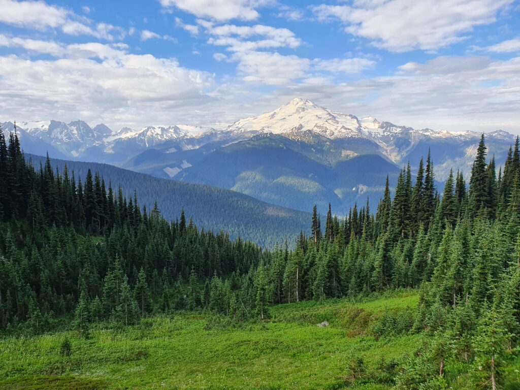
Up at Buck Creek Pass we had a great view of Glacier Peak and more specifically the Chocolate Glacier.
The next few hours were a blur as we hiked 9 miles down the valley. Though not exactly hard it seemed to go on forever but we arrived at the Trinity Trailhead just as it got dark. Dan hiked the 3 miles back to the car in the dark while I set up camp and before long our trip had come to an end.
The next few hours were a blur as we hiked 9 miles down the valley. Though not exactly hard it seemed to go on forever but we arrived at the Trinity Trailhead just as it got dark. Dan hiked the 3 miles back to the car in the dark while I set up camp and before long our trip had come to an end.
Final Thought on the Spider Gap Buck Creek Loop
Was the Spider Gap Buck Creek Loop worth it……..Yes!!! It is a relatively easy route to see some of the best mountains in the Cascades without the need for crampons or Ice Axes. In my opinion going counter clockwise is preferred if starting later in the day as the Buck Creek Valley is quite a bit longer before getting to a good camping spot. If the temperatures were cold I would probably bring Snow Spikes for the Upper Lyman Lake area but being hot out the snow was super easy.
A huge thanks goes to Skier Dan for being a good friend for so long with us having many crazy adventures as we slowly learned how to backcountry ski.
Thank you for making it to the end and here is a list of the hiking trips in Summer 2022.