
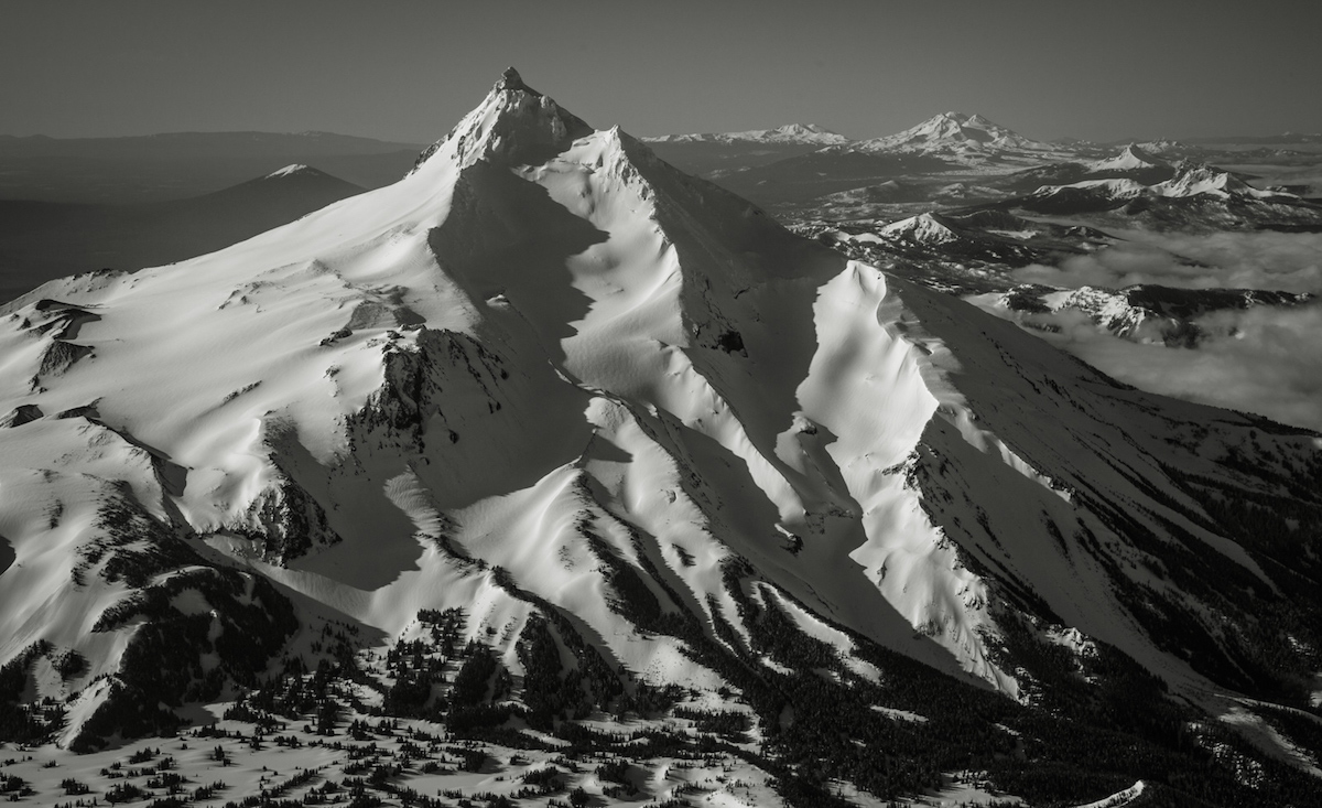
Mount Jefferson is the second highest volcano in the Oregon Cascades. With a summit elevation of 10,497 feet and numerous glaciers it offers skiing all year round. Although it’s northern brother is Mount Hood it gets far less traffic. The volcano is separated by Warm Springs Indian Reservation to the East and Mount Jefferson Wilderness to the west. There are 4 different glaciers on the volcano named Whitewater, Jefferson Park, Russell, and Waldo Glaciers. It was originally named Seekseekqua by the Native Americans then Mount Vancouver by the British. The name Mount Jefferson came from the Lewis and Clark expeditions as a thank you to the then president Thomas Jefferson. On average has numerous 6,000 foot descents.
Heading Towards the White Water Trailhead on Mount Jefferson
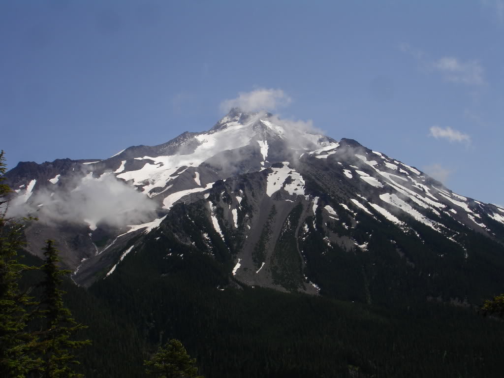
After an eventful day of hiking through a storm on Three fingered Jack I was happy to be back in my car. I was now heading north towards Jefferson Park Wilderness. By now I had visited Oregon four times over the season in an attempt to ride 25 separate volcanoes. Driving over Santiam pass for the sixth and final time this season I noticed that Mount Jefferson was covered in dark clouds. I had hopes that the sun would burn off the clouds as I entered Mount Jefferson wilderness via the White Water road.
The rain slowly misted as I drove up Whitewater Creek and progressed to a downpour as the road gained elevation. Finally I was at the Whitewater Trailhead but the weather was much worse then I had hoped for. My original plan was to camp there so I could get an early start. Instead I decided to camp much lower where it was barely a drizzle.
I tossed and turned all night with the downpour amplifying as it hit the tent. My mind was pondering if the rain would delay my plans as I tried to sleep. After what felt like less then an hour of sleep the ear piercing noise of my alarm woke me up. The rain had not yet let up and I would have to wait if I wanted dry gear on the trip. Every hour or so I would awaken to check the status on the weather and by 11:00 it let off. By now the occasional patch of blue skies gave me hope that better weather was coming.
A Late Start to the Day Turns it into an Overnight Trip
After a quick breakfast of Oatmeal and Instant coffee I packed my backpack and drove up towards the trailhead. I had originally planned to summit Mount Jefferson via the Whitewater glacier then on my return I would climb and snowboard the Jefferson Park Glacier. After loosing most the hours of the day because of bad weather I changed my plan to an overnight trip.
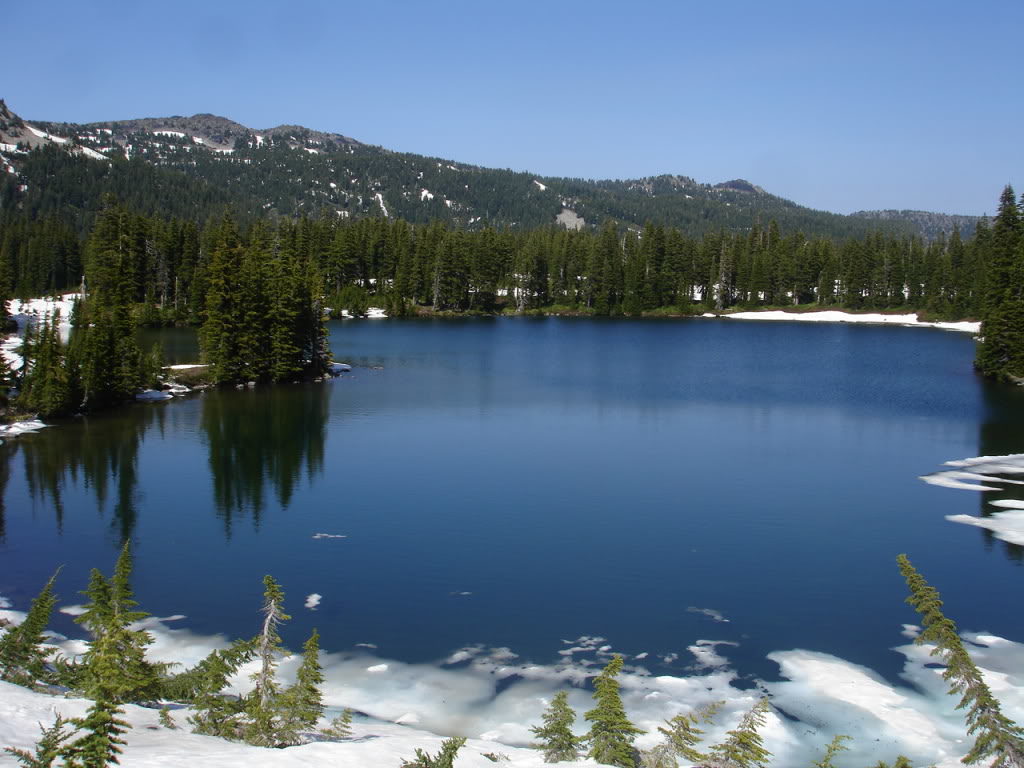
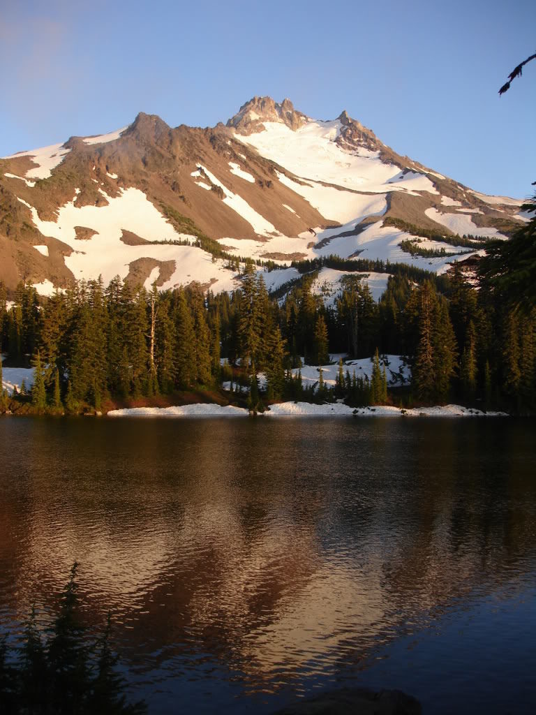
I kept a consistent pace for the 6 mile hike out to Scout Lake hiking in running shoes. It was a well maintained trail until reaching the final mile which was buried under consolidated snow. Once arriving at the snowpack I followed the footprints heading towards snowless terrain. Soon enough I abandoned the track and started heading directly towards Scout lake. Within ten minutes of abandoning the trail I found myself on the northern shore with Mount Jefferson and its north face reflecting on the lakes surface. Within seconds my pack was off and I was setting up my camp for the night. From my tent I had a perfect view of Jefferson Park Glacier and decided to go check it out.
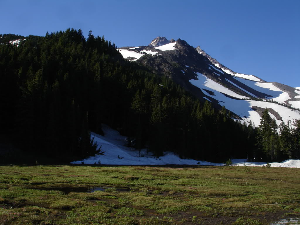
Leaving Camp for the Jefferson Park Glacier
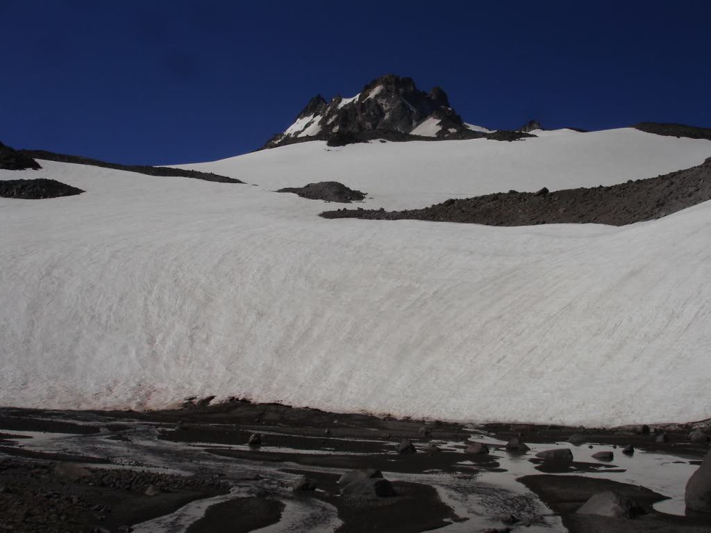
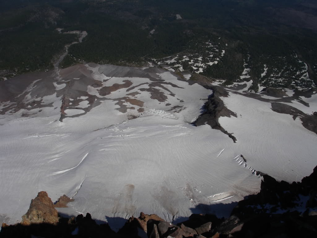
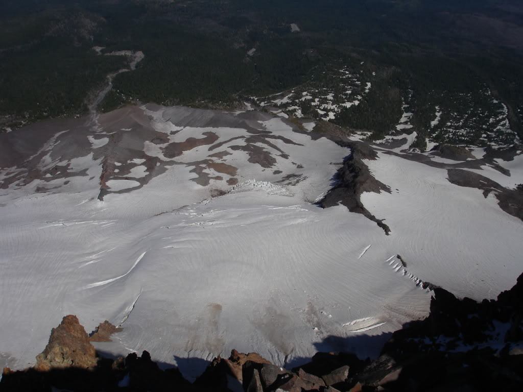
From Scout Lake I climbed up a steep permanent snowfield for the first 1500 feet. Soon enough I reached a saddle that allowed me access to the Jefferson Park Glacier. From a distance the glacier looked all broken up but could see an obvious route. It seemed like a good route to the summit of Mount Jefferson but there were some crevasses up high. Not knowing the route I would take up to the summit the next day I decided to go check it out.
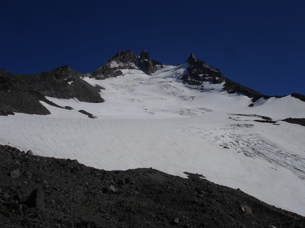
I started off cramponing but switched over to skinning on the low angled slopes. After around 500 vert I made my way to a few crevasses on the left hand side of the Glacier. Curiosity got the best of me as I moved towards the edge and looked in. Though I expected the crevasse to be deep there was solid ground only 4 feet below. Wondering if they were all that shallow I made my way towards the gut. Soon enough I found myself staring into a bottomless abysses in the middle of the glacier.
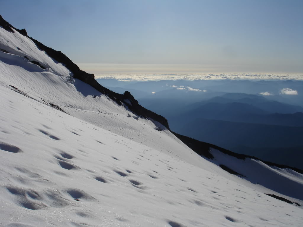
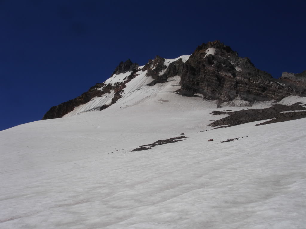
Once arriving at 9000 feet the slope angle dramatically changed from low angled to a 40 degree pitch. Without crevasses below I would usually stick to skinning but there was exposure below. I switched over to crampons and started kick stepping up the sun softened slopes. I was alone so I had to use extra caution traveling on the glacier. Carefully I probed the path ahead of me searching for covered crevasses exposing a hidden one. Soon I was stopped by a massive shrund that extended across the whole slope. I was unroped and solo so I decided not to continue.
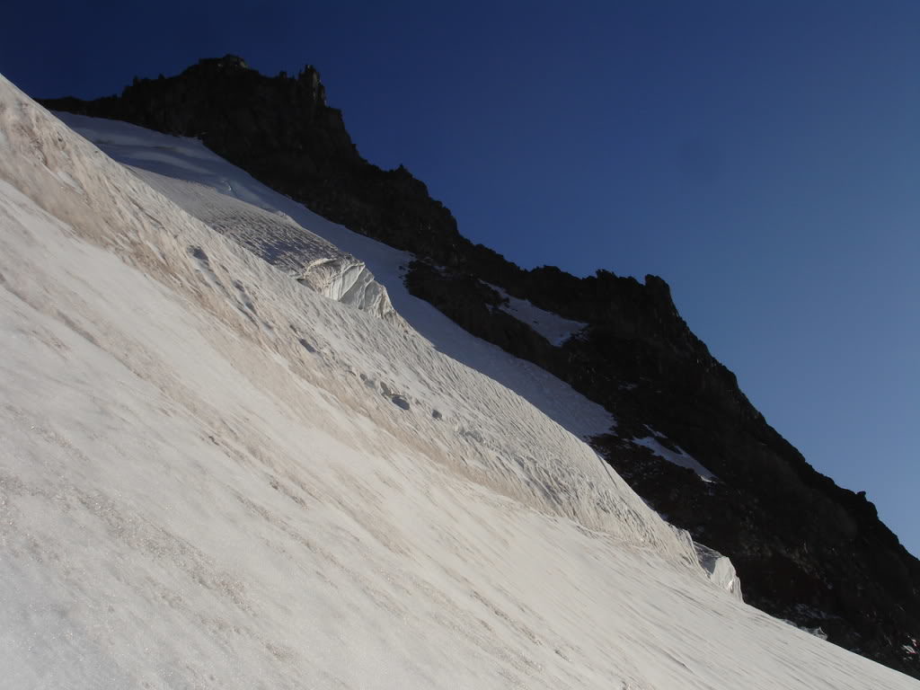
Stopped by a Crevasse for my First Run on Mount Jefferson
I sat at the edge of the shrund for 10 minutes taking in the views of the landscape. Glowing in the late afternoon sun Mount Hood dominated the skyline to the North. Below me was a 3500 foot run that would take me to within a few minutes of camp. I would be able to ride the whole way following my ascent route with only one quick carry over.
With Ice axe in hand for potential self arrest I started riding down the Jefferson Park headwall. The sun had softened the snow delivering conditions that ranged from deep soft corn to solid glacial Ice. Within five minutes I was at the bottom of what took me hours to climb. Crossing the saddle I looked back at the glacier one final time before descending to camp. With soft corn below I rode down the final 1500 feet before hitting the uphill on the opposite side of the slope.
Once arriving back at camp I changed over to dry clothes and cooked macaroni and cheese. After a quick overview for the day ahead I fell asleep under Mount Jefferson with the final rays of light illuminating above. It had been a great afternoon exploring the Jefferson Park Glacier. Hopefully I would reach the summit the following day.
Day 2 Summiting and Snowboarding Mount Jefferson
The next day I woke up early to check out the sunrise. Watching the early morning sun crest over the cascades for one final time in my journey I packed my bag for the long day ahead. Soon I was back on the trail searching for an efficient route over to the Whitewater Glacier. Within an hour I stumbled upon a group of three campers who were trekking across the PCT for 12 days. They had lost the trail in the snowpack the day before and I pointed them in the right direction.
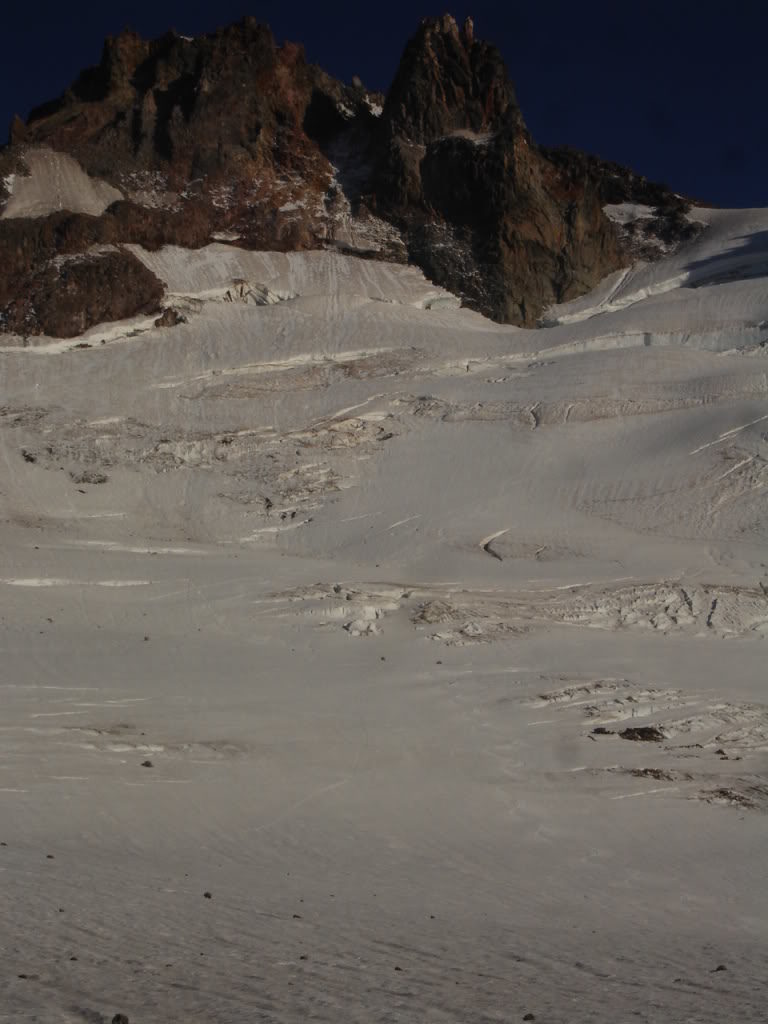
I arrived to the lower slopes of the NE side of Mt Jefferson and after some map checking I decided to abandon the climbers trail. Everything seemed straightforward and I decided I would save time going my own way. I put on my crampons and climbed the firm slopes until reaching the base of the Whitewater Glacier.
The climbing route traverses over a mile long before reaching the south facing scree ridge. After eating some food and enjoying fresh water from the glacier I was skinning across the glacier. I had seen Mount Jefferson from the summits of Washington Volcano’s and Mount hood many times. Finally I was on it and it felt rewarding to look back and see them in the distance.
From Red Saddle to the Summit of Mount Jefferson
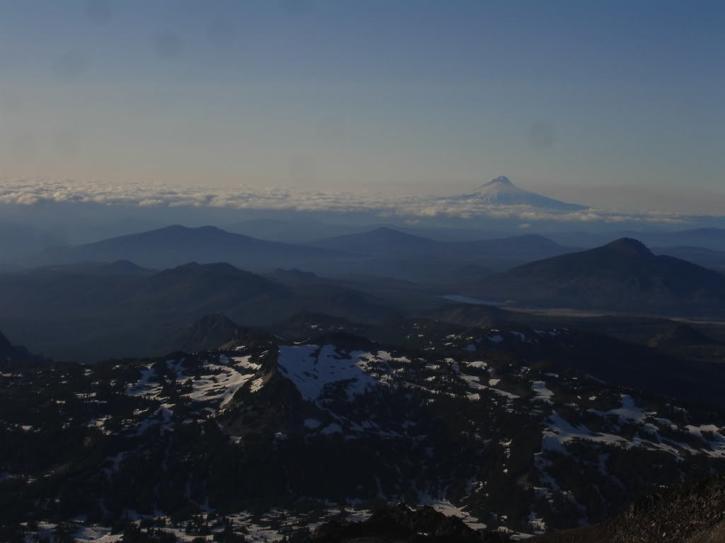
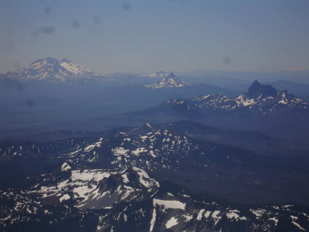
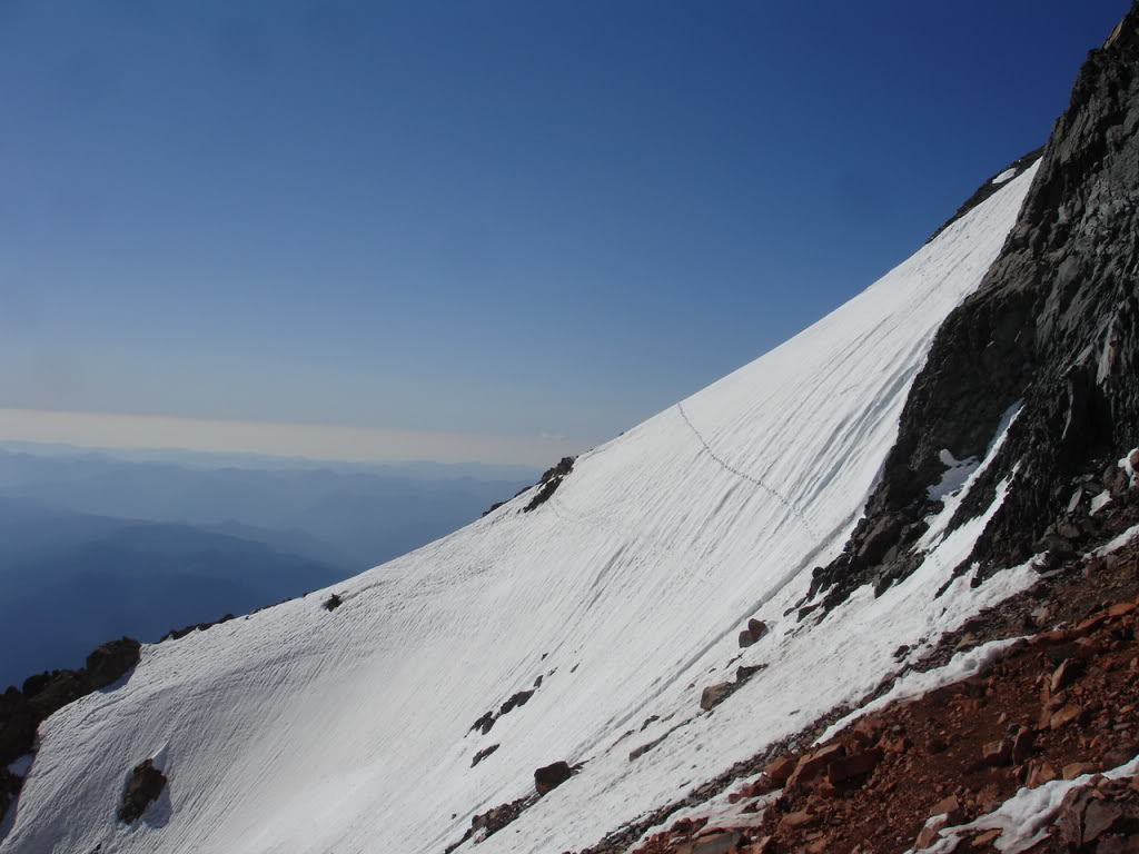
Once arriving at the southern ridge I started climbing the steep scree field until reaching Red Saddle. From here I had a perfect view of the Southern Oregon volcanoes. From Three Fingered Jack to Diamond Peak they rose out of the low mountain landscape. By now I had snowboarded all of them and was close to finishing my goal of riding 25 volcanoes in a single season. with the Three Sisters wilderness in-between and to the North was a sketchy 60 degree slope I would have to cross to summit proper. I had heard about the traverse and thought nothing of it but after seeing it I almost considered turning around.

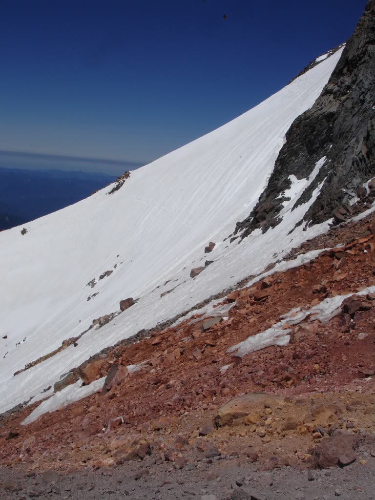
To the North was a sketchy 60 degree slope I would have to cross to summit proper. I had heard about the traverse and after looking at it I almost considered turning around. If I was going to do it I would have to put in the bootpack and carefully cross the 300 feet of west facing slopes. Looking down it was a 3000 foot gully filled with cliffs and rocks. I decided to take it slow and switched over to crampons and Ice axe and pushed forward. Each step was a process as I placed the Ice axe in the snow and kicked out a platform. Once I had a step I would pack down the snow being extra cautious of my other foot not slipping out. Each step took a few minutes and what would normally take 15 minutes took around two hours.
Arriving on the Summit of Mount Jefferson
My feet were in pain from kicking the ice as I finally reached solid ground. Above me 200 feet was technical rock and the summit of Mount Jefferson. With excitement I took off the crampons and put my Ice axe in my backpack before pushing for the summit. Looking around I noticed a spot that was exposed but seemed climbable. Once on the route I found solid hand and footholds along the way. With some semi technical moves I was standing on the summit of Mount Jefferson. I stood on the summit a few minutes taking in 12 different volcanoes of which 9 I could see my ski routes.
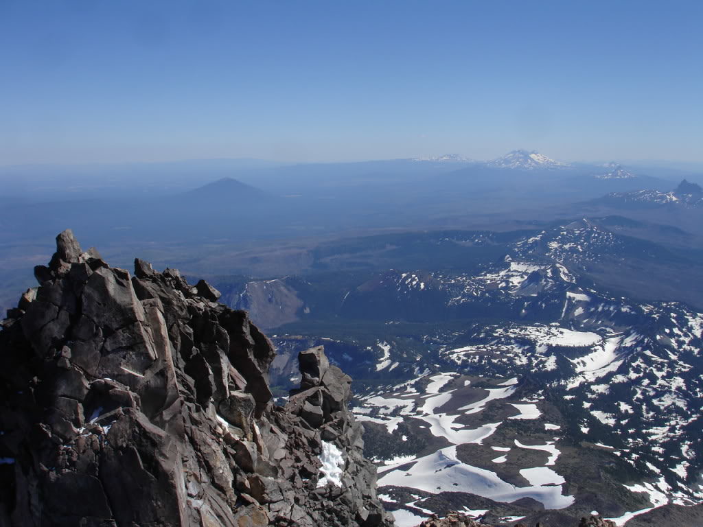
Looking to the East it was a big drop to the Whitewater Glacier. This was the route I would ski back to camp but I knew the upper face was melted out. Instead of dropping in from up high I would instead retrace my ascent route. Though I imagine the line would go in Winter it was late in the season.
I carefully down climbed the rock wall on the route that had the least amount of Ice. Before long I was back on the traverse that took me so long to cross. I was happy that I took the extra time putting in the steps as heading back almost effortlessly. Placing my Ice axe in its previous trench and would carefully place my feet on the steps. Once arriving at the red saddle I was relived knowing all the technical climbing was over with. From here on it was easy slope back to camp.
The Long Exit to Whitewater Trailhead
The ride down the Whitewater glacier was a disappointing traverse with only about 10 turns along the way. I had originally planned to be back at camp by 3 p.m. but I was riding the glacier at 7 p.m. To make up for lost time I chose the most direct path to camp. Instead of snowboarding I would have to down climb 1000 feet before arriving at snow once again.
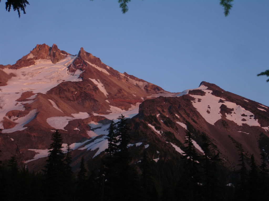
After climbing 12 hours I was back at camp and throwing all my gear in my backpack. Still having 7 mile before the trailhead I knew I would exit in the dark. I started moving around 8:30 as the sunset illuminated on Mount Jefferson. Jogging down the trail I wanted to take advantage of the last 45 minutes of light. After tripping a few times I switched over to a headlamp and was back at the trailhead a little bit after 10:00. I was exhausted but happy that I had stood on the summit of Mount Jefferson earlier in the day.
In conclusion Mount Jefferson was one of the most technical climbs within the Oregon Volcanoes. I was glad that I had gained experience throughout the season before attempting the peak. Within the Oregon Volcanoes Mount Jefferson by far has the best summit view being centrally located within the range.