Mount Washington Ski Circumference

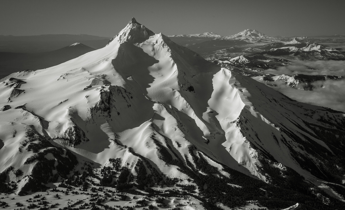
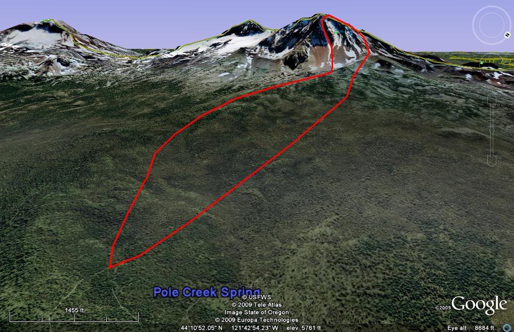
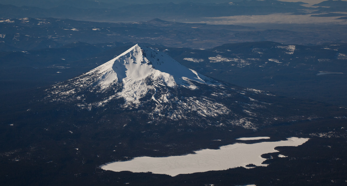
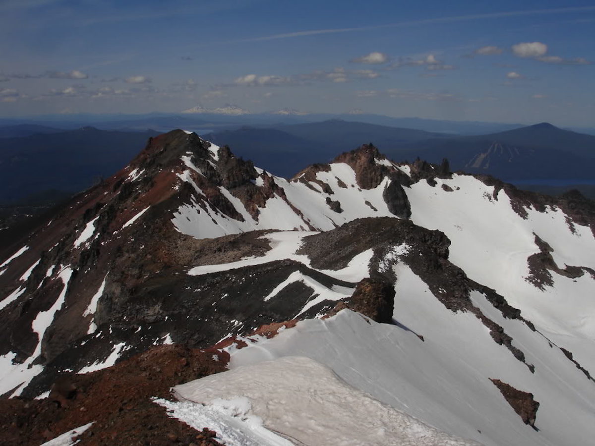
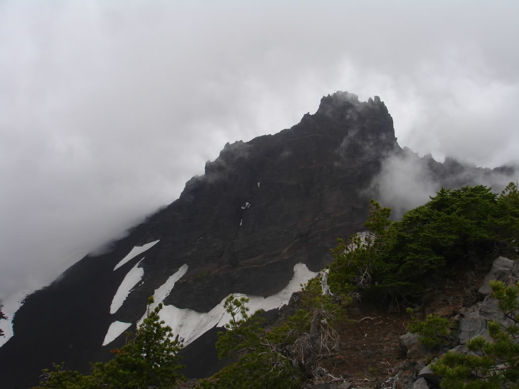
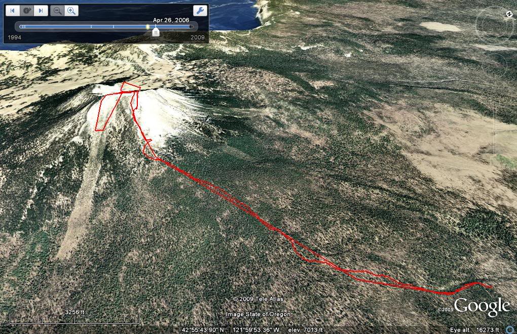
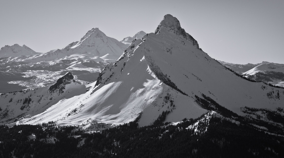
Mount Washington is one of the lesser known volcanoes in the Cascade Range. With a summit elevation of 7,795 feet it is the 30th highest peak of prominence. It is known as part of Oregon’s Matterhorns with massive erosion causing it to have a Matterhorn like look. Though questionable most people believe that it is an inactive volcano. The Mountains first summit was on August 26, 1923 by 6 boys from Bend. Mount Washington is located in Central Oregon off Santiam Pass with the nearest ski resort being Hoodoo. It can be accessed from the north by taking State Hwy. 20 to Forest Road 2690 before ending at Big Lake West Campground.

My Forth Roadtrip of the Season to Snowboard the Oregon Volcanoes

My fourth road trip to the Oregon Cascades started with 30 dollars in my bank account. A few days earlier I had received an email from Buell. He was willing to give me a few days work digging trenches for his business in exchange for some money. Soon enough I was driving south and on my way to Eugene. After two days of digging trenches I was back on the road and heading towards Mount Washington.

Read more

Mount Jefferson in the Oregon Cascades

Mount Jefferson is the second highest volcano in the Oregon Cascades. With a summit elevation of 10,497 feet and numerous glaciers it offers skiing all year round. Although it’s northern brother is Mount Hood it gets far less traffic. The volcano is separated by Warm Springs Indian Reservation to the East and Mount Jefferson Wilderness to the west. There are 4 different glaciers on the volcano named Whitewater, Jefferson Park, Russell, and Waldo Glaciers. It was originally named Seekseekqua by the Native Americans then Mount Vancouver by the British. The name Mount Jefferson came from the Lewis and Clark expeditions as a thank you to the then president Thomas Jefferson. On average has numerous 6,000 foot descents.

Heading Towards the White Water Trailhead on Mount Jefferson

After an eventful day of hiking through a storm on Three fingered Jack I was happy to be back in my car. I was now heading north towards Jefferson Park Wilderness. By now I had visited Oregon four times over the season in an attempt to ride 25 separate volcanoes. Driving over Santiam pass for the sixth and final time this season I noticed that Mount Jefferson was covered in dark clouds. I had hopes that the sun would burn off the clouds as I entered Mount Jefferson wilderness via the White Water road.

The rain slowly misted as I drove up Whitewater Creek and progressed to a downpour as the road gained elevation. Finally I was at the Whitewater Trailhead but the weather was much worse then I had hoped for. My original plan was to camp there so I could get an early start. Instead I decided to camp much lower where it was barely a drizzle.

Read more

Broken Top Snowboarding in the Oregon Cascades

Broken Top is a 9,177 feet volcano on the southern slopes of Three Sisters Wilderness. Situated between Mount Bachelor and the South Sister it is a popular climbing destination for hikers and mountaineers. The name Broken Top represents the erosion of the stratovolcano which unlike Mount Saint Helens is from glacial erosion. The main access is via the Cascade Lakes Road to the south once plowed out for the summer. During the winter the best way to get in is via the Todd Lake Trailhead.

Heading to Oregon to Ski Broken Top and the Oregon Volcanoes

It started off with a phone call on Saturday afternoon. With more then a week of free time and the hopes of finding good snow it was time to head down to Oregon. Both Jon Garrison and I were soon on our way down to 3 Sisters Wilderness to snowboard Broken Top. We arrived at the Todd Lake trail head junction at 3 A.M. and decided to get a few hours of sleep.

The map of our route climbing Broken Top


Read more

Wy’East Route on Mount Hood Ski Descent

The Wy’East Route on Mount Hood is a great alternative to the Old Chute. The route can be accessed via both Timberline and Mount Hood Meadows. While the first one starts much higher the second has a better fall line run. The descent can be almost 6,000 feet and instead of being a chute the area is a wide open face. Though it is a bit longer day then the main route we found it to be a much better ski line. After a week of riding the volcanoes of Oregon it was time to head up to Mount Hood and ride the Wy’East Route.

Riding Mount Hood via the Wy’East Route

After an interesting day on the North Sister we said goodbye to Buell. Both Ari and I were on our way north and decided to ski tour Mt Hood. Our original intention was to climb the Leuthold couloir but being late season we knew its conditions would be bad. I had done the Old Chute the year prior so check out the Wy’East Route instead. We decided that the approach from Meadows would be better then Timberline. Looking at the maps it would be a better fall line and minimal traversing. Being late June we could stay in the snow compared to the long scree climbing.

Leaving the Parking Lot we were happy to find continuous snow from the base of Mount Hood Meadows. From the start we were able to skin all the way up to the top lifts shack. Once past them we were bootpacking on scree with our boards on our packs. Though we were climbing on dirt just to our east was the Wy’East Headwall and what looked to be a perfect ski descent.

A map of our climb and ski descent of Mount Hood via the Wy'East Route

Read more

North Sister Via the Early Morning Couloir

The North Sister is a 10,090 foot volcano in Three Sisters Wilderness. Being the oldest of the Three Sisters the last eruption off its slopes was around 46,000 years ago. While the South sister is an active volcano both the North and the Middle are not. The mountain can be accessed from the west via the Obsidian Trailhead and the East via the Pole Creek Trail.

There is a long Native American history of the area as it gave access to Obsidian for arrowheads. The first Westerner to see the Three Sisters was the explorer Peter Skene Ogden from the Hudson Bay Company in 1825. The first recorded ascent of North Sister was made in 1857 by six people which was published in the Overland Monthly in 1870. While most people know it as the North Sister locals have refereed to it as “Faith” for over 100 years. With the Early Morning Couloir looking so aesthetic it was time to go after it on my 3rd trip of the season to Oregon.

Looking at a map of our route up the east side of the North Sister via Pole Creek Trailhead

Read more

Diamond Peak in the Oregon Cascades

Diamond Peak is one of the more isolated Volcanoes of Oregon. Situated in Diamond Peak Wilderness it has a summit elevation of 8,748 feet. Situated between Mount Bailey to the South and Three Sisters Wilderness to the North it is accessed via Willamette Pass. William Macy and John Diamond climbed Diamond Peak in July 1852 as part of a survey parts and the first recorded ascent. They named the summit after a settler living in Eugene. Although named Diamond Peak no mineral resources of interest have been identified in the area. Our intentions was to ski the Massive wide open NW slopes of Diamond Peak. We decided to start our journey at the Lake Vivian trailhead and follow the Mt Yoran trail.

Read more

Three Fingered Jack in Central Oregon

After a long night of sleeping on the Pacific Crest trailhead I was at the base of Three Fingered Jack. While the forecast called for partly cloudy skies I woke up to a white out. My plans started deteriorating as I waited for the weather to clear. I knew that the snow conditions were bad and my only chance was the NE facing bowls. My original plans were to be on the trail by 9 a.m. but was still at the car at noon. I watched the weather for hours as the cloud deck would raise and fall within 500 feet of my head. After a while I decided the weather wasn’t going to get any better. If I wanted to get Three Fingered Jack I was going to have to come up with another approach.

Looking at the summit of Three Fingered Jack

Read more

Mount Scott triple shot near Crater Lake

Cascadian Volcano Raid part 6 0f 9 Mt Scott triple shot

Mount Scott is a small stratovolcano on the southeast side of Crater Lake. The summit is the highest point in Crater Lake National Park with a summit elevation of 8,850 feet. While it is not as well known as most other peaks in the Oregon Cascades it is the 10th highest mountain. With its relative short distance away from Mount Mazama it was able to survive the massive eruption and collapse 7,700 years ago. While there are trees all the way to the summit there are numerous aspects that have open slopes. The northeast and southeast slopes offer around 2,500 feet of vertical while the west side is just over 1000 feet. It is named after Levi Scott who was a pioneer of the Oregon Cascades.

Our route map climbing Mount Scott in the Oregon Cascades

Read more