Mount Washington is one of the lesser known volcanoes in the Cascade Range. With a summit elevation of 7,795 feet it is the 30th highest peak of prominence. It is known as part of Oregon’s Matterhorns with massive erosion causing it to have a Matterhorn like look. Though questionable most people believe that it is an inactive volcano. The Mountains first summit was on August 26, 1923 by 6 boys from Bend. Mount Washington is located in Central Oregon off Santiam Pass with the nearest ski resort being Hoodoo. It can be accessed from the north by taking State Hwy. 20 to Forest Road 2690 before ending at Big Lake West Campground.
My Forth Roadtrip of the Season to Snowboard the Oregon Volcanoes
My fourth road trip to the Oregon Cascades started with 30 dollars in my bank account. A few days earlier I had received an email from Buell. He was willing to give me a few days work digging trenches for his business in exchange for some money. Soon enough I was driving south and on my way to Eugene. After two days of digging trenches I was back on the road and heading towards Mount Washington.
Buell and I arrived at Santaim pass around 6 p.m. on Friday night and scopes out the access. After running into a few dead ends we found ourselves at the parking lot for a religious group called the 6th day Adventists. Once arriving we were greeted by a security guard in the parking lot who wouldn’t let us pass. Turning back we parked at the Pacific Crest Trailhead and set up camp for the night.
Heading out to Mount Washington with no Plans
We woke up to the sound of a dirt biker offroading at 6:00a.m. After eating some oatmeal and drinking coffee before long we were on our way towards Mount Washington. We kept a steady pace hiking with swarms of mosquitoes over our heads fearing stopping. After 3 miles we found a cairn that represented the trail head for the Mount Washington climbing route and started heading east to obtain the Northern ridge. The hope was that this would bring us to continuous snow and an easy route to the summit pinnacle. Soon enough we were gaining elevation with scenic views of the Central Oregon Landscape. To the north Mount Jefferson rose above the surrounding peaks.
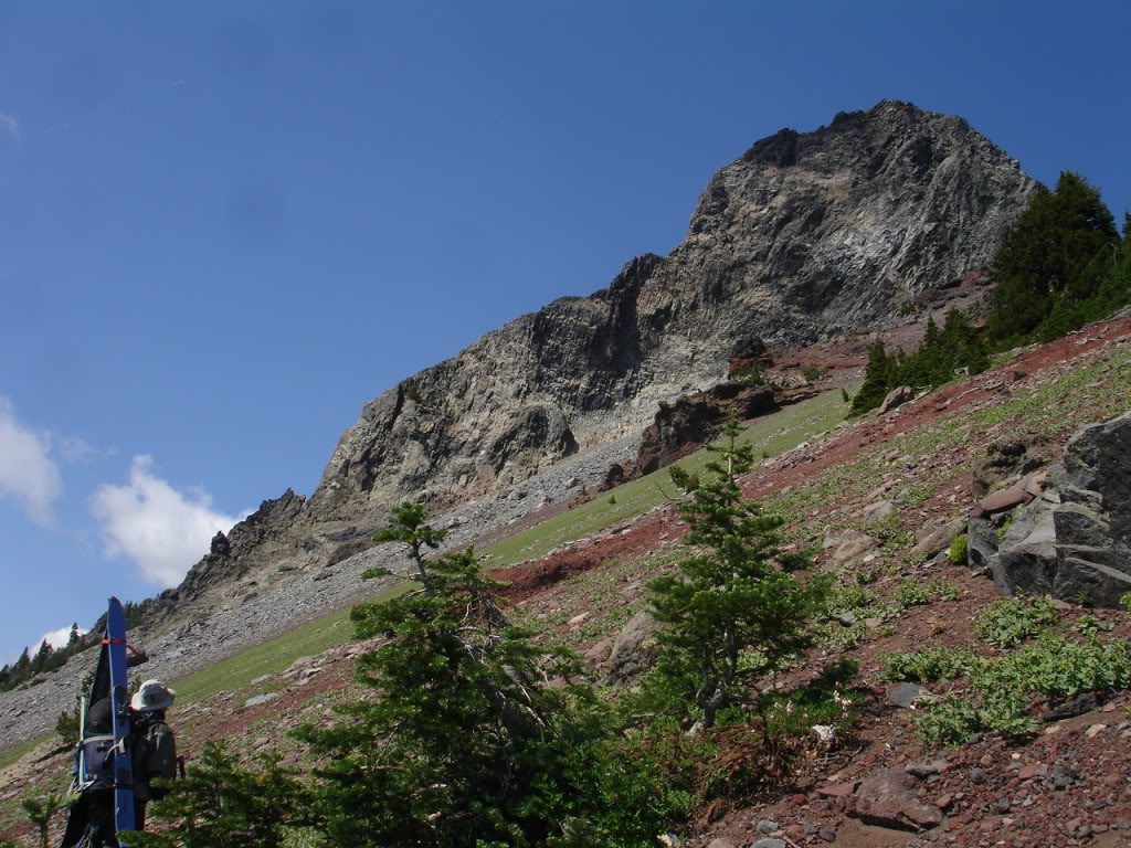
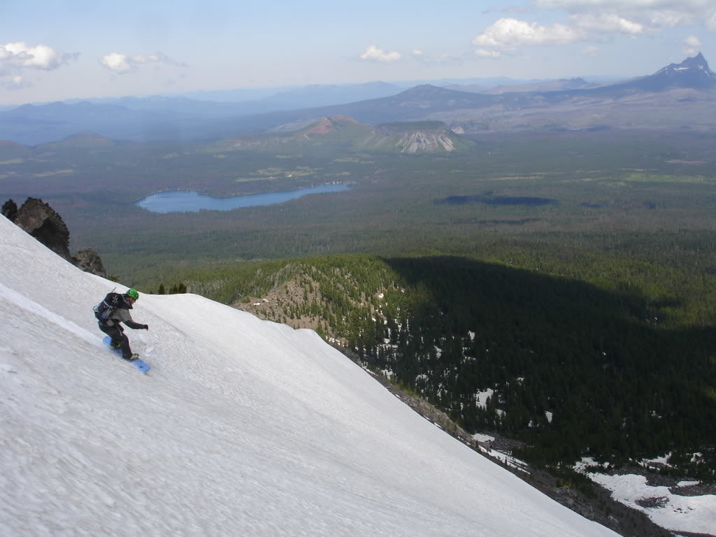
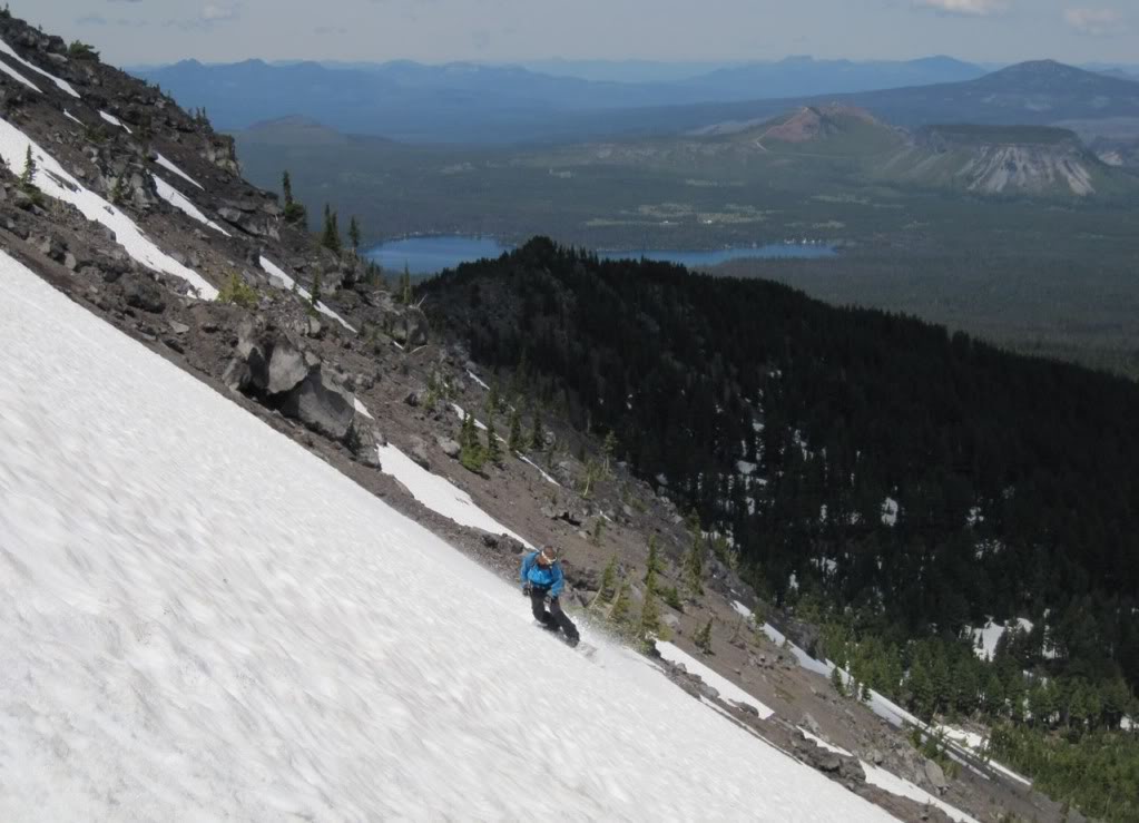
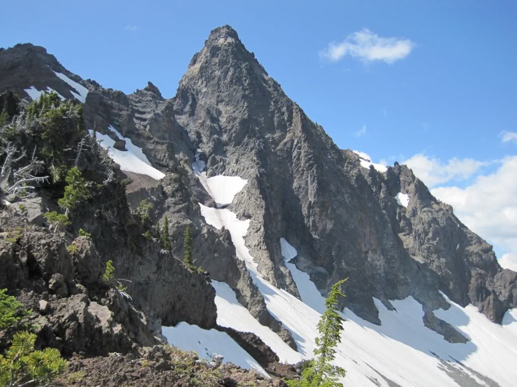
Before long we were at the base of the summit Pinnacle. Above us was around 500 feet of loose rock between us and the summit of Mount Washington. We saw 7 people climbing and decided that it wasn’t a good idea to climb the 4th class rock. The North bowl of Mount Washington had the longest fall line on the mountain being over a thousand vert of continuous snow. Soon enough we were dropping in to find smooth and great corn conditions.
Making our way between rock ridges we worked with the continuous snow patch to the valley below. Once at the base of the north face we wondered what to do next. The day was still early and Buell was interested in checking out lines for the next season.
Deciding to do a Circumnavigation of Mount Washington
We decided to traverse out to a col that separated the North and Eastern bowls. This would allow us to see what other options were available and ride something different. Soon enough we put our boards on our backpacks and started gaining elevation. Making a low angle traverse we made our way below the summit rock of Mount Washington.
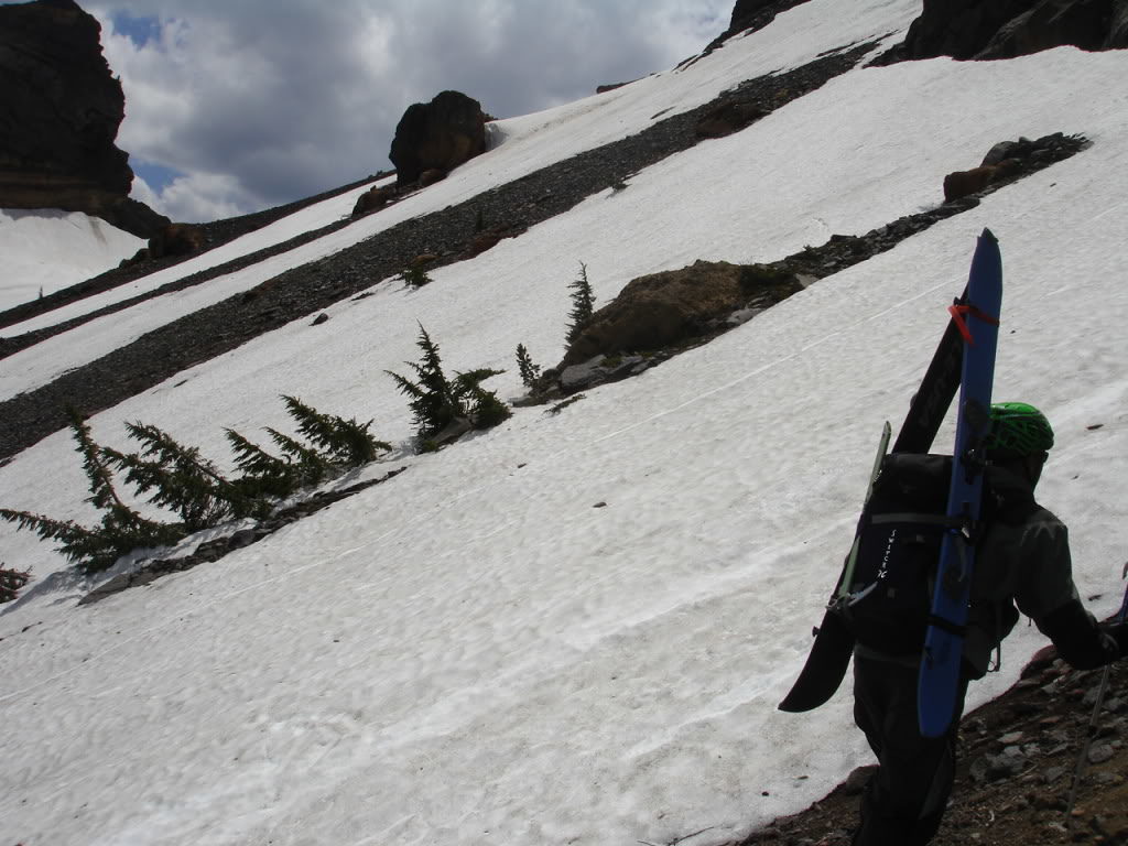
Once on the col we found ourselves having to make a decision. We were at the halfway point so could back track to the climbing trail or do a circumference of the mountain. We decided the circumference would be more exciting and after a quick snowboard down were back to climbing.
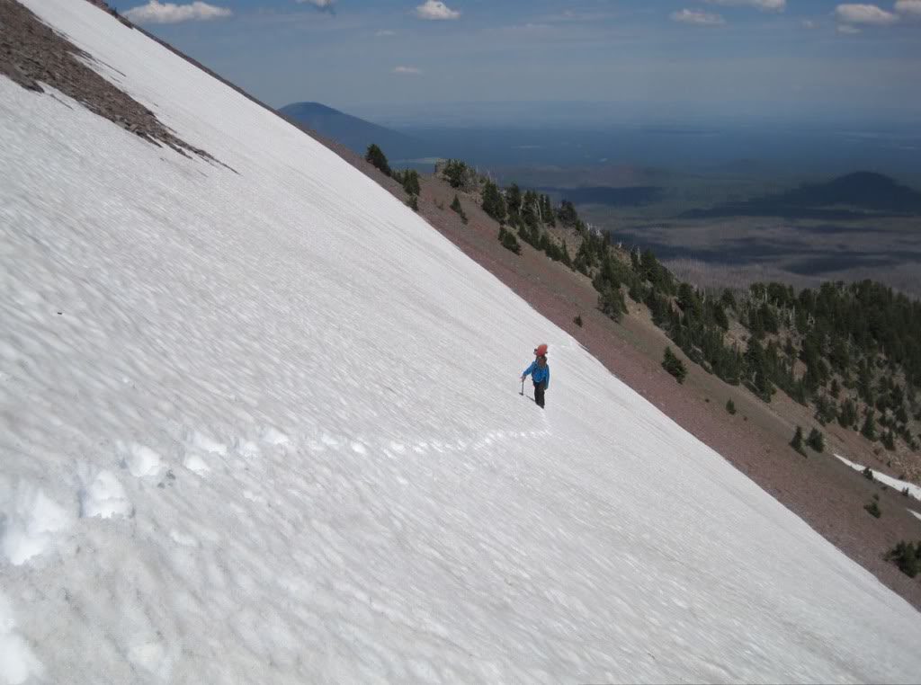
Moving between patches of snow we made our way towards the low col. It was already late June and most of the season snow was already melted out. Making our way up we would occasional look back at our traversing tracks. It hadn’t been a long run but it was much better then walking on loose rocks.
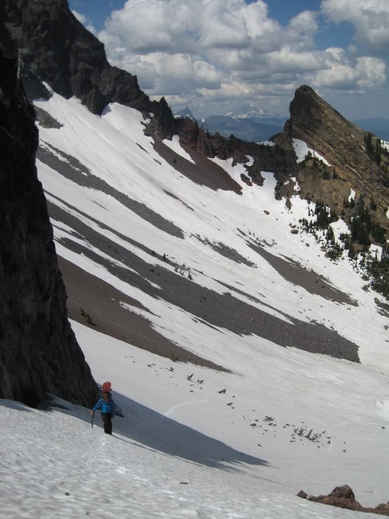
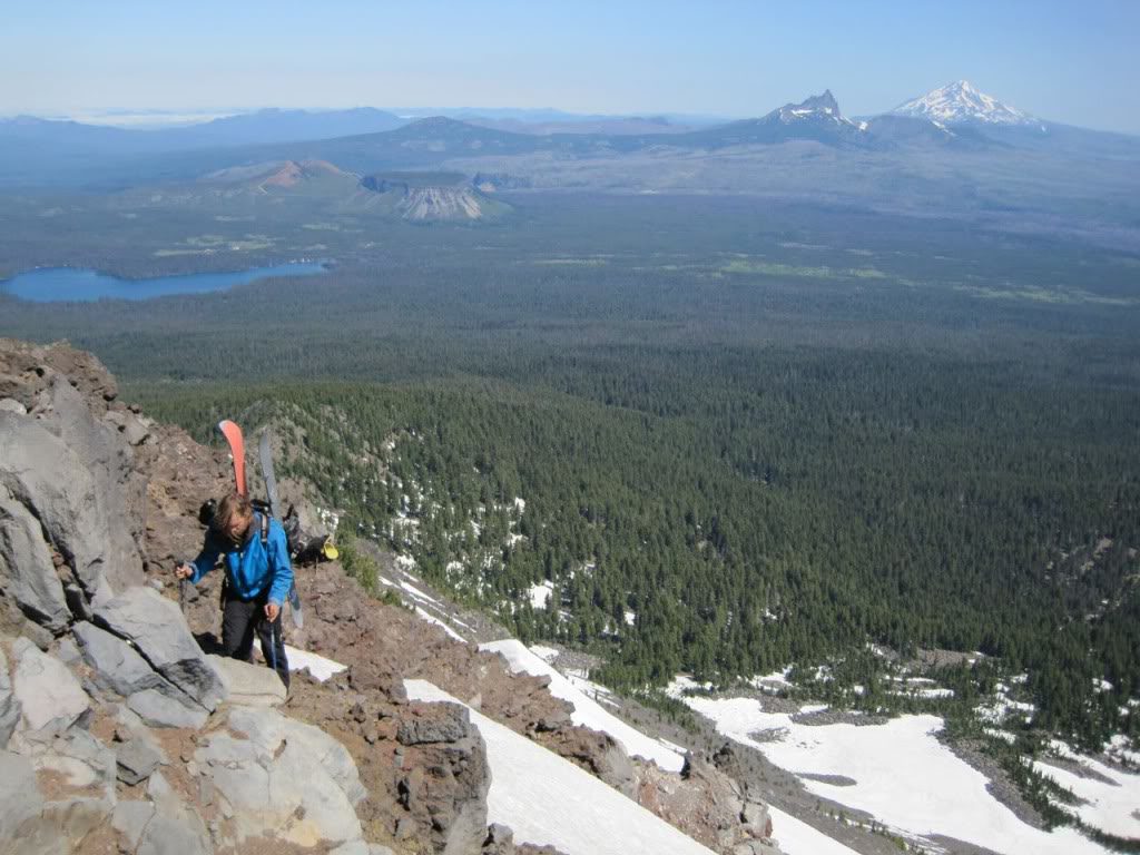
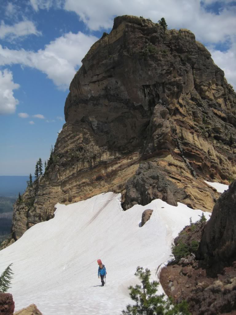
Before long we were traversing around the south face. From our vantage point we had a dramatic view of the summit of Mount Washington. Though it wasn’t skiable it seemed like a great rock climb. There seemed to be a few chutes that would be great in the middle of winter but they were all melted out.
Traversing the south face of Mount Washington we decided not to snowboard the slopes because it was only a few hundred feet. Buell made his way over first while I followed his bootpack. Being semi soft slush we didn’t have to use crampons and were able to scope out some fun terrain.
Dry Ground Hiking from here on out
It wasn’t long before we were off the snow again and making our across the southwest slopes. To the South we had a clear view of the North Sister and the volcanic landscape. I didn’t know what to expect when we arrived at Mount Washington but we were exploring more then snowboarding. While a great day it turned into a hiking trip while carrying our snowboards.
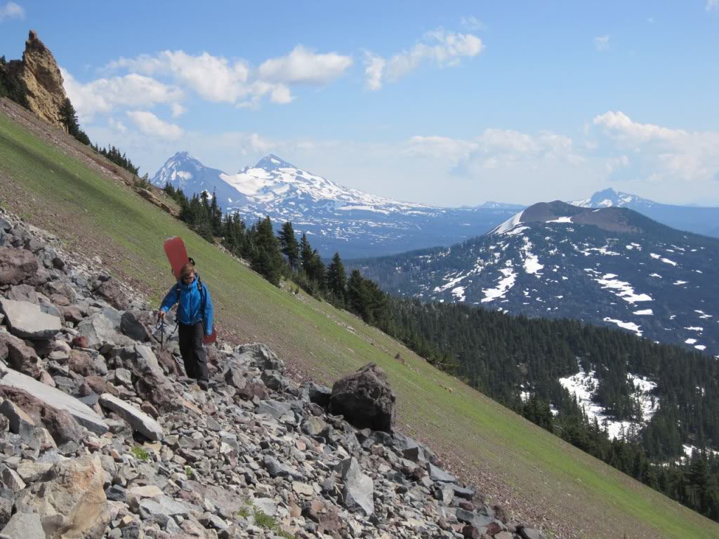
By now we were running low on both calories and water as we finished the circumnavigation. Before long we jumped back on the PCT for the final three miles back to the cars. Being a rocky summit I don’t think Mount Washington is ever rideable from the summit. That being said the prime season is mid winter delivering numerous aspects with an average of 1’500 feet of perfect fall line. The only problem with the area is the 6 mile approach.