After a climbing Broken Top of the previous day we were on our way to the south. Before long we were arriving at the Mount McLoughlin summit trail head. After packing up our gear and eating some quick snacks we were on the trail head around 10:00. The hope was that a later starting time … Read more
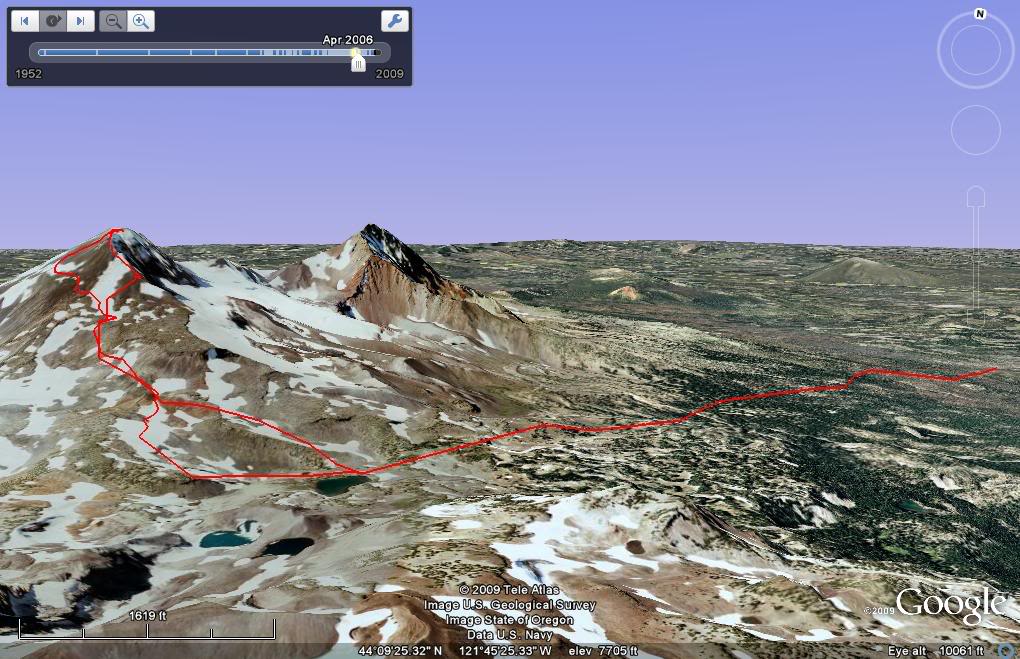
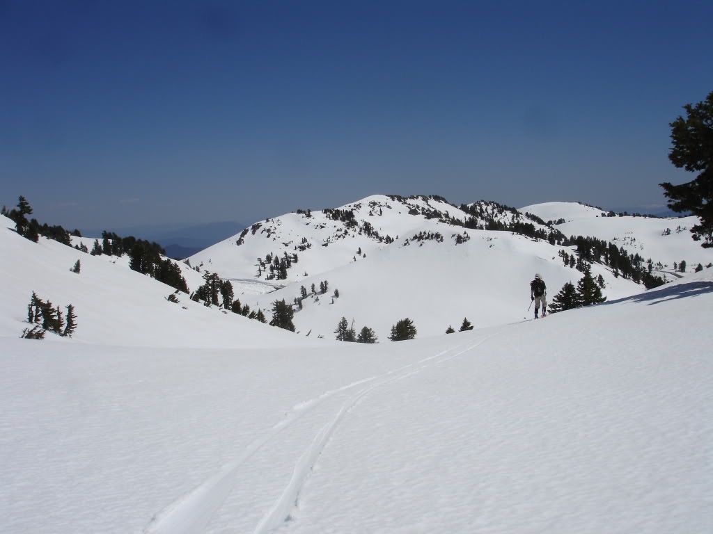
Diamond Peak is one of the more isolated Volcanoes of Oregon. Situated in Diamond Peak Wilderness it has a summit elevation of 8,748 feet. Situated between Mount Bailey to the South and Three Sisters Wilderness to the North it is accessed via Willamette Pass. William Macy and John Diamond climbed Diamond Peak in July 1852 as part of a survey parts and the first recorded ascent. They named the summit after a settler living in Eugene. Although named Diamond Peak no mineral resources of interest have been identified in the area. Our intentions was to ski the Massive wide open NW slopes of Diamond Peak. We decided to start our journey at the Lake Vivian trailhead and follow the Mt Yoran trail.
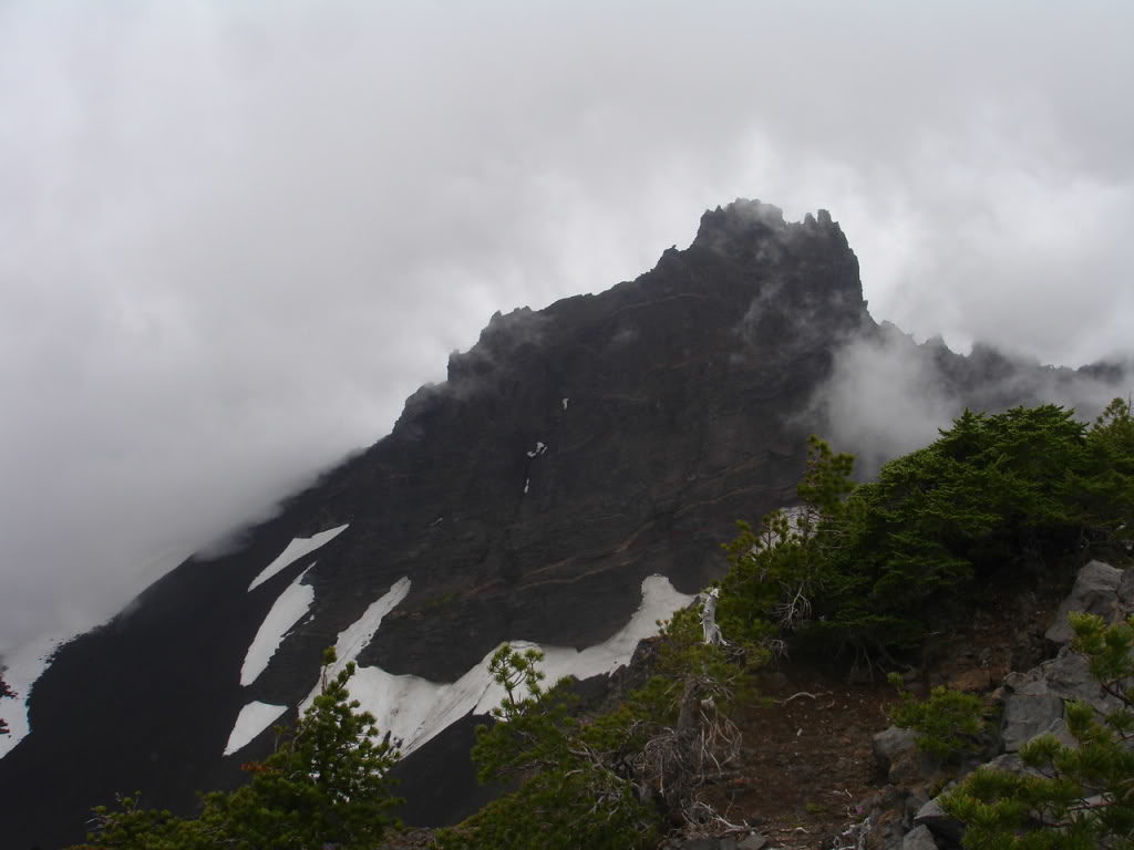
After a long night of sleeping on the Pacific Crest trailhead I was at the base of Three Fingered Jack. While the forecast called for partly cloudy skies I woke up to a white out. My plans started deteriorating as I waited for the weather to clear. I knew that the snow conditions were bad and my only chance was the NE facing bowls. My original plans were to be on the trail by 9 a.m. but was still at the car at noon. I watched the weather for hours as the cloud deck would raise and fall within 500 feet of my head. After a while I decided the weather wasn’t going to get any better. If I wanted to get Three Fingered Jack I was going to have to come up with another approach.
Yamsay Mountain is a relatively unknown ski tour in Eastern Oregon with great backcountry. Though it can be a long approach the skiing is quite good. It has steep lines and mellow lines so lots of great options. Here is the trip report below.
Cascadian Volcano Raid part 6 0f 9 Mt Scott triple shot
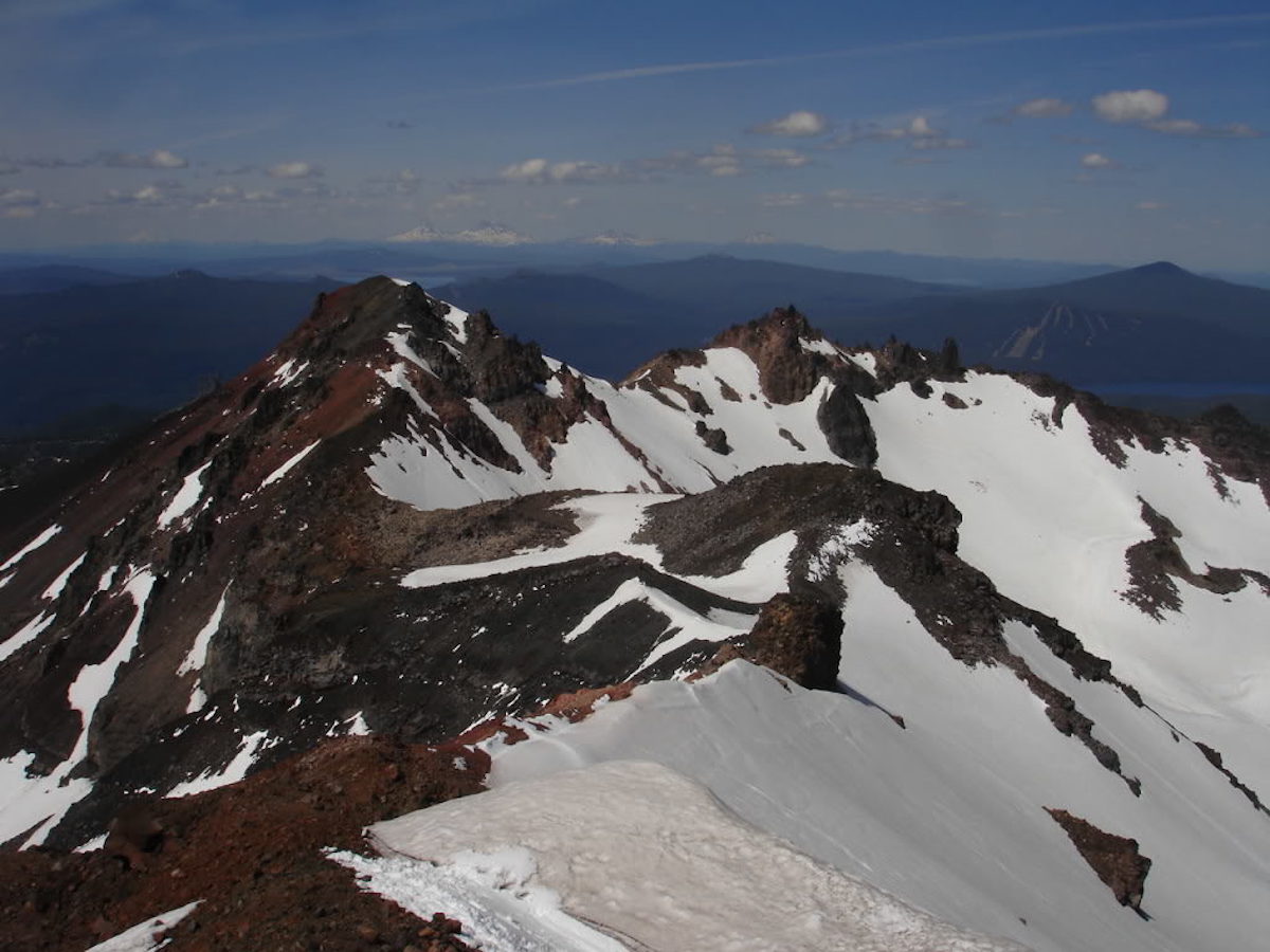
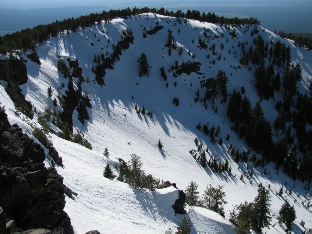
Mount Scott is a small stratovolcano on the southeast side of Crater Lake. The summit is the highest point in Crater Lake National Park with a summit elevation of 8,850 feet. While it is not as well known as most other peaks in the Oregon Cascades it is the 10th highest mountain. With its relative short distance away from Mount Mazama it was able to survive the massive eruption and collapse 7,700 years ago. While there are trees all the way to the summit there are numerous aspects that have open slopes. The northeast and southeast slopes offer around 2,500 feet of vertical while the west side is just over 1000 feet. It is named after Levi Scott who was a pioneer of the Oregon Cascades.
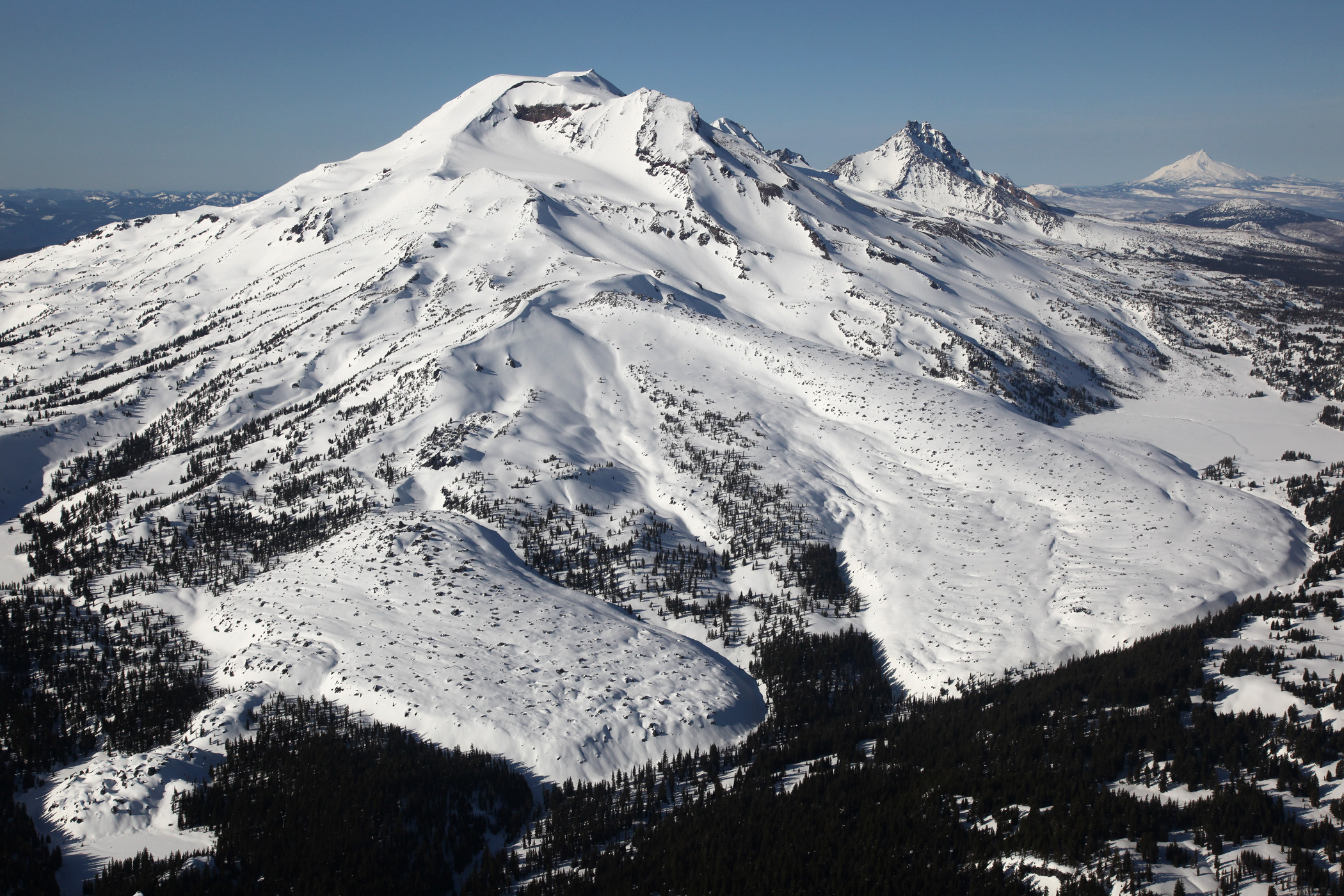
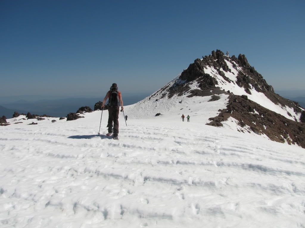
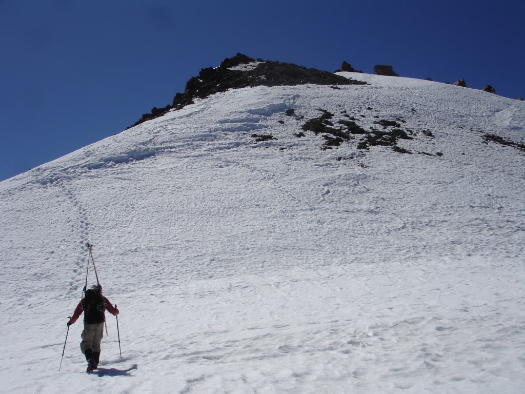
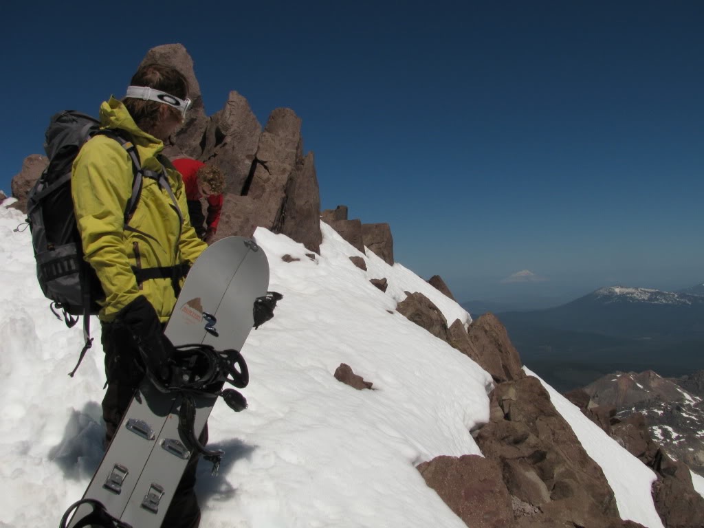
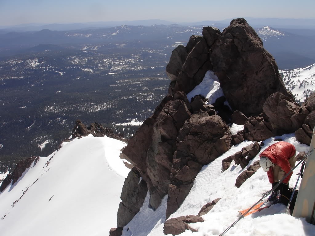
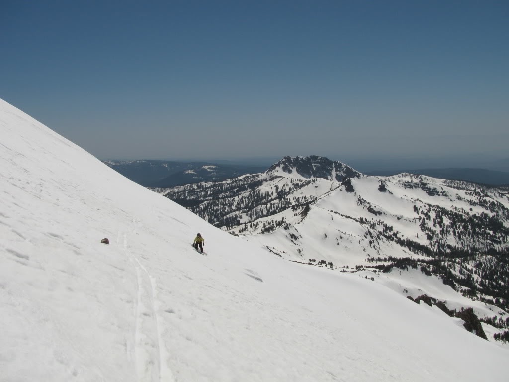
Shastina is the highest satellite cone of the western slopes of Mount Shasta. At 12,335 feet it is the 3rd tallest volcano in the Cascade Range being under 2,000 feet lower then its Eastern neighbor. The most common climbing route is Cascade Gulch via the Bunny Flats Trailhead. With snow still holding on Cascade Gulch Amar and I decided to head that way for a ski descent. While it was a side trip from Mount Shasta its a great ski tour non the less.
The Three Sisters wilderness is a volcanic playground in Central Oregon. With 4 massive volcano’s within its boundaries you can find great ski lines on every aspect. Though the area has an abundant snowpack it is most popular for late spring corn. Our access would be via the Pole Creek Trailhead on the East side of the Wilderness. The plan was to put up our tent at Camp Lake and ascend both the South and Middle Sisters. Our first day would be focused on the Southwest Ridge of the Middle Sister. Then the following day we would ascend the South Sister from the northwest before descending the Prouty Glacier Headwall.
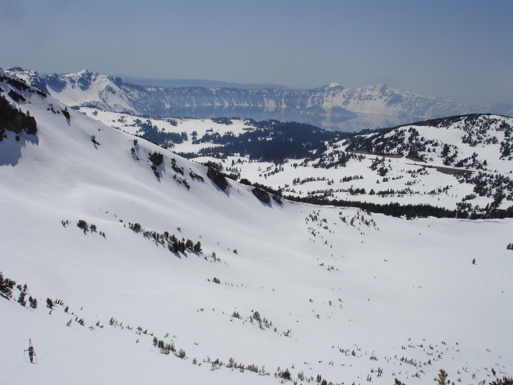
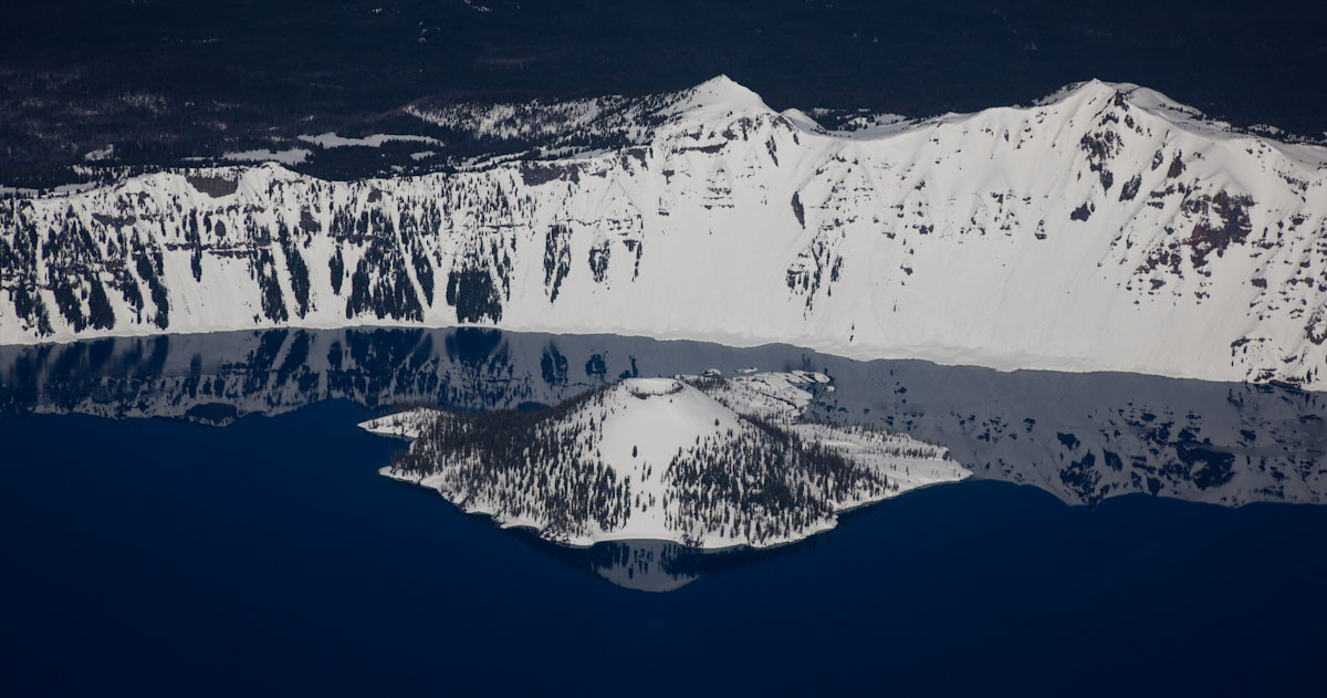
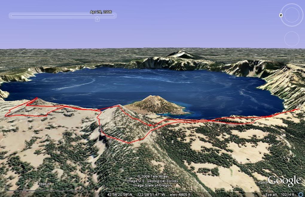
Mount Mazama is a world famous volcanic complex in Central Oregon and is mainly known as Crater Lake. At one time it was around 12,000 feet but 7,700 years ago lost over 3,000 feet. What was first an eruption quickly collapsed into a massive crater which slowly filled with rain water. Now Crater Lake is the deepest freshwater lake in the United States and sees tourists from around the world. The Klamath Native Americans believed that Mount Mazama was inhabited by Llao, their “Chief of the Below World.” The English name for the volcano, “Mount Mazama”, came from William G. Steel who was the founder of The Mazamas climbing club
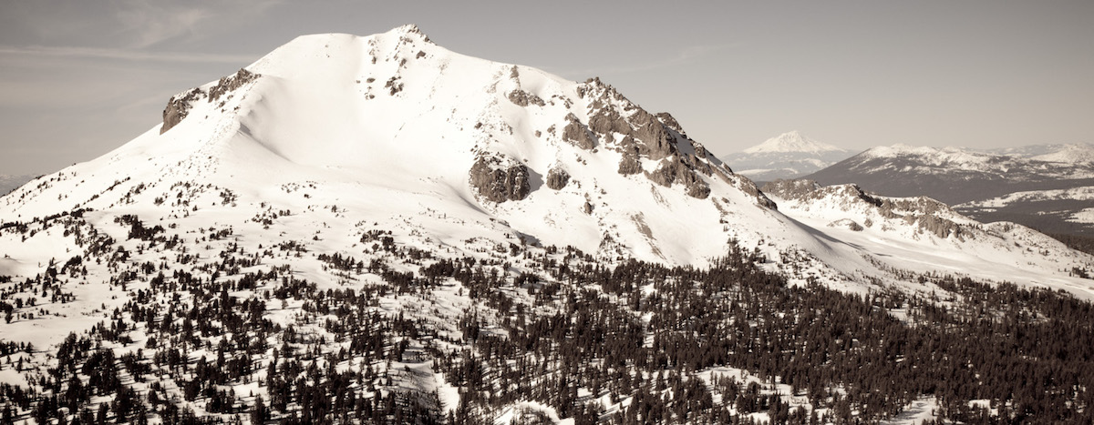
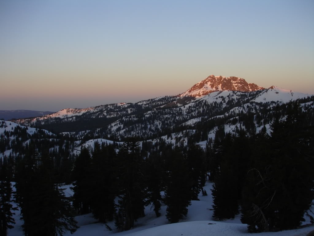
Lassen Peak is the southern most volcano in the Cascade Range. Being the high point of Lassen Volcanic National Park the whole area has numerous options for ski descents. With a summit elevation of 10,457 feet there is numerous 2,000 foot descents. The latest eruption was on May 22, 1915 and it spread ash 280 miles to the east. The park itself is 106,372 acres with numerous mountains and hot springs within the area. With an average snowfall of 660 inches it is the snowiest place in California.
Lassen Peak is known among native populations as Amblu Kai, which means “Mountain Ripped Apart” or “Fire Mountain”. The first white man to reach Lassen Peak was Jedediah Smith, who passed through the area in 1821. Lassen Peak was named in honor of a Danish blacksmith, Peter Lassen, who guided immigrants past the peak. The first recorded ascent took place in 1851, led by Grover K. Godfrey. Theodore Roosevelt established the Lassen Peak National Monument in 1907. Once the volcano became active again in 1914, the monument was expanded to establish the Lassen Volcanic National Park on August 9, 1916.
Driving Down I-5 to Lassen Peak Trailhead
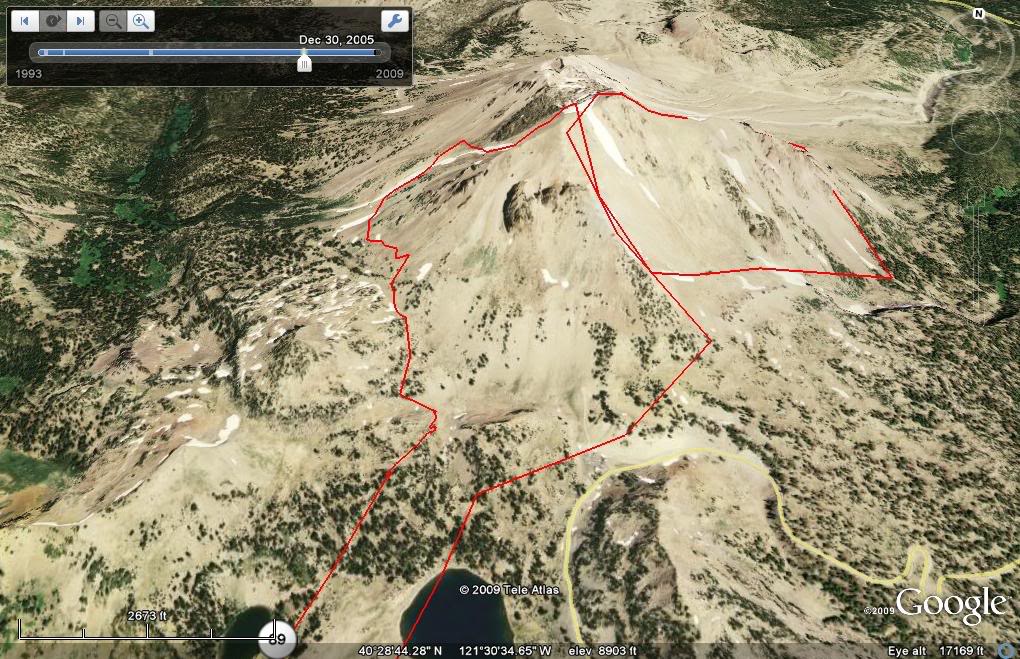
After two great days riding off of Mount Shasta Amar and I decided to head south. The plan was to climb Lassen Peak and from the summit ride numerous different aspects. We would start early in the day and start off on the East side before ending via the west side.
Our route for the day on Lassen Peak
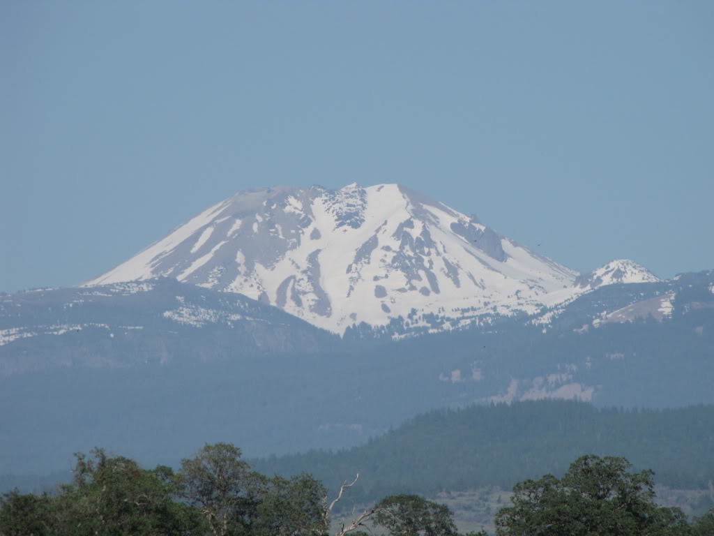
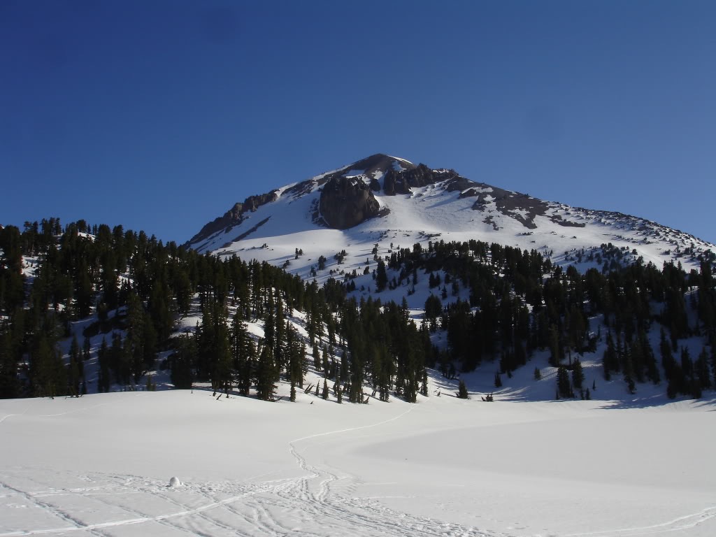
Driving down Interstate 5 we had a clear via of the west side of Lassen Peak. being Mid May we could see that it was starting to melt off but still had an abundant snowpack. Wrapping around the southern slopes we were soon at the main trailhead. We would spend the night camping there before starting our climb early in the morning.
Looking at the West face of Lassen Peak from the Redding Valley
Starting our Ski Tour at the Lassen Peak Trailhead
We woke up to a stunning sunrise as we shuffled out of our sleeping bags. It was a calm and clear morning as I boiled water for coffee and oatmeal. Before long the early morning alpenglow hit Diller Mountain turning it a bright red. With the plan of being on the summit around 11 a.m. we took in the views of surrounding scenery while packing our gear.
Sunrise over Diller Mountain
Not knowing how the snow would be we decided to take both our skins and our crampons. Though it would be straightforeword we needed to prepare for icy slopes. Before long we were off from the Lassen Peak Trailhead and doing a low angle traverse to the southeast bowl.
Looking at the Southern face of Lassen Peak from Lake Helen
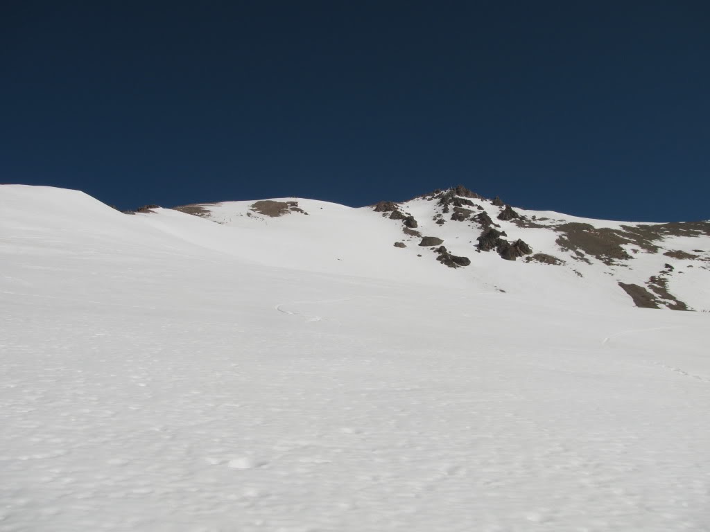
Once in the southeast bowl it was time to gain elevation to the summit. During the summer there is a trail all the way to the top but it was buried under feet of snow. Unlike other volcanoes in the Cascade Range this was a seasonal snowpack so there were no concerns of crevasses.
Looking at the Eastern face of Lassen with our ascent route on the left side
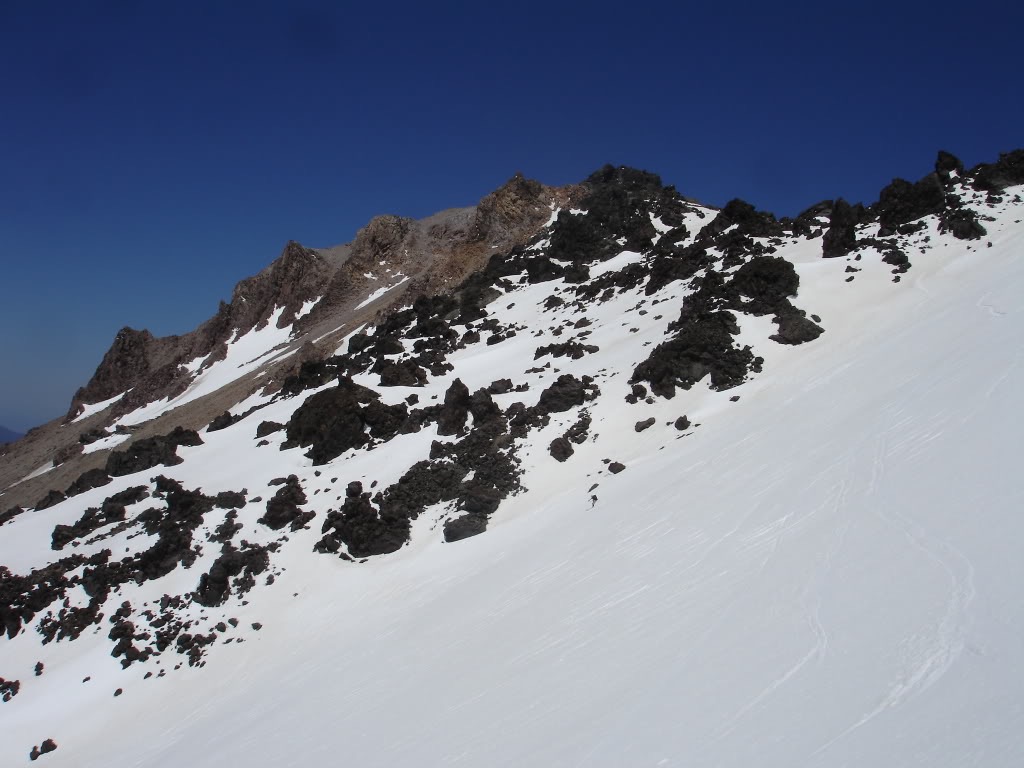
Making our way up the low slopes the terrain got steeper on the upper headwall. While firm we were able to get traction as long as we didn’t sidehill. Using the full surface of my skins I was able to keep climbing without slipping out. It was that delicate line between just steep enough and too steep but we were able to ascend without the use of crampons.
Skinning up the ridge with Bumpass Mountain in the background
Arriving at the Summit Crater
Before long we were already on the crater rim and just below the true summit of Lassen Peak. With it only taking us an hour to get to the top we were already ahead of schedule. Being that it was the perfect day to climb we weren’t alone on the mountain.
Skinning on the Crater with summit proper in the Background
The summit area was much firmer then the lower slopes as we made our way to the top. Being only an additional 50 feet with a bootpack in place we decided to hike it. Though the slopes were smooth on the lower portion this area was rough and would be a teeth chattering descent.
Amar bootpacking to the summit proper
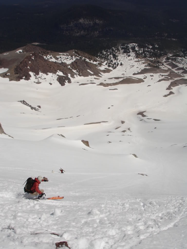
Finally we were standing on the top of Lassen Peak and looking at our ski descent options. We were a bit early as we slowly transitioned from touring mode to riding. Standing up top we soaked in the views of the surrounding landscape. Off to the north Mount Shasta rose above the surrounding peaks. We had just come down after spending two days in the area.
Chillin on the Summit of Lassen Peak looking North towards Mt Shasta
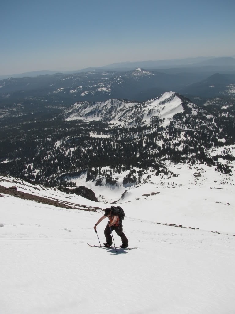
It was an obvious chose of where to do as we stood on top of the northeast slopes. This area had received the most sun so far and would be the best skiing. We would be able to drop off the summit proper and immediately be descending. There would be no need to ride the firm ice on the crater rim as we transitioned on the edge of our line.
Amar getting ready to do some skiing
The First Run Down the NE Side of Lassen Peak
Amar dropped in and from his first turn I could tell the snow was in perfect condition. Below him there was already someone hiking up as if a sign to let us know it was soft enough. This area is known as the Devastation zone as at one time the whole face slid off. Now it is possibly the best run off the top of Lassen Peak.
Amar droping into the NE face
Once Amar had taken a few turns I dropped into the line making turns right off the top. By now the area had just enough sun not being too soft or icy. Leaving the uniquely shaped weather tower behind we planned to ride as low as the snow was good.
Snowboarding down the NE face of Lassen Peak
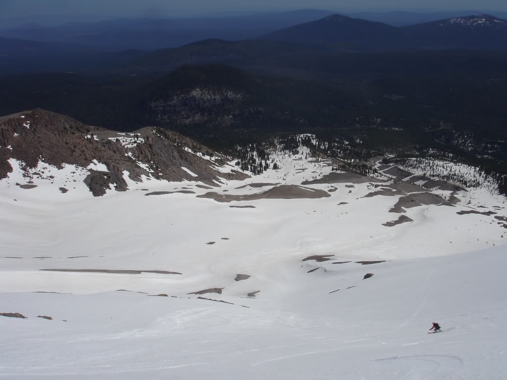
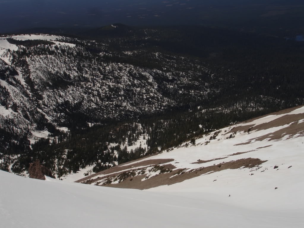
In the end we decended all the way into the flats of the valley before stopping. We had two options for ascending back to the top of Lassen Peak and went over our options. Either we could climb back up what we had just skied or wrap around to the southeast bowl.
Amar skiing down in perfect corn
In the end we decided to do a low angle traverse around the west side. The reason behind this was to see the terrain as well as climb back up our original route. Since we had been able to skin it before we knew that we wouldn’t have to bootpack. If we had climbed back up our ascent route we would have had to bootpack the enitre route.
Amar skinning back up to a low pass
Heading Back up for our Second Descent
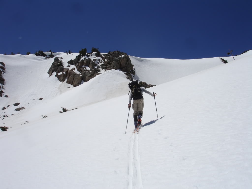
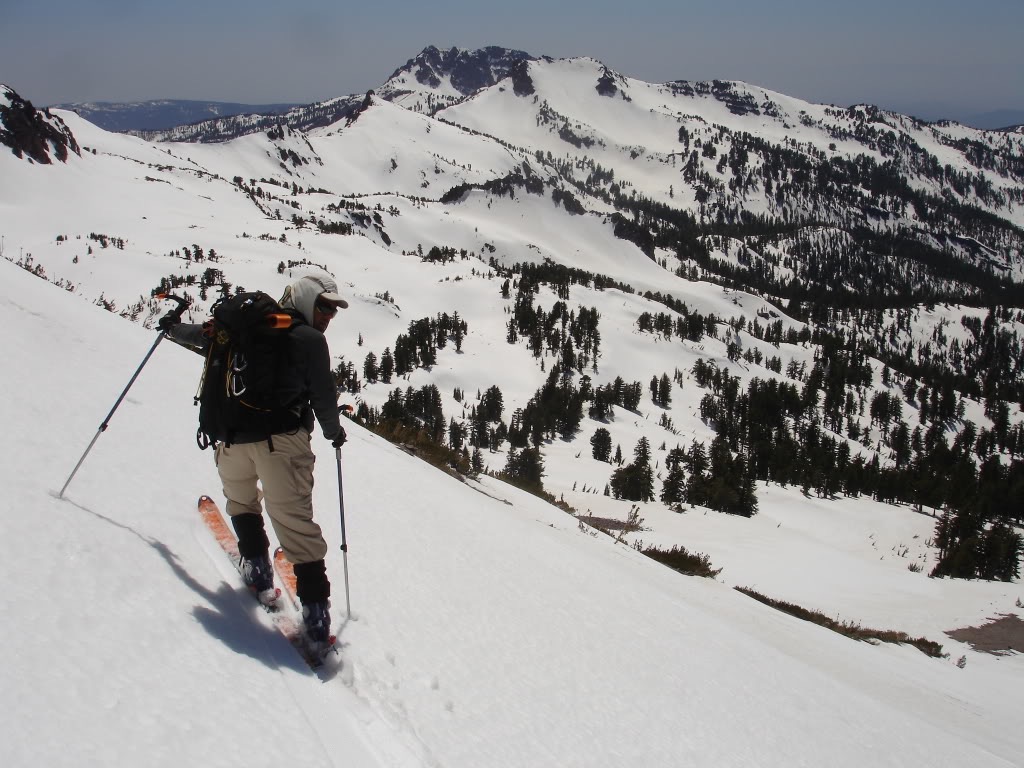
Soon enough we were back on our old skin track and heading towards the crater once again. Though it had been a bit less direct then climbing up the face we had saved energy by skinning. By now it was a bit early in the afternoon and hopefully the western slopes had softened enough.
Heading back up to the summit of Lassen Peak
Making our way over to the west end of the Crater Rim we took a short break to take in the views. There was still more then two feet of snowpack that we reference from a sign that was almost buried. Since we had climbed around the southwest side of the slopes we knew it was too late in the season for that line.
Amar looking at a sign on the summit with Bumpass Mountain in the background
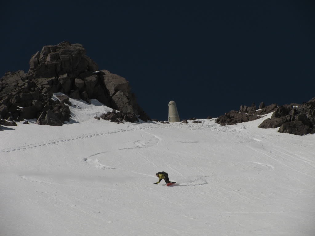
Making our way across the crater rim we were soon on top of the west face. It was one of those rare days without wind or clouds as we slowly transitioned for our final descent of the day. We had already seen the face on our drive down and we knew that it was still in.
Skiing across the summit crater
Standing on the edge we switched over to our boards preparing to ride almost 1,500 feet before traversing back to the car. While the snow was bumpy on top it would be much better once descending. After a quick confirmation that we were on the right line it was time to drop in.
Getting ready to snowboard the West face of Lassen Peak
Skiing the West Slopes of Lassen Peak Back to the Car
With a quick traverse we were making our way down the west slopes of Lassen Peak. It had a completely different feel then the north face but just as good snow. Almost immediately we were on a smooth surface and loosing elevation fast.
Riding down with Vulcans Castle and Eagle Peak in the background
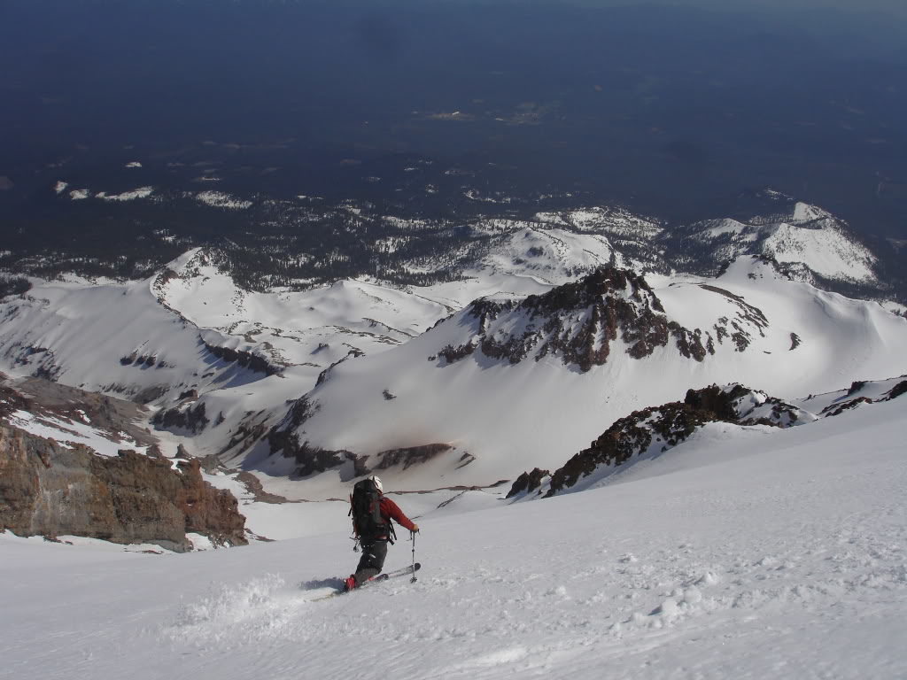
While I stuck to the skiers left side Amar went for the skiers right side. Making turns next to the rocks we could see the different colors of the slopes. This was the most recent lava flow being just under 100 years old.
Amar skiing down with the remnants of an old lava flow in the background
Before long we were following the main bully over to the southwest side. Like our previous descent we would ride until the snow became too slushy before climbing a bit of elevation. Within the next hour we would be back at the parking lot and off to our next destination.
Amar skiing down the lower apron with Loomis Mountain in the background
Exiting via Eagle and Lassen Peak Col
Soon enough the snow started getting too soft and it was time for our final ascent. Making our way to the low point between Eagle and Lassen Peak we would be able to ski back to the car. We had already been out for 5 hours and had 2 descents so we were happy with our time in the area. By now the snow was already cooked and any other ski descent wouldn’t be enjoyable.
Back to skinning towards the parking lot
Amar was able to make his way over the low col without the use of skins while I had to transition. Once on the top we made a low angle traverse to the Lassen Peak Trailhead.
The low saddle that give us access to the parking lot after 400 vert
Once at the car it was time to throw our gear in the back and drive towards the next destination. In the end we had traveled over 7.5 miles and 5,2000 feet of great terrain. I was surprised by how good the skiing was and knew I would be returning in the future. It was time to leave California and head up to Oregon to check out the volcanic landscape. The following day we would be ski touring around Mount Mazama with a camp on the Crater Lake Rim.
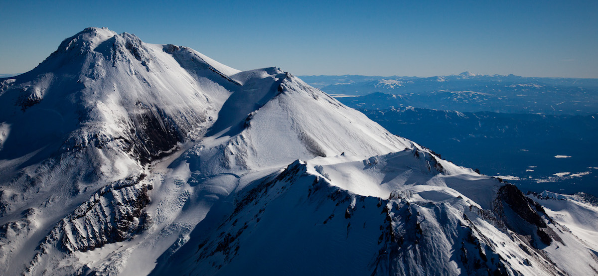
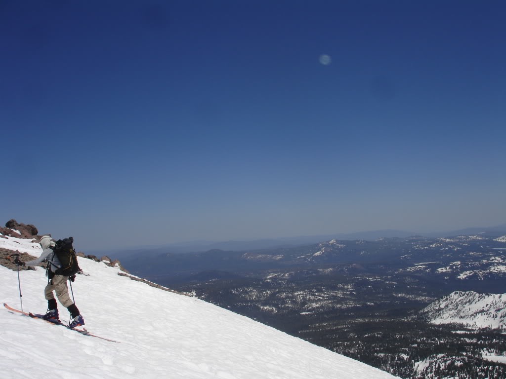
Mount Shasta is the second highest volcano in the Cascade Range located in Northern California. With 9,700 feet of prominence it is possibly the best ski touring volcano within the range. During the last 10,000 years, Mount Shasta has erupted an average of every 800 years and the last record eruption was around 1250 AD. The name is a bit confusing at the name Sasty was given to Mount McLoughlin in 1827. After a mapping expedition in 1842 the name Mount Shasta was officially given to the volcano. Some Native American Tribes gave it the name White Mountain for obvious reasons. Being a massive volcano there is concern that the slopes could collapse similarly to Crater Lake. With numerous populated areas nearby this is one of the more dangerous volcanoes in the Cascades Range.
Since Mount Shasta is a rather isolated volcano Mount Shasta has numerous colorful legends behind it. Starting with the Native Americans within the Klamath Tribe Mount Shasta is inhabited by the Spirit of the Above-World, Skell. He fought with the Spirit of the Below-World, Llao, who resided at Mount Mazama. Later settlers started a legend about a hidden city of advanced beings from the lost continent of Lemuria living in the mountain. Many people consider Mount Shasta as one of a small number of global “power centers”.
Cascadian Volcano Raid part 1 0f 9 Mt Shasta
5/15/09
After an 8 hour drive from Seattle we found ourselves in the shadow of Mount Shasta. We set up camp in the parking lot and were quickly waken up by people arriving before sun rise. Waking up my attention immediately focused on the slopes directly to the east. This was my first time so close to Mount Shasta and it quickly became apparent that there were numerous different descent options.
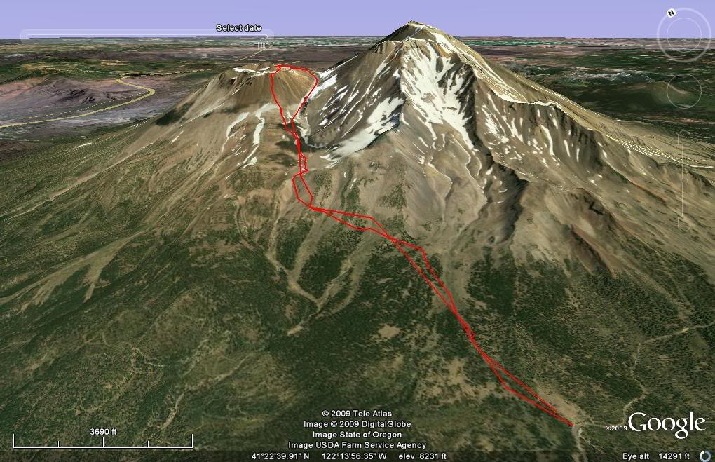
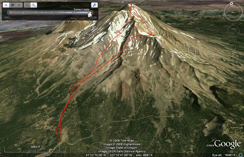
Our Ascent and Descent Route of Mount Shasta
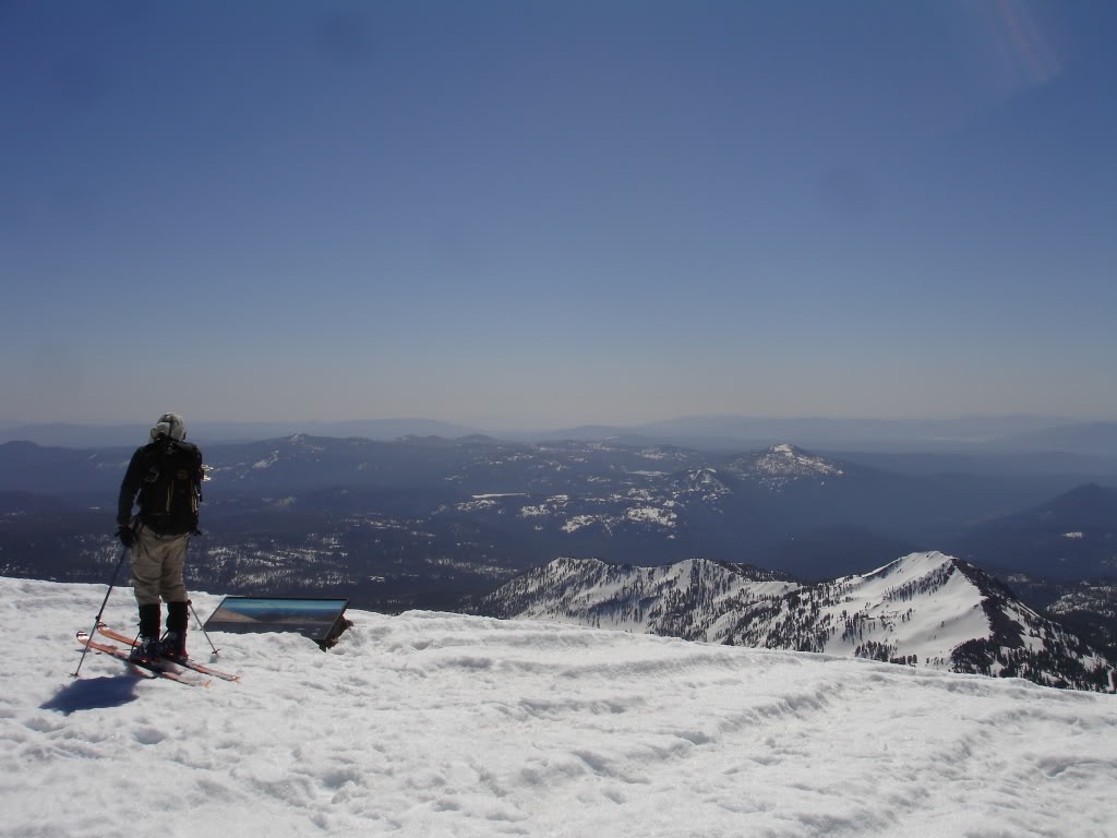
Packing our bags the plan was to do an ascent up the standard Avalanche Gulch route. Though we would be skinning most the way we need to bring crampons with us for the upper face. Once on the summit we would decent via The Konwakiton Glacier on the South side. Once at 10,800 feet we would then skin up the Mud Glacier and traverse the old ski bowl then back to Bunny flats.