
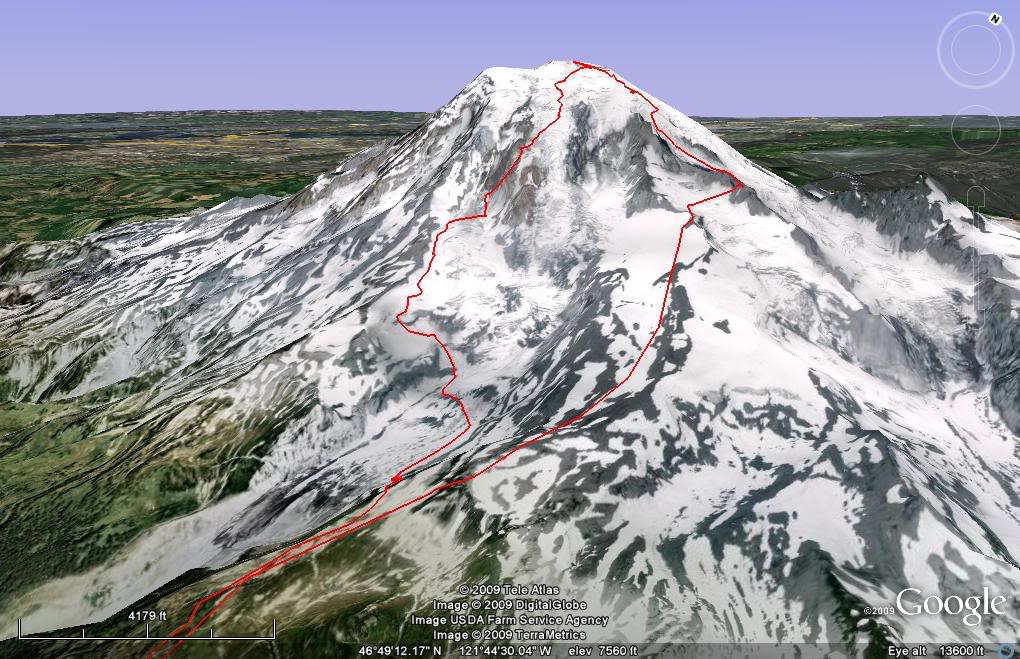
The Fuhrer Thumb is possible one of the best lines in all of Mount Rainier National Park. Being steep and aesthetic with perfect fall line for a potential 11,000 feet it’s almost as if it is built for skiing. Being located on the south side of the peak there is a good chance the Couloir and it’s twin the Fuhrer Finger have caught you attention while touring around Paradise. This was the case with Amar, Ben and I as we wanted to take advantage of a perfect day in late Mid May. We would do an overnight push up the Ingraham Direct Route and ride down the Fuhrer Thumb.
Heading up to Camp Muir at 2: 30 A.M.
We arrived to the Paradise Visitor Center parking lot and were immediately noticed the area was jammed full of cars. With it being the start of the Memorial Day Weekend and a clear weather forecast it seemed that a bunch of other groups had similar plans to ours. After packing our bags with the necessities we were off from the parking lot at 2:30 a.m. We quickly made our was up to Panarama point and with the snow being firm we switched to crampons. Following the well beaten in path up the Muir Snowfield we arrived at Camp Muir just in time to watch the early morning alpenglow.
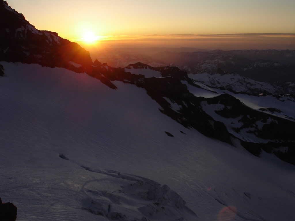
Sunrise From the Beehive
I sat on the Beehive watching everything around me turning bright run as the sun was cresting over the eastern horizon. A month prior Amar I and had climbed the Ingraham route and before riding the Gib Chute. It had turned out to be an icy day and I wondering if we would experience similar conditions while looking up at the Mountain.
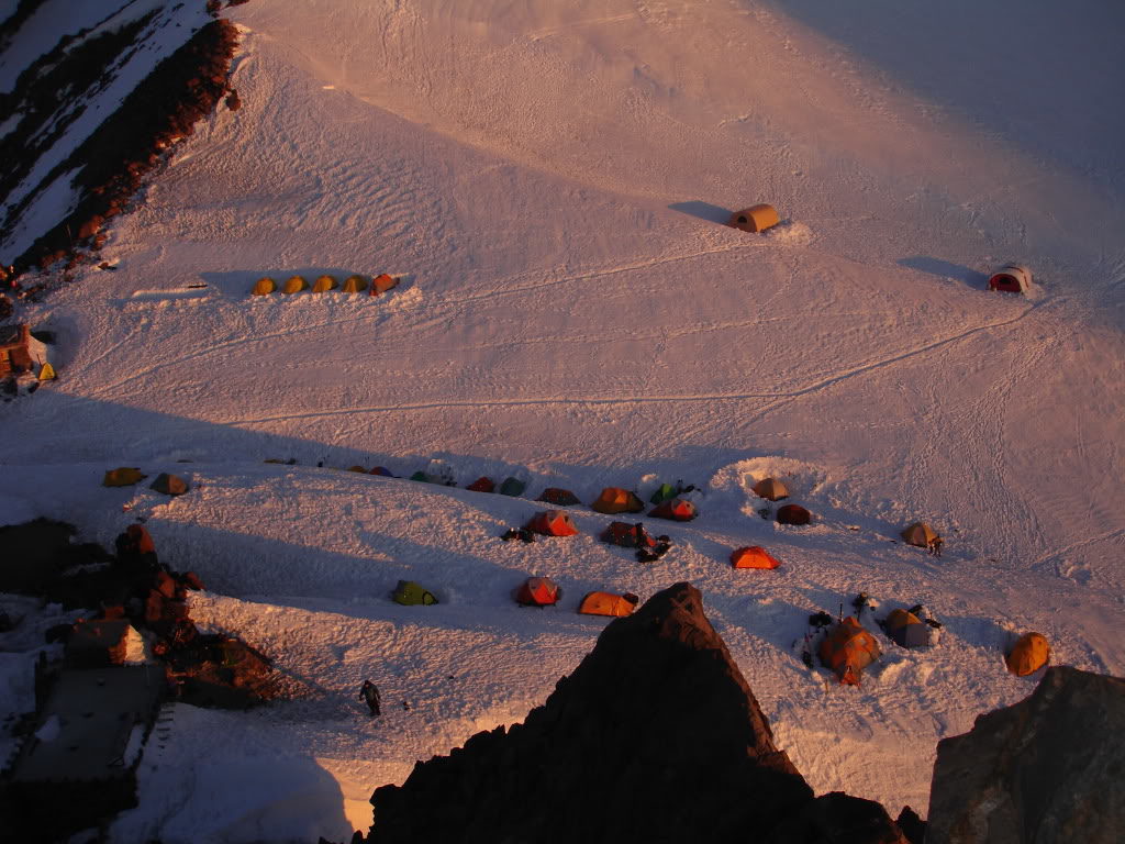
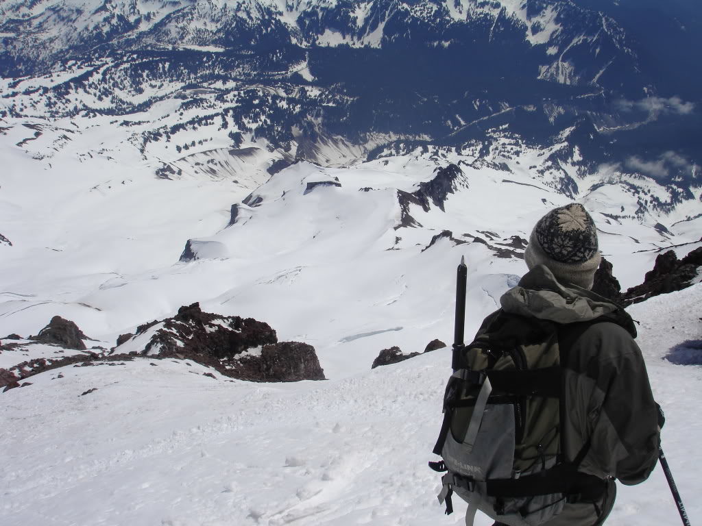
Looking down at the scattered tents on the upper Cowlitz Glacier I noticed how quiet they were. There was no movement and people hassling with there gear as they made a late start climbing the mountain. Maybe they were already on the peak or possibly they were sleeping in and resting for the next day summit ascent.
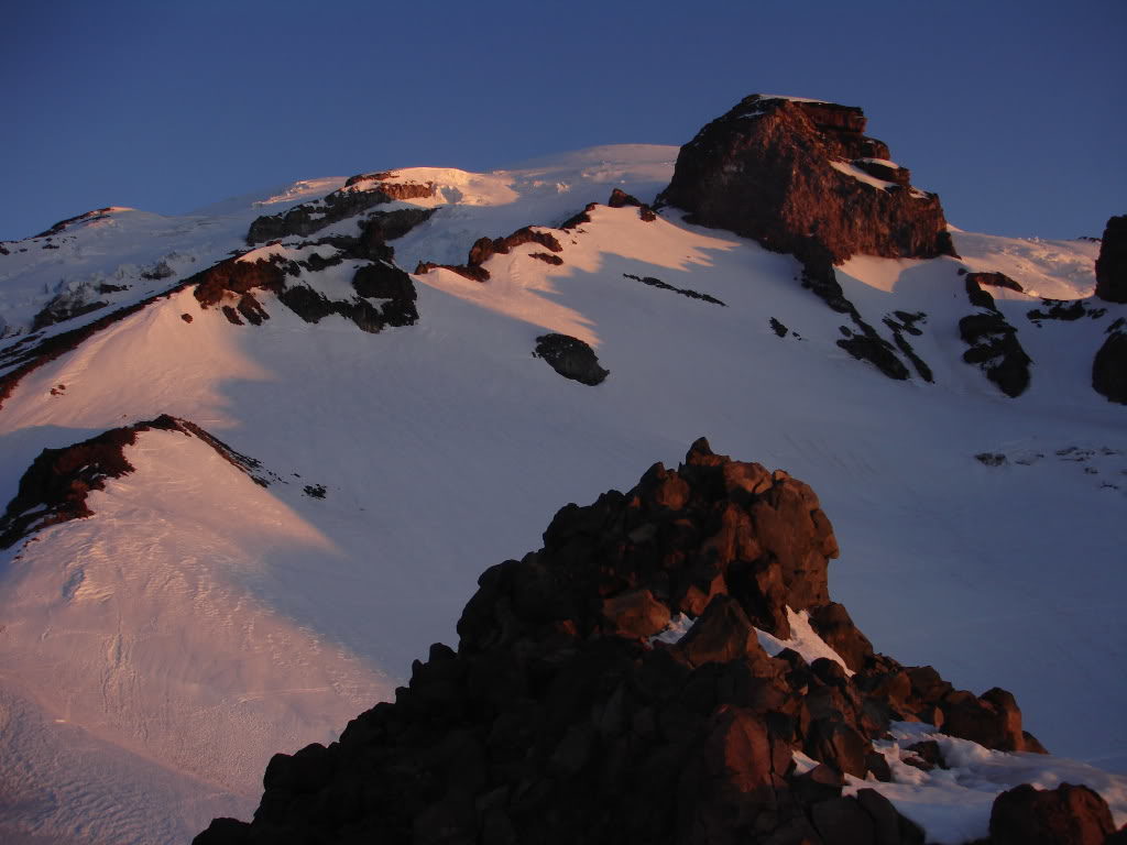
By now the sun had started hitting the peaks to the south coating the Tatoosh Range and Mount Adams in a bright pink. In front of us I could see climbers making there way up the Muir Snowfield in the early hours.
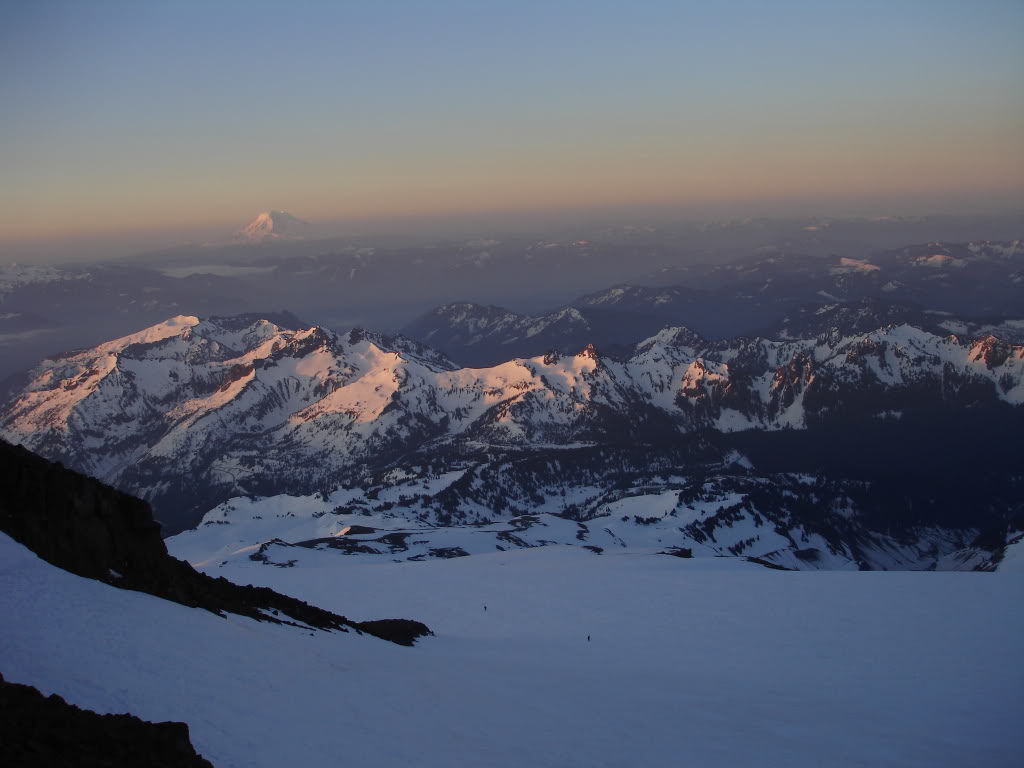
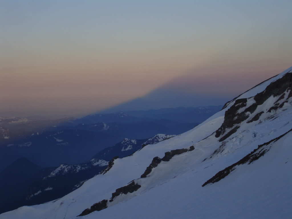
To the west Mount Rainier was casting a shadow towards the lower Puget Sound. It was a beautifully clear and windless day and we were excited for the perfect summiting day. After an two hours of rest it would be time to start climbing.
Heading up the Ingraham Direct Route for the Fuhrer Thumb
As we wrapped around Cathedral Gap we immediately noticed the ascent path up the Ingraham Direct Route. When we climbed the route the previous month there was not a track to be seen and now it felt like a highway.
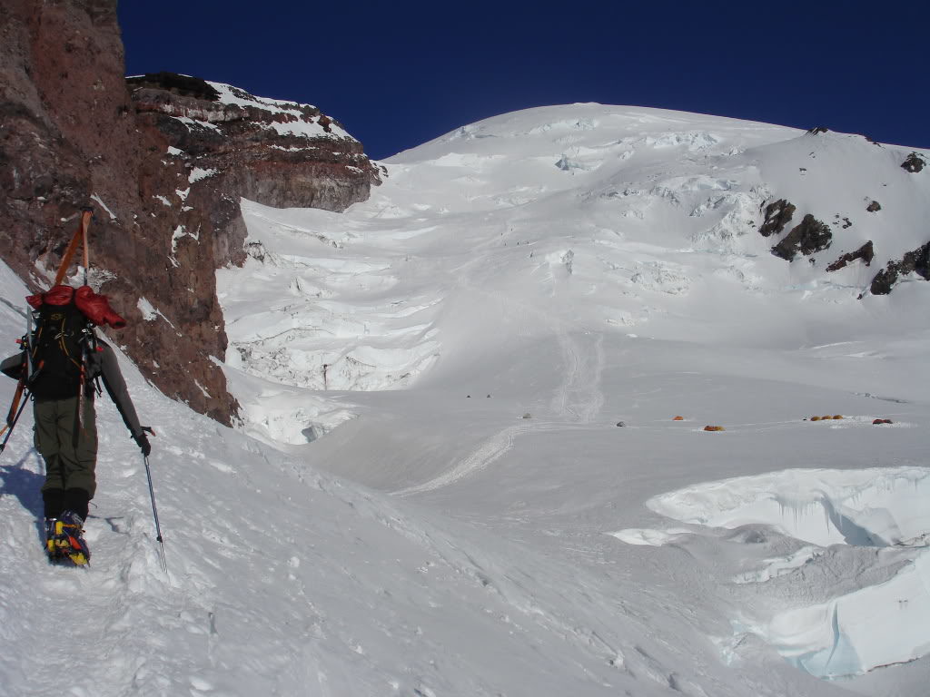
With the route broken in there was no need to skin as we crampon climbed past the Flats on onto the upper slopes. A step at a time we pushed forward on the Ingraham Direct route quickly passing Cadaver Gap.
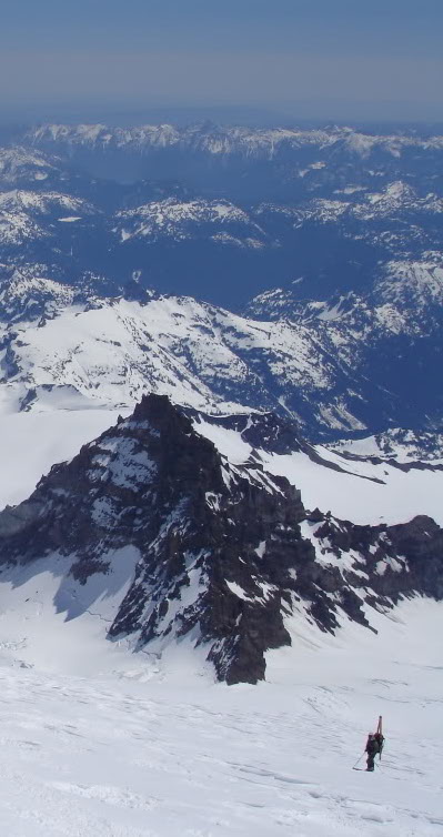
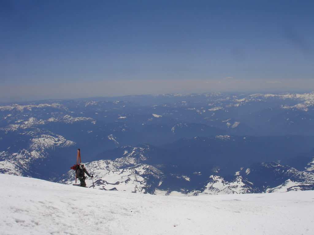
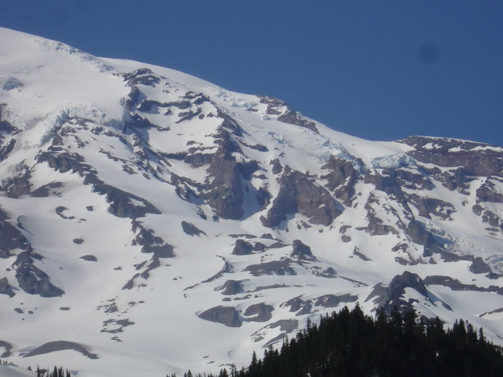
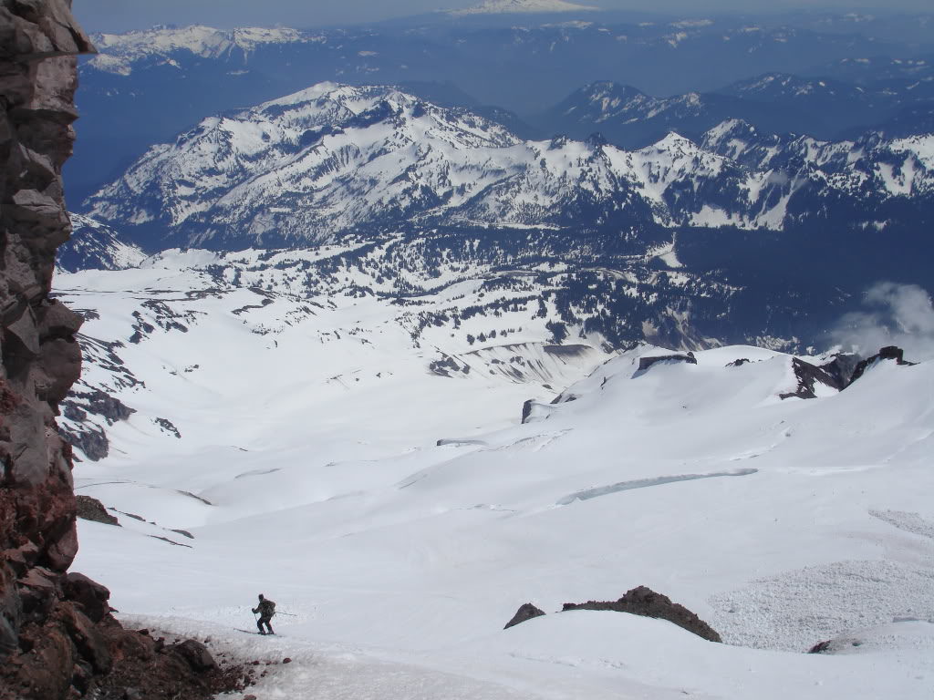
A Scenic Climb in the Alpine
Occasionally I would look back at Little Tahoma to reference how high we were. At 11,138 ft once we were above it we had just over 3,000 feet to go before standing on the summit.
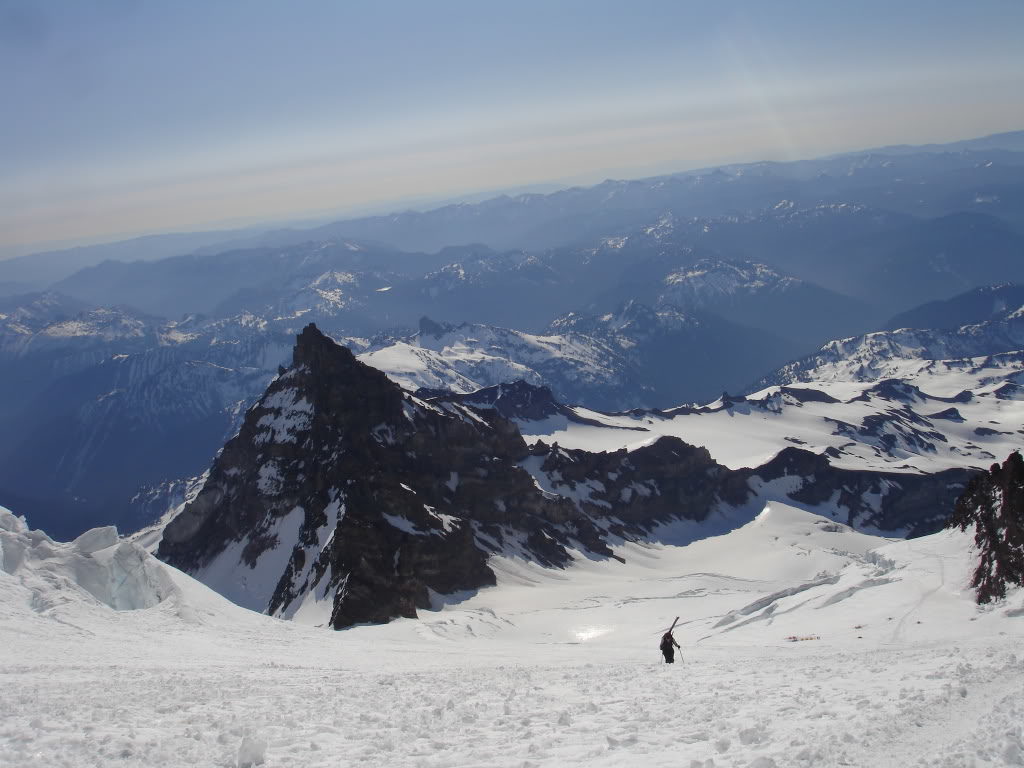
To the northeast I would look at the terrain around the White River area taking in the views of my favorite areas. It was nice to get a different perspective as I looked down upon the summits of the same mountains I would usually be looking up from.
With there being no wind the route felt like an oven. We were making a fast pace and didn’t plan on descending until 1 p.m. so we made sure to take breaks along the way. Keeping our packs light we would stop to melt some snow and eat some food before pushing on.
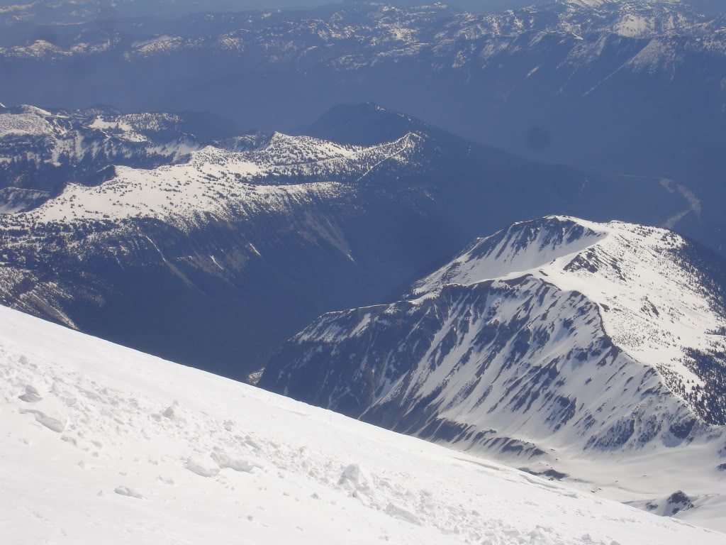
By 13,500 feet the full extend of the eastern side of Mount Rainier National Park had come into view. We were less than 1,000 feet away from the summit and feeling strong for our descent of the Fuhrer Thumb
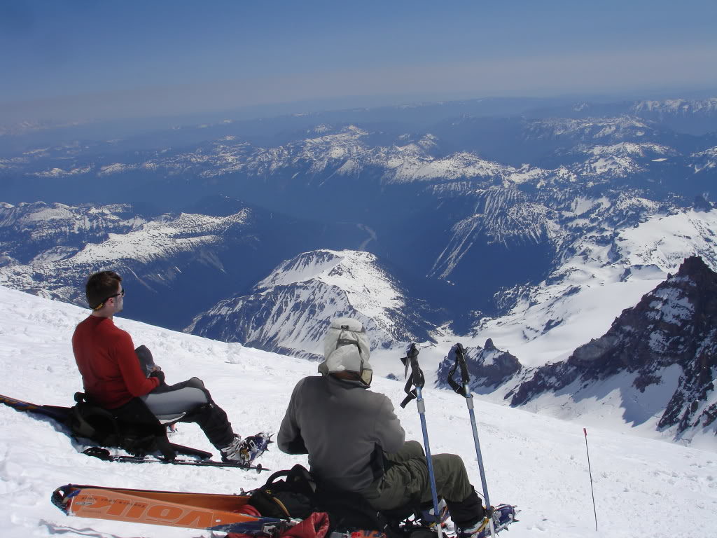
Arriving at the Summit Crater
Soon we were taking our final steps to the crater rim of Mount Rainier and off the Ingraham Glacier. We had made it to the summit in less than 4 hours and now it was a waiting game for the Fuhrer Thumb to soften up.
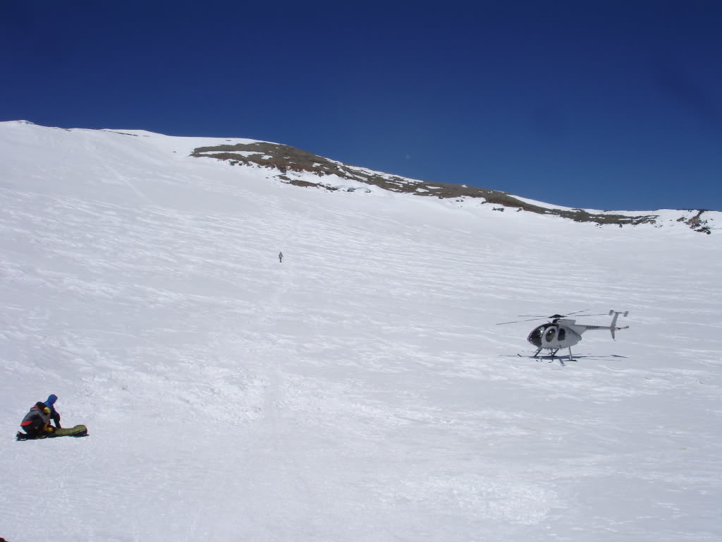
On the crater rim we were surprised to find a helicopter was up there. It turns out the someone had fallen into through the snow and into one of the many steam caves. Rumor had it that they had broken a few ribs and needed to be evacuated.
The summit was less busy than we had expected as most of the climbers had already retreated back towards camp. Having an hour to spare we made our way over to the summit. Waiting on the highest point in the Cascades we knew that the Gib Chute would be perfect corn soon. Before long it was time to drop as the clock hit 1 p.m.
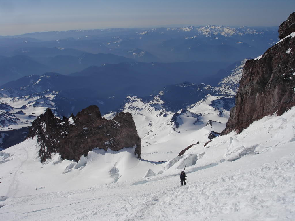
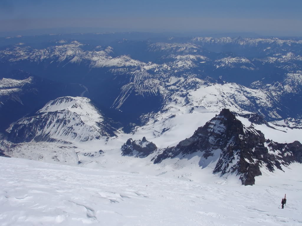
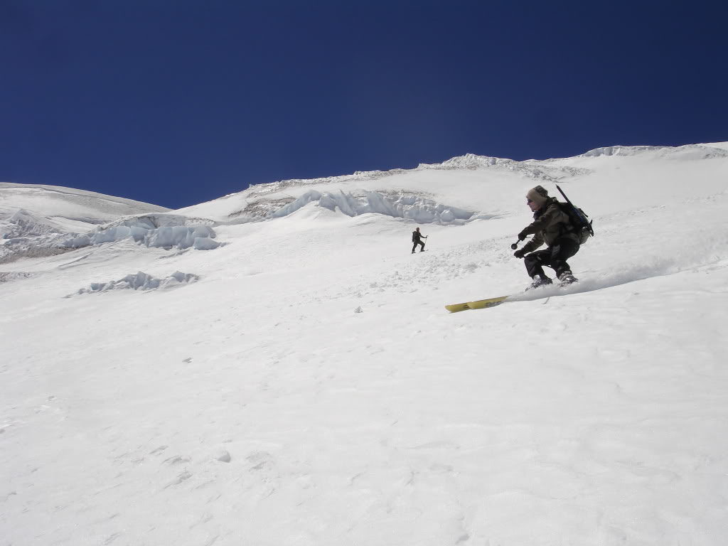
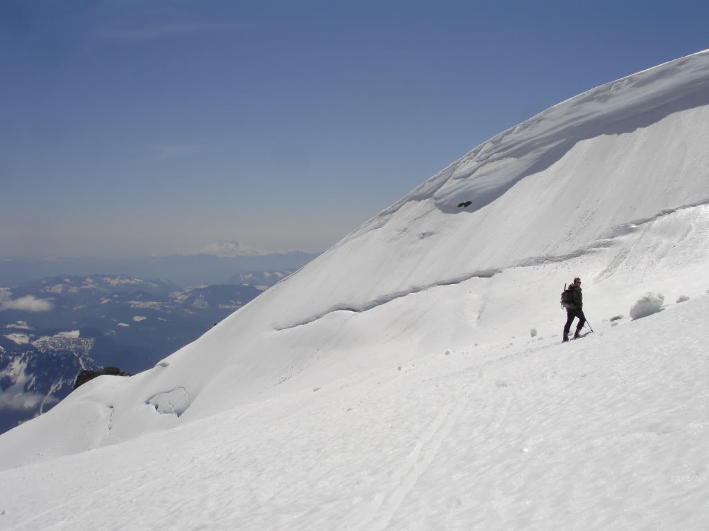
Skiing Down the Wilson Glacier Towards the Fuhrer Thumb
Dropping in the snow was perfect as it was a bit firm but edgeable. It was a delicate balance as we had a potential 11,000 foot run below us and didn’t want the lower slopes to be slush. The terrain dropped away as we started riding down the upper Wilson Glacier.

Making our way down towards the Fuhrer Thumb we were happy to have the high season snowpack. Once things are melting out there are a few crevasses to cross but we barely even noticed as we were able to open our turns up.
Within a few minutes we could start seeing rocks on the edge of the Wilson Glacier. We were starting to get close to the Fuhrer Thumb and would have to pay attention to the route. If we kept going straight we would get sucked into the Fuhrer Finger which wouldn’t be bad but not the line we intended on riding.
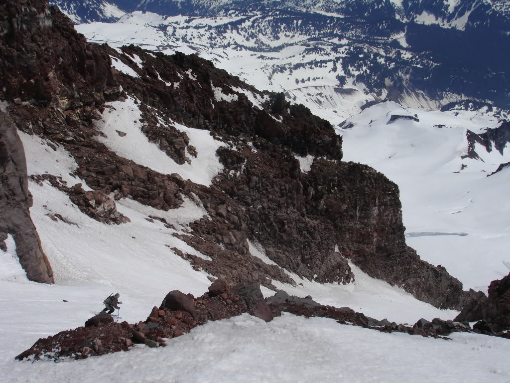
Dropping into the Fuhrer Thumb
Soon enough we spotted our line and traversed over to the top. It was a bit of a roll over and we couldn’t see the entire route but based on previous experience we were confident the line went.
Dropping into the Fuhrer Thumb we were happy to see that we were laying down first tracks. Being a gully it can have a runnel but it was still early in the season and smooth.
Wrapping around the bend of the route we had our first view of the Wilson Glacier below. The snow was getting softer with every turn but was still easy to manage. We this was the only section of our route that wasn’t on glacier as we made it to the lower apron careful not to hit random rocks in the snowpack.
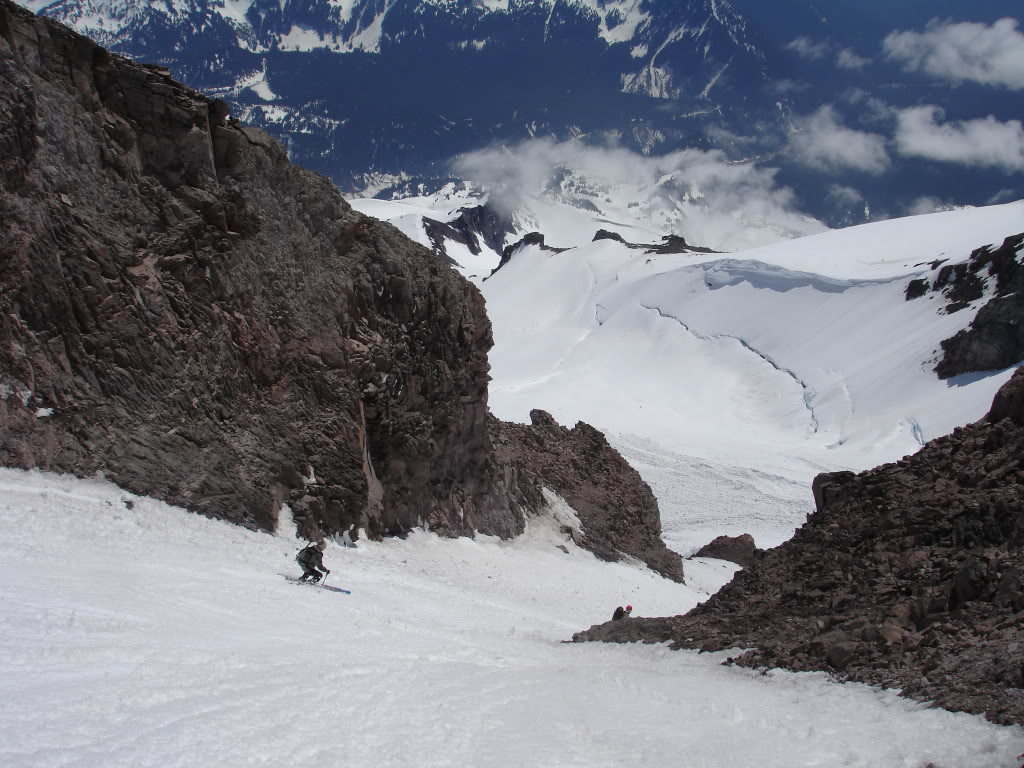
Exiting the Fuhrer Thumb and Riding Down to the Nisqually Glacier
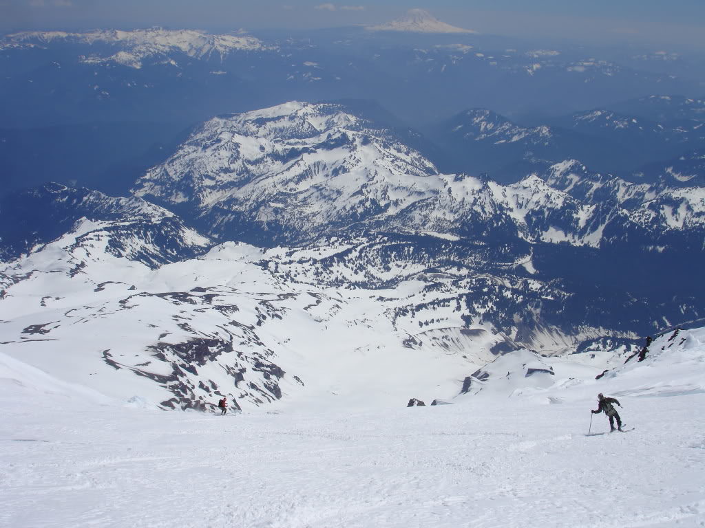
Before long we were out of the line and back onto the Wilson Glacier below. The Fuhrer Thumb has been a great and steep chute and now we were in open slopes all the way to the Nisqually Glacier below.
We traversed over to the high ridge of the Wilson Glacier to look back up at our line. It had been a great run from top to bottom and felt rewarding as we looked up at our tracks. Below us was mellow terrain with a few crevasses to mitigate before riding down the Nisqually Glacier.
Exiting to Paradise Visitor Center
After a few minutes we were ripping turns down the Wilson Glacier all the way down to 6’000 feet. Once there we had to make a decision whether we would ride all the way down to the Nisqually Bridge or skin up towards Paradise. By now the route down to the bridge was looking to be in bad conditions with quite a few creek crossing so we decided to skin up. Putting in a high traverse I arrived at the lower moraine while Ben and Amar took a bit higher route. After a quick 200 foot boot pack we were near Panorama Point.
Finally we were riding the final slopes down to the Paradise parking lot. It had been the perfect day in Mount Rainier National Park and as we put our gear in the car we would occasionally glance back up the the Fuhrer Thumb. It felt great riding a line that I had been interested in for years and finally I ticked it off the list. In total it was a 12 miles trip with over 10,000 feet of fall line riding.
Thank you for reading this trip on the Fuhrer Thumb. If you want to see more ski tours within Mount Rainier Backcountry check out this link.